Signs Tagged With Big Green Sign
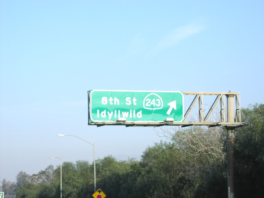
I-10 East Exit 100
I-10 east at Exit 100 - CA-243/8th St./Idyllwild.
Taken 03-01-2007

 Banning
Riverside County
California
United States
Banning
Riverside County
California
United States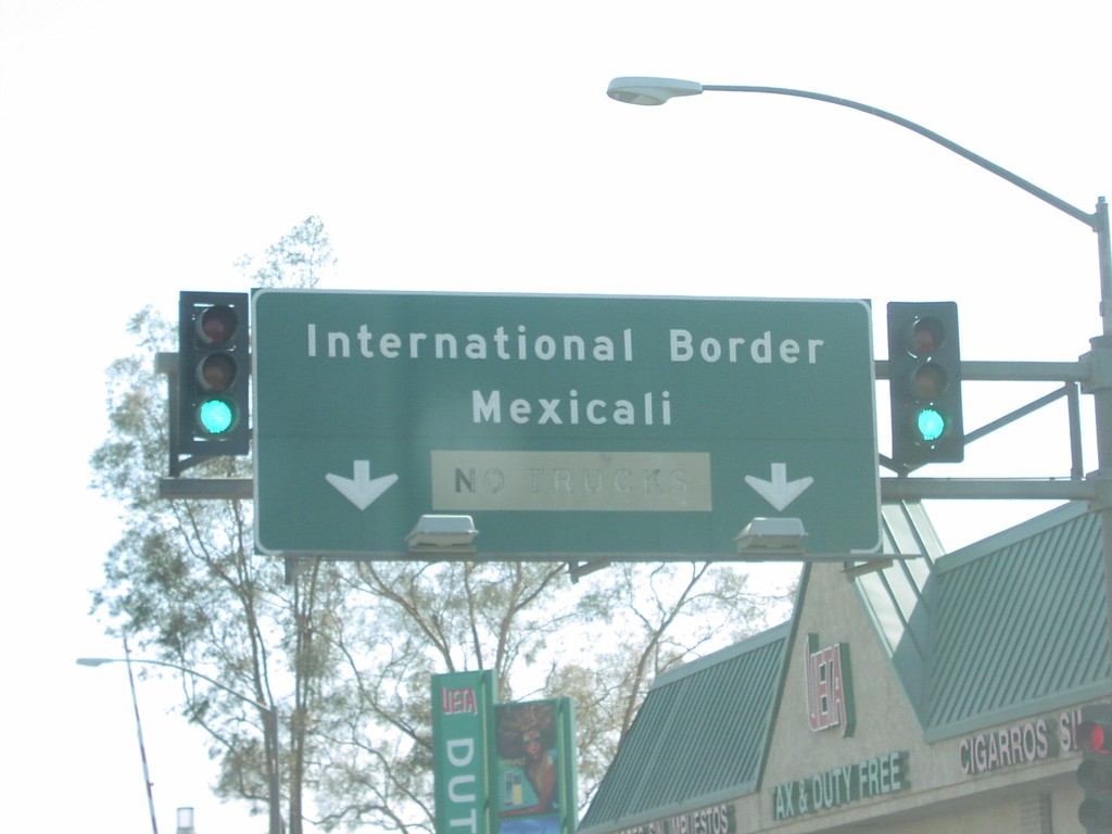
End CA-111 South at International Border
End CA-111 at the International Boundary. Mexicali is just past the border post.
Taken 03-01-2007
 Calexico
Imperial County
California
United States
Calexico
Imperial County
California
United States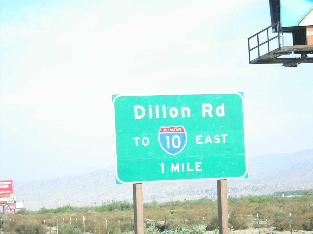
CA-86S North Approaching I-10
CA-86S north approaching Dillon Road/To I-10 East, 1 mile.
Taken 03-01-2007
 Coachella
Riverside County
California
United States
Coachella
Riverside County
California
United States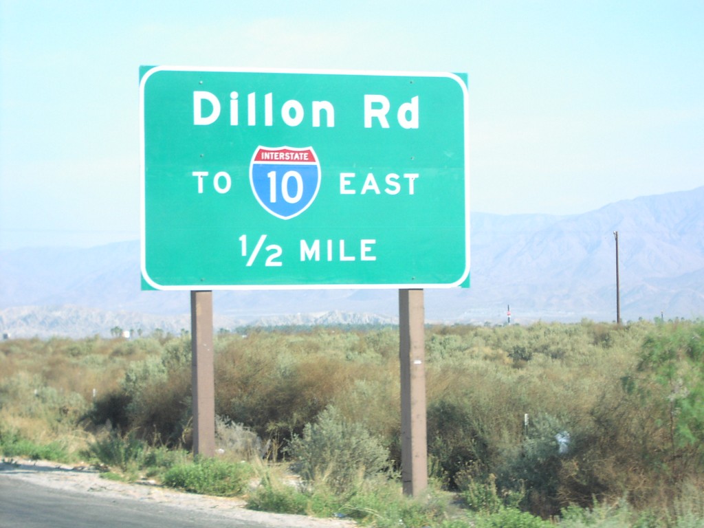
CA-86S North Approaching I-10
CA-86S north approaching Dillon Road/To I-10 East, 1/2 mile.
Taken 03-01-2007
Coachella
Riverside County
California
United States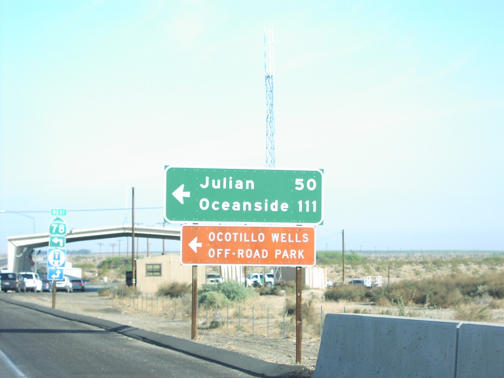
CA-86 North/CA-78 West at CA-78 West
CA-86 North/CA-78 West at CA-78 West to Oceanside and Julian. Border Patrol Checkpoint in background.
Taken 03-01-2007

 Borrego Springs
Imperial County
California
United States
Borrego Springs
Imperial County
California
United States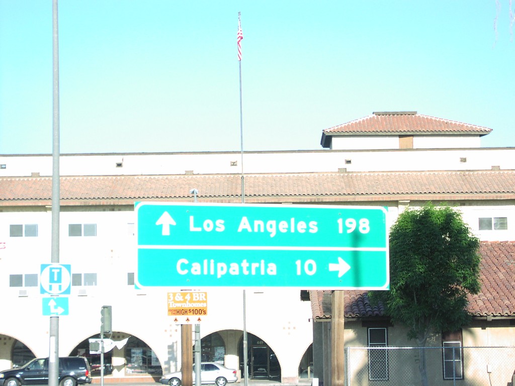
CA-78 East/CA-111 North at Split
CA-111 North/CA-78 West at CA-111 (to Calipatria)/CA-78 (to Los Angeles) split in Brawley.
Taken 03-01-2007
Brawley
Imperial County
California
United States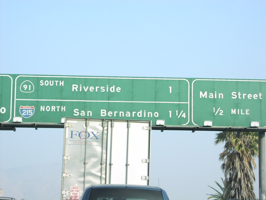
CA-60 East Exits 53AB and 52B
CA-60 east approaching Exit 52B - Main St., Exit 53A - CA-91 South/Riverside, and Exit 53B - I-215 North/San Bernardino.
Taken 03-01-2007


 Riverside
 County
California
United States
Riverside
Riverside County
California
United States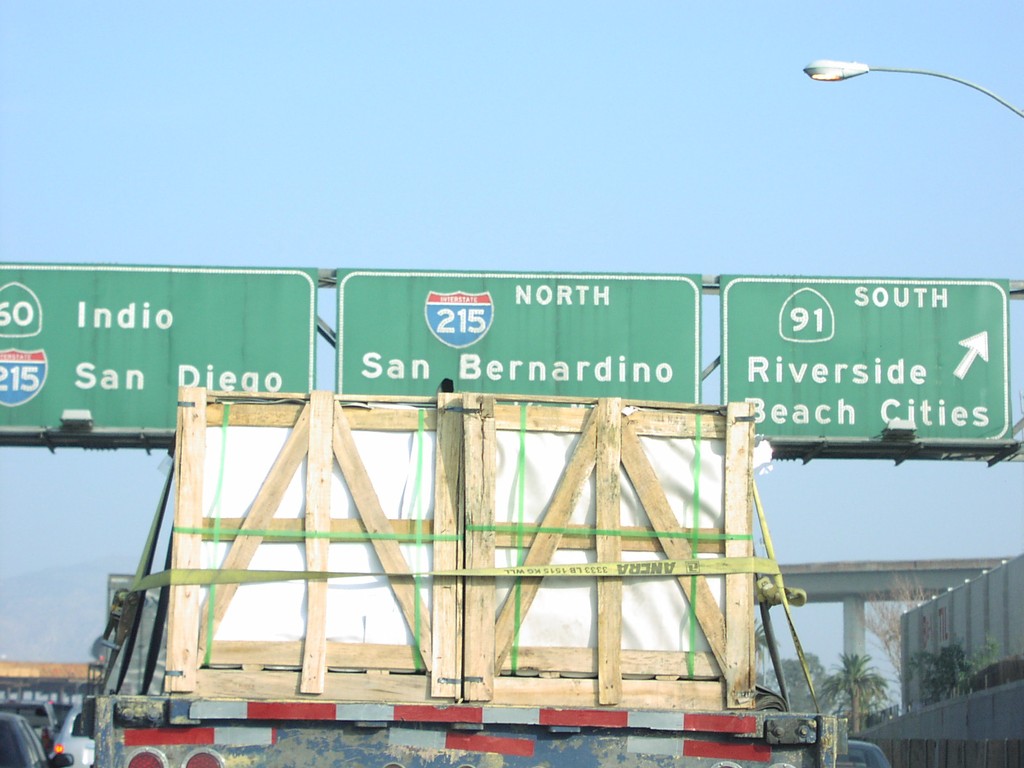
CA-60 East Exits 53AB
CA-60 east at Exit 53A - CA-91 South/Riverside/Beach Cities, and Exit 53B - I-215 North/San Bernardino.
Taken 03-01-2007
Riverside
Riverside County
California
United States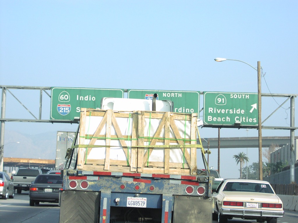
CA-60 East Exits 53AB
CA-60 east at Exit 53A - CA-91 South to Riverside and Beach Cities. New control city on CA-60 is Indio.
Taken 03-01-2007
Riverside
Riverside County
California
United States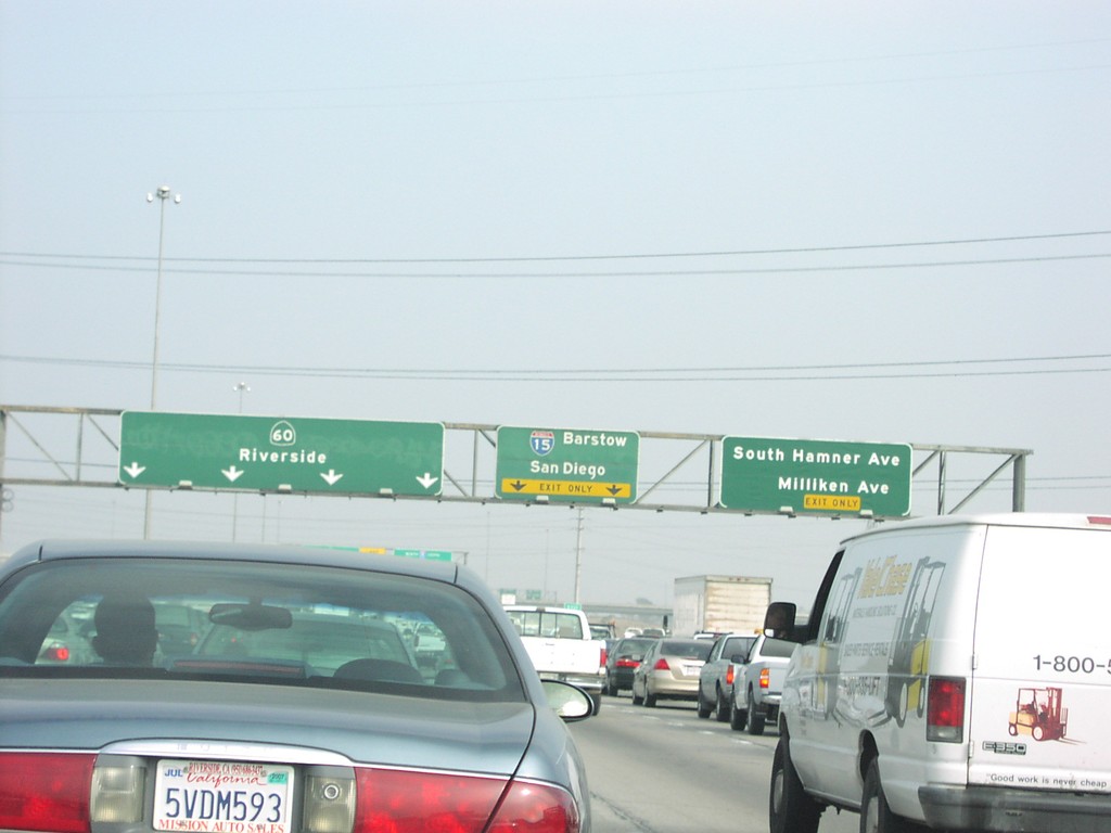
CA-60 East Exits 40 and 41
CA-60 east at Exit 40 - S. Hamner Ave./Milliken Ave. Next exit is Exit 41 - I-15/Barstow/San Diego.
Taken 03-01-2007
 Ontario
San Bernardino County
California
United States
Ontario
San Bernardino County
California
United States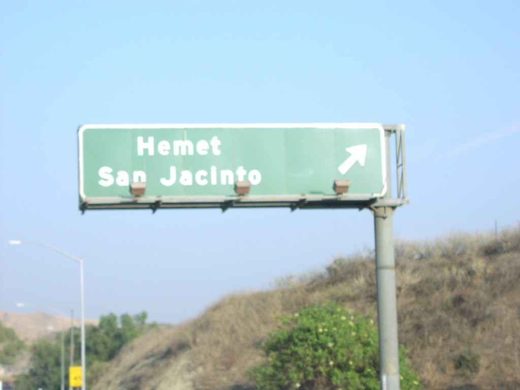
CA-60 East Exit 68
CA-60 east at Exit 68 - Hemet/San Jacinto exit (Gilman Springs Road).
Taken 03-01-2007
Moreno Valley
Riverside County
California
United States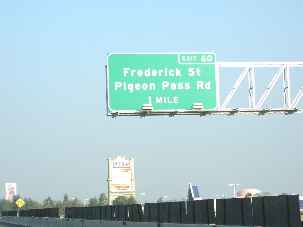
CA-60 East Exit 60
CA-60 east approaching Exit 60 - Frederick St./Pigeon Pass Road, 1 mile.
Taken 03-01-2007
Moreno Valley
Riverside County
California
United States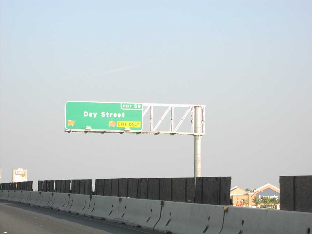
CA-60 East Exit 59
CA-60 east at Exit 59 - Day St.
Taken 03-01-2007
Riverside
Riverside County
California
United States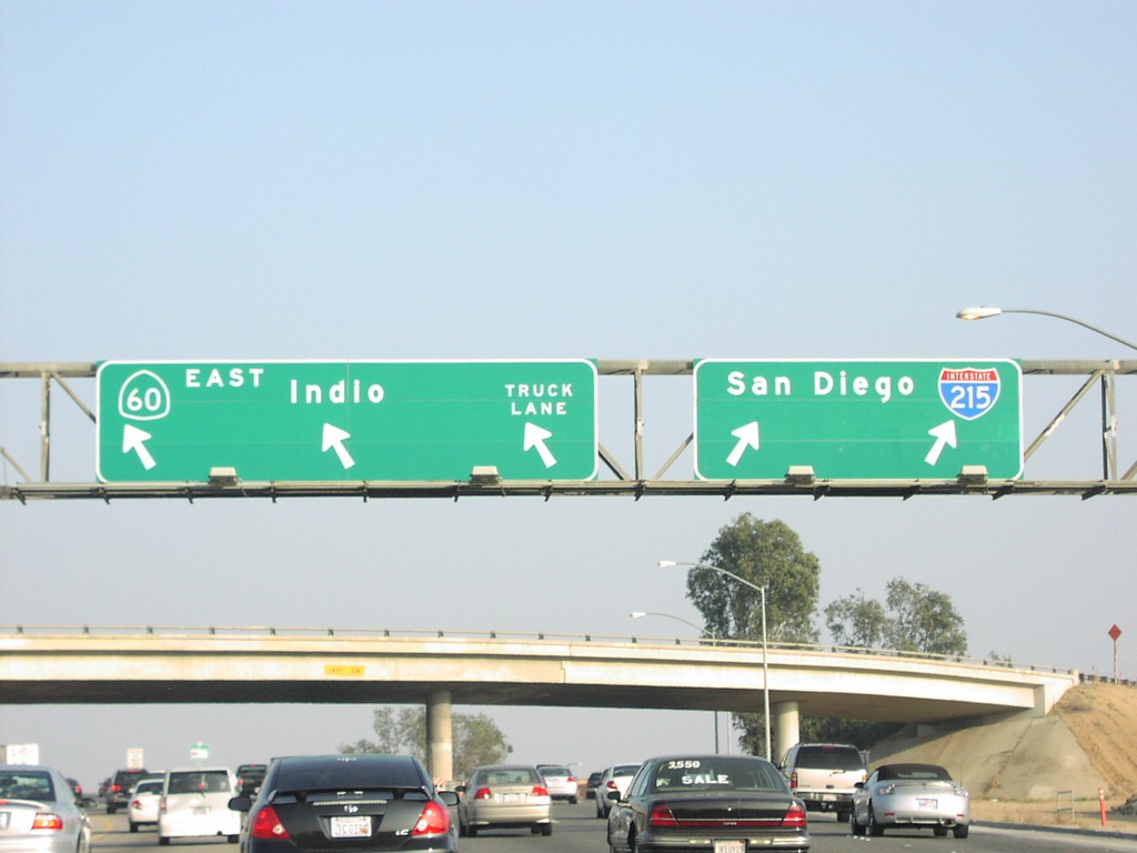
CA-60 East Exit 53B
CA-60 East/I-215 South at Exit 53B - I-215/CA-60 split. I-215 south to San Diego; CA-60 east to Indio.
Taken 03-01-2007
Riverside
Riverside County
California
United States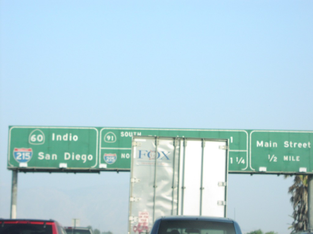
CA-60 East Exit 52B
CA-60 east approaching Exit 52B - Main St. and Exits 53AB CA-91/I-215
Taken 03-01-2007
Riverside
Riverside County
California
United States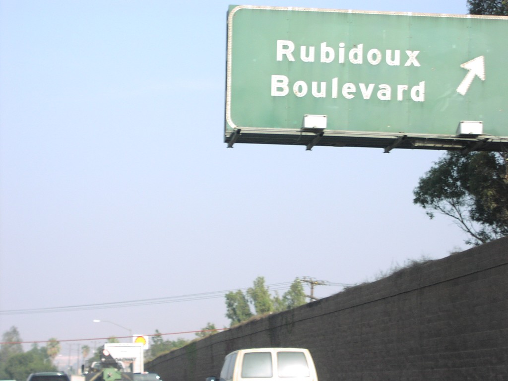
CA-60 East Exit 50
CA-60 east at Exit 50 - Rubidoux Blvd.
Taken 03-01-2007
Riverside
Riverside County
California
United States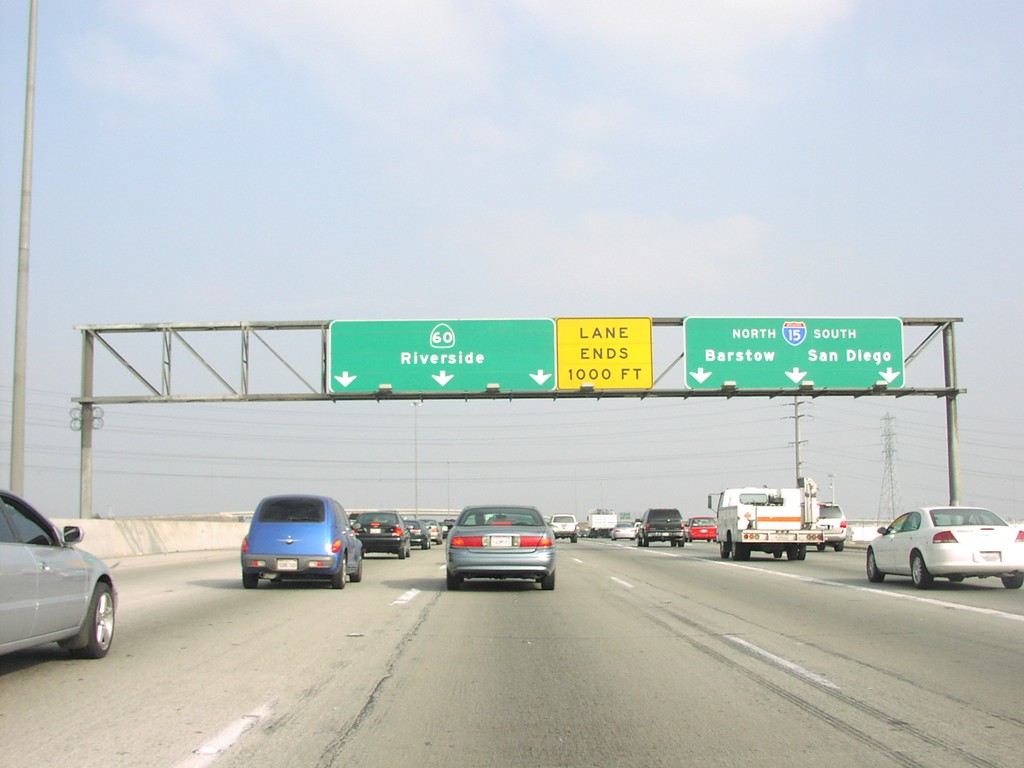
CA-60 East Exit 41
CA-60 east at Exit 41 - I-15/Barstow/San Diego
Taken 03-01-2007
Ontario
San Bernardino County
California
United States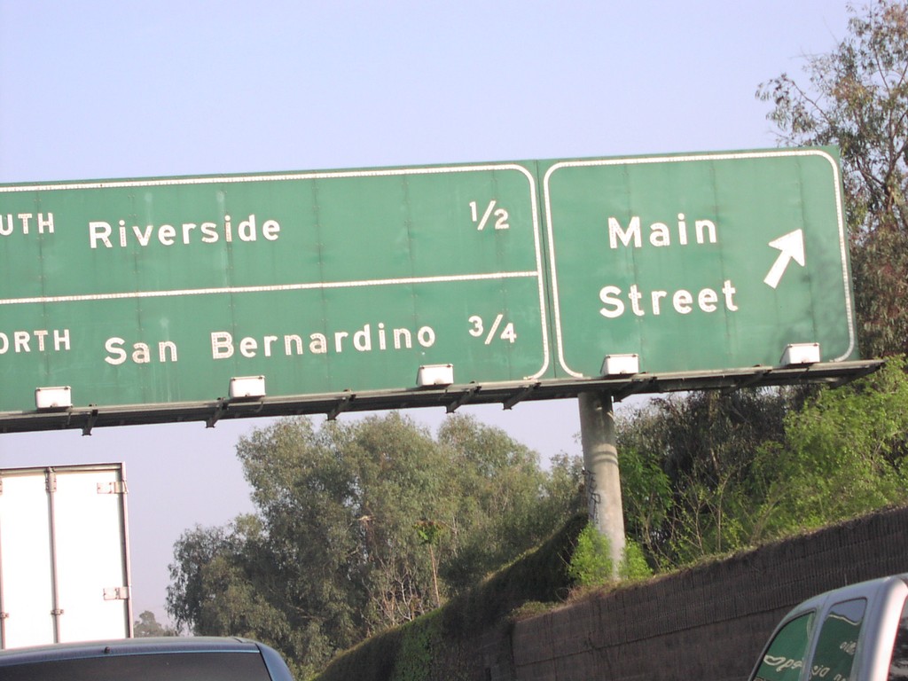
CA-60 East at Exit 52B and Exits 53AB
CA-60 east at Main St. Approaching CA-91/Riverside, and I-215 north to San Bernardino. CA-60 and I-215 are multiplexed east through Riverside.
Taken 03-01-2007
Riverside
Riverside County
California
United States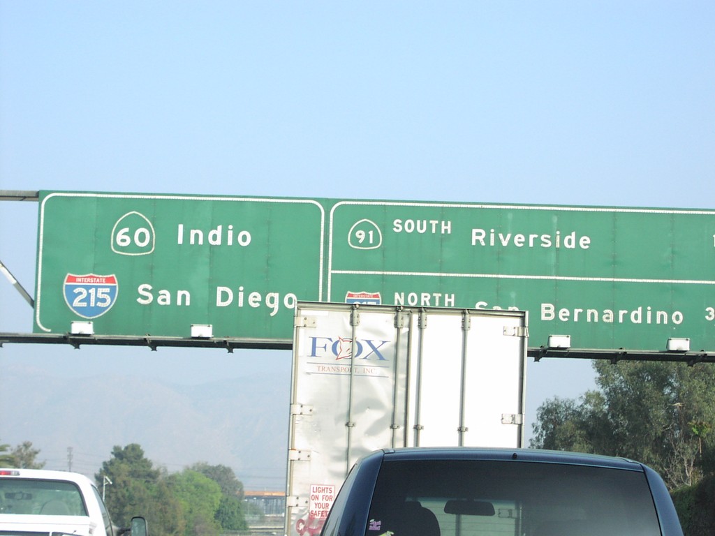
CA-60 East Approaching Exits 53AB
CA-60 east approaching Exit 53A - CA-91/Riverside, and Exit 53B - I-215 North/San Bernardino.
Taken 03-01-2007
Riverside
Riverside County
California
United States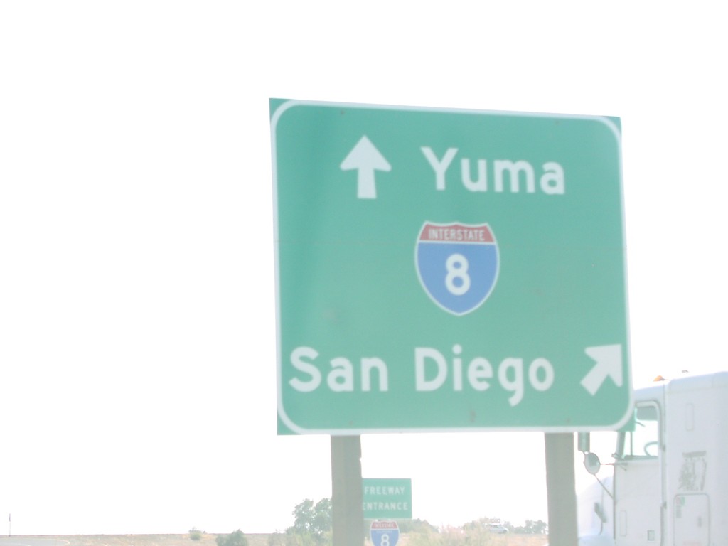
CA-111 South at I-8 West
CA-111 south at I-8 west to San Diego.
Taken 03-01-2007
 El Centro
Imperial County
California
United States
El Centro
Imperial County
California
United States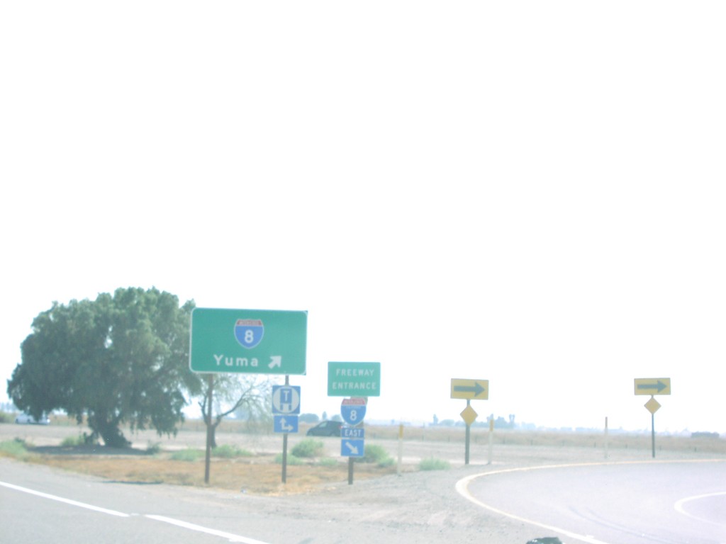
CA-111 South at I-8 East
CA-111 south at I-8 east freeway entrance to Yuma (AZ).
Taken 03-01-2007
El Centro
Imperial County
California
United States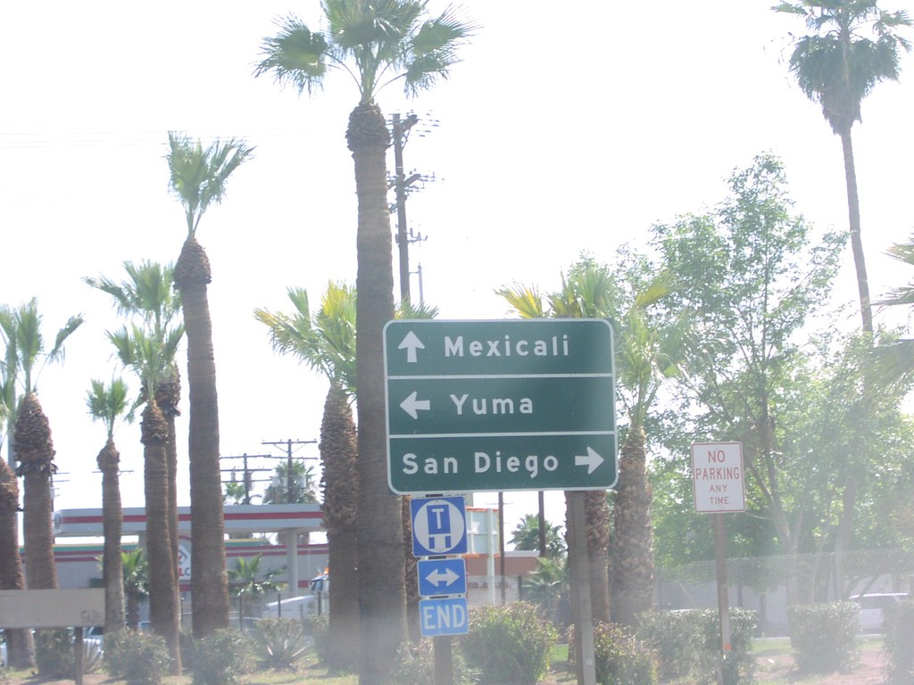
CA-111 South at CA-98
CA-111 south to Mexicali at CA-98 west to San Diego, and east to Yuma.
Taken 03-01-2007
 Calexico
Imperial County
California
United States
Calexico
Imperial County
California
United States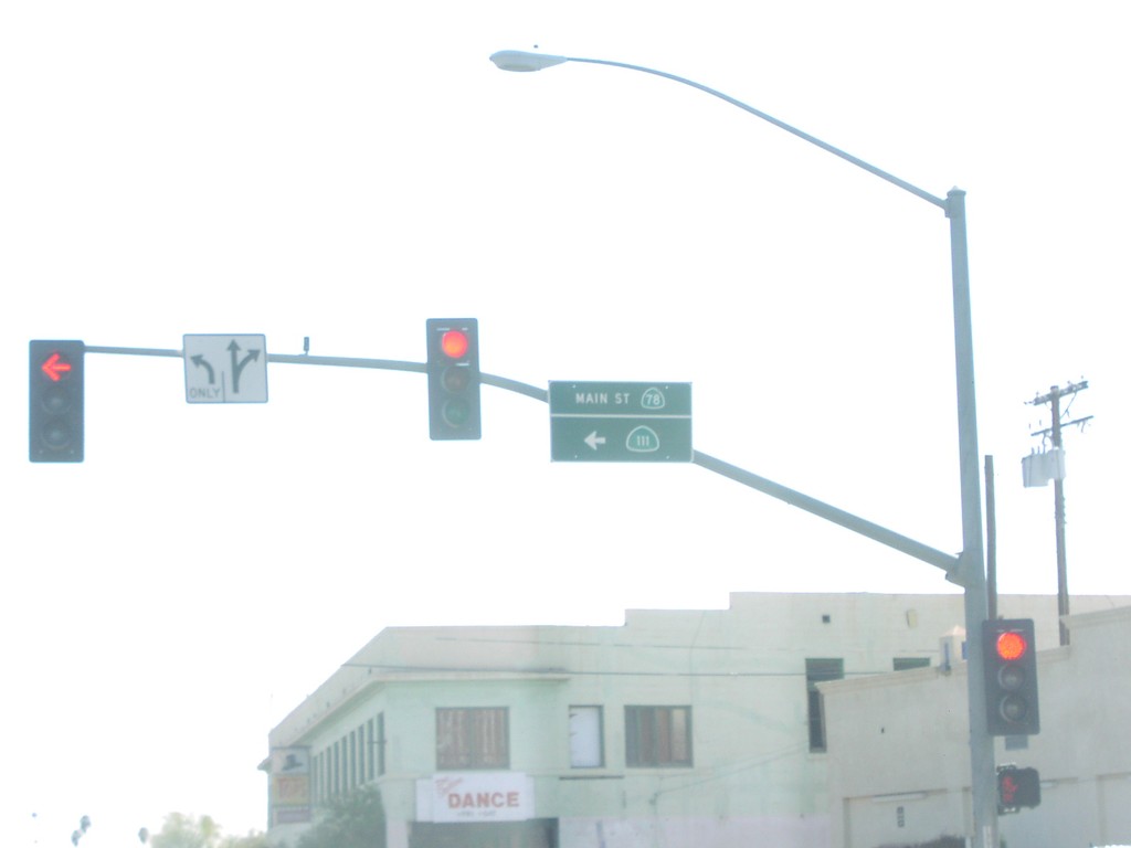
CA-111 South at CA-78
CA-111 south at CA-78. CA-111 follows CA-78 east through Brawley.
Taken 03-01-2007
Brawley
Imperial County
California
United States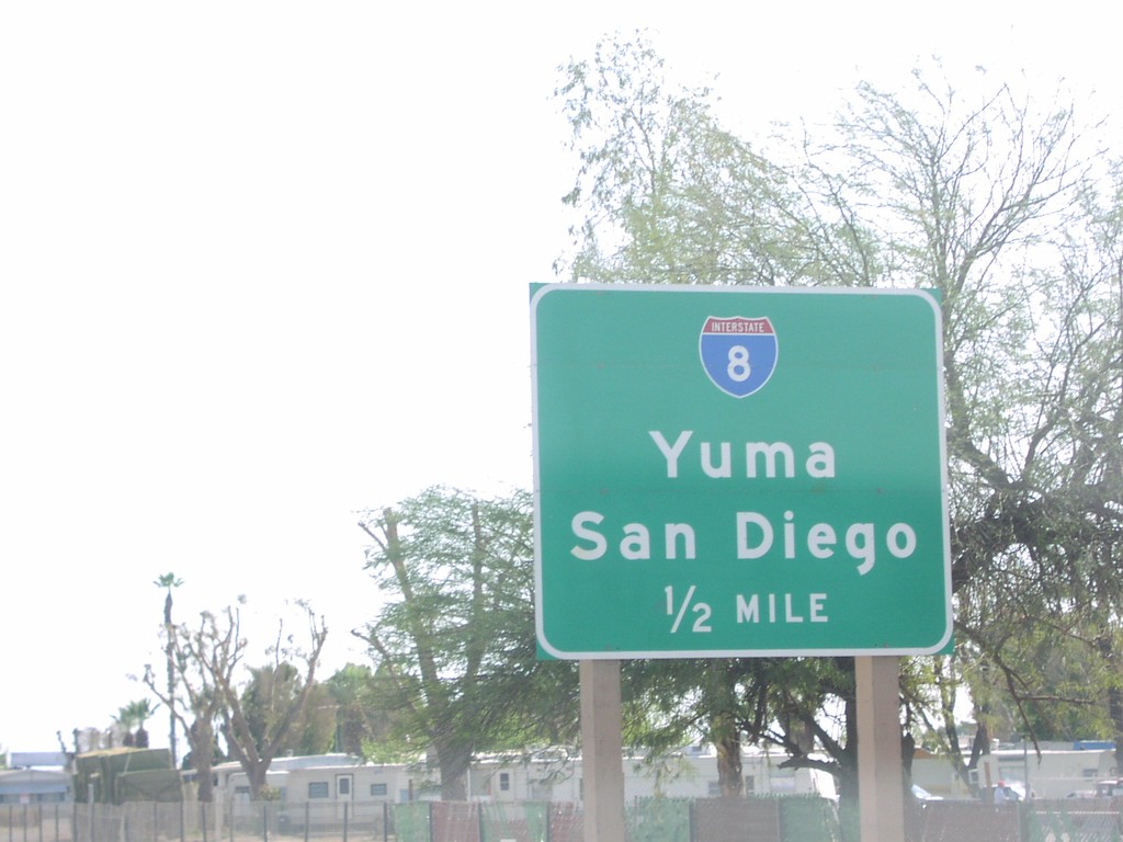
CA-111 South Approaching I-8
CA-111 south approaching I-8/Yuma/San Diego, 1/2 mile.
Taken 03-01-2007
El Centro
Imperial County
California
United States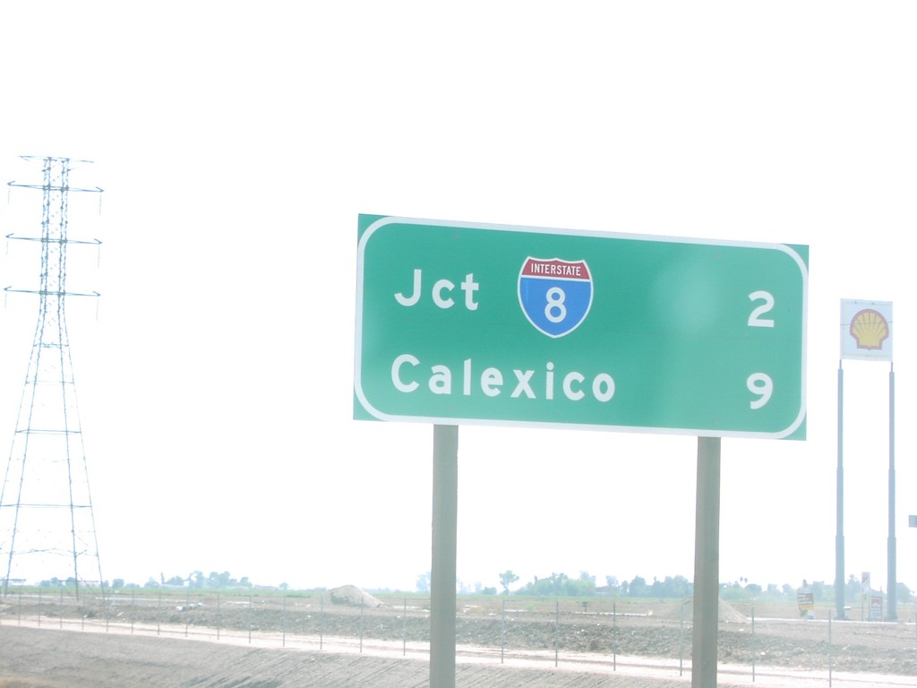
CA-111 South - Distance Marker
CA-111 south of Evan Hewes Hwy., to I-8 and Calexico.
Taken 03-01-2007
El Centro
Imperial County
California
United States