Signs Tagged With Big Green Sign
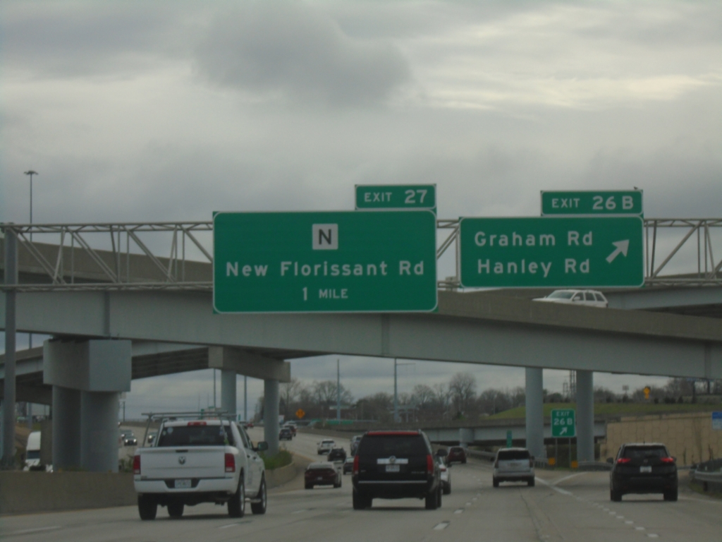
I-270 East - Exits 26B and Exit 27
I-270 East at Exit 26B - Graham Road/Hanley Road. Approaching Exit 27 - MO-N/New Florissant Road.
Taken 03-27-2026

 Hazelwood
St. Louis County
Missouri
United States
Hazelwood
St. Louis County
Missouri
United States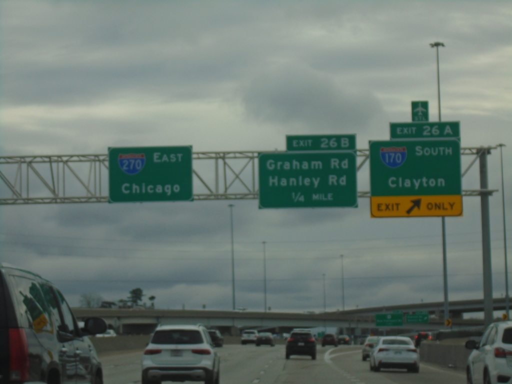
I-270 East - Exits 27A and 27B
I-270 East at Exit 27A - I-170 South/Clayton. Approaching Exit 27B - Graham Road/Hanley Road. Continue east on I-270 to Chicago (Illinois).
Taken 03-27-2026
 Hazelwood
St. Louis County
Missouri
United States
Hazelwood
St. Louis County
Missouri
United States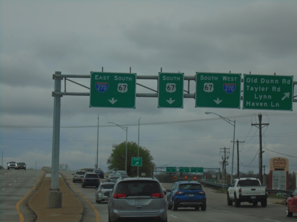
US-67 South - Old Dunn Road and I-270 Interchange
US-67 South at Old Dunn Road/Taylor Road/Lynn Haven Lane interchange. Approaching I-270 junction.
Taken 03-27-2026
 Hazelwood
St. Louis County
Missouri
United States
Hazelwood
St. Louis County
Missouri
United States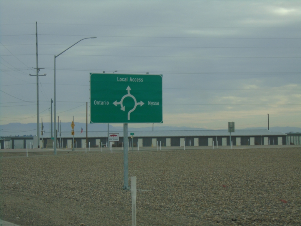
US-20/US-26 East at OR-201 Roundabout
US-20/US-26 East at OR-201 roundabout. Roundabout serves (US-20/US-26 East/OR-201 South) Nyssa, (OR-201 North) Ontario and Local Access.
Taken 02-16-2026


 Ontario
Malheur County
Oregon
United States
Ontario
Malheur County
Oregon
United States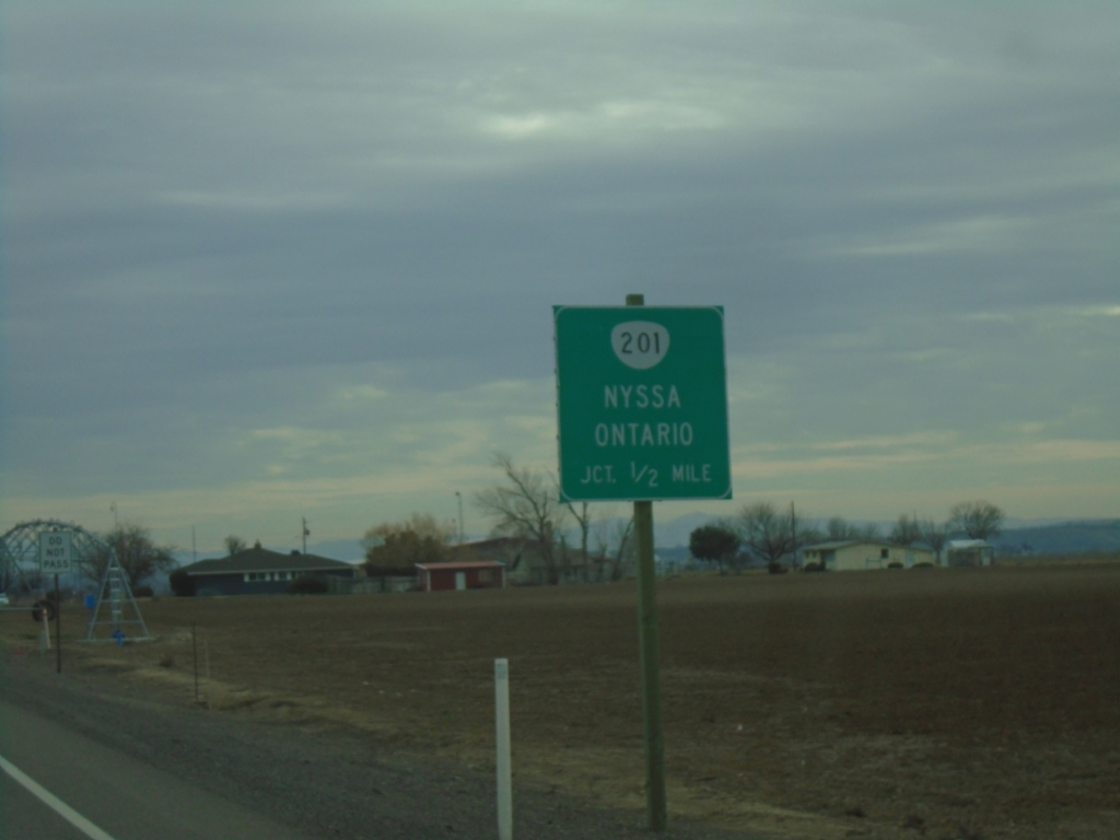
US-20/US-26 East Approaching OR-201
US-20/US-26 east approaching OR-201 to Nyssa and Ontario.
Taken 02-16-2026
Ontario
Malheur County
Oregon
United States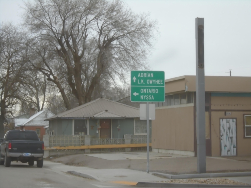
US-26 East at US-20 - Vale
US-26 East at US-20 in Vale. Turn left for US-20/US-26 East to Ontario and Nyssa; continue straight for Adrian and Lake Owyhee.
Taken 02-16-2026
Vale
Malheur County
Oregon
United States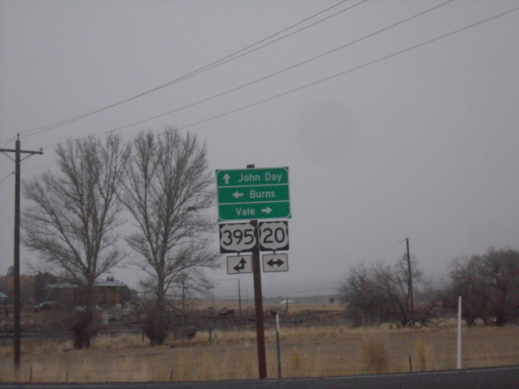
Fry Road North at US-20/US-395 Junction
Fry Road North at US-20/US-395 Junction. Turn right for US-20 East to Vale; left for US-20 West/US-395 South to Burns; continue straight for US-395 North to John Day.
Taken 02-16-2026
 Burns
Harney County
Oregon
United States
Burns
Harney County
Oregon
United States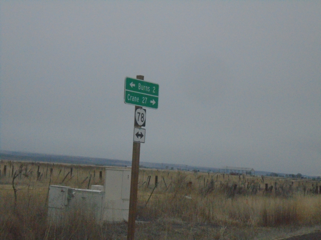
End OR-205 North at OR-78
End OR-205 North at OR-78 in Harney County. Turn right for OR-78 East to Crane; left for OR-78 West to Burns.
Taken 02-16-2026

 Burns
Harney County
Oregon
United States
Burns
Harney County
Oregon
United States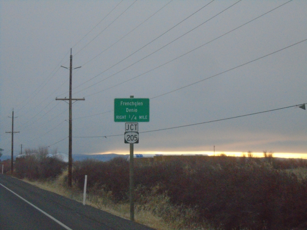
OR-78 East Approaching OR-205
OR-78 East approaching OR-205. Use OR-205 south to Frenchglen and Denio (Nevada).
Taken 02-16-2026
Burns
Harney County
Oregon
United States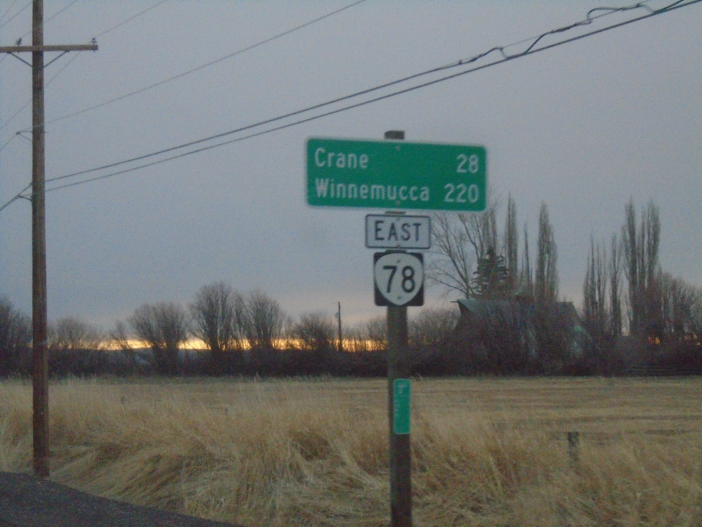
OR-78 East - Distance Marker
Distance marker on OR-78 east. Distance to Crane and Winnemucca (Nevada).
Taken 02-16-2026
Burns
Harney County
Oregon
United States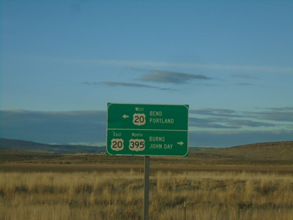
US-395 North at US-20 - Riley
US-395 North at US-20 in Riley. Use US-20 West to Bend and Portland; use US-395 North/US-20 East to Burns and John Day. US-395 North joins US-20 East to Burns.
Taken 02-15-2026
Riley
Harney County
Oregon
United States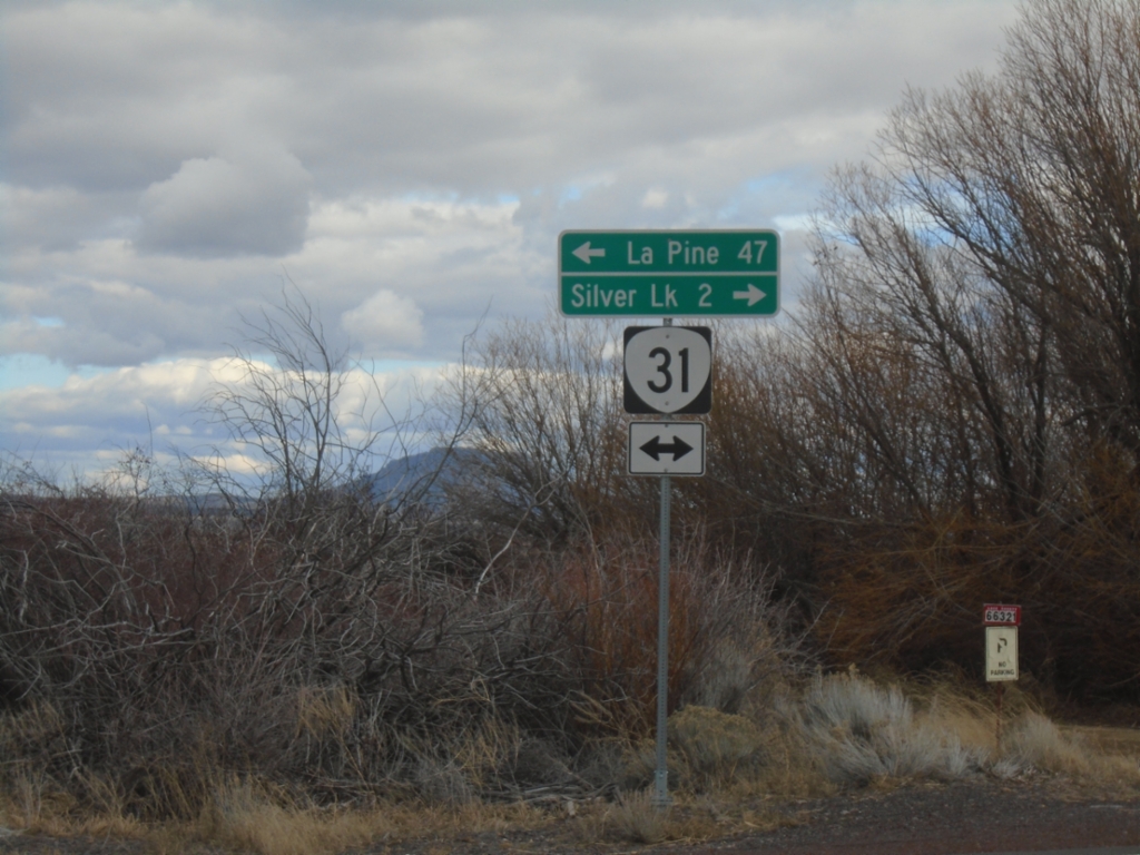
End Silver Creek Marsh Road at OR-31
End Silver Creek Marsh Road at OR-31. Turn right on OR-31 for Silver Lake. Turn left on OR-31 for La Pine.
Taken 02-15-2026
 Silver Lake
Lake County
Oregon
United States
Silver Lake
Lake County
Oregon
United States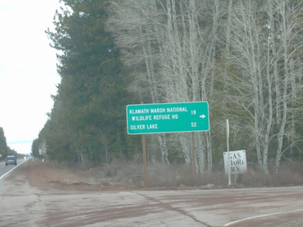
US-97 North - Silver Lake Road
US-97 north at Silver Lake Road. Use Silver Lake Road for Klamath Marsh National Wildlife Refuge HQ and Silver Lake.
Taken 02-15-2026
 Chiloquin
Klamath County
Oregon
United States
Chiloquin
Klamath County
Oregon
United States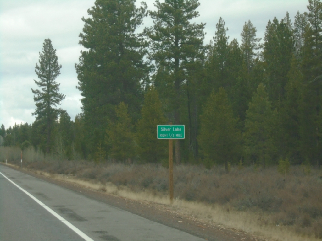
US-97 North Approaching Silver Lake Junction
US-97 North approaching Silver Lake Junction
Taken 02-15-2026
Klamath County
Oregon
United States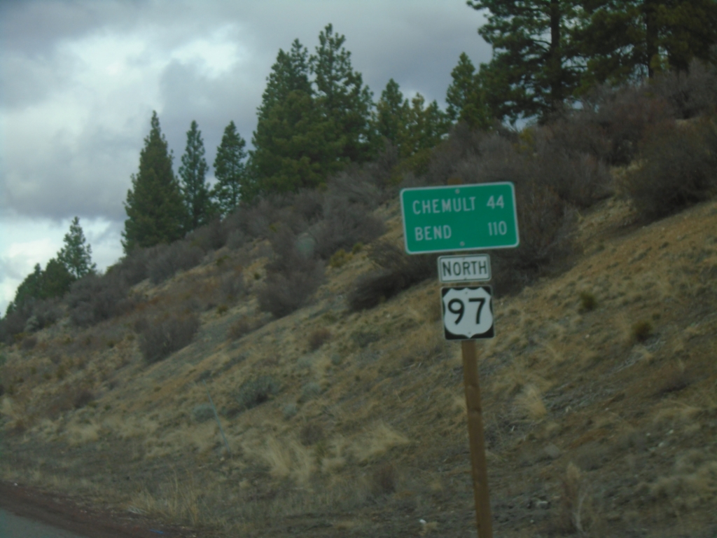
US-97 North - Distance Marker
Distance marker on US-97 north. Distance to Chemult and Bend.
Taken 02-15-2026
Chiloquin
Klamath County
Oregon
United States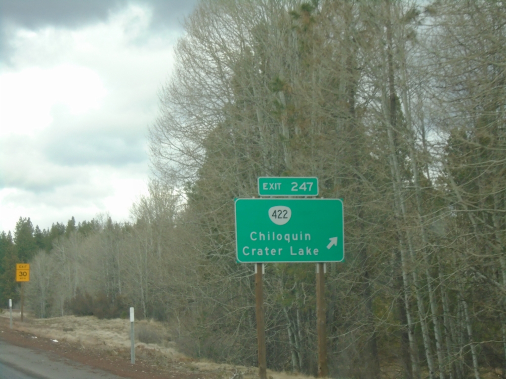
US-97 North - Exit 247
US-97 North at Exit 247 - OR-422/Chiloquin/Crater Lake.
Taken 02-15-2026
 Chiloquin
Klamath County
Oregon
United States
Chiloquin
Klamath County
Oregon
United States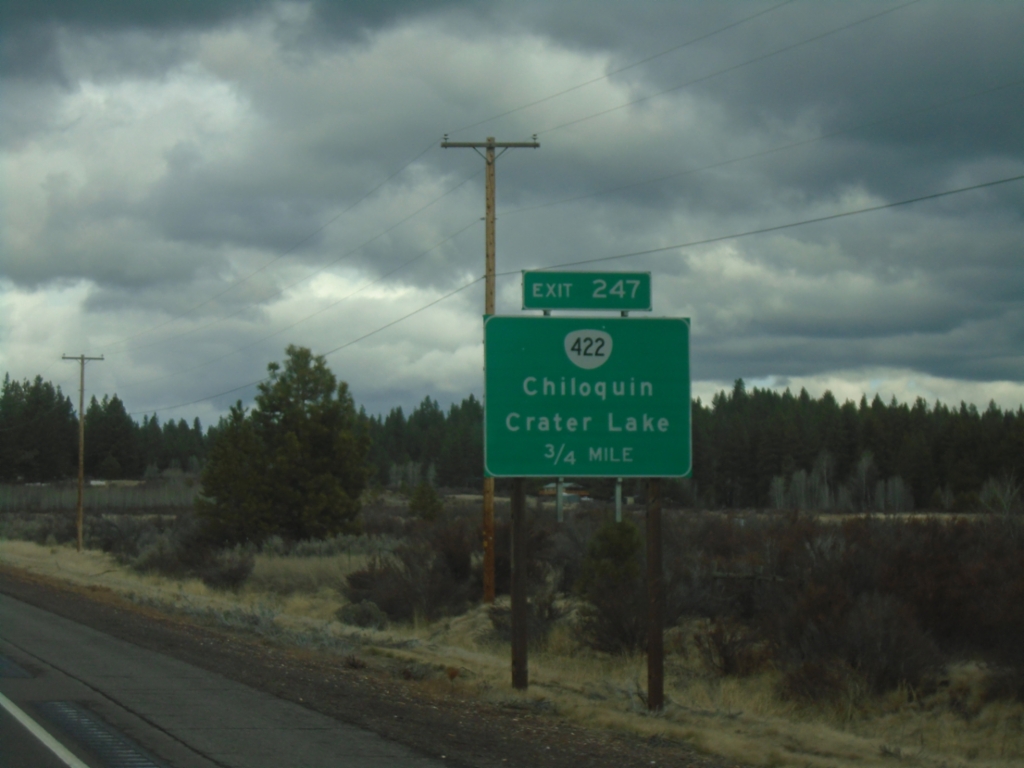
US-97 North - Exit 247
US-97 north approaching Exit 247 - OR-422/Chiloquin/Crater Lake.
Taken 02-15-2026
Chiloquin
Klamath County
Oregon
United States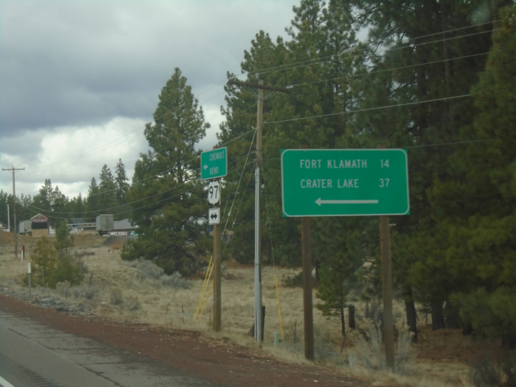
US-97 North at OR-62
US-97 North at OR-62 in Klamath County. Use OR-62 for Fort Klamath and Crater Lake.
Taken 02-15-2026
 Chiloquin
Klamath County
Oregon
United States
Chiloquin
Klamath County
Oregon
United States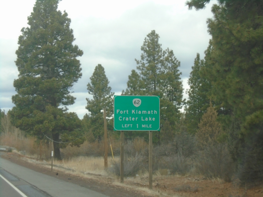
US-97 North Approaching OR-62
US-97 north approaching OR-62 to Fort Klamath and Crater Lake.
Taken 02-15-2026
Modoc Point
Klamath County
Oregon
United States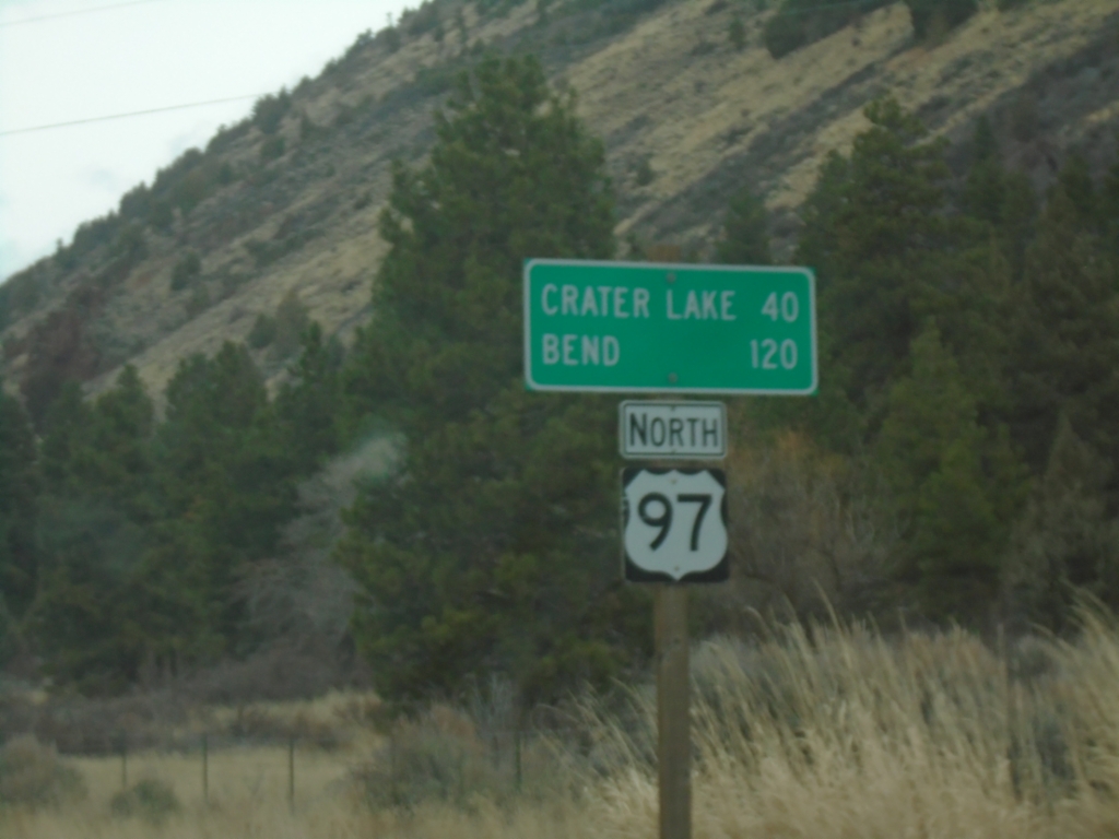
US-97 North - Distance Marker
Distance marker on US-97 north. Distance to Crater Lake and Bend.
Taken 02-15-2026
Modoc Point
Klamath County
Oregon
United States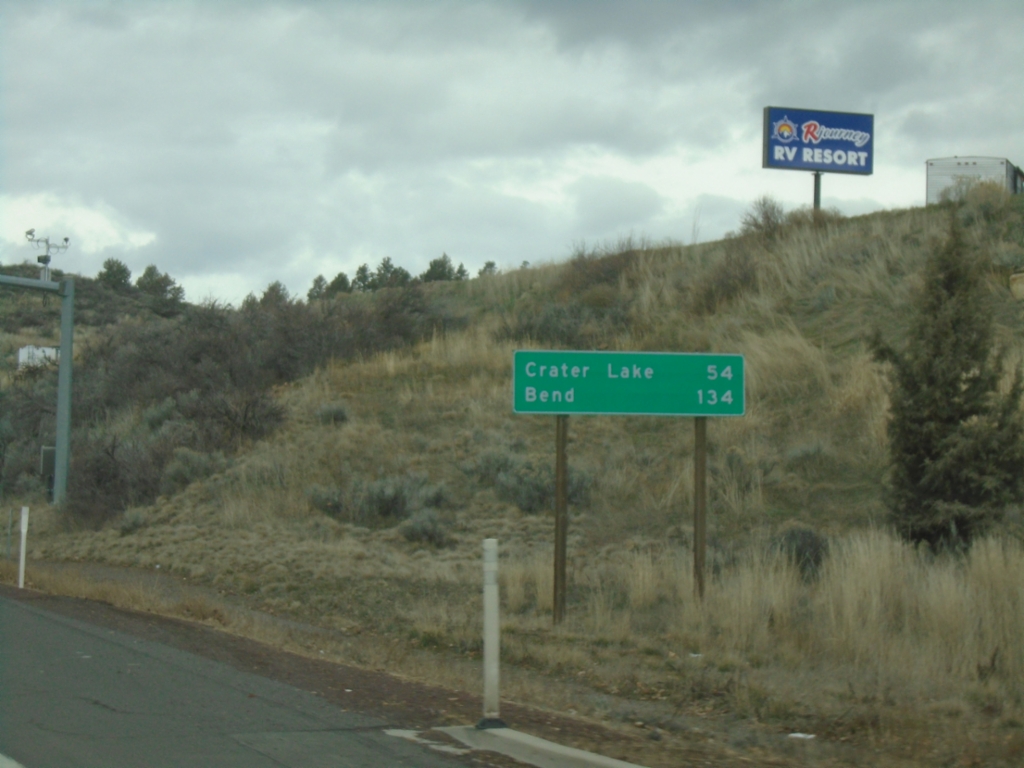
US-97 North - Distance Marker
Distance marker on US-97 north. Distance to Crater Lake and Bend.
Taken 02-15-2026
Klamath Falls
Klamath County
Oregon
United States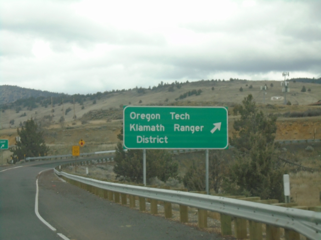
US-97 North - Exit 272
US-97 north at Exit 272 - Oregon Tech/Klamath Falls Ranger District.
Taken 02-15-2026

 Klamath Falls
Klamath County
Oregon
United States
Klamath Falls
Klamath County
Oregon
United States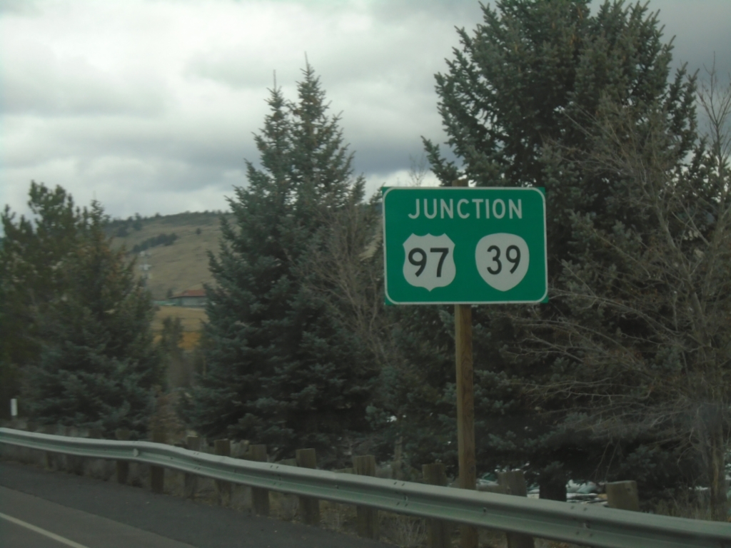
US-97 North - Exit 272
US-97 North approaching Exit 272. Use Exit 272 for OR-39.
Taken 02-15-2026
Klamath Falls
Klamath County
Oregon
United States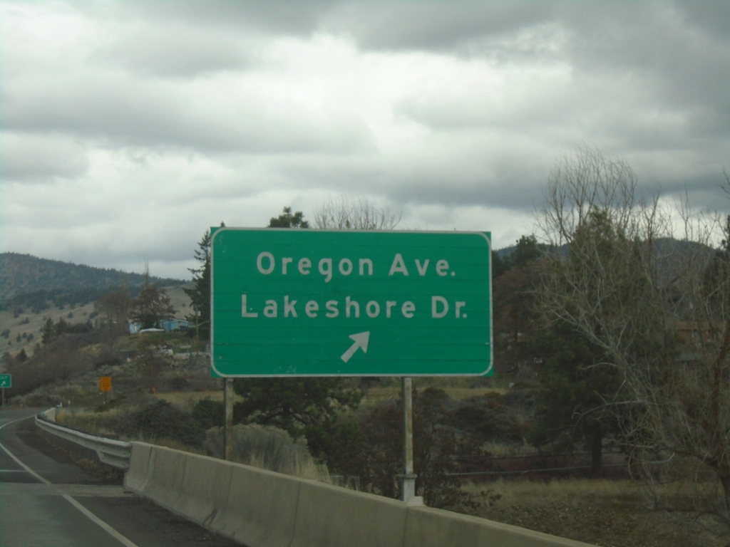
US-97 North - Exit 273
US-97 North at Exit 273 - Oregon Ave./Lakeshore Drive.
Taken 02-15-2026
Klamath Falls
Klamath County
Oregon
United States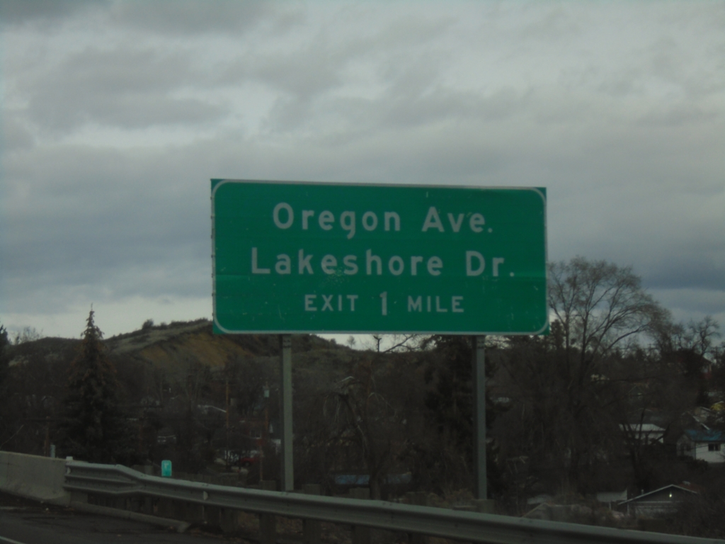
US-97 North - Exit 273
US-97 North approaching Exit 273 - Oregon Ave./Lakeshore Drive.
Taken 02-15-2026
Klamath Falls
Klamath County
Oregon
United States