Signs Tagged With Big Green Sign
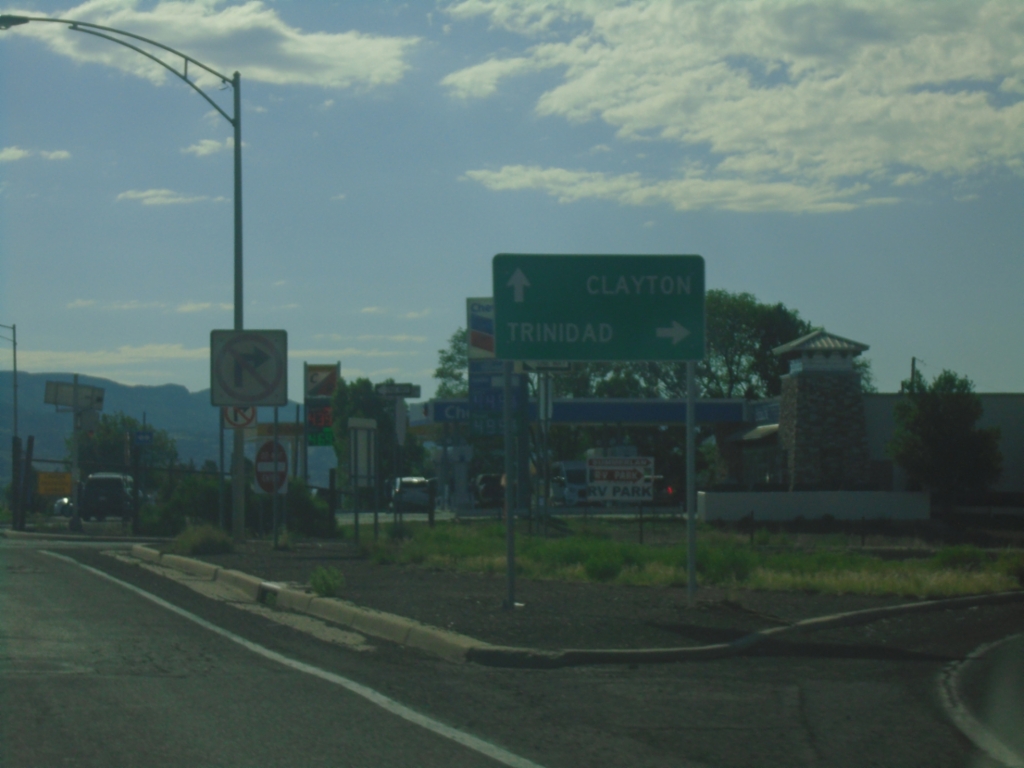
US-64 East/US-87 South at I-25 North
US-64 East/US-87 South at I-25 North (Exit 451) to Trinidad (Colorado). Continue on US-64 East/US-87 South to Clayton.
Taken 06-20-2026


 Raton
Colfax County
New Mexico
United States
Raton
Colfax County
New Mexico
United States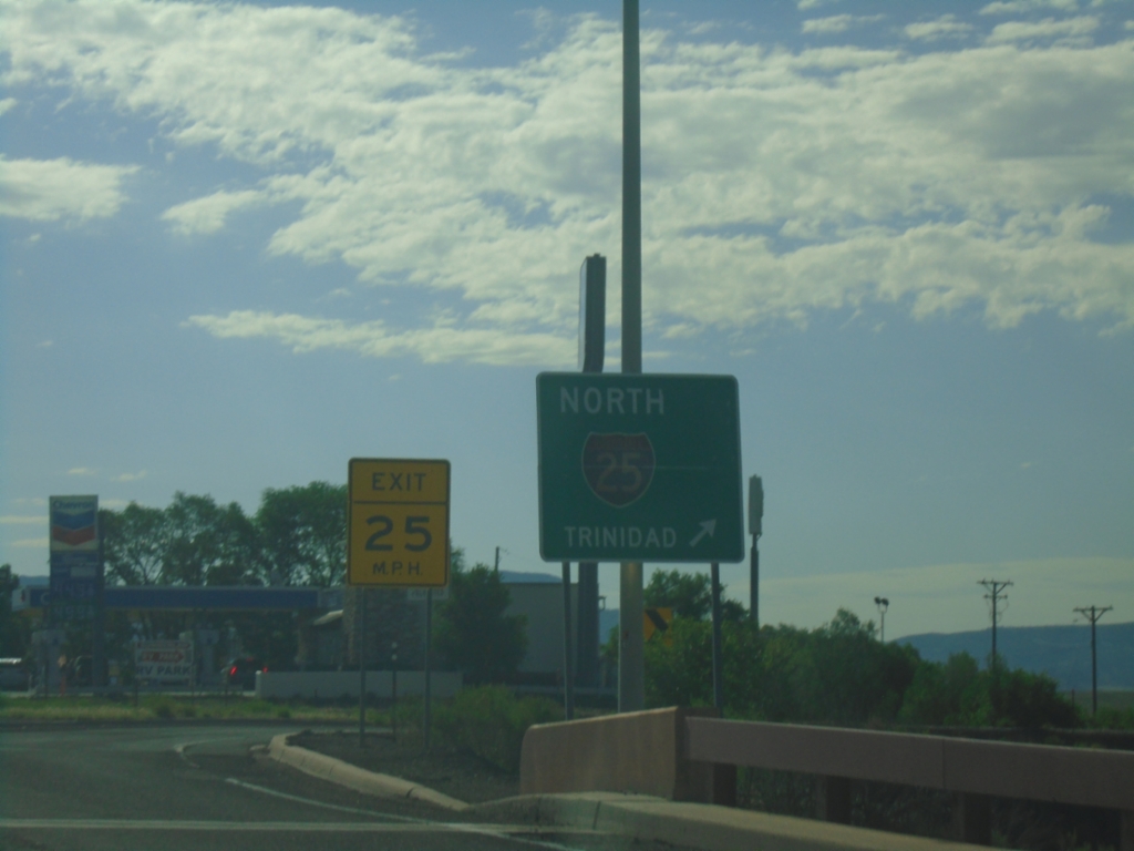
US-64 East/US-87 South at I-25 North
US-64 East/US-87 South at I-25 north to Trinidad (Colorado).
Taken 06-20-2026
Raton
Colfax County
New Mexico
United States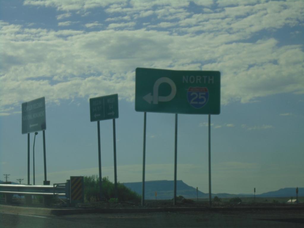
US-64 East at I-25 (Exit 451)
US-64 East at I-25 (Exit 451) in Raton. Use right lane for I-25 North.
Taken 06-20-2026
Raton
Colfax County
New Mexico
United States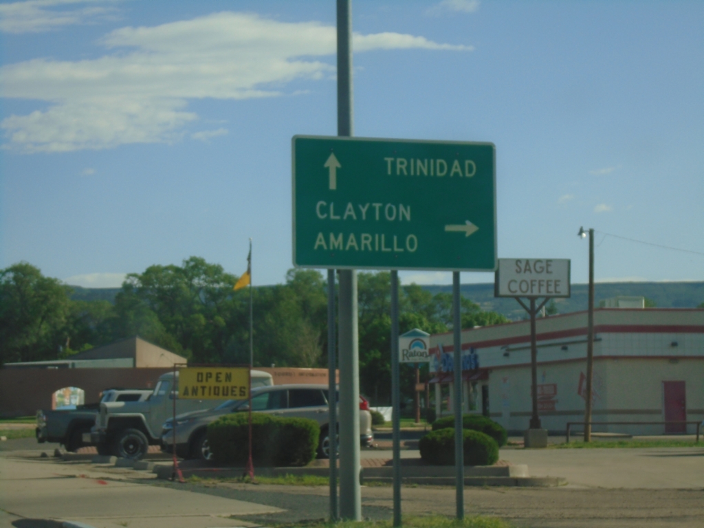
BL-25 North/US-64 East at US-64
BL-25 North/US-64 East (2nd St.) at US-64 (Clayton Road) junction. Turn right to continue east on US-64 to Clayton and Amarillo (Texas). Continue north on BL-25 to Trinidad (Colorado).
Taken 06-20-2026
 Raton
Colfax County
New Mexico
United States
Raton
Colfax County
New Mexico
United States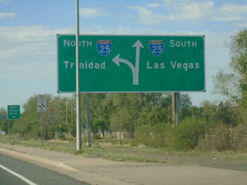
BL-25 South/US-64 West Approaching I-25
BL-25 South/US-64 West (2nd St.) approaching I-25 in Raton. Use I-25 south to Las Vegas; I-25 north to Trinidad (Colorado).
Taken 06-20-2026
Raton
Colfax County
New Mexico
United States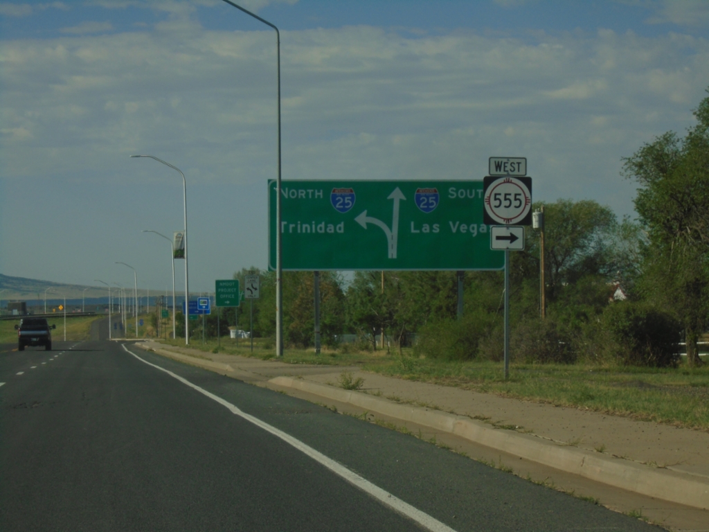
BL-25 South/US-64 West at NM-555 / Approaching I-25
BL-25 South/US-64 West (2nd St.) at NM-555 West. Approaching I-25 South to Las Vegas and North to Trinidad (Colorado).
Taken 06-20-2026
 Raton
Colfax County
New Mexico
United States
Raton
Colfax County
New Mexico
United States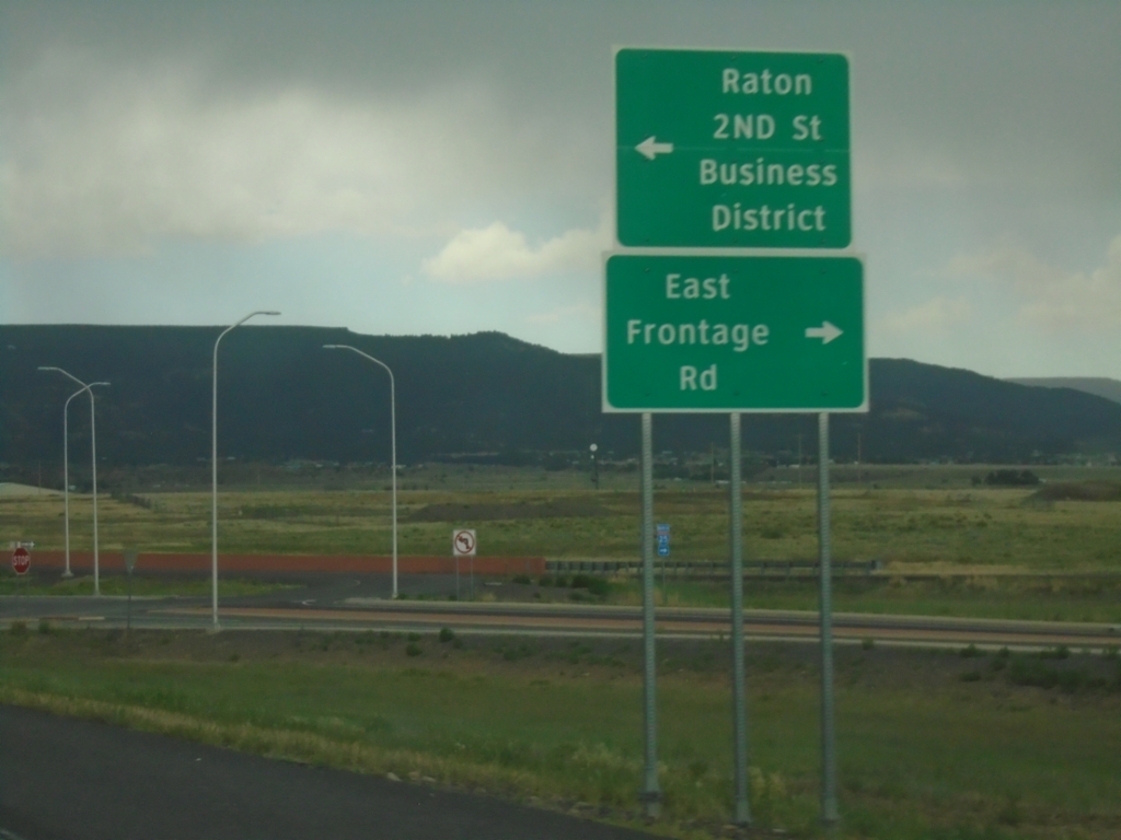
I-25 North - Exit 450 Offramp
I-25 North on Exit 450 Offramp. Turn left for BL-25 North/US-64 East to Raton/2nd St./Business District. Turn right for East Frontage Road.
Taken 06-19-2026
Raton
Colfax County
New Mexico
United States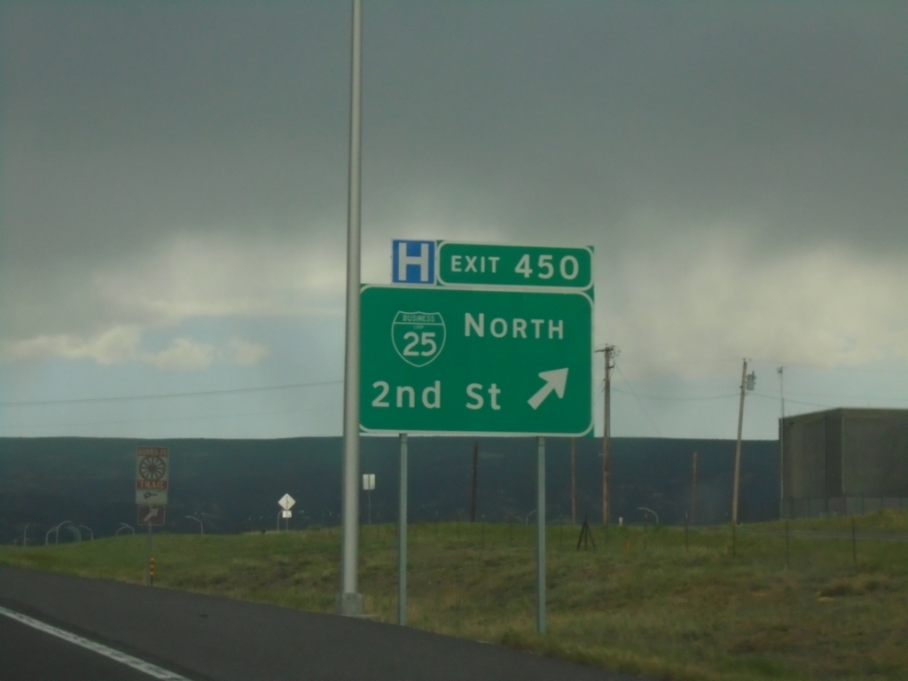
I-25 North - Exit 450
I-25 north at Exit 450 - BL-25 North/2nd St. US-64 East leaves I-25 here.
Taken 06-19-2026
Raton
Colfax County
New Mexico
United States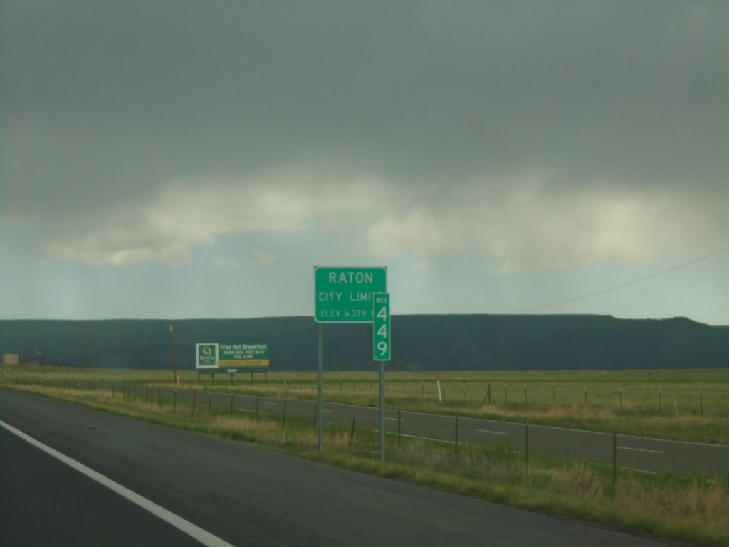
I-25 North - Entering Raton
Raton City Limit - Elevation 6279 Feet on I-25 North. Mile 449.
Taken 06-19-2026
Raton
Colfax County
New Mexico
United States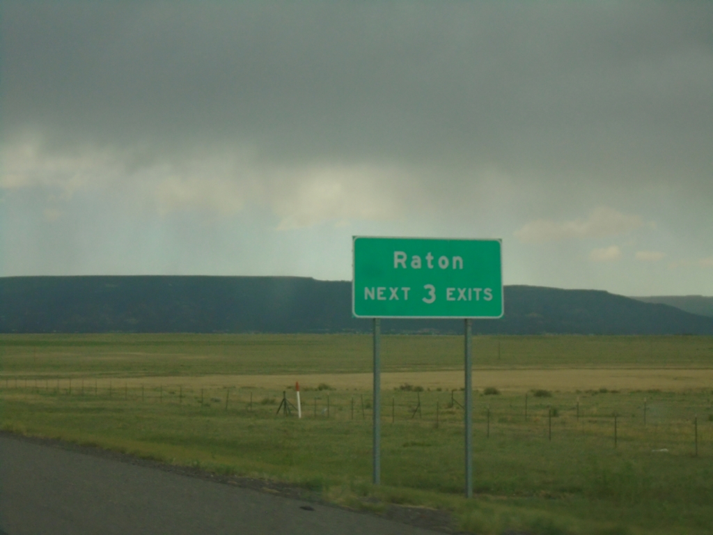
I-25 North - Raton
Raton Next 3 Exits on I-25 North.
Taken 06-19-2026
Raton
Colfax County
New Mexico
United States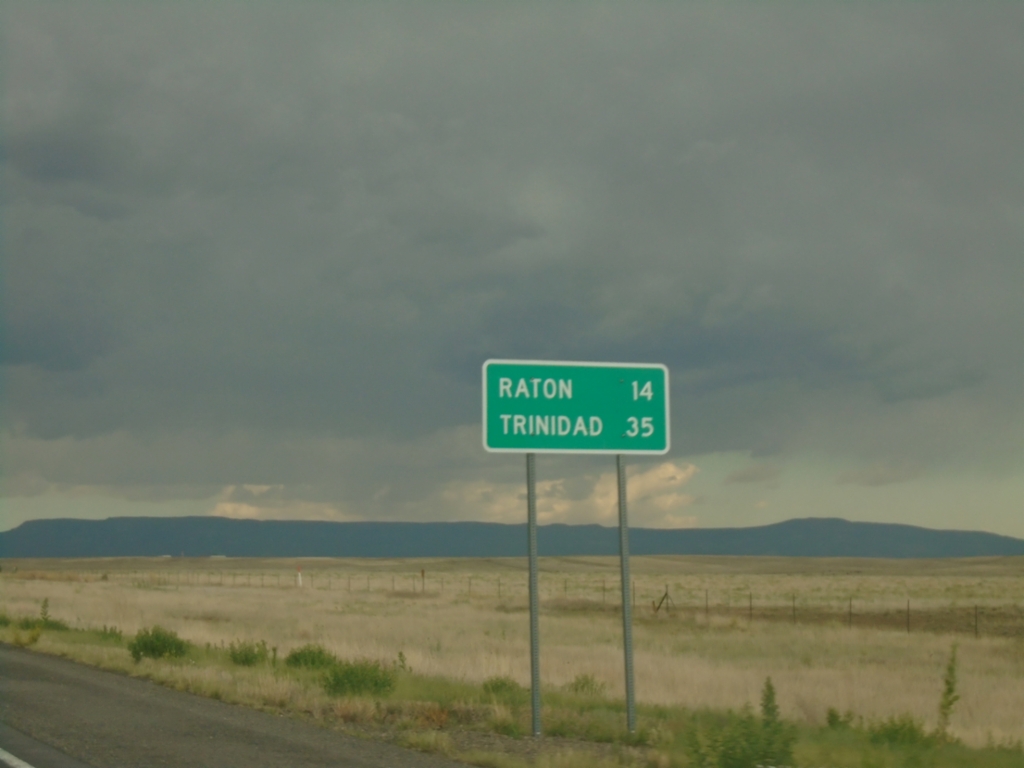
US-64 - Distance Marker
Distance marker on US-64. Distance to Raton and Trinidad (Colorado).
Taken 06-19-2026
Colfax County
New Mexico
United States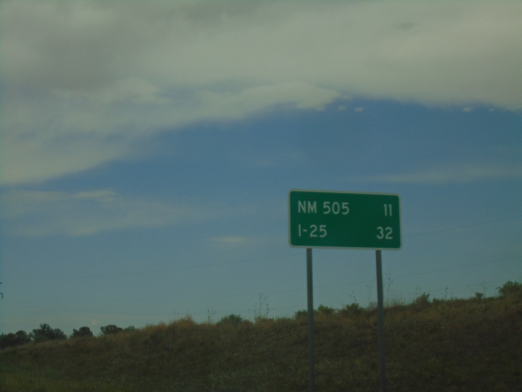
US-64 East - Distance Marker
Distance marker on US-64 east. Distance to NM-505 Junction and I-25 Junction.
Taken 06-19-2026
 Cimarron
Colfax County
New Mexico
United States
Cimarron
Colfax County
New Mexico
United States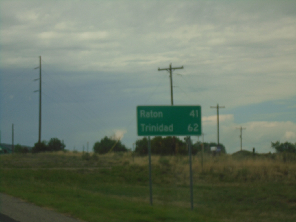
US-64 East - Distance Marker
Distance marker on US-64 East. Distance to Raton and Trinidad (Colorado).
Taken 06-19-2026
Cimarron
Colfax County
New Mexico
United States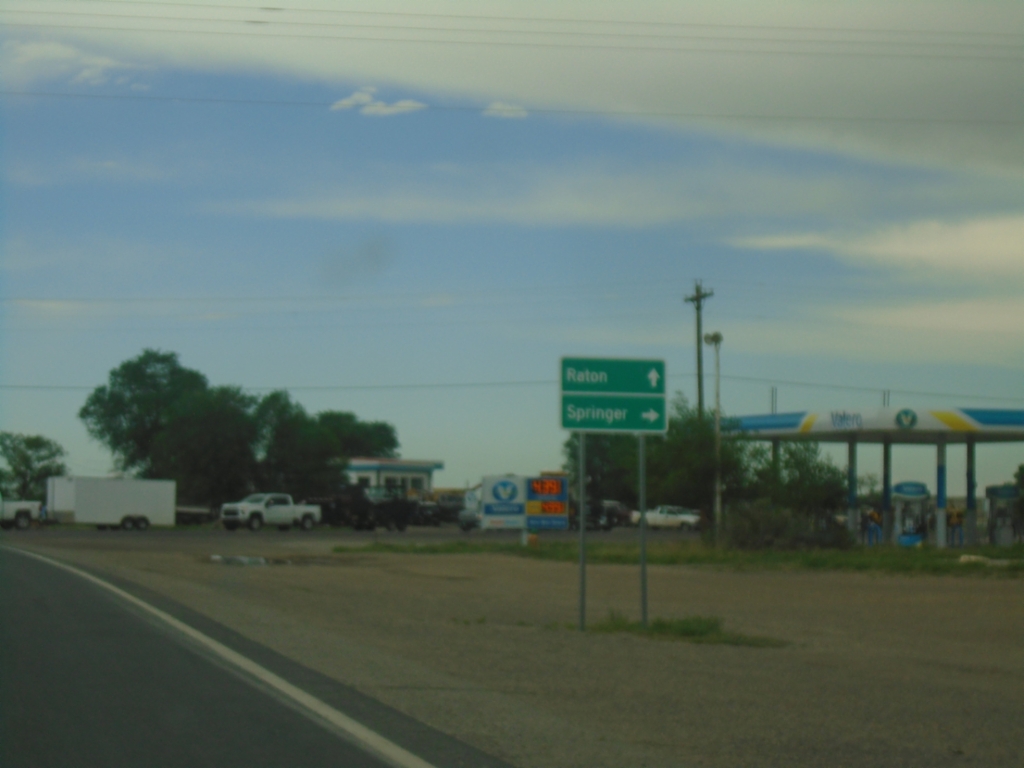
US-64 East at NM-58 East
US-64 East at NM-58 East in Cimarron. Use NM-58 East to Springer; continue east on US-64 to Raton.
Taken 06-19-2026
 Cimarron
Colfax County
New Mexico
United States
Cimarron
Colfax County
New Mexico
United States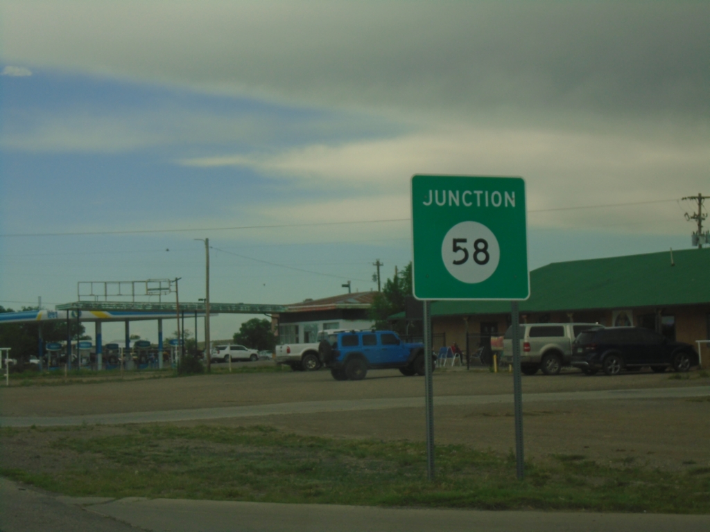
US-64 East Approaching NM-58
US-64 East approaching NM-58 in Cimarron.
Taken 06-19-2026
Cimarron
Colfax County
New Mexico
United States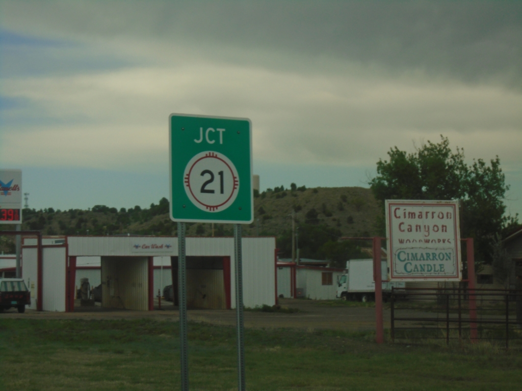
US-64 East Approaching NM-21
US-64 East approaching NM-21 in Cimarron.
Taken 06-19-2026
 Cimarron
Colfax County
New Mexico
United States
Cimarron
Colfax County
New Mexico
United States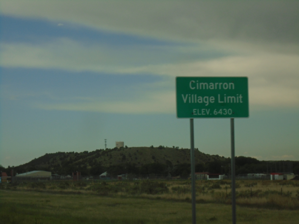
US-64 East - Cimarron
Cimarron Village Limit - Elevation 6430 Feet on US-64 east.
Taken 06-19-2026
Cimarron
Colfax County
New Mexico
United States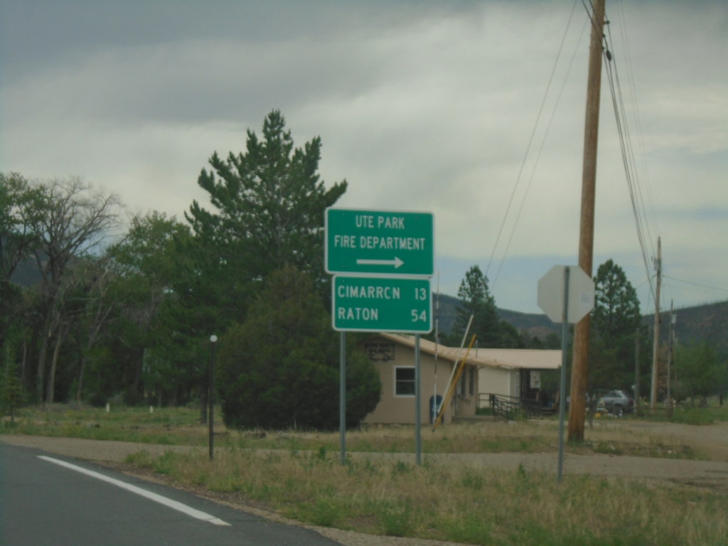
US-64 East - Ute Park
US-64 East at Ute Park Fire Department junction. Continue east on US-64 for Cimarron and Raton.
Taken 06-19-2026
Ute Park
Colfax County
New Mexico
United States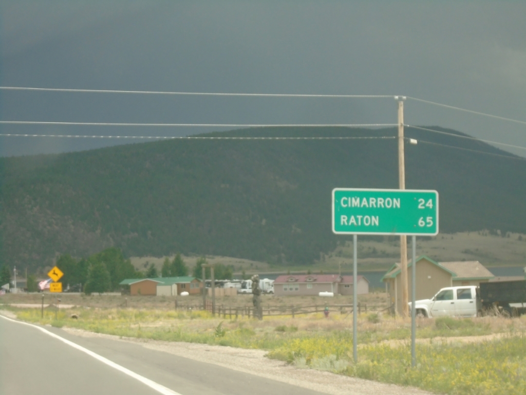
US-64 East - Distance Marker
Distance marker on US-64 east. Distance to Cimarron and Raton.
Taken 06-19-2026
Eagle Nest
Colfax County
New Mexico
United States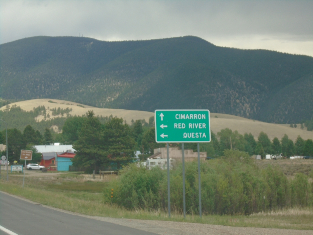
US-64 East at NM-38
US-64 East at NM-38 in Eagle Nest. Use NM-38 West to Red River and Questa. Use US-64 East to Cimarron.
Taken 06-19-2026
 Eagle Nest
Colfax County
New Mexico
United States
Eagle Nest
Colfax County
New Mexico
United States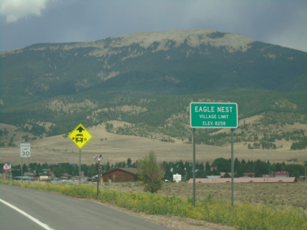
US-64 East - Eagle Nest
Eagle Nest Village Limit on US-64 East. Elevation 8258 Feet.
Taken 06-19-2026
Eagle Nest
Colfax County
New Mexico
United States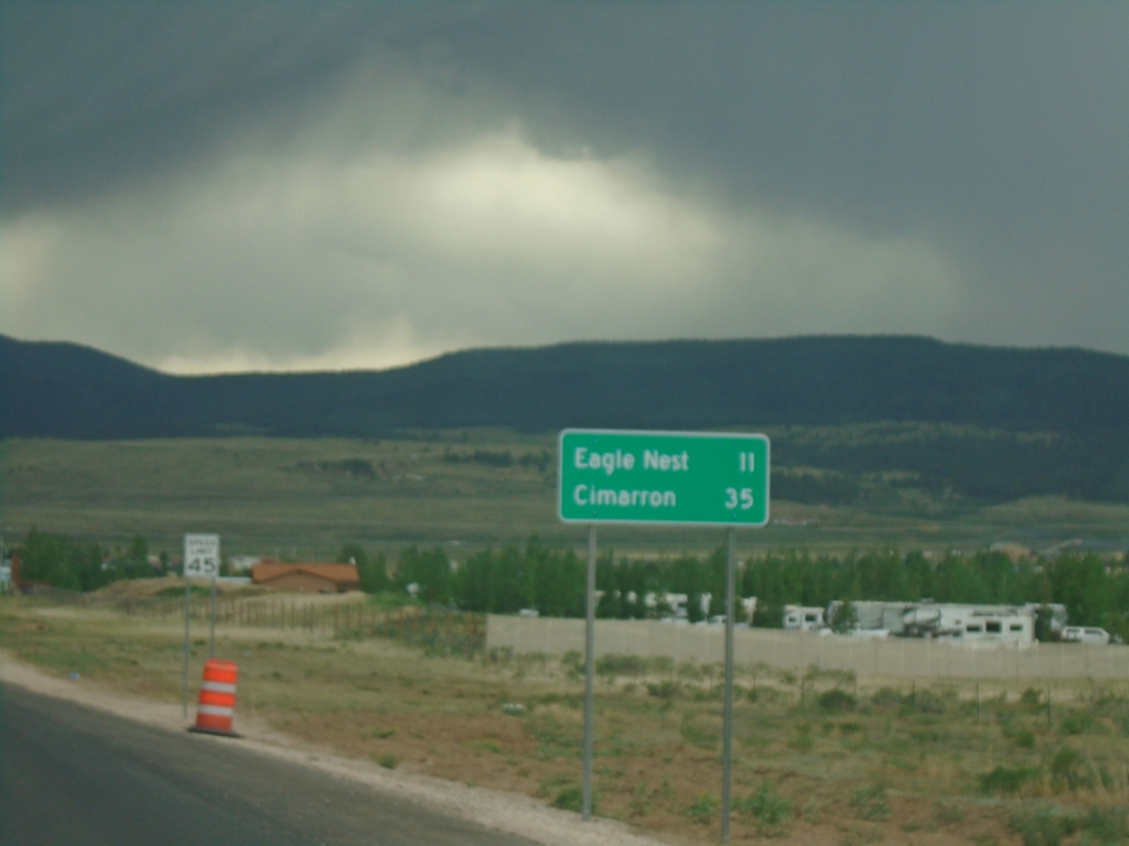
US-64 East - Distance Marker
Distance marker on US-64 east. Distance to Eagle Nest and Cimarron.
Taken 06-19-2026
Eagle Nest
Colfax County
New Mexico
United States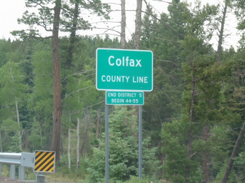
US-64 East - Colfax County Line
Colfax County Line on US-64 east at Palo Flechado Pass between Taos and Angel Fire.
Taken 06-19-2026
Colfax County
New Mexico
United States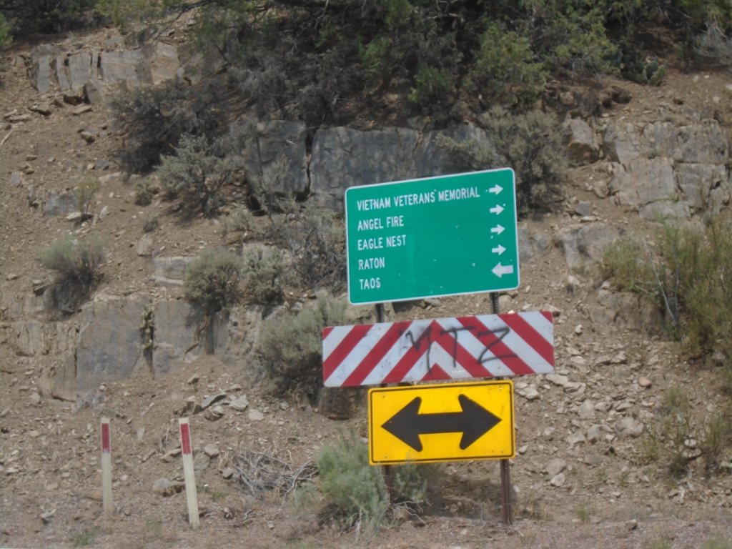
End NM-585 at US-64
End NM-585 at US-64. Use US-64 East to Vietnam Veterans Memorial, Angel Fire, Eagle Nest, and Raton; use US-64 West to Taos.
Taken 06-19-2026
 Taos
Taos County
New Mexico
United States
Taos
Taos County
New Mexico
United States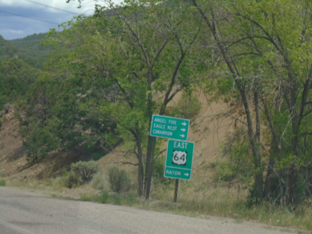
End NM-585 East at US-64
End NM-585 East at US-64. Use US-64 East to Raton, Angel Fire, Eagle Nest, and Cimarron.
Taken 06-19-2026
Taos
Taos County
New Mexico
United States