Signs Tagged With Big Green Sign
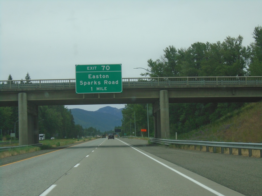
I-90 West - Exit 70
I-90 west approaching Exit 70 - Easton/Sparks Road
Taken 06-13-2024
 Easton
Kittitas County
Washington
United States
Easton
Kittitas County
Washington
United States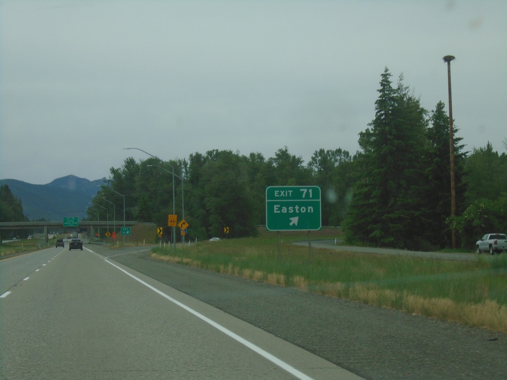
I-90 West - Exit 71
I-90 west at Exit 71 - Easton.
Taken 06-13-2024
Easton
Kittitas County
Washington
United States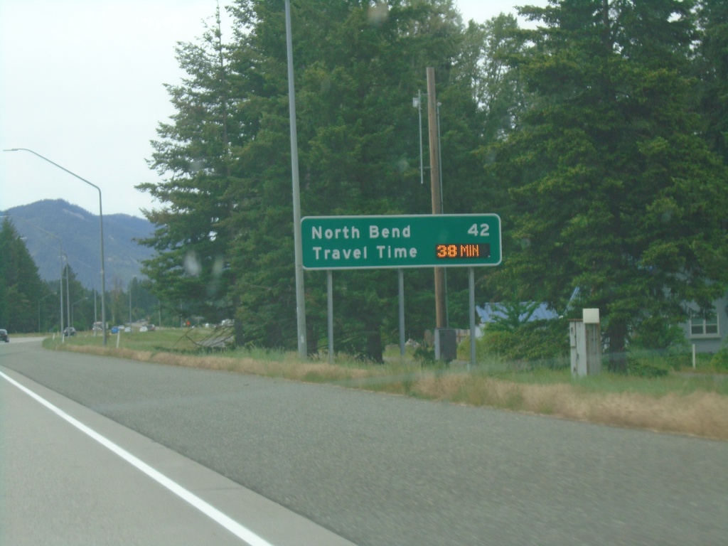
I-90 West - Distance Marker/Travel Time
Distance marker and dynamic travel time sign on I-90 west. Distance and travel time to North Bend, which is a Seattle suburb.
Taken 06-13-2024
Cle Elum
Kittitas County
Washington
United States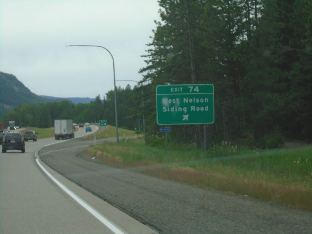
I-90 West - Exit 74
I-90 west at Exit 74 - East Nelson Siding Road
Taken 06-13-2024
Cle Elum
Kittitas County
Washington
United States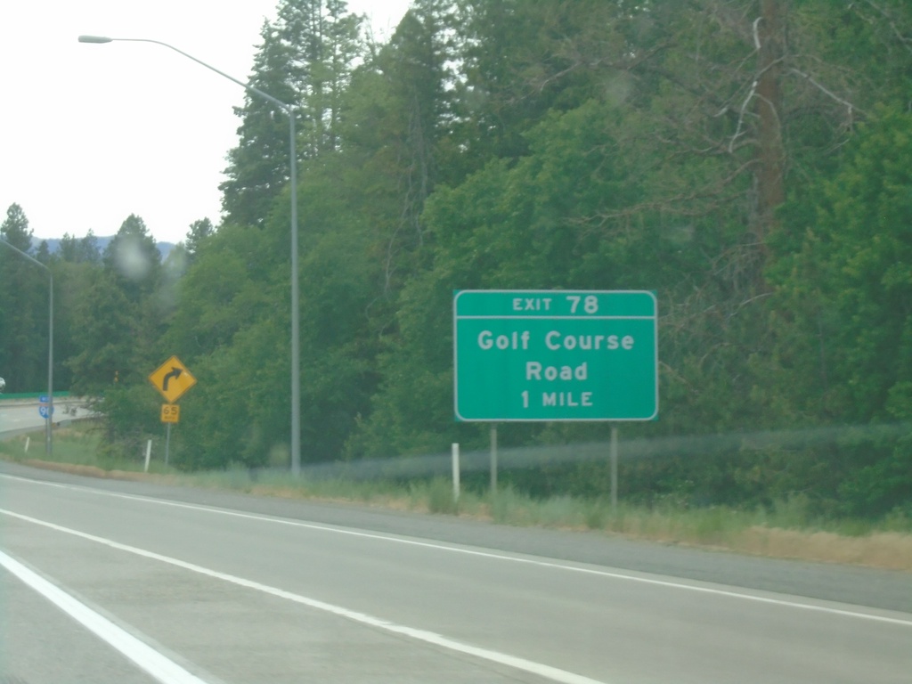
I-90 West - Exit 78
I-90 west approaching Exit 78 - Golf Course Road.
Taken 06-13-2024
Cle Elum
Kittitas County
Washington
United States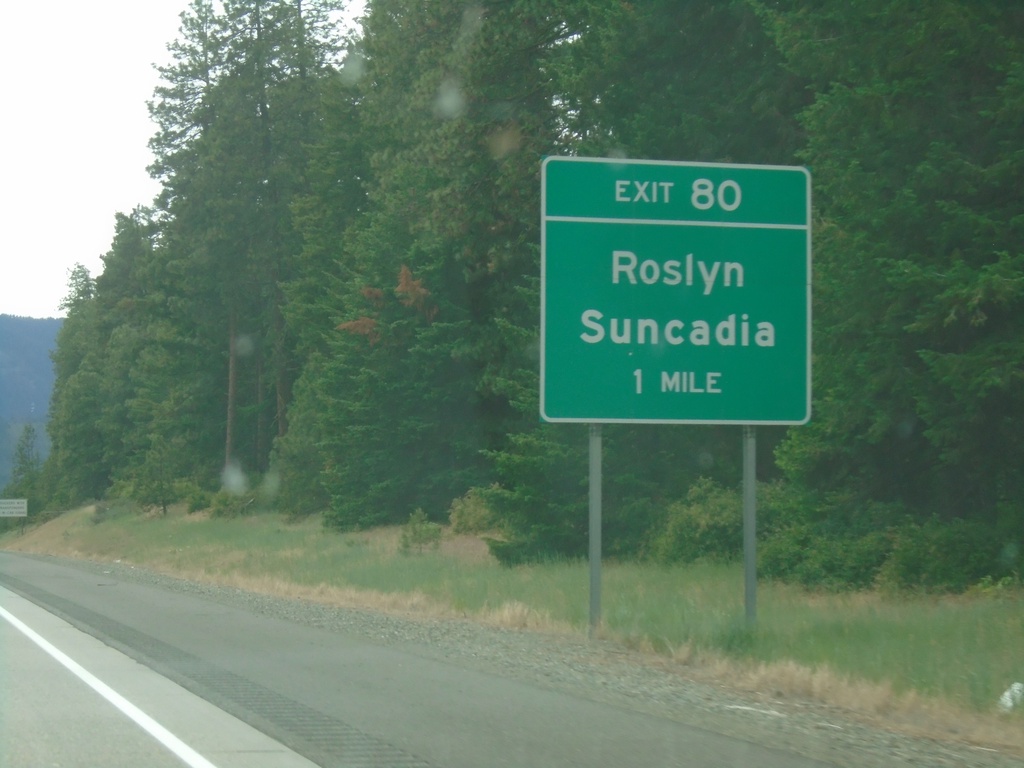
I-90 West - Exit 80
I-90 west approaching Exit 80 - Roslyn/Suncadia.
Taken 06-13-2024
Cle Elum
Kittitas County
Washington
United States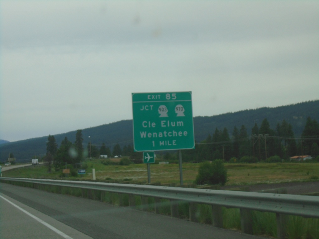
I-90 West - Exit 85
I-90 west approaching Exit 85 - Jct. WA-903/WA-970/Wenatchee/Cle Elum.
Taken 06-13-2024

 Cle Elum
Kittitas County
Washington
United States
Cle Elum
Kittitas County
Washington
United States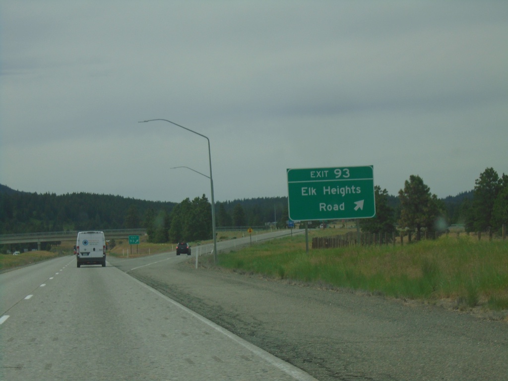
I-90 West - Exit 93
I-90 west at Exit 93 - Elk Heights Road.
Taken 06-13-2024
Horlick
Kittitas County
Washington
United States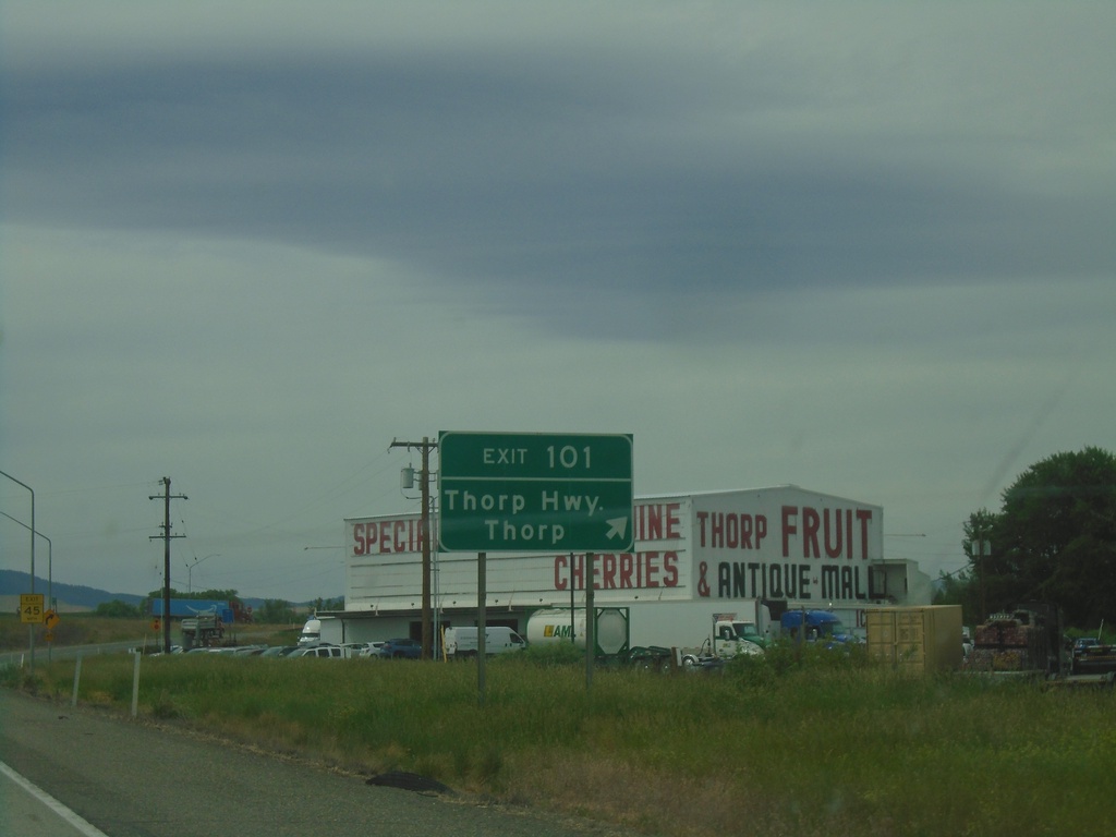
I-90 West - Exit 101
I-90 west at Exit 101 - Thorp Highway/Thorp.
Taken 06-13-2024
Thorp
Kittitas County
Washington
United States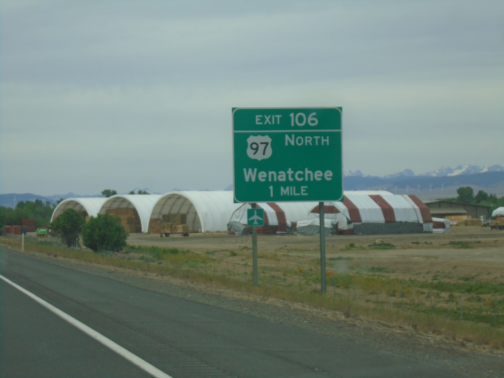
I-90 West - Exit 106
I-90 west approaching Exit 106 - US-97 North/Wenatchee. US-97 northbound leaves I-90 here.
Taken 06-13-2024
 Ellensburg
Kittitas County
Washington
United States
Ellensburg
Kittitas County
Washington
United States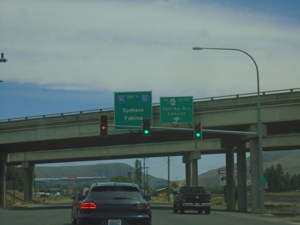
Canyon Road at I-90/US-97
Canyon Road at I-90/US-97 (Exit 109) in Ellensburg. Use I-90 East/To I-82 to Spokane and Yakima. Continue on Canyon Road for WA-821 South to Yakima River Canyon.
Taken 06-13-2024

 Ellensburg
Kittitas County
Washington
United States
Ellensburg
Kittitas County
Washington
United States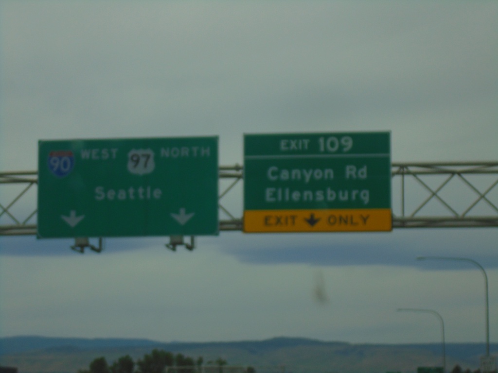
I-90 West - Exit 109
I-90 west at Exit 109 - Canyon Road/Ellensburg. I-90 West/US-97 North continues to Seattle.
Taken 06-13-2024
Ellensburg
Kittitas County
Washington
United States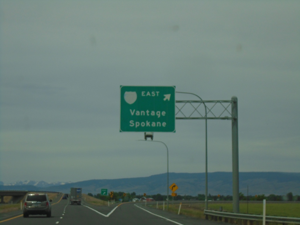
End I-82 West at I-90
End I-82 west at I-90. Use right lane for I-90 West/Vantage/Spokane.
Taken 06-13-2024
Ellensburg
Kittitas County
Washington
United States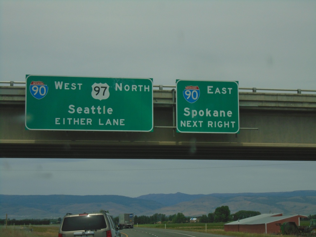
End I-82 West at I-90
End I-82 West at I-90. Use right lane for I-90 East/Spokane. Use all lanes for I-90 West/US-97 North/Seattle.
Taken 06-13-2024
Ellensburg
Kittitas County
Washington
United States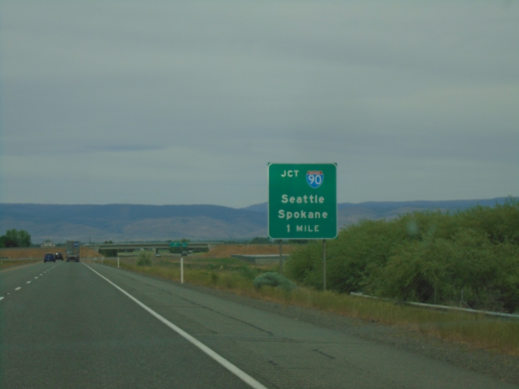
I-82 West Approaching I-90
I-82 West approaching I-90 to Seattle and Spokane. This is the western terminus of I-82.
Taken 06-13-2024
Ellensburg
Kittitas County
Washington
United States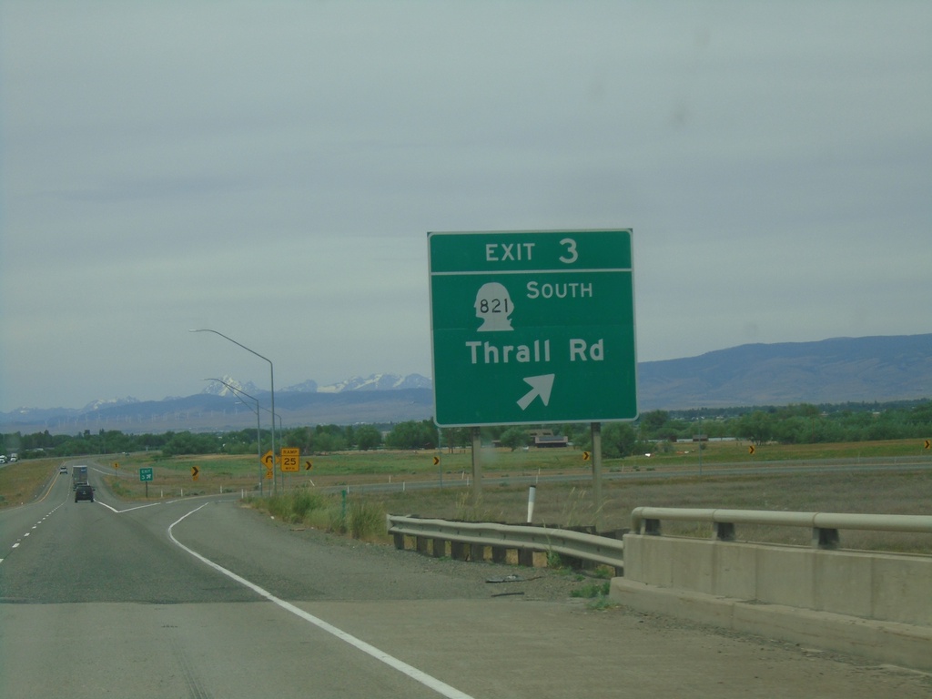
I-82 West - Exit 3
I-82 west at Exit 3 - WA-821 South/Thrall Road.
Taken 06-13-2024
Ellensburg
Kittitas County
Washington
United States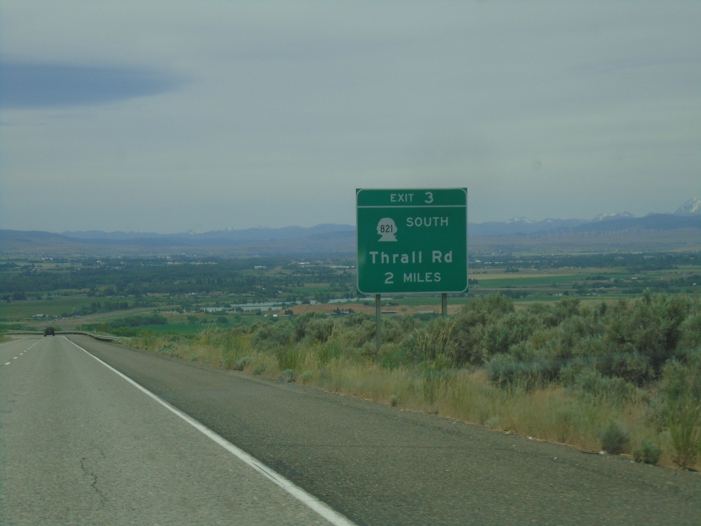
I-82 West - Exit 3
I-82 west approaching Exit 3 - WA-821 South/Thrall Road.
Taken 06-13-2024
Ellensburg
Kittitas County
Washington
United States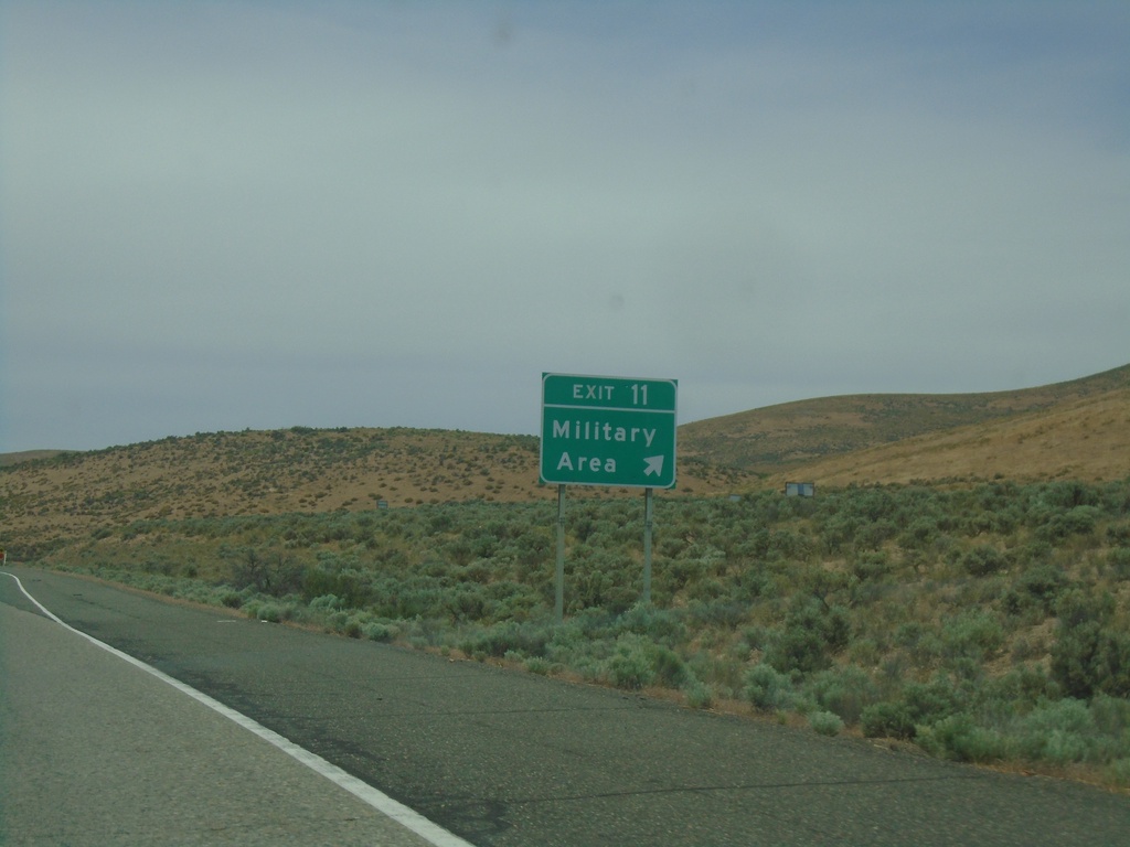
I-82 West - Exit 11
I-82 west at Exit 11 - Military Area.
Taken 06-13-2024
Wymer
Kittitas County
Washington
United States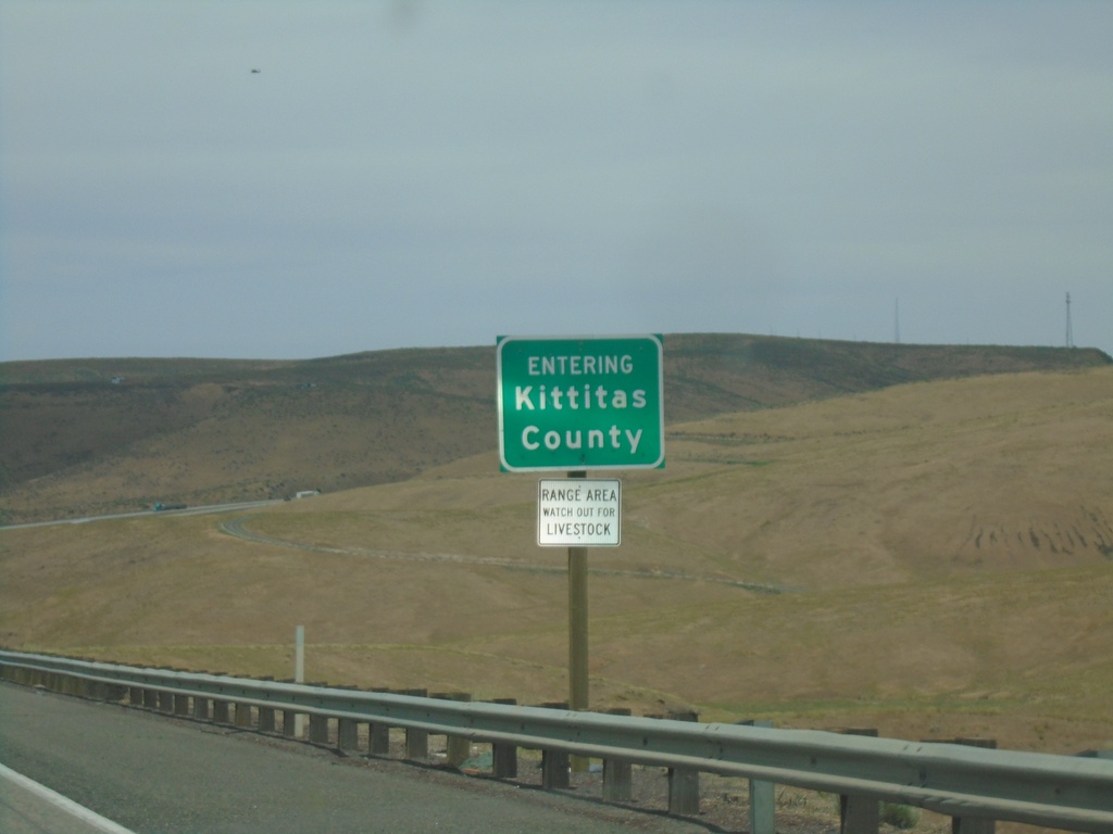
I-82 West - Kittitas County
Entering Kittitas County on I-82 west.
Taken 06-13-2024
Yakima
Kittitas County
Washington
United States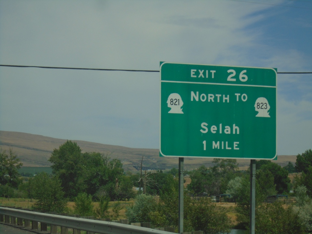
I-82 West - Exit 26
I-82 west approaching Exit 26 - WA-821 North/To WA-823/Selah.
Taken 06-13-2024
 Yakima
 County
Washington
United States
Yakima
Yakima County
Washington
United States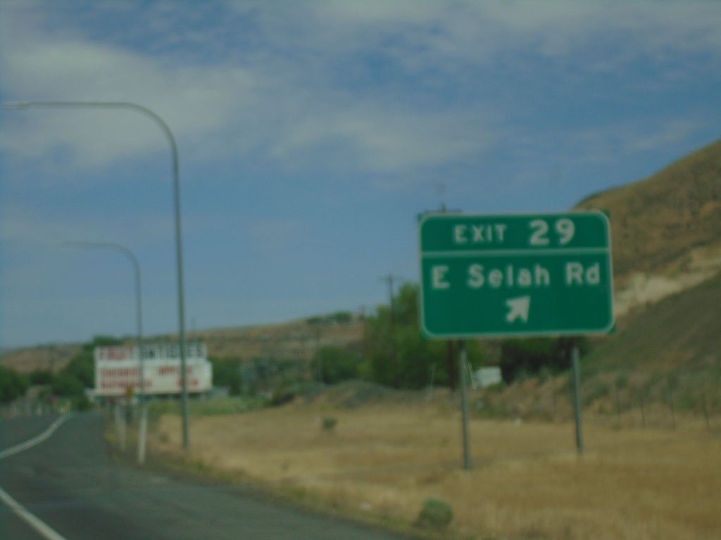
I-82 West - Exit 29
I-82 west at Exit 29 - East Selah Road.
Taken 06-13-2024
Yakima
Yakima County
Washington
United States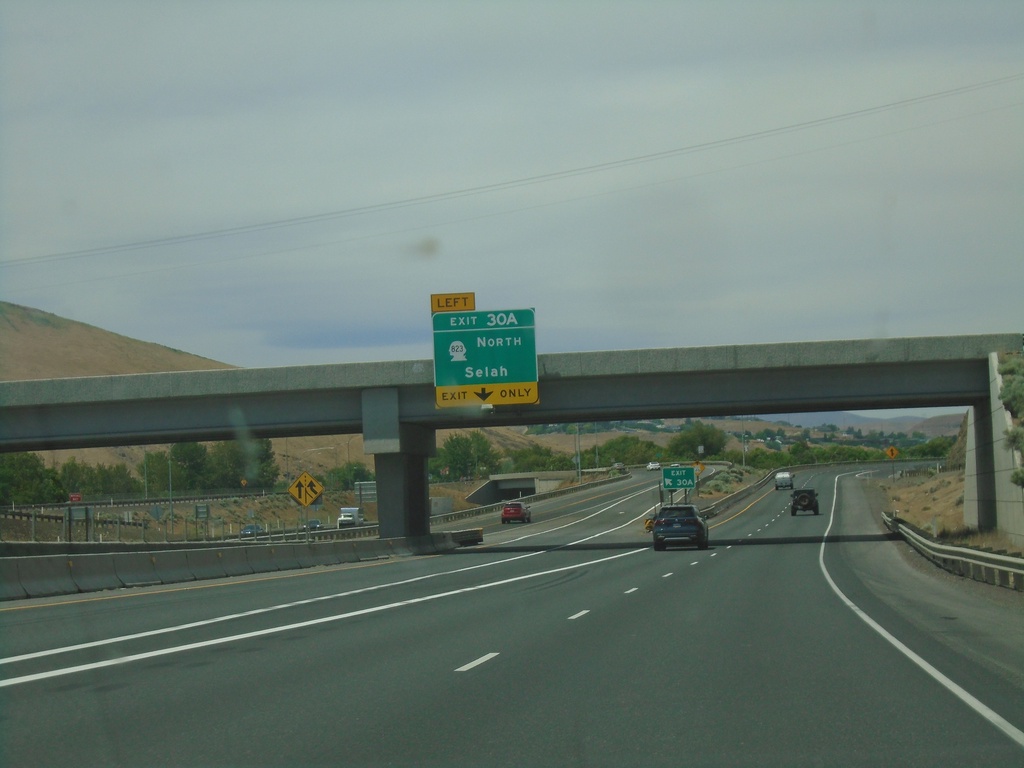
I-82 West - Exit 30B
I-82 west at Exit 30B - WA-823 North/Selah.
Taken 06-13-2024
Yakima
Yakima County
Washington
United States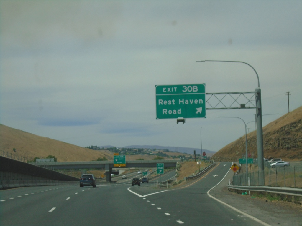
I-82 West - Exit 30B
I-82 west at Exit 30B - Rest Haven Road.
Taken 06-13-2024
Yakima
Yakima County
Washington
United States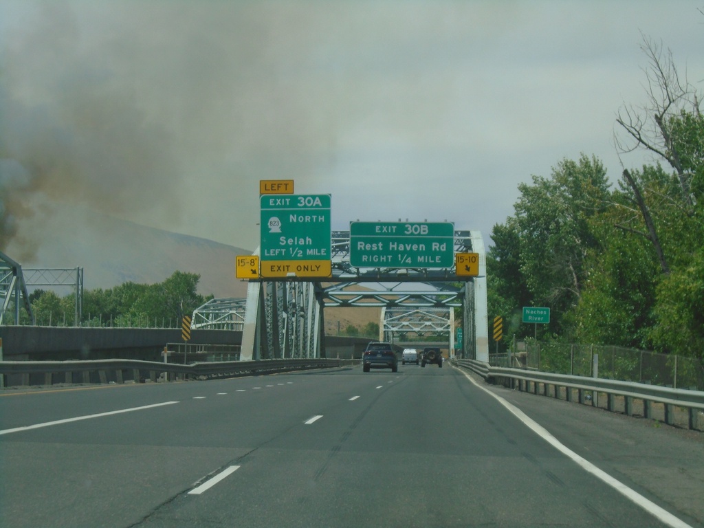
I-82 West - Exits 30B and 30A
I-82 west approaching Exit 30B - Rest Haven Road. Approaching Exit 30A - WA-823 North/Selah. Approaching bridge over the Yakima River.
Taken 06-13-2024
Yakima
Yakima County
Washington
United States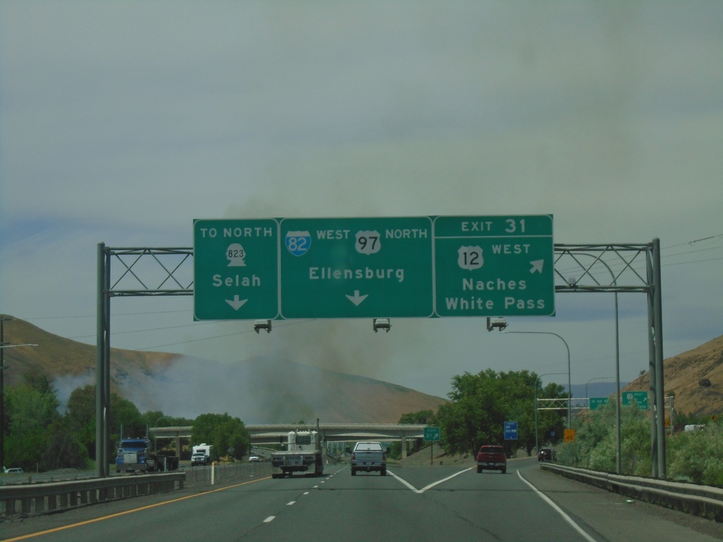
I-82 West - Exit 31
I-82 west at Exit 31 - US-12 West/Naches/White Pass. I-82 West/US-97 North continues to Ellensburg. Use left lanes for WA-823 North to Selah. US-12 westbound leaves I-82 westbound here.
Taken 06-13-2024
 Yakima
 County
Washington
United States
Yakima
Yakima County
Washington
United States