Signs Tagged With Big Green Sign
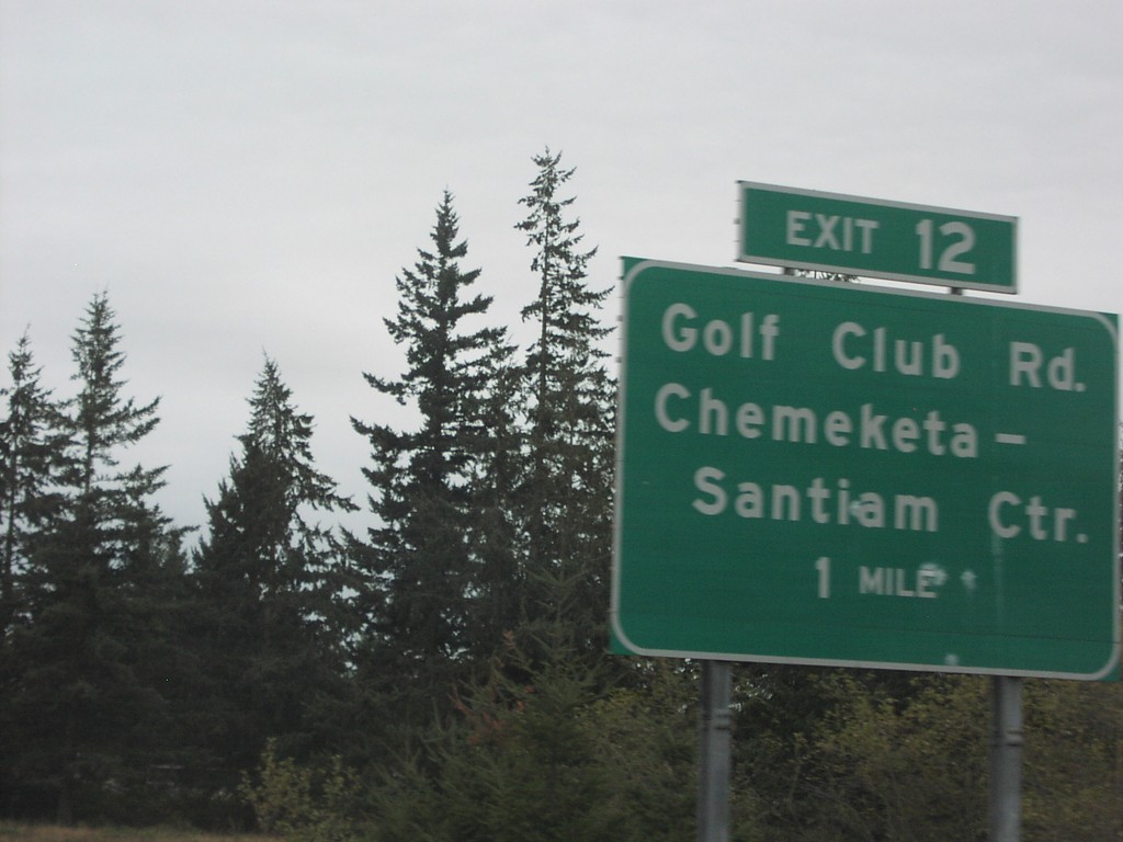
OR-22 East - Exit 12
OR-22 east approaching Exit 12, Golf Club Road/Chemeketa-Santiam Center, 1 mile.
Taken 10-01-2006
 Aumsville
Marion County
Oregon
United States
Aumsville
Marion County
Oregon
United States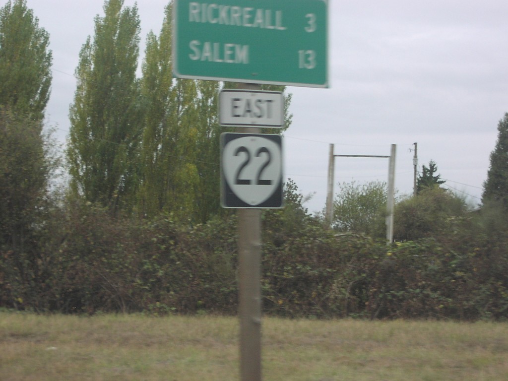
OR-22 East - Distance Marker
Distance marker on OR-22 east to Rickreall and Salem.
Taken 10-01-2006
Dallas
Polk County
Oregon
United States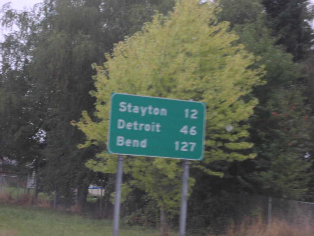
OR-22 East - Distance Marker
Distance marker on OR-22 east to Stayton, Detroit, and Bend.
Taken 10-01-2006
Salem
Marion County
Oregon
United States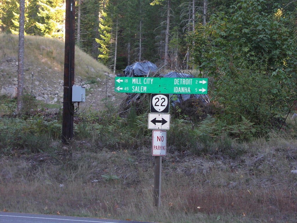
OR-22 - Detroit Lake StatePark
OR-22 west to Salem and Mill City; east to Detroit and Idanha at Detroit Lake State Park.
Taken 10-01-2006
Detroit
Marion County
Oregon
United States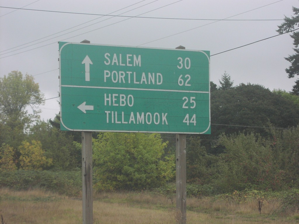
OR-18 East at OR-22
OR-18 east at OR-22 west to Hebo and Tillamook. OR-18/OR-22 east continue on to Portland and Salem.
Taken 10-01-2006
 Grand Ronde
Polk County
Oregon
United States
Grand Ronde
Polk County
Oregon
United States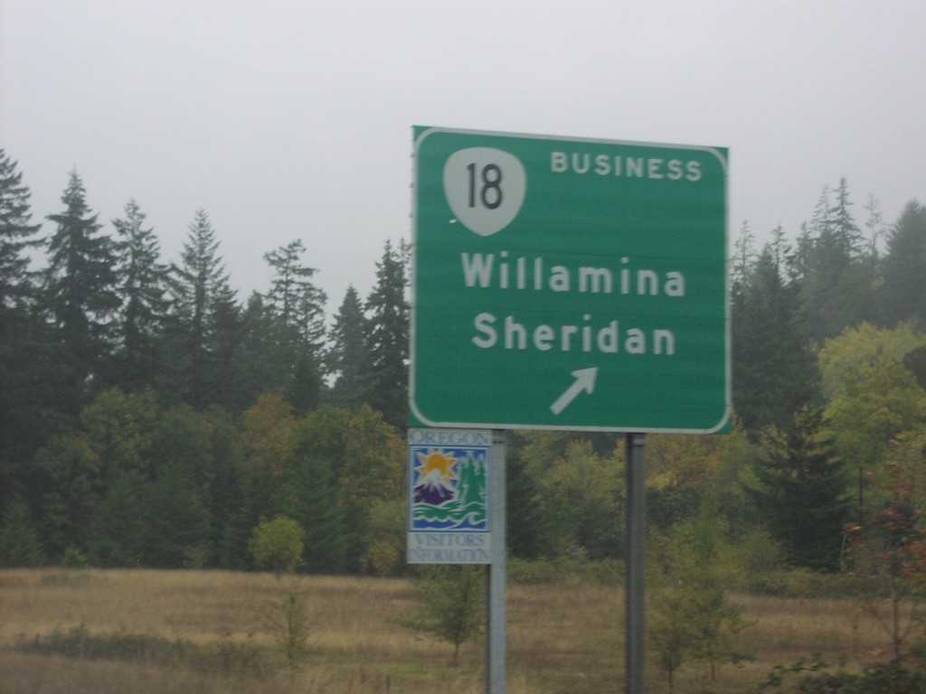
OR-18 East at OR-18 Bus.
OR-18/OR-22 east at Bus. OR-18 to Willamina and Sheridan.
Taken 10-01-2006
Willamina
Polk County
Oregon
United States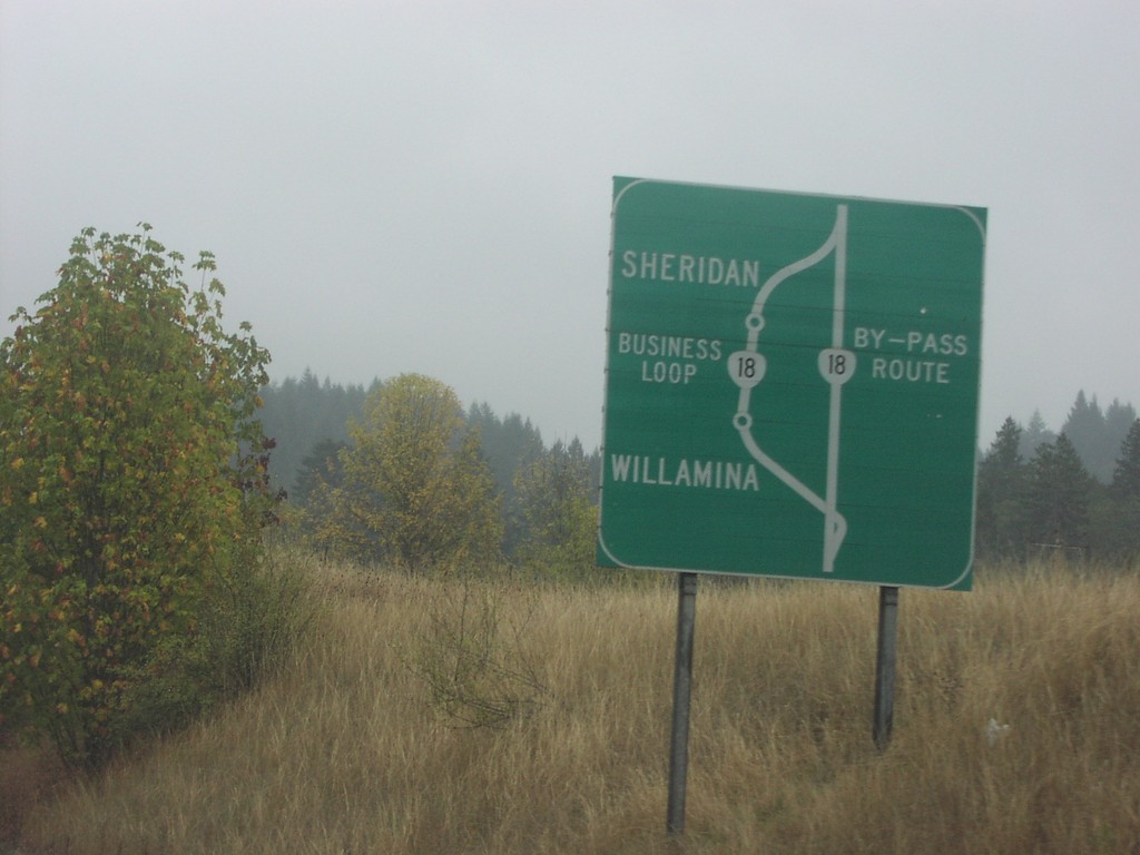
OR-18 Bus. Loop Route Diagram
Diagram of Bus. OR-18 through Willamina and Sheridan on OR-18/OR-22 east.
Taken 10-01-2006
Willamina
Polk County
Oregon
United States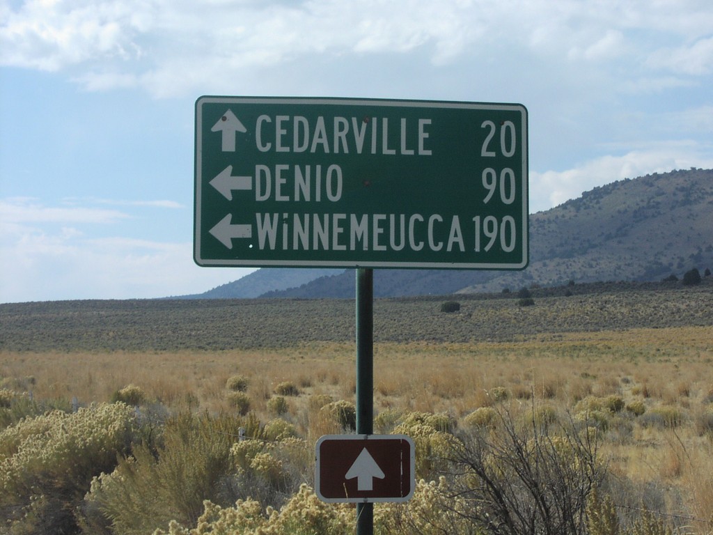
NV-8A/NV-34 Jct.
NV-34 south at NV-8A. NV-8A/NV-34 west to Cedarville, NV-8A east to Denio and Winnemucca.
Taken 10-01-2006

 Vya
Washoe County
Nevada
United States
Vya
Washoe County
Nevada
United States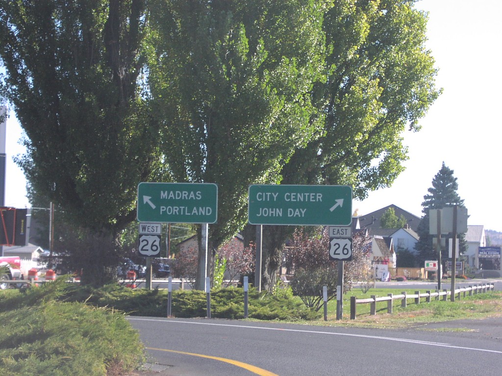
End OR-126 East at US-26
End OR-126 at US-26 west to Madras and Portland; east to John Day and City Center.
Taken 10-01-2006

 Prineville
Crook County
Oregon
United States
Prineville
Crook County
Oregon
United States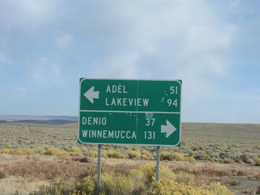
End NV-8A at NV-140
End NV-8A at NV-140. NV-140 west to Adel and Lakeview; east to Denio and Winnemucca.
Taken 10-01-2006
 Humboldt County
Nevada
United States
Humboldt County
Nevada
United States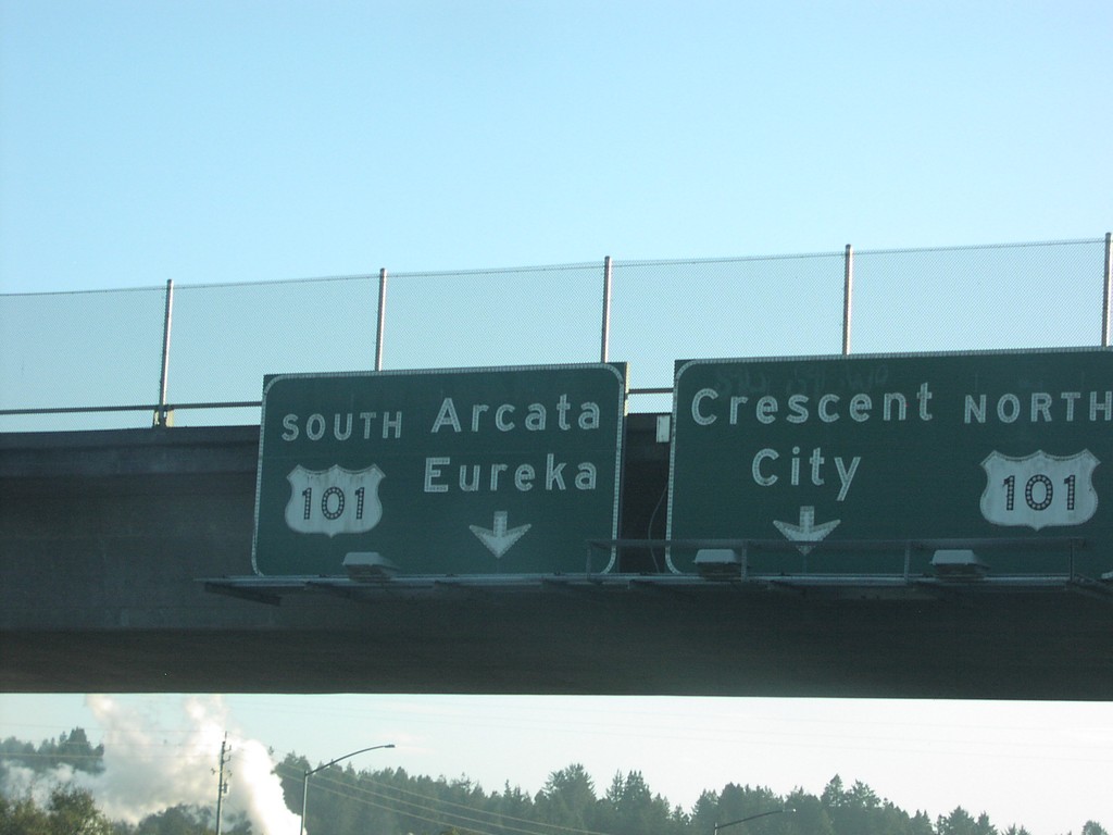
End CA-299 West at US-101
End CA-299 west at US-101 south to Arcata and Eureka; north to Crescent City.
Taken 10-01-2006

 Arcata
Humboldt County
California
United States
Arcata
Humboldt County
California
United States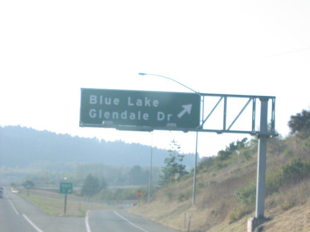
CA-299 West Exit 5
CA-299 west at Exit 5, Blue Lake/Glendale Drive.
Taken 10-01-2006
McKinleyville
Humboldt County
California
United States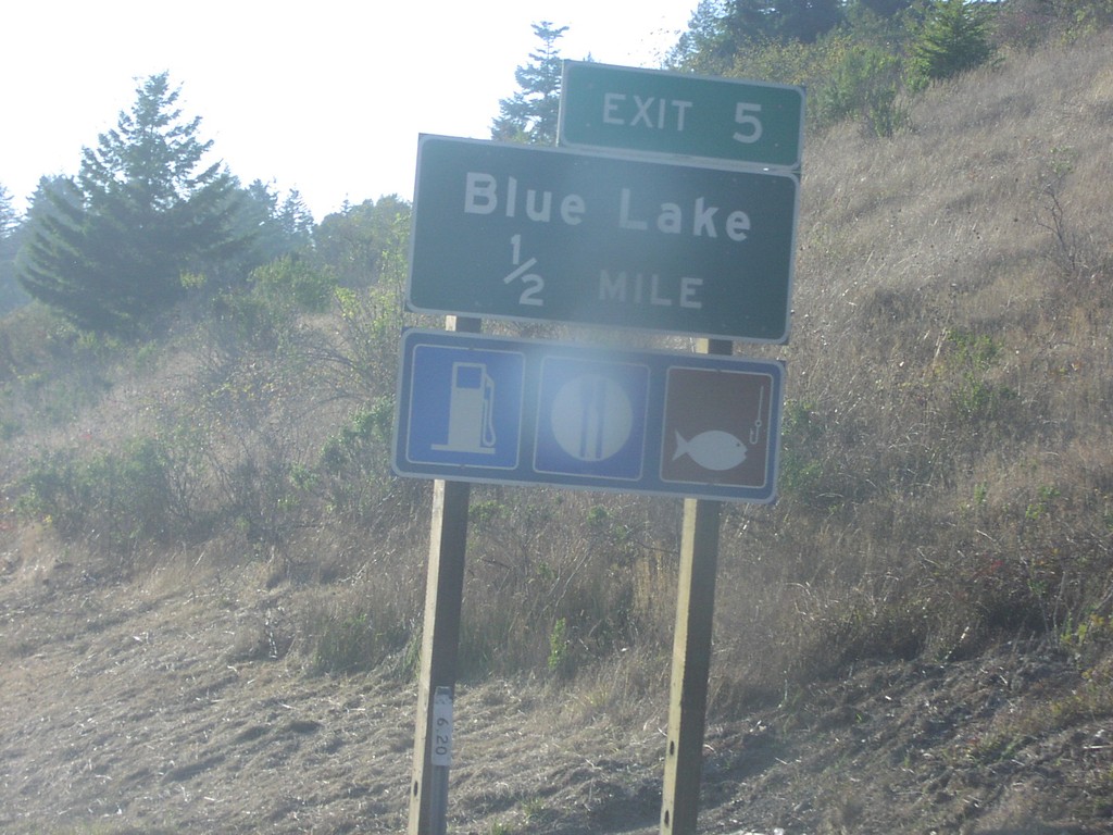
CA-299 West Exit 5
CA-299 west approaching Exit 5, Blue Lake, 1/2 mile.
Taken 10-01-2006
Blue Lake
Humboldt County
California
United States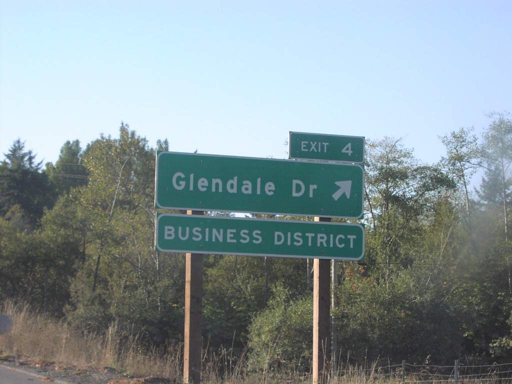
CA-299 West Exit 4
CA-299 west at Exit 4, Glendale Drive.
Taken 10-01-2006
McKinleyville
Humboldt County
California
United States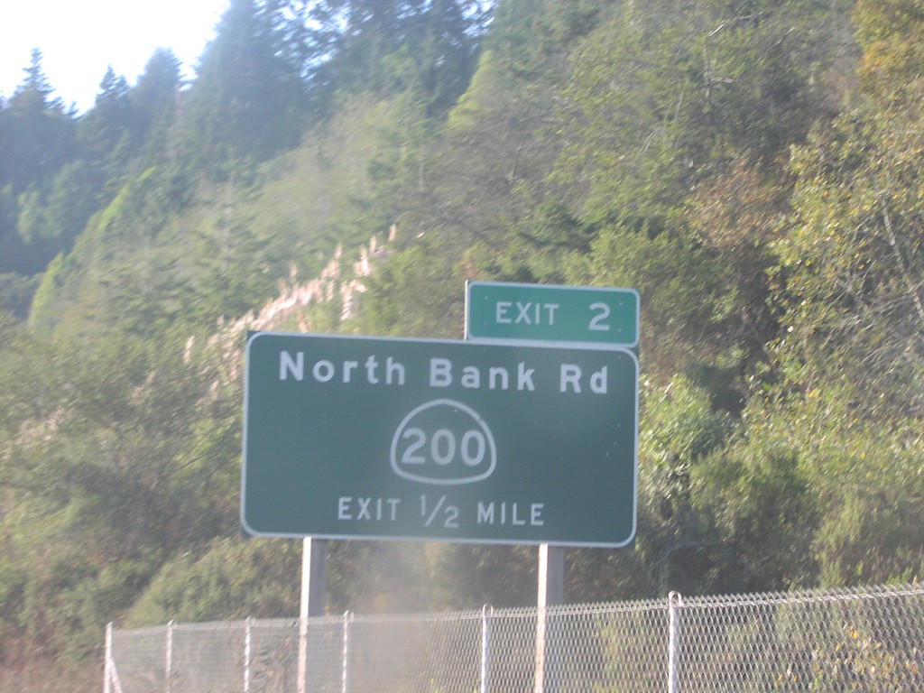
CA-299 West Exit 2
CA-299 west approaching Exit 2, CA-200/North Bank Road, 1/2 mile.
Taken 10-01-2006
 McKinleyville
Humboldt County
California
United States
McKinleyville
Humboldt County
California
United States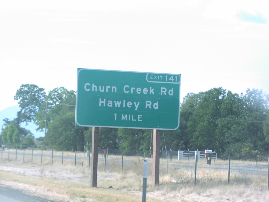
CA-299 West Exit 141
CA-299 west approaching Exit 141, Churn Creek Road/Hawley Road, 1 mile.
Taken 10-01-2006
Redding
Shasta County
California
United States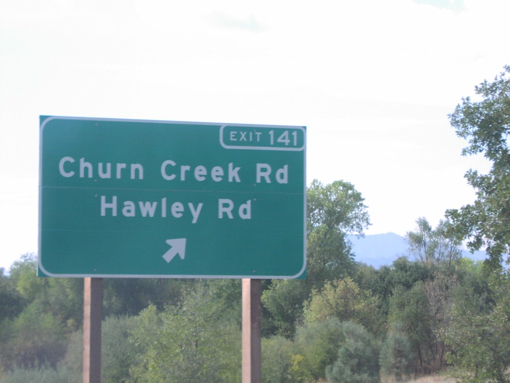
CA-299 West Exit 141
CA-299 west at Exit 141, Churn Creek Road/Hawley Road.
Taken 10-01-2006
Redding
Shasta County
California
United States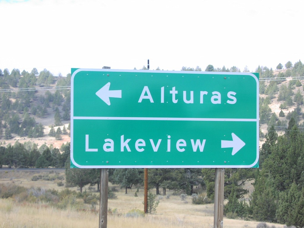
CA-299 West at US-395
CA-299 west at US-395 north to Lakeview, and south to Alturas.
Taken 10-01-2006
 Surprise Station
Modoc County
California
United States
Surprise Station
Modoc County
California
United States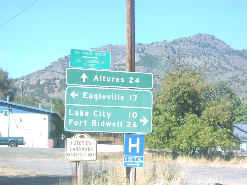
CA-299 West at Suprise Valley Road
CA-299 west at Surprise Valley Road north to Fort Bidwell, south to Eagleville.
Taken 10-01-2006
Alturas
Modoc County
California
United States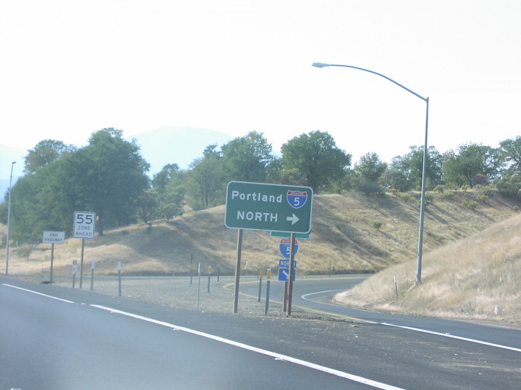
CA-299 West at I-5 North
CA-299 west at I-5 north to Portland.
Taken 10-01-2006
 Redding
Shasta County
California
United States
Redding
Shasta County
California
United States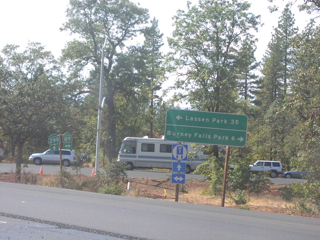
CA-299 West at CA-89
CA-299 west at CA-89 north to Burney Falls State Park, and south to Lassen Park.
Taken 10-01-2006
 Cassel
Shasta County
California
United States
Cassel
Shasta County
California
United States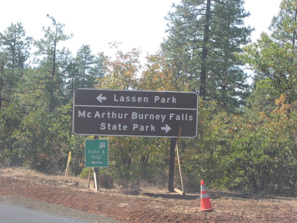
CA-299 West at CA-89
CA-299 west approaching CA-89 north to McArthur-Burney Falls State Park, and south to Lassen Park.
Taken 10-01-2006
Cassel
Shasta County
California
United States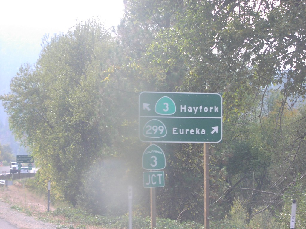
CA-299 West at CA-3
CA-299 west at CA-3 south to Hayfork. CA-3 north/CA-299 west to Eureka.
Taken 10-01-2006
 Douglas City
Trinity County
California
United States
Douglas City
Trinity County
California
United States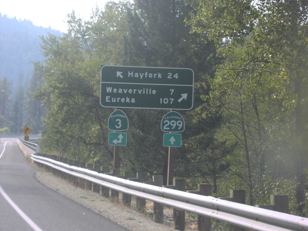
CA-299 West at CA-3
CA-299 west approaching CA-3 south to Hayfork. CA-3 north joins CA-299 west to Weaverville.
Taken 10-01-2006
Douglas City
Trinity County
California
United States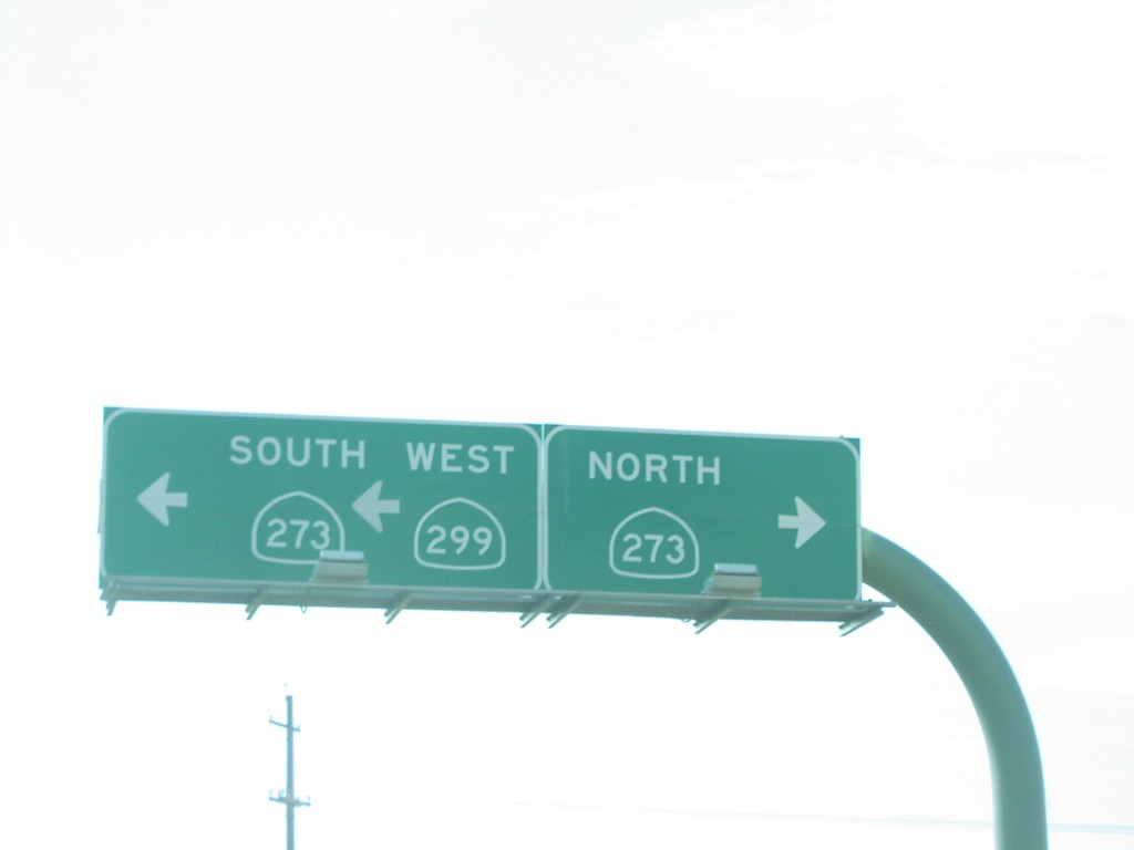
CA-299 West at CA-273
CA-299 west at CA-273. CA-299 west follows CA-273 south through Redding.
Taken 10-01-2006
 Redding
Shasta County
California
United States
Redding
Shasta County
California
United States