Signs Tagged With Big Green Sign
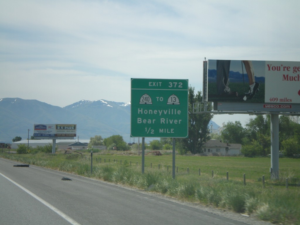
I-15 South - Exit 372
I-15 south approaching Exit 372 - UT-240/To UT-13/Honeyville/Bear River
Taken 05-24-2007
 Honeyville
Box Elder County
Utah
United States
Honeyville
Box Elder County
Utah
United States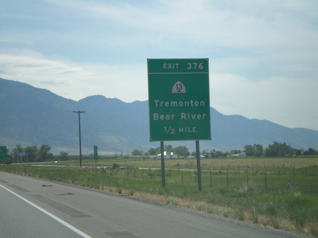
I-15 South - Exit 376
I-15 south at Exit 376 - UT-13/Tremonton/Bear River
Taken 05-24-2007
Elwood
Box Elder County
Utah
United States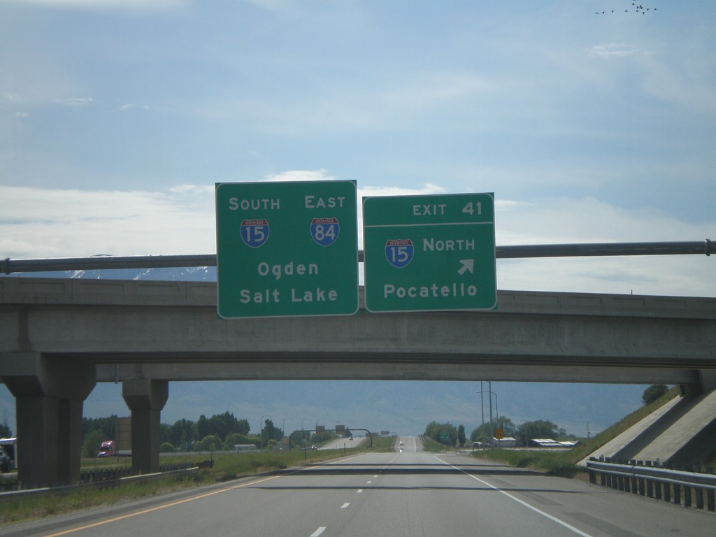
I-84 East at Exit 41 - I-15 Jct.
I-84 east at Exit 41, I-15 North/Pocatello. I-84 East joins I-15 south to Ogden.
Taken 05-24-2007
 Tremonton
Box Elder County
Utah
United States
Tremonton
Box Elder County
Utah
United States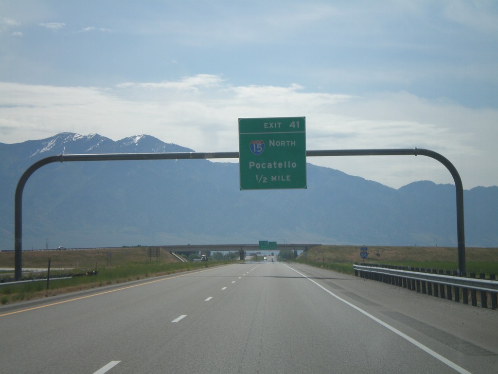
I-84 East Exit 41 - 1/2 Mile
I-84 east approaching Exit 41, I-15 North/Pocatello, 1/2 mile.
Taken 05-24-2007
Tremonton
Box Elder County
Utah
United States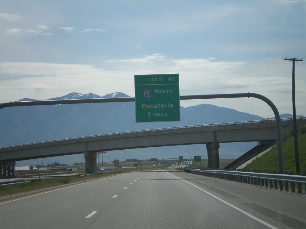
I-84 East Exit 41 - 1 Mile
I-84 east approaching Exit 41, I-15 North/Pocatello, 1 mile.
Taken 05-24-2007
Tremonton
Box Elder County
Utah
United States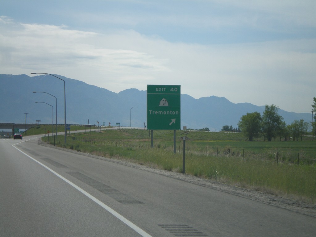
I-84 East Exit 40
I-84 east at Exit 40, UT-102/Tremonton.
Taken 05-24-2007

 Tremonton
Box Elder County
Utah
United States
Tremonton
Box Elder County
Utah
United States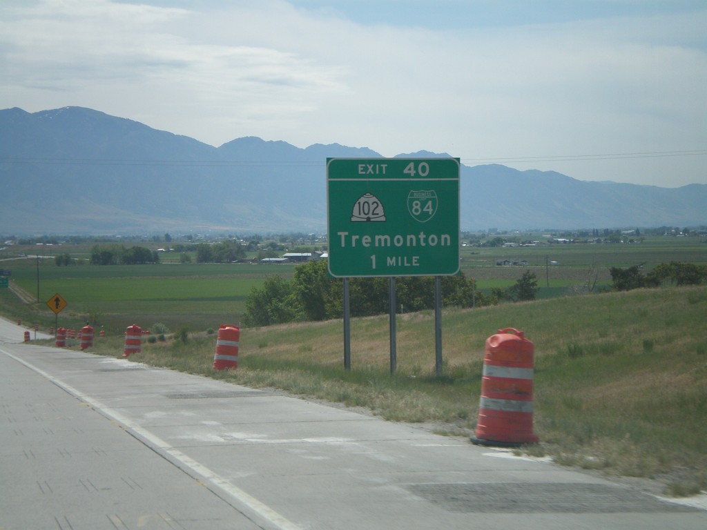
I-84 East Exit 40
I-84 east approaching Exit 40, UT-102/BL-84/Tremonton, 1 mile.
Taken 05-24-2007
Tremonton
Box Elder County
Utah
United States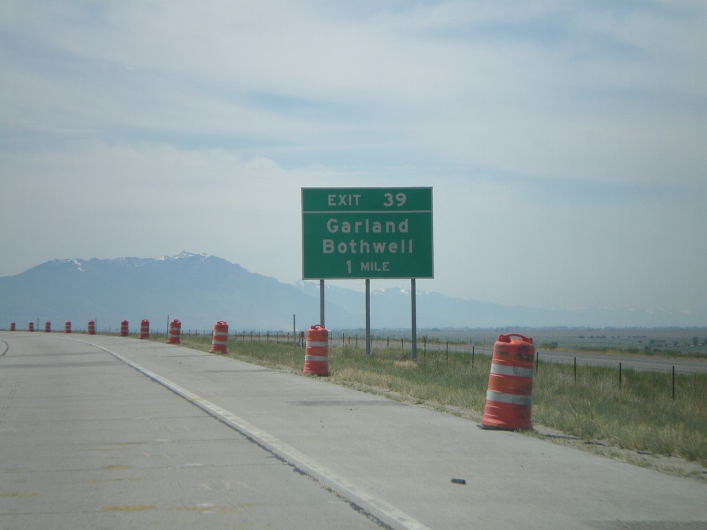
I-84 East Exit 39
I-84 east approaching Exit 39, Garland/Bothwell, 1 mile.
Taken 05-24-2007
Tremonton
Box Elder County
Utah
United States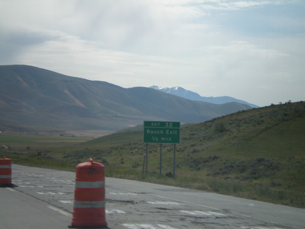
I-84 East Exit 32
I-84 east approaching Exit 32, Ranch Exit, 1/2 mile.
Taken 05-24-2007
Tremonton
Box Elder County
Utah
United States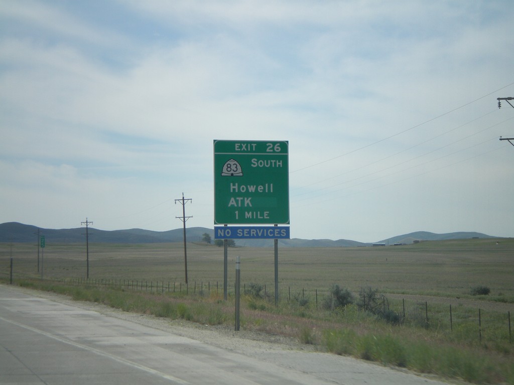
I-84 East Exit 26
I-84 east approaching Exit 26, UT-83 South/Howell/ATK, 1 mile.
Taken 05-24-2007
 Howell
Box Elder County
Utah
United States
Howell
Box Elder County
Utah
United States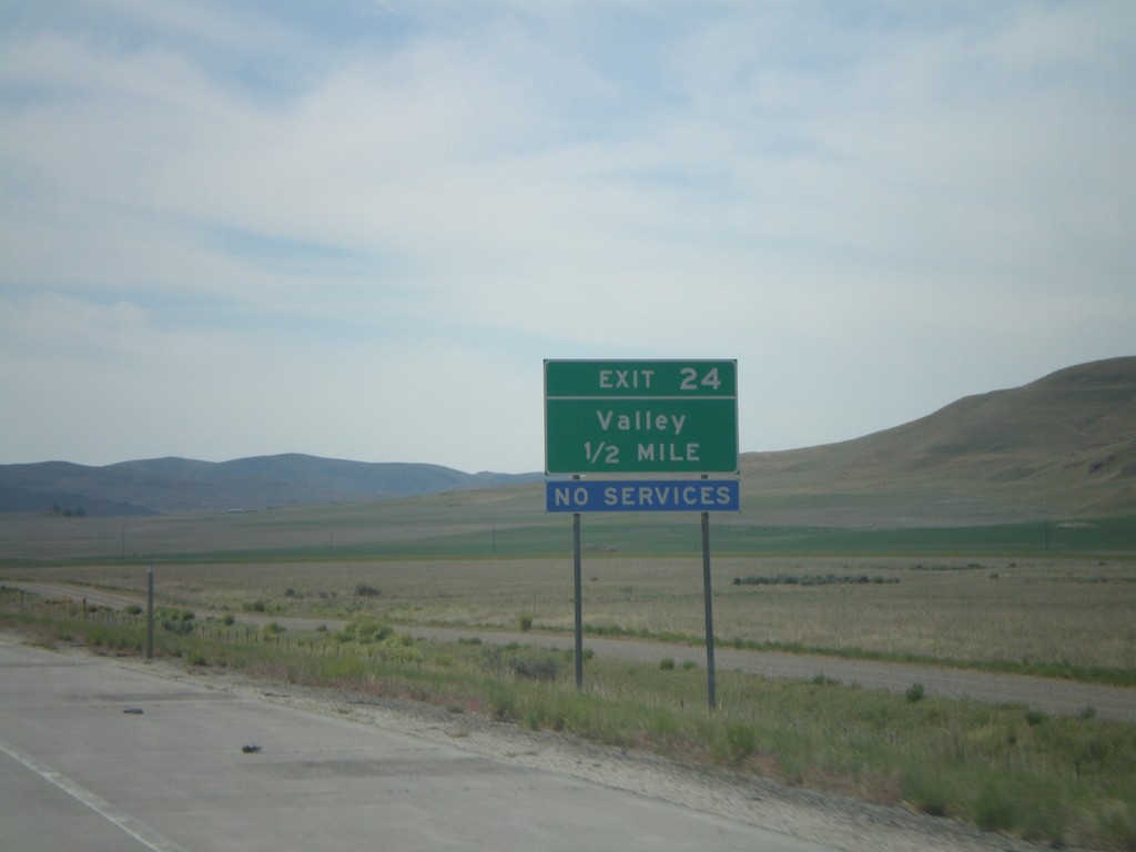
I-84 East Exit 24
I-84 east approaching Exit 24, Valley, 1/2 mile.
Taken 05-24-2007
Howell
Box Elder County
Utah
United States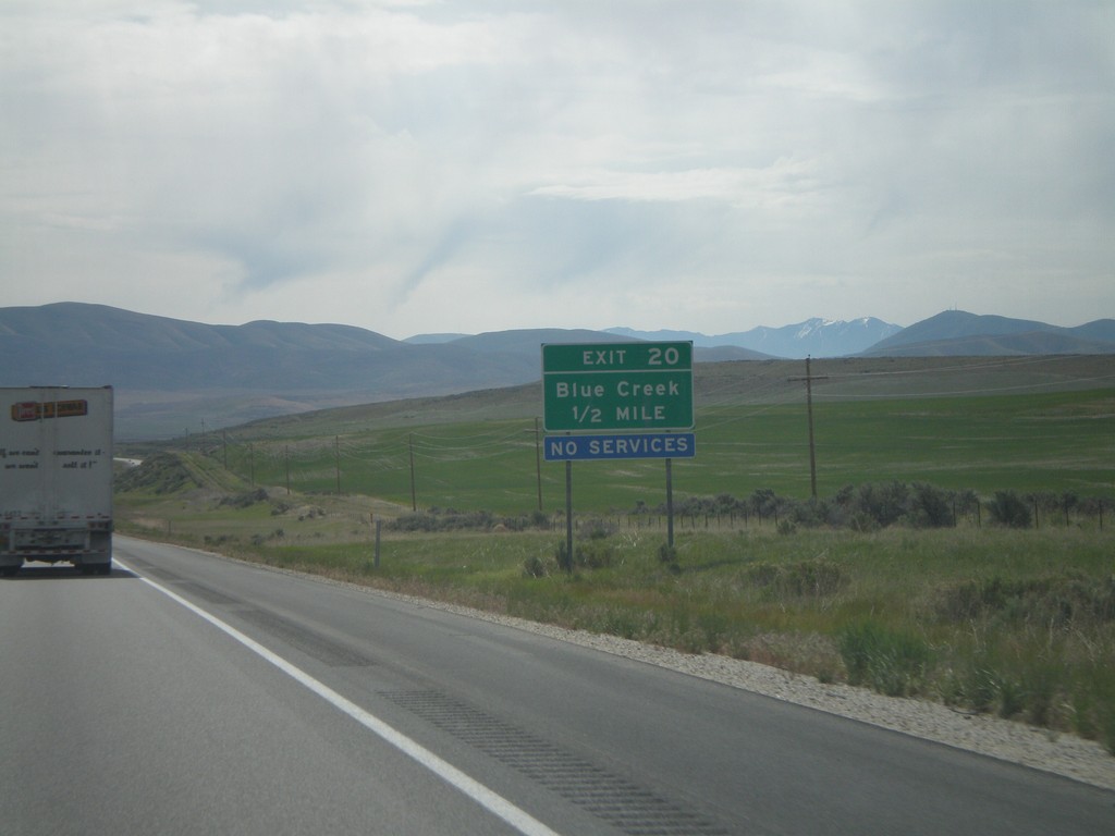
I-84 East Exit 20
I-84 east approaching Exit 20, Blue Creek, 1/2 mile.
Taken 05-24-2007
Tremonton
Box Elder County
Utah
United States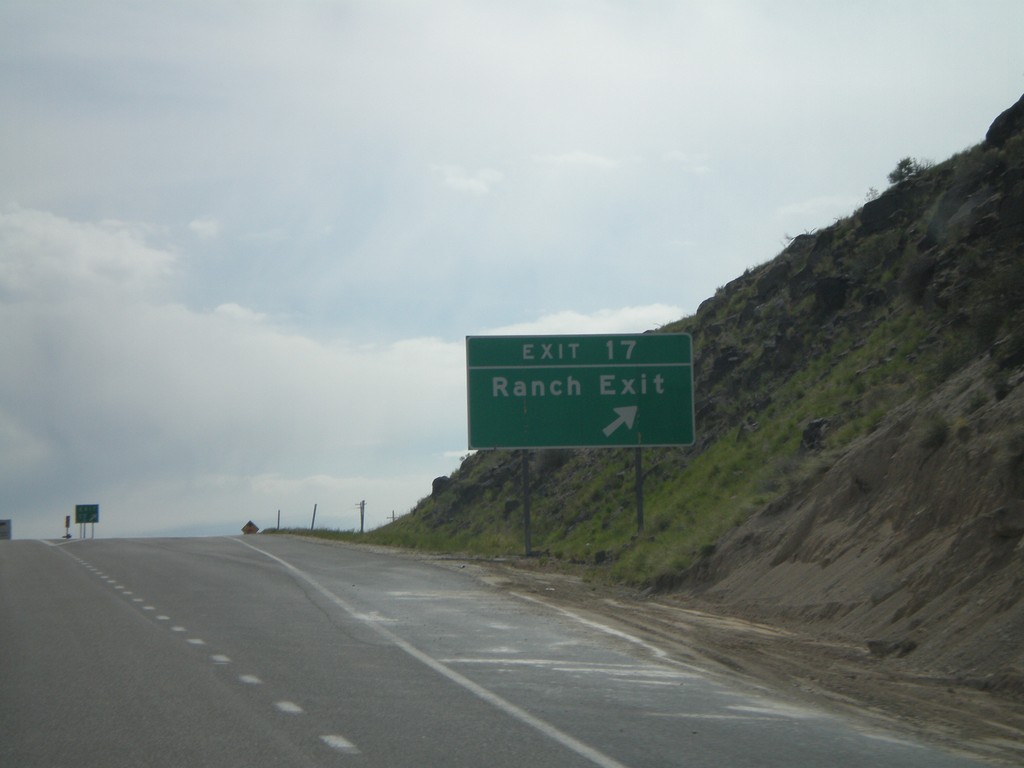
I-84 East Exit 17
I-84 east at Exit 17, Ranch Exit.
Taken 05-24-2007
Howell
Box Elder County
Utah
United States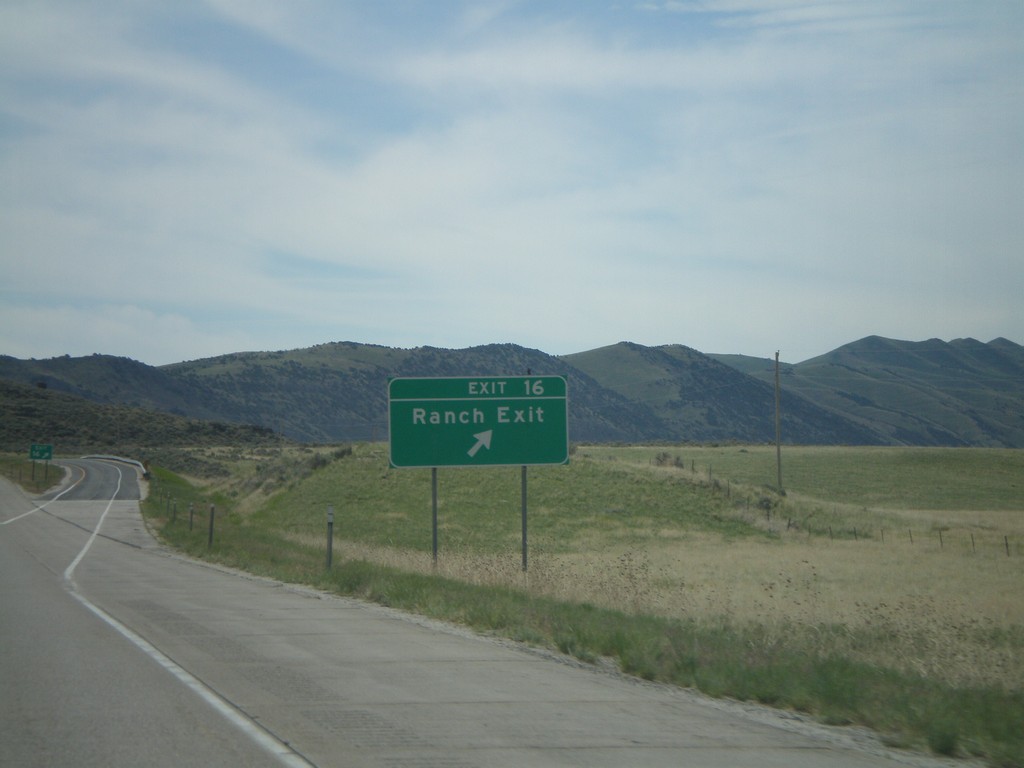
I-84 East Exit 16
I-84 east at Exit 16, Ranch Exit.
Taken 05-24-2007
Howell
Box Elder County
Utah
United States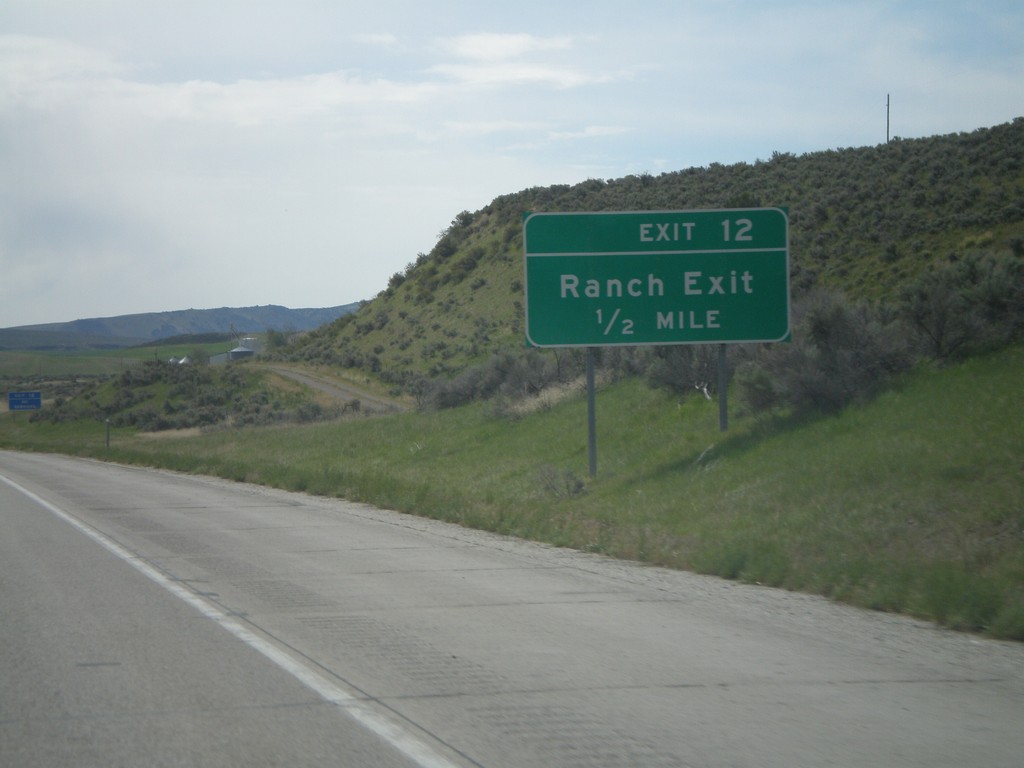
I-84 East Exit 12
I-84 east approaching Exit 12, Ranch Exit, 1/2 mile.
Taken 05-24-2007
Snowville
Box Elder County
Utah
United States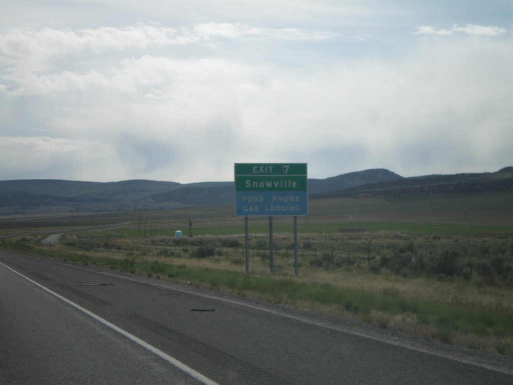
I-84 East Exit 7
I-84 east approaching Exit 7, Snowville, next exit.
Taken 05-24-2007
Snowville
Box Elder County
Utah
United States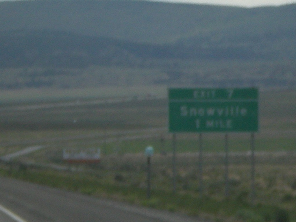
I-84 East Exit 7
I-84 east approaching Exit 7, Snowville, 1 mile.
Taken 05-24-2007
Snowville
Box Elder County
Utah
United States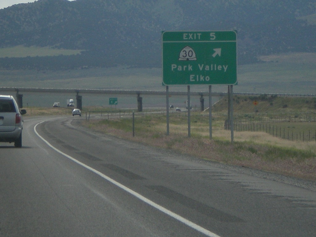
I-84 East Exit 5
I-84 east at Exit 5, UT-30/Park Valley/Elko, NV
Taken 05-24-2007
 Snowville
Box Elder County
Utah
United States
Snowville
Box Elder County
Utah
United States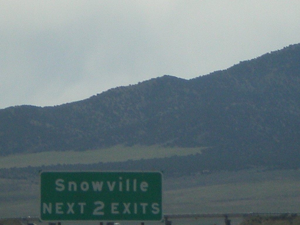
I-84 East - Snowville Next 2 Exits
Snowville Next 2 Exits, on I-84 east, approaching Exit 5.
Taken 05-24-2007
Snowville
Box Elder County
Utah
United States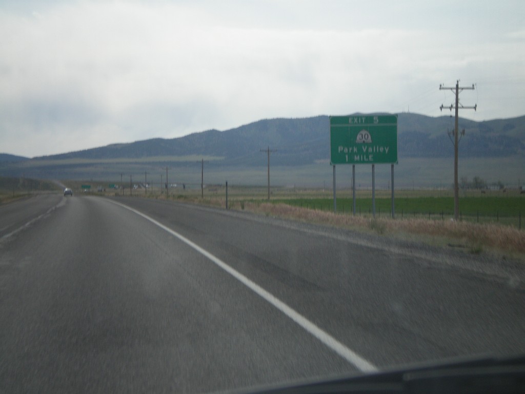
I-84 East Exit 5
I-84 east approaching Exit 5, UT-30/Park Valley, 1 mile.
Taken 05-24-2007
Snowville
Box Elder County
Utah
United States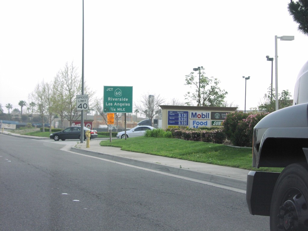
S. Haven Ave. Approaching CA-60
S. Haven Ave. approaching CA-60, Riverside Fwy, to Riverside and Los Angeles.
Taken 03-01-2007
 Ontario
San Bernardino County
California
United States
Ontario
San Bernardino County
California
United States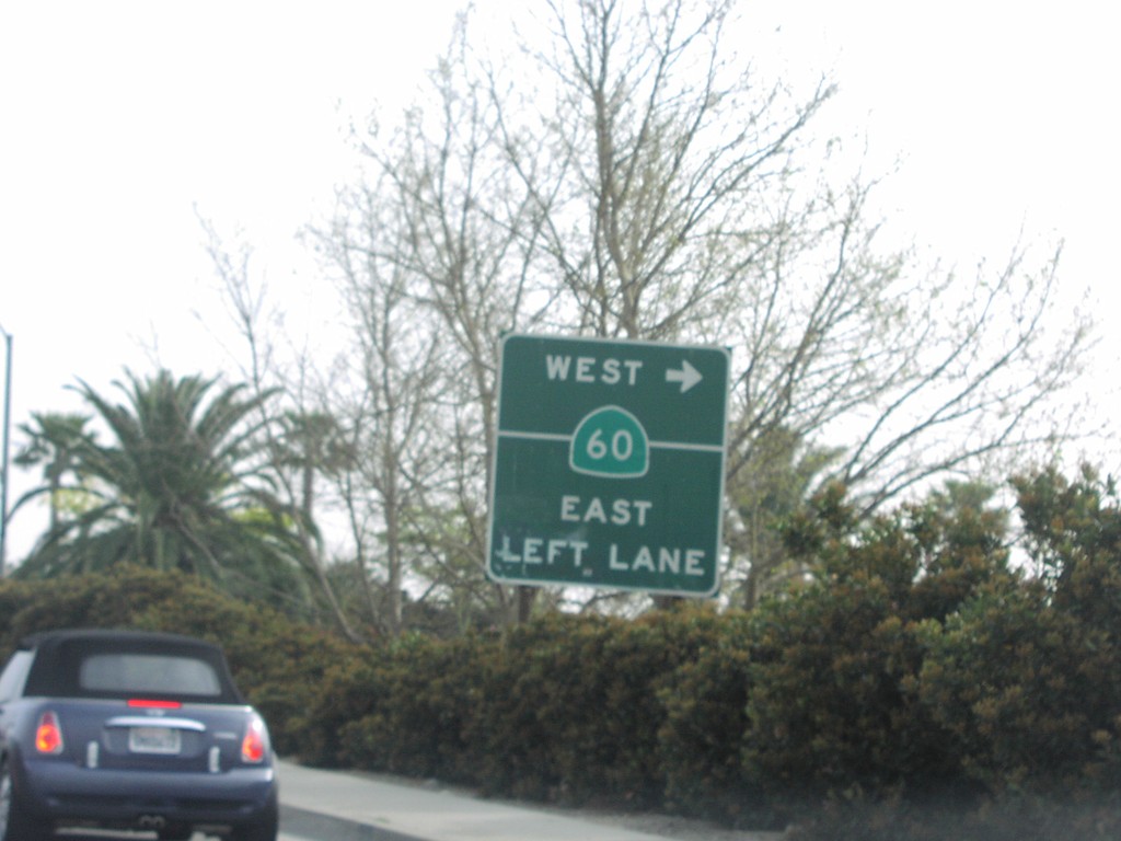
S. Haven Ave. Approaching CA-60
S. Haven Ave. at CA-60 west onramp.
Taken 03-01-2007
Ontario
San Bernardino County
California
United States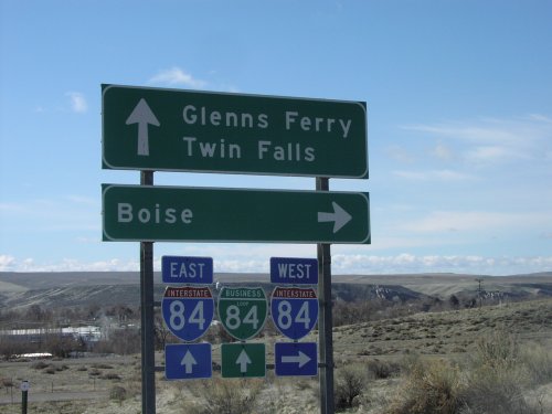
Old US-30 at I-84/BL-84
Old US-30 at I-84/BL-84 junction. Turn right on I-84 west towards Boise. Continue ahead for I-84/BL-84 towards Glenns Ferry and Twin Falls.
Taken 03-01-2007

 Glenns Ferry
Elmore County
Idaho
United States
Glenns Ferry
Elmore County
Idaho
United States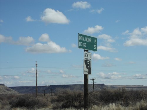
ID-51 North - Distance Marker
Distance marker on ID-51 north to Mountain Home and Boise.
Taken 03-01-2007
 Bruneau
Owyhee County
Idaho
United States
Bruneau
Owyhee County
Idaho
United States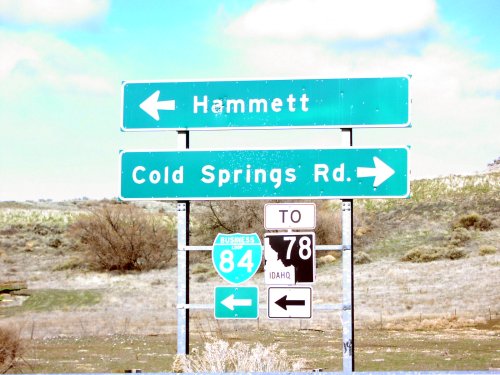
I-84 West at BL-84/To ID-78
I-84 west at Exit 114 offramp. Turn left for BL-84 West/To ID-78 to Hammett. Turn right for Cold Springs Road.
Taken 03-01-2007
 Hammett
Elmore County
Idaho
United States
Hammett
Elmore County
Idaho
United States