Signs Tagged With Big Green Sign
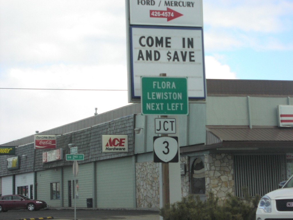
OR-82 East Approaching OR-3 North
OR-82 east approaching OR-3 north to Flora and Lewiston.
Taken 02-01-2007

 Enterprise
Wallowa County
Oregon
United States
Enterprise
Wallowa County
Oregon
United States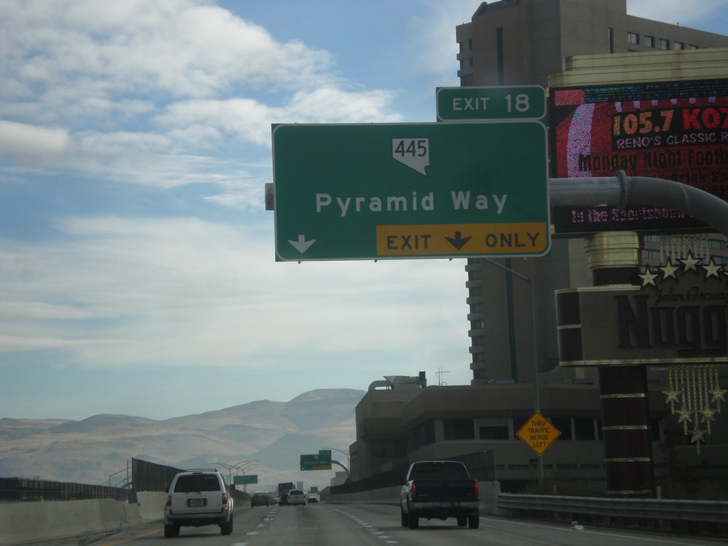
I-80 East - Exit 18
I-80 east approaching Exit 18. Exit 18 - NV-445/Pyramid Way.
Taken 01-24-2007

 Sparks
Washoe County
Nevada
United States
Sparks
Washoe County
Nevada
United States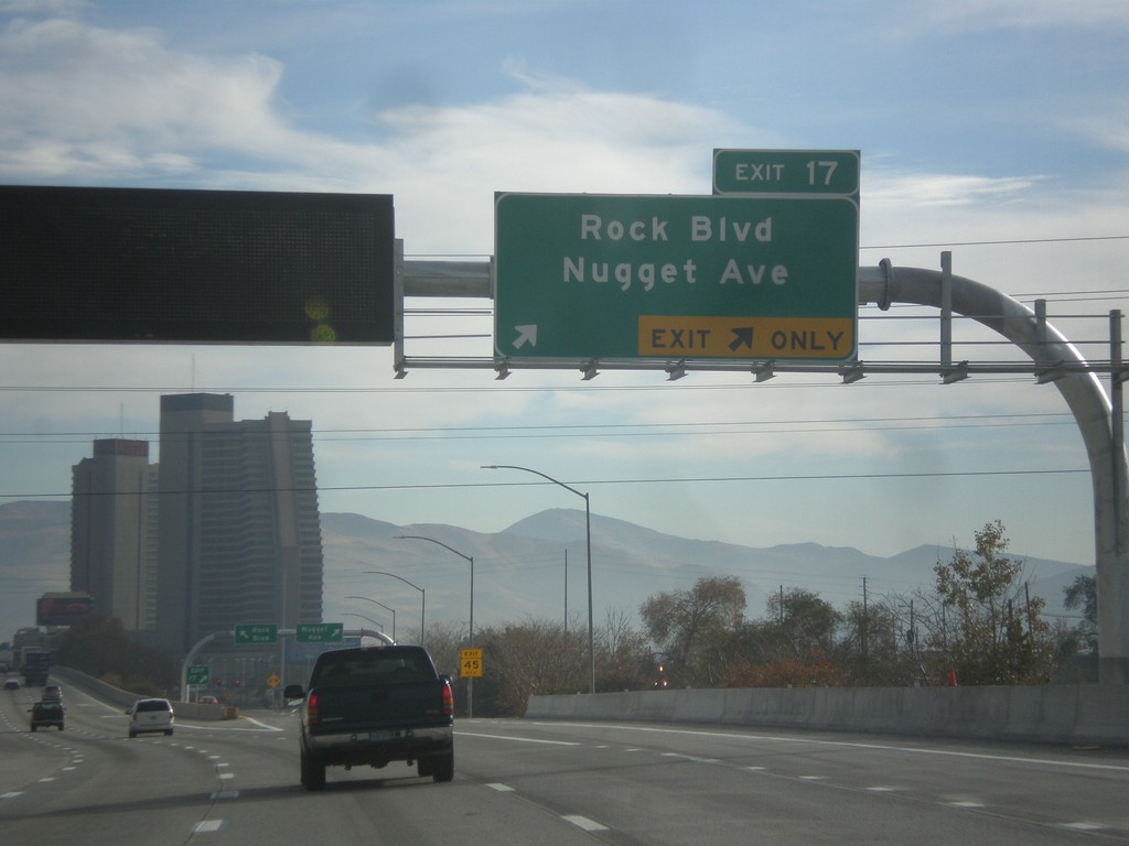
I-80 East - Exit 17
I-80 east at Exit 17 - Rock Blvd./Nugget Ave.
Taken 01-24-2007
Sparks
Washoe County
Nevada
United States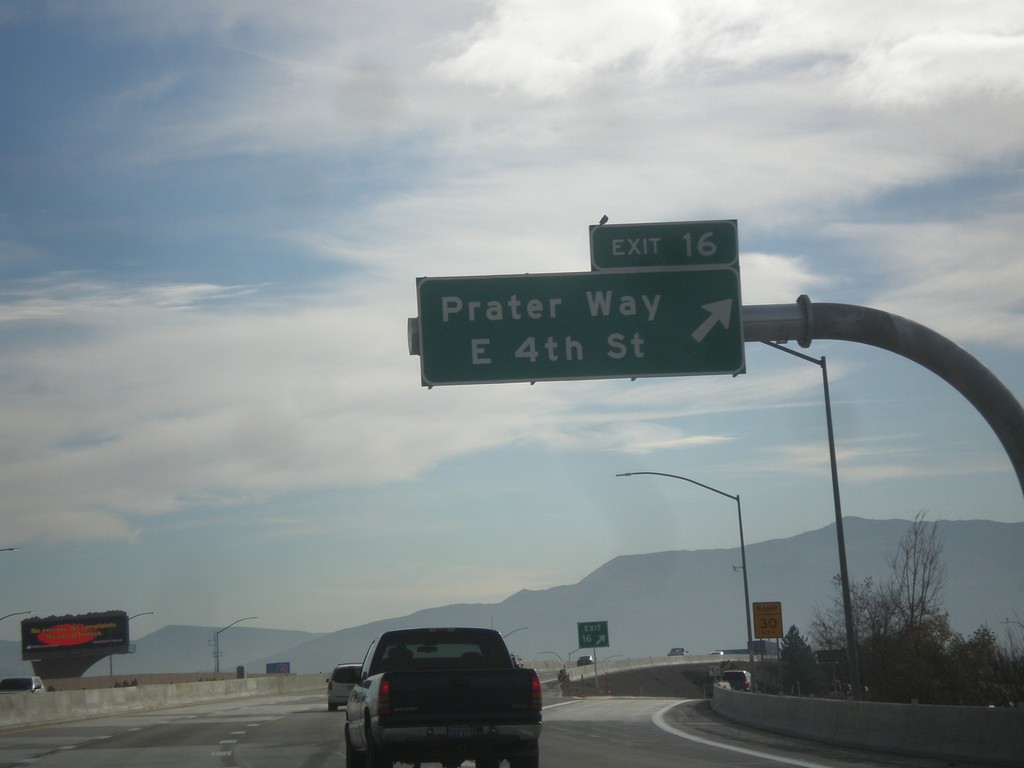
I-80 East - Exit 16
I-80 east at Exit 16 - Prater Way/East 4th St. This exit was renamed in 2012 from Victorian Ave./E. 4th St.
Taken 01-24-2007
Reno
Washoe County
Nevada
United States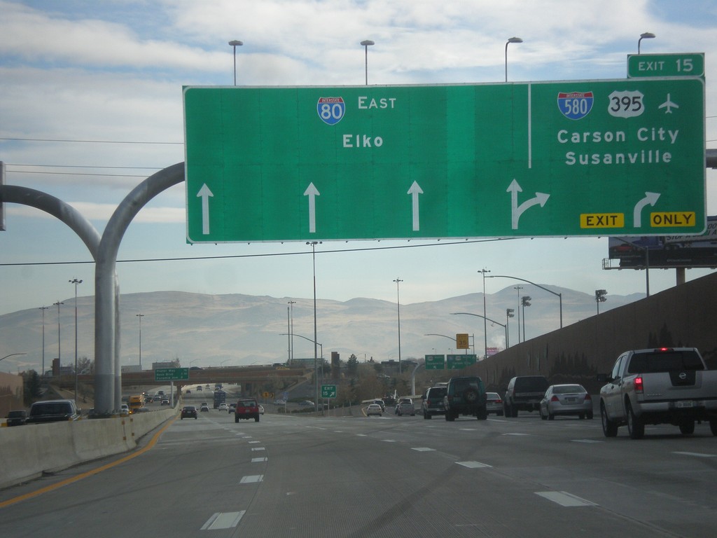
I-80 East - Exit 15
I-80 east at Exit 15 - I-580/US-395/Carson City/Susanville (California). Continue east on I-80 for Elko.
Taken 01-24-2007

 Reno
Washoe County
Nevada
United States
Reno
Washoe County
Nevada
United States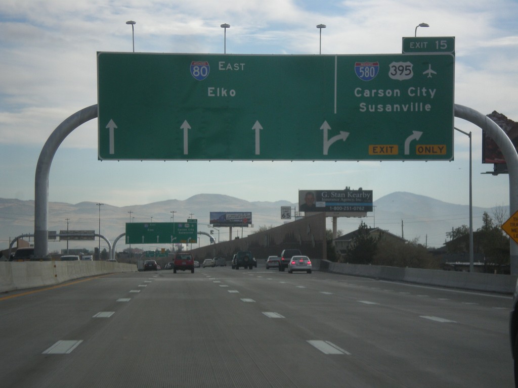
I-80 East Approaching Exit 15
I-80 east approaching Exit 15 - I-580/US-395/Carson City/Susanville (California). Continue east on I-80 for Elko.
Taken 01-24-2007
Reno
Washoe County
Nevada
United States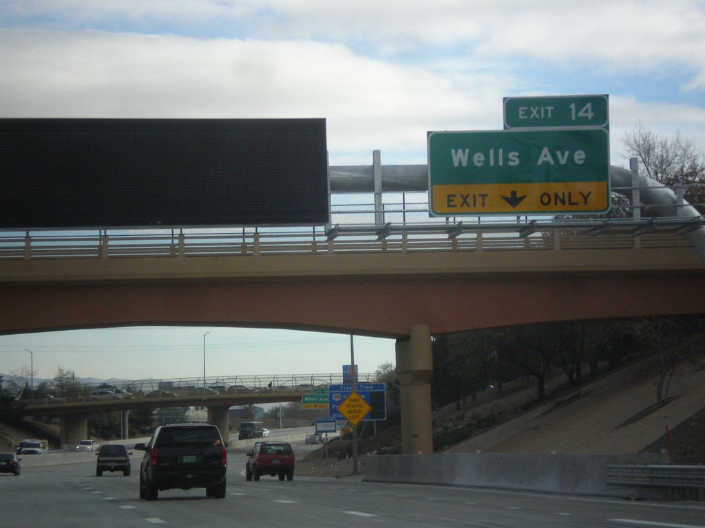
I-80 East Approaching Exit 14
I-80 east approaching Exit 14 - Wells Ave.
Taken 01-24-2007
Reno
Washoe County
Nevada
United States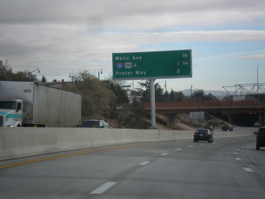
I-80 East - Reno/Sparks Exits
Next 3 Reno/Sparks exits on I-80 East: Wells Ave., I-580/US-395, Prater Way.
Taken 01-24-2007
Reno
Washoe County
Nevada
United States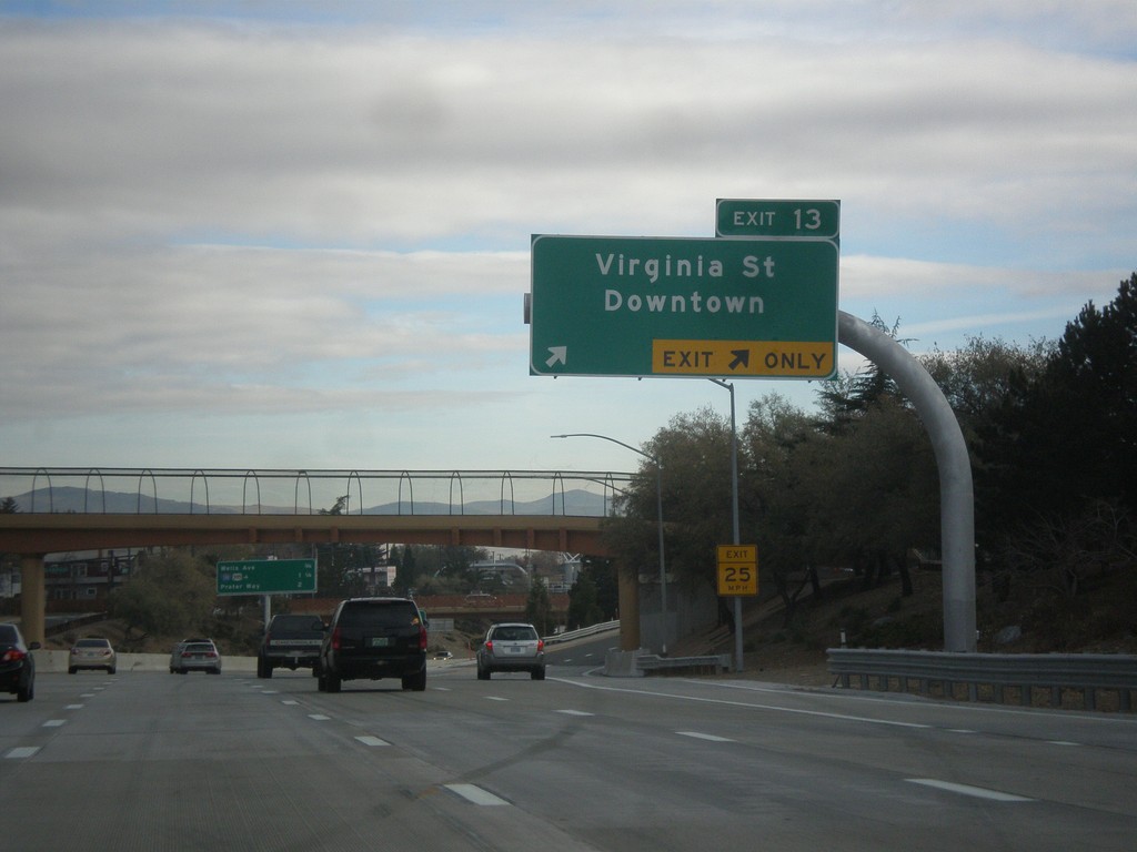
I-80 East - Exit 13
I-80 east at Exit 13 - Virginia St./Downtown.
Taken 01-24-2007
Reno
Washoe County
Nevada
United States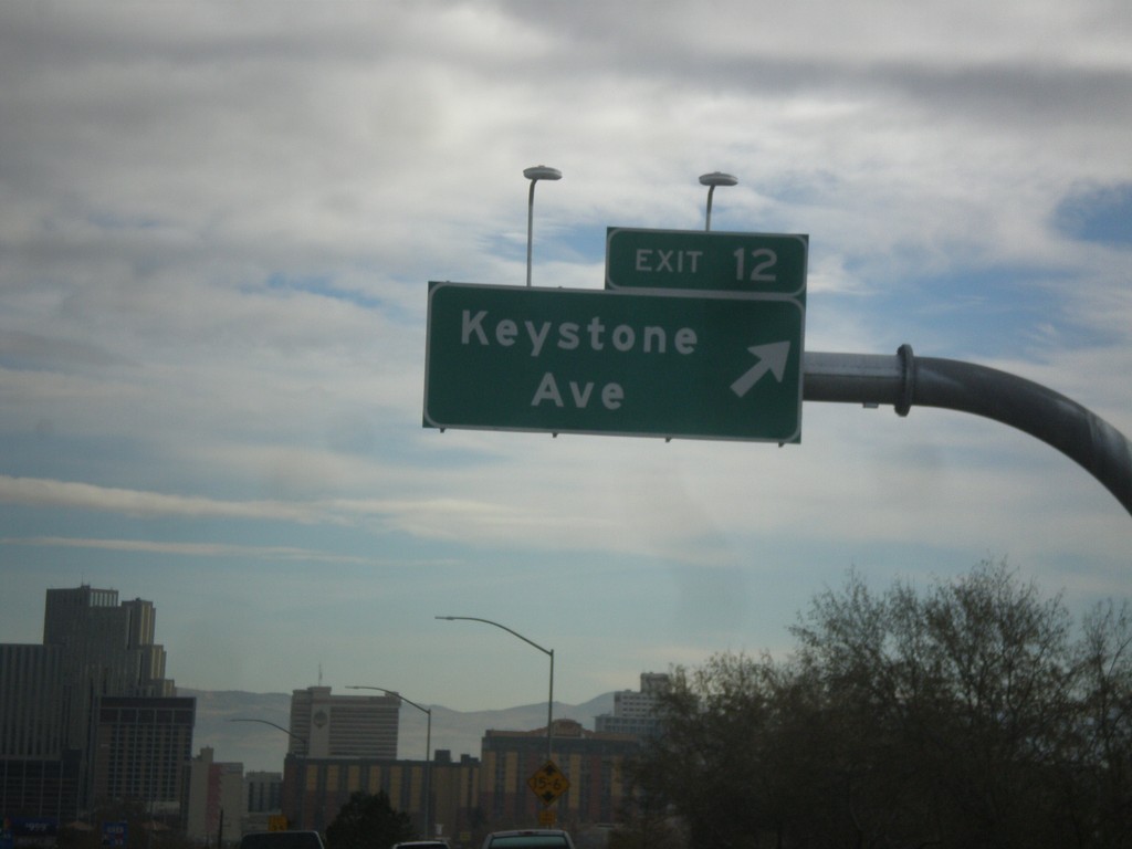
I-80 East - Exit 12
I-80 east at Exit 12 - Keystone Ave.
Taken 01-24-2007
Reno
Washoe County
Nevada
United States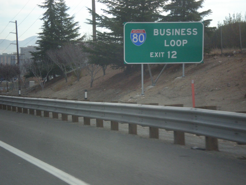
I-80 East - Business Loop I-80 Use Exit 12
I-80 east approaching Exit 12. Use Exit 12 for Business Loop I-80.
Taken 01-24-2007
 Reno
Washoe County
Nevada
United States
Reno
Washoe County
Nevada
United States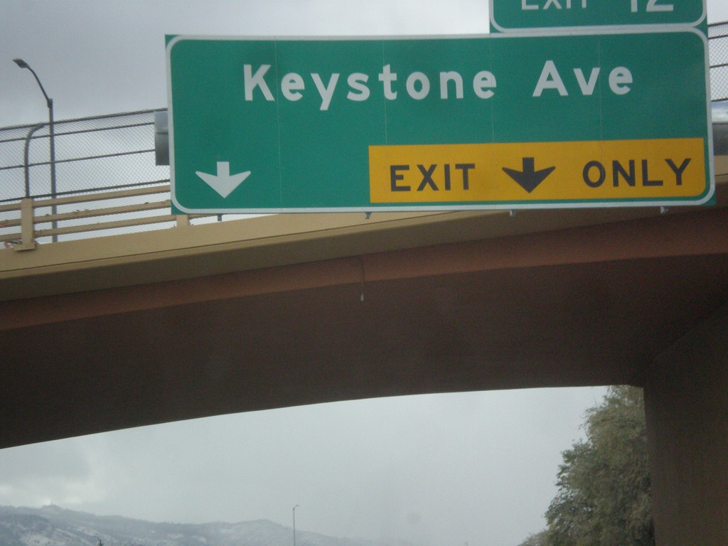
I-80 West - Exit 12
I-80 west at Exit 12 - Keystone Ave.
Taken 01-21-2007
Reno
Washoe County
Nevada
United States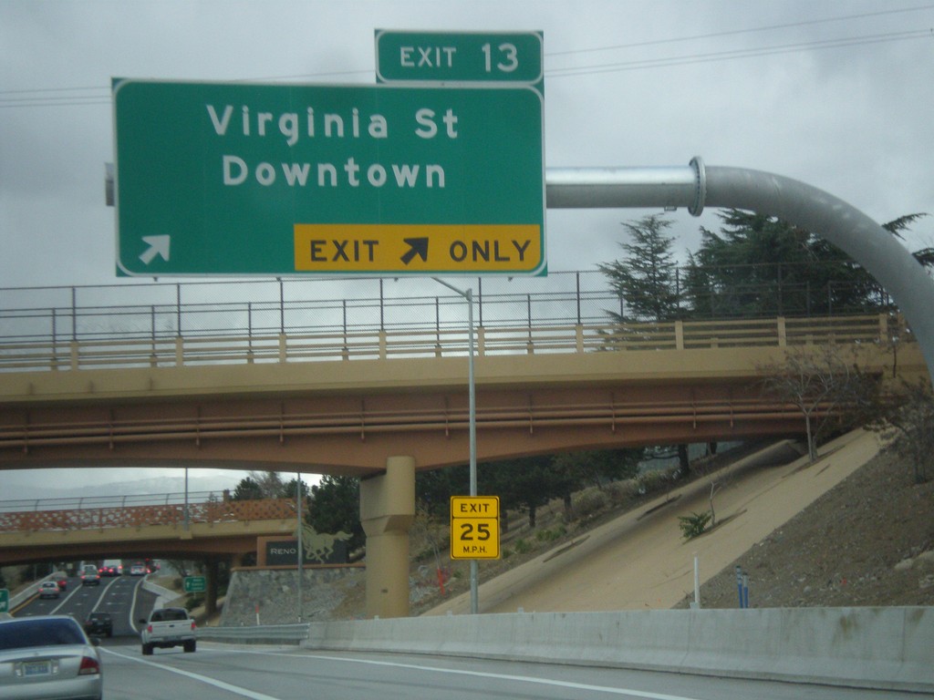
I-80 West - Exit 13
I-80 west at Exit 13 - Virginia St./Downtown.
Taken 01-21-2007
Reno
Washoe County
Nevada
United States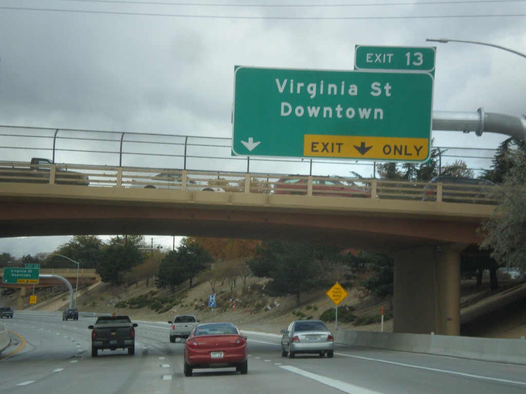
I-80 West Approaching Exit 13
I-80 west approaching Exit 13 - Virginia St./Downtown.
Taken 01-21-2007
Reno
Washoe County
Nevada
United States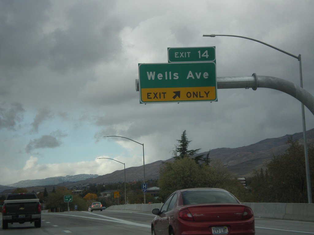
I-80 West - Exit 14
I-80 west at Exit 14 - Wells Ave.
Taken 01-21-2007
Reno
Washoe County
Nevada
United States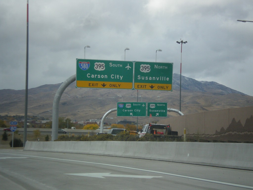
I-80 West - Exit 15
Connection from I-80 west to I-580/US-395. Use the right lane for US-395 north to Susanville (California). Use left lane for I-580/US-395 south to Carson City.
Taken 01-21-2007
Reno
Washoe County
Nevada
United States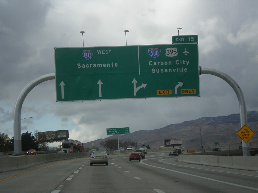
I-80 West - Exit 15
I-80 west at Exit 15 - I-580/US-395/Carson City/Susanville (California). Continue on I-80 west for Sacramento (California).
Taken 01-21-2007
Sparks
Washoe County
Nevada
United States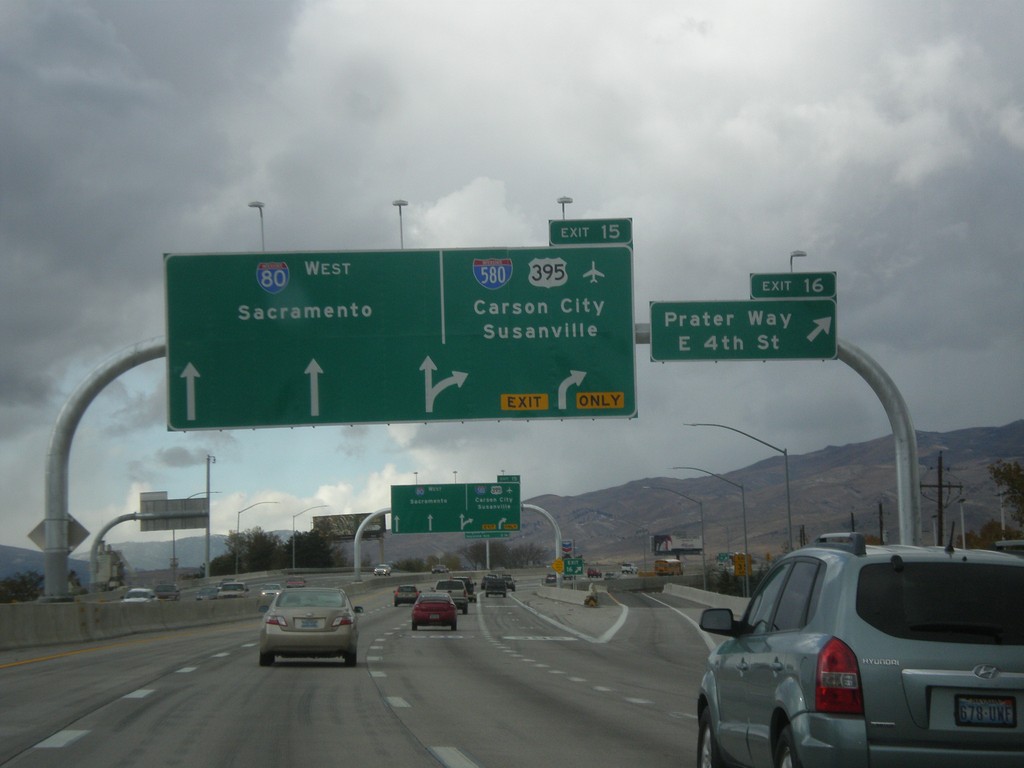
I-80 West - Exits 16 and 15
I-80 west at Exit 16 - Prater Way/E. 4th St. Approaching Exit 15 - I-580/US-395/Carson City/Susanville (California). Continue west on I-80 towards Sacramento (California).
Taken 01-21-2007
Sparks
Washoe County
Nevada
United States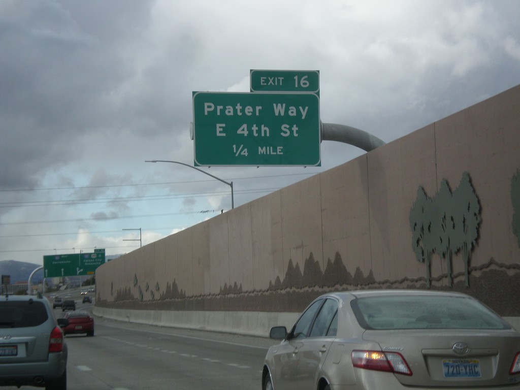
I-80 West - Exit 16
I-80 west at Exit 16 - Prater Way/East 4th St.
Taken 01-21-2007
Sparks
Washoe County
Nevada
United States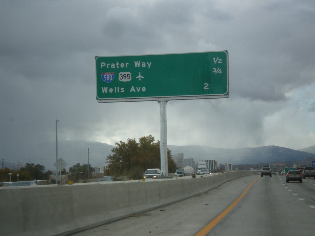
I-80 West - Distance Marker
Distance marker for next three Sparks/Reno area exits on I-80 west. Distance to Prater Way, US-395/I-580, Wells Ave.
Taken 01-21-2007
Sparks
Washoe County
Nevada
United States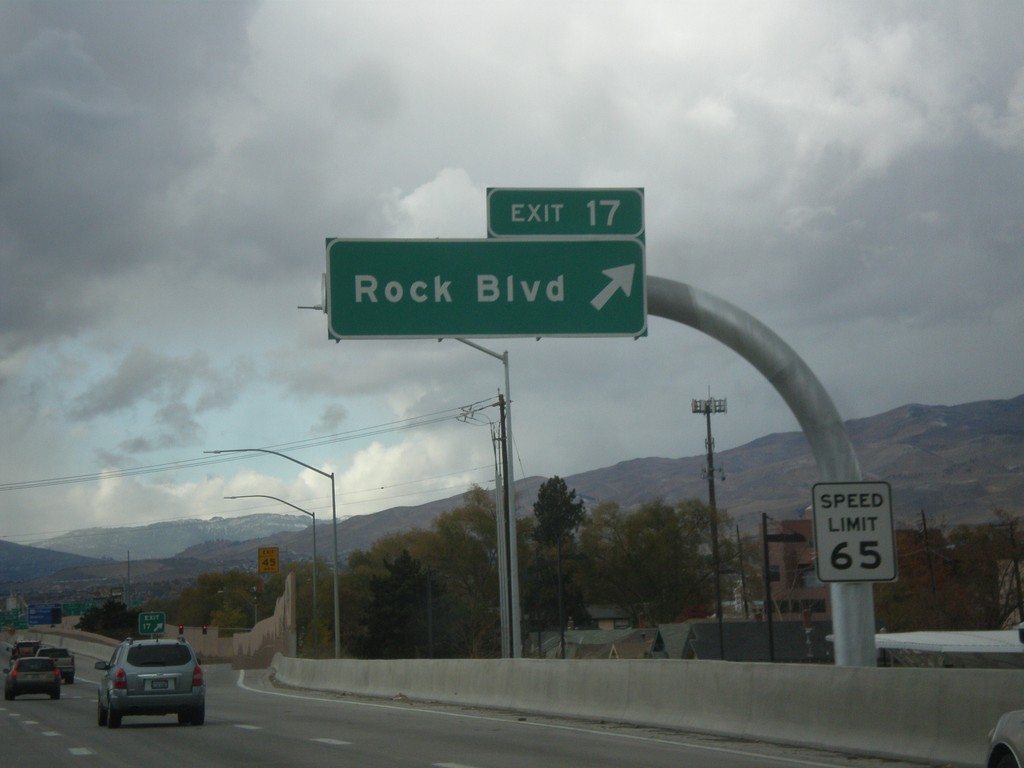
I-80 West - Exit 17
I-80 west at Exit 17 - Rock Blvd.
Taken 01-21-2007
Sparks
Washoe County
Nevada
United States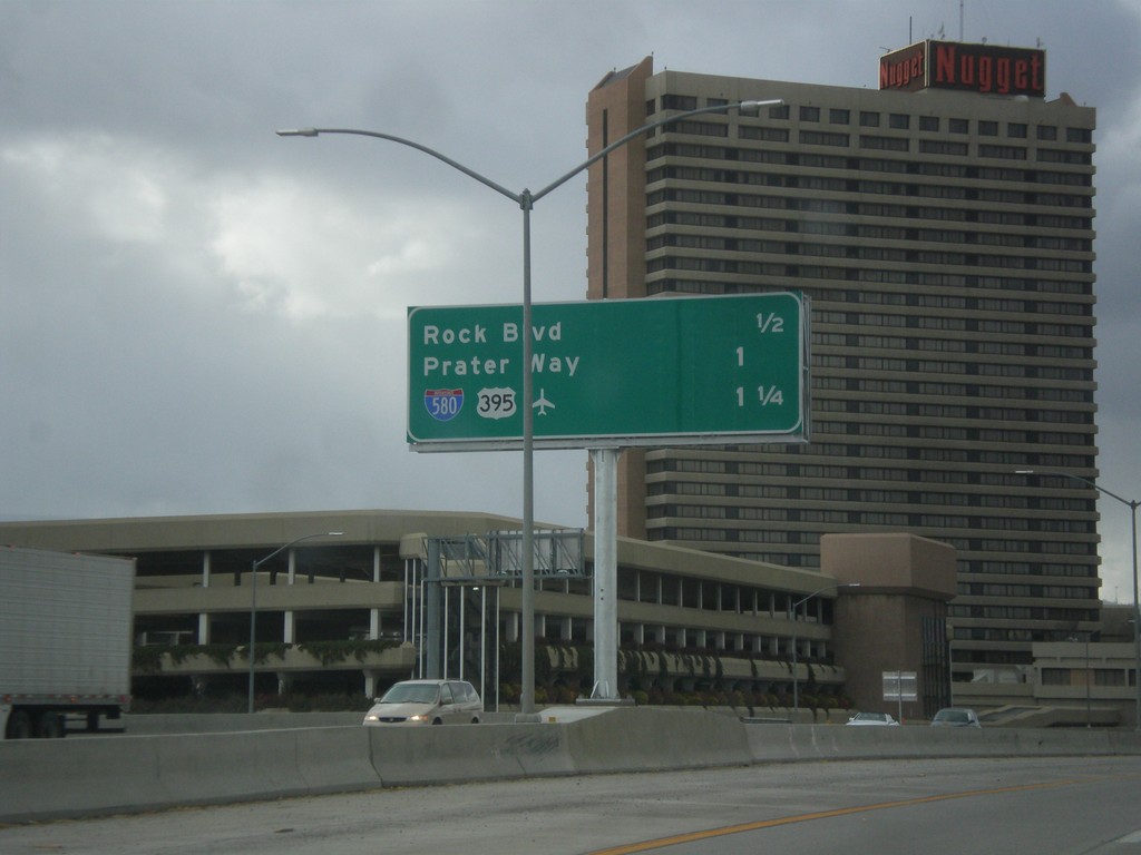
I-80 West - Distance Marker
Distance marker for next three Sparks/Reno exits on I-80 west: Rock Blvd., Prater Way, and US-395/I-580.
Taken 01-21-2007
Sparks
Washoe County
Nevada
United States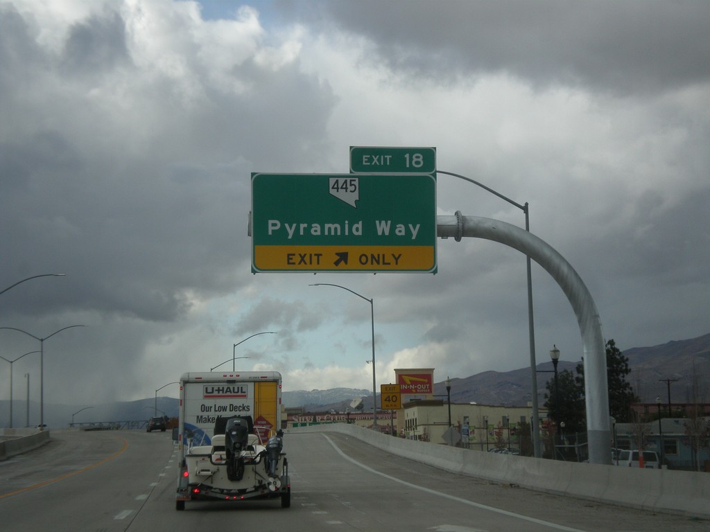
I-80 West - Exit 18
I-80 west at Exit 18 - NV-445/Pyramid Way.
Taken 01-21-2007
Sparks
Washoe County
Nevada
United States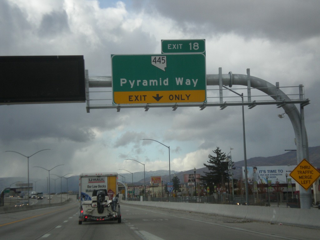
I-80 West Approaching Exit 18
I-80 west approaching Exit 18 - NV-445/Pyramid Way.
Taken 01-21-2007
Sparks
Washoe County
Nevada
United States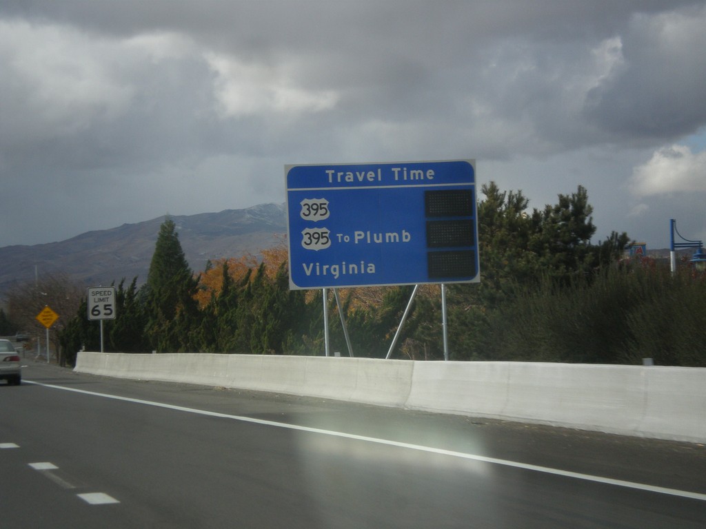
I-80 West - Reno Travel Times
Electronic sign that lists Reno/Sparks area travel times. The sign currently is not displaying times. The sign lists times to US-395, Plumb Lane (via US-395) and Virginia St.
Taken 01-21-2007
Sparks
Washoe County
Nevada
United States