Signs Tagged With Big Green Sign
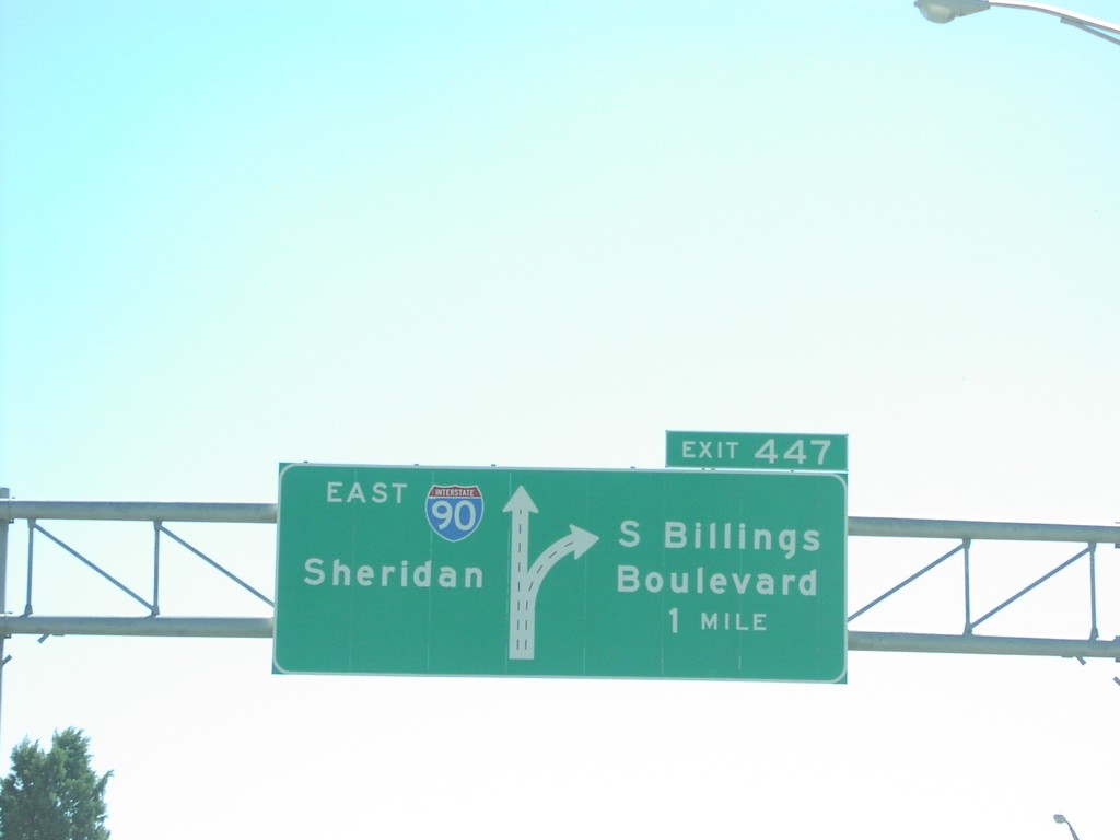
I-90 East Exit 447
I-90 east to Sheridan approaching Exit 447, S. Billings Blvd.
Taken 07-01-2006
 Billings
Yellowstone County
Montana
United States
Billings
Yellowstone County
Montana
United States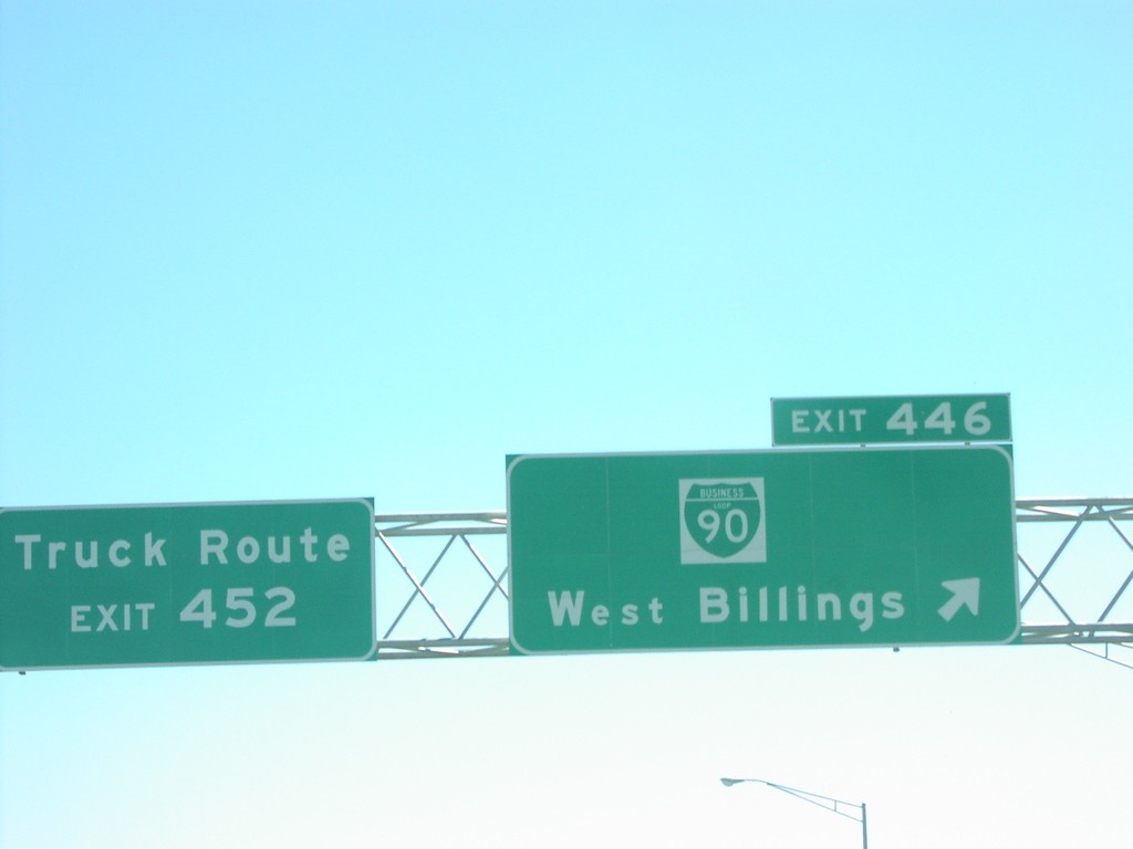
I-90 East Exit 446
I-90 east at Exit 446, BL-90/West Billings.
Taken 07-01-2006
Billings
Yellowstone County
Montana
United States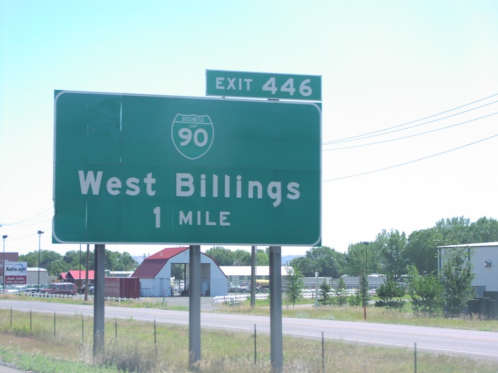
I-90 East Exit 446
I-90 east approaching Exit 446, BL-90/West Billings, 1 mile.
Taken 07-01-2006
Billings
Yellowstone County
Montana
United States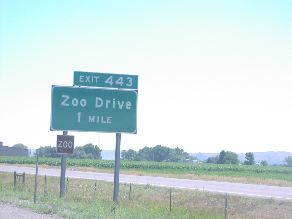
I-90 East Exit 443
I-90 east approaching Exit 443, Zoo Drive, 1 mile.
Taken 07-01-2006
 Billings
Yellowstone County
Montana
United States
Billings
Yellowstone County
Montana
United States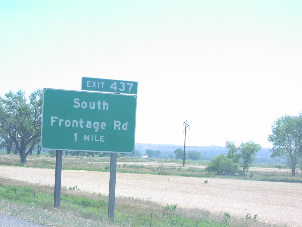
I-90 East Exit 437
I-90 east approaching Exit 437, South Frontage Road, 1 mile.
Taken 07-01-2006
Laurel
Yellowstone County
Montana
United States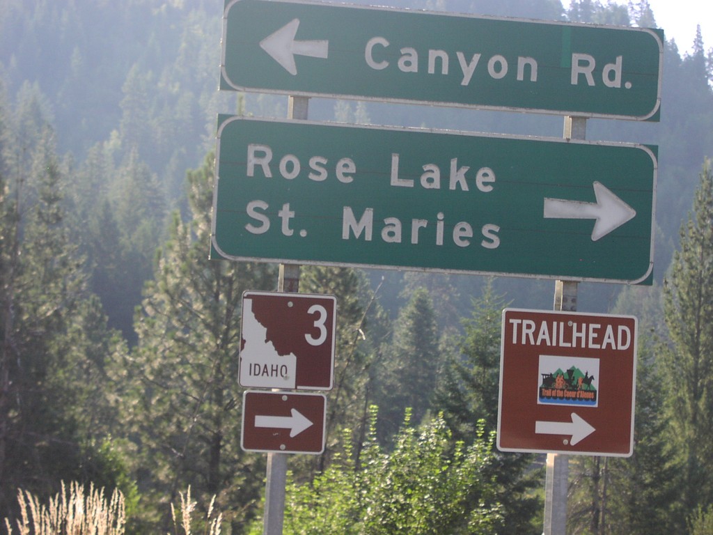
I-90 East Exit 34 Offramp at ID-3
I-90 east Exit 34 offramp at ID-3 to Rose Lake and St. Maries.
Taken 07-01-2006
 Cataldo
Kootenai County
Idaho
United States
Cataldo
Kootenai County
Idaho
United States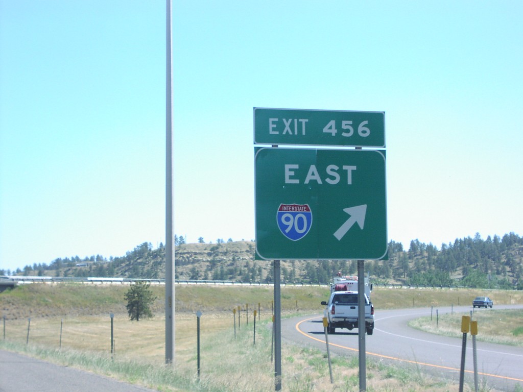
I-90 East at I-94
Exit 456 gore sign at I-90 East/I-94 junction.
Taken 07-01-2006
Billings
Yellowstone County
Montana
United States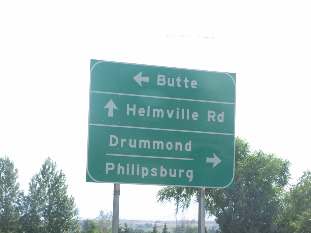
I-90 East at Drummond Offramp
MTS-271 at I-90 east to Butte. Right turn for Drummond and Phillipsburg and MT-1.
Taken 07-01-2006

 Drummond
Granite County
Montana
United States
Drummond
Granite County
Montana
United States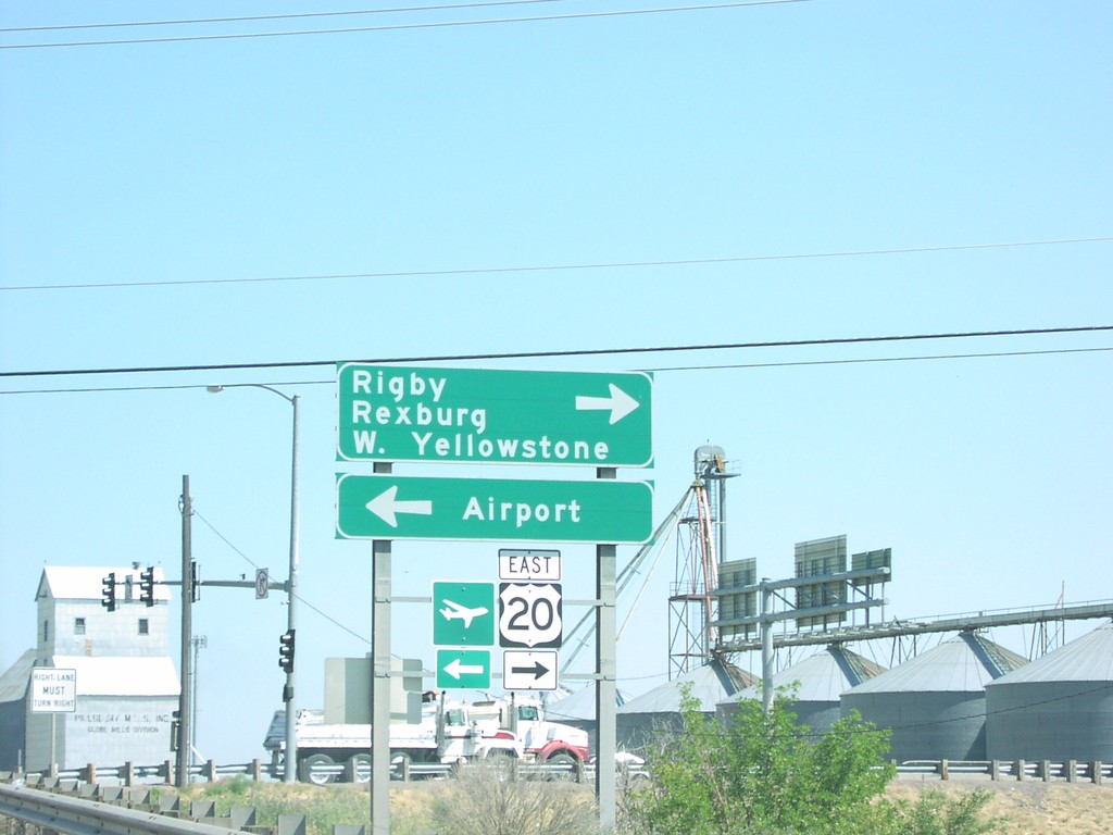
I-15 North Exit 119 Offramp at US-20 East
I-15 north offramp at US-20 east to Rexburg, Rigby, and W. Yellowstone, and the Idaho Falls Airport.
Taken 07-01-2006

 Idaho Falls
Bonneville County
Idaho
United States
Idaho Falls
Bonneville County
Idaho
United States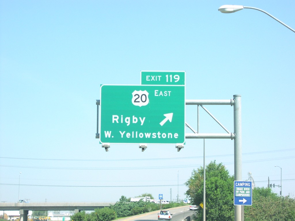
I-15 North Exit 119
I-15/US-20 north at Exit 119, US-20 East/Rigby/W. Yellowstone(MT).
Taken 07-01-2006
Idaho Falls
Bonneville County
Idaho
United States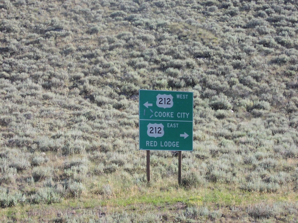
End WY-296 at US-212
End WY-296 at US-212 to Cooke City and Red Lodge.
Taken 07-01-2006
 Cody
Park County
Wyoming
United States
Cody
Park County
Wyoming
United States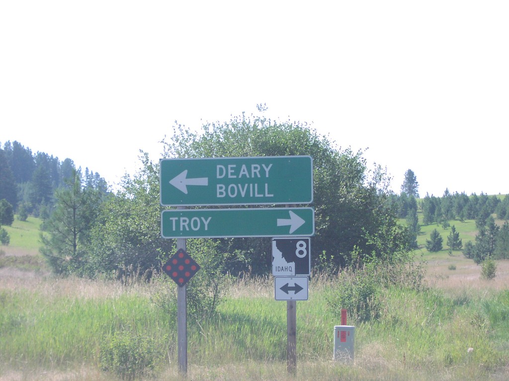
End ID-9 at ID-8
End ID-9 at ID-8 east to Deary and Bovill, and west to Troy.
Taken 07-01-2006

 Deary
Latah County
Idaho
United States
Deary
Latah County
Idaho
United States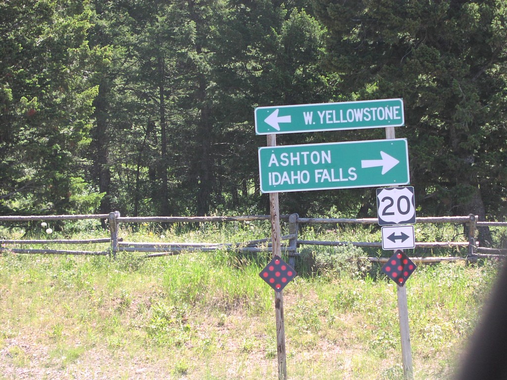
End ID-87 South at US-20
End ID-87 south at US-20, to Ashton, Idaho Falls, and W. Yellowstone.
Taken 07-01-2006
 Island Park
Fremont County
Idaho
United States
Island Park
Fremont County
Idaho
United States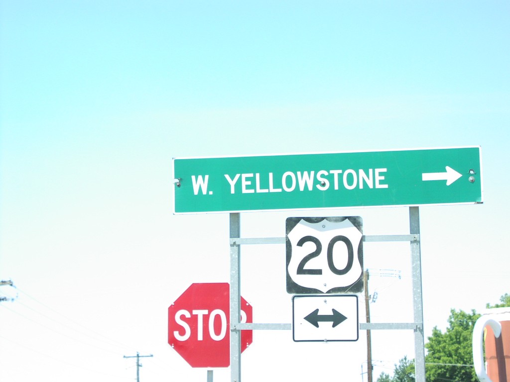
End ID-47 South at US-20
End ID-47 south at US-20. Use US-20 east for West Yellowstone, MT.
Taken 07-01-2006
 Ashton
Fremont County
Idaho
United States
Ashton
Fremont County
Idaho
United States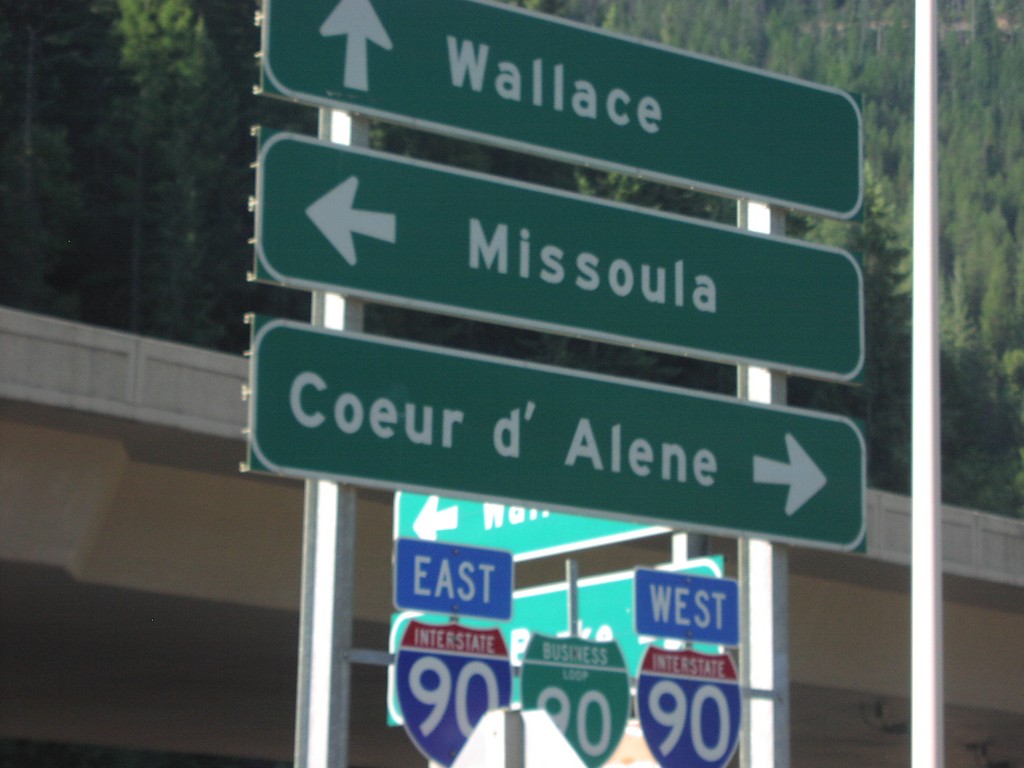
End ID-4 South at I-90/BL-90
Southern end of ID-4 at I-90 to Coeur d’Alene and Missoula, and BL-90 into Wallace.
Taken 07-01-2006

 Wallace
Shoshone County
Idaho
United States
Wallace
Shoshone County
Idaho
United States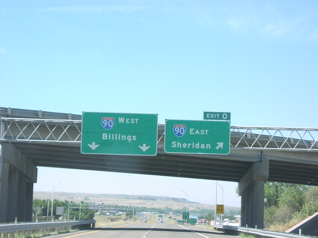
End I-94 West at I-90
End I-94 west at Exit 0, I-90 East/Sheridan, I-90 West/Billings. I-90 west continues on same piece of roadway.
Taken 07-01-2006
 Billings
Yellowstone County
Montana
United States
Billings
Yellowstone County
Montana
United States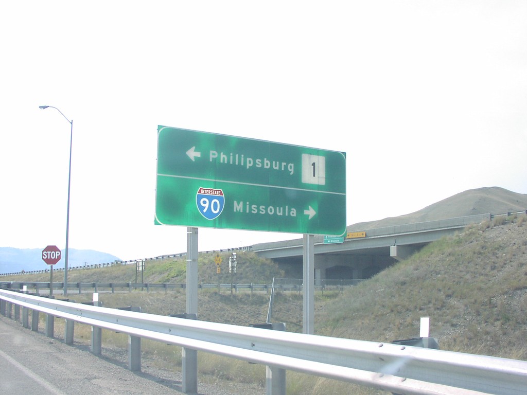
BL-90 at MT-1 to Phillipsburg and Missoula
MT-1 junction on Front St. in Drummond. MT-1 goes south to Phillipsburg, north goes to I-90 jct.
Taken 07-01-2006
 Drummond
Granite County
Montana
United States
Drummond
Granite County
Montana
United States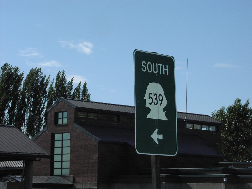
WA-539 South - Leaving US Customs
WA-539 south leaving the US Customs facility.
Taken 06-01-2006
 Lynden
Whatcom County
Washington
United States
Lynden
Whatcom County
Washington
United States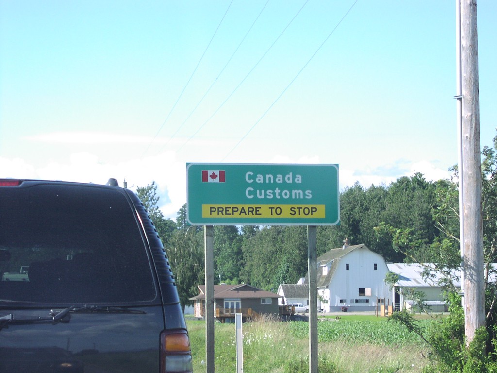
WA-539 North At Canada Customs
WA-539 north approaching Canada Customs - Be Prepared To Stop.
Taken 06-01-2006
Lynden
Whatcom County
Washington
United States
Vedder Road South at TC-1 East
Vedder Road south at TC-1 east to Hope, closeup.
Taken 06-01-2006
 Chilliwack
Fraser Valley
British Columbia
Canada
Chilliwack
Fraser Valley
British Columbia
Canada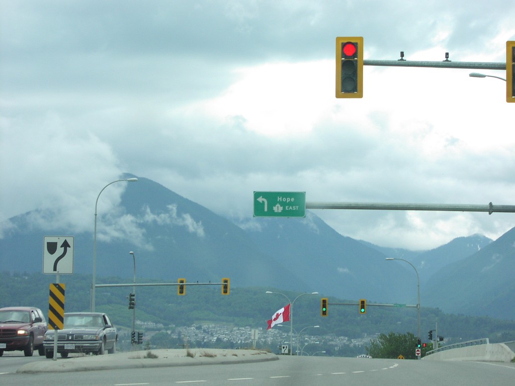
Vedder Road South at TC-1 East
Vedder Road south at TC-1 east to Hope.
Taken 06-01-2006
Chilliwack
Fraser Valley
British Columbia
Canada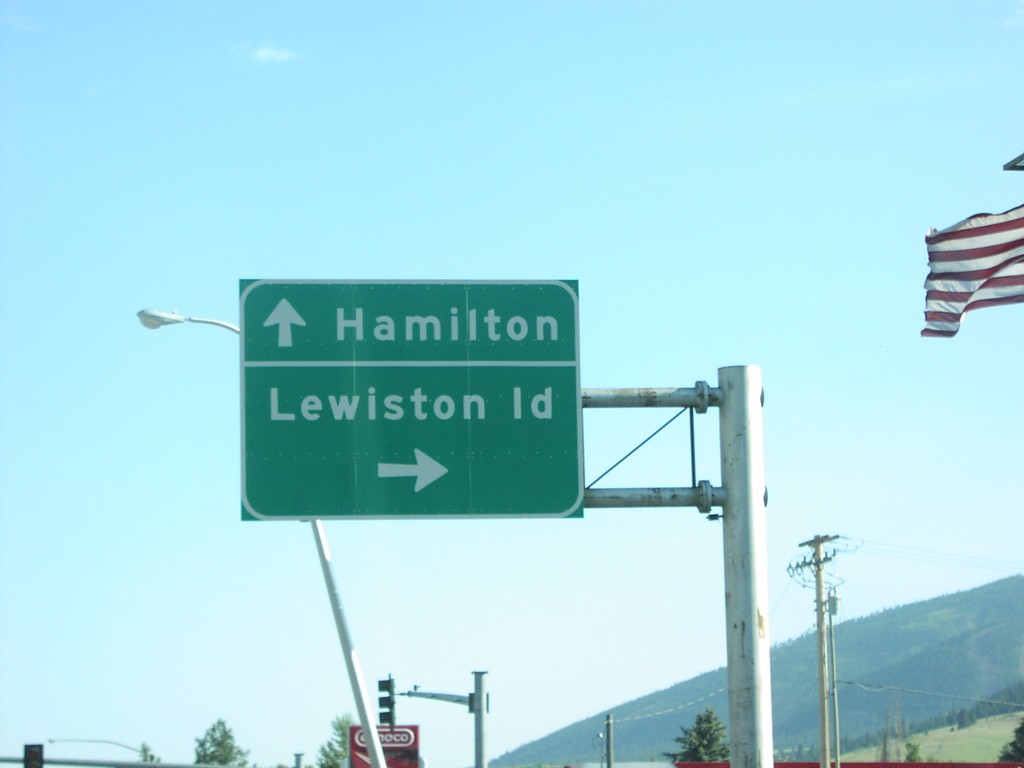
US-93 South/US-12 West at US-12
US-93 South/US-12 West Split in Lolo. Turn right for US-12 west to Lewiston (Idaho); continue straight for US-93 south to Hamilton.
Taken 06-01-2006
 Lolo
Missoula County
Montana
United States
Lolo
Missoula County
Montana
United States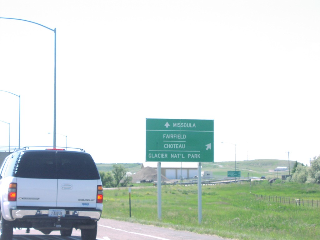
US-89 North/MT-200 West Split
US-89 North/MT-200 West at US-89/MT-200 split. Merge right for US-89 north to Fairfield, Choteau, and Glacier National Park. Continue west on MT-200 for Missoula.
Taken 06-01-2006

 Sun River
Cascade County
Montana
United States
Sun River
Cascade County
Montana
United States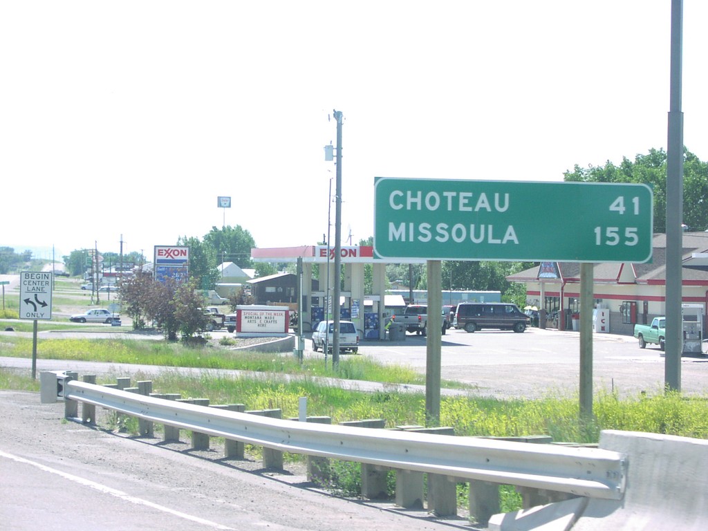
US-89 North/MT-200 West - Distance Marker
Distance marker on US-89 North/MT-200 West. Distance to Choteau (via US-89) and Missoula (via MT-200).
Taken 06-01-2006
Vaughn
Cascade County
Montana
United States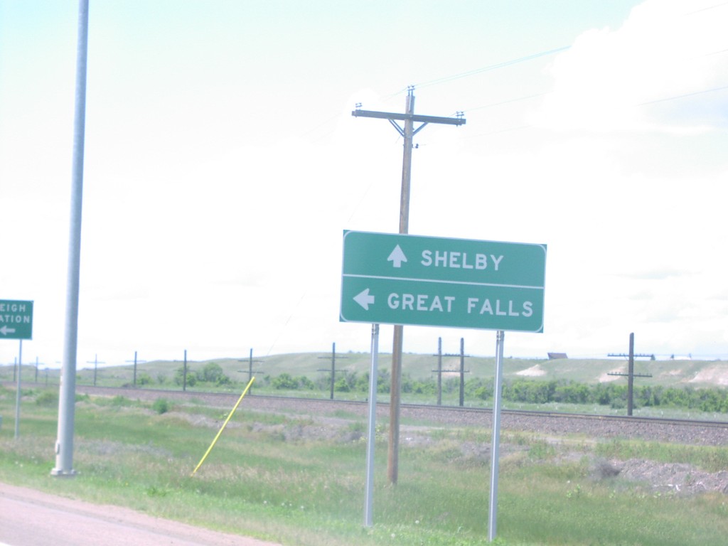
US-2 West at US-87 South
US-2 west approaching US-87 south. Use US-87 south for Great Falls; continue west on US-2 for Shelby.
Taken 06-01-2006

 Havre
Hill County
Montana
United States
Havre
Hill County
Montana
United States