Signs Tagged With Big Green Sign
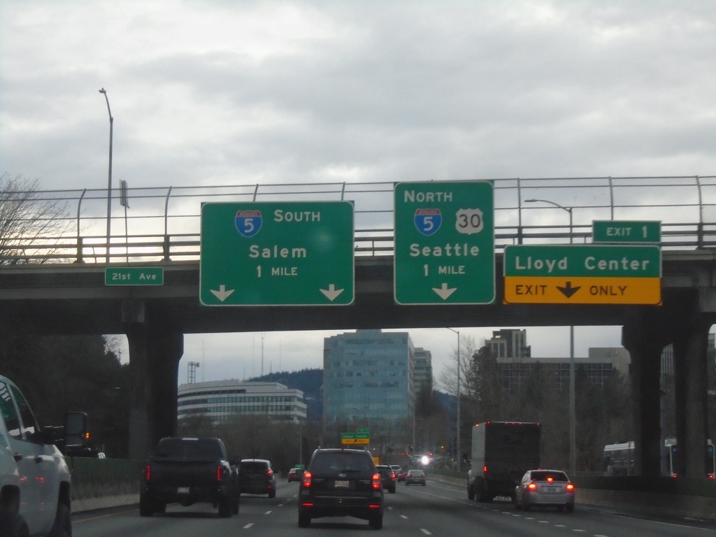
I-84 West - Exits 1 and I-5 Junction
I-84 West approaching Exit 1 - Lloyd Center and I-5 South/Salem and I-5 North/US-30 West/Seattle (WA).
Taken 01-02-2024


 Portland
Multnomah County
Oregon
United States
Portland
Multnomah County
Oregon
United States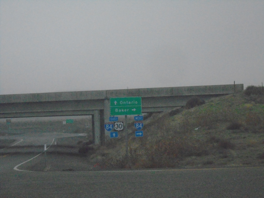
US-30 East at I-84 Exit 352
US-30 East at I-84. Use I-84 west to Baker; I-84/US-30 East to Ontario.
Taken 01-02-2024
Huntington
Baker County
Oregon
United States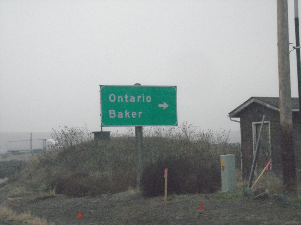
US-30 East Approaching I-84 (Exit 353)
US-30 East approaching I-84 (Exit 353) in Malheur County. Turn right for I-84 access to Ontario and Baker.
Taken 01-02-2024
Huntington
Malheur County
Oregon
United States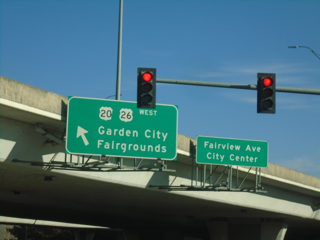
Fairview Ave. East Approaching US-20/US-26 West
Fairview Ave. East approaching US-20/US-26 West in Boise. Turn left for US-20/US-26 West/Garden City/Fairgrounds. Continue straight for Fairview Ave./(Boise) City Center.
Taken 01-01-2024

 Boise
Ada County
Idaho
United States
Boise
Ada County
Idaho
United States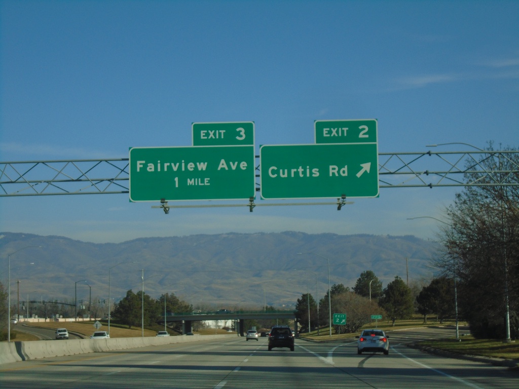
I-184 East - Exit 2. Approaching Exit 3
I-184 east at Exit 2 - Curtis Road. Approaching Exit 3 - Fairview Ave.
Taken 01-01-2024
 Boise
Ada County
Idaho
United States
Boise
Ada County
Idaho
United States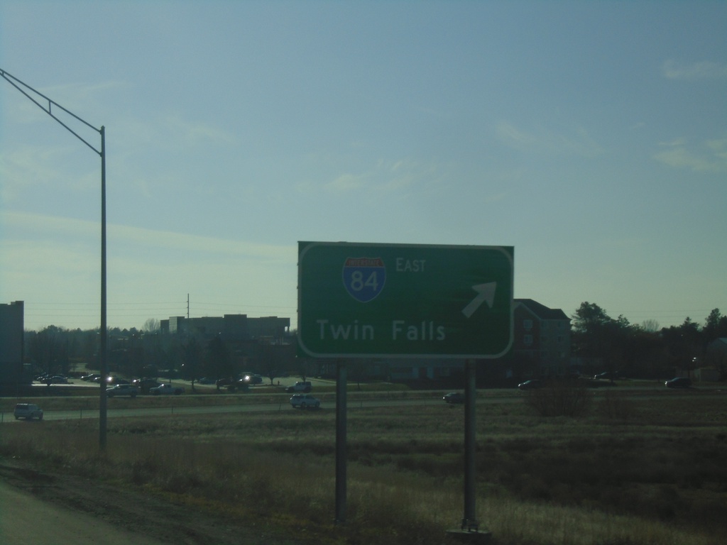
ID-55 South at I-84/US-30 East
ID-55 South at I-84/US-30 East to Twin Falls.
Taken 01-01-2024
 Meridian
Ada County
Idaho
United States
Meridian
Ada County
Idaho
United States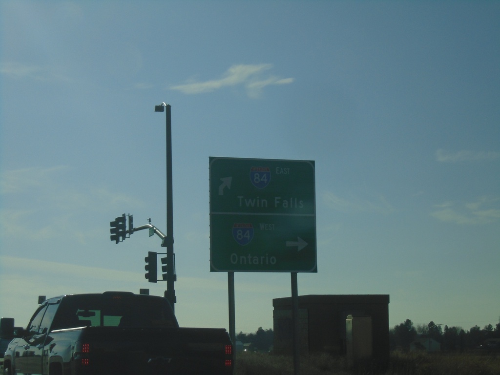
ID-55 South at I-84 West - Meridian
ID-55 South at I-84 West in Meridian. Turn right for I-84 West/US-30 West/ID-55 South to Ontario (Oregon). Continue over freeway for I-84 East to Twin Falls.
Taken 01-01-2024
Meridian
Ada County
Idaho
United States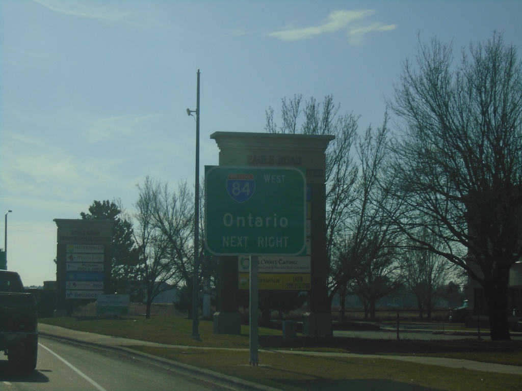
ID-55 South Approaching I-84 West
ID-55 South (Eagle Road) approaching I-84 West in Meridian. Use I-84 west for Ontario (Oregon). ID-55 south joins I-84 westbound to Nampa.
Taken 01-01-2024
Meridian
Ada County
Idaho
United States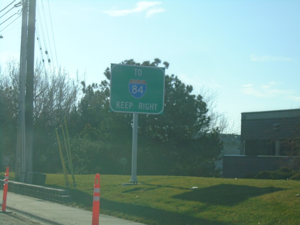
ID-55 South - Use Right Lanes for I-84
ID-55 south (Eagle Road) approaching I-84. Use right lanes for I-84 traffic.
Taken 01-01-2024
Meridian
Ada County
Idaho
United States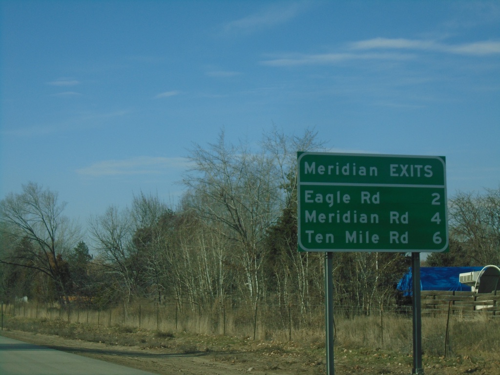
I-84 West - Meridian Exits
Meridian Exits on I-84 west: Eagle Road (ID-55), Meridian Road (ID-69), and Ten Mile Road.
Taken 01-01-2024
Boise
Ada County
Idaho
United States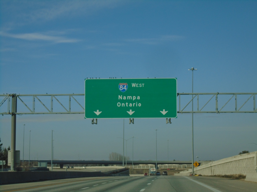
I-84 West - Nampa/Ontario
Overhead for I-84 West - Nampa/Ontario (Oregon) on I-84 just west of the I-84/I-184 junction.
Taken 01-01-2024
Boise
Ada County
Idaho
United States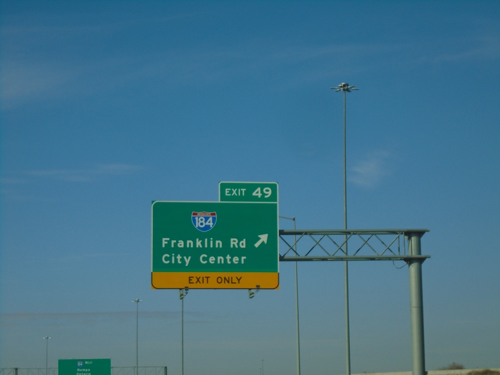
I-84 West - Exit 49
I-84 west at Exit 49 - I-184/Franklin Road/City Center.
Taken 01-01-2024
Boise
Ada County
Idaho
United States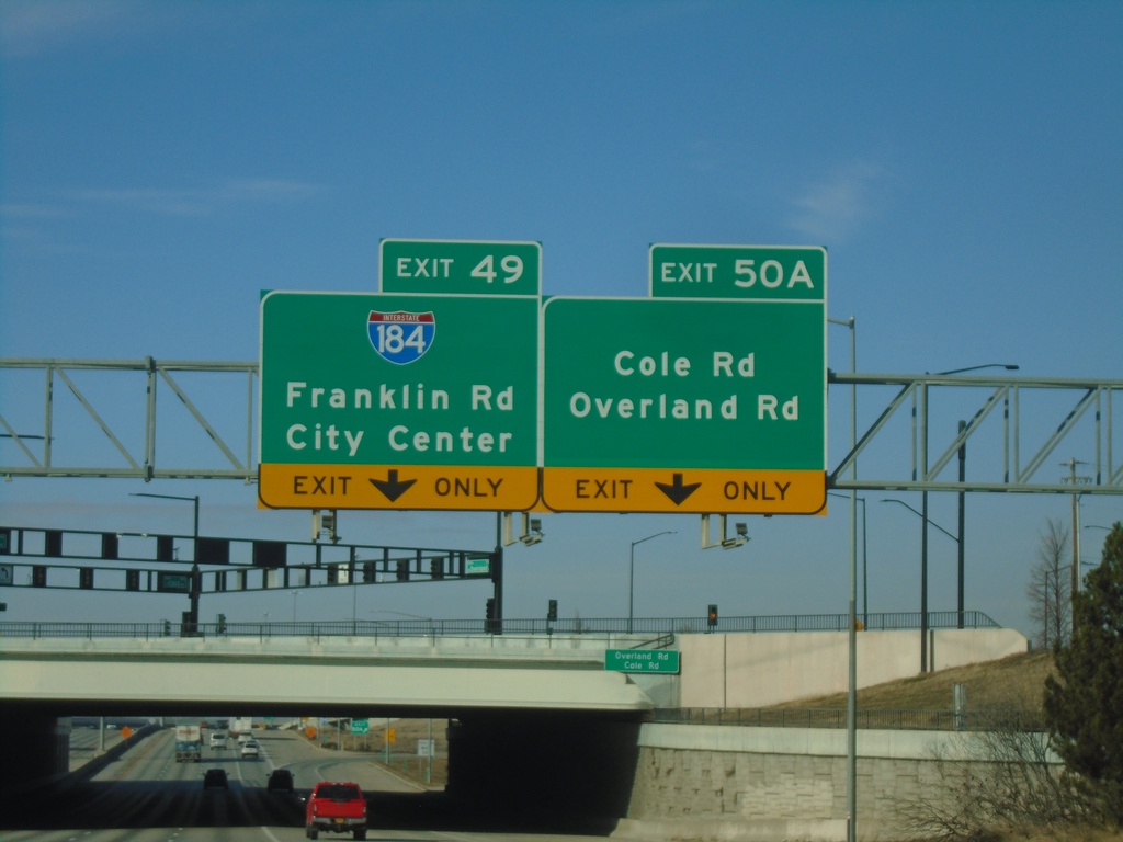
I-84 West - Exit 50A and Exit 49
I-84 west at Exit 50A - Cole Road/Overland Road. Approaching Exit 49 - I-184/Franklin Road/City Center.
Taken 01-01-2024
Boise
Ada County
Idaho
United States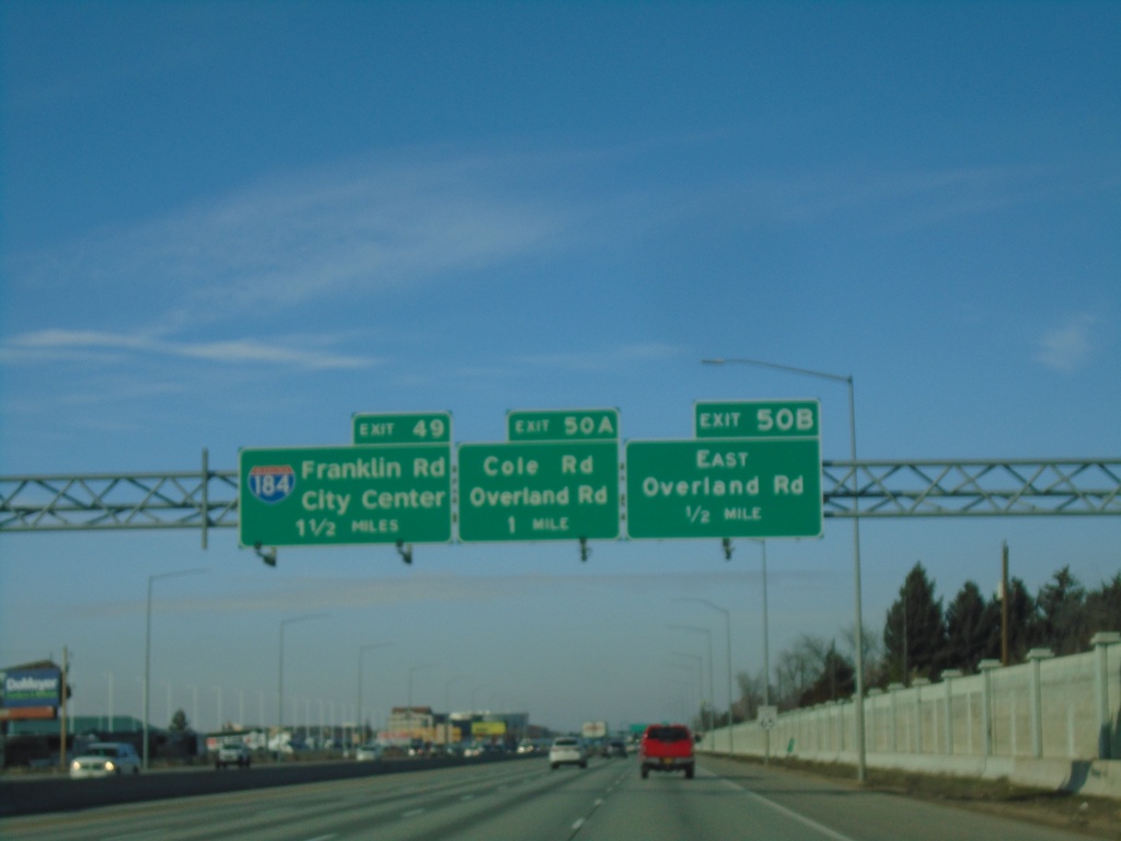
I-84 West - Exits 50B-A, and 49
I-84 West approaching Exit 50B - East Overland Road, Exit 50B - Overland Road/Cole Road and Exit 49 - I-184/Franklin Road/City Center.
Taken 01-01-2024
Boise
Ada County
Idaho
United States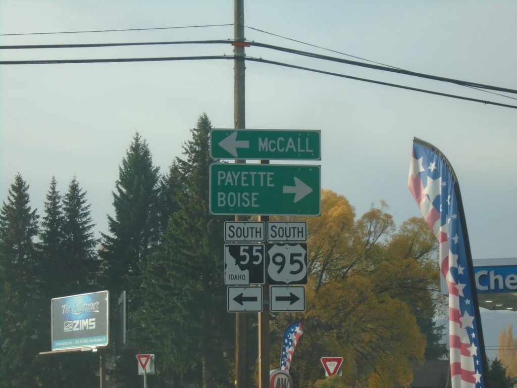
US-95 South at ID-55
US-95 South at ID-55 in New Meadows. Turn right for US-95 South to Weiser and Boise; turn left for ID-55 south to McCall.
Taken 10-22-2023
 New Meadows
Adams County
Idaho
United States
New Meadows
Adams County
Idaho
United States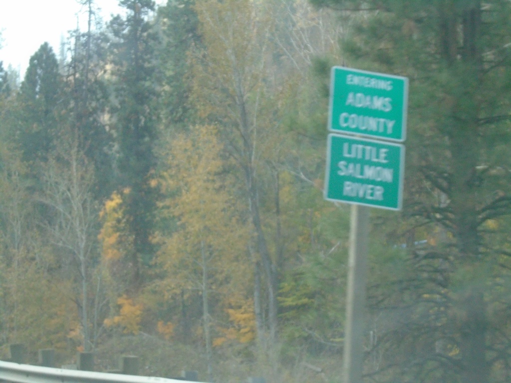
US-95 South - Entering Adams County
Entering Adams County on US-95 South at the Little Salmon River.
Taken 10-22-2023
New Meadows
Adams County
Idaho
United States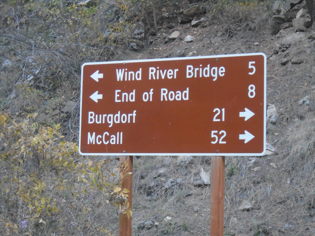
Salmon River Road at French Creek Road
Salmon River Road at French Creek Road. Turn right for French Creek Road south to Burgdorf and McCall. Turn left for Salmon River Road east to Wind River Bridge and End of Road.
Taken 10-20-2023
Riggins Idaho County Idaho United States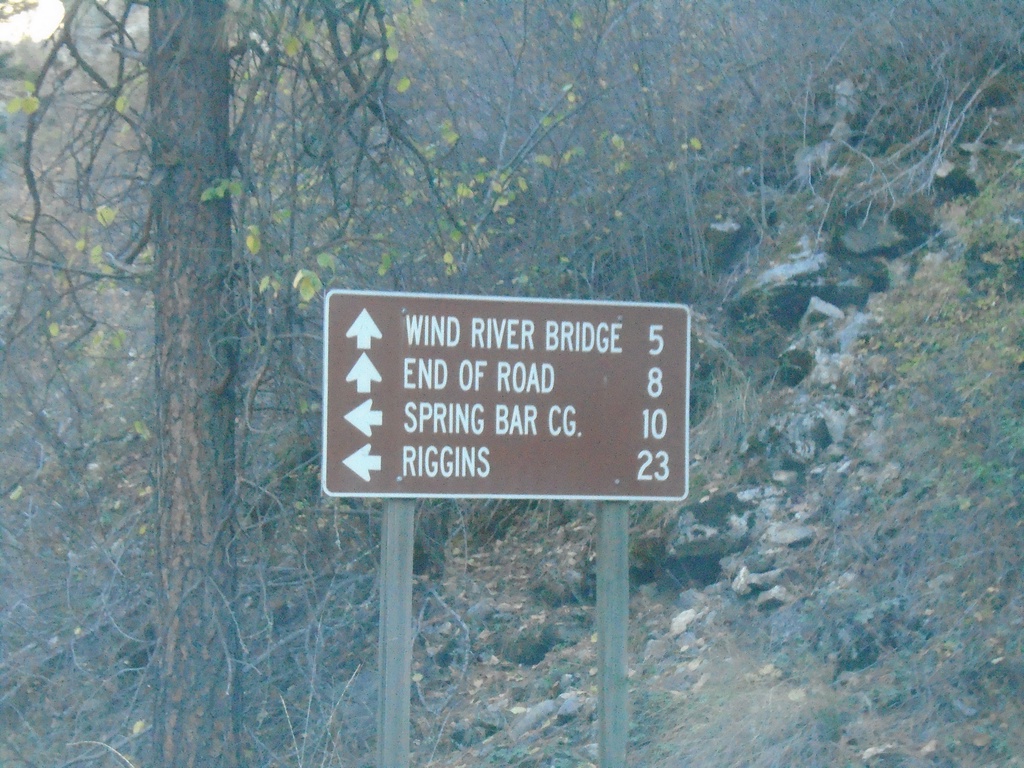
French Creek Road at Salmon River Road
End French Creek Road at Salmon River Road. Continue straight for the Salmon River Road east to Wind River Bridge and End of Road. Turn left for Salmon River Road west to Spring Bar Camp Ground and Riggins.
Taken 10-20-2023
Riggins Idaho County Idaho United States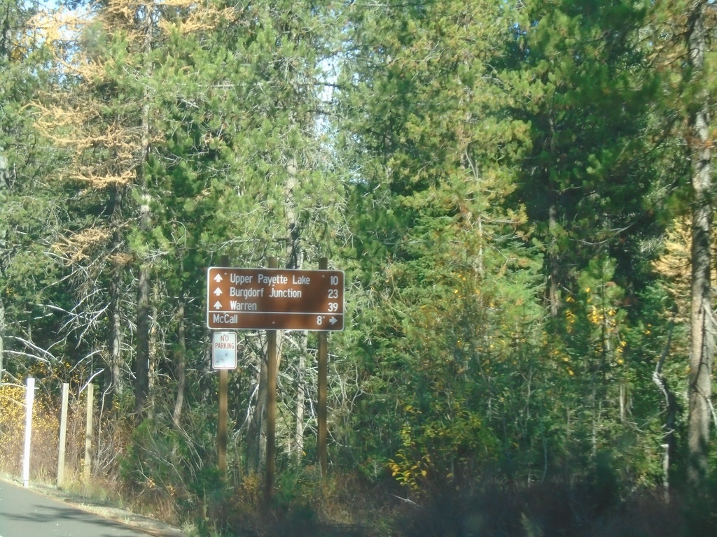
Warren Wagon Road at East Side Road
Warren Wagon Road northbound at East Side Road. Use East Side Road to return to McCall via the east side of Payette Lake. Continue north on Warren Wagon Road for Upper Payette Lake, Burgdorf Junction and Warren.
Taken 10-20-2023
McCall Valley County Idaho United States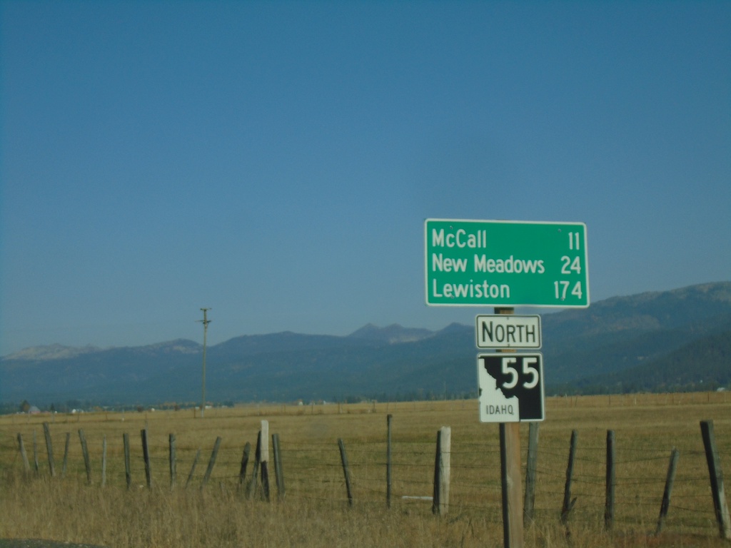
ID-55 North - Distance Marker
Distance marker on ID-55 north. Distance to McCall, New Meadows, and Lewiston.
Taken 10-20-2023
McCall
Valley County
Idaho
United States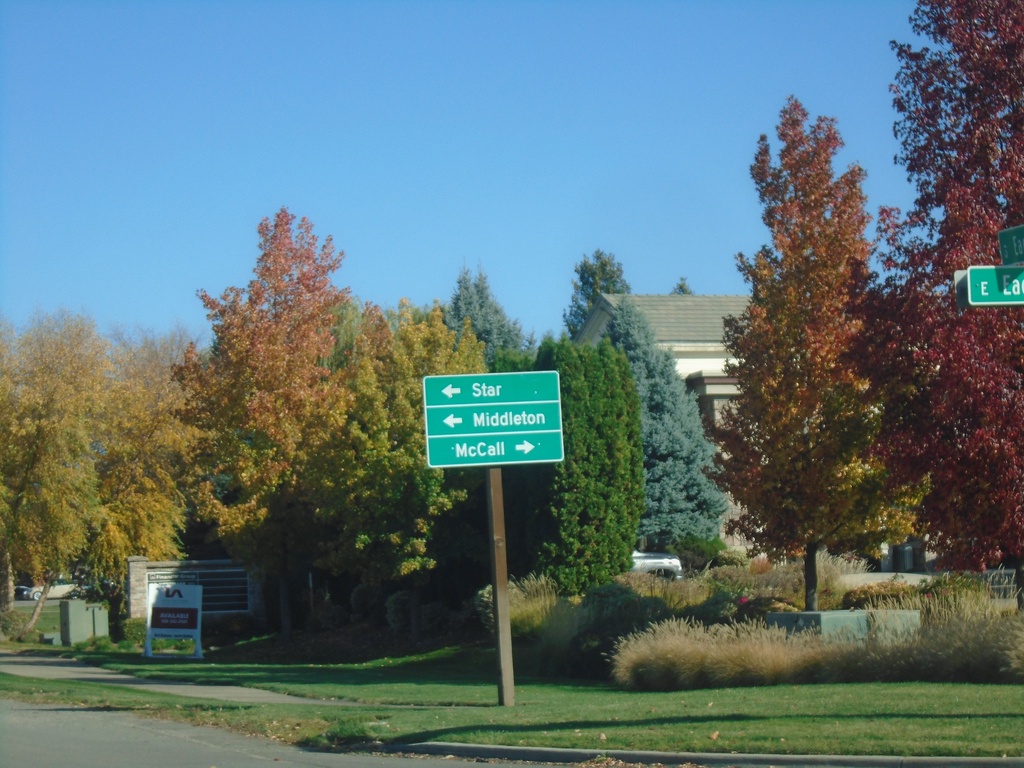
ID-55 North Approaching ID-44
ID-55 North approaching ID-44 in Eagle. Use ID-44 west for Star and Middleton; use ID-44 east/ID-55 north to McCall.
Taken 10-20-2023
 Eagle
Ada County
Idaho
United States
Eagle
Ada County
Idaho
United States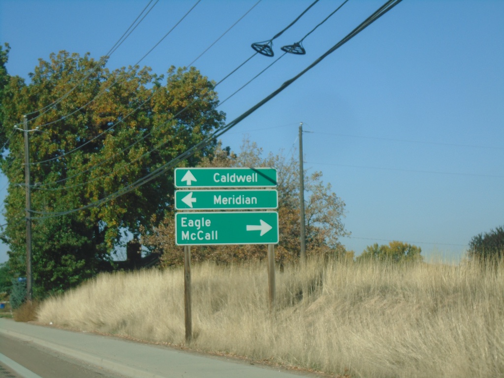
US-20/US-26 West at ID-55
US-20/US-26 West (Chinden Blvd.) at ID-55 (Eagle Road) in Boise. Turn right on ID-55 north for Eagle and McCall. Turn left for ID-55 south to Meridian. Continue west for US-20/US-26 to Caldwell.
Taken 10-20-2023
Boise
Ada County
Idaho
United States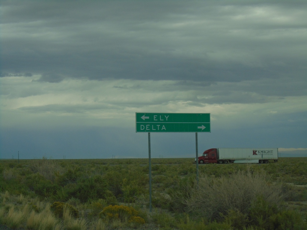
End UT-159 North at US-6/US-50
End UT-159 North at US-6/US-50 in Millard County. Use US-6/US-50 East to Delta; US-6/US-50 West to Ely (Nevada).
Taken 09-09-2023


 Garrison
Millard County
Utah
United States
Garrison
Millard County
Utah
United States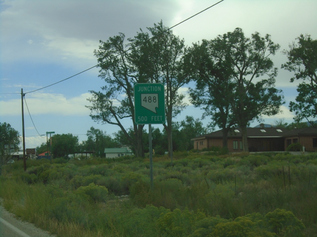
NV-487 South Approaching NV-488
NV-487 south approaching NV-488 in 500 Feet.
Taken 09-09-2023

 Baker
White Pine County
Nevada
United States
Baker
White Pine County
Nevada
United States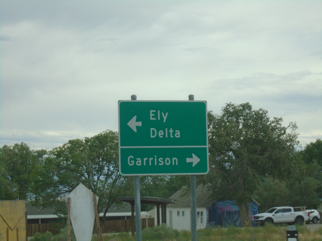
End NV-488 East at NV-487
End NV-488 East at NV-487 in Baker. Use NV-487 south for Garrison (Utah). Use NV-487 north for Delta (Utah) and Ely.
Taken 09-09-2023
Baker
White Pine County
Nevada
United States