Signs Tagged With Big Green Sign
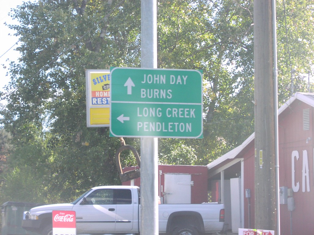
US-26 East at US-395 North
US-26 east at US-395 north to Long Creek and Pendleton, and US-26 east/US-395 south to John Day and Burns.
Taken 10-01-2006

 Mount Vernon
Grant County
Oregon
United States
Mount Vernon
Grant County
Oregon
United States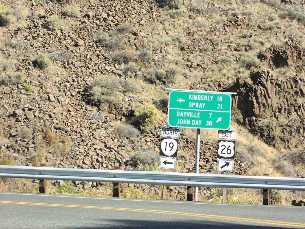
US-26 East at OR-19
US-26 east at OR-19 north to Kimberly and Spray.
Taken 10-01-2006
 Dayville
Grant County
Oregon
United States
Dayville
Grant County
Oregon
United States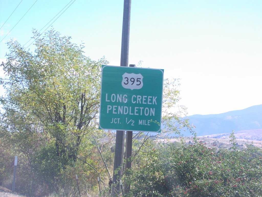
US-26 East approaching US-395 North
US-26 east approaching US-395 north to Long Creek and Pendleton, 1/2 mile.
Taken 10-01-2006
Mount Vernon
Grant County
Oregon
United States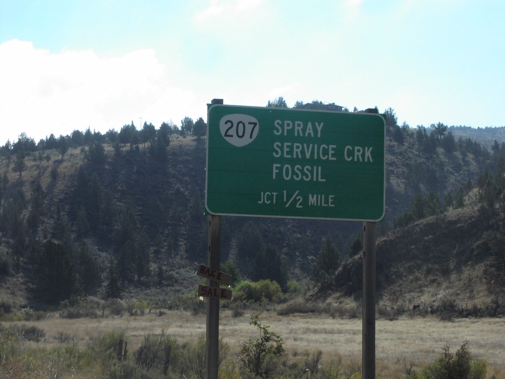
US-26 East approaching OR-207
US-26 approaching OR-207 north to Spray, Service Creek, and Fossil, 1/2 mile.
Taken 10-01-2006
 Mitchell
Wheeler County
Oregon
United States
Mitchell
Wheeler County
Oregon
United States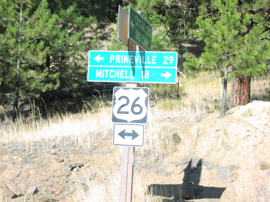
US-26 - Crystal Springs Camp Rd
US-26 west to Prineville; east to Mitchell at end of Crystal Springs Camp Road.
Taken 10-01-2006
Prineville
Crook County
Oregon
United States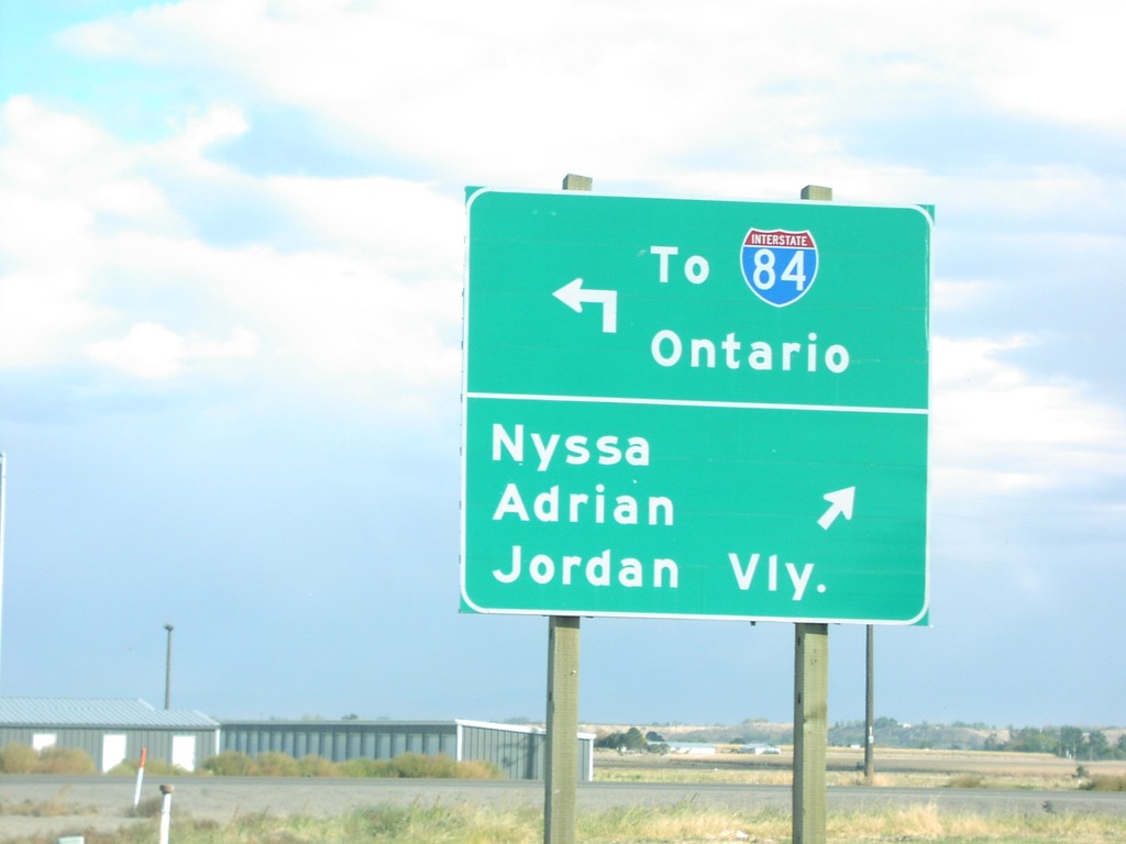
US-20/US-26 East at OR-201
US-20/US-26 east at OR-201 north To I-84/Ontario and south to Nyssa, Adrian, and Jordan Valley.
Taken 10-01-2006

 Ontario
Malheur County
Oregon
United States
Ontario
Malheur County
Oregon
United States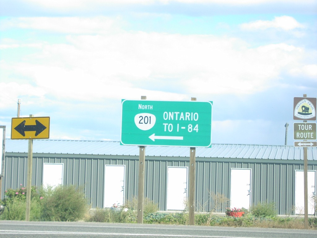
US-20/US-26 East at OR-201
US-20/US-26 east at OR-201 north To I-84 and Ontario.
Taken 10-01-2006
Ontario
Malheur County
Oregon
United States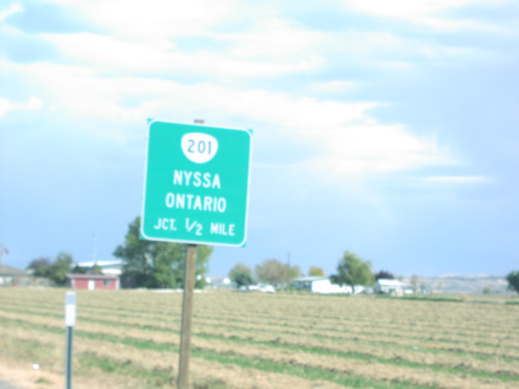
US-20/US-26 East Approaching OR-201
US-20/US-26 east approaching OR-201 to Nyssa and Ontario, 1/2 mile.
Taken 10-01-2006
Ontario
Malheur County
Oregon
United States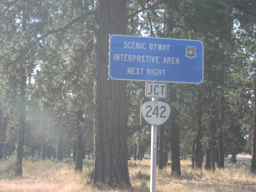
US-20/OR-126 East at OR-242
US-20/OR-126 east approaching OR-242 west, for scenic Mackenzie Pass.
Taken 10-01-2006

 Sisters
Deschutes County
Oregon
United States
Sisters
Deschutes County
Oregon
United States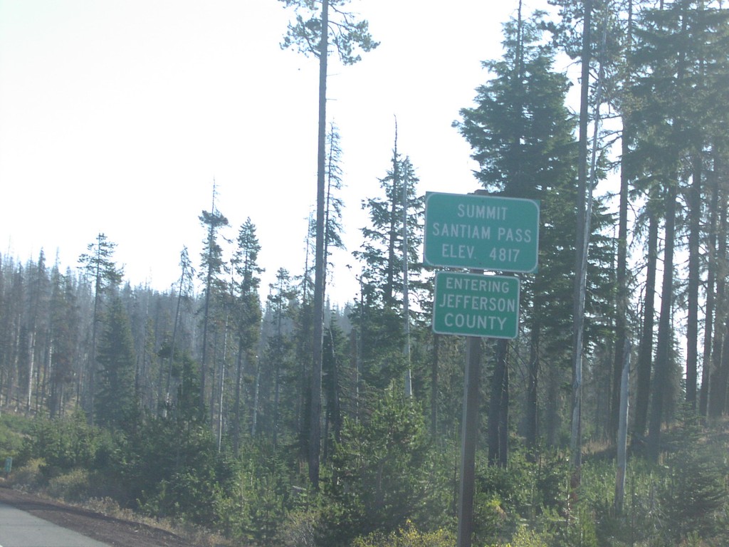
US-20 East - Santiam Pass/Jefferson County Line
US-20/OR-126 east at Santiam Pass, Jefferson-Linn County line.
Taken 10-01-2006
Sisters
Linn County
Oregon
United States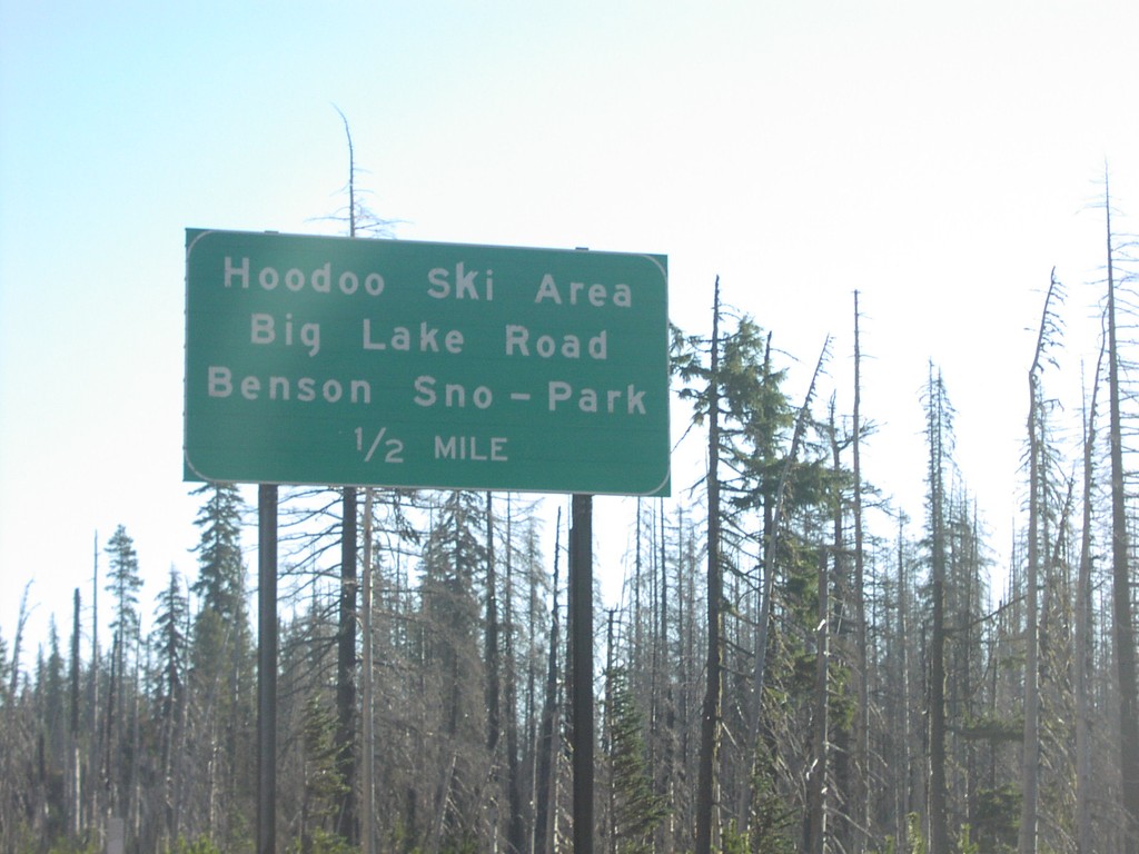
US-20 East - Hoodoo Ski Area
US-20/OR-126 east approaching Hoodoo Butte Ski Area/Big Lake Road/Benson Snow Park, 1/2 mile.
Taken 10-01-2006
Sisters
Linn County
Oregon
United States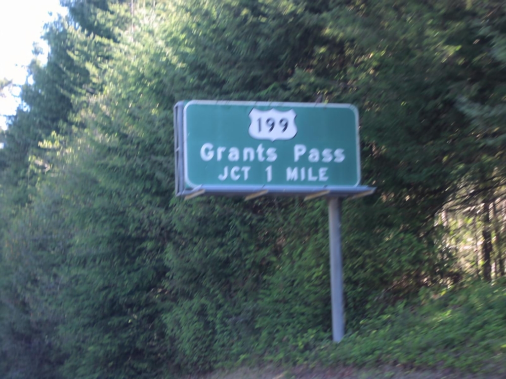
US-101 North Exit 794 - US-199 Jct.
US-101 north approaching US-199/Grants Pass, 1 mile.
Taken 10-01-2006

 Crescent City
Del Norte County
California
United States
Crescent City
Del Norte County
California
United States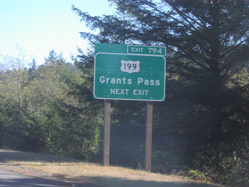
US-101 North Exit 794
US-101 north approaching Exit 794, US-199/Grants Pass, next exit
Taken 10-01-2006
Crescent City
Del Norte County
California
United States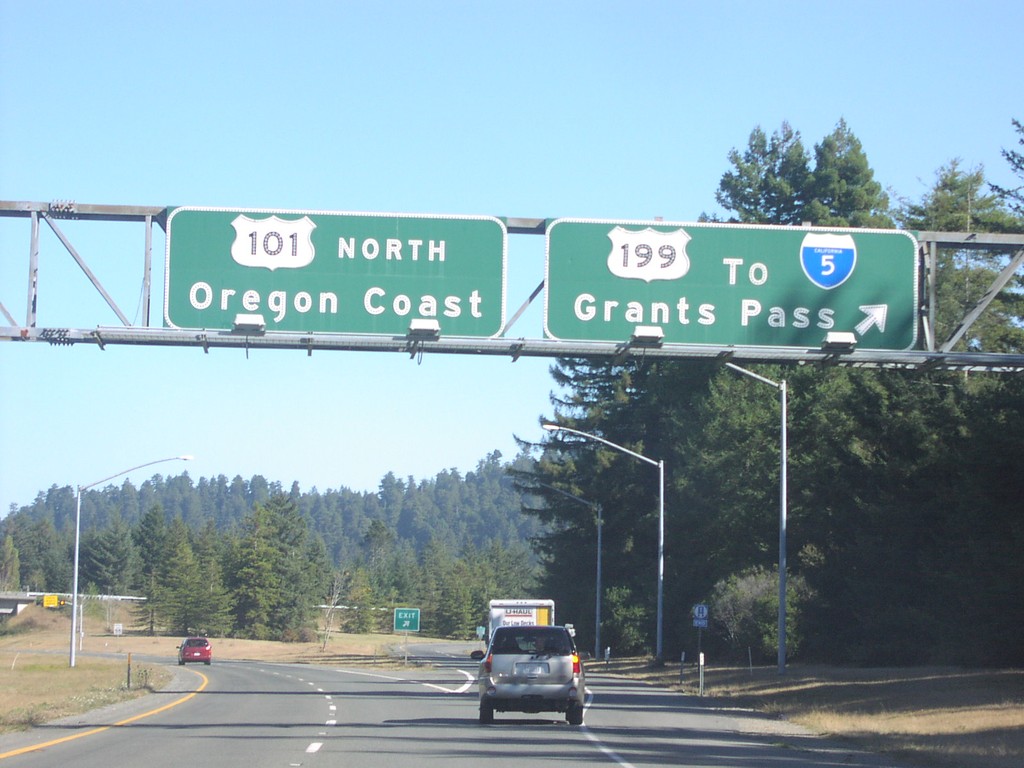
US-101 North Exit 794
US-101 north to Oregon Coast at US-199 to I-5 and Grants Pass.
Taken 10-01-2006
 Crescent City
Del Norte County
California
United States
Crescent City
Del Norte County
California
United States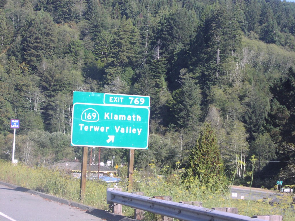
US-101 North Exit 769
US-101 north at Exit 769, CA-169/Klamath/Terwer Valley.
Taken 10-01-2006
 Klamath
Del Norte County
California
United States
Klamath
Del Norte County
California
United States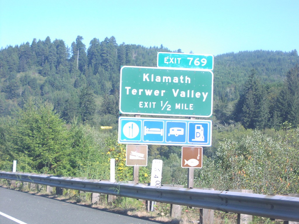
US-101 North Exit 769
US-101 north approaching Exit 769, Klamath/Terwer Valley, 1/2 mile.
Taken 10-01-2006
Klamath
Del Norte County
California
United States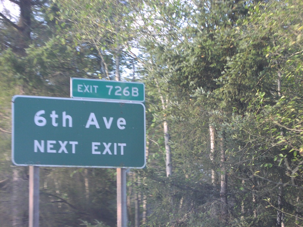
US-101 North Exit 726B
US-101 approaching Exit 726B, 6th Ave., next exit.
Taken 10-01-2006
Trinidad
Humboldt County
California
United States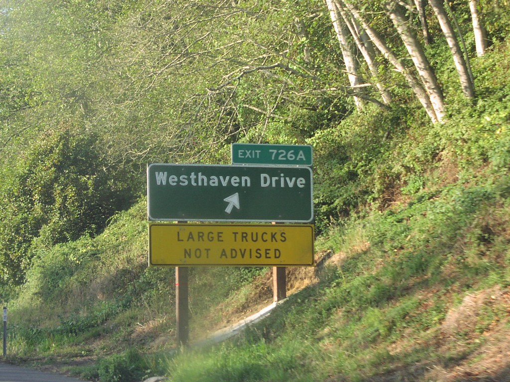
US-101 North Exit 726A
US-101 north at Exit 726A, Westhaven Drive.
Taken 10-01-2006
Trinidad
Humboldt County
California
United States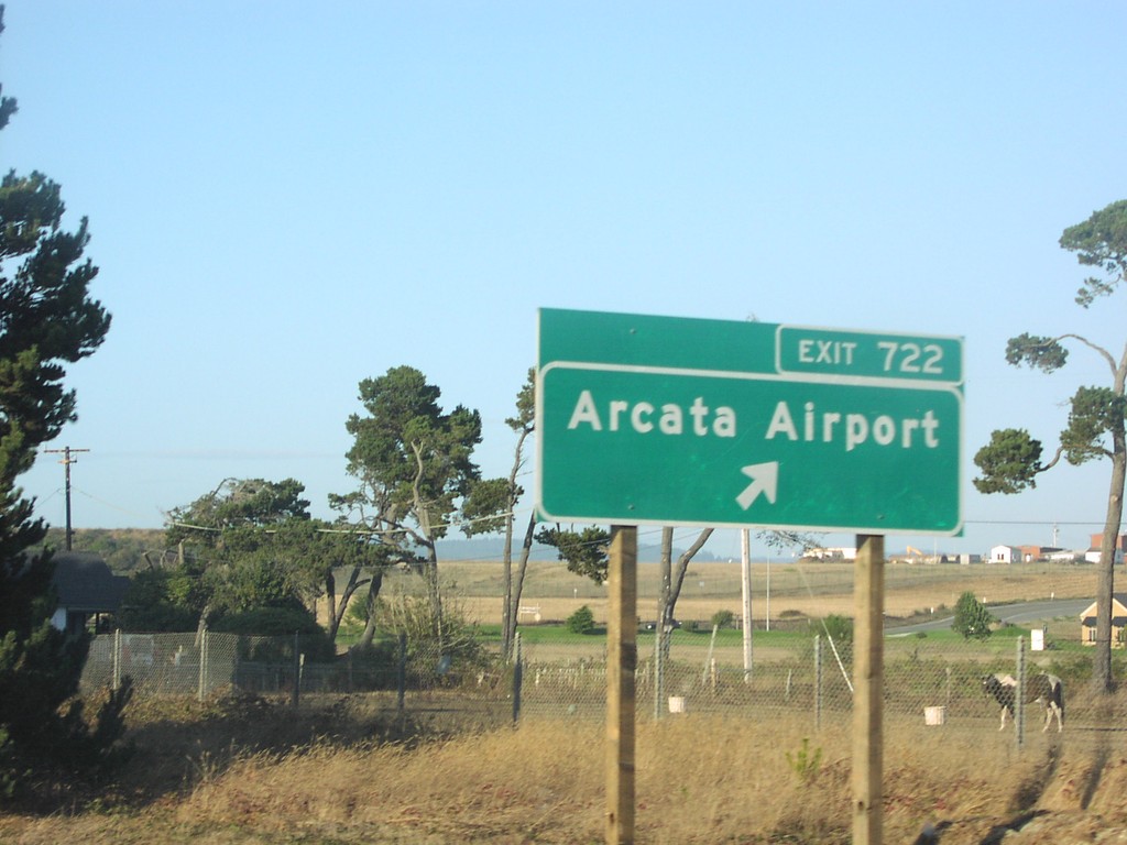
US-101 North Exit 722
US-101 north at Exit 722, Arcata Airport.
Taken 10-01-2006
McKinleyville
Humboldt County
California
United States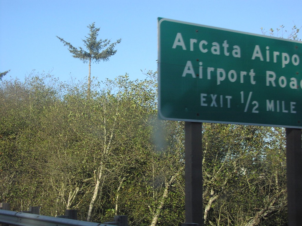
US-101 North Exit 722
US-101 north approaching Exit 722, Arcata Airport/Airport Road, 1/2 mile.
Taken 10-01-2006
McKinleyville
Humboldt County
California
United States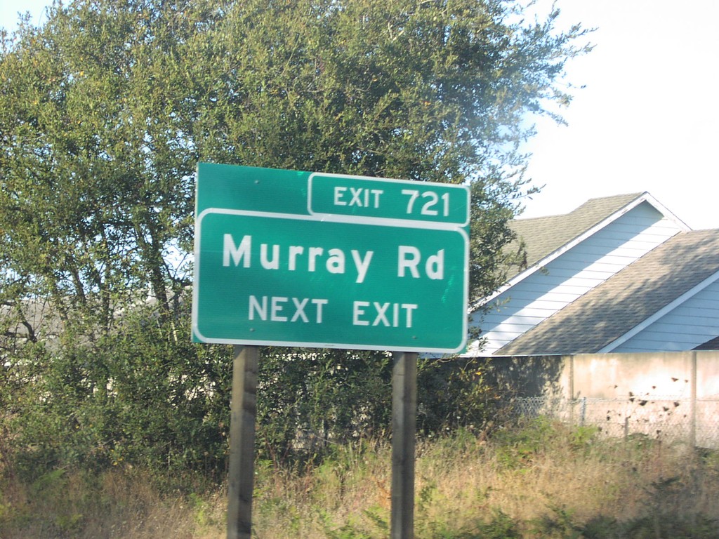
US-101 North Exit 721
US-101 north approaching Exit 721, Murray Road, next exit.
Taken 10-01-2006
McKinleyville
Humboldt County
California
United States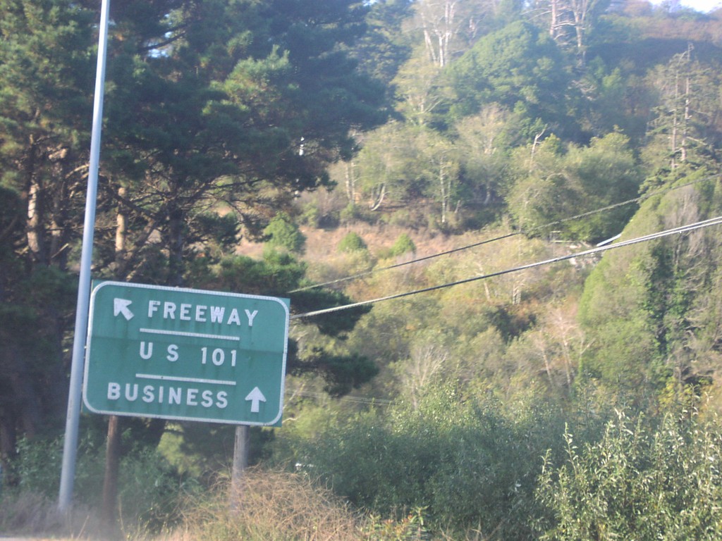
US-101 North Exit 718
US-101 north at Exit 718, Central Ave./McKinleyville. Use this exit for US-101 Business.
Taken 10-01-2006
McKinleyville
Humboldt County
California
United States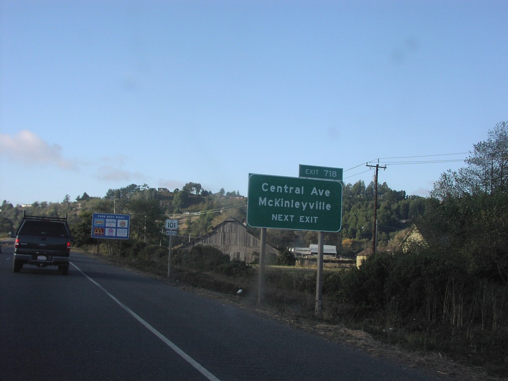
US-101 North Exit 718
US-101 north approaching Exit 718, Central Ave./McKinleyville, next exit.
Taken 10-01-2006
Arcata
Humboldt County
California
United States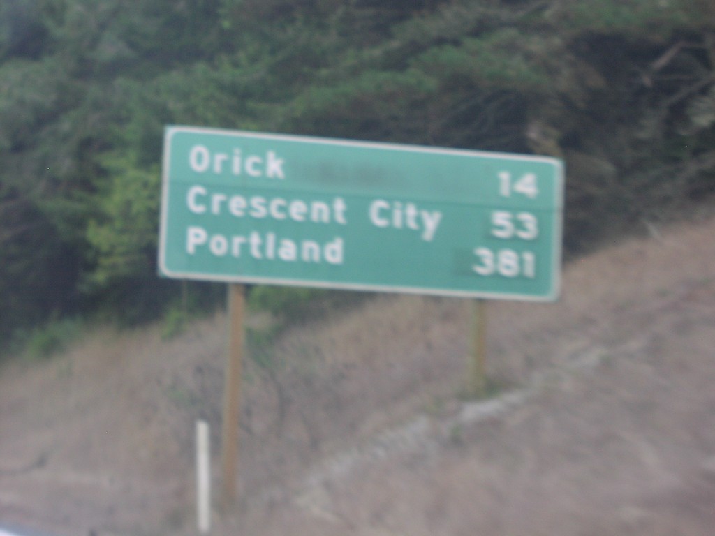
US-101 North Distance Marker
Distance marker on US-101 north to Orick, Crescent City, and Portland.
Taken 10-01-2006
Trinidad
Humboldt County
California
United States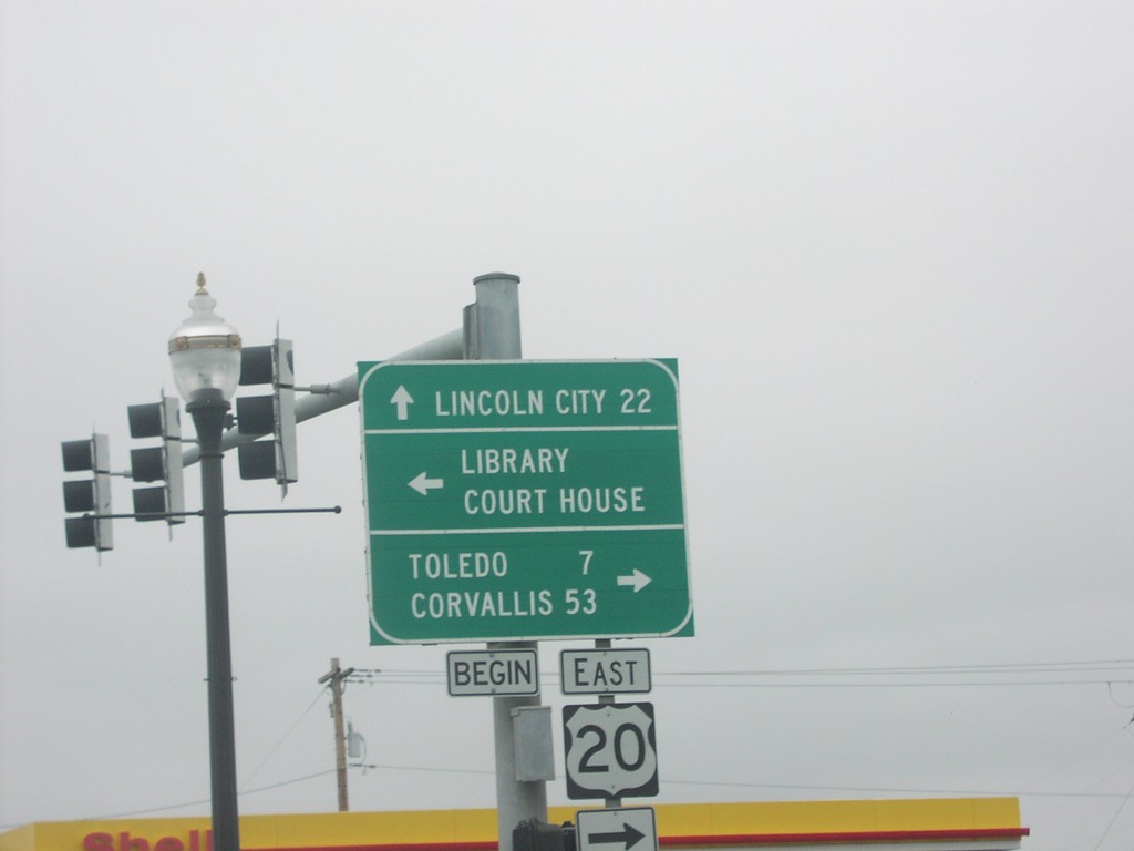
US-101 North at Western End of US-20
Begin US-20 east to Toledo and Corvallis on US-101 north.
Taken 10-01-2006
Newport
Lincoln County
Oregon
United States