Signs Tagged With Big Green Sign
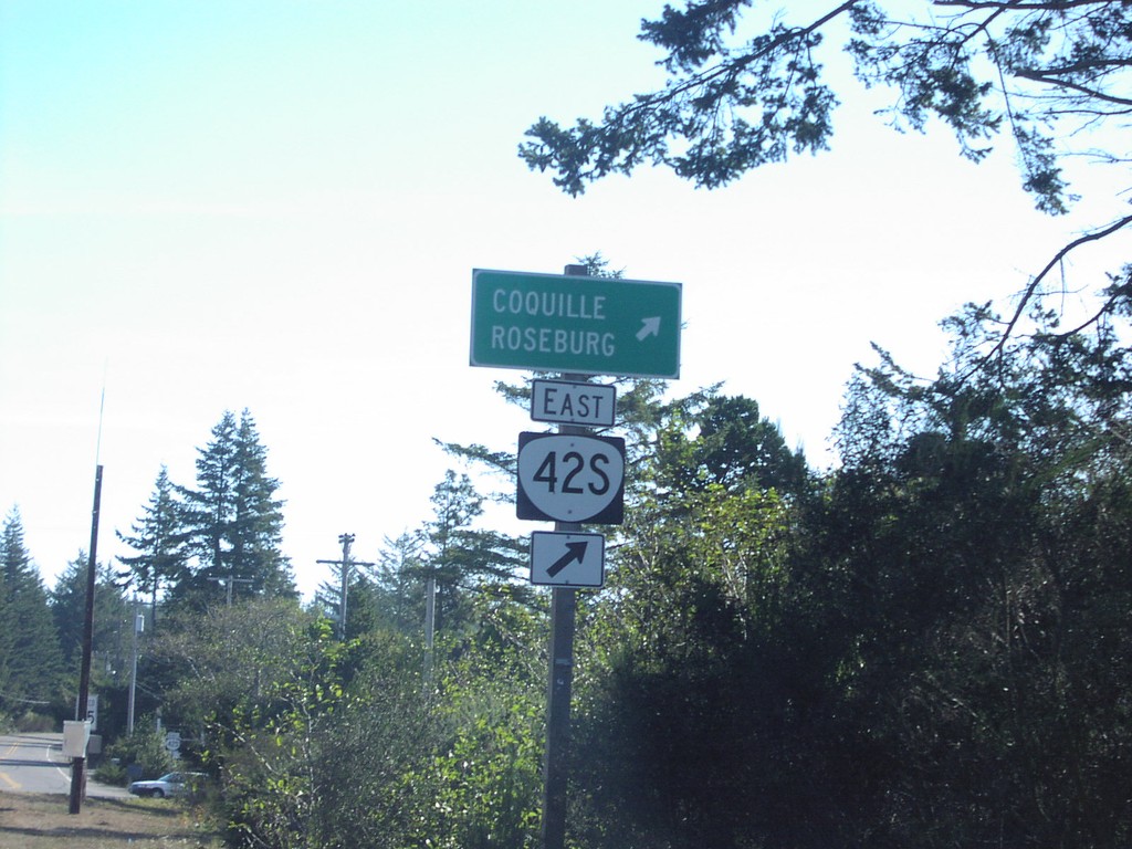
US-101 North at OR-42S East
US-101 north approaching OR-42S to Coquille and Roseburg.
Taken 10-01-2006

 Bandon
Coos County
Oregon
United States
Bandon
Coos County
Oregon
United States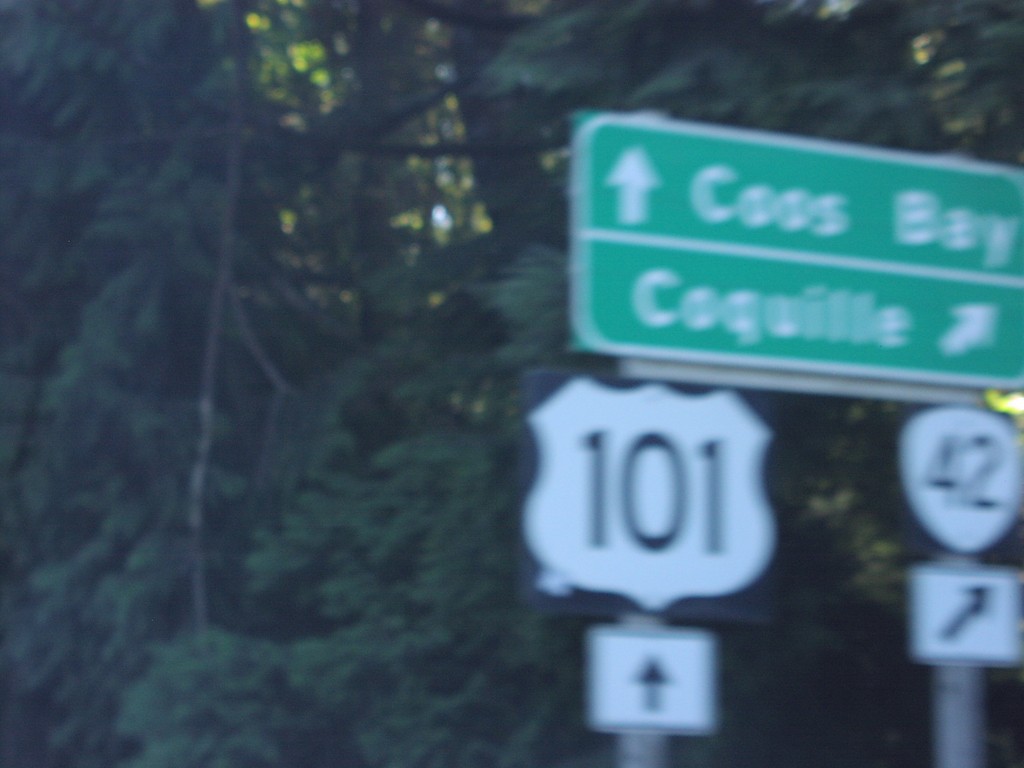
US-101 North at OR-42 East
US-101 north to Coos Bay at OR-42 east to Coquille.
Taken 10-01-2006
 Coos Bay
Coos County
Oregon
United States
Coos Bay
Coos County
Oregon
United States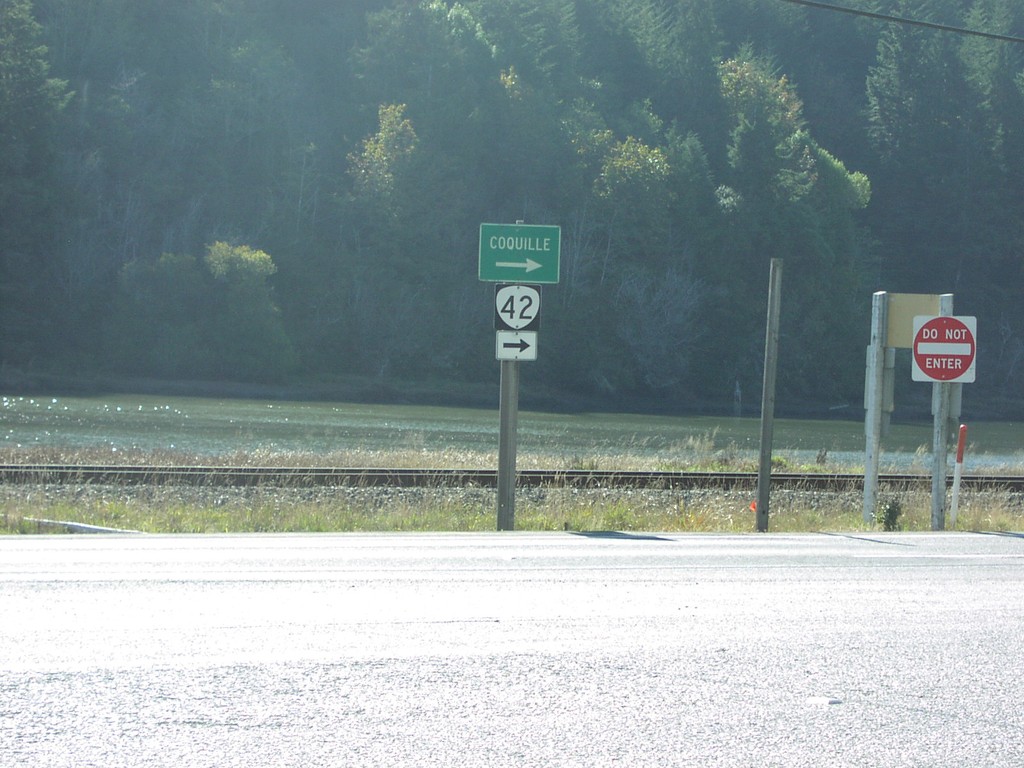
US-101 North at OR-42 East
US-101/OR-42 connector road at OR-42 south to Coquille.
Taken 10-01-2006
Coos Bay
Coos County
Oregon
United States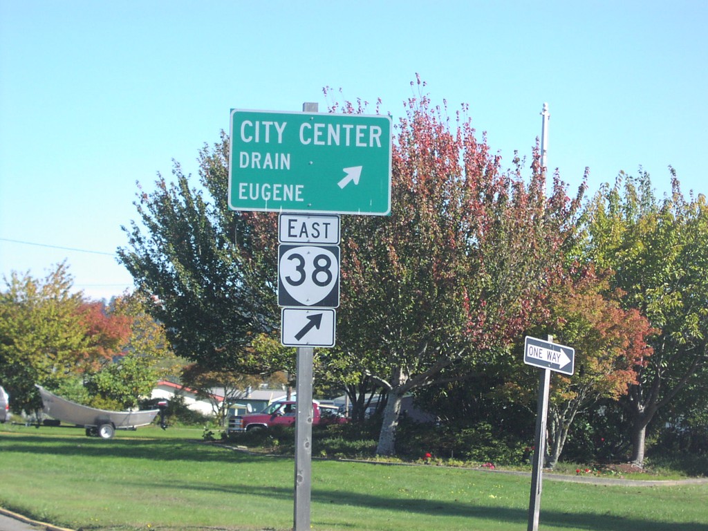
US-101 North at OR-38 East
US-101 north at OR-38 to City Center, Drain, and Eugene.
Taken 10-01-2006
 Reedsport
Douglas County
Oregon
United States
Reedsport
Douglas County
Oregon
United States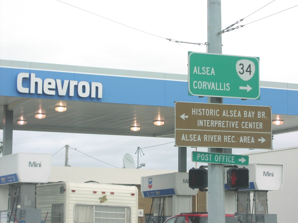
US-101 North at OR-34 East
US-101 north at OR-34 east to Corvallis and Alsea.
Taken 10-01-2006
 Waldport
Lincoln County
Oregon
United States
Waldport
Lincoln County
Oregon
United States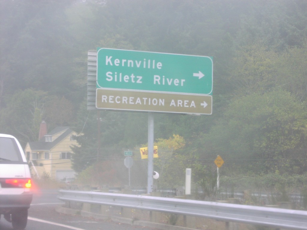
US-101 North at OR-229
US-101 north at OR-229 south to Kernville and Siletz River.
Taken 10-01-2006
 Lincoln City
Lincoln County
Oregon
United States
Lincoln City
Lincoln County
Oregon
United States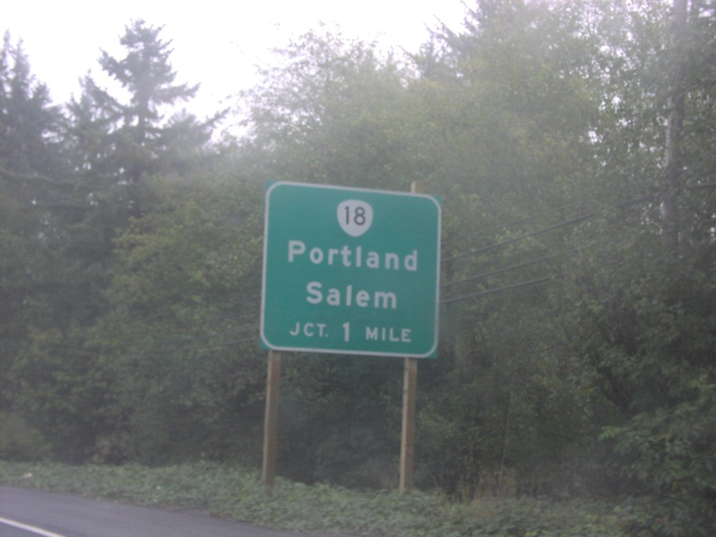
US-101 North at OR-18 East
US-101 north approaching OR-18 to Portland and Salem, 1 mile.
Taken 10-01-2006
 Lincoln City
Lincoln County
Oregon
United States
Lincoln City
Lincoln County
Oregon
United States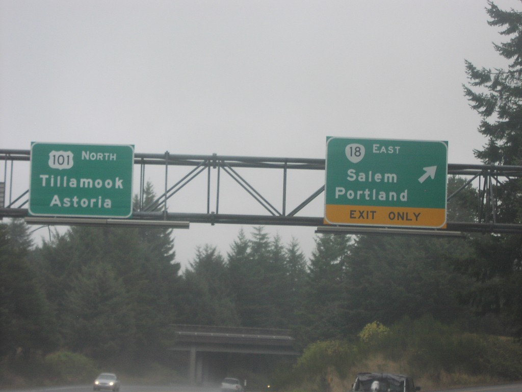
US-101 North at OR-18 East
US-101 north to Tillamook and Astoria at OR-18 east to Portland and Salem.
Taken 10-01-2006
Otis
Lincoln County
Oregon
United States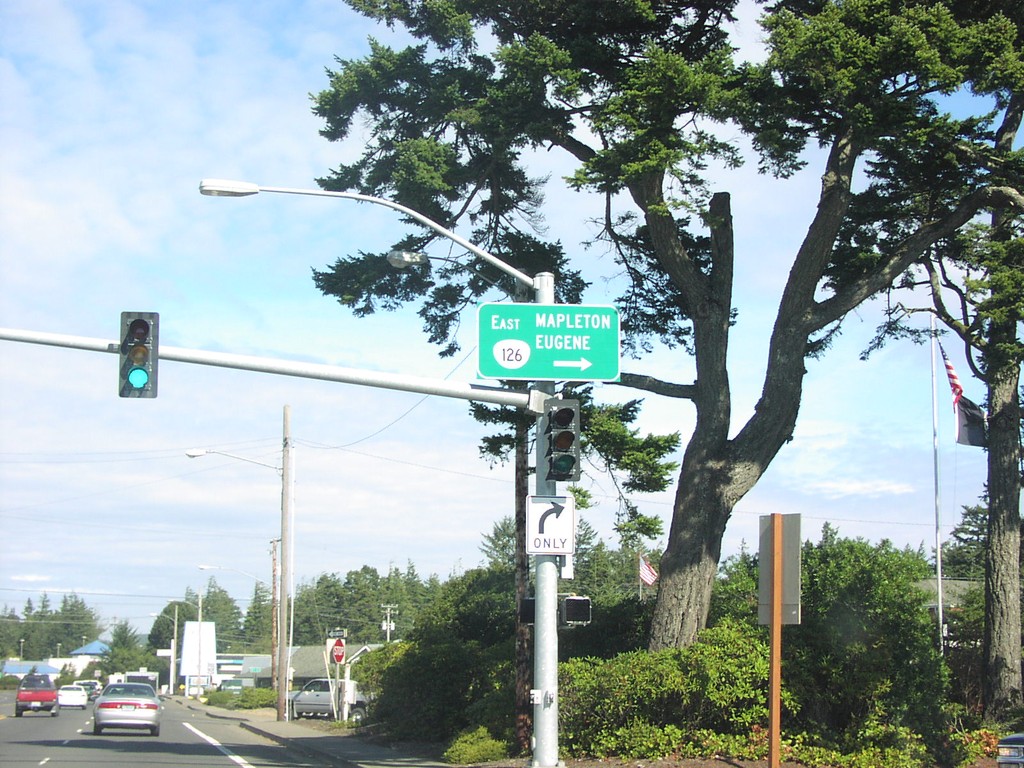
US-101 North at OR-126 East
US-101 north at eastern terminous of OR-126 to Mapleton and Eugene.
Taken 10-01-2006
 Florence
Lane County
Oregon
United States
Florence
Lane County
Oregon
United States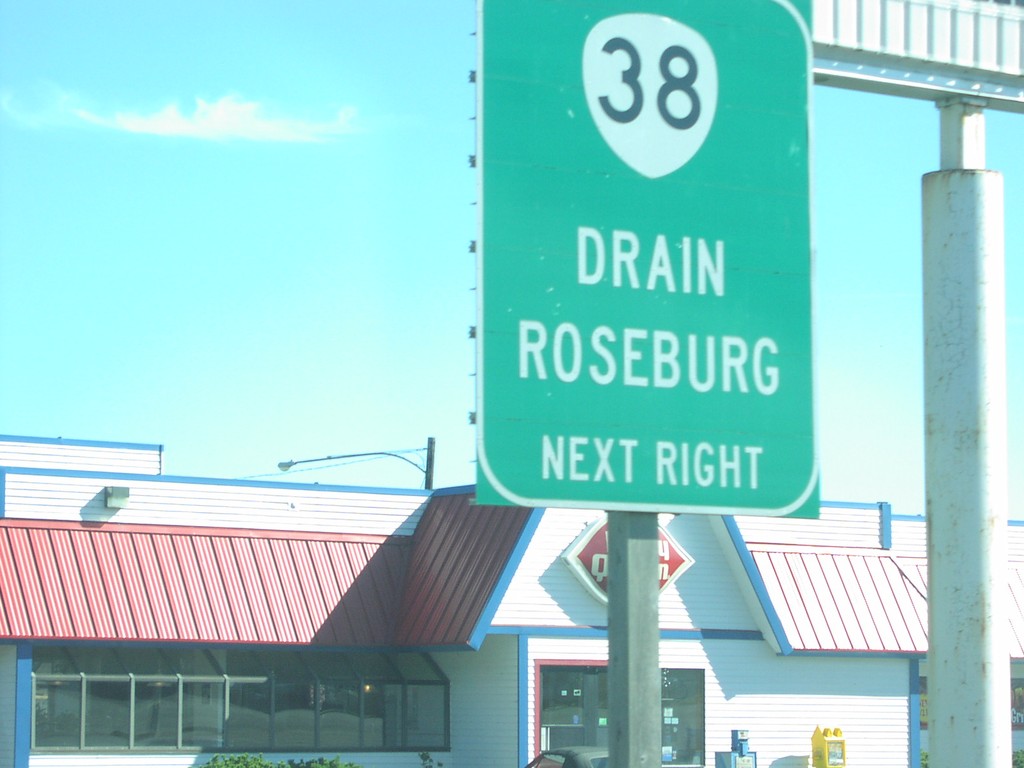
US-101 North approaching OR-38
US-101 north approaching OR-38 to Drain and Eugene, next right.
Taken 10-01-2006
Reedsport
Douglas County
Oregon
United States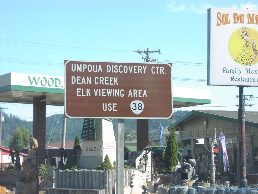
US-101 North approaching OR-38
US-101 north approaching OR-38 to Umpqua Discovery Center and Dean Creek Elk Viewing Area.
Taken 10-01-2006
Reedsport
Douglas County
Oregon
United States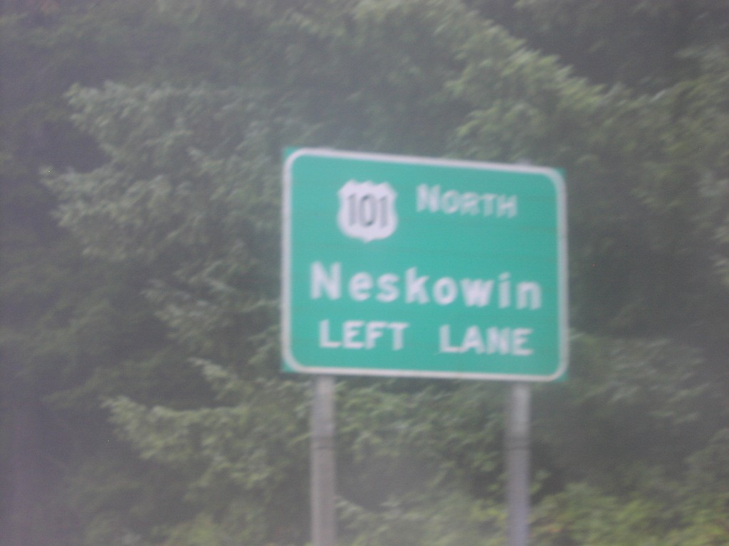
US-101 North approaching OR-18 East
US-101 north to Neskowin approaching OR-18 junction.
Taken 10-01-2006
Otis
Lincoln County
Oregon
United States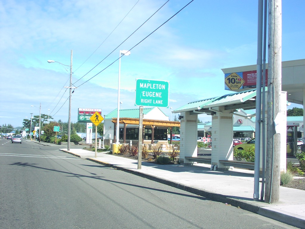
US-101 North approaching OR-126 East
US-101 north approaching OR-126 to Mapleton and Eugene.
Taken 10-01-2006
Florence
Lane County
Oregon
United States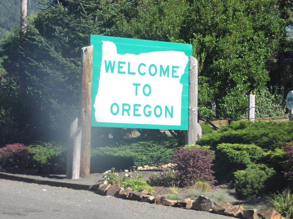
US-101 North - Welcome To Oregon
Welcome to Oregon on US-101 north at the California line.
Taken 10-01-2006
Brookings
Curry County
Oregon
United States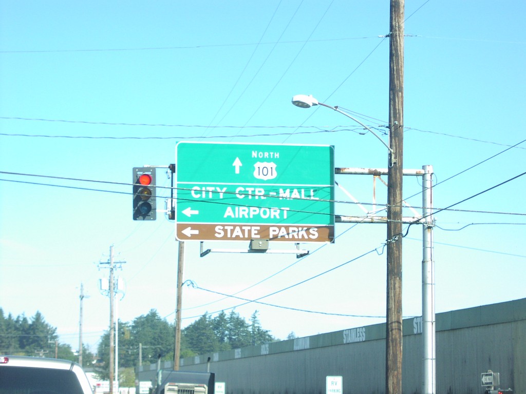
US-101 North - North Bend City Center
US-101 north overhead in North Bend, to State Parks and City Center.
Taken 10-01-2006
North Bend
Coos County
Oregon
United States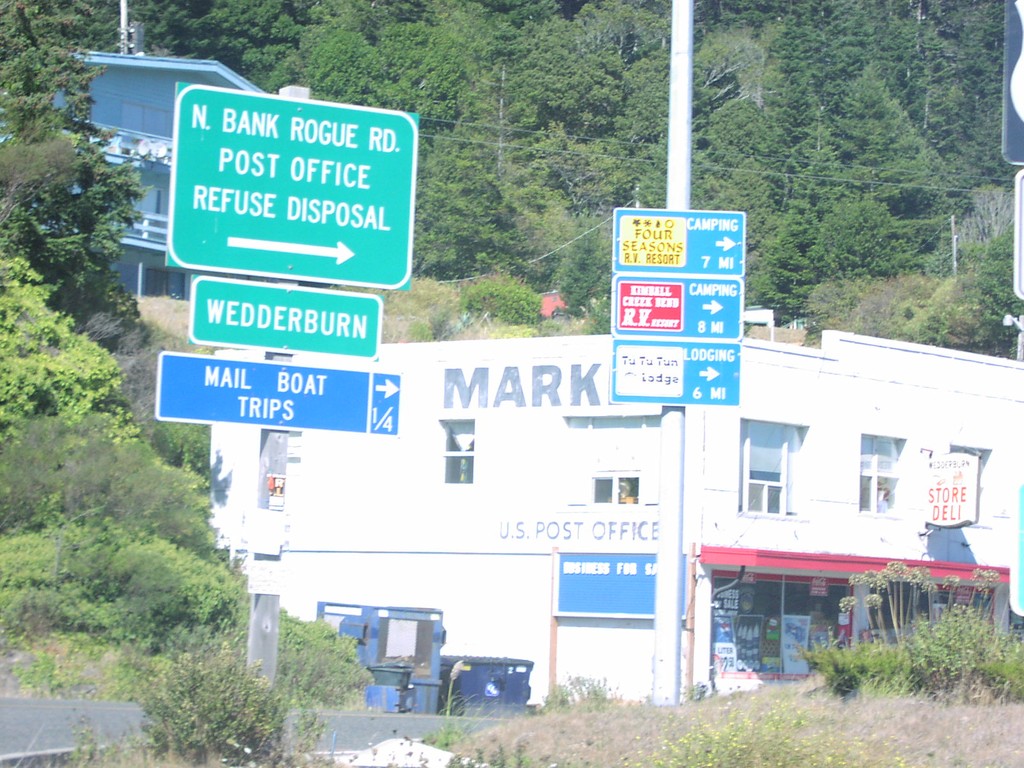
US-101 North - North Bank Rogue Road
US-101 north at North Bank Road, on the northern side of the Rogue River.
Taken 10-01-2006
Gold Beach
Curry County
Oregon
United States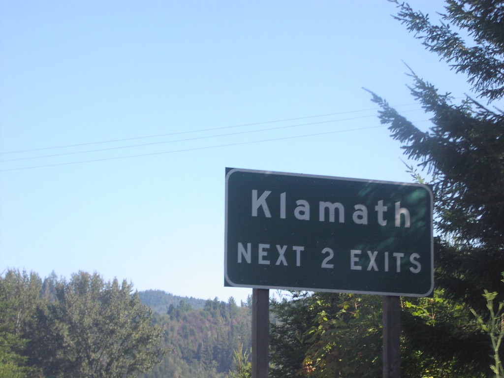
US-101 North - Klamath Exits
Klamath next 2 exits on US-101 north.
Taken 10-01-2006
Klamath
Del Norte County
California
United States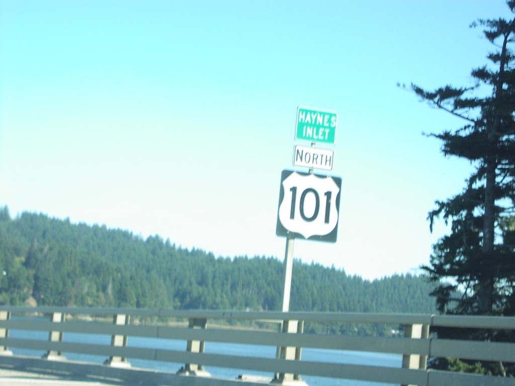
US-101 North - Haynes Inlet
US-101 north crossing Haynes Inlet.
Taken 10-01-2006
North Bend
Coos County
Oregon
United States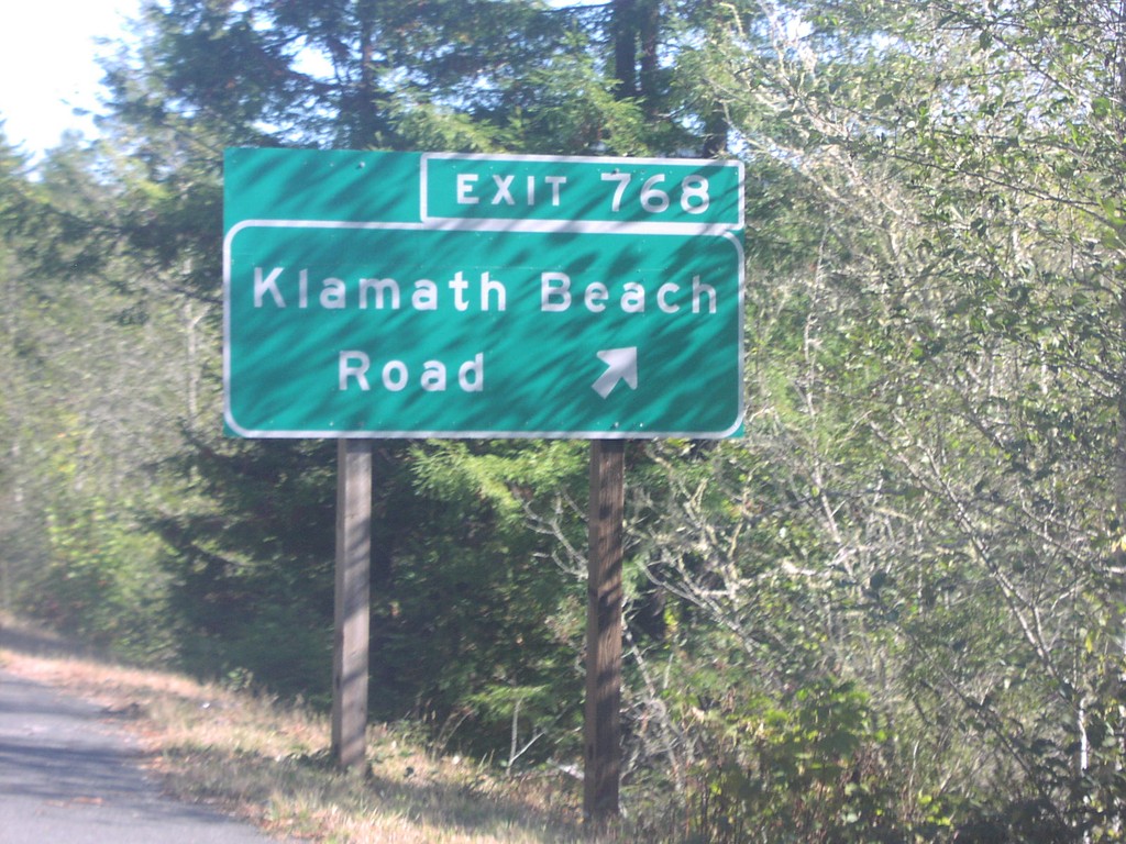
US-101 North - Exit 768
US-101 north at Exit 768, Klamath Beach Road.
Taken 10-01-2006
Klamath
Del Norte County
California
United States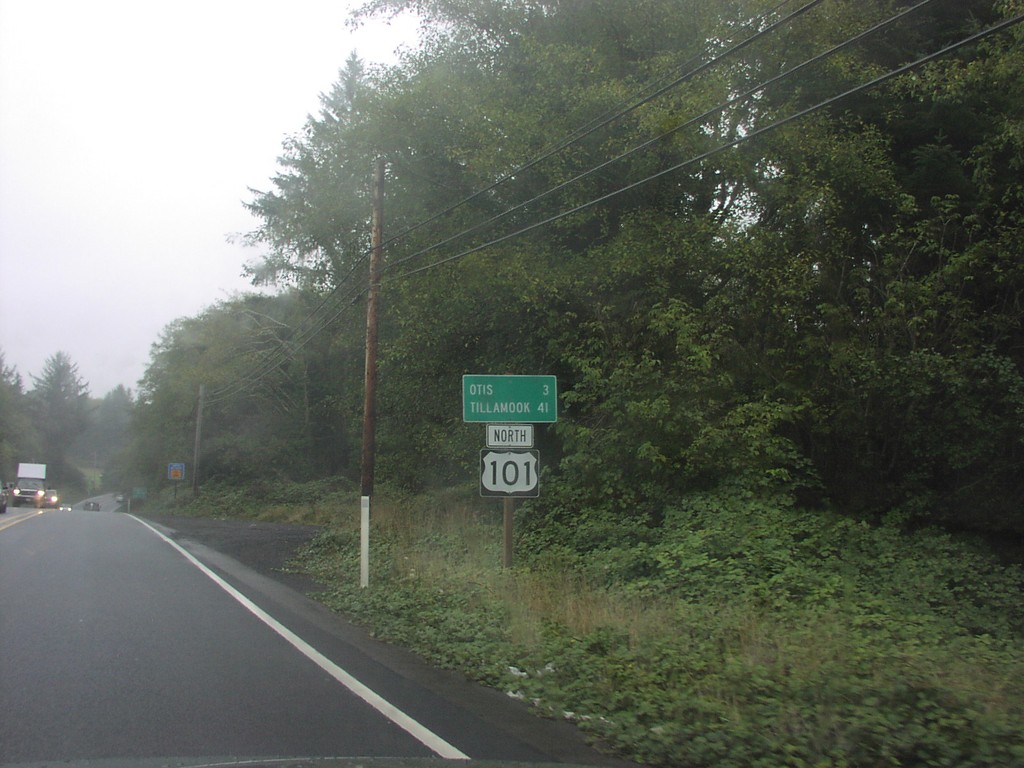
US-101 North - Distance Marker
Distance marker on US-101 north to Otis and Tillamook.
Taken 10-01-2006
Neotsu
Lincoln County
Oregon
United States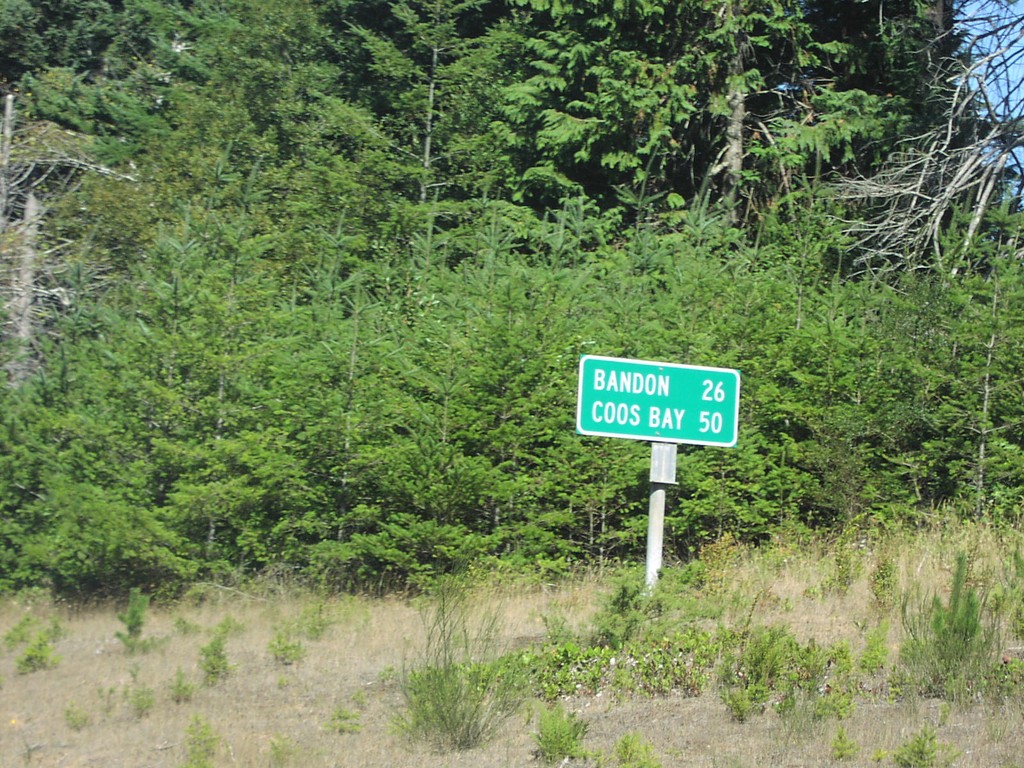
US-101 North - Distance Marker
Distance marker on US-101 north to Bandon and Coos Bay.
Taken 10-01-2006
Port Orford
Curry County
Oregon
United States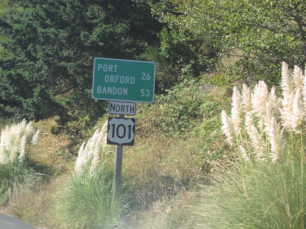
US-101 North - Distance Marker
Distance marker on US-101 north to Port Orford and Bandon.
Taken 10-01-2006
Gold Beach
Curry County
Oregon
United States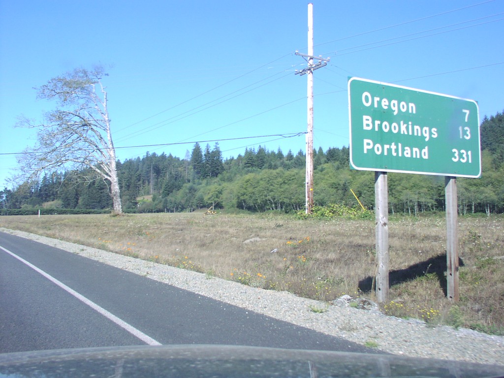
US-101 North - Distance Marker
Distance marker on US-101 north to Oregon, Brookings, and Portland.
Taken 10-01-2006
Smith River
Del Norte County
California
United States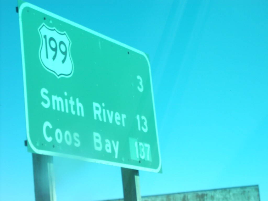
US-101 North - Distance Marker
Distance marker on US-101 north to US-199, Smith River, and Coos Bay.
Taken 10-01-2006
Crescent City
Del Norte County
California
United States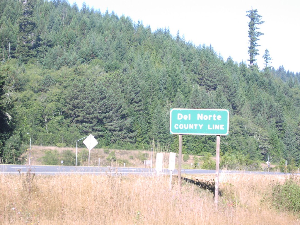
US-101 North - Del Norte County
Del Norte County Line on US-101 north.
Taken 10-01-2006
Klamath
Del Norte County
California
United States