Signs Tagged With Big Green Sign
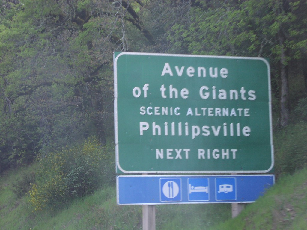
US-101 North at Phillipsville Exit
US-101 north at Avenue of The Giants (CA-254)/Phillipsville
Taken 04-01-2006

 Myers Flat
Humboldt County
California
United States
Myers Flat
Humboldt County
California
United States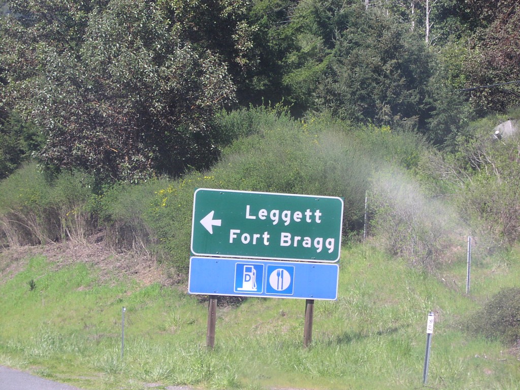
US-101 North at Northern End of CA-1
US-101 north at CA-1 to Fort Bragg and Leggett.
Taken 04-01-2006
 Leggett
Mendocino County
California
United States
Leggett
Mendocino County
California
United States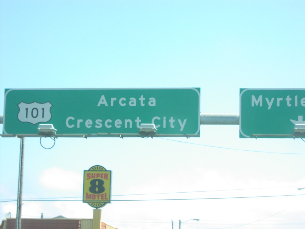
US-101 North at Myrtle St. in Eureka
US-101 north to Arcata and Crescent City overhead, at Myrtle St.
Taken 04-01-2006
Eureka
Humboldt County
California
United States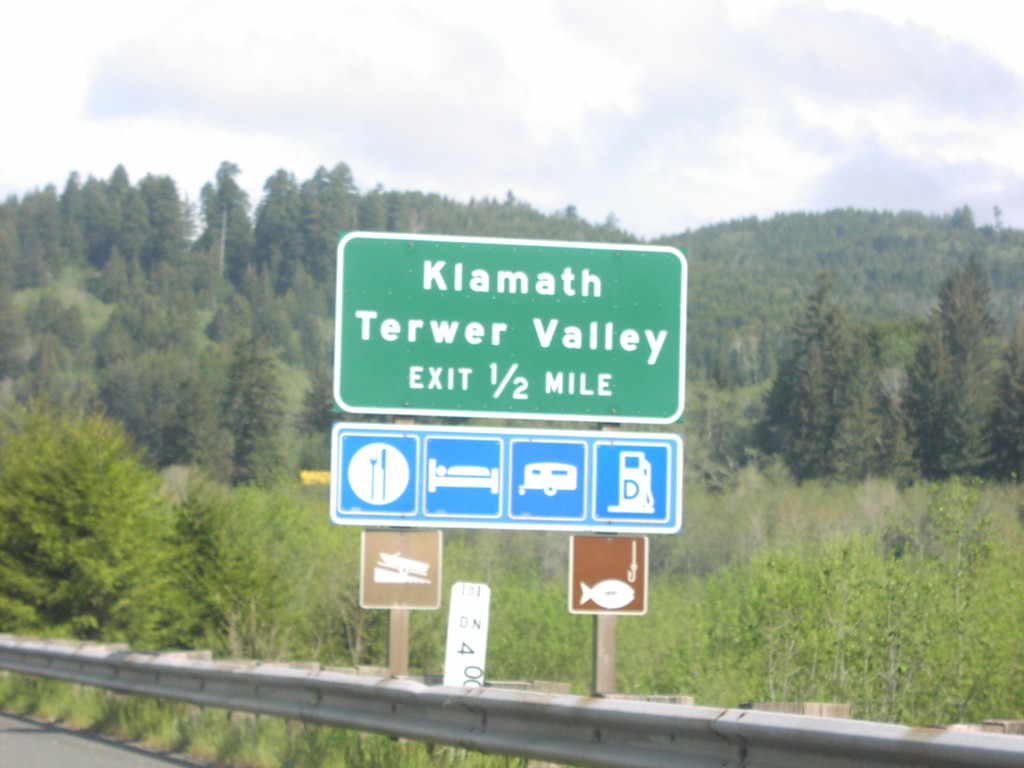
US-101 North at Klamath Exit
US-101 north approaching Klamath/Terwer Valley (CA-169) exit.
Taken 04-01-2006
 Klamath
Del Norte County
California
United States
Klamath
Del Norte County
California
United States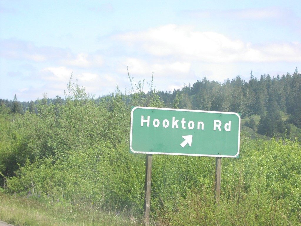
US-101 North at Hookton Road Exit
US-101 north at Hookton Road exit.
Taken 04-01-2006
Loleta
Humboldt County
California
United States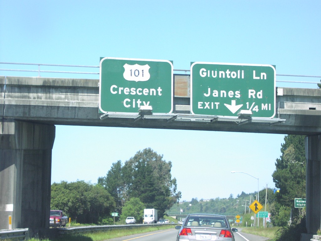
US-101 North at Guintoli Ln. Exit
US-101 north approaching Guintoli Lane/James Road exit, 1/4 mile, and US-101/Crescent City overhead.
Taken 04-01-2006
Arcata
Humboldt County
California
United States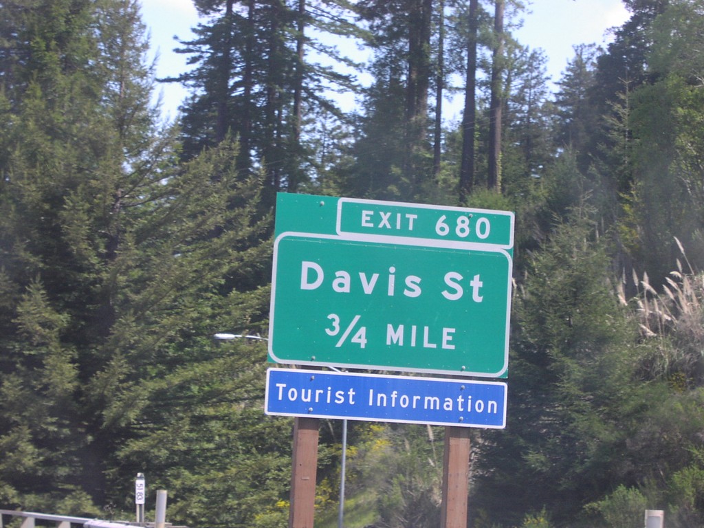
US-101 North at Exit 680
US-101 north approaching Exit 680, Davis St, 3/4 mile.
Taken 04-01-2006
Rio Dell
Humboldt County
California
United States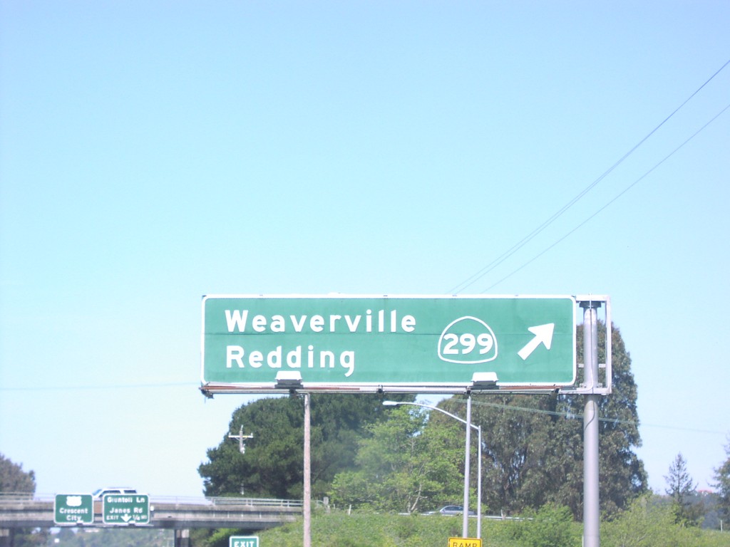
US-101 North at CA-299/Redding Exit
US-101 north at CA-299 to Weaverville and Redding.
Taken 04-01-2006
 Arcata
Humboldt County
California
United States
Arcata
Humboldt County
California
United States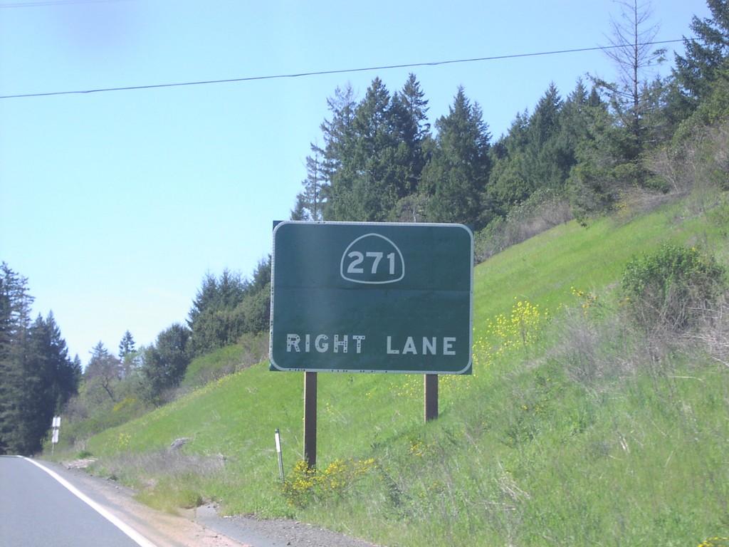
US-101 North at CA-271
US-101 north at CA-271
Taken 04-01-2006
 Piercy
Mendocino County
California
United States
Piercy
Mendocino County
California
United States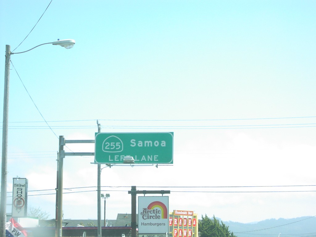
US-101 North at CA-255/Samoa
US-101 north at CA-255 to Samoa, left turn.
Taken 04-01-2006
 Eureka
Humboldt County
California
United States
Eureka
Humboldt County
California
United States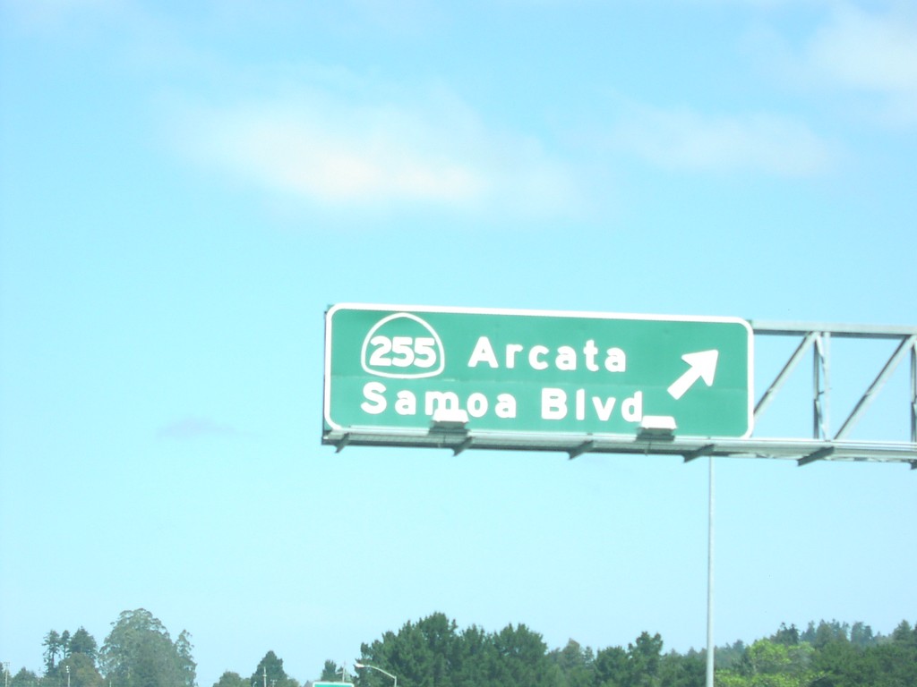
US-101 North at CA-255/Arcata Exit
US-101 north at CA-255/Arcata/Samoa Blvd. exit.
Taken 04-01-2006
Arcata
Humboldt County
California
United States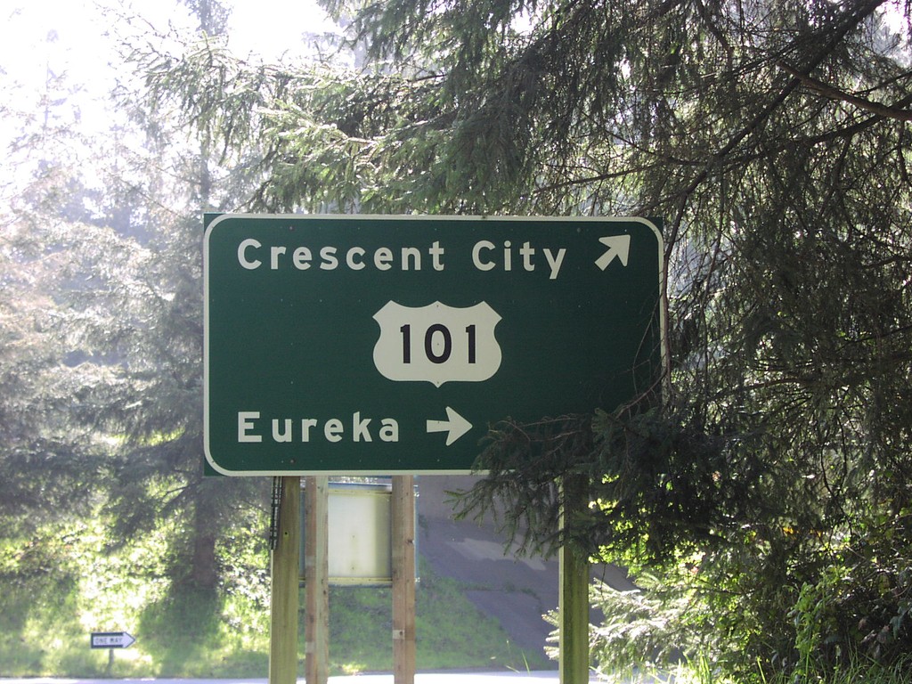
Patrick Point Road at US-101
US-101 to Eureka and Crescent City on Patricks Point Road.
Taken 04-01-2006
Trinidad
Humboldt County
California
United States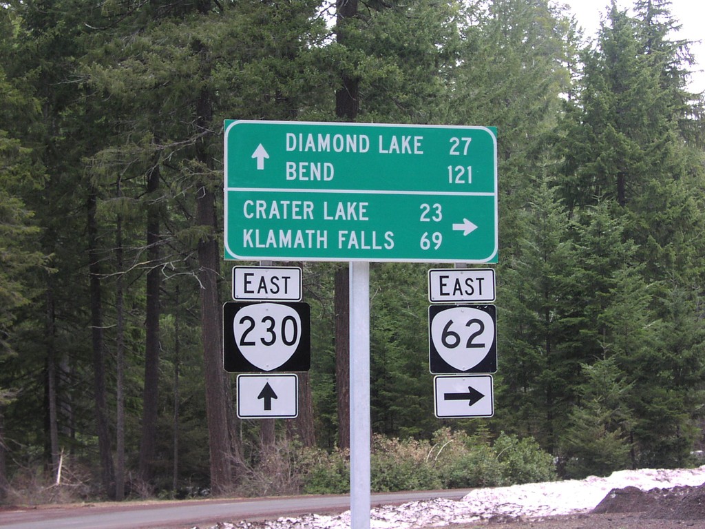
OR-62 North at OR-230
OR-62 north at OR-230 to Diamond Lake and Bend.
Taken 04-01-2006

 Prospect
Jackson County
Oregon
United States
Prospect
Jackson County
Oregon
United States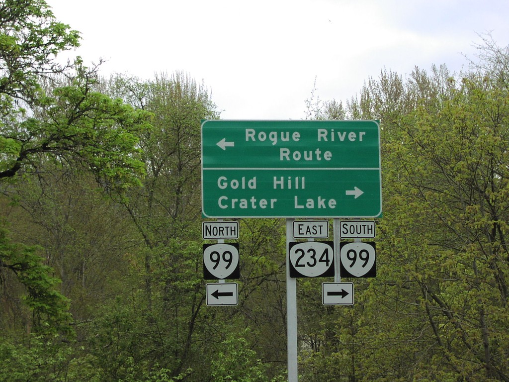
OR-234 North at OR-99
OR-234 north at OR-99/OR-234 to Rogue River Route, Gold Hill, and Crater Lake.
Taken 04-01-2006

 Gold Hill
Jackson County
Oregon
United States
Gold Hill
Jackson County
Oregon
United States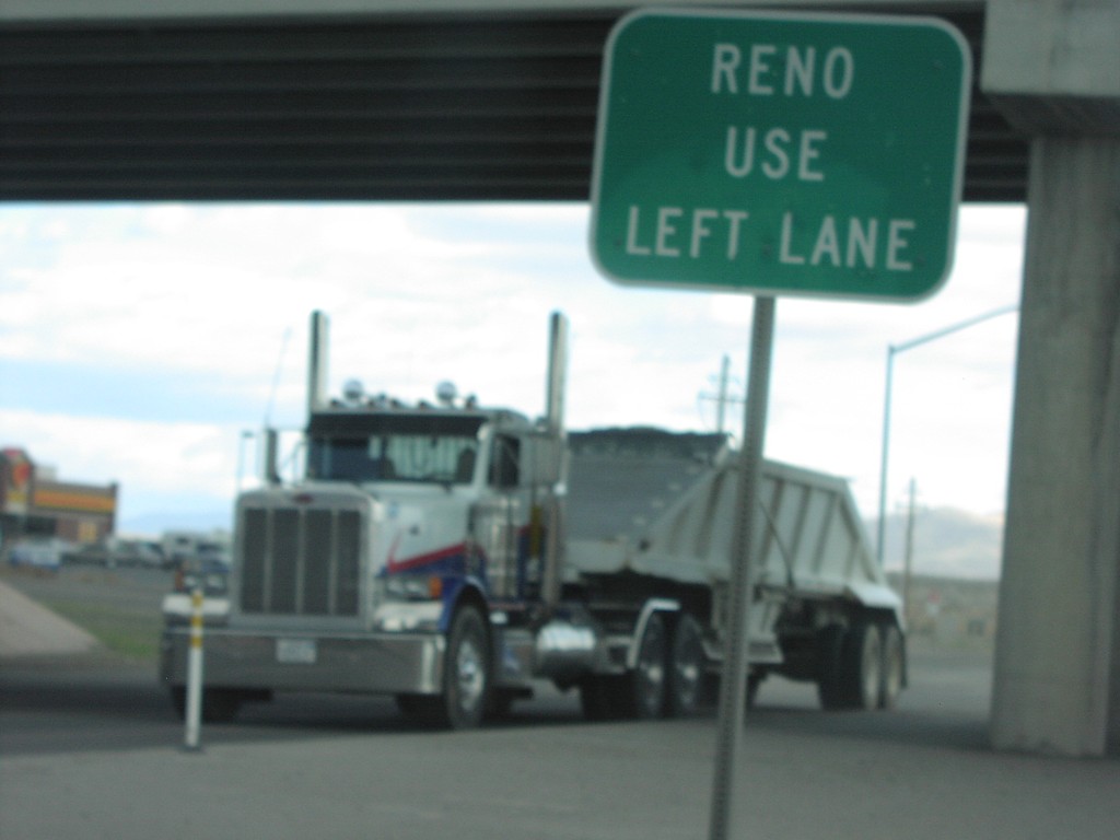
NV-427 North at I-80 West to Reno
NV-427 north at I-80 west to Reno.
Taken 04-01-2006


 Fernley
Lyon County
Nevada
United States
Fernley
Lyon County
Nevada
United States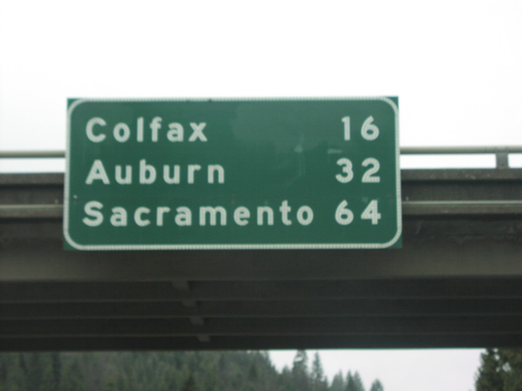
I-80 West Overhead Distance Marker
Distance marker on I-80 west at Drum Forebay IC. Colfax, Auburn, and Sacramento.
Taken 04-01-2006
Alta
Placer County
California
United States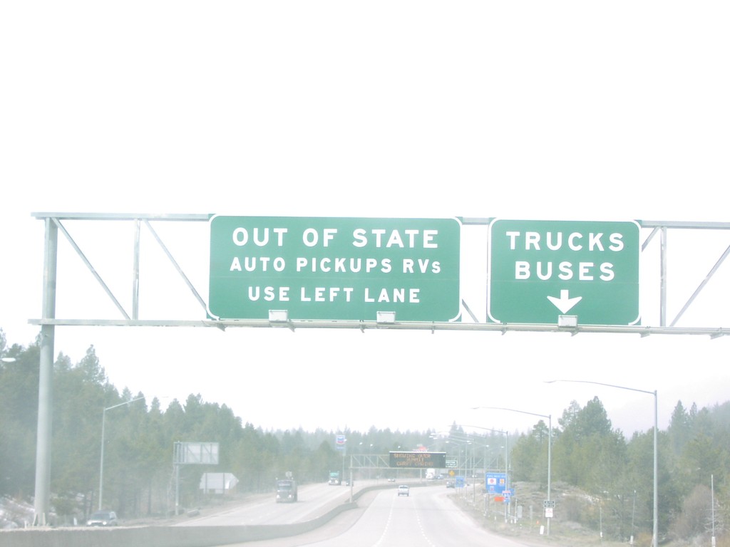
I-80 West Old Agricultural Inspection Station
I-80 west approaching California State Agricultural Inspection
Taken 04-01-2006
Truckee
Nevada County
California
United States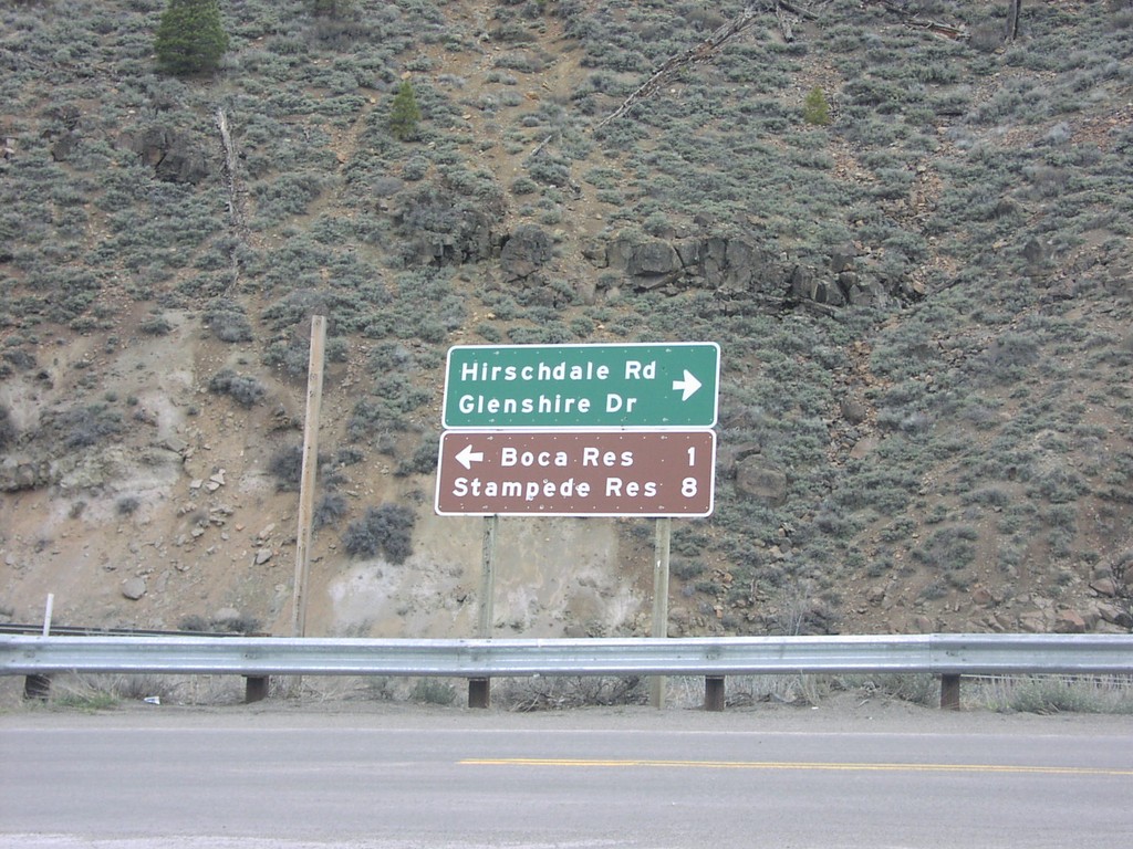
I-80 West Offramp at Hirshdale Road
I-80 offramp at Hirshdale IC at Hirshdale Road and Glenshire Road.
Taken 04-01-2006
Truckee
Nevada County
California
United States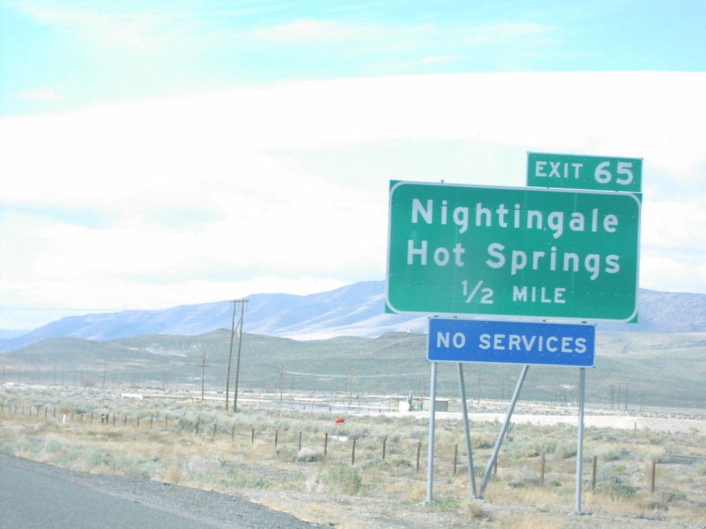
I-80 West Exit 65
I-80 west approaching Exit 65, Nightingale/Hot Springs, 1/2 mile.
Taken 04-01-2006
 Fernley
Lyon County
Nevada
United States
Fernley
Lyon County
Nevada
United States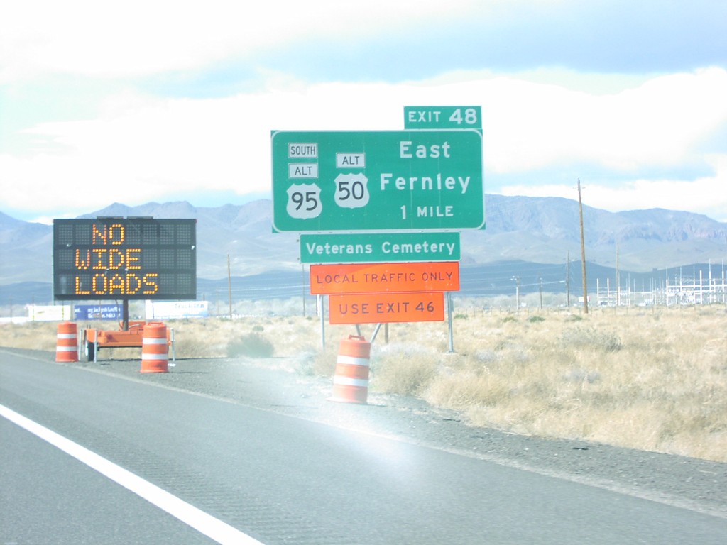
I-80 West Exit 48
I-80 west approaching Exit 48, Alt US-95A/Alt US-50/East Fernley, 1 mile.
Taken 04-01-2006
 Fernley
Lyon County
Nevada
United States
Fernley
Lyon County
Nevada
United States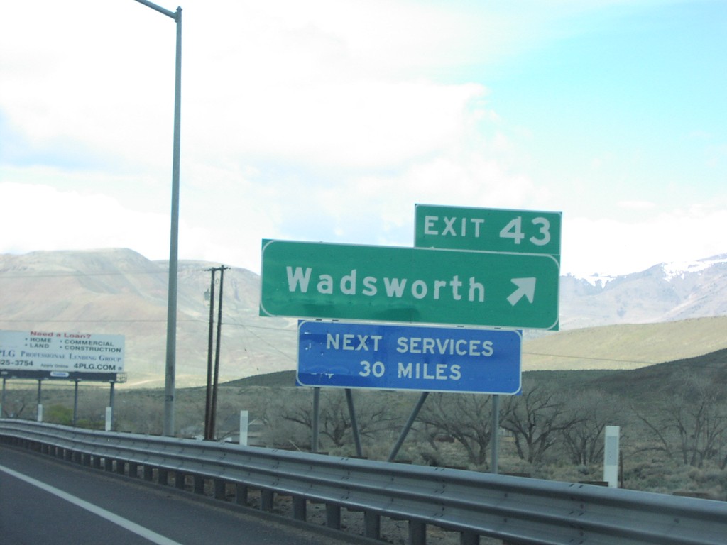
I-80 West Exit 43
I-80 west at Exit 43, Wadsworth
Taken 04-01-2006
Fernley
Washoe County
Nevada
United States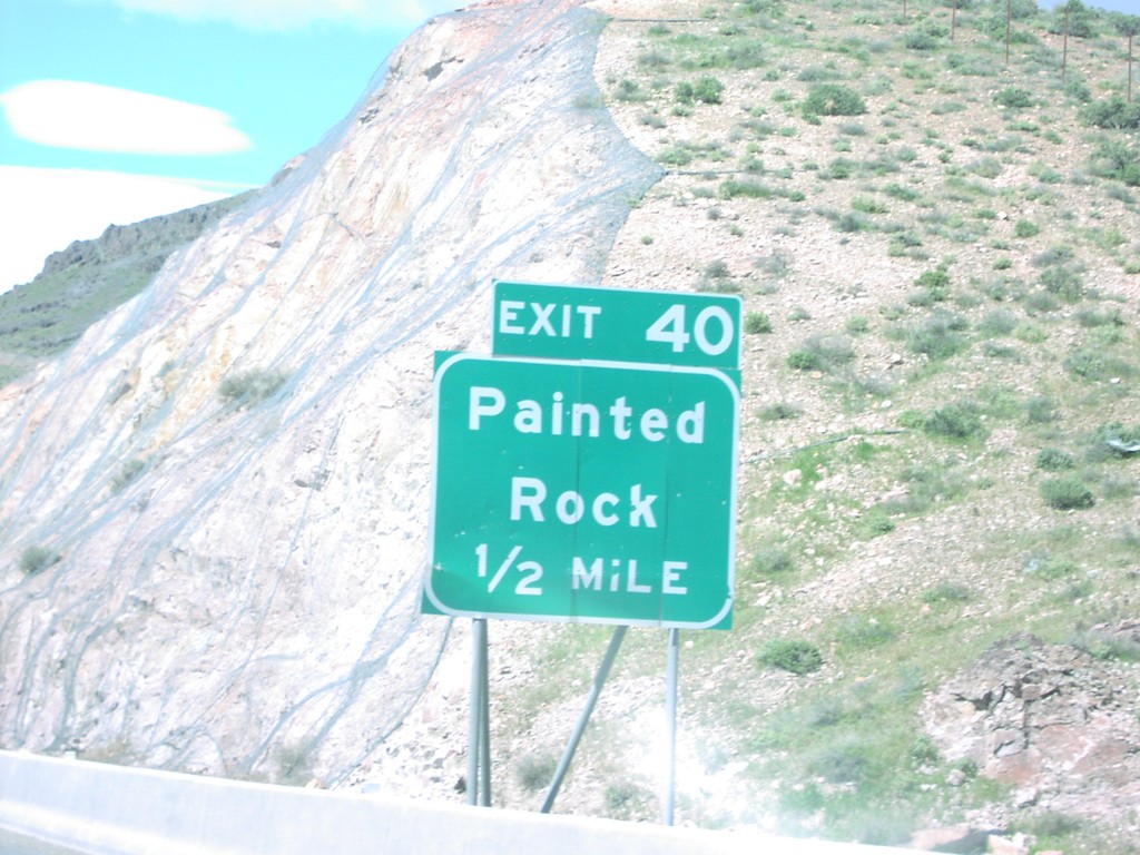
I-80 West Exit 40
I-80 west approaching Exit 40, Painted Rock
Taken 04-01-2006
Fernley
Lyon County
Nevada
United States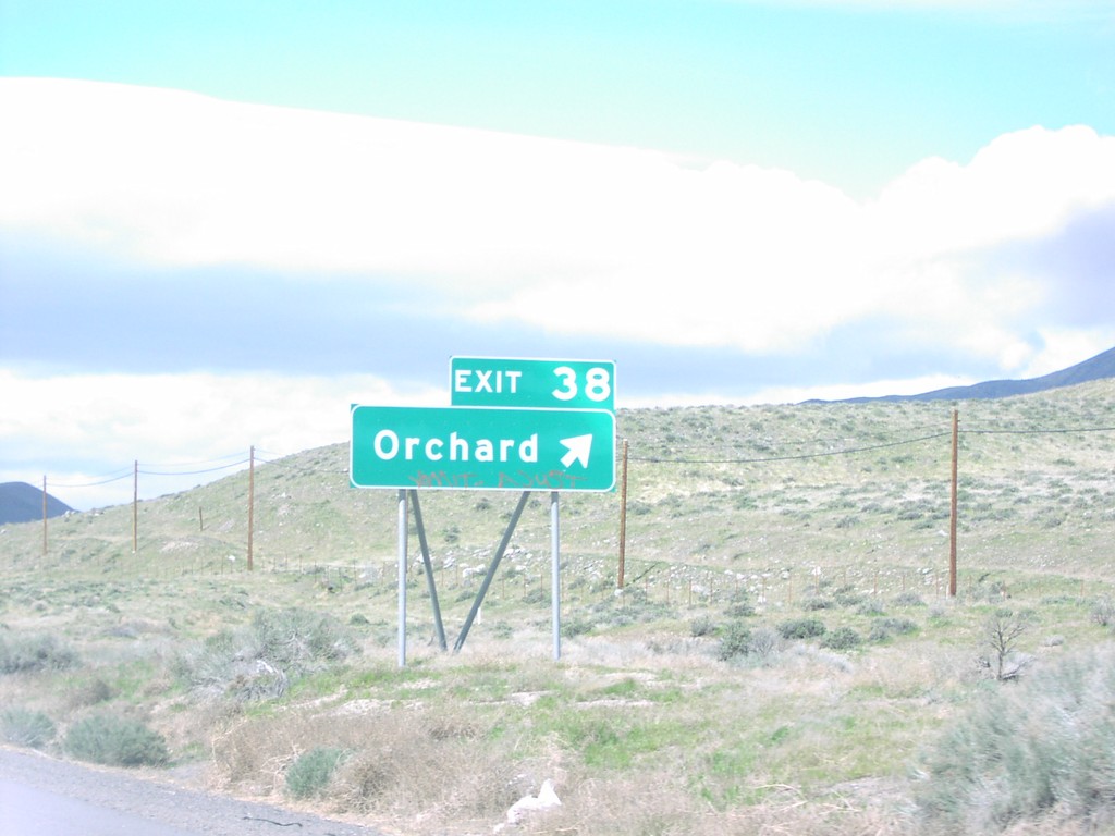
I-80 West Exit 38
I-80 west at Exit 38, Orchard
Taken 04-01-2006
Fernley
Lyon County
Nevada
United States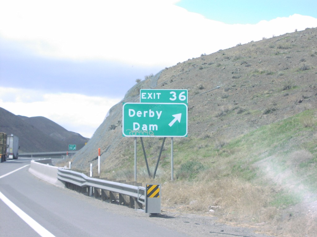
I-80 West Exit 36
I-80 west at Exit 36, Derby Dam
Taken 04-01-2006
Sparks
Washoe County
Nevada
United States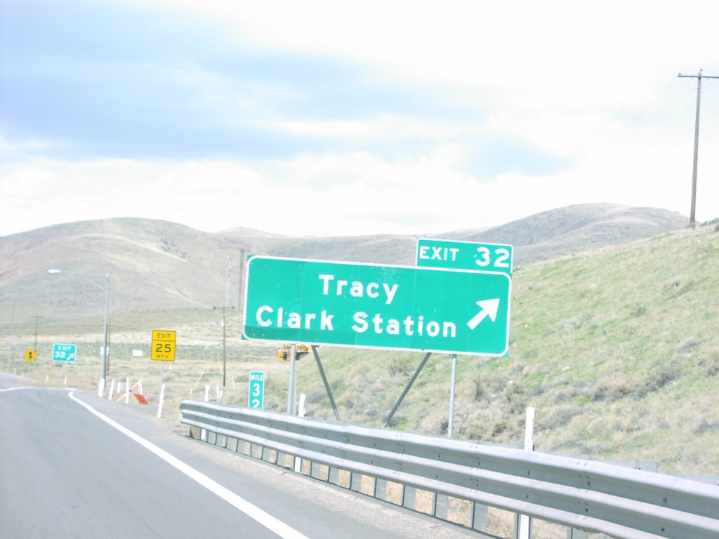
I-80 West Exit 32
I-80 west at Exit 32, Tracy/Clark Station
Taken 04-01-2006
Sparks
Washoe County
Nevada
United States