Signs Tagged With Big Green Sign

US-93 North at US-50/US-6
US-93 North at US-93/US-6/US-50 to Ely and US-6/US-50 to Delta (Utah)
Taken 02-01-2006


 Majors Place
White Pine County
Nevada
United States
Majors Place
White Pine County
Nevada
United States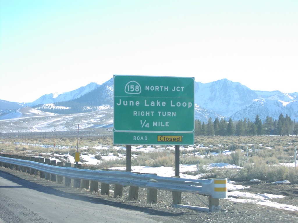
US-395 South CA-158 Jct.
CA-158 junction (north) to June Lake
Taken 02-01-2006


 Lee Vining
Mono County
California
United States
Lee Vining
Mono County
California
United States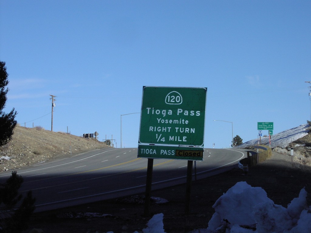
US-395 South CA-120 West
US-395 south at CA-120 west to Tioga Pass/Yosemite
Taken 02-01-2006
Lee Vining
Mono County
California
United States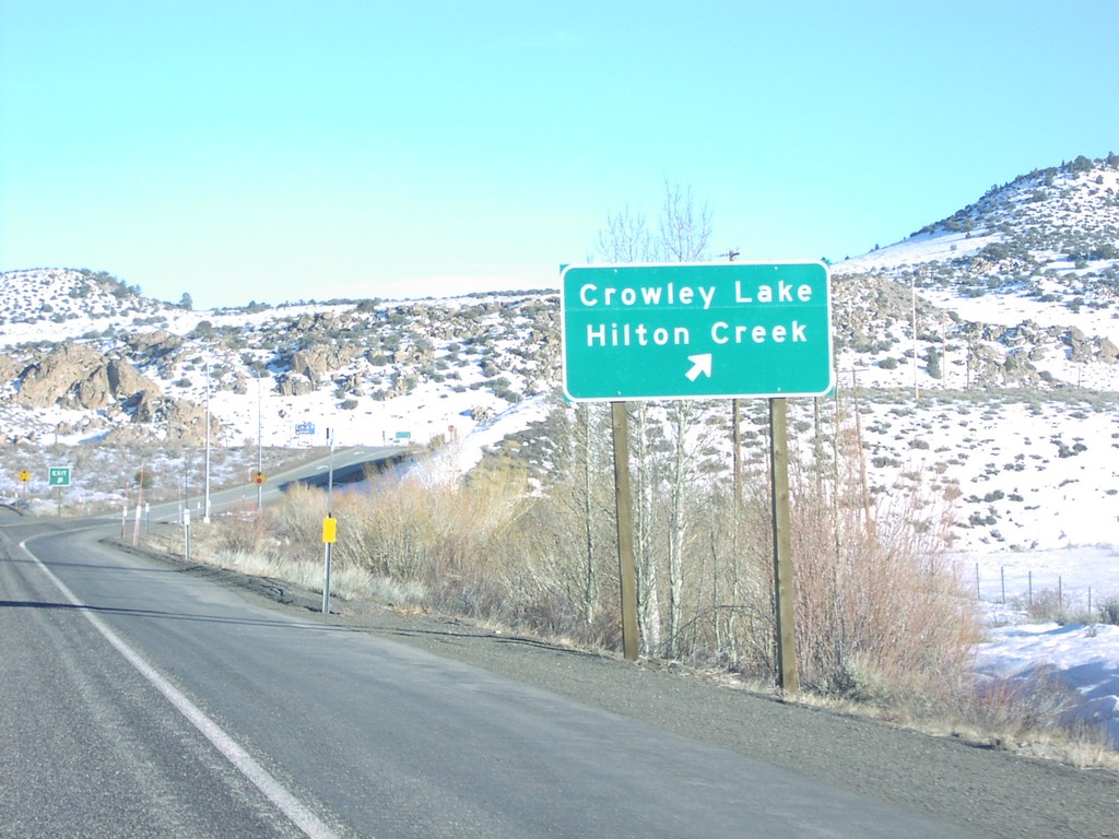
US-395 South at Crowley Lake
Crowley Lake/Hilton Creek exit on US-395 south
Taken 02-01-2006
Mammoth Lakes
Mono County
California
United States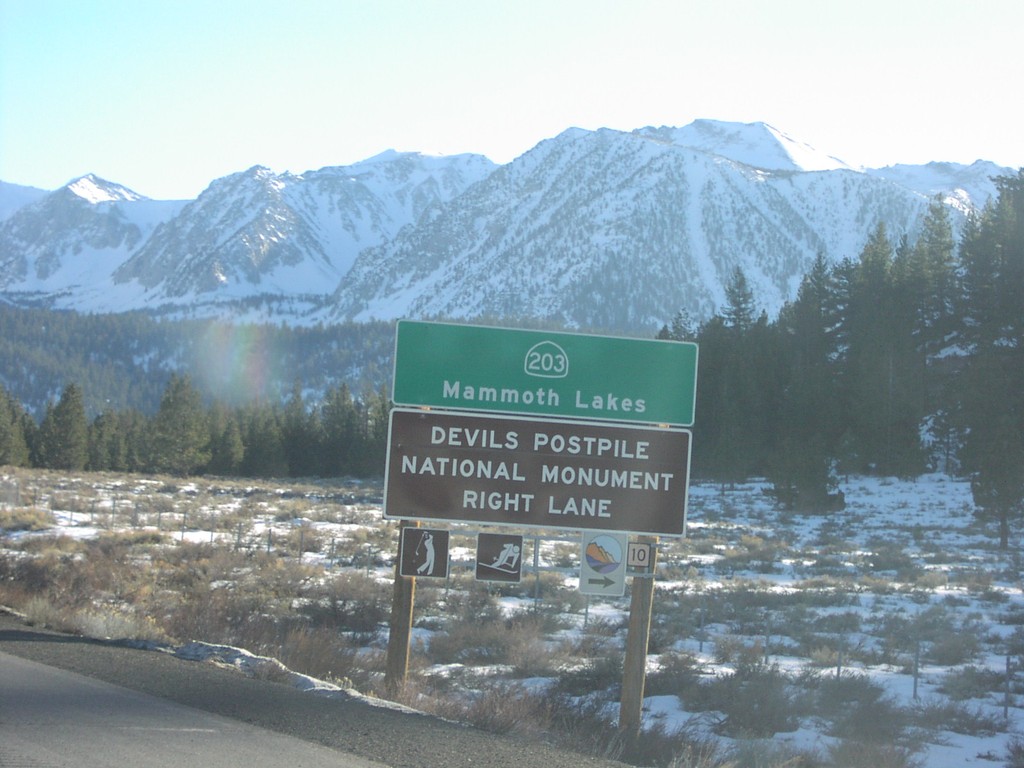
US-395 South at CA-203
CA-203 to Mammoth Lakes and Devils Postpile National Monument, right lane
Taken 02-01-2006
 Mammoth Lakes
Mono County
California
United States
Mammoth Lakes
Mono County
California
United States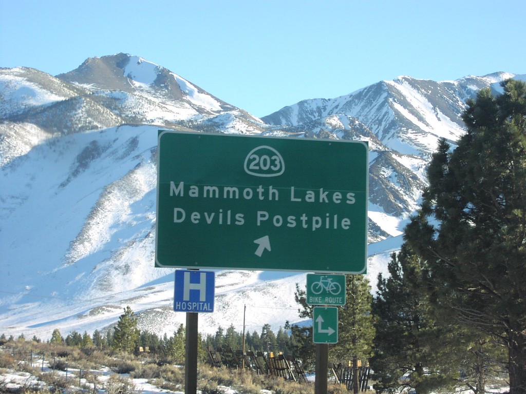
US-395 South at CA-203
CA-203/Devils Postpile/Mammoth Lakes exit on US-395 south
Taken 02-01-2006
Mammoth Lakes
Mono County
California
United States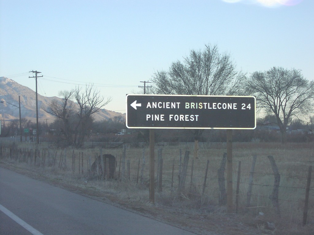
US-395 South at CA-168 East
US-395 south at CA-168 east junction to Ancient Bristlecone Pine Forest, 24 miles.
Taken 02-01-2006
 Big Pine
Inyo County
California
United States
Big Pine
Inyo County
California
United States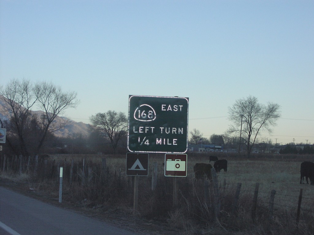
US-395 South at CA-168 East
CA-168 east, Left Turn, on US-395 south
Taken 02-01-2006
Big Pine
Inyo County
California
United States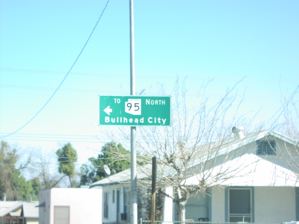
River Rd.@Harbor Ave. To AZ-95
To AZ-95/Bullhead City on River Road
Taken 02-01-2006

 Needles
San Bernardino County
California
United States
Needles
San Bernardino County
California
United States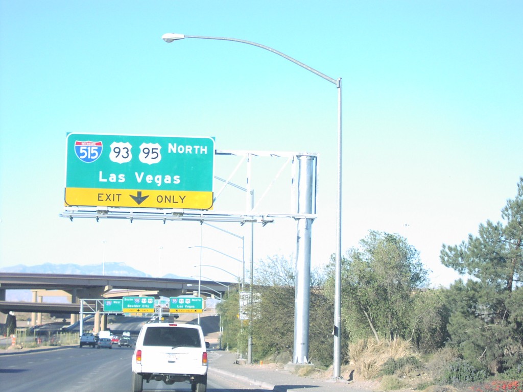
NV-564 West at I-215 and I-515
Entrance ramp to I-515/US-93/US-95 north to Las Vegas. End of NV-564 (Lake Mead Pkwy) west at I-515/I-215.
Taken 02-01-2006


 Henderson
Clark County
Nevada
United States
Henderson
Clark County
Nevada
United States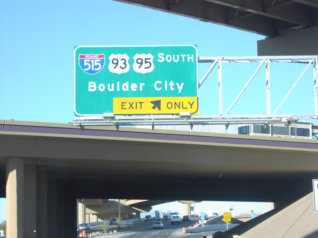
NV-564 West at I-215 and I-515
Entrance ramp to I-515/US-93/US-95 south to Boulder City. End of NV-564 (Lake Mead Pkwy) west at I-515/I-215.
Taken 02-01-2006
Henderson
Clark County
Nevada
United States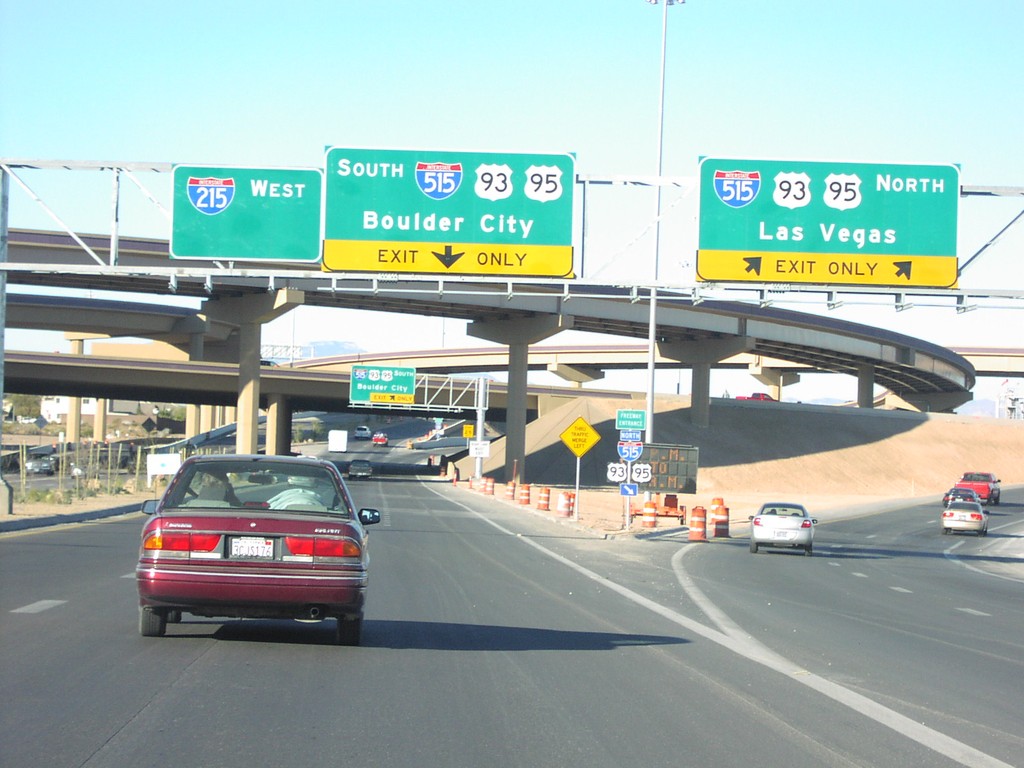
NV-564 West at I-215 and I-515
Entrance ramp to I-515/US-93/US-95 to Las Vegas and Boulder City. End of NV-564 (Lake Mead Pkwy) west at I-515/I-215.
Taken 02-01-2006
Henderson
Clark County
Nevada
United States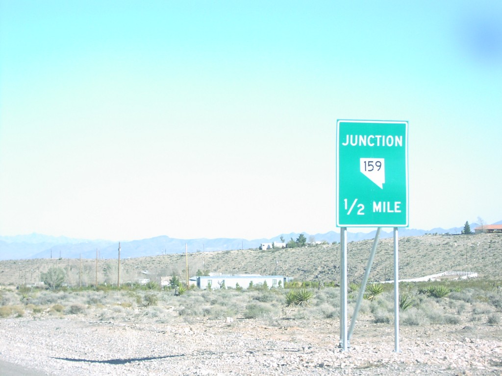
NV-160 East Nearing NV-159
Junction NV-159 1/2 mile on NV-160 east
Taken 02-01-2006
 Blue Diamond
Clark County
Nevada
United States
Blue Diamond
Clark County
Nevada
United States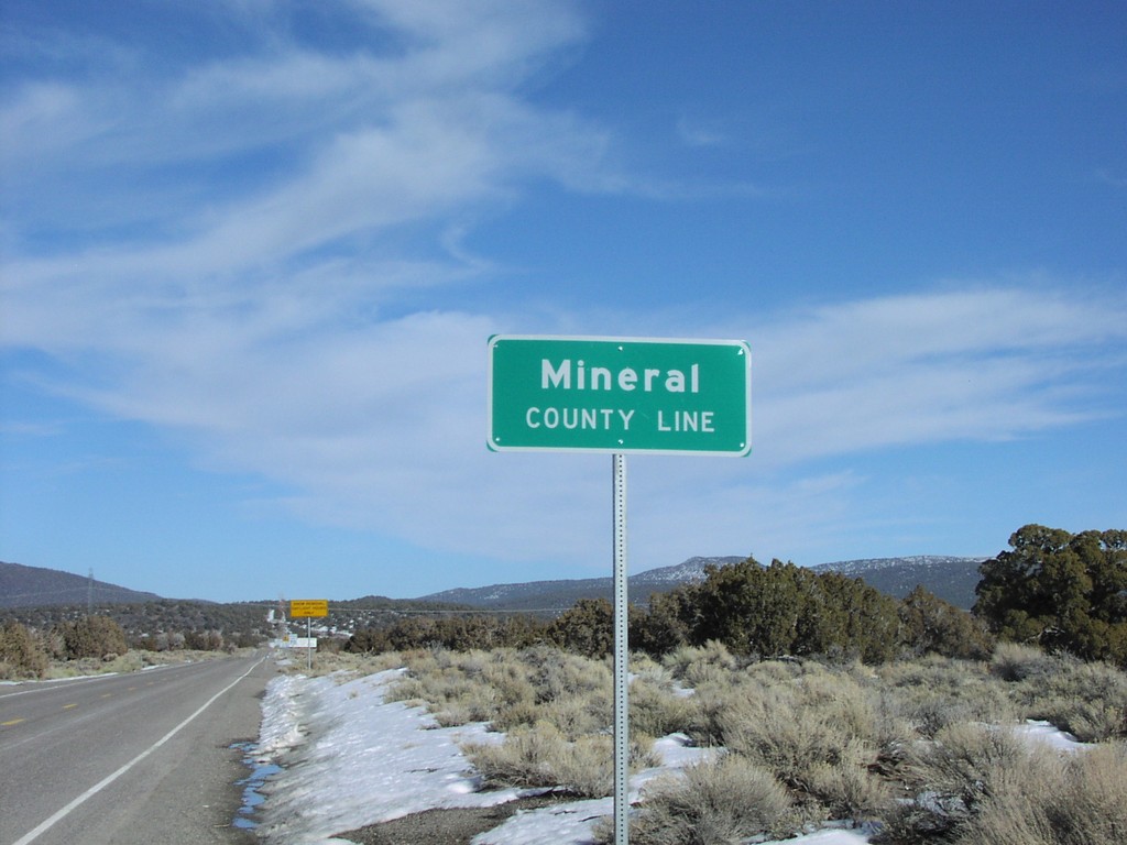
Mineral County Line on NV-359 North
Mineral County line at California border
Taken 02-01-2006
 Mina
Mineral County
Nevada
United States
Mina
Mineral County
Nevada
United States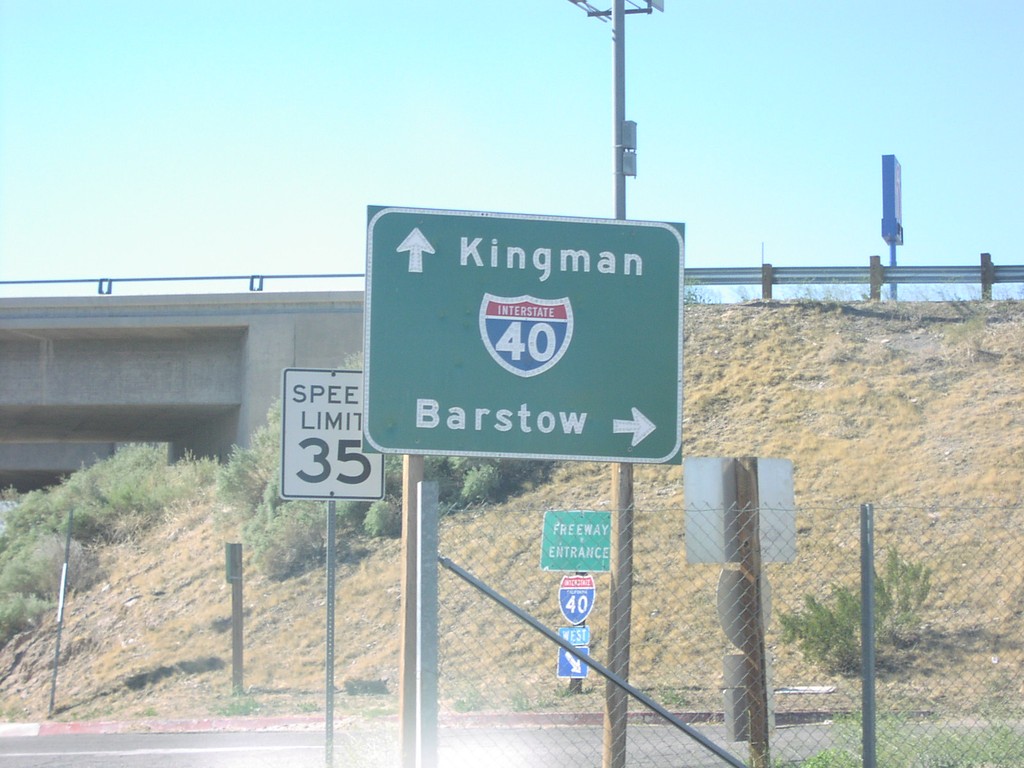
J St at I-40
J St. at I-40 freeway entrance to Kingman and Barstow.
Taken 02-01-2006
 Needles
San Bernardino County
California
United States
Needles
San Bernardino County
California
United States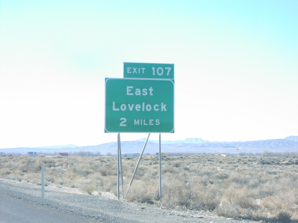
I80 West Exit 107
East Lovelock 2 Miles, Exit 107
Taken 02-01-2006
 Lovelock
Pershing County
Nevada
United States
Lovelock
Pershing County
Nevada
United States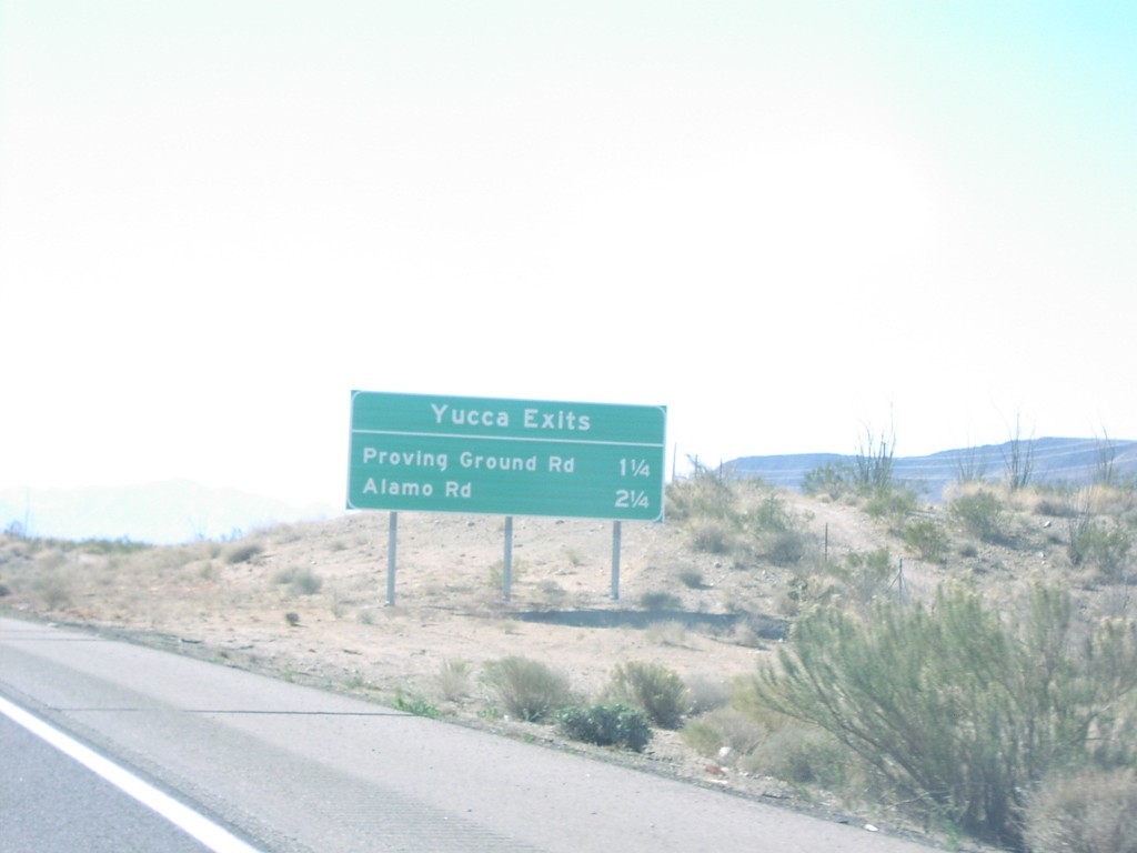
I40 West Yucca Exits
I-40 west, Yucca Exits: Proving Ground Rd/Alamo Rd
Taken 02-01-2006
Golden Valley
Mohave County
Arizona
United States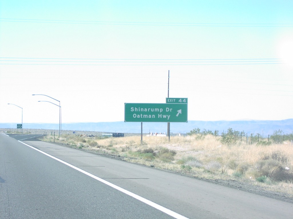
I40 West Exit 44
I-40 west at Exit 44, Oatman Hwy/Shinarump Drive
Taken 02-01-2006
McConnico
Mohave County
Arizona
United States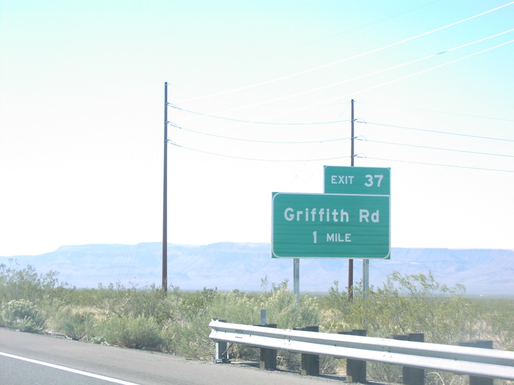
I40 West Exit 37
I-40 west approaching Exit 37, Griffith Road
Taken 02-01-2006
Drake
Mohave County
Arizona
United States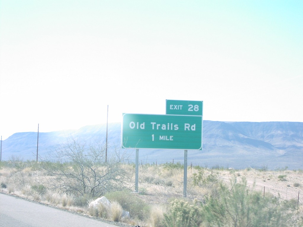
I40 West Exit 28
I-40 west approaching Exit 28, Old Trails Road
Taken 02-01-2006
Golden Valley
Mohave County
Arizona
United States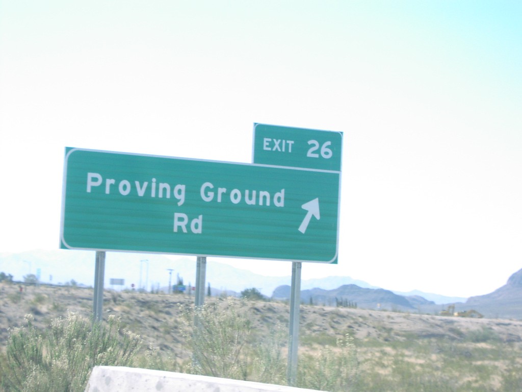
I40 West Exit 26
I-40 west at Exit 26, Proving Ground Road
Taken 02-01-2006
Yucca
Mohave County
Arizona
United States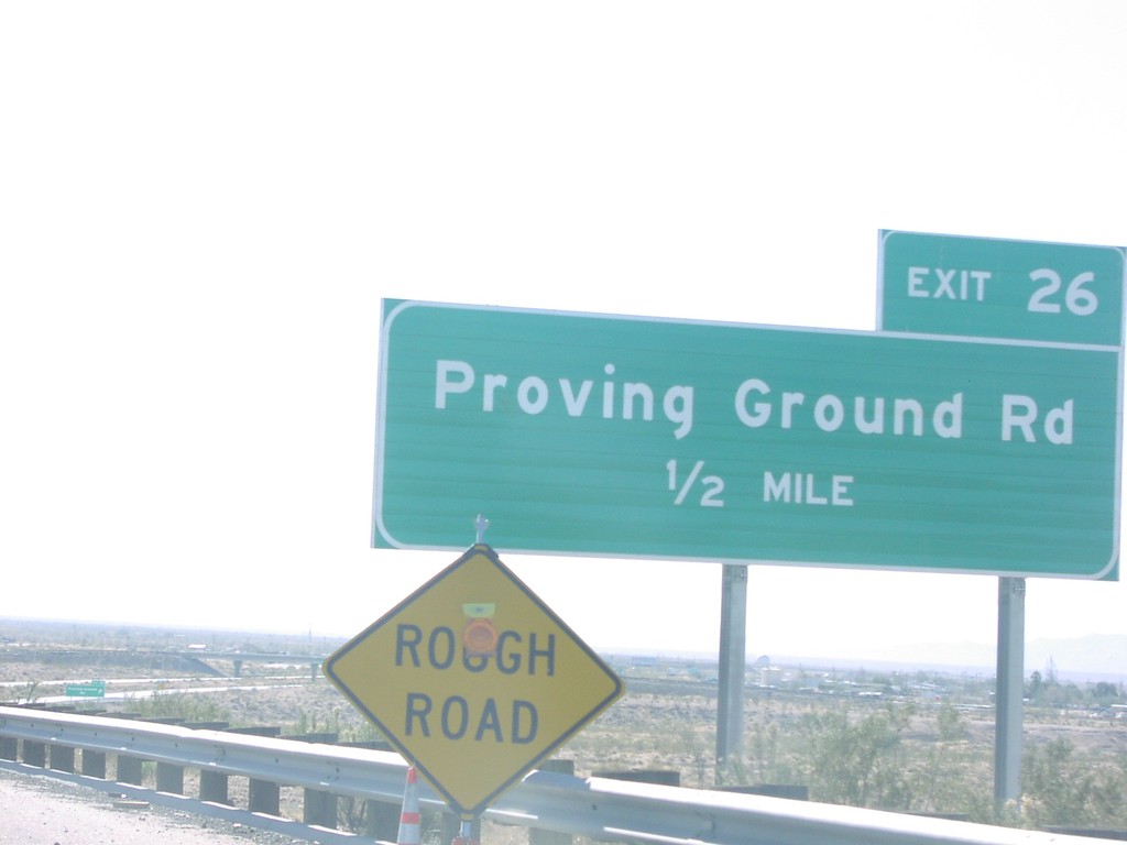
I40 West Exit 26
I-40 west approaching Exit 26, Proving Ground Road, 1/2 mile
Taken 02-01-2006
Yucca
Mohave County
Arizona
United States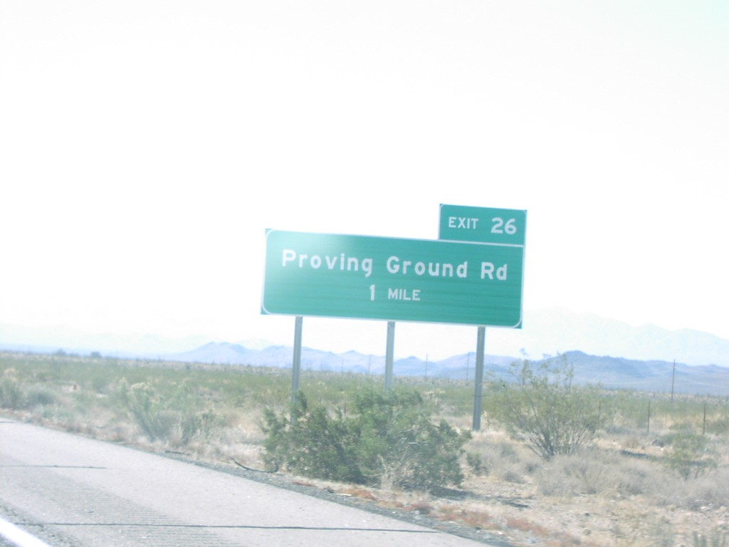
I40 West Exit 26
I-40 west approaching Exit 26, Proving Ground Road, 1 Mile
Taken 02-01-2006
Yucca
Mohave County
Arizona
United States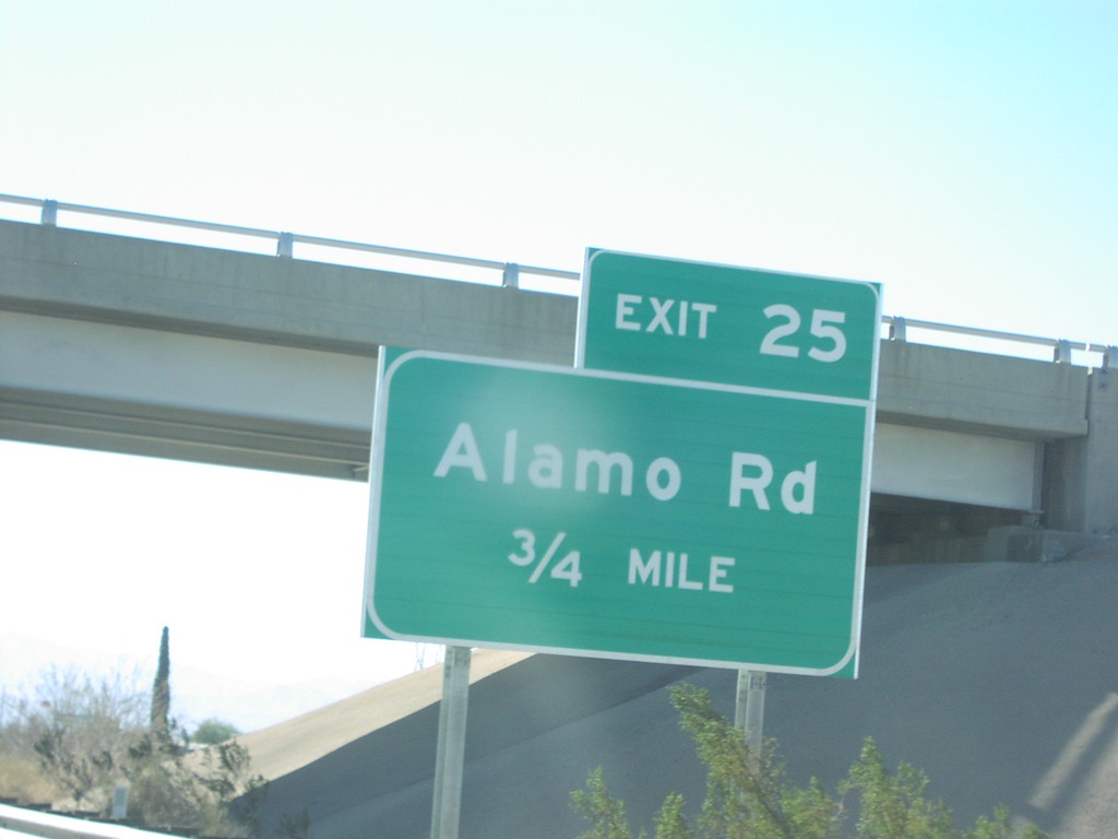
I40 West Exit 25
I-40 west approaching Exit 25, Alamo Road, 3/4 mile
Taken 02-01-2006
Yucca
Mohave County
Arizona
United States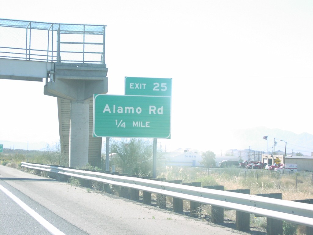
I40 West Exit 25
I-40 west approaching Exit 25, Alamo Road, 1/4 mile
Taken 02-01-2006
Yucca
Mohave County
Arizona
United States