Signs Tagged With Big Green Sign
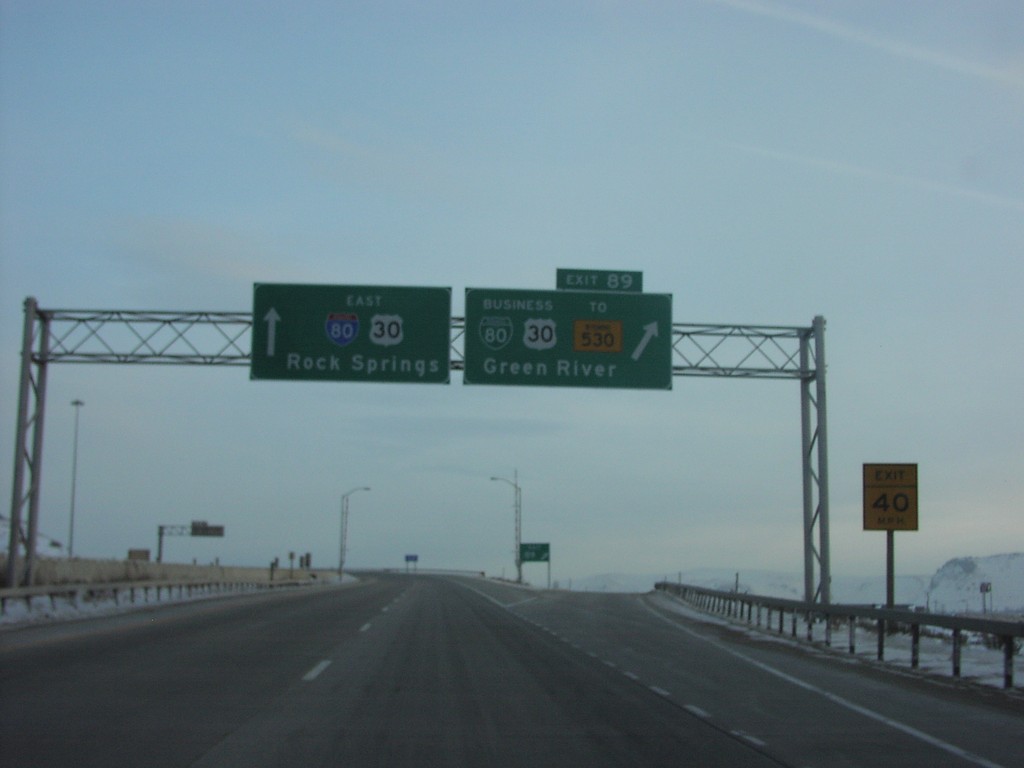
I-80 East Exit 89
I-80 East At BL-80
Taken 02-01-2004


 Green River
Sweetwater County
Wyoming
United States
Green River
Sweetwater County
Wyoming
United States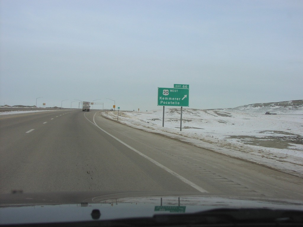
I-80 East Exit 66
I-80 East at Exit 66 - US-30 West/Kemmerer/Pocatello. US-30 joins I-80 eastbound to just east of Rawlins.
Taken 02-01-2004
Little America
Sweetwater County
Wyoming
United States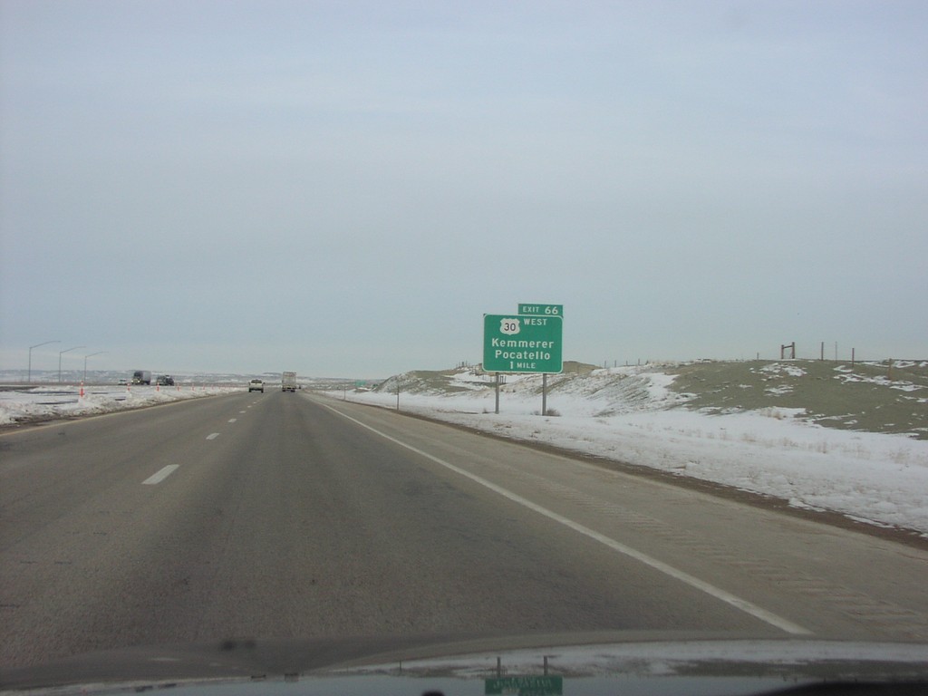
I-80 East Exit 66
I-80 East Approaching US-30 to Granger
Taken 02-01-2004
Granger
Sweetwater County
Wyoming
United States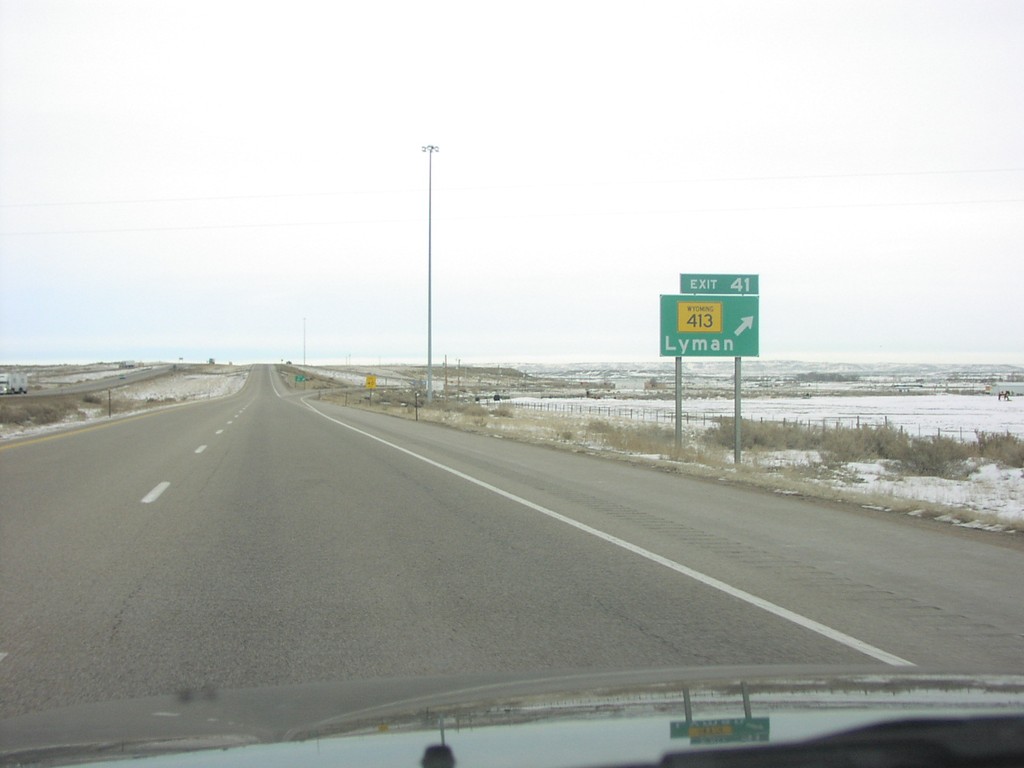
I-80 East Exit 41
I-80 East at WY-413 near Lyman
Taken 02-01-2004
 Lyman
Uinta County
Wyoming
United States
Lyman
Uinta County
Wyoming
United States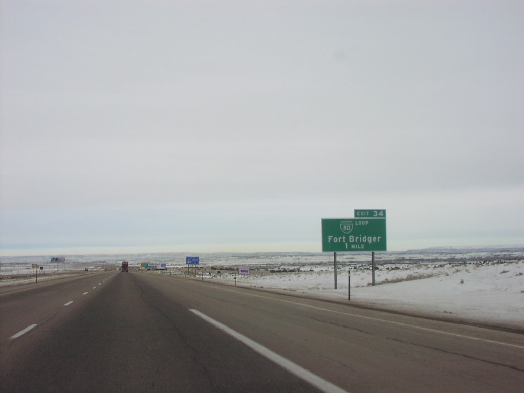
I-80 East Exit 34
I-80 East Approaching BL-80 to Fort Bridger
Taken 02-01-2004
 Fort Bridger
Uinta County
Wyoming
United States
Fort Bridger
Uinta County
Wyoming
United States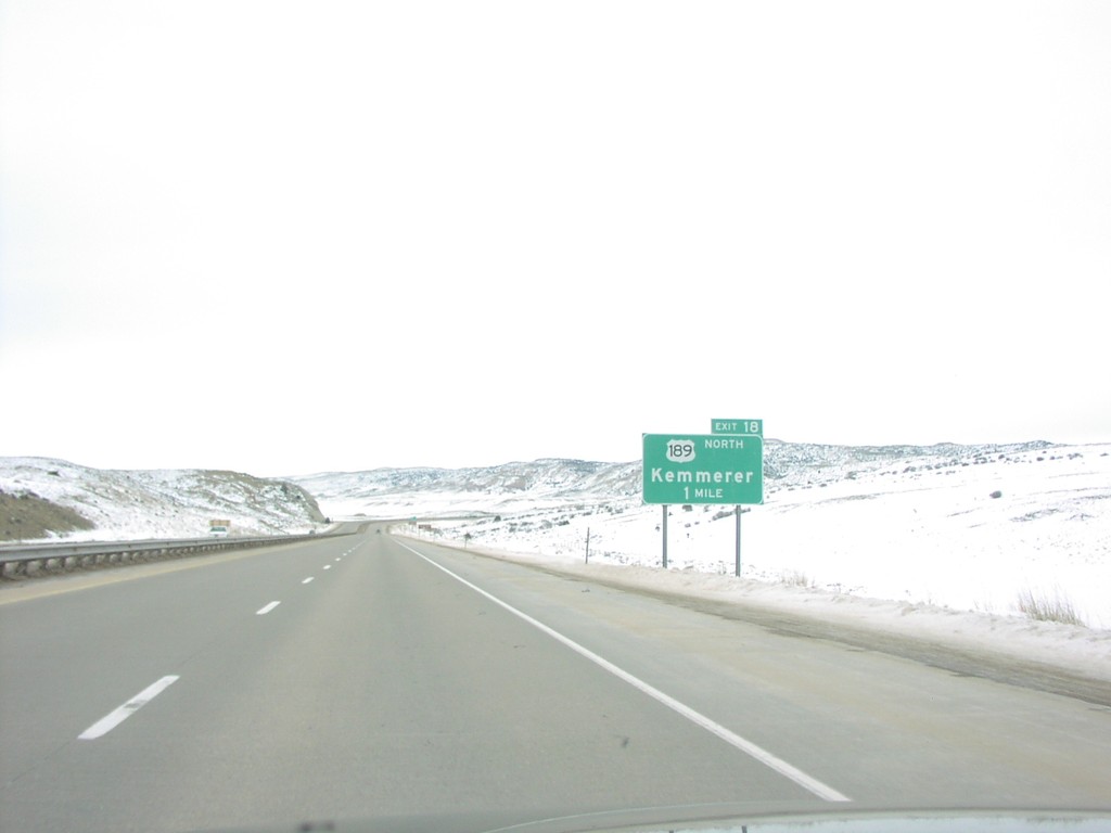
I-80 East Exit 18
I-80 East at US-189 North Exit
Taken 02-01-2004
 Evanston
Uinta County
Wyoming
United States
Evanston
Uinta County
Wyoming
United States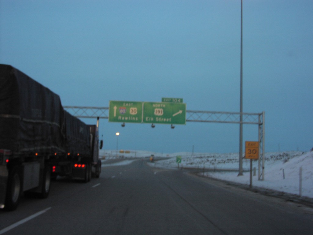
I-80 East Exit 104
I-80 East at US-191 North Junction
Taken 02-01-2004
 Rock Springs
Sweetwater County
Wyoming
United States
Rock Springs
Sweetwater County
Wyoming
United States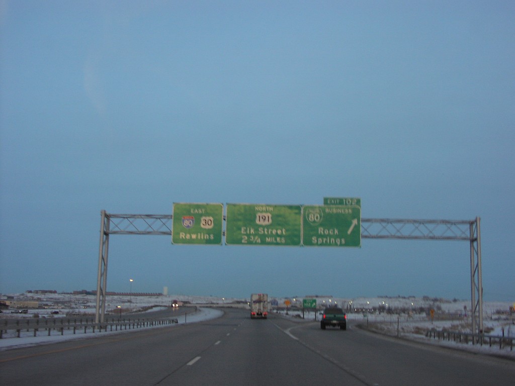
I-80 East Exit 102
I-80 East at Exit 102 - BL-80/Rock Springs. Next exit is College Drive which is unsigned. The exit after that is Exit 104 - US-191 North/Elk St. I-80/US-30 continues east towards Rawlins.
Taken 02-01-2004
Rock Springs
Sweetwater County
Wyoming
United States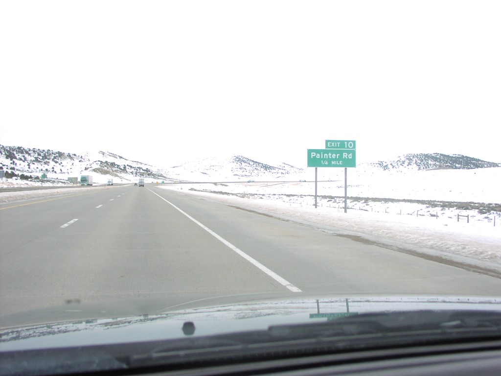
I-80 East Exit 10
I-80 East at Painter Road Exit
Taken 02-01-2004
Evanston
Uinta County
Wyoming
United States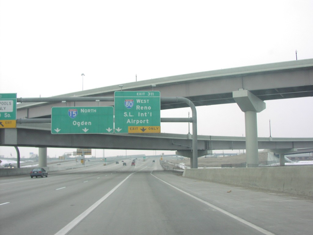
I-15 North/I-80 West Split Exit 311
I-80 West To Reno on I-15 North
Taken 02-01-2004
 Salt Lake City
Salt Lake County
Utah
United States
Salt Lake City
Salt Lake County
Utah
United States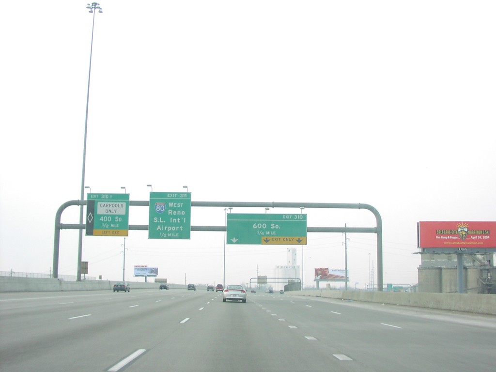
I-15 North/I-80 West Exits310/311
Overhead on I-15/I-80 for 600 South and I-80 West to Reno
Taken 02-01-2004
Salt Lake City
Salt Lake County
Utah
United States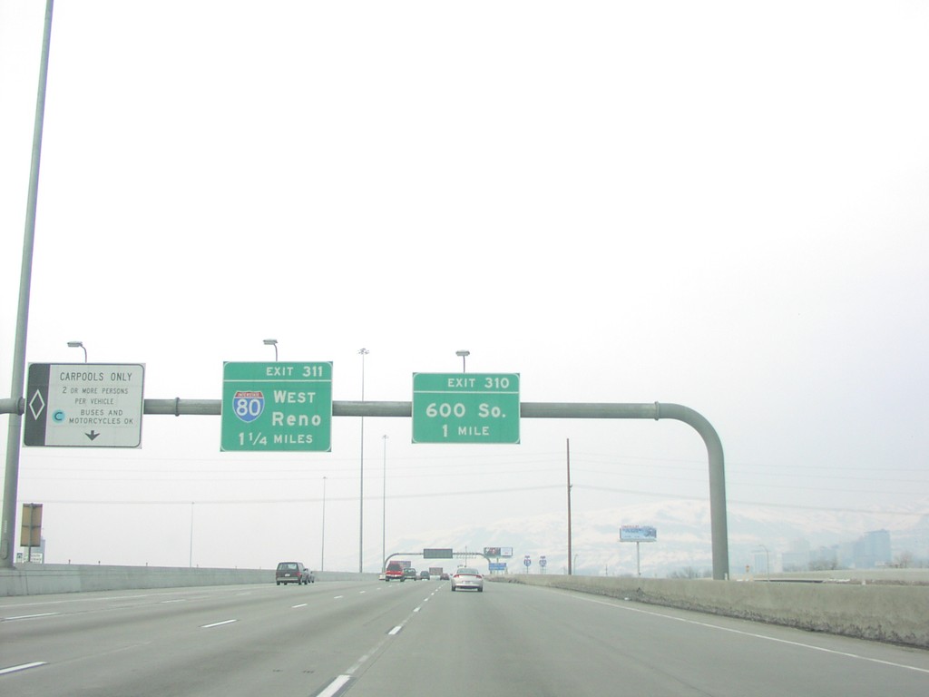
I-15 North/I-80 West Exit 310/Exit 311
I-15 North/I-80 West approaching 600 South
Taken 02-01-2004
Salt Lake City
Salt Lake County
Utah
United States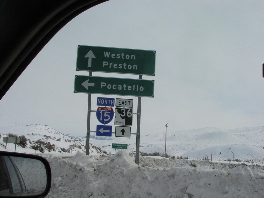
I-15 North - Exit 17 Offramp at ID-36
I-15 North - Exit 17 Offramp at ID-36. Use ID-36 east for Weston and Preston. Continue north on I-15 for Pocatello.
Taken 02-01-2004
 Malad City
Oneida County
Idaho
United States
Malad City
Oneida County
Idaho
United States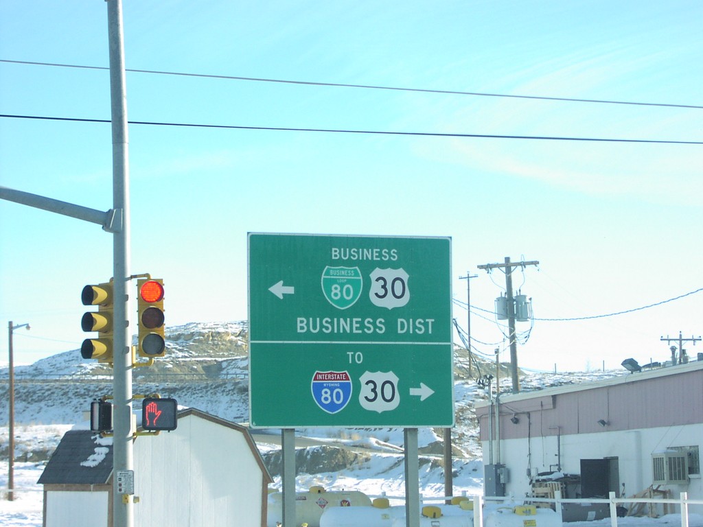
End WY-372 at BL-80
End WY-372 at BL-80
Taken 02-01-2004
 Rock Springs
Sweetwater County
Wyoming
United States
Rock Springs
Sweetwater County
Wyoming
United States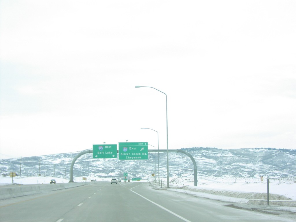
End US-40 at I-80
End US-40 at I-80 Junction
Taken 02-01-2004
 Park City
Summit County
Utah
United States
Park City
Summit County
Utah
United States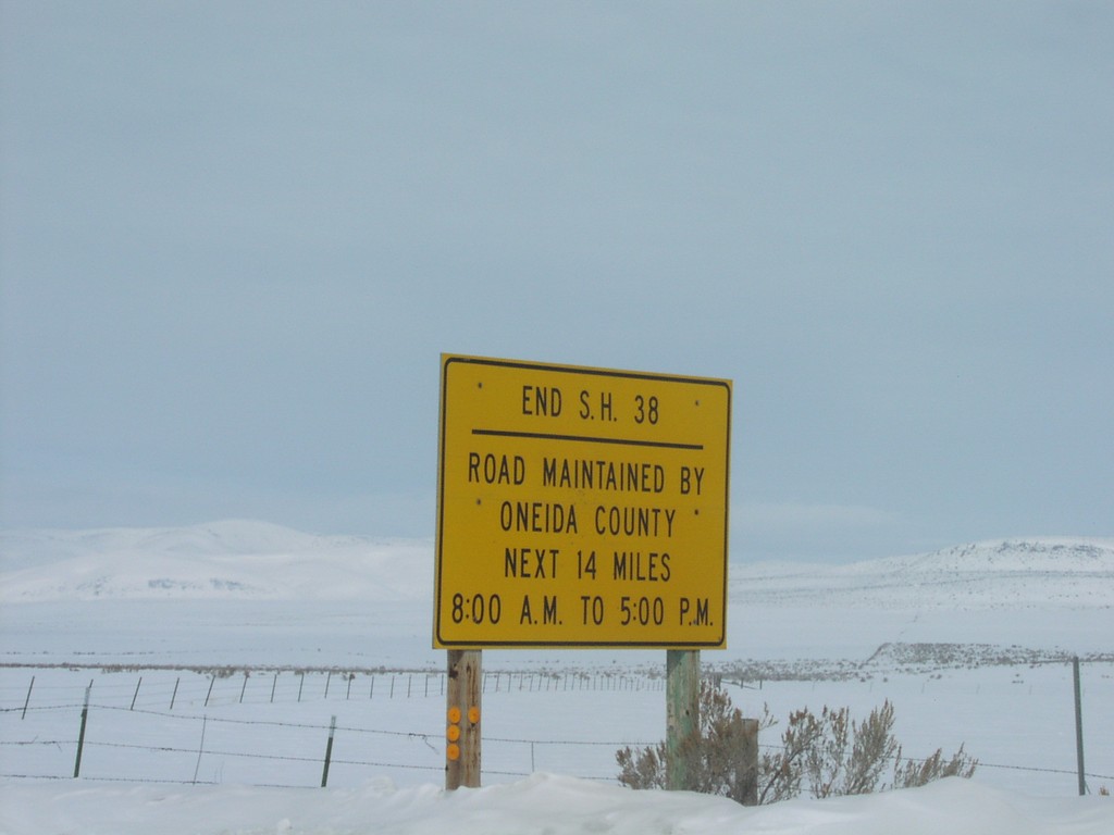
End ID-38 in Holbrook
Snow Indicating End of ID-38 and Beginning of Oneida County Maintenance
Taken 02-01-2004
 Holbrook
Oneida County
Idaho
United States
Holbrook
Oneida County
Idaho
United States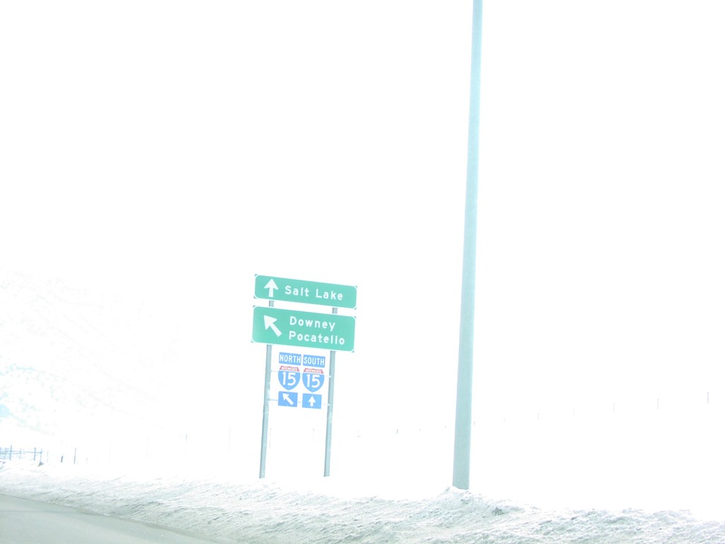
End ID-38 at I-15
End ID-38 west at I-15 in Malad. Use I-15 south for Salt Lake; I-15 north for Downey and Pocatello.
Taken 02-01-2004
Malad City
Oneida County
Idaho
United States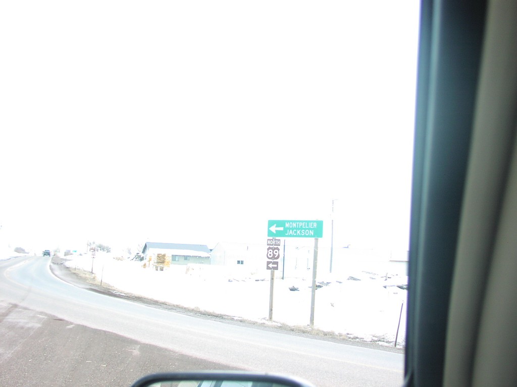
End ID-36 at US-89
End ID-36 at US-89 Junction, north of Paris
Taken 02-01-2004
 Ovid
Bear Lake County
Idaho
United States
Ovid
Bear Lake County
Idaho
United States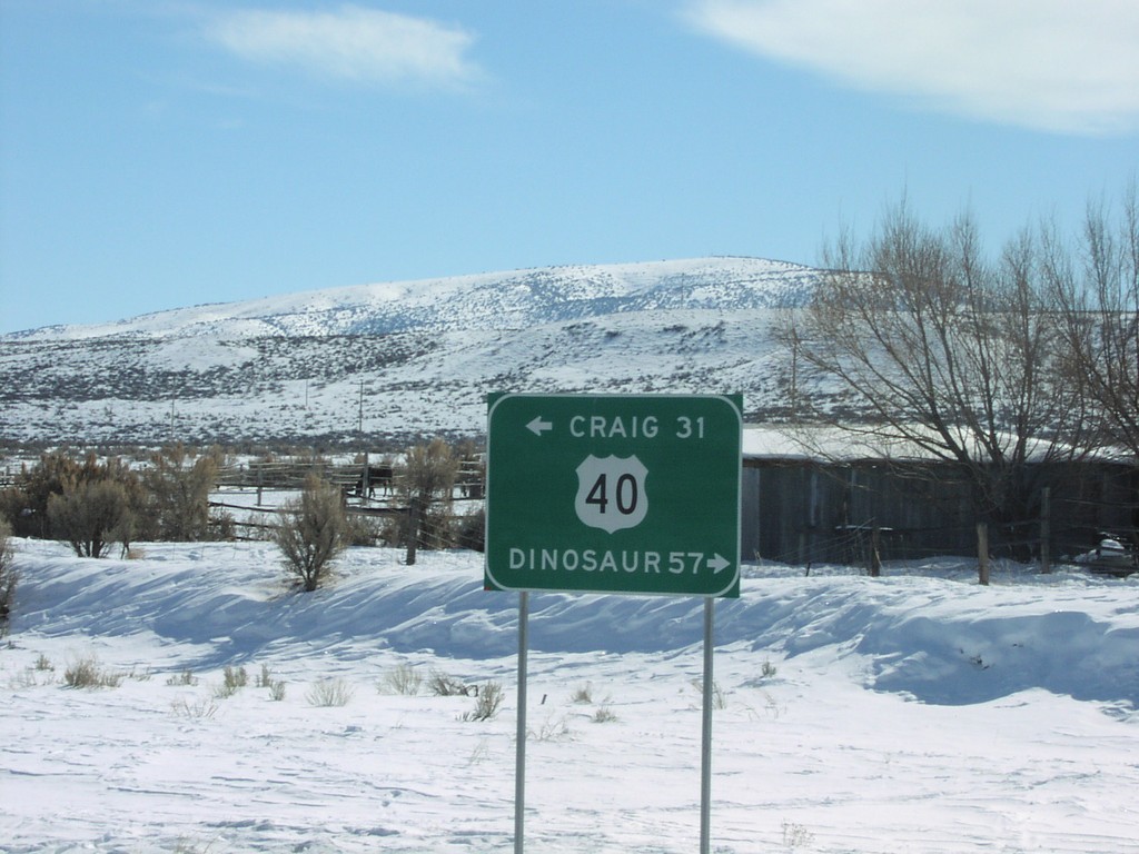
End CO-318 at US-40.
US-40 to Craig and Dinosaur at end of CO-318, near Maybell.
Taken 02-01-2004
 Moffat County
Colorado
United States
Moffat County
Colorado
United States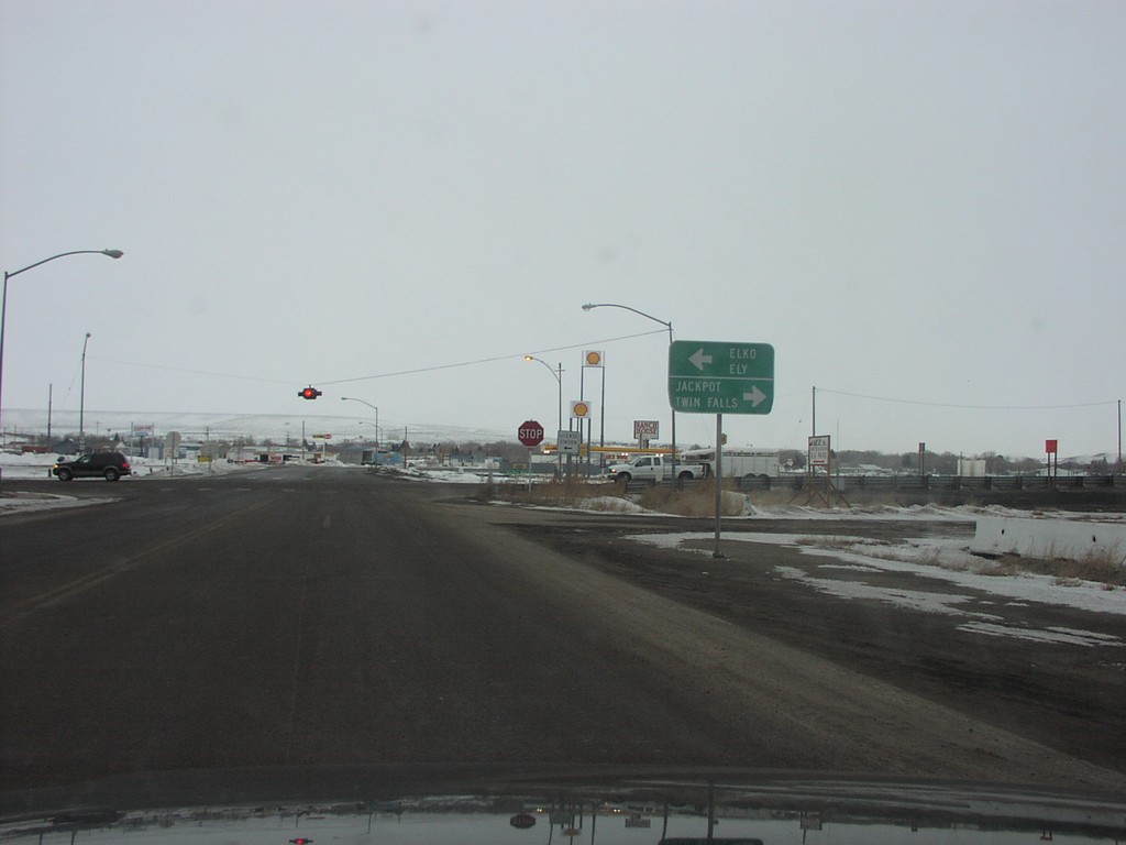
BL-80 West at US-93 - Wells
Direction Sign to Twin Falls, Jackpot and Ely at US-93/BL-80 Junction
Taken 02-01-2004
Wells
Elko County
Nevada
United States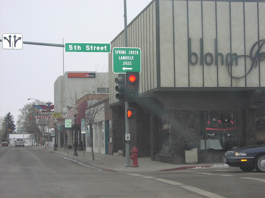
BL-80 West at NV-227
BL-80 West at NV-227 Junction
Taken 02-01-2004
 Elko
Elko County
Nevada
United States
Elko
Elko County
Nevada
United States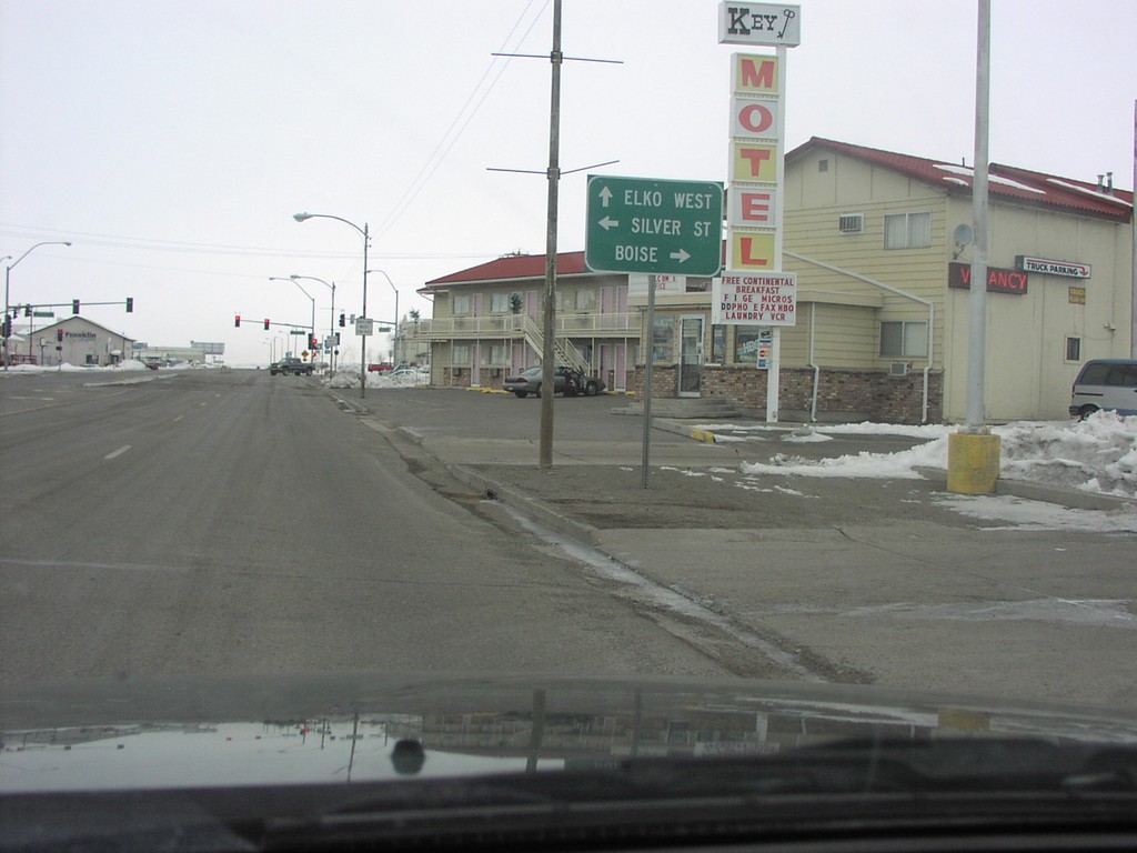
BL-80 West at NV-225
BL-80 West (Idaho Street) at NV-225 North. Use NV-225 north to Boise. Continue west on BL-80 to Elko West. Turn left for Silver St.
Taken 02-01-2004
 Elko
Elko County
Nevada
United States
Elko
Elko County
Nevada
United States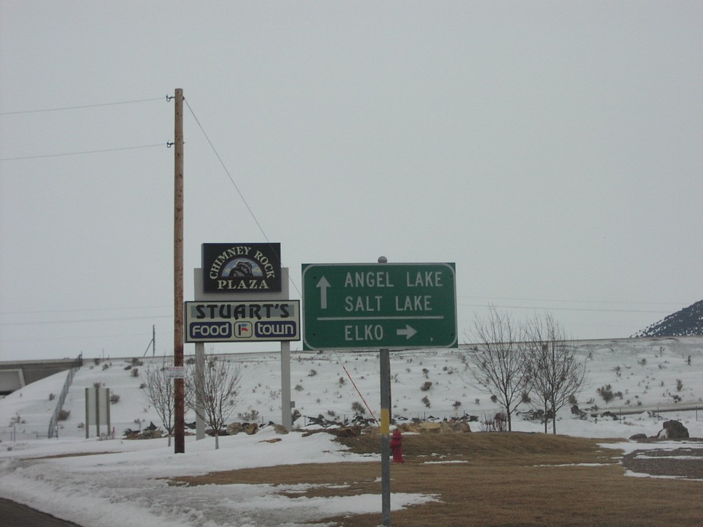
BL-80 West at I-80 - Wells, NV
Direction Sign To Elko and Salt Lake at I-80 Junction
Taken 02-01-2004
Wells
Elko County
Nevada
United States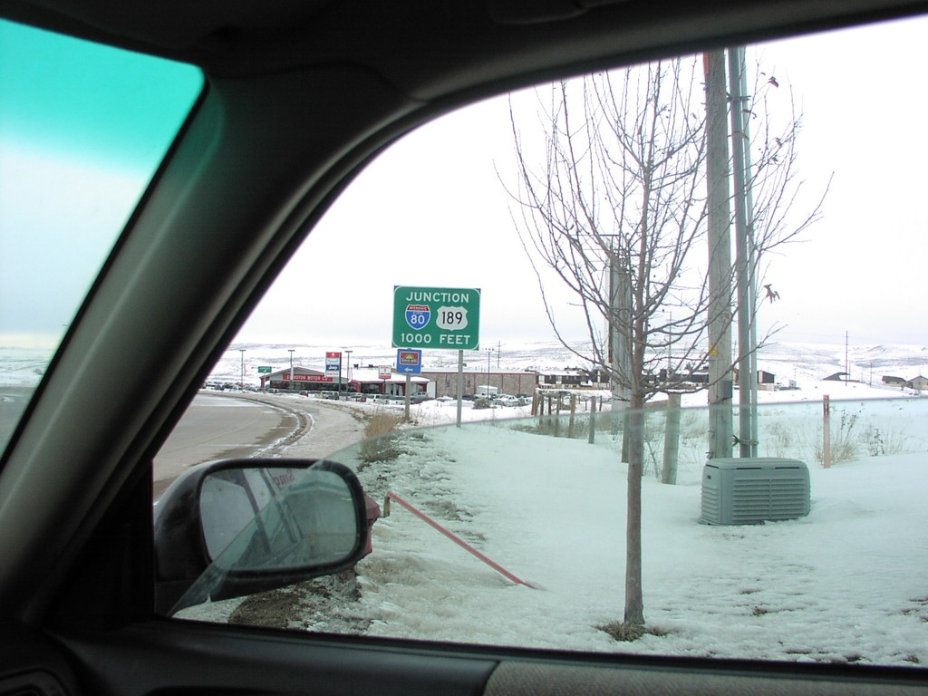
BL-80 West Approaching I-80/US-189 Onramp
I-80/US-189 1000 Feet Sign Approaching I-80 at Exit 2
Taken 02-01-2004
 Evanston
Uinta County
Wyoming
United States
Evanston
Uinta County
Wyoming
United States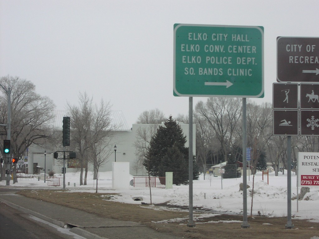
BL-80 West - Elko City Offices
Sign for Elko City Offices on BL-80 West
Taken 02-01-2004
Elko
Elko County
Nevada
United States