Signs Tagged With Big Green Sign
Begin ID-38 in Holbrook
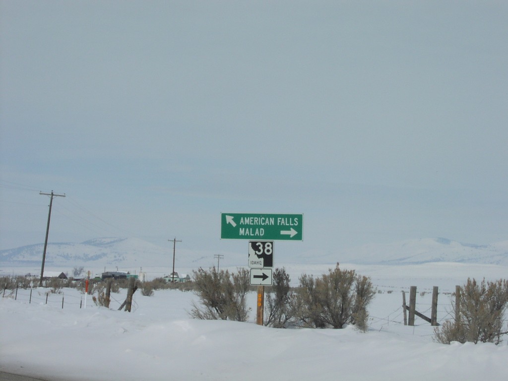
ID-38 to Malad and Oneida County Road to American Falls
Taken 02-01-2004
 Holbrook
Oneida County
Idaho
United States
Holbrook
Oneida County
Idaho
United States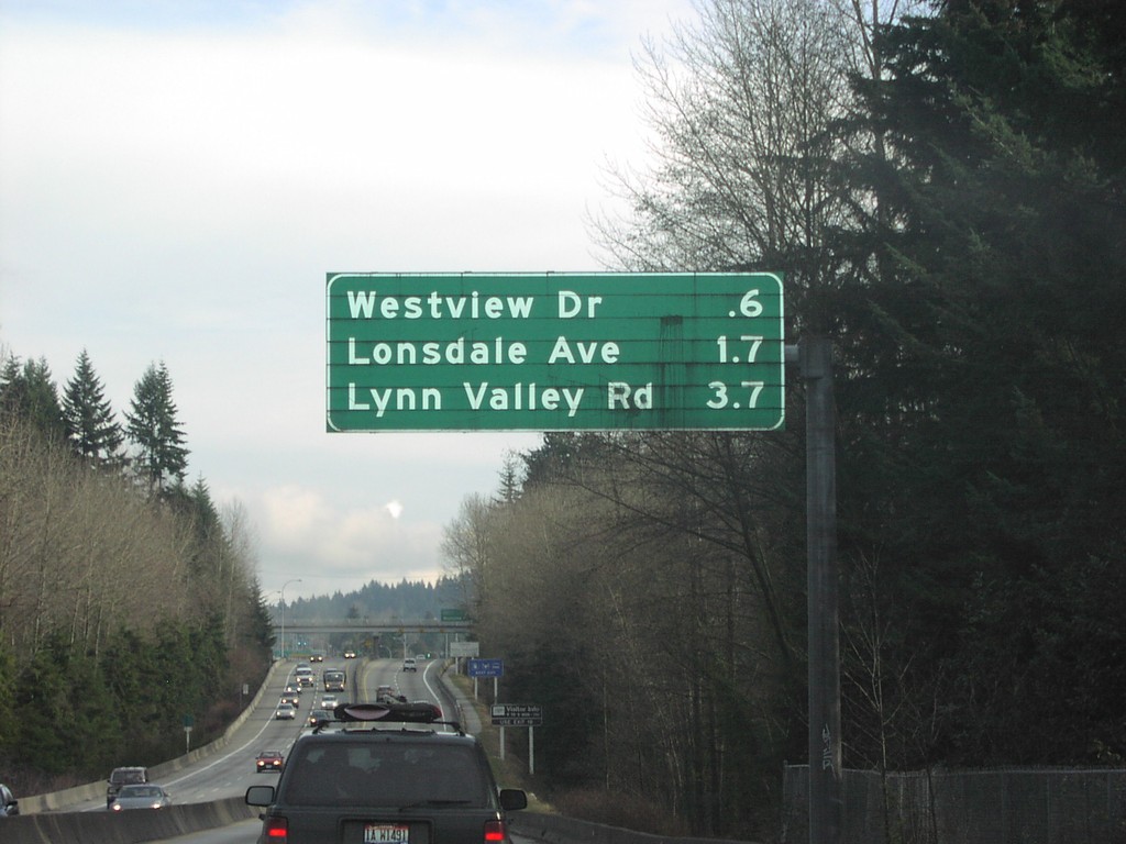
TC-1 East - North Vancouver Exits
North Vancouver Exits on TC-1 East.
Taken 01-01-2004
 North Vancouver
Metro Vancouver
British Columbia
Canada
North Vancouver
Metro Vancouver
British Columbia
Canada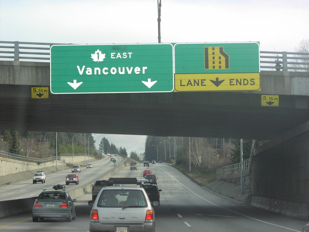
TC-1 East - Lane Ends
TC-1 East Overhead
Taken 01-01-2004
North Vancouver
Metro Vancouver
British Columbia
Canada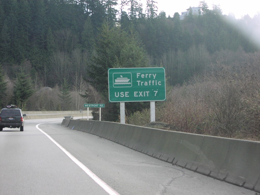
TC-1 East - Ferry Traffice use Exit 7
Ferry Traffic Use Exit 7 Sign on TC-1 East.
Taken 01-01-2004
 West Vancouver
Metro Vancouver
British Columbia
Canada
West Vancouver
Metro Vancouver
British Columbia
Canada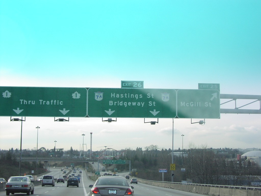
TC-1 East - Exits 25 and 26
TC-1 East at Hastings St./Broadway St., and TC-1 Overhead.
Taken 01-01-2004
 Vancouver
Metro Vancouver
British Columbia
Canada
Vancouver
Metro Vancouver
British Columbia
Canada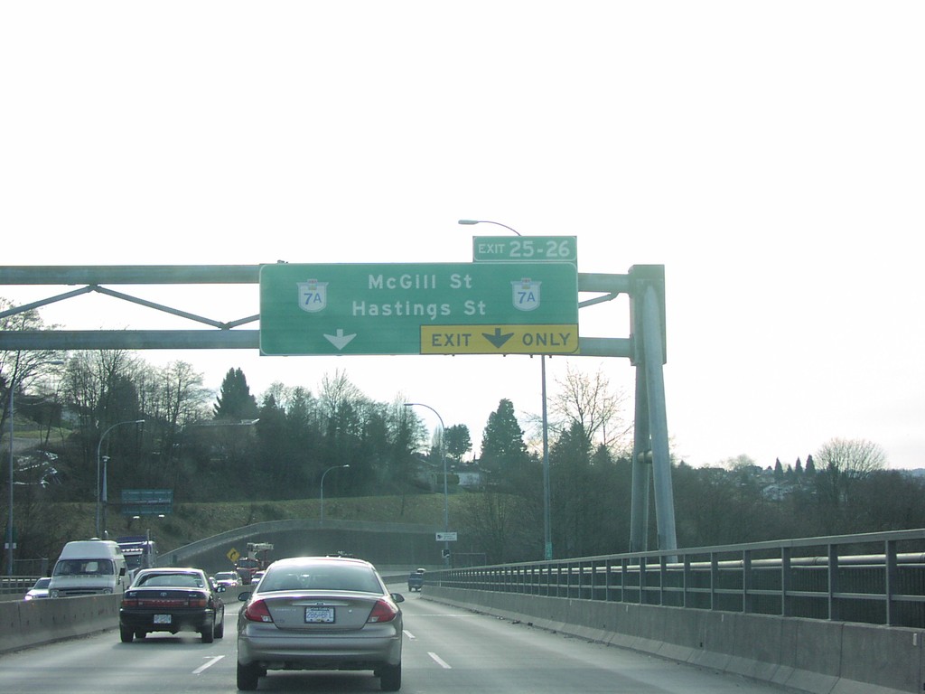
TC-1 East - Exits 25 and 26
TC-1 East at Exit 25-26 BC-7A/Hastings St./McGill St.
Taken 01-01-2004
Vancouver
Metro Vancouver
British Columbia
Canada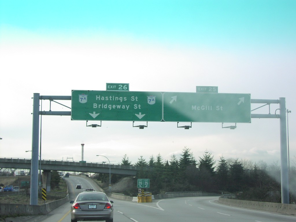
TC-1 East - Exits 25 and 26
TC-1 East at Exit 25 and Exit 26.
Taken 01-01-2004
Vancouver
Metro Vancouver
British Columbia
Canada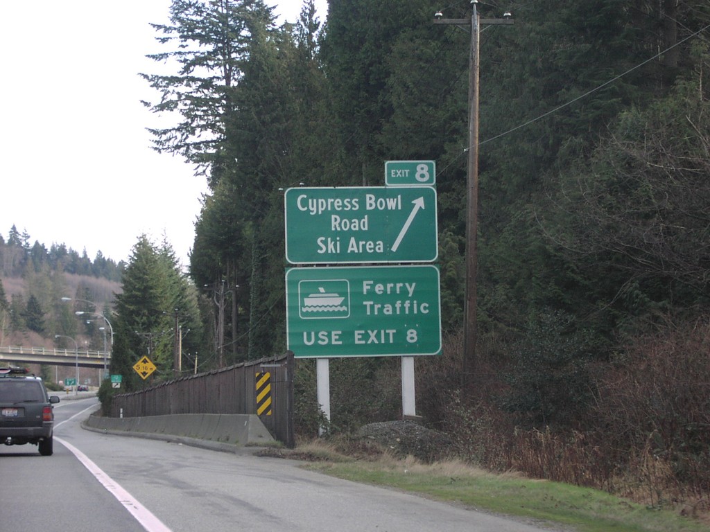
TC-1 East - Exit 8
TC-1 at Exit 8, Cypress Bowl Road/Ski Area.
Taken 01-01-2004
West Vancouver
Metro Vancouver
British Columbia
Canada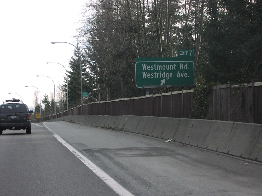
TC-1 East - Exit 7
TC-1 East at Exit 7, Westridge Ave./Westmount Drive.
Taken 01-01-2004
West Vancouver
Metro Vancouver
British Columbia
Canada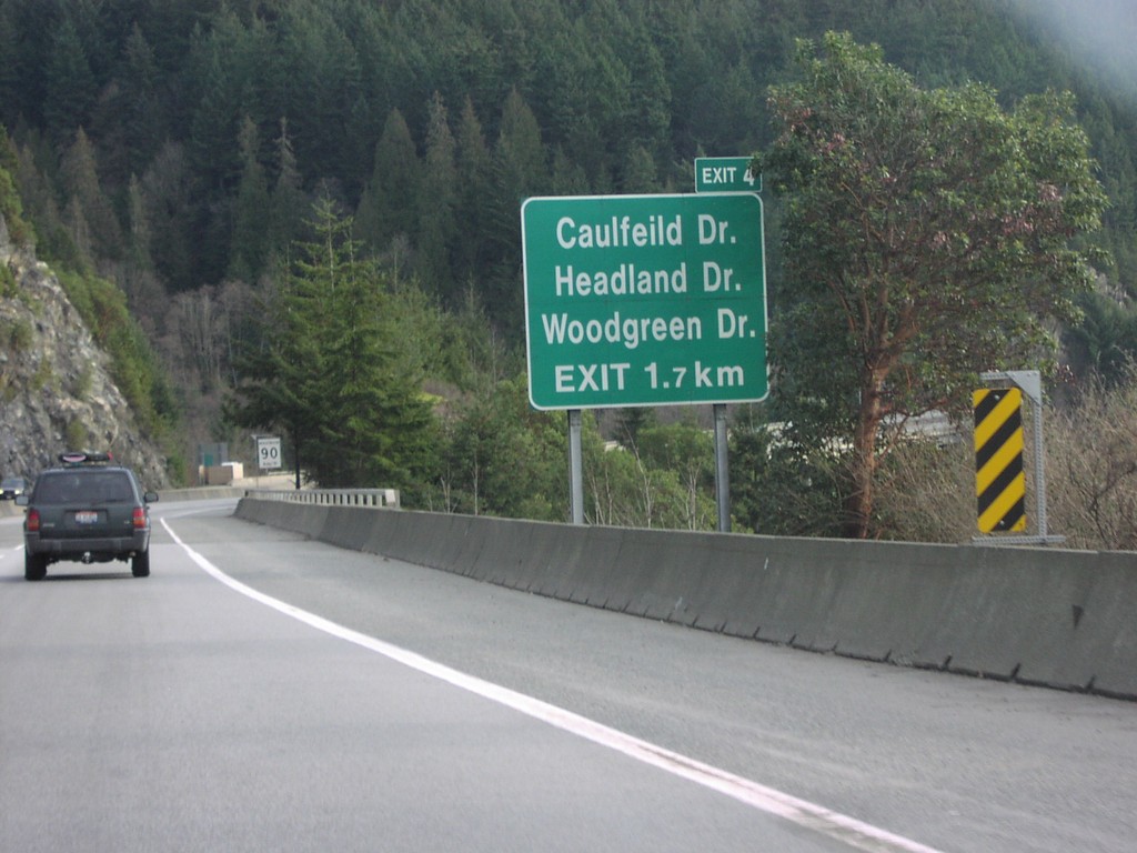
TC-1 East - Exit 4
TC-1 East at Exit 4, Caulfield Drive/Headland Drive/Woodgreen Drive.
Taken 01-01-2004
West Vancouver
Metro Vancouver
British Columbia
Canada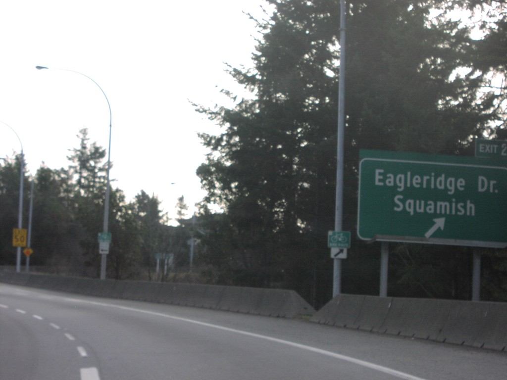
TC-1 East - Exit 2
TC-1 East at Exit 2, Eagleridge Drive/Squamish.
Taken 01-01-2004
West Vancouver
Metro Vancouver
British Columbia
Canada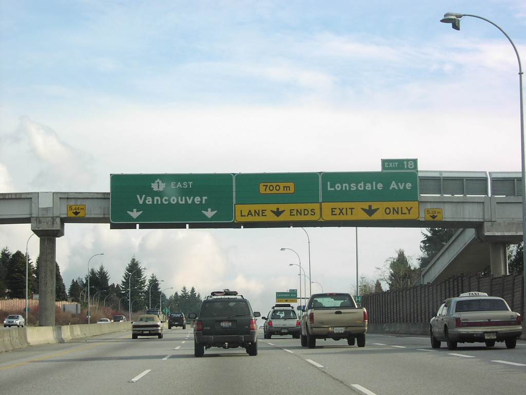
TC-1 East - Exit 18
TC-1 East at Exit 18, Lonsdale Ave., and TC-1 East Overhead.
Taken 01-01-2004
North Vancouver
Metro Vancouver
British Columbia
Canada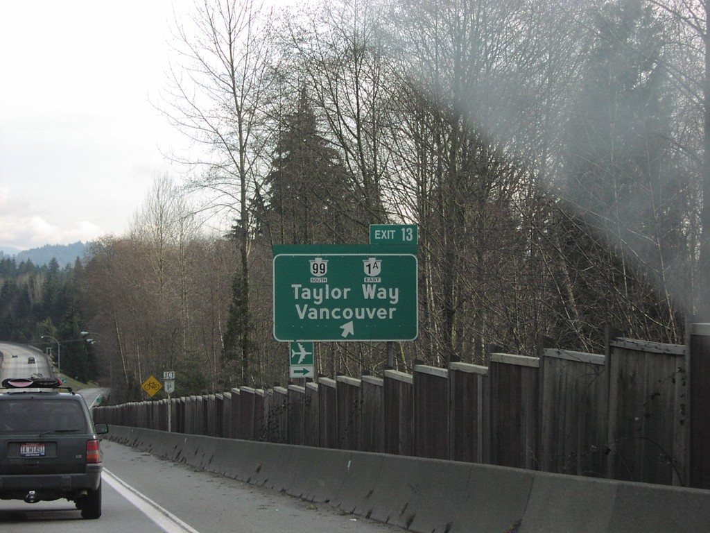
TC-1 East - Exit 13
TC-1 East at Exit 13, BC-99/BC-99A To Vancouver.
Taken 01-01-2004
 West Vancouver
Metro Vancouver
British Columbia
Canada
West Vancouver
Metro Vancouver
British Columbia
Canada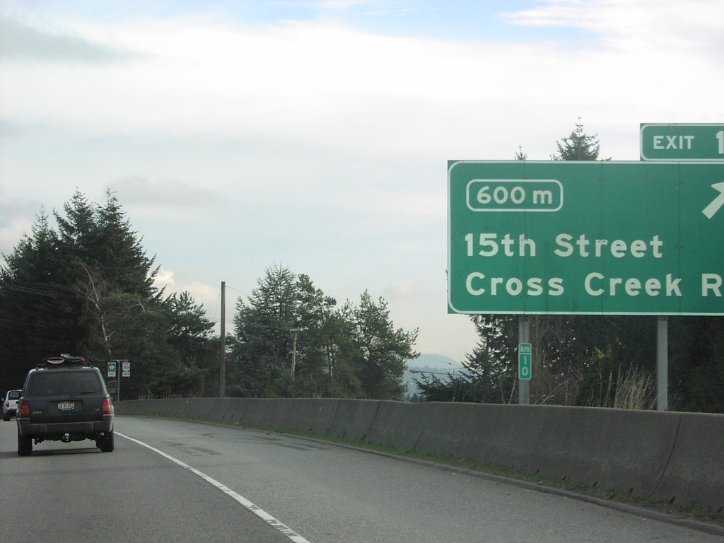
TC-1 East - Exit 10
TC-1 East at Exit 10 15th St./Cross Creek Road and Km 10.
Taken 01-01-2004
West Vancouver
Metro Vancouver
British Columbia
Canada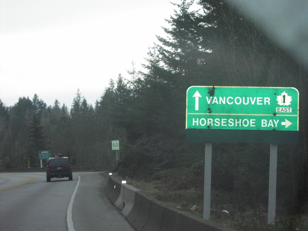
BC-99 South at Horseshoe Bay
BC-99 South at Horseshoe Bay turnoff.
Taken 01-01-2004
West Vancouver
Metro Vancouver
British Columbia
Canada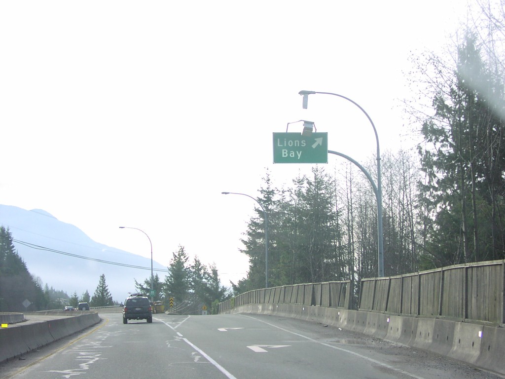
BC-99 South - Lions Bay Exit
BC-99 South at Lions Bay Exit
Taken 01-01-2004
Lions Bay
Metro Vancouver
British Columbia
Canada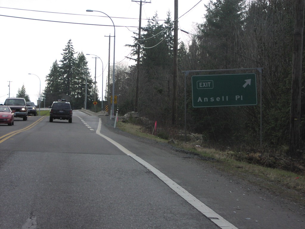
BC-99 South - Ansell Place Exit
BC-99 South at Ansell Place Exit,
Taken 01-01-2004
Lions Bay
Metro Vancouver
British Columbia
Canada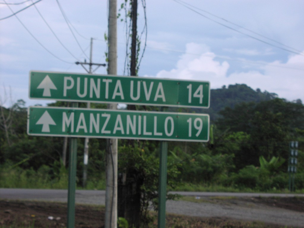
Puerto Viejo Road - Distance Marker
CR-36 at the junction with the coast road to Puerto Viejo, Manzanillo, and Punta Uva
Taken 09-23-2003

 Puerto Viejo de Talamanca
Limón Province
Costa Rica
Puerto Viejo de Talamanca
Limón Province
Costa Rica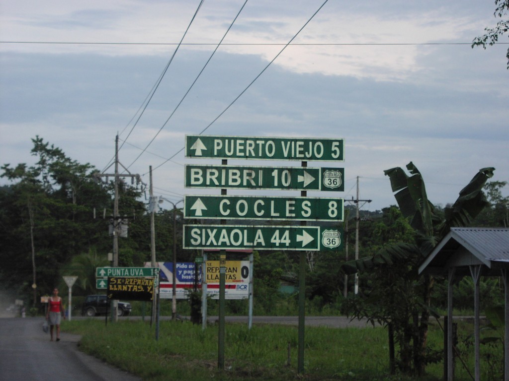
CR-36 South - Puerto Viejo Jct.
CR-36 south at Puerto Viejo/Cocles junction
Taken 09-23-2003
Limón Province
Costa Rica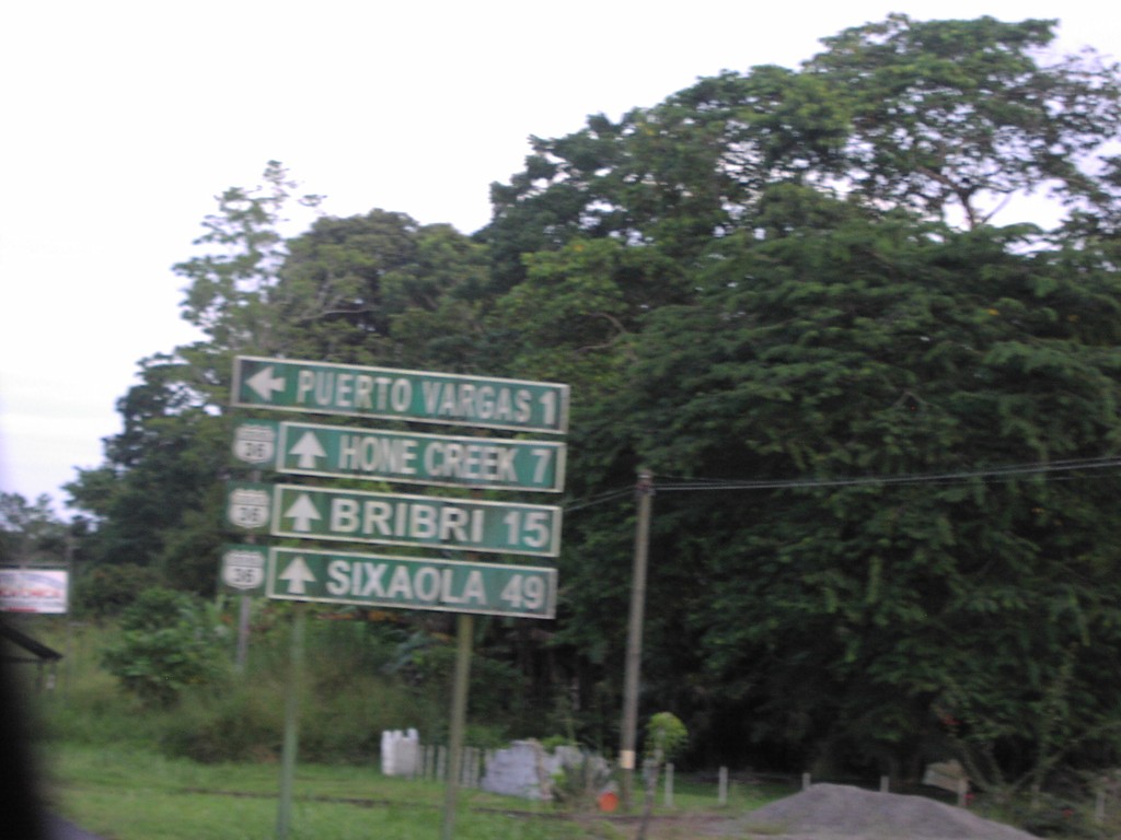
CR-36 South - Puerto Vargas Jct.
CR-36 south at Puerto Vargas junction
Taken 09-23-2003
Limón Province
Costa Rica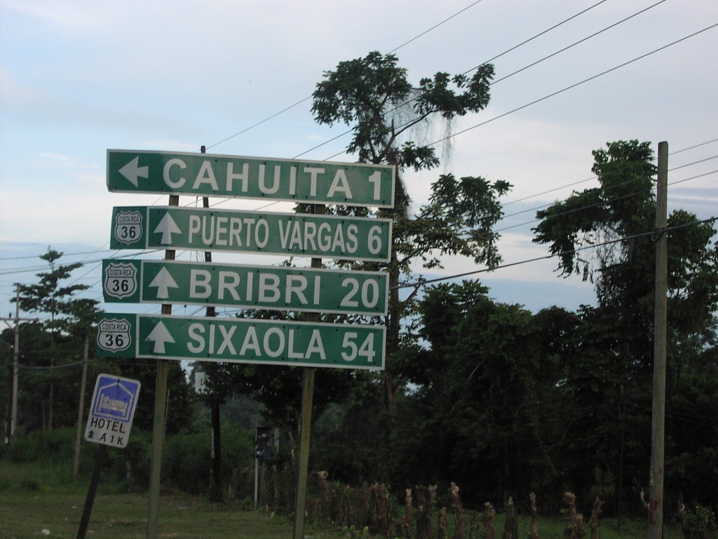
CR-36 South - Chauita Jct.
CR-36 south to Puerto Vargas, Bribri, and Sixaola at Chauita jct.
Taken 09-23-2003
Cahuita
Limón Province
Costa Rica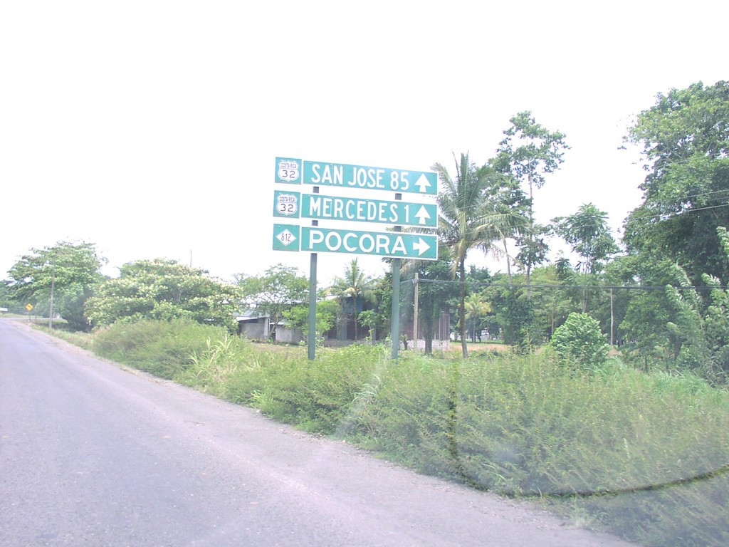
CR-32 West at CR-812
CR-32 west to San Jose at CR-812 north to Pocora
Taken 09-23-2003

 Pocora
Limón Province
Costa Rica
Pocora
Limón Province
Costa Rica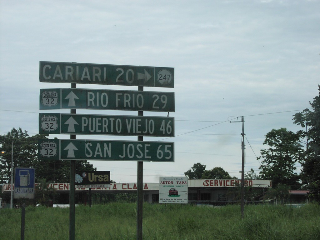
CR-32 West at CR-247
CR-32 west to San Jose, Rio Frio, and Puerto Viejo at CR-247 to Cariari
Taken 09-23-2003
 Guapiles
Pococí
Limón Province
Costa Rica
Guapiles
Pococí
Limón Province
Costa Rica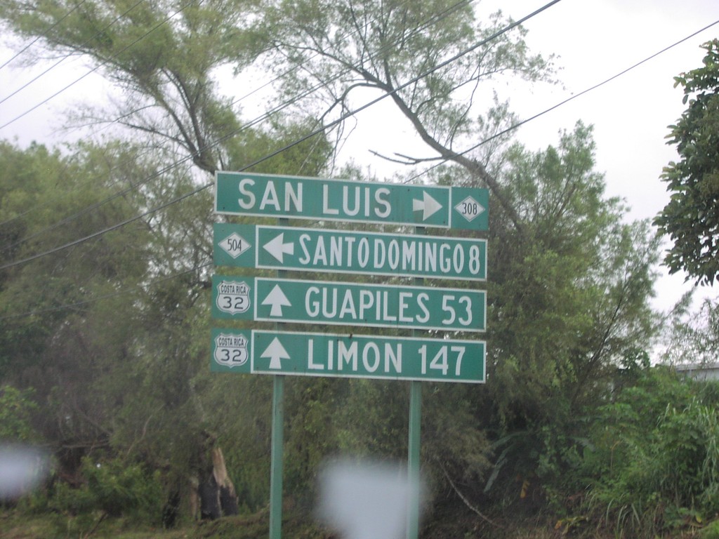
CR-32 North at CR-308/CR-504
CR-32 east to Limon and Guaplies at CR-308/CR-504 junction
Taken 09-23-2003

 Cantón de Santo Domingo
Heredia Province
Costa Rica
Cantón de Santo Domingo
Heredia Province
Costa Rica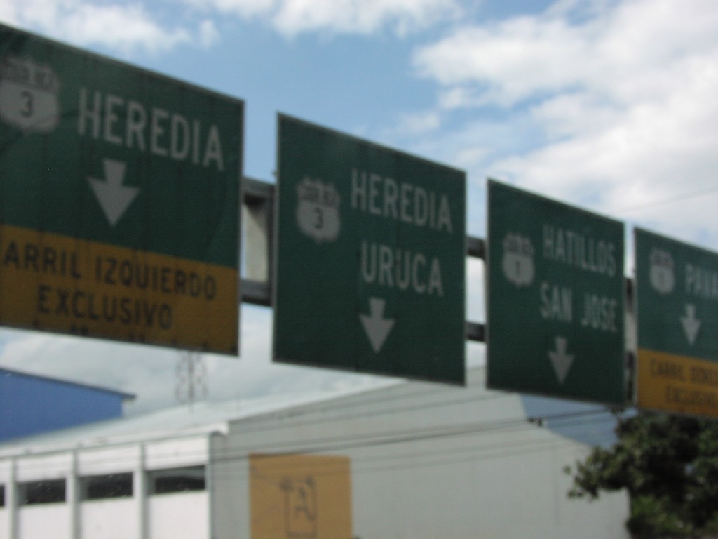
CR-1 South at CR-3
CR-1 south at CR-3 north to Uruca and Heredia
Taken 09-23-2003

 San José
 Province
Costa Rica
San José
San José Province
Costa Rica