Signs Tagged With Big Green Sign
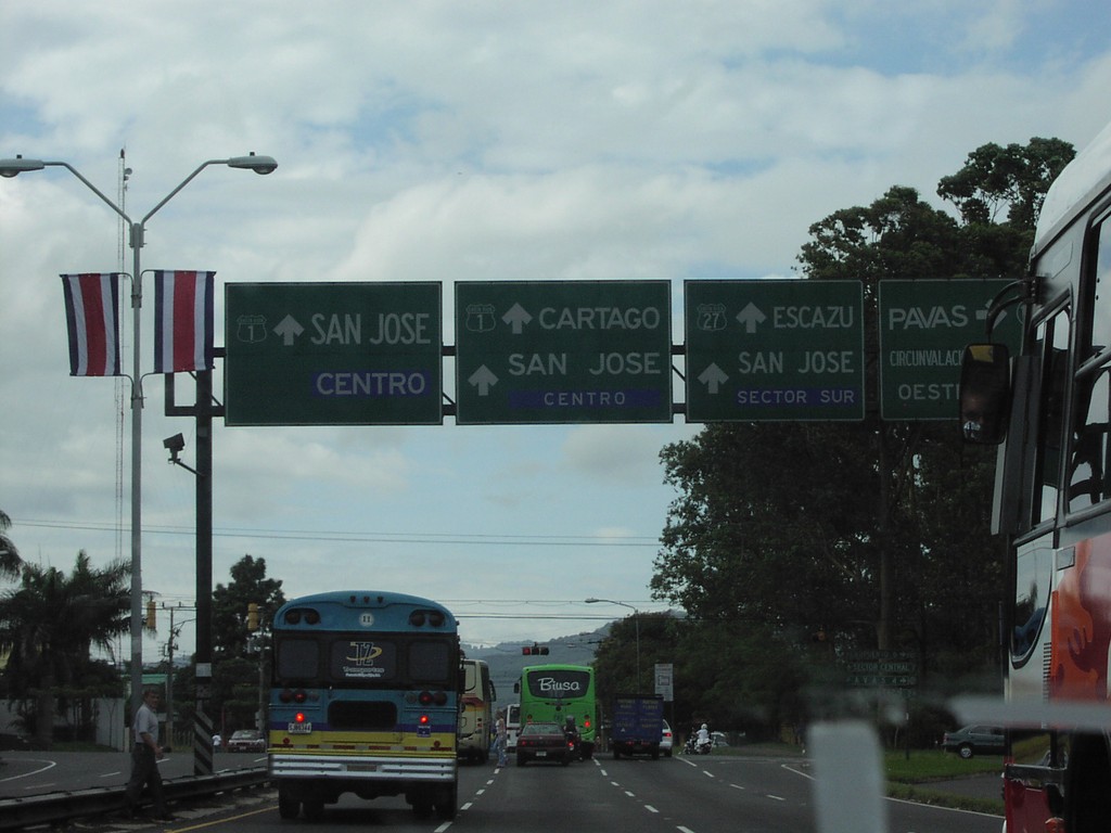
CR-1 South Approaching CR-27
CR-1 south approaching CR-27 to Escazu
Taken 09-23-2003

 San José
 Province
Costa Rica
San José
San José Province
Costa Rica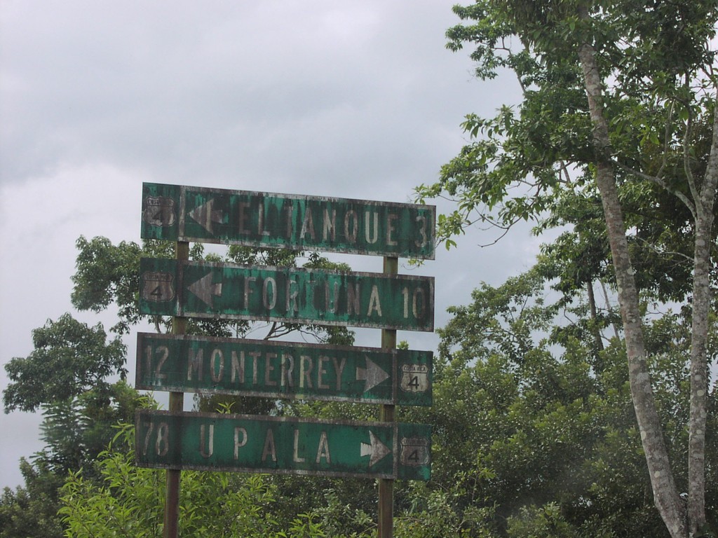
Costa Rica 4/Costa Rica 141 Junction
CR-4/CR-141 junction to Monterrey,Upala,Tanque, and La Fortuna. CR-4 to Tanque is actually CR-141
Taken 09-23-2003

 Mirador
San Carlos
Alajuela Province
Costa Rica
Mirador
San Carlos
Alajuela Province
Costa Rica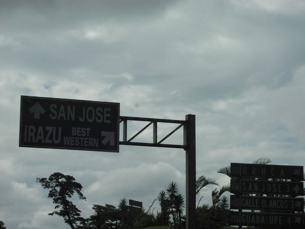
Costa Rica 1 South at Costa Rica 39
Sign to Irazu Best Western, and San Jose
Taken 09-23-2003
 San José
 Province
Costa Rica
San José
San José Province
Costa Rica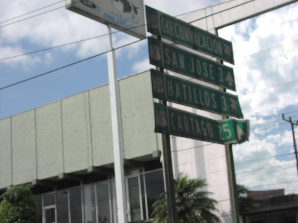
Costa Rica 1 South at Costa Rica 39
CR-1 at northern Circumnavalacion
Taken 09-23-2003
San José
San José Province
Costa Rica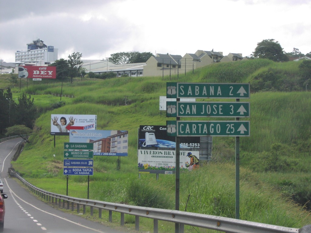
Costa Rica 1 South - Distance Marker
Distance marker on CR-1 south. Distance to Sabana, San Jose, and Cartago.
Taken 09-23-2003
San José
San José Province
Costa Rica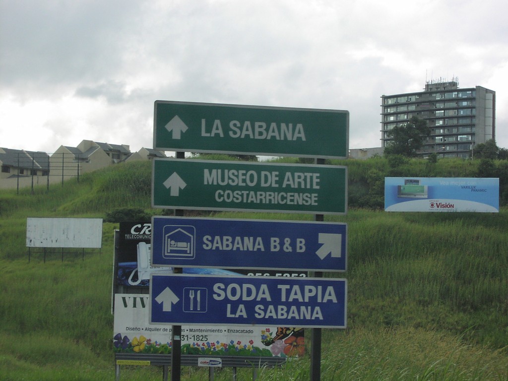
Costa Rica 1 South - Advertisements Approaching San Jose
CR-1 south advertisements.
Taken 09-23-2003
San José
San José Province
Costa Rica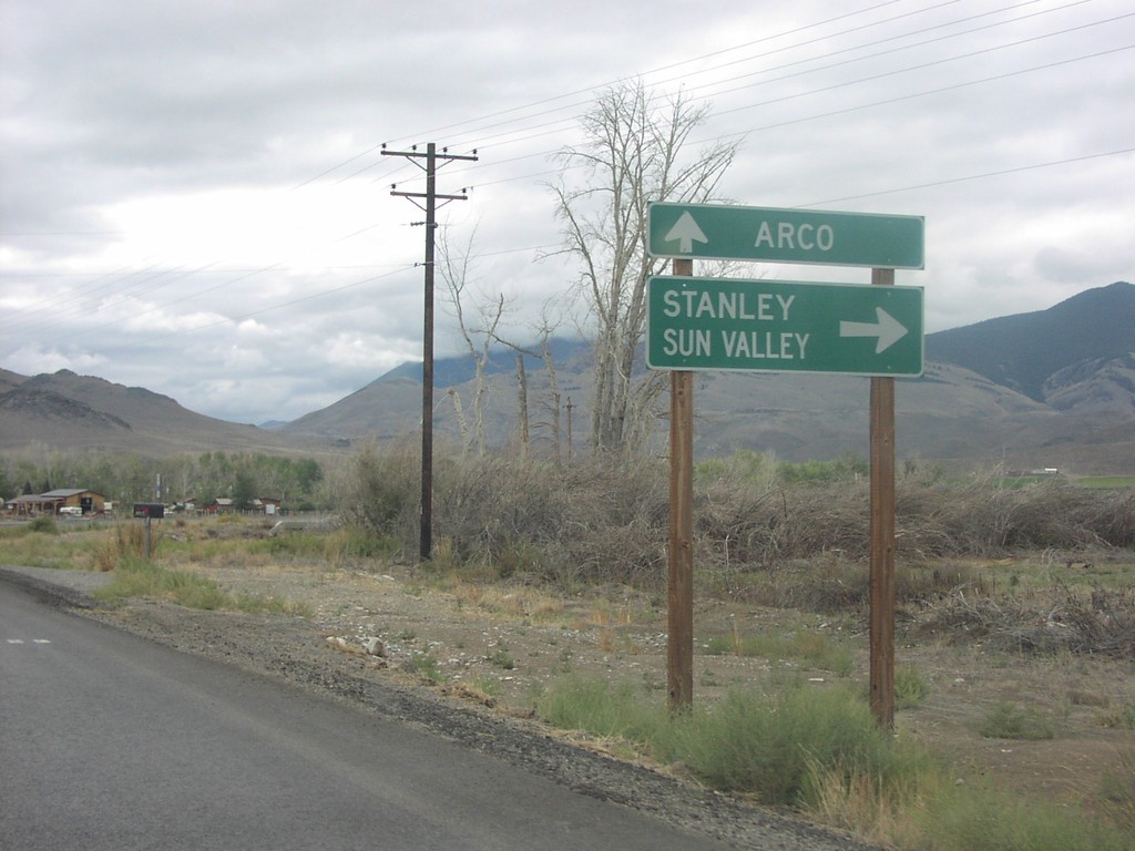
US-93 South at ID-75
Junction ID-75/US-93 To Arco and Stanley on US-93 South
Taken 09-01-2003

 Challis
Custer County
Idaho
United States
Challis
Custer County
Idaho
United States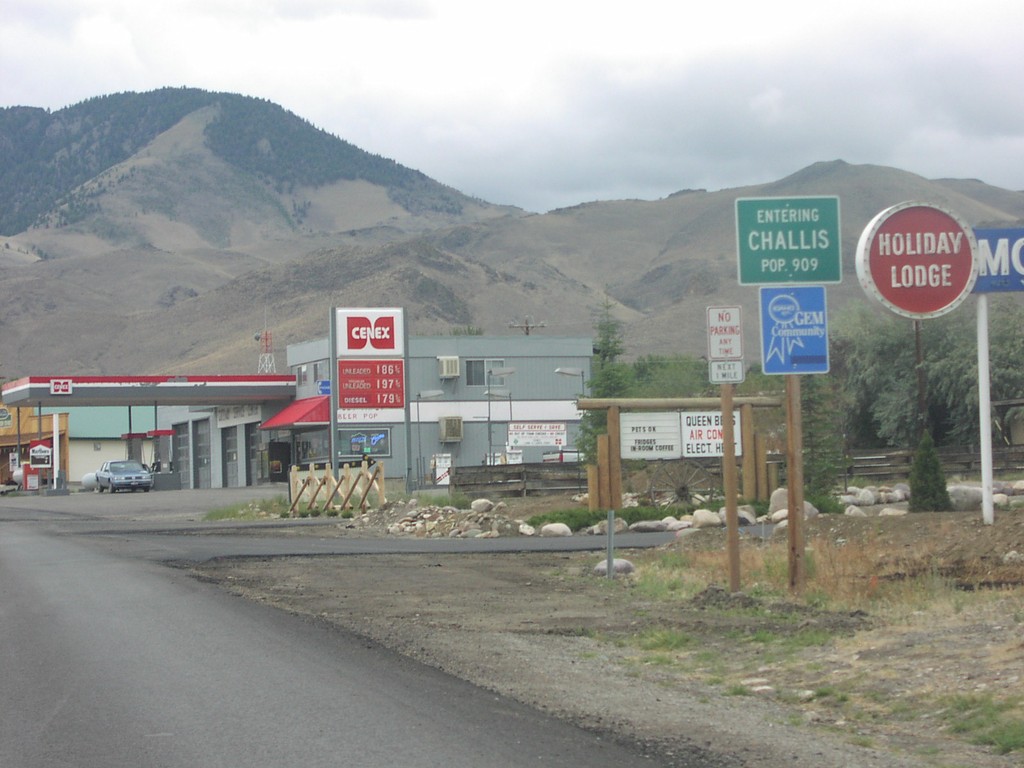
US-93 South - Entering Challis
Entering Challis on US-93 South
Taken 09-01-2003
Challis
Custer County
Idaho
United States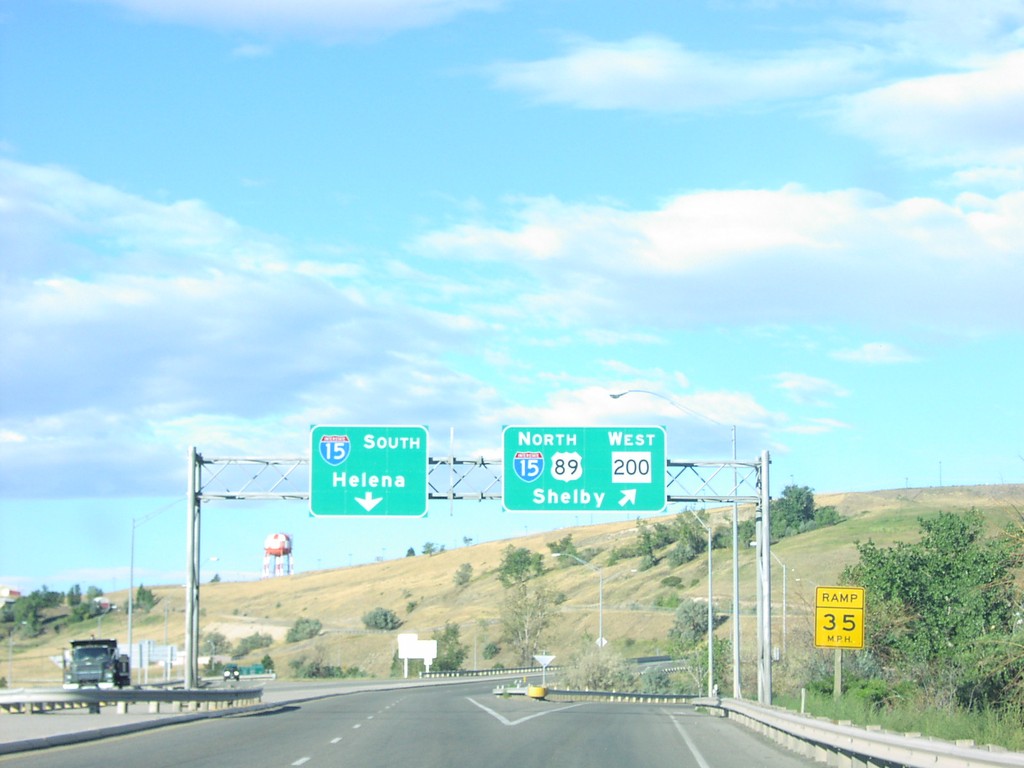
US-89 North/MT-200 West at I-15
I-15/US-89/MT-200 Overhead on US-89 North at I-15 Junction
Taken 09-01-2003


 Great Falls
Cascade County
Montana
United States
Great Falls
Cascade County
Montana
United States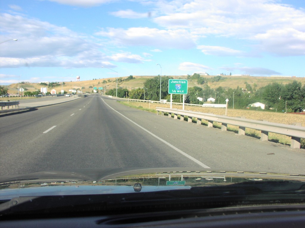
US-89 North/MT-200 East Approaching I-15
US-89 North Appoaching I-15 on 10th Ave. West
Taken 09-01-2003
Great Falls
Cascade County
Montana
United States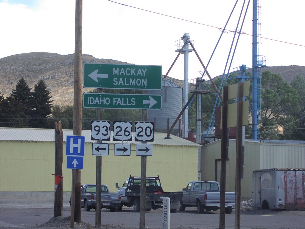
US-20/US-26 East/US-93 North Split
US-20/US-26/US-93 Junction to Mackay and Idaho Falls on US-20 East
Taken 09-01-2003

 Arco
Butte County
Idaho
United States
Arco
Butte County
Idaho
United States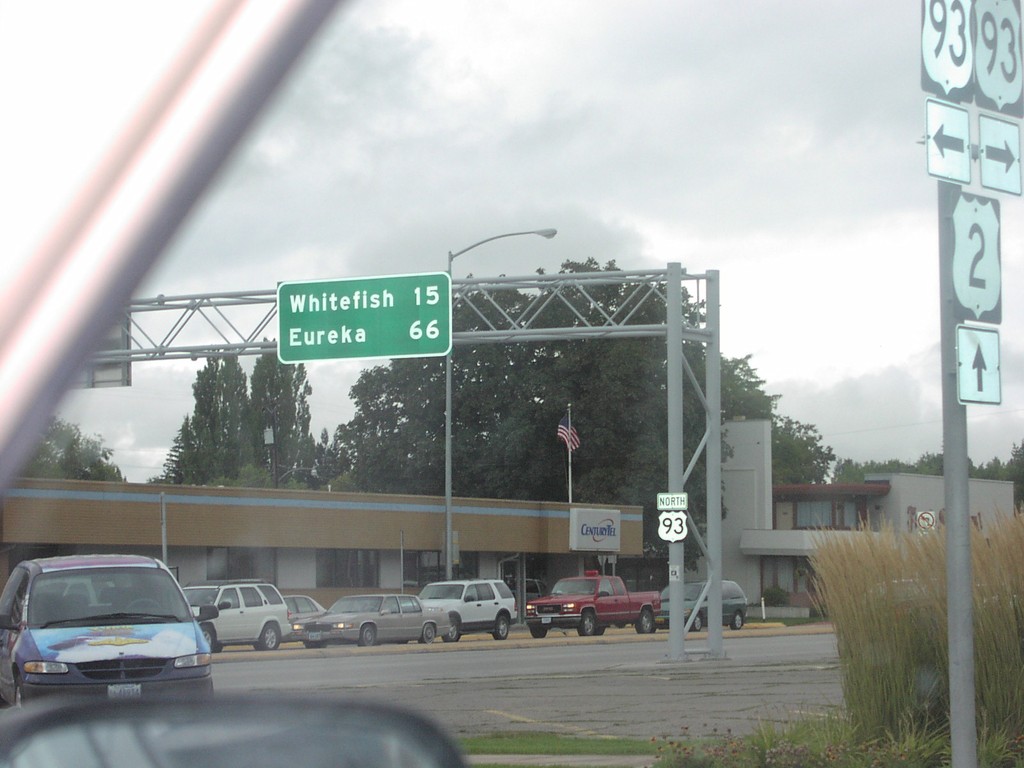
US-2 West at US-93
US-93 North to Whitefish and Eureka at US-93/US-2 Junction
Taken 09-01-2003
 Kalispell
Flathead County
Montana
United States
Kalispell
Flathead County
Montana
United States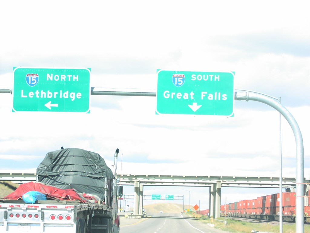
US-2 West at I-15 to Great Falls and Lethbridge
I-15 Overhead to Great Falls and Lethbridge
Taken 09-01-2003
 Shelby
Toole County
Montana
United States
Shelby
Toole County
Montana
United States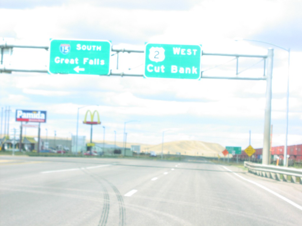
US-2 West at I-15 South to Great Falls
I-15/US-2 Overhead To Great Falls and Cut Bank on US-2 West
Taken 09-01-2003
Shelby
Toole County
Montana
United States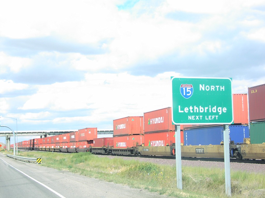
US-2 West at I-15 North to Lethbridge
I-15 North Freeway Entrance on US-2 West
Taken 09-01-2003
Shelby
Toole County
Montana
United States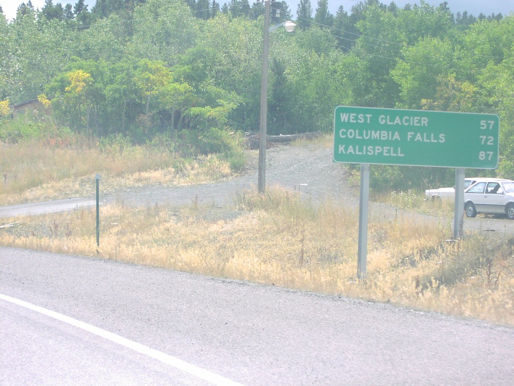
US-2 West - Distance Marker
Distance Marker To Kalispell on US-2 West
Taken 09-01-2003
East Glacier Park
Glacier County
Montana
United States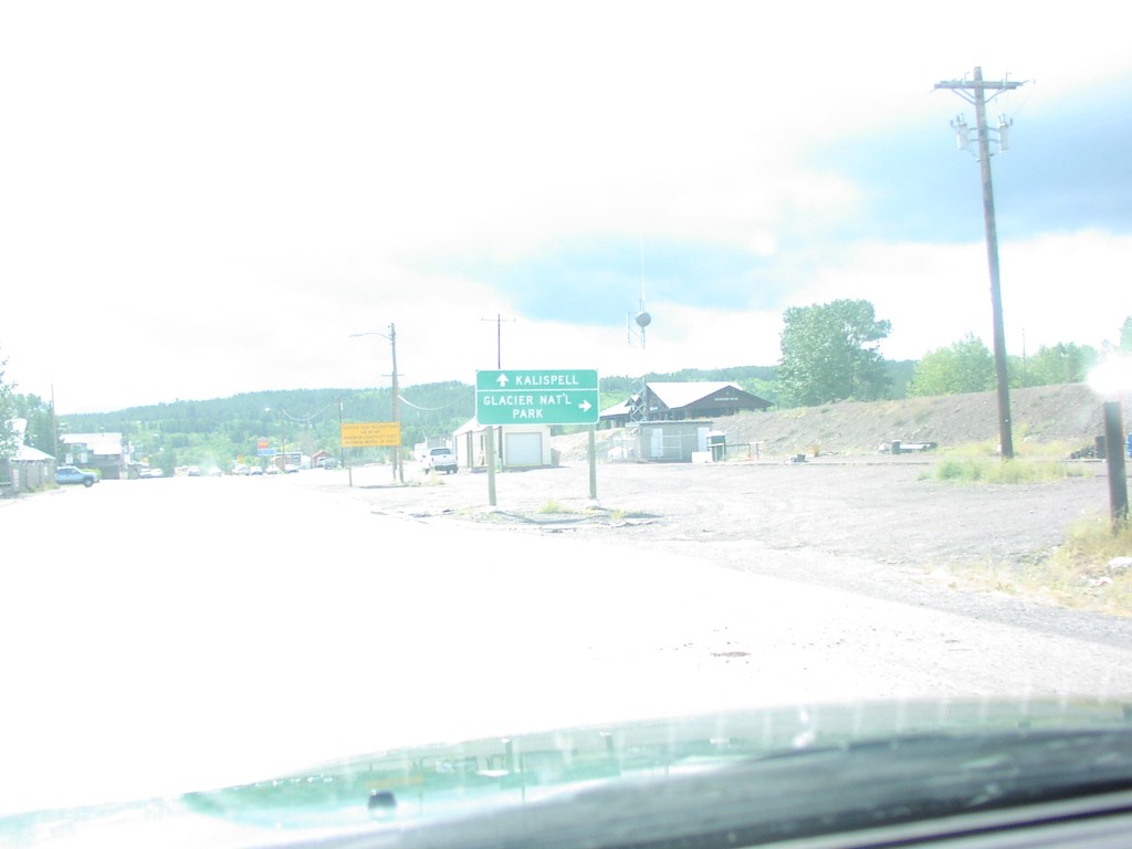
US-2 East at US-89
US-2/US-89 Junction on US-2 East
Taken 09-01-2003
 Browning
Glacier County
Montana
United States
Browning
Glacier County
Montana
United States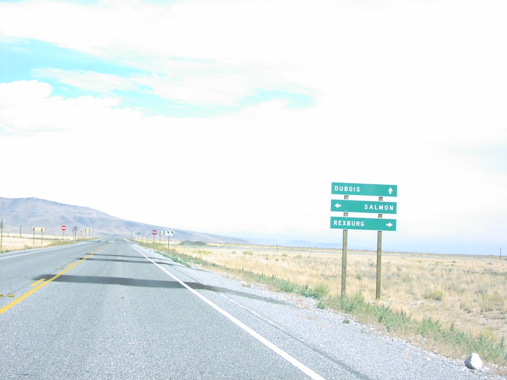
ID-22 North at ID-28
ID-22/ID-28 Junction to Dubois/Salmon/Rexburg on ID-22 East
Taken 09-01-2003

 Monteview
Clark County
Idaho
United States
Monteview
Clark County
Idaho
United States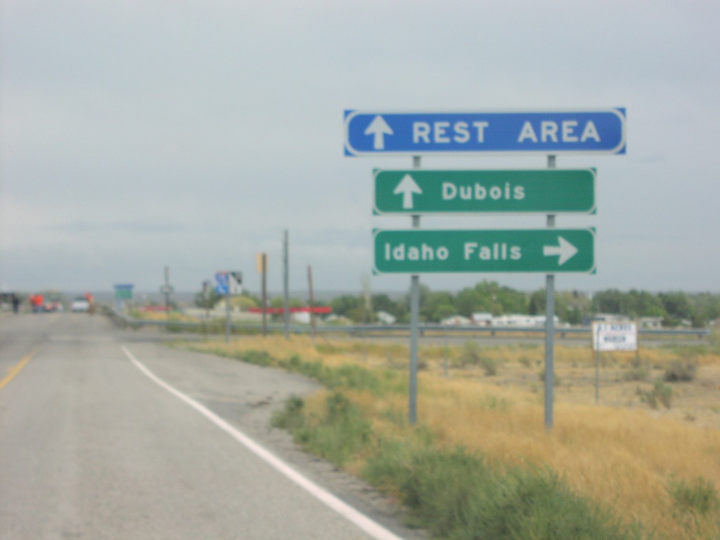
ID-22 North at I-15
Freeway Entrance for I-15 at Eastern Terminus of ID-22 North
Taken 09-01-2003
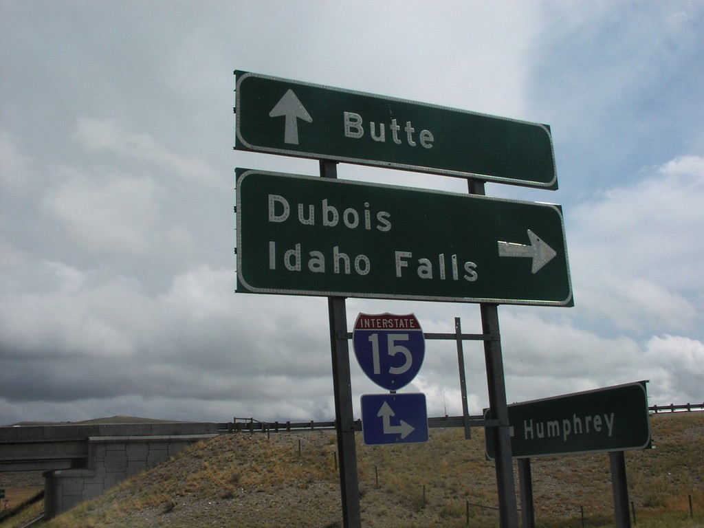
I-15 Onramp Exit 190
I-15 Freeway Entrance To Butte and Dubois at Last Idaho Interchange (Exit 190), Humphrey.
Taken 09-01-2003
Humphrey
Clark County
Idaho
United States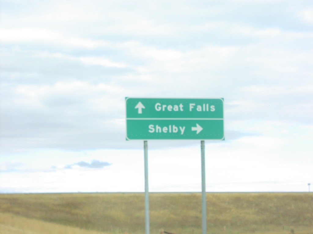
I-15 Onramp at Exit 352
I-15 Freeway Entrance To Great Falls and Shelby
Taken 09-01-2003
Shelby
Toole County
Montana
United States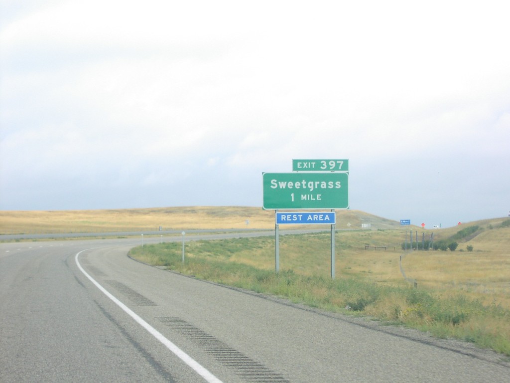
I-15 North Exit 397
Approaching Sweetgrass Exit on I-15 North
Taken 09-01-2003
Sweet Grass
Toole County
Montana
United States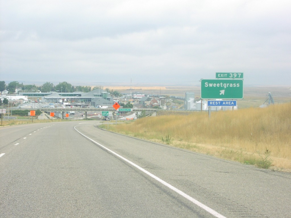
I-15 North Exit 397
Sweetgrass Exit on I-15 North. Last Exit on I-15 North Before Customs Canada
Taken 09-01-2003
Sweet Grass
Toole County
Montana
United States
I-15 North Exit 389
Sunburst Exit on I-15 North
Taken 09-01-2003
 Sunburst
Toole County
Montana
United States
Sunburst
Toole County
Montana
United States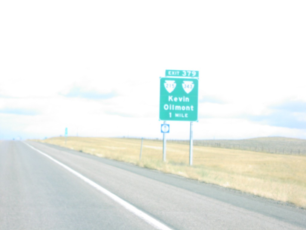
I-15 North Exit 379
Kevin/Oilmont Exit on I-15 North
Taken 09-01-2003

 Oilmont
Toole County
Montana
United States
Oilmont
Toole County
Montana
United States