Signs Tagged With Big Green Sign
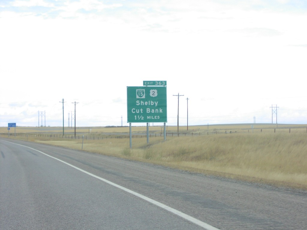
I-15 North Exit 363
US-2/Shelby/Cut Bank Exit on I-15 North
Taken 09-01-2003


 Shelby
Toole County
Montana
United States
Shelby
Toole County
Montana
United States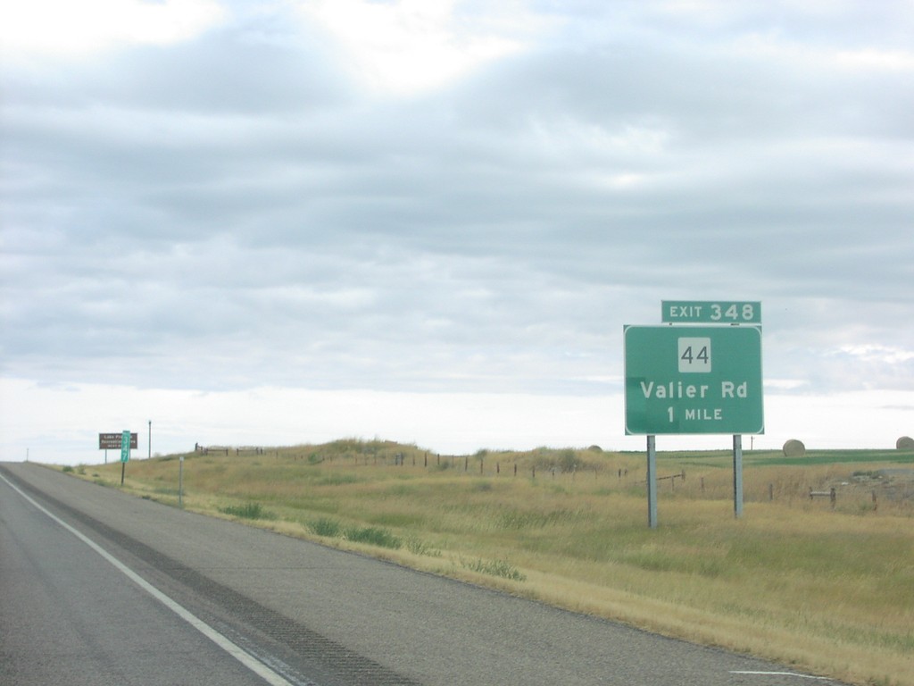
I-15 North Exit 348
MT-44/Valier Road Exit on I-15 North
Taken 09-01-2003
 Ledger
Pondera County
Montana
United States
Ledger
Pondera County
Montana
United States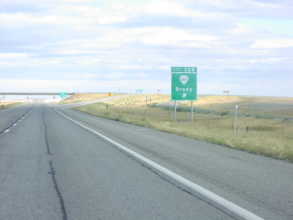
I-15 North Exit 328
MTS-365/Brady Exit on I-15 North
Taken 09-01-2003
 Brady
Pondera County
Montana
United States
Brady
Pondera County
Montana
United States
I-15 North Exit 290
US-89 North/MT-200 East Approaching I-15
Taken 09-01-2003

 Sun Prairie
Cascade County
Montana
United States
Sun Prairie
Cascade County
Montana
United States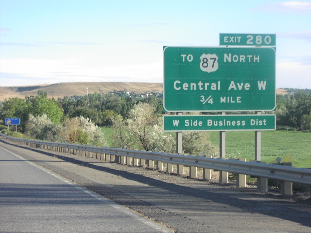
I-15 North Exit 280
To US-87/Central Ave. West Exit on I-15 North
Taken 09-01-2003
 Great Falls
Cascade County
Montana
United States
Great Falls
Cascade County
Montana
United States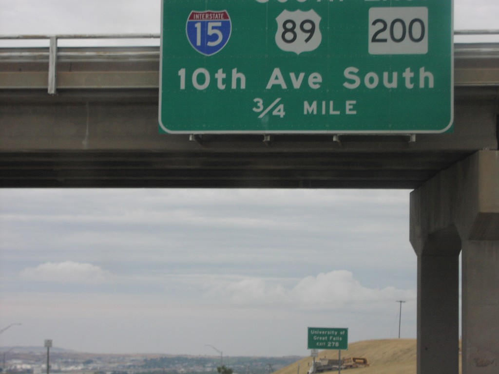
I-15 North Exit 278
BL-15/US-89/MT-200/10th Ave. West Exit on I-15 North
Taken 09-01-2003
Great Falls
Cascade County
Montana
United States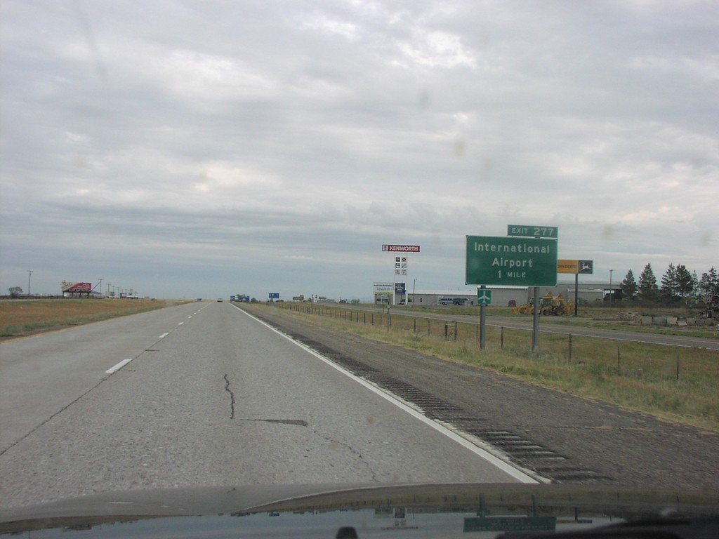
I-15 North Exit 277
International Airport Exit on I-15 North
Taken 09-01-2003
Great Falls
Cascade County
Montana
United States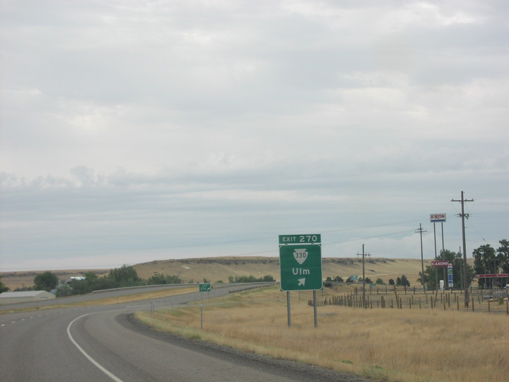
I-15 North Exit 270
MTS-330/Ulm Exit on I-15 North
Taken 09-01-2003
 Great Falls
Cascade County
Montana
United States
Great Falls
Cascade County
Montana
United States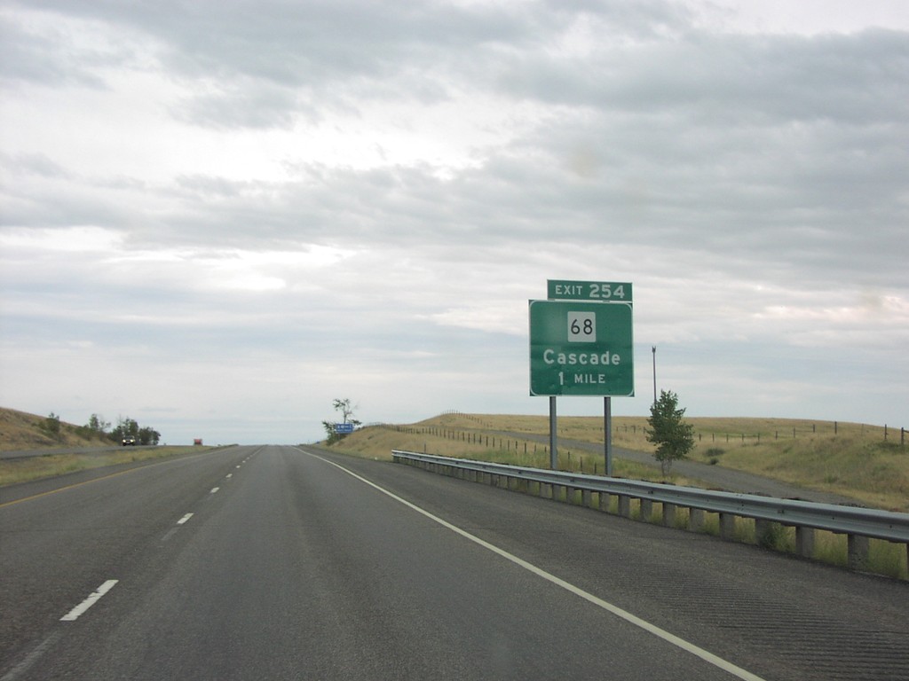
I-15 North Exit 254
MT-68/Cascade Exit on I-15 North
Taken 09-01-2003
 Cascade
 County
Montana
United States
Cascade
Cascade County
Montana
United States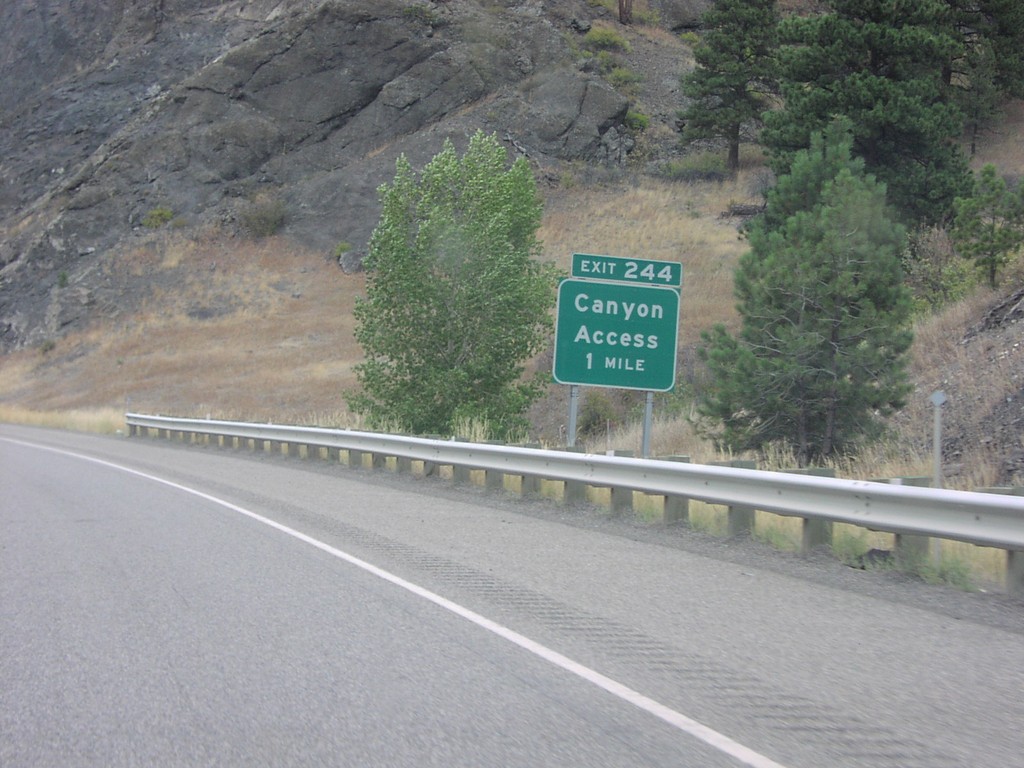
I-15 North Exit 244
Canyon Access Exit on I-15 North
Taken 09-01-2003
Mid Canon
Cascade County
Montana
United States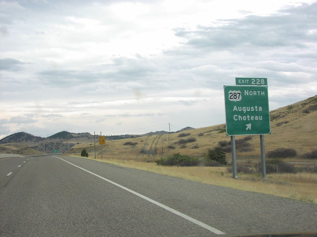
I-15 North Exit 228
US-287/Augusta/Choteau Exit on I-15 North
Taken 09-01-2003
 Wolf Creek
Lewis and Clark County
Montana
United States
Wolf Creek
Lewis and Clark County
Montana
United States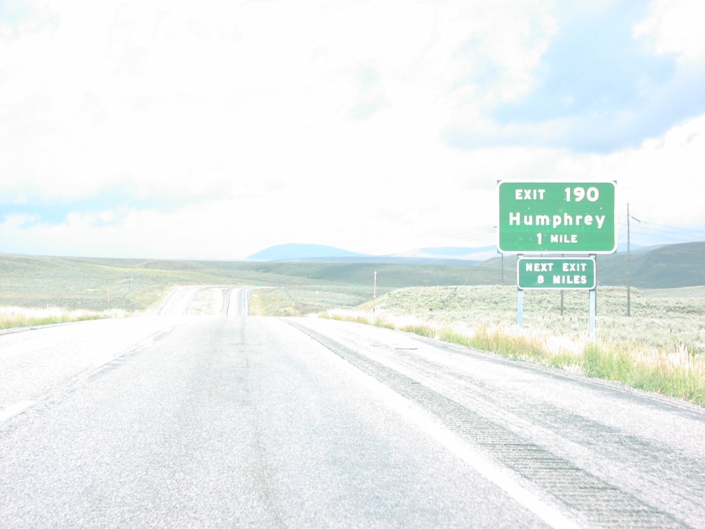
I-15 North Exit 190
Humphrey Exit on I-15 North, Humphrey. Last Idaho exit.
Taken 09-01-2003
Spencer
Clark County
Idaho
United States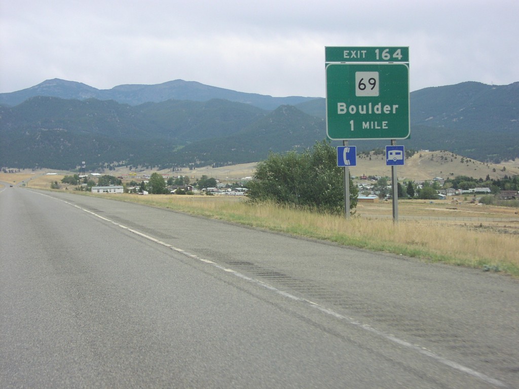
I-15 North Exit 164
MT-69/Boulder Exit on I-15 North
Taken 09-01-2003
 Boulder
Jefferson County
Montana
United States
Boulder
Jefferson County
Montana
United States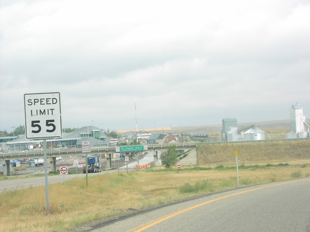
I-15 North at Canada Border
View of US-Canada Border at Northern Terminus of I-15
Taken 09-01-2003
Sweet Grass
Toole County
Montana
United States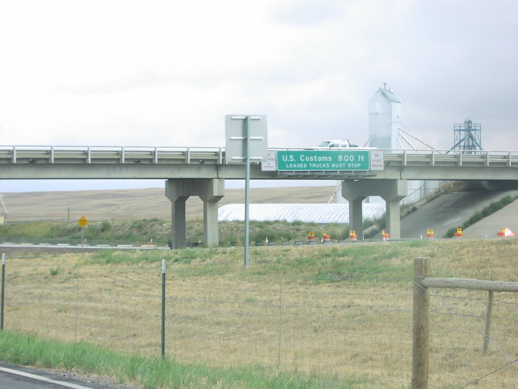
I-15 North Approaching US Customs
US Customs 800 Feet on I-15 North
Taken 09-01-2003
Sweet Grass
Toole County
Montana
United States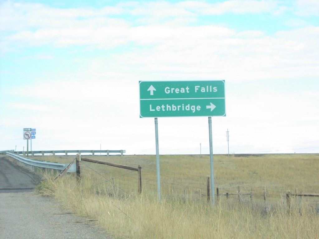
I-15 Exit 369 Onramp
I-15 Freeway Entrance To Great Falls and Lethbridge
Taken 09-01-2003
Shelby
Toole County
Montana
United States
Approaching Northern End of I-15
End of I-15 at the Canadian Border
Taken 09-01-2003
Sweet Grass
Toole County
Montana
United States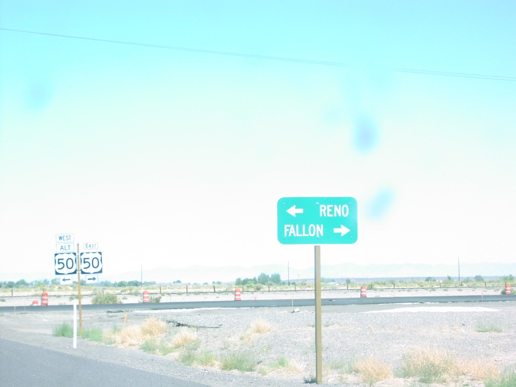
US-50 East Approaching Alt. US-50 West
US-50/US-50 ALT Junction on US-50 East to Reno and Fallon
Taken 08-01-2003

 Fallon
Churchill County
Nevada
United States
Fallon
Churchill County
Nevada
United States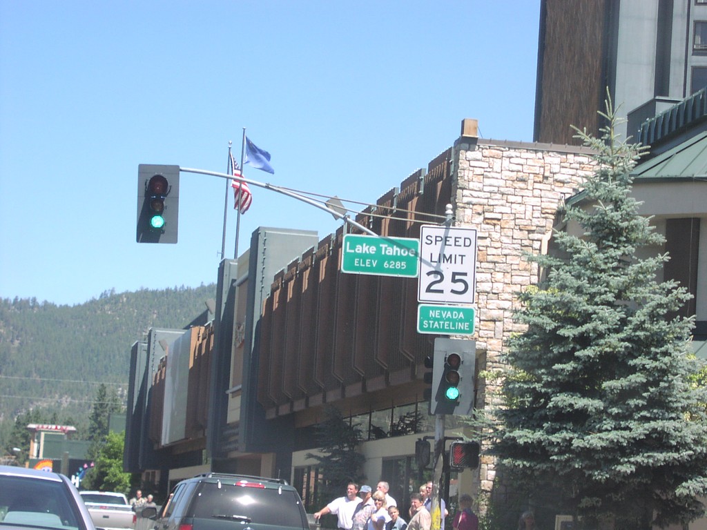
US-50 East - Nevada State Line
US-50 east at the California-Nevada state line.
Taken 08-01-2003
Stateline
Douglas County
Nevada
United States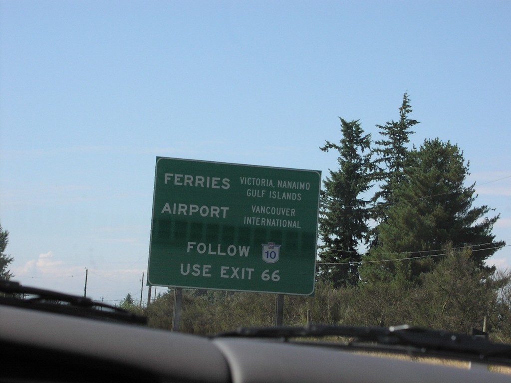
TC-1 West Approaching Exit 66
TC-1 west approaching Exit 66. Use Exit 66 for Vancouver Island Ferries and Vancouver Intl. Airport.
Taken 08-01-2003

 Langley Township
Metro Vancouver
British Columbia
Canada
Langley Township
Metro Vancouver
British Columbia
Canada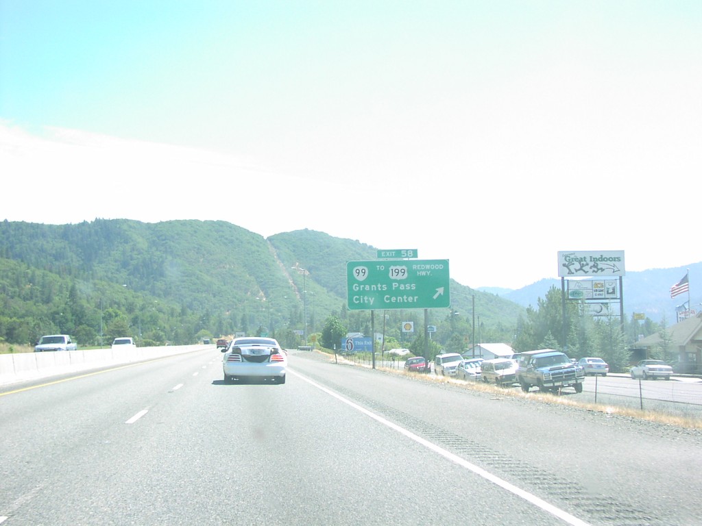
I-5 South - Exit 58
I-5 south at Exit 58 - OR-99/To US-191/Redwood Highway/Grants Pass/City Center.
Taken 08-01-2003


 Grants Pass
Josephine County
Oregon
United States
Grants Pass
Josephine County
Oregon
United States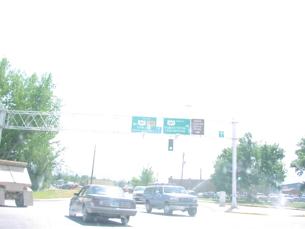
WY-789 South at US-287
US-287/WY-789 Overheads To Rawlins and Yellowstone
Taken 07-01-2003
Lander
Fremont County
Wyoming
United States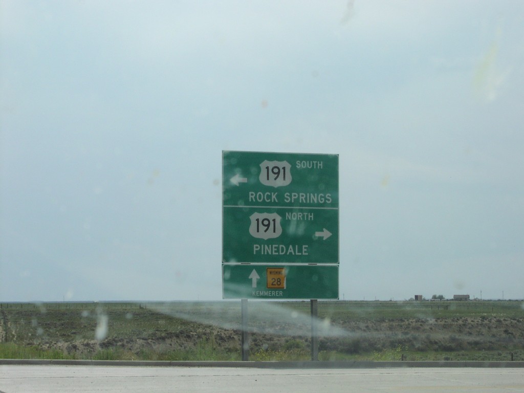
WY-28 West at US-191
US-191 Junction To Rock Springs and Pinedale on WY-28 West
Taken 07-01-2003

 Farson
Sweetwater County
Wyoming
United States
Farson
Sweetwater County
Wyoming
United States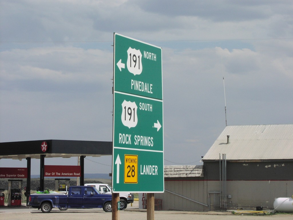
WY-28 West at US-191
US-191 Junction To Rock Springs and Pinedale on WY-28 East
Taken 07-01-2003
Farson
Sweetwater County
Wyoming
United States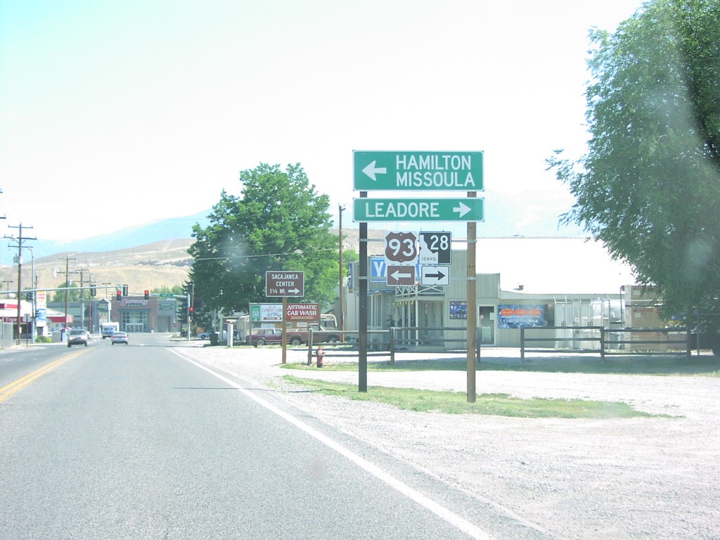
US-93 North at ID-28
US-93/ID-28 Junction To Missoula/Leadore on US-93 North
Taken 07-01-2003

 Salmon
Lemhi County
Idaho
United States
Salmon
Lemhi County
Idaho
United States