Signs Tagged With Big Green Sign
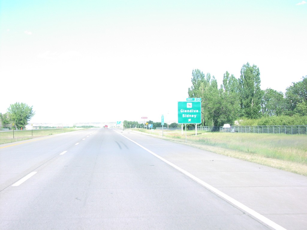
I-94 East Exit 213
MT-16/Glendive/Sidney Exit on I-94 East
Taken 07-01-2003
 Glendive
Dawson County
Montana
United States
Glendive
Dawson County
Montana
United States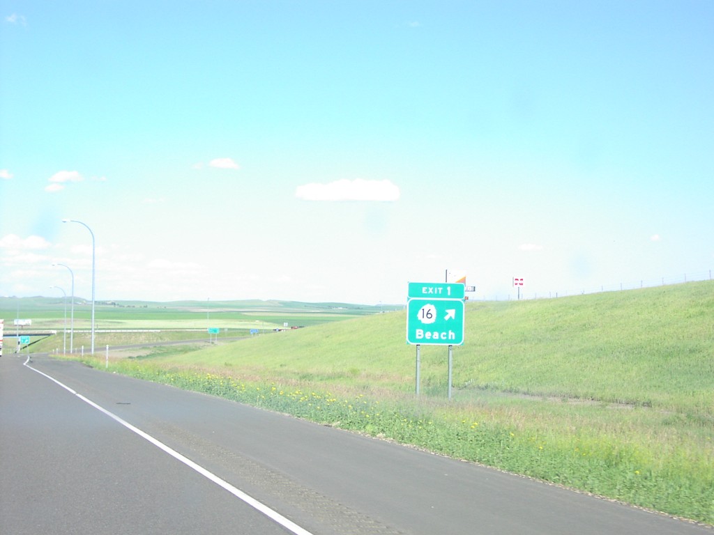
I-94 East Exit 1
ND-16/Beach Exit on I-94 East
Taken 07-01-2003
 Beach
Golden Valley County
North Dakota
United States
Beach
Golden Valley County
North Dakota
United States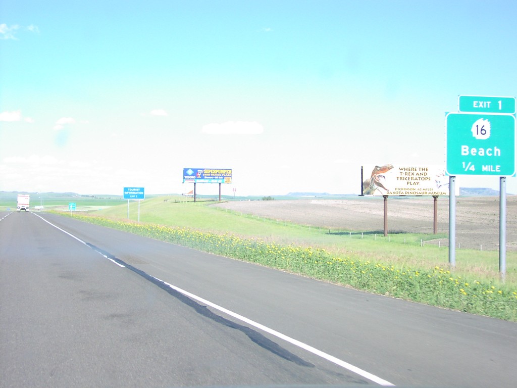
I-94 East Exit 1
Approaching ND-16/Beach Exit on I-94 East
Taken 07-01-2003
Beach
Golden Valley County
North Dakota
United States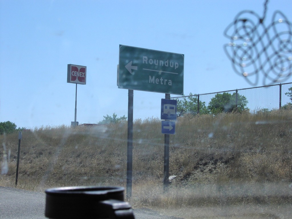
I-90 East Exit 452 Offramp
I-90 Ramp at US-87 North Junction to Roundup and Metra
Taken 07-01-2003
 Billings
Yellowstone County
Montana
United States
Billings
Yellowstone County
Montana
United States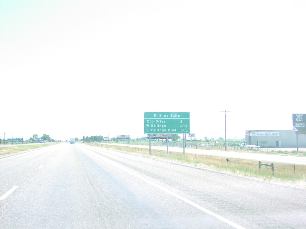
I-90 East - Billings Exits
Exits for Billings on I-90 East
Taken 07-01-2003
 Billings
Yellowstone County
Montana
United States
Billings
Yellowstone County
Montana
United States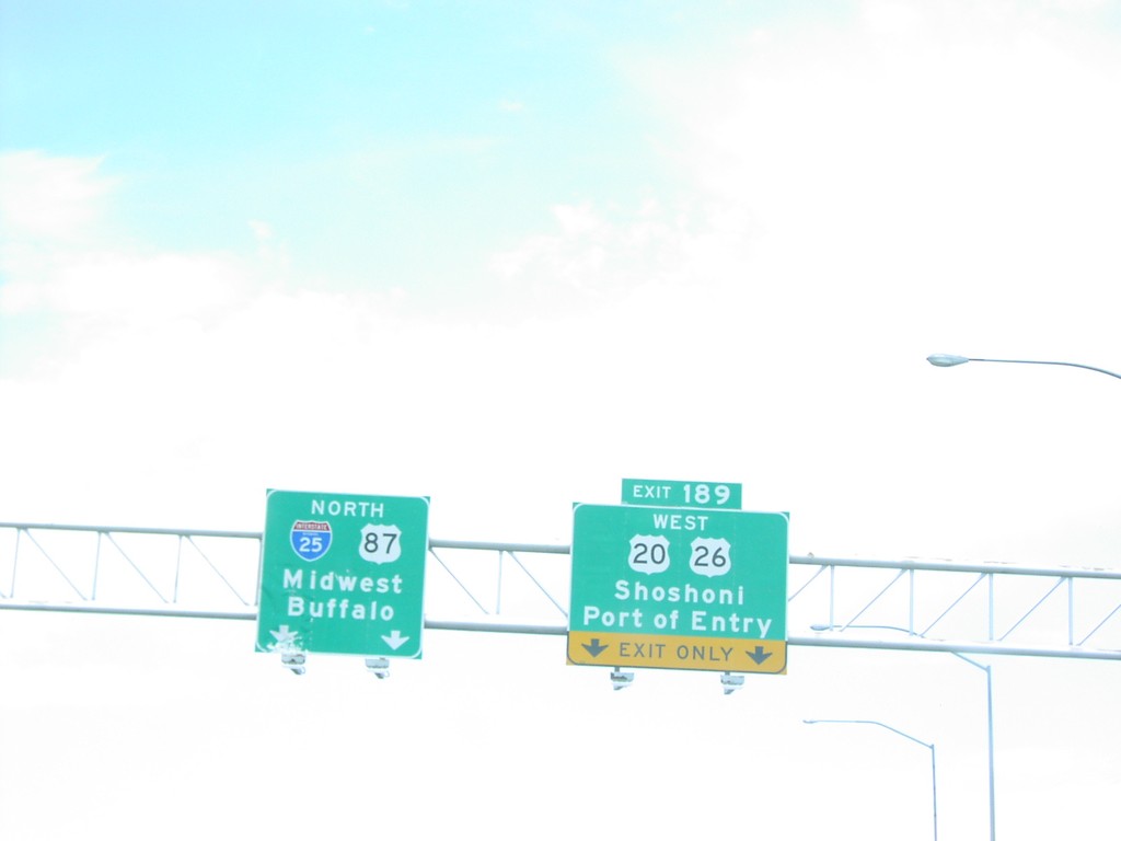
I-25 North Exit 189
US-20/US-26/Shoshoni/Port of Entry Exit on I-25 North
Taken 07-01-2003


 Casper
Natrona County
Wyoming
United States
Casper
Natrona County
Wyoming
United States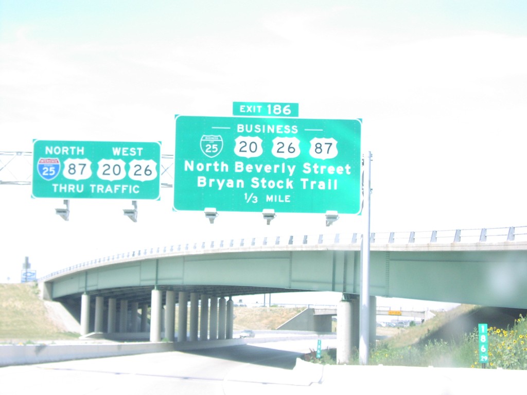
I-25 North Exit 186
BL-25/BL US-20/BL US-26/BL US-87/Beverly St./Bryan Stock Trail Exit on I-25 North
Taken 07-01-2003


 Casper
Natrona County
Wyoming
United States
Casper
Natrona County
Wyoming
United States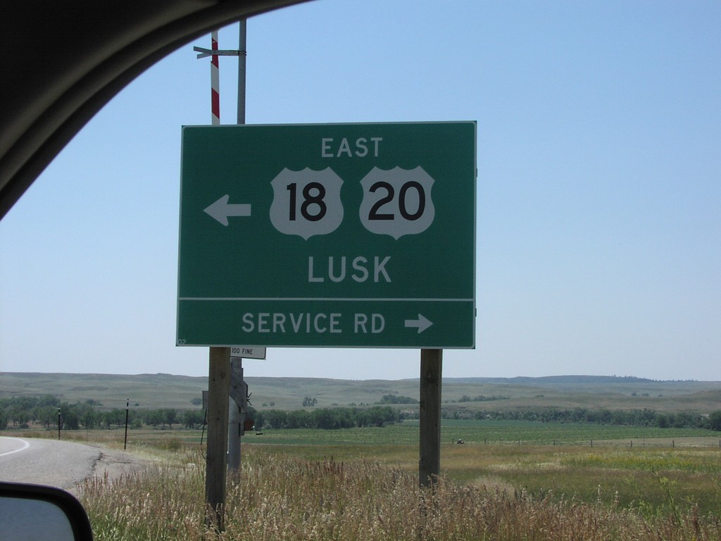
I-25 Exit 126 Offramp at US-20/US-18
US-20/US-18 at I-25 to Lusk
Taken 07-01-2003
 Orin
Converse County
Wyoming
United States
Orin
Converse County
Wyoming
United States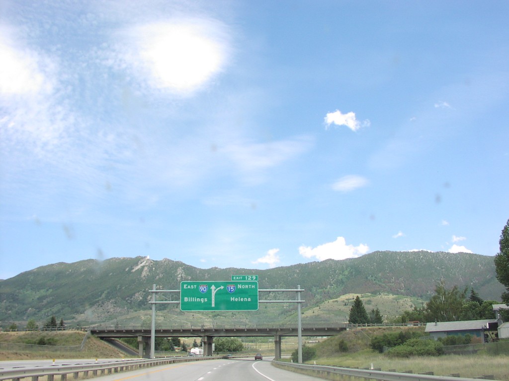
I-15 North Exit 129, I-90 Jct.
Approaching I-90 East at I-15 North Junction To Helena
Taken 07-01-2003
 Butte
Silver Bow County
Montana
United States
Butte
Silver Bow County
Montana
United States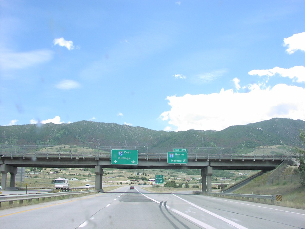
I-15 North Exit 129, I-90 Jct.
I-90 East at I-15 North Junction To Helena
Taken 07-01-2003
Butte
Silver Bow County
Montana
United States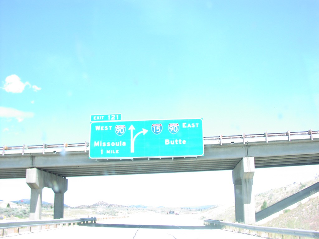
I-15 North Exit 121, I-90 Jct.
I-15 North at I-15/I-90 Junction To Butte and Missoula, Silver Bow County
Taken 07-01-2003
Butte
Silver Bow County
Montana
United States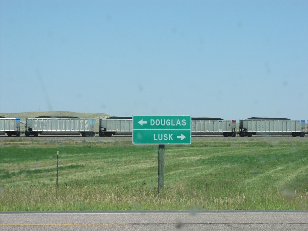
End WY-319 at US-18/US-20
Terminus of WY-319 on US-18/US-20
Taken 07-01-2003
Orin
Converse County
Wyoming
United States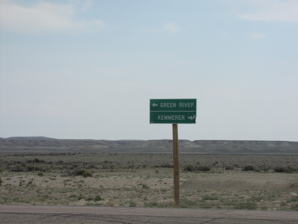
End WY-28 at WY-372
Directional Marker at End WY-28 at WY-372
Taken 07-01-2003

 Green River
Sweetwater County
Wyoming
United States
Green River
Sweetwater County
Wyoming
United States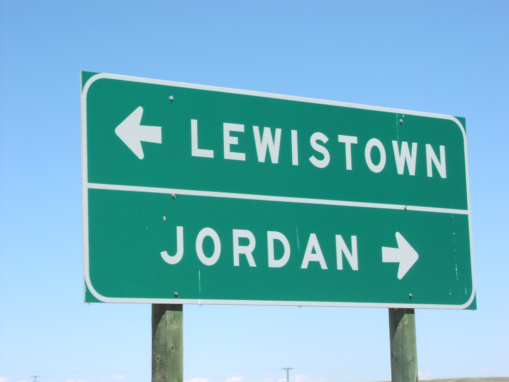
End MTS-244 North at MT-200
MT-200/MTS-244 Junction to Lewistown and Jordan, MTS-244 Terminus
Taken 07-01-2003

 Winnett
Petroleum County
Montana
United States
Winnett
Petroleum County
Montana
United States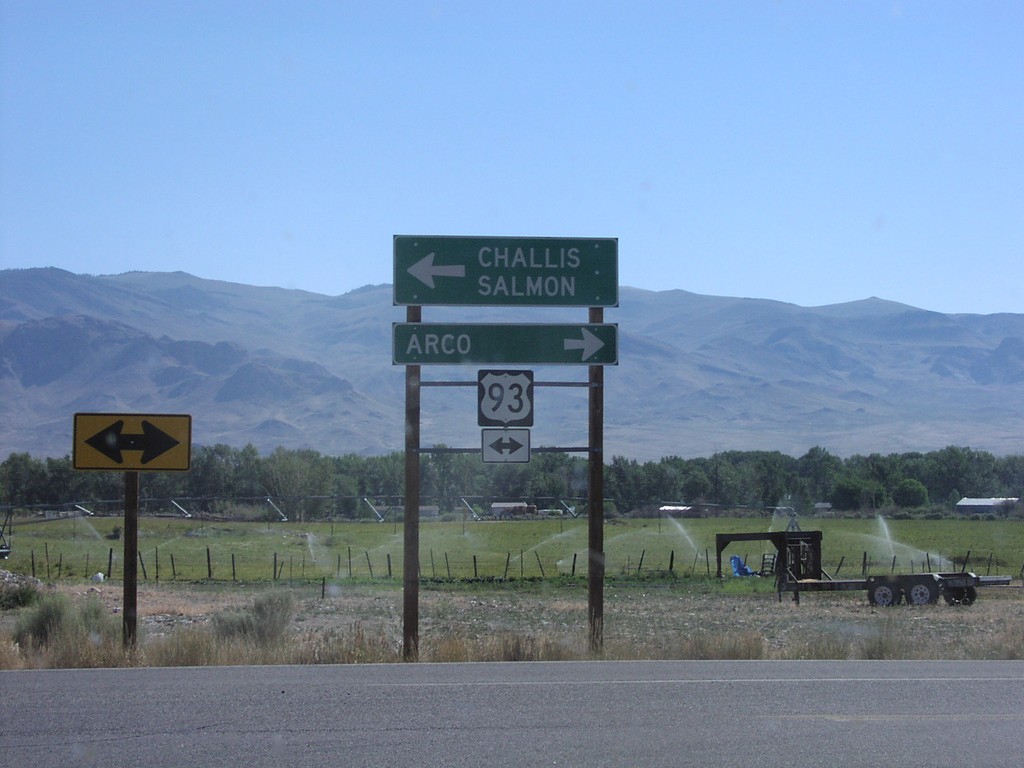
End ID-75 North at US-93
End ID-75 at US-93 to Arco and Salmon
Taken 07-01-2003

 Challis
Custer County
Idaho
United States
Challis
Custer County
Idaho
United States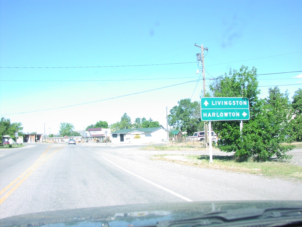
BL-90 West at US-191
Directional Sign at US-191 Juntion on BL-90 West
Taken 07-01-2003

 Big Timber
Sweet Grass County
Montana
United States
Big Timber
Sweet Grass County
Montana
United States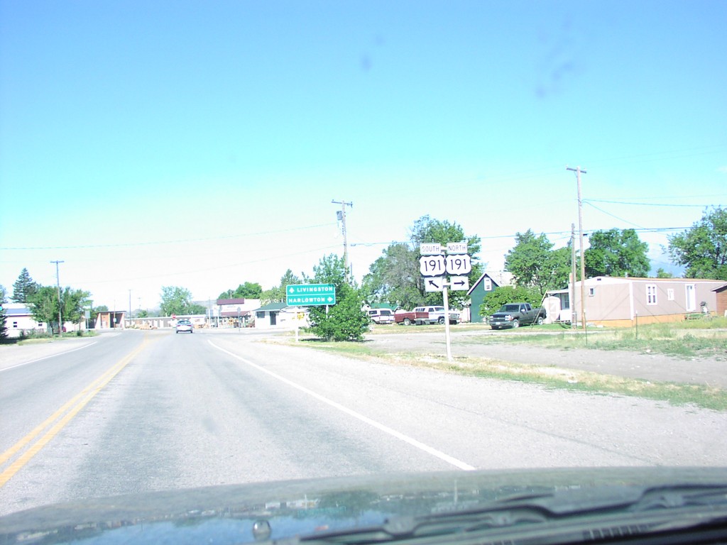
BL-90 West at US-191
US-191 at BL-90 West
Taken 07-01-2003
Big Timber
Sweet Grass County
Montana
United States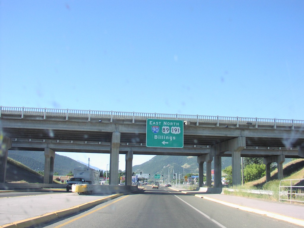
BL-90 West at I-90/US-89/US-191 Jct.
US-89 at I-90/US-191 Junction To Butte
Taken 07-01-2003
Livingston
Park County
Montana
United States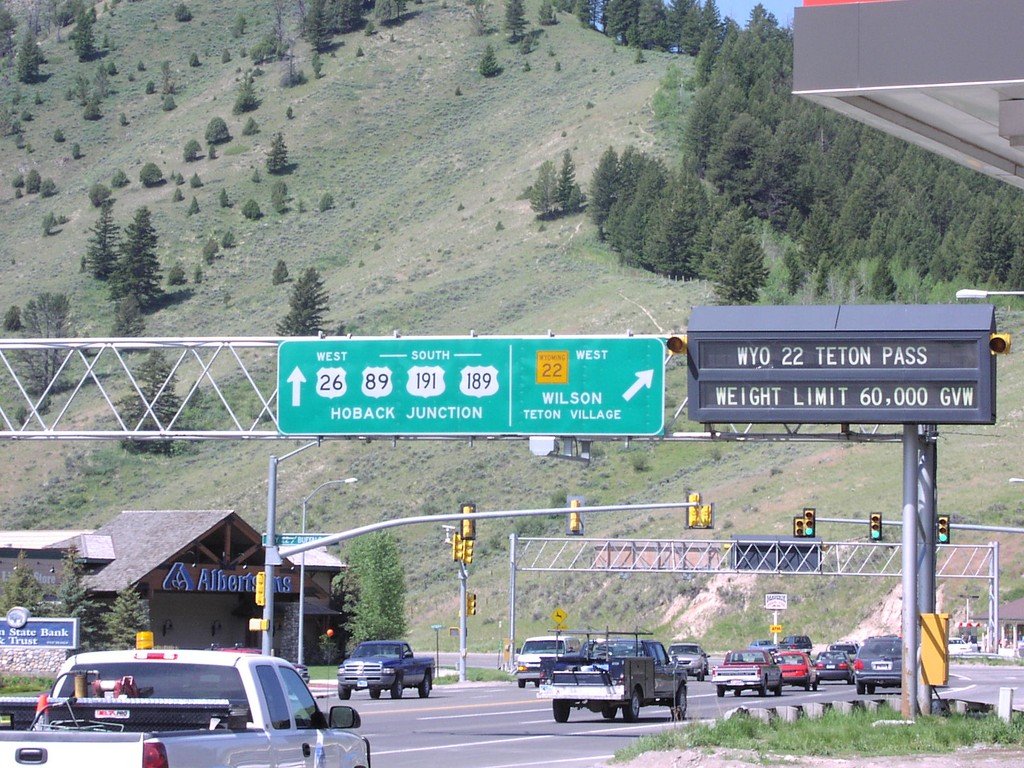
US-89/US-191/US-26/US-189 South At WY-22
US-89/US-191/US-26/US-189 South At WY-22 West to Wilson and Teton Village. Continue on US-89/US-191/US-189 South/US-26 West to Hoback Junction.
Taken 05-01-2003


 Jackson
Teton County
Wyoming
United States
Jackson
Teton County
Wyoming
United States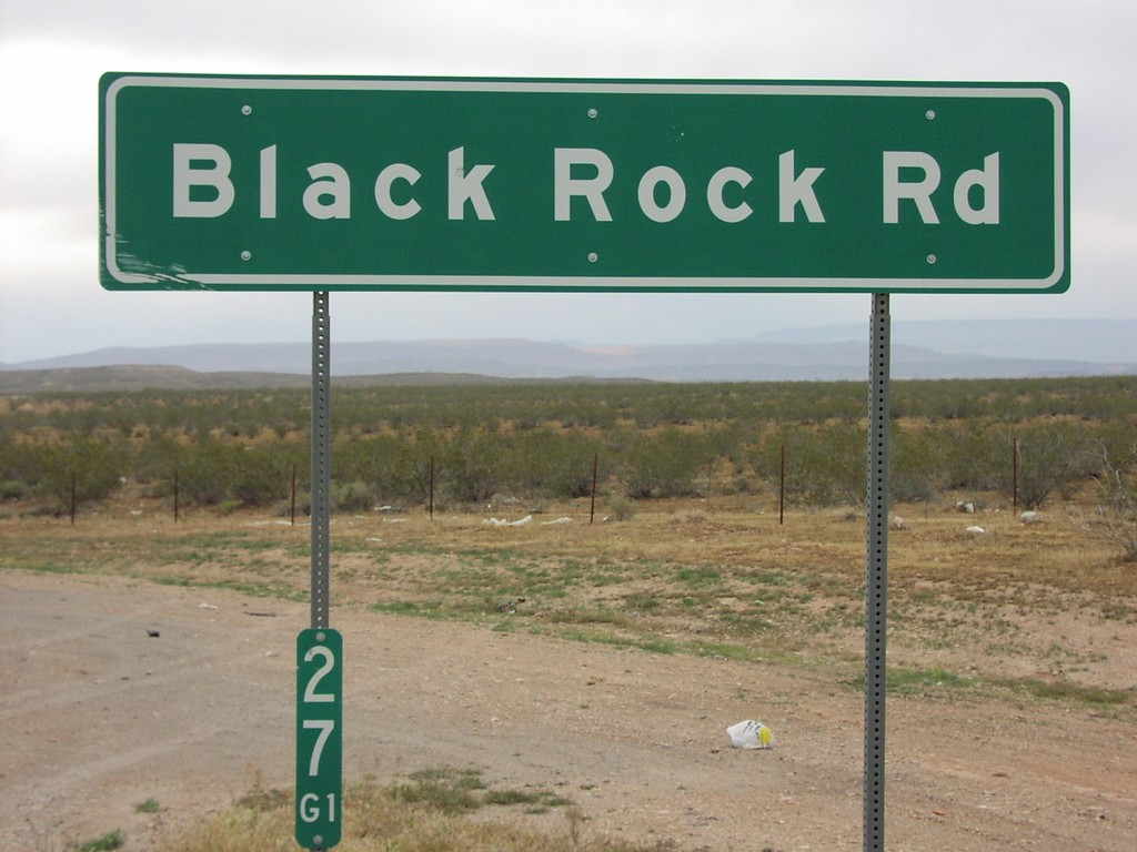
I-15 Exit 27 Interchange
I-15 Exit 27 offramp at Black Rock Road.
Taken 05-01-2003
Littlefield
Mohave County
Arizona
United States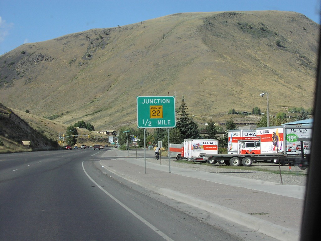
US-89/US-191/US-26/US-189 North Approaching WY-22
US-26 East/US-89/US-191/US-189 North approaching WY-22 in Jackson.
Taken 08-01-2002
Jackson
Teton County
Wyoming
United States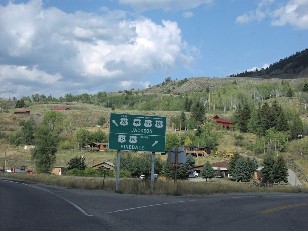
US-89 North/US-26 East at US-189/US-191 - Hoback Jct.
US-89 North/US-26 East at US-189/US-191 - Hoback Junction. Use US-189/US-191 South to Pinedale. Use US-89/US-189/US-191 North/US-26 East to Jackson. This intersection was replaced with a roundabout in 2014.
Taken 08-01-2002
Jackson
Teton County
Wyoming
United States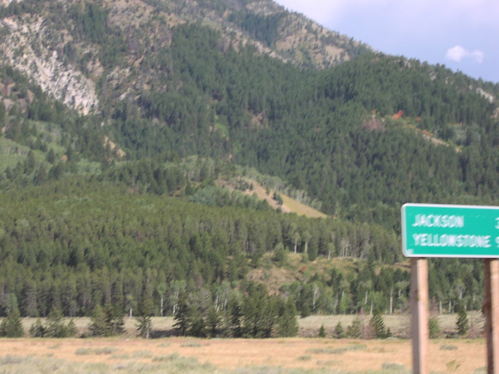
US-89 North/US-26 East - Distance Marker
Distance marker on US-89 North/US-26 East. Distance to Jackson and Yellowstone.
Taken 08-01-2002
Alpine
Lincoln County
Wyoming
United States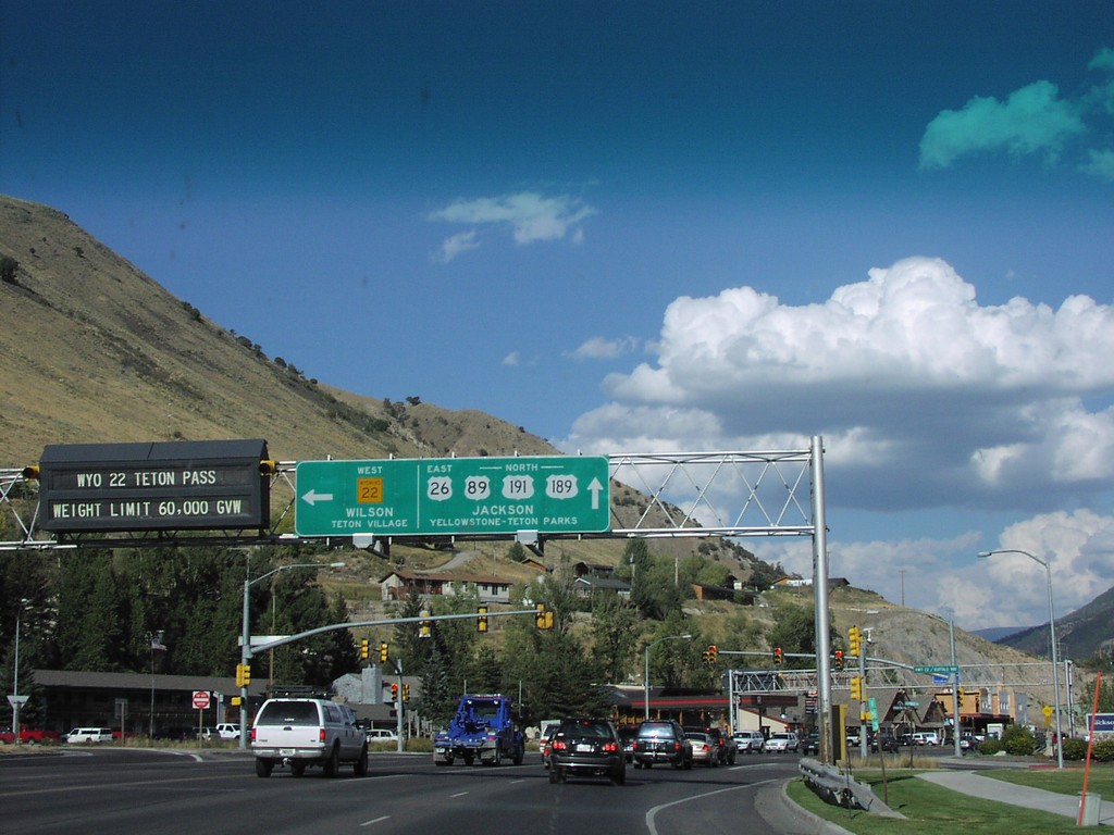
US-26/US-89/US-191/US-189 at WY-22
US-26 East/US-89/US-191/US-189 North at WY-22 West to Wilson and Teton Village. Continue on US-26 East/US-89/US-191/US-189 North to Jackson, Teton National Park, and Yellowstone National Park.
Taken 08-01-2002
Jackson
Teton County
Wyoming
United States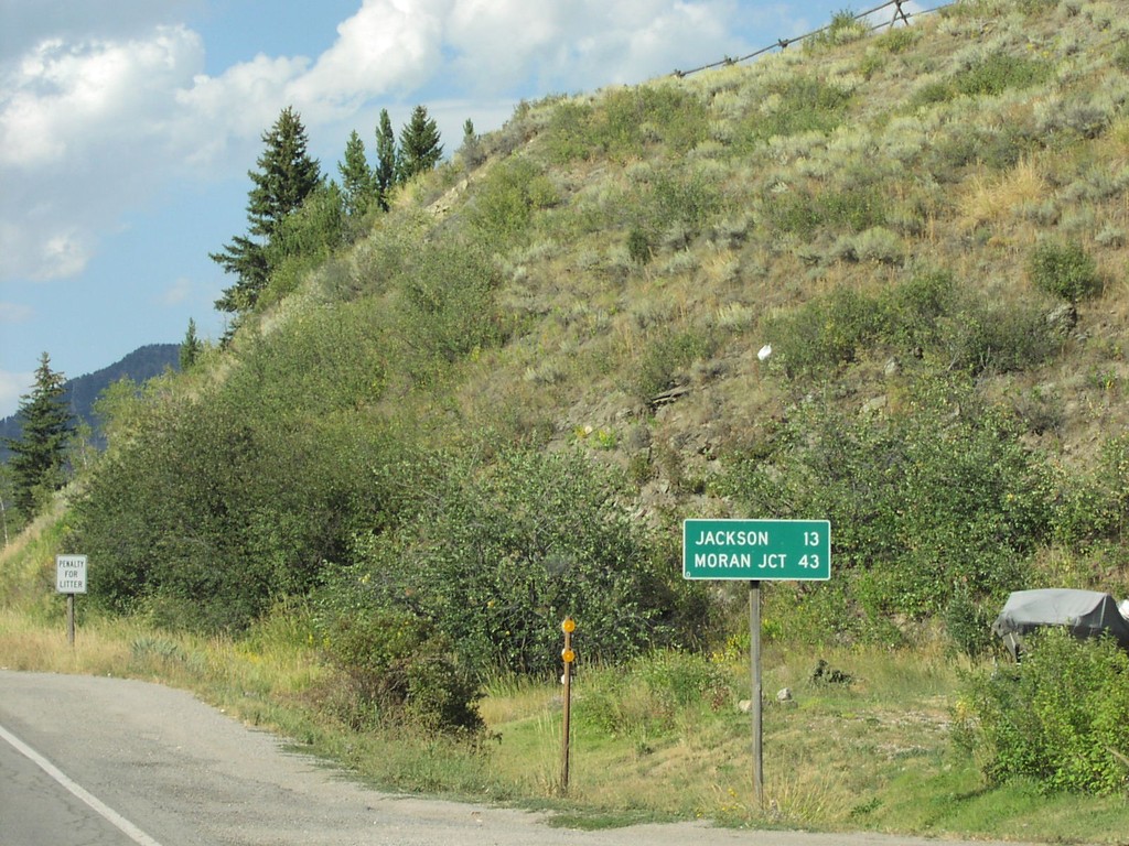
US-26 East/US-89/US-189/US-191 North - Distance Marker
Distance Marker on US-26 East/US-89/US-189/US-191 North. Distance to Jackson and Moran Junction.
Taken 08-01-2002
Hoback
Teton County
Wyoming
United States