Signs Tagged With Big Green Sign
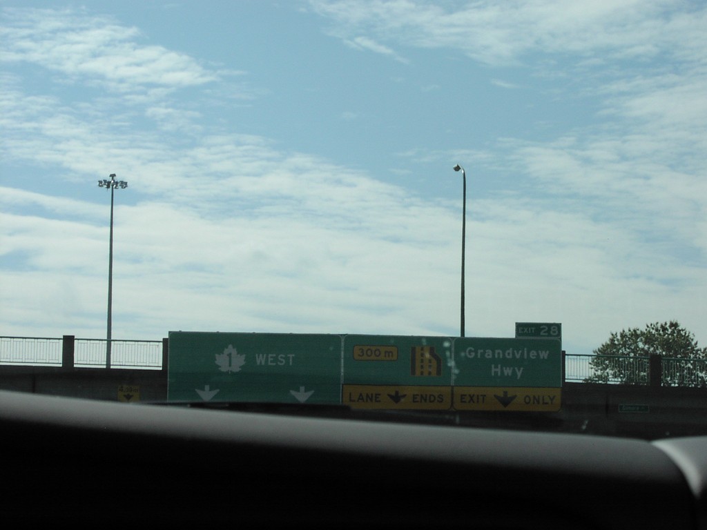
TC-1 West - Exit 28
TC-1 West at Exit 28, Grandview Highway.
Taken 08-01-2002
 Burnaby
Metro Vancouver
British Columbia
Canada
Burnaby
Metro Vancouver
British Columbia
Canada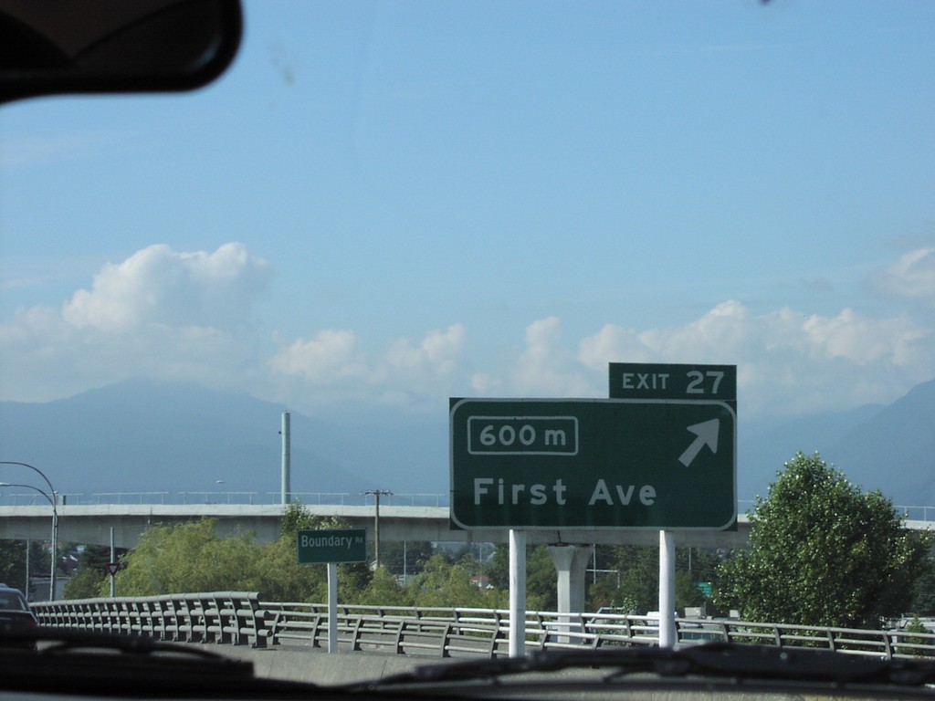
TC-1 West - Exit 27
TC-1 West at Exit 27, First Ave.
Taken 08-01-2002
Burnaby
Metro Vancouver
British Columbia
Canada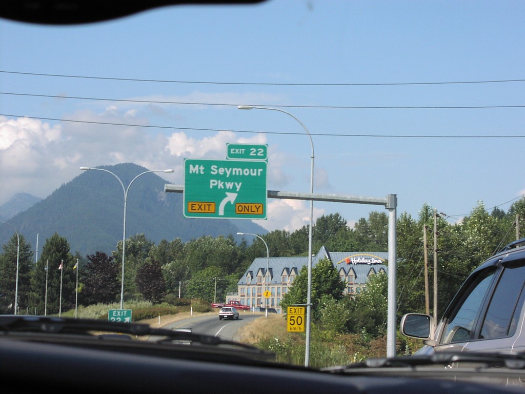
TC-1 West - Exit 22
TC-1 West at Exit 22, Mount Seymour Parkway.
Taken 08-01-2002
North Vancouver
Metro Vancouver
British Columbia
Canada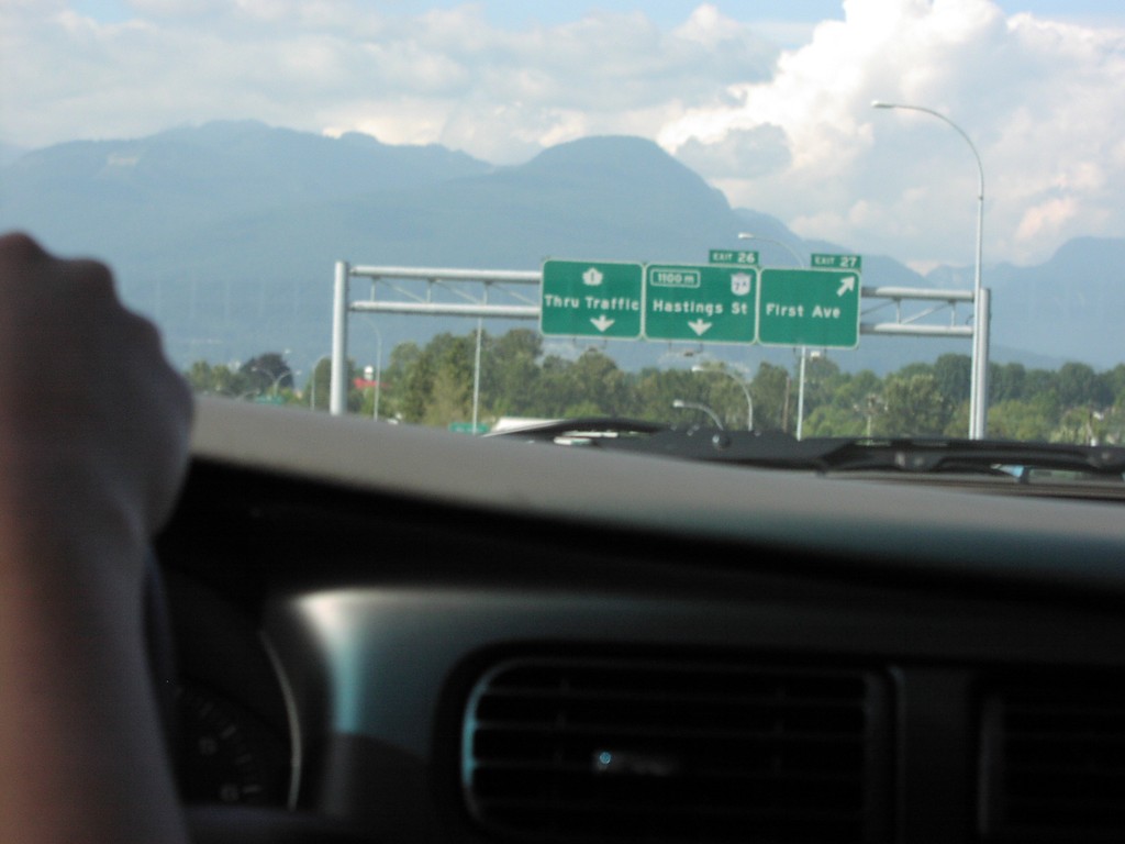
TC-1 East - Exits 25 and 26
TC-1 West at Exit 25 and Exit 26.
Taken 08-01-2002
 Vancouver
Metro Vancouver
British Columbia
Canada
Vancouver
Metro Vancouver
British Columbia
Canada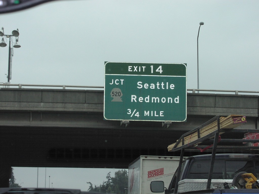
I-405 North - Exit 14
I-405 North approaching Exit 14 - WA-520/Redmond/Seattle.
Taken 08-01-2002

 Bellevue
King County
Washington
United States
Bellevue
King County
Washington
United States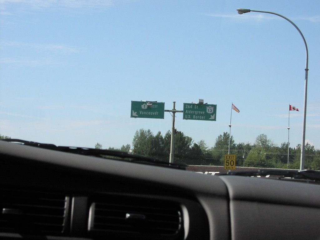
BC-13 North at TC-1
BC-13/TC-1 Junction on BC-13 North
Taken 08-01-2002
 Langley Township
Metro Vancouver
British Columbia
Canada
Langley Township
Metro Vancouver
British Columbia
Canada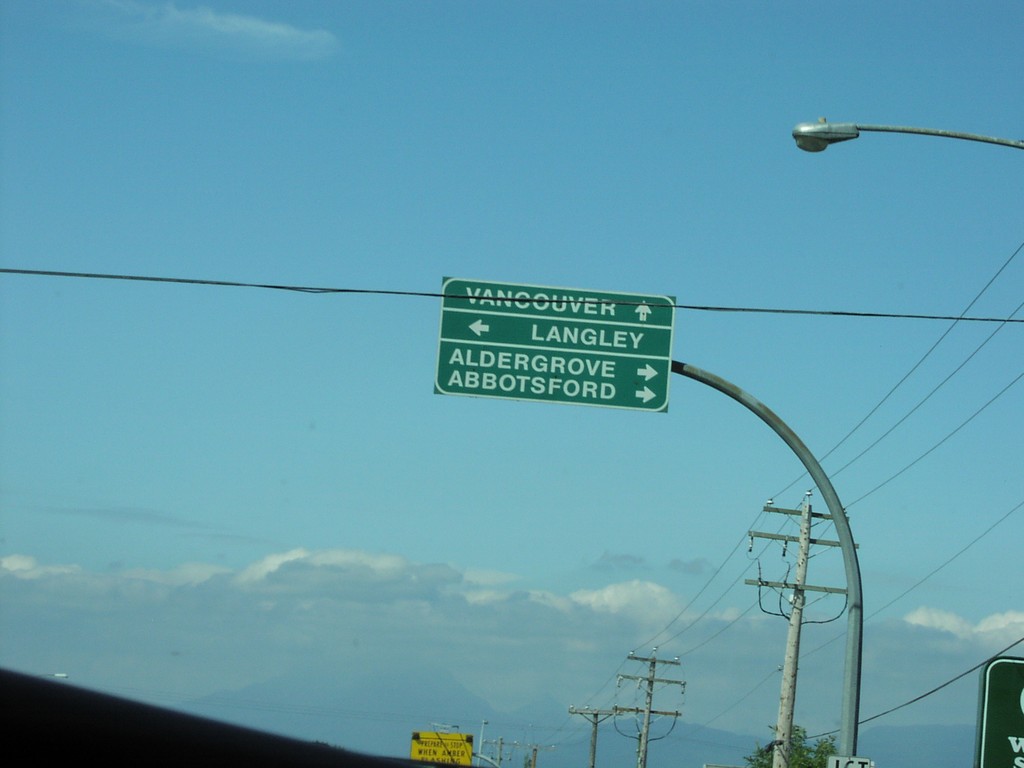
BC-13 North at BC-1A
BC-13 north at BC-1A. Use BC-1A east for Aldergrove and Abbotsford. Use BC-1A west for Langley. Continue north on BC-13 for Vancouver.
Taken 08-01-2002
 Langley Township
Metro Vancouver
British Columbia
Canada
Langley Township
Metro Vancouver
British Columbia
Canada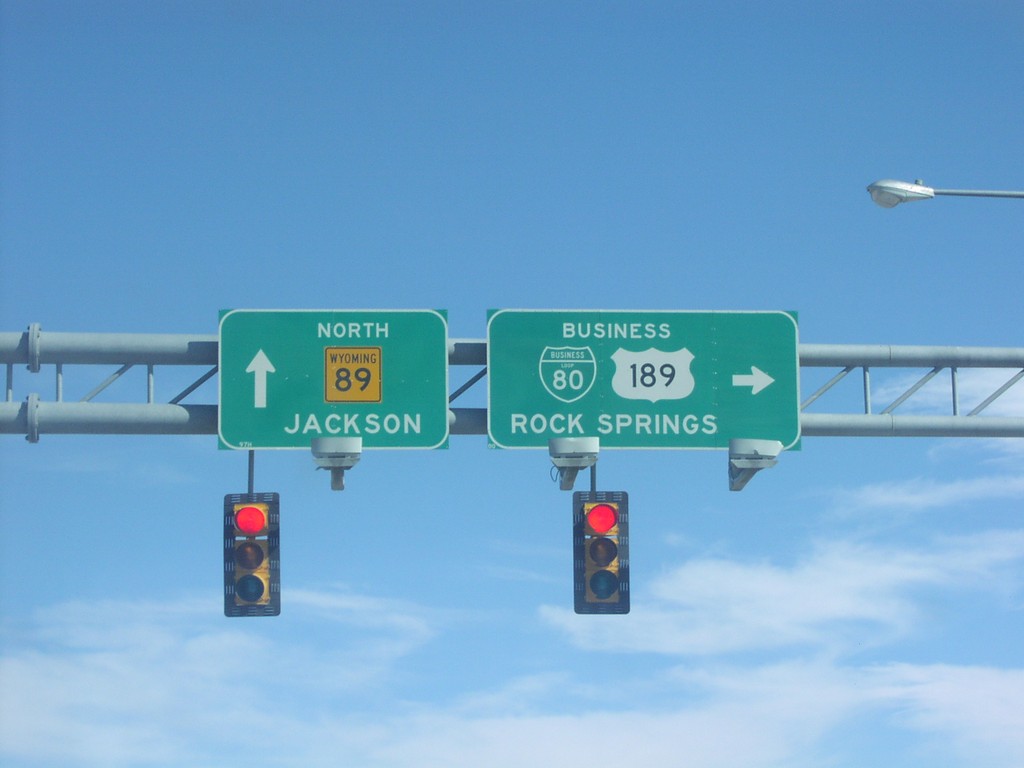
WY-89 North at BL-80/US-189 East
WY-89 Overhead at BL-80/US-189 Junction
Taken 04-01-2002

 Evanston
Uinta County
Wyoming
United States
Evanston
Uinta County
Wyoming
United States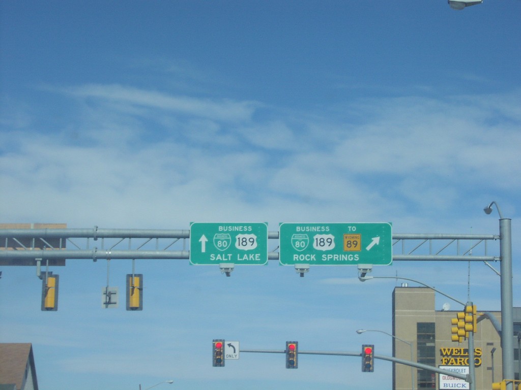
WY-89 North at BL-80/BL-189
WY-89 North at BL-80/BL-189 to Salt Lake, and BL-80/BL-189/WY-89/Rock Springs.
Taken 04-01-2002
Evanston
Uinta County
Wyoming
United States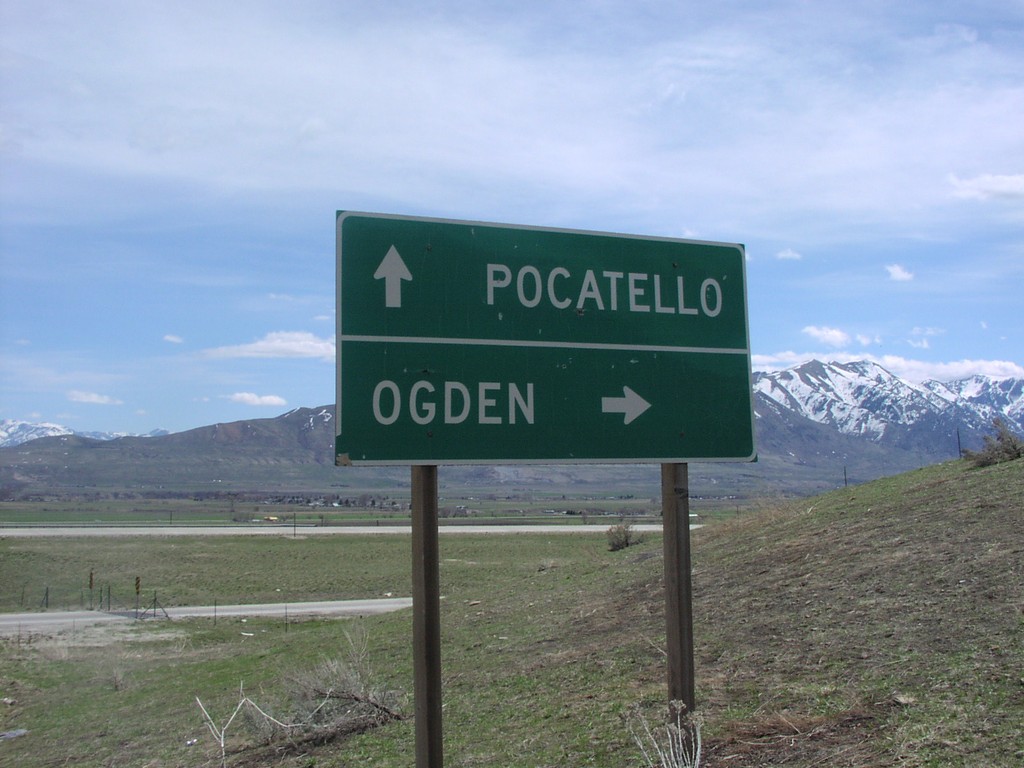
UT-30 at I-15 Exit 387 Onramp
UT-30 at I-15 Junction To Pocatello and Ogden.
Taken 04-01-2002

 Riverside
Box Elder County
Utah
United States
Riverside
Box Elder County
Utah
United States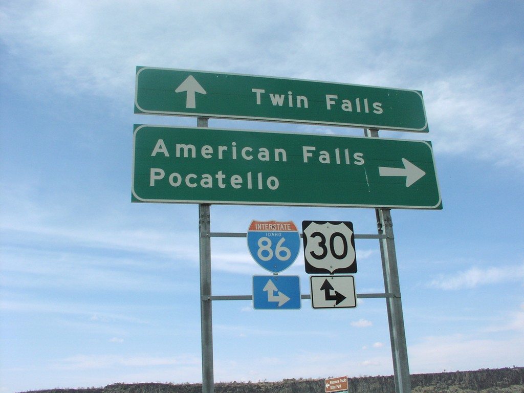
I-86 Onramp at Exit 28
I-86 Freeway Entrance at Massacre Rocks State Park
Taken 04-01-2002

 Neeley
Power County
Idaho
United States
Neeley
Power County
Idaho
United States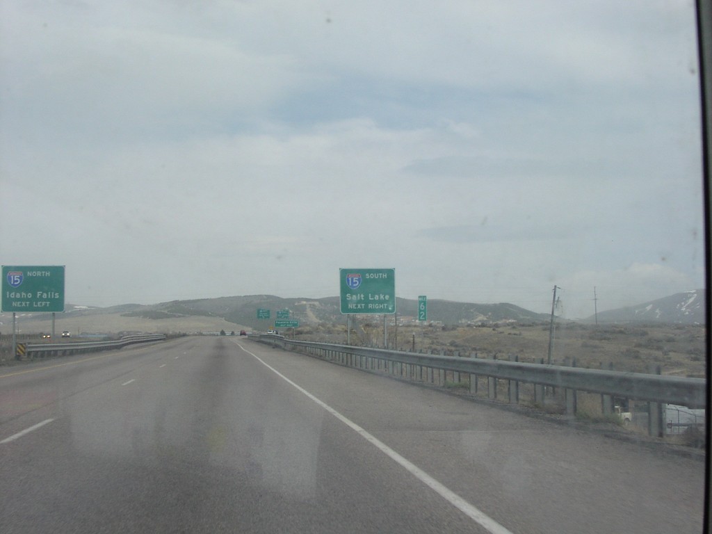
I-86 East Exit 63
I-86 Approaching I-15 To Idaho Falls and Salt Lake
Taken 04-01-2002
Pocatello
Bannock County
Idaho
United States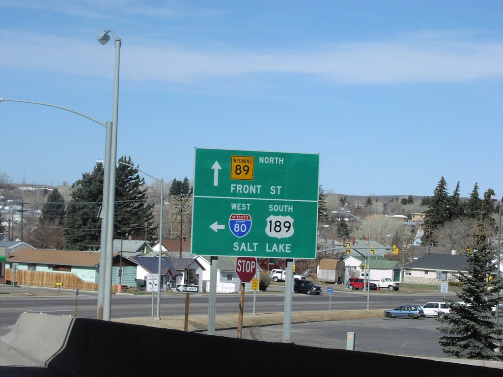
I-80 Exit 5 Onramp to Salt Lake
WY-89 at I-80 Junction To Salt Lake
Taken 04-01-2002

 Evanston
Uinta County
Wyoming
United States
Evanston
Uinta County
Wyoming
United States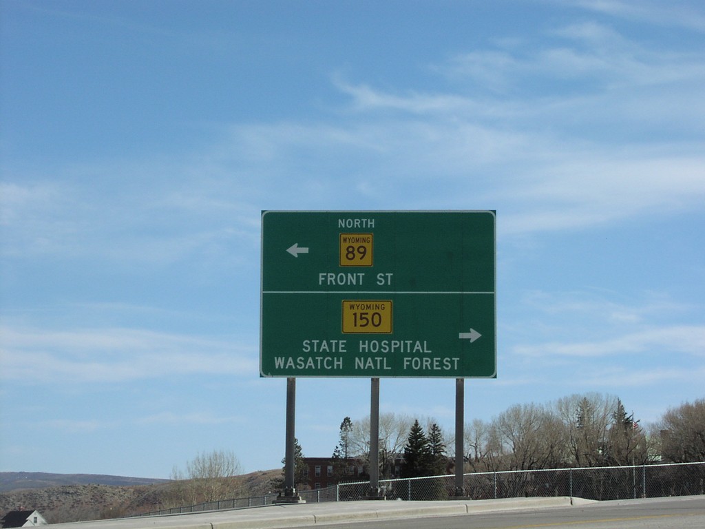
I-80 Exit 5 Offramp at WY-89/WY-150
WY-89/WY-150 To State Hospital and Front Street at I-80 Junction
Taken 04-01-2002
 Evanston
Uinta County
Wyoming
United States
Evanston
Uinta County
Wyoming
United States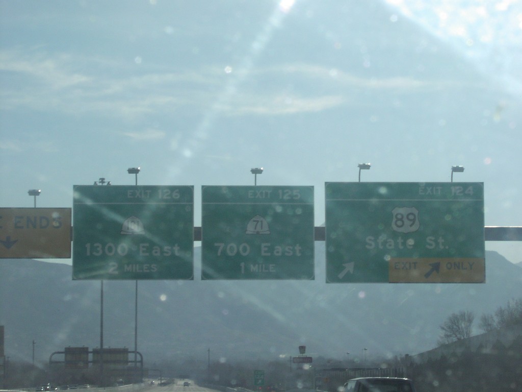
I-80 East Exits 124, 125, and 126
I-80 East, Exits 124,125, and 126. Exit 124 - US-89/State St., Exit 125 - UT-71/700 East, Exit 126 - UT-181/1300 East
Taken 04-01-2002


 South Salt Lake
Salt Lake County
Utah
United States
South Salt Lake
Salt Lake County
Utah
United States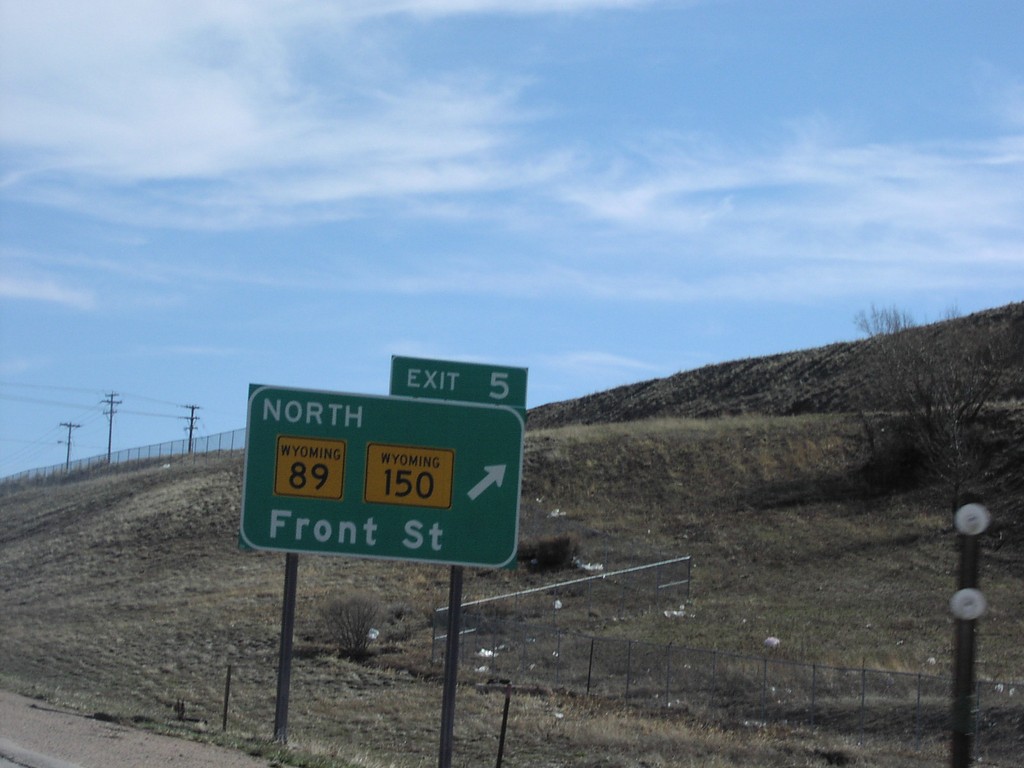
I-80 East Exit 5
Exit 5 - WY-89/WY-150/Front Street Exit on I-80 East
Taken 04-01-2002
Evanston
Uinta County
Wyoming
United States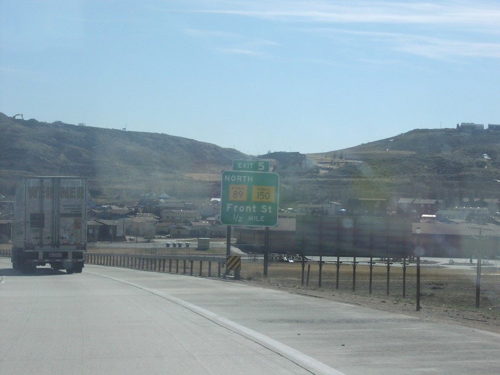
I-80 East Exit 5
I-80 East Approaching Exit 5 - WY-89/WY-150/Front Street Exit on I-80 East
Taken 04-01-2002
Evanston
Uinta County
Wyoming
United States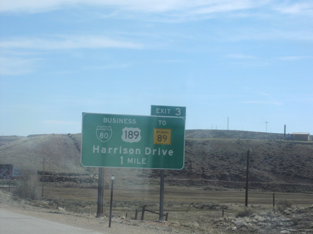
I-80 East Exit 3
Approaching Exit 3 - BL-80/BL US-189/To WY-89/Harrison Drive Exit on I-80 East, Evanston
Taken 04-01-2002
 Evanston
Uinta County
Wyoming
United States
Evanston
Uinta County
Wyoming
United States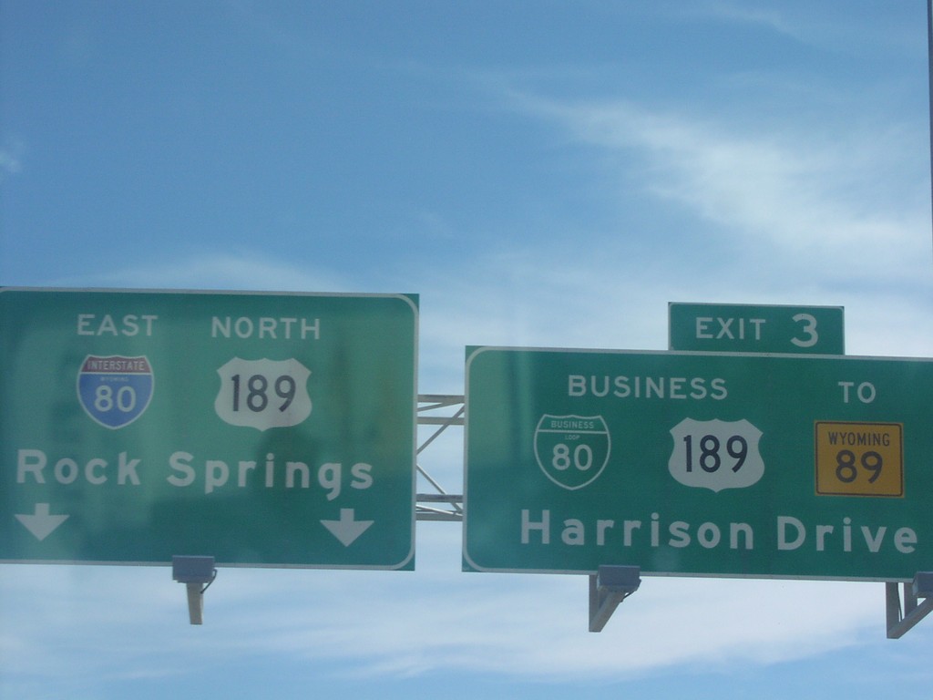
I-80 East Exit 3
BL-80/BL US-189/To WY-89/Harrison Drive Exit on I-80 East
Taken 04-01-2002
Evanston
Uinta County
Wyoming
United States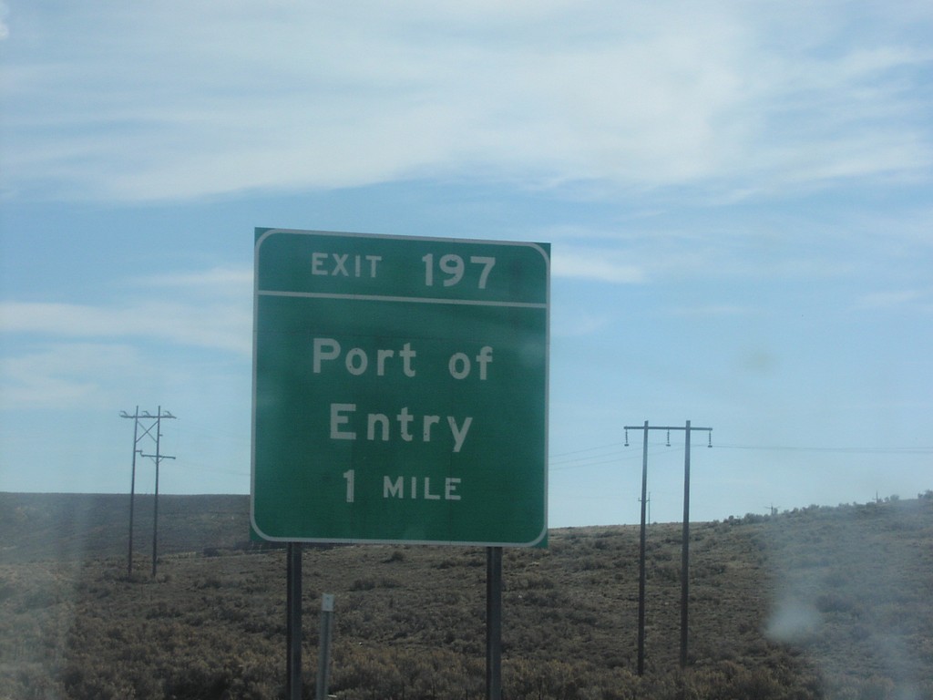
I-80 East Exit 197
I-80 east Exit 197 - Port of Entry. This is the ramp to the Wyoming Port of Entry, near the Utah-Wyoming line.
Taken 04-01-2002
Wahsatch
Summit County
Utah
United States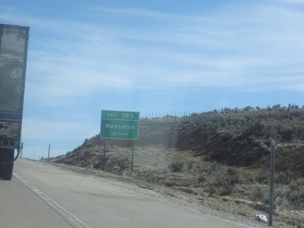
I-80 East Exit 193
I-80 East at Exit 193 - Wahsatch. Last Utah exit.
Taken 04-01-2002
Wahsatch
Summit County
Utah
United States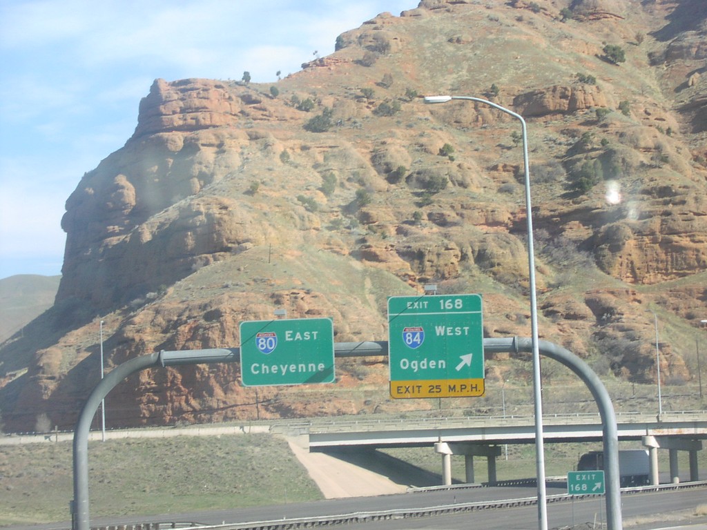
I-80 East Exit 168
I-80 East at Exit 168 - I-84 West/Ogden. I-80 East/Cheyenne overhead.
Taken 04-01-2002
 Coalville
Summit County
Utah
United States
Coalville
Summit County
Utah
United States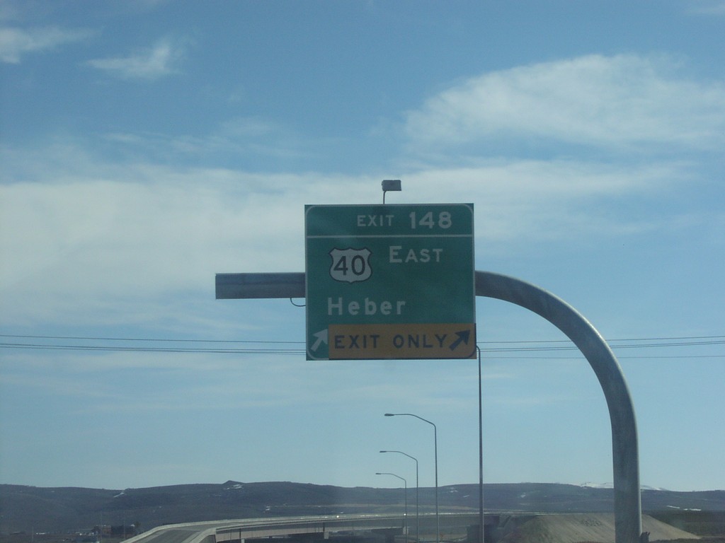
I-80 East Exit 148
I-80 East at Exit 148 - US-40 East/Heber. This is the beginning of US-40.
Taken 04-01-2002
 Park City
Summit County
Utah
United States
Park City
Summit County
Utah
United States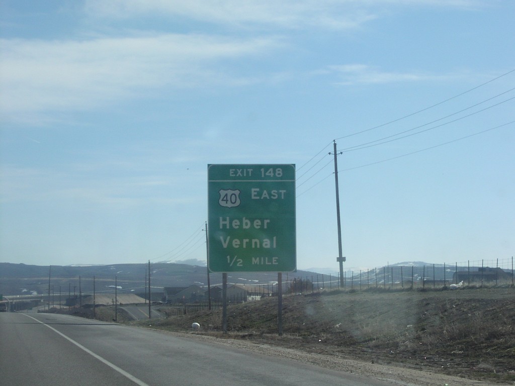
I-80 East Exit 148
I-80 east approaching Exit 148 - US-40/Heber/Vernal on I-80 East, Summit County.
Taken 04-01-2002
Park City
Summit County
Utah
United States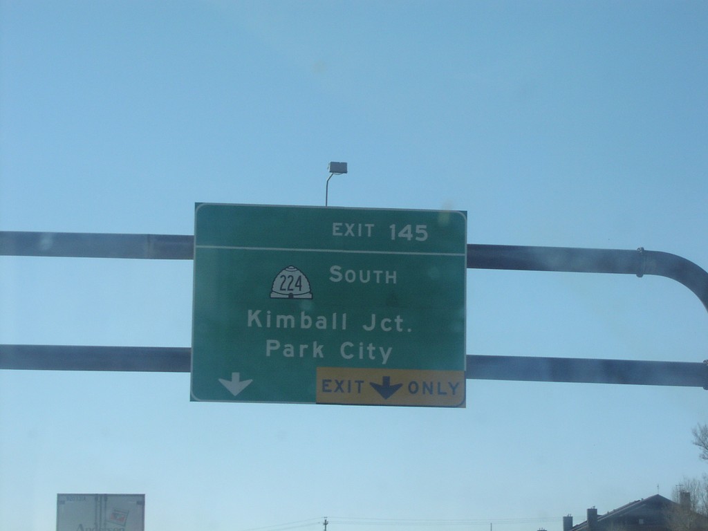
I-80 East Exit 145
I-80 east at Exit 145 - UT-224 South/Kimball Junction/Park City exit.
Taken 04-01-2002
 Silver Summit
Summit County
Utah
United States
Silver Summit
Summit County
Utah
United States