Signs Tagged With Big Green Sign
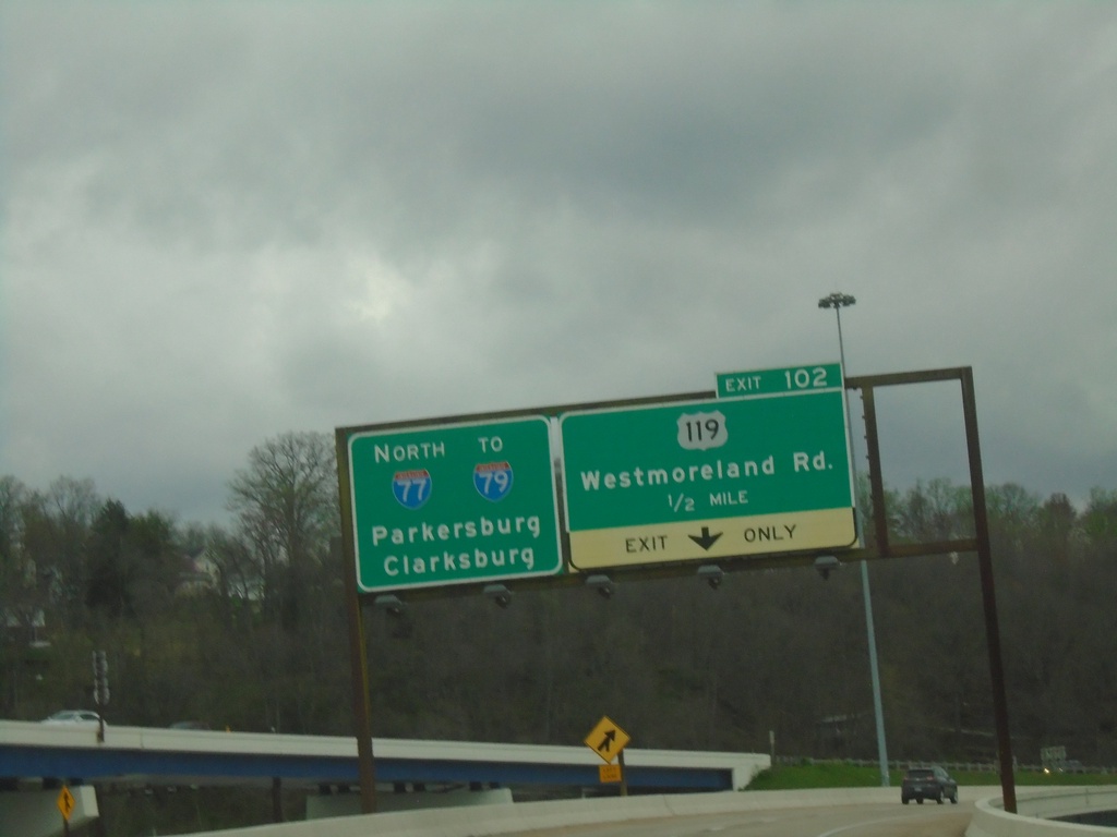
I-77 North - Exit 102
I-77 north approaching Exit 102 - US-119/Westmoreland Road. Continue on I-77 North/To I-79 to Parkersburg and Clarksburg.
Taken 04-01-2024


 Charleston
Kanawha County
West Virginia
United States
Charleston
Kanawha County
West Virginia
United States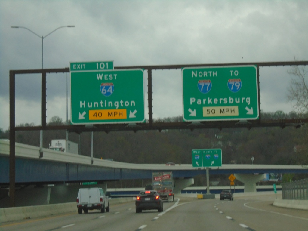
I-77 North/I-64 West - Exit 101
I-77 North/I-64 West at Exit 101 - I-64 West/Huntington. Continue on I-77 North/To I-79 to Parkersburg.
Taken 04-01-2024
 Charleston
Kanawha County
West Virginia
United States
Charleston
Kanawha County
West Virginia
United States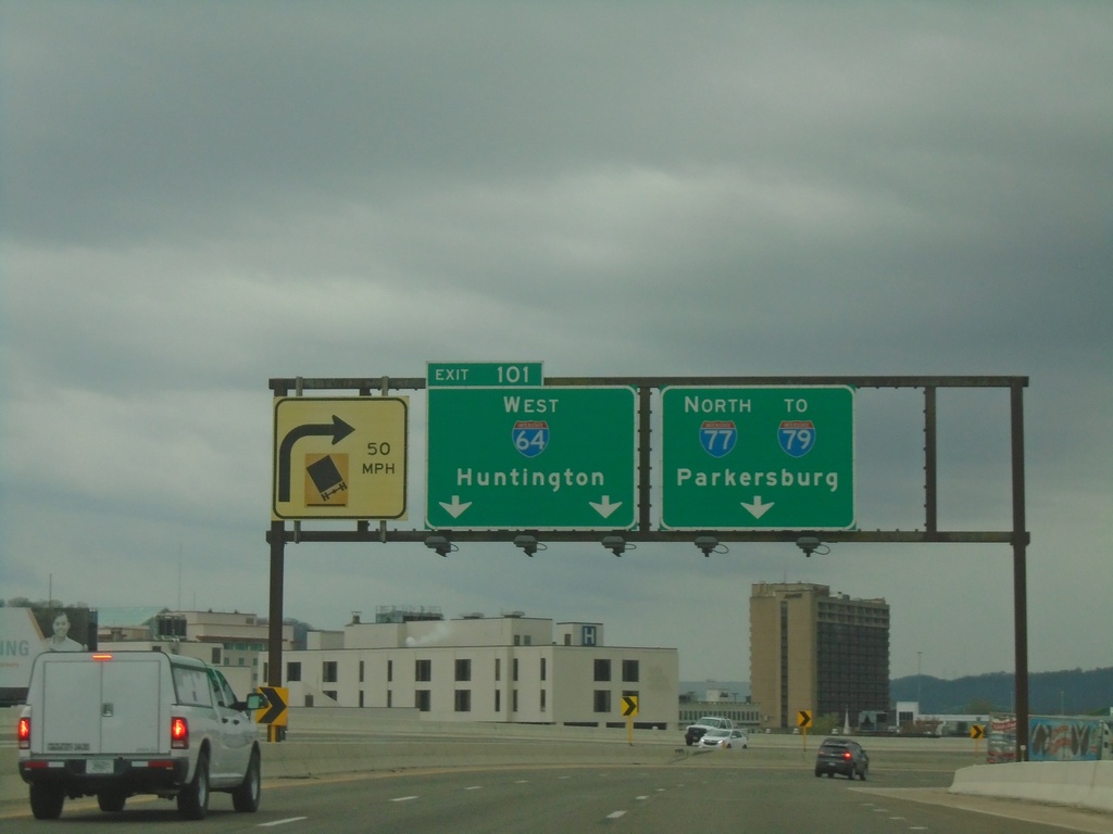
I-64 West/I-77 North - Exit 101
I-64 West/I-77 North at Exit 101 - I-64 West/Huntington. Continue north on I-77/To I-79 to Parkersburg.
Taken 04-01-2024
Charleston
Kanawha County
West Virginia
United States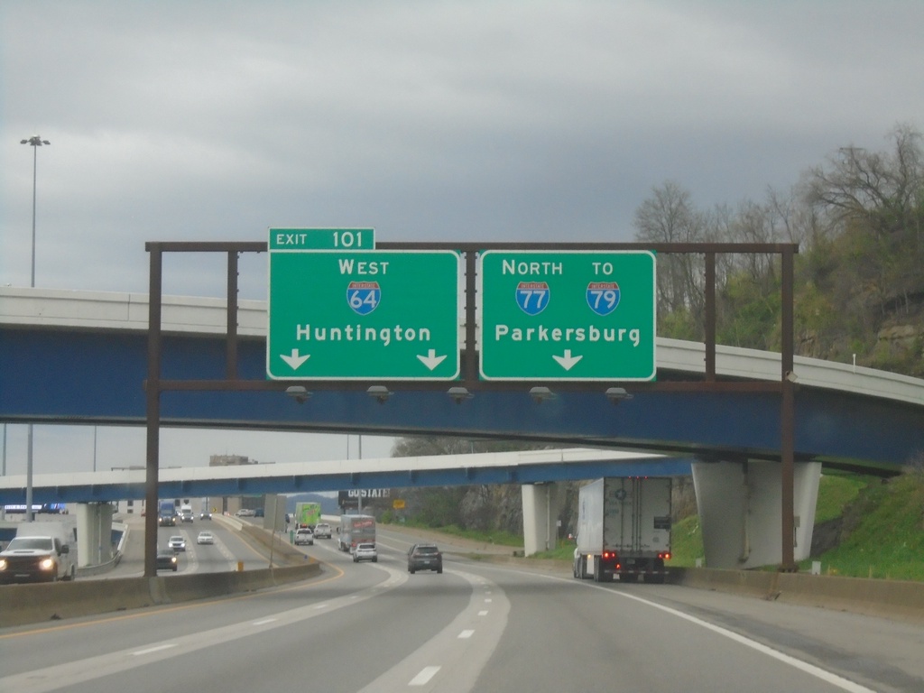
I-64 West/I-77 North - Exit 101
I-64 West/I-77 North at Exit 101 - I-64 West/Huntington. Continue north on I-77 North/To I-79/Parkersburg.
Taken 04-01-2024
Charleston
Kanawha County
West Virginia
United States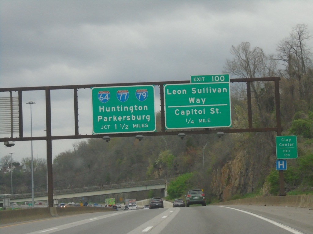
I-77 North/I-64 West - Exits 100 and 101
I-77 North/I-64 West at Exit 100 - Leon Sullivan Way/Capitol St. Approaching Exit 101 - I-64/I-77/I-79/Huntington/Parkersburg. Use Exit 100 for City Center.
Taken 04-01-2024
Charleston
Kanawha County
West Virginia
United States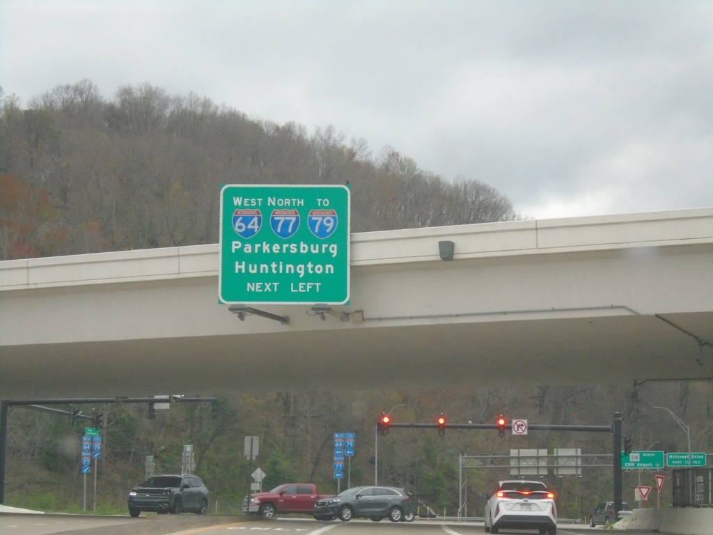
WV-114 North at I-77 North/I-64 West/To I-79
WV-114 North at I-77 North/I-64 West/To I-79/Parkersburg/Huntington.
Taken 04-01-2024
 Charleston
Kanawha County
West Virginia
United States
Charleston
Kanawha County
West Virginia
United States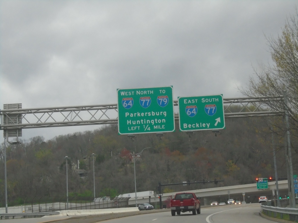
WV-114 North Approaching I-64/I-77/To I-79
WV-114 North approaching I-64/I-77/To I-79. Merge right for I-64 East/I-77 South to Beckley. Continue under freeway to I-64 West/I-77 North/To I-79/Huntington/Parkersburg.
Taken 04-01-2024
Charleston
Kanawha County
West Virginia
United States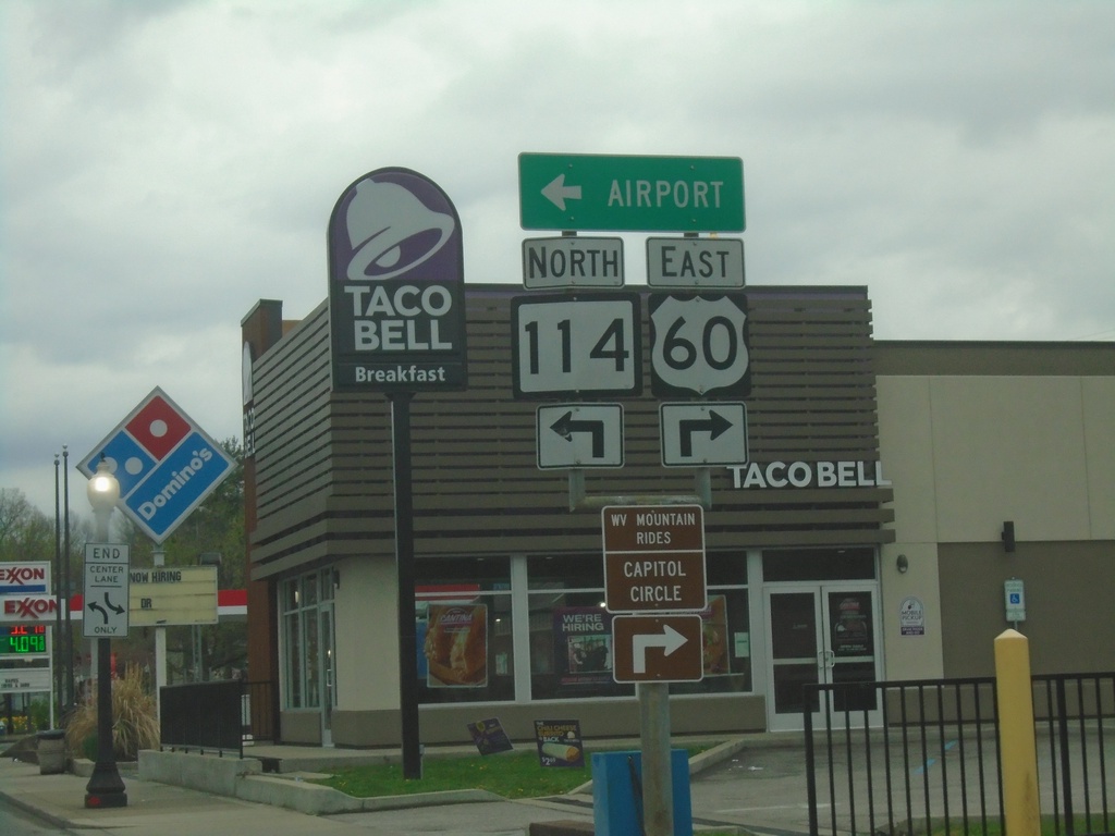
US-60 East at WV-114
US-60 East (Washington St.) at WV-114 North to Airport.
Taken 04-01-2024
 Charleston
Kanawha County
West Virginia
United States
Charleston
Kanawha County
West Virginia
United States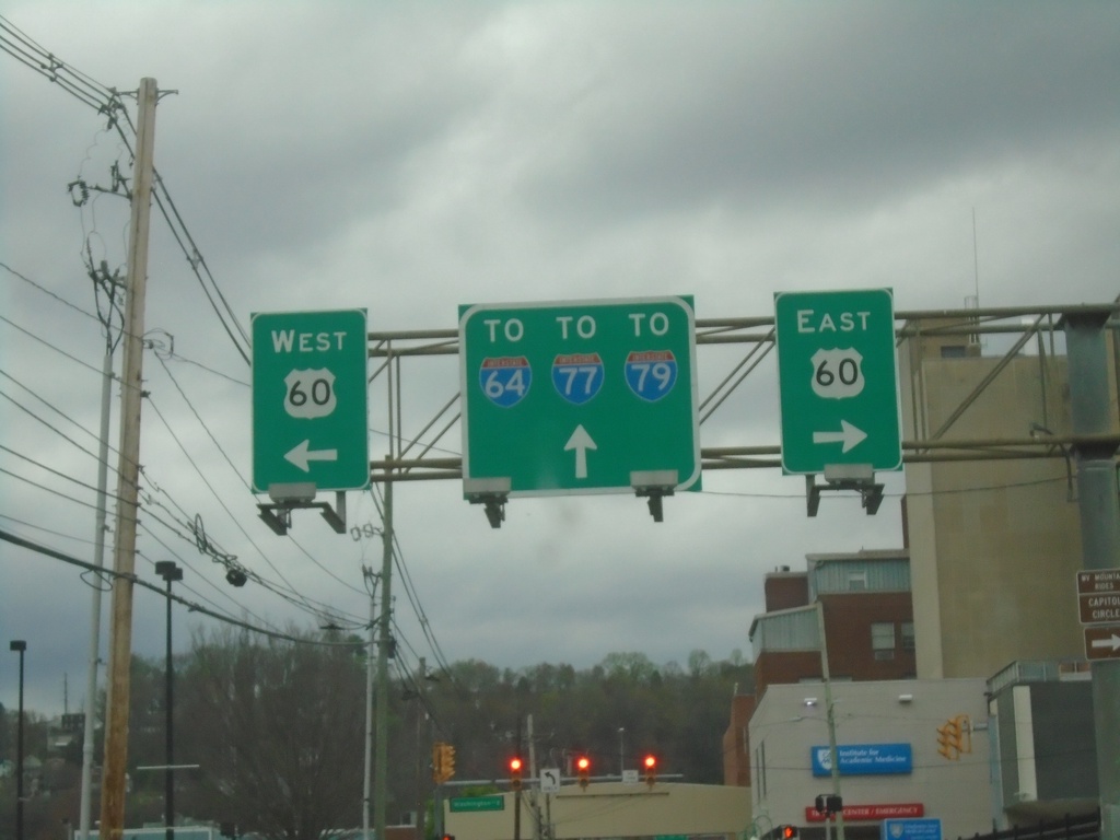
US-60 East - Brooks St. at Washington St.
US-60 East - Brooks St. at Washington St. Turn right on Washington St. for US-60 East; left on Washington St. for US-60 West. Continue north on Brooks St. to I-64/I-77/I-79.
Taken 04-01-2024
Charleston
Kanawha County
West Virginia
United States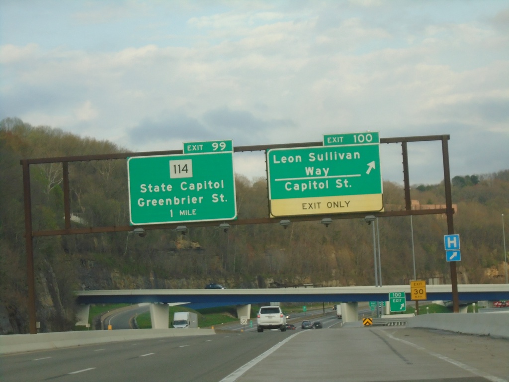
I-64 East/I-77 South - Exits 100 and 99
I-64 East/I-77 South at Exit 100 - Leon Sullivan Way/Capitol St. Approaching Exit 99 - WV-114/State Capitol/Greenbrier St.
Taken 03-31-2024
Charleston
Kanawha County
West Virginia
United States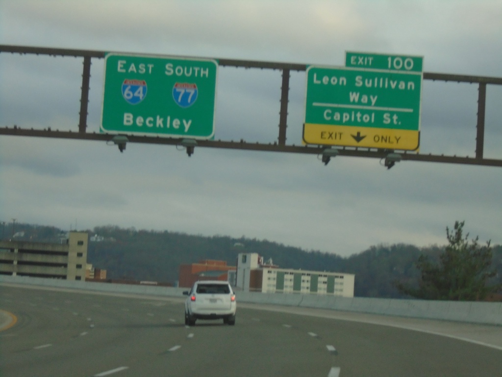
I-64 East/I-77 South - Exit 100
I-64 East/I-77 South at Exit 100 - Leon Sullivan Way/Capitol St. I-64 East/I-77 South continues towards Beckley.
Taken 03-31-2024
Charleston
Kanawha County
West Virginia
United States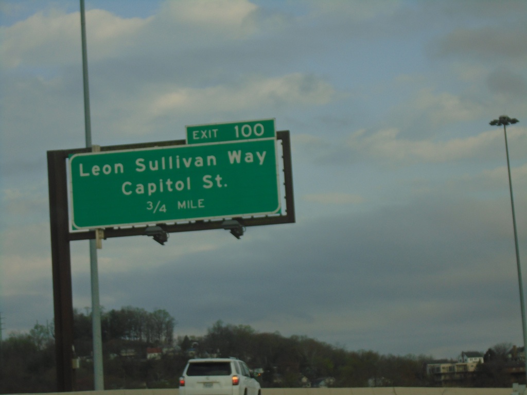
I-64 East/I-77 South - Exit 100
I-64 East/I-77 South approaching Exit 100 - Leon Sullivan Way/Capitol St.
Taken 03-31-2024
Charleston
Kanawha County
West Virginia
United States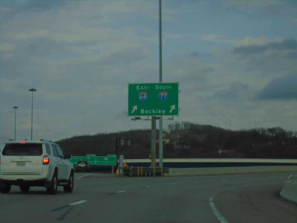
I-64 East - Exit 59
I-64 East at Exit 59. Use right lane for I-64 East/I-77 South/Beckley.
Taken 03-31-2024
Charleston
Kanawha County
West Virginia
United States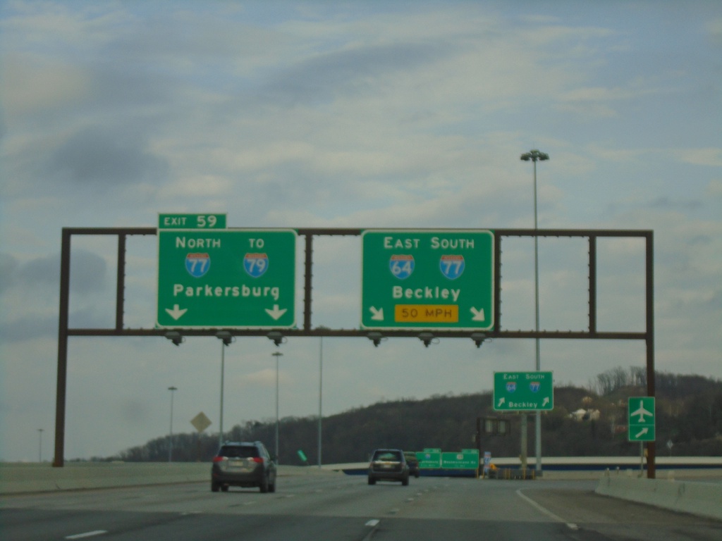
I-64 East - Exit 59
I-64 East at Exit 59 - I-77 North/To I-79/Parkersburg. Use right lanes for I-64 East/I-77 South/Beckley. I-77 South joins I-64 eastbound to Beckley.
Taken 03-31-2024
Charleston
Kanawha County
West Virginia
United States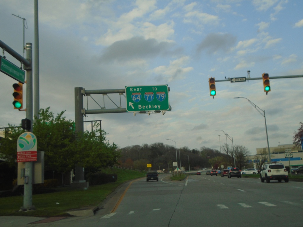
US-119 North at I-64/To I-77/To I-79
US-119 North at I-64 East/To I-77/To I-79 to Beckley.
Taken 03-31-2024
Charleston
Kanawha County
West Virginia
United States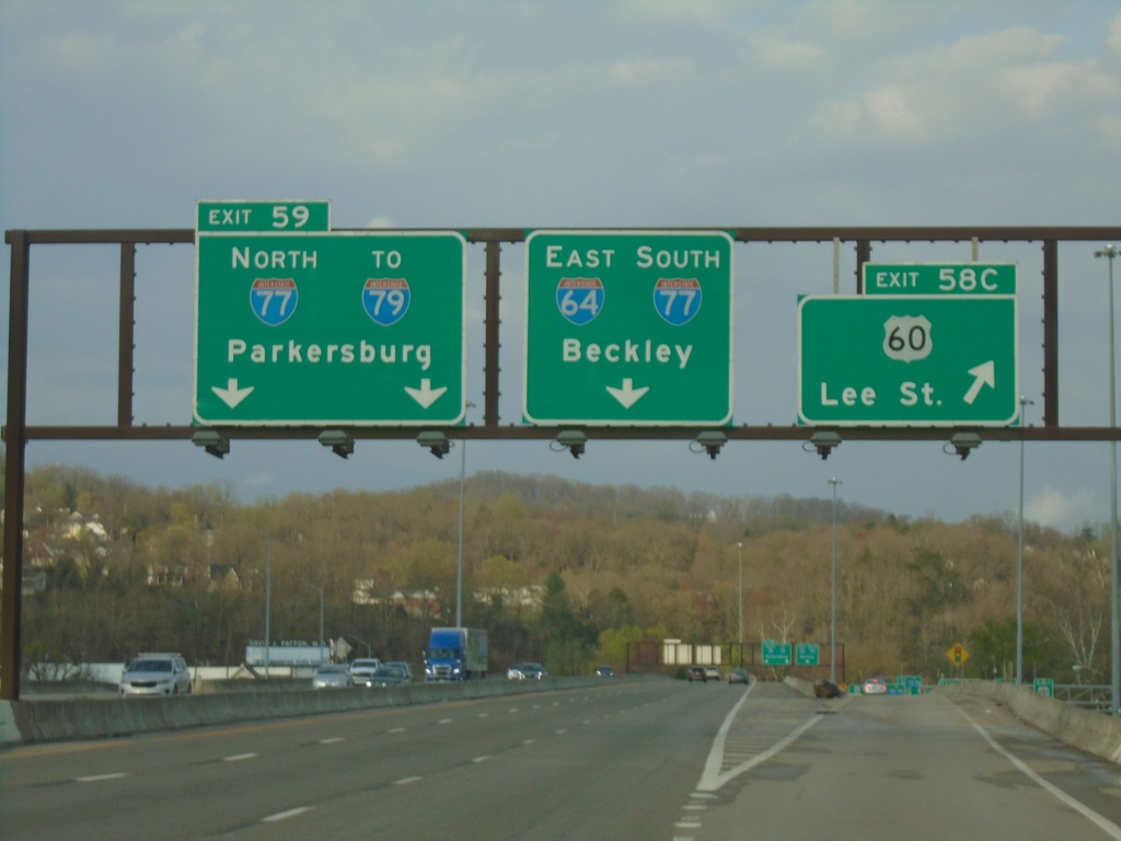
I-64 East - Exits 58C and 59
I-64 East at Exit 58C - US-60/Lee St. Approaching Exit 59 - I-77 North/To I-79/Parkersburg. Continue east on I-64 East/I-77 South to Beckley.
Taken 03-31-2024
Charleston
Kanawha County
West Virginia
United States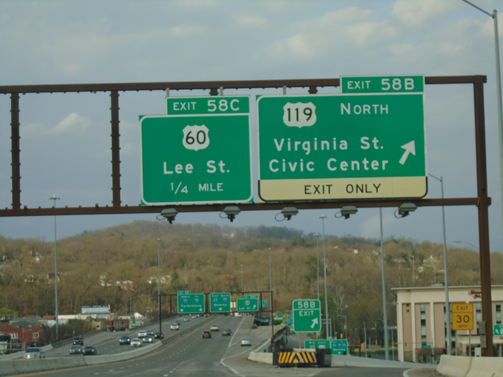
I-64 East - Exits 58B, and 59C
I-64 East at Exit 58B - US-119 North/Virginia St./Civic Center. Approaching Exit 59C - US-60/Lee St.
Taken 03-31-2024
Charleston
Kanawha County
West Virginia
United States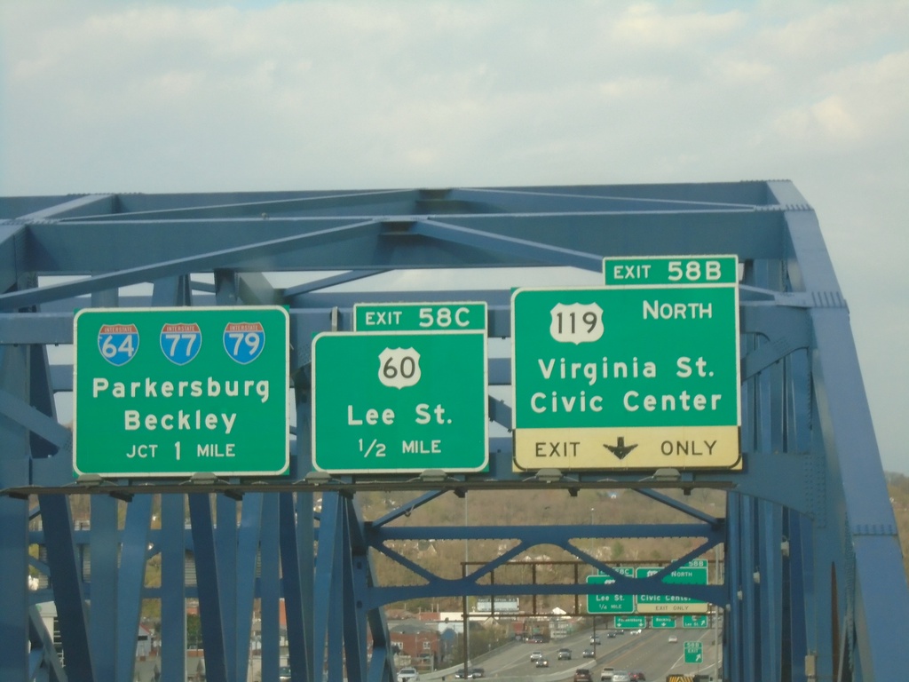
I-64 East - Exits 58B, 58C, and Exit 59
I-64 East - Exits 58B - US-119 North/Virginia St./Civic Center. Approaching Exit 59C - US-60/Lee St. Approaching I-64/I-77/I-79/Parkersburg/Beckley. Taken on the bridge over the Kanawah River.
Taken 03-31-2024
Charleston
Kanawha County
West Virginia
United States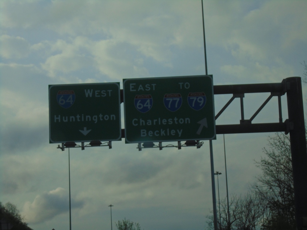
US-119 North at I-64 - Charleston
US-119 North at I-64 in Charleston. Use left lane for I-64 West/Huntington. Right lane for I-64 East/To I-77/To I-79/Charleston/Beckley. US-119 joins I-64 eastbound.
Taken 03-31-2024
Charleston
Kanawha County
West Virginia
United States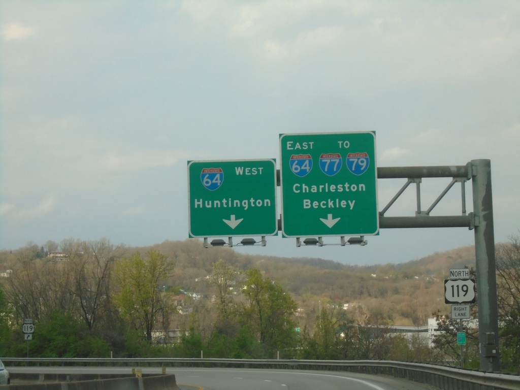
US-119 North at I-64
US-119 North at I-64. Use right lanes for I-64 East/To I-77/To I-79/Charleston/Beckley. Use left lane for I-64 West to Huntington. US-119 north joins I-64 east.
Taken 03-31-2024
Charleston
Kanawha County
West Virginia
United States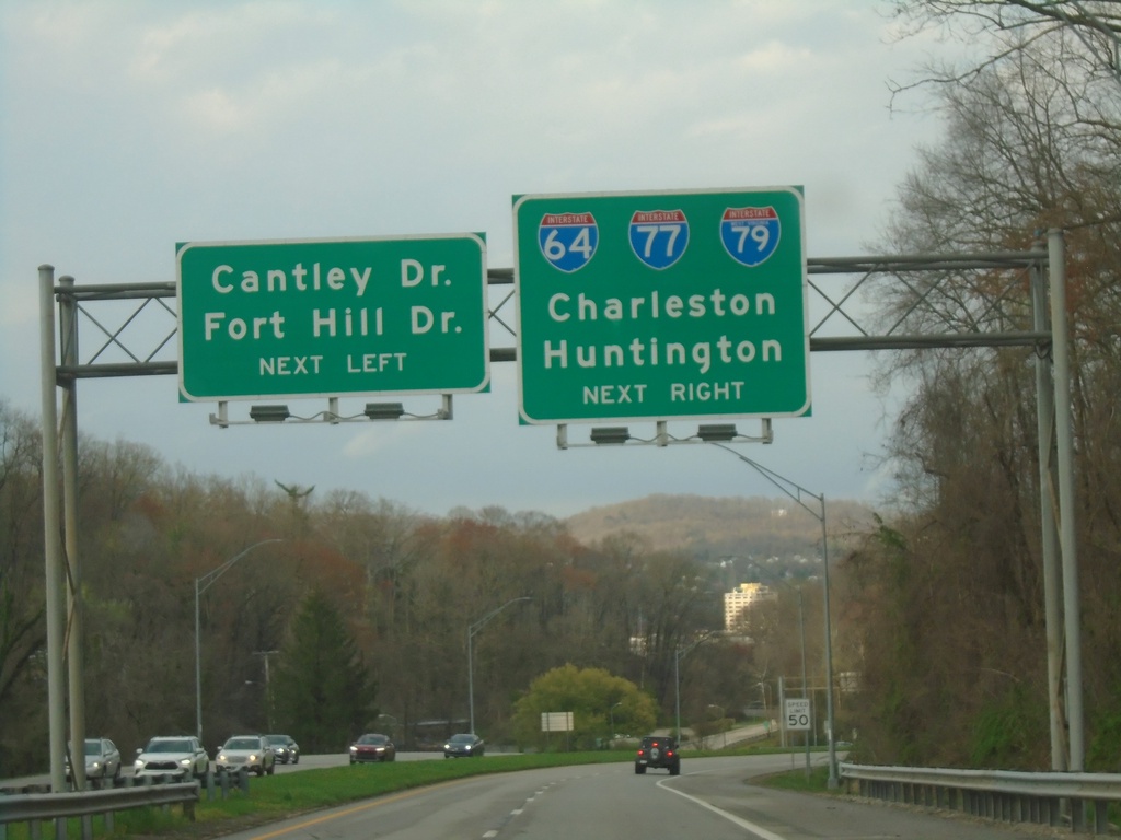
US-119 North Approaching I-64/To I-77/To I-79
US-119 North Approaching I-64/To I-77/To I-79 in Charleston. Continue in left lane for Cantley Drive/Fort Hill Drive. Use right lanes for US-119 North/I-64/To I-77/To I-79/Charleston/Huntington.
Taken 03-31-2024
Charleston
Kanawha County
West Virginia
United States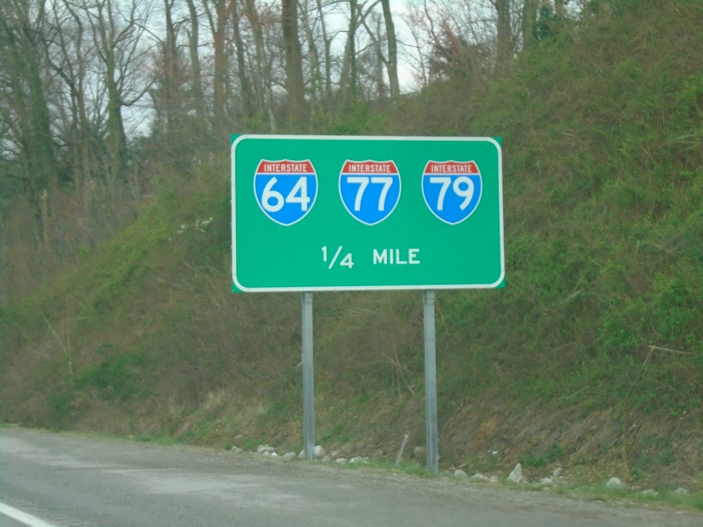
US-119 North Approaching I-64/(To)I-77/(To) I-79
US-119 North approaching I-64/(To)I-77/(To) I-79 in Charleston.
Taken 03-31-2024
Charleston
Kanawha County
West Virginia
United States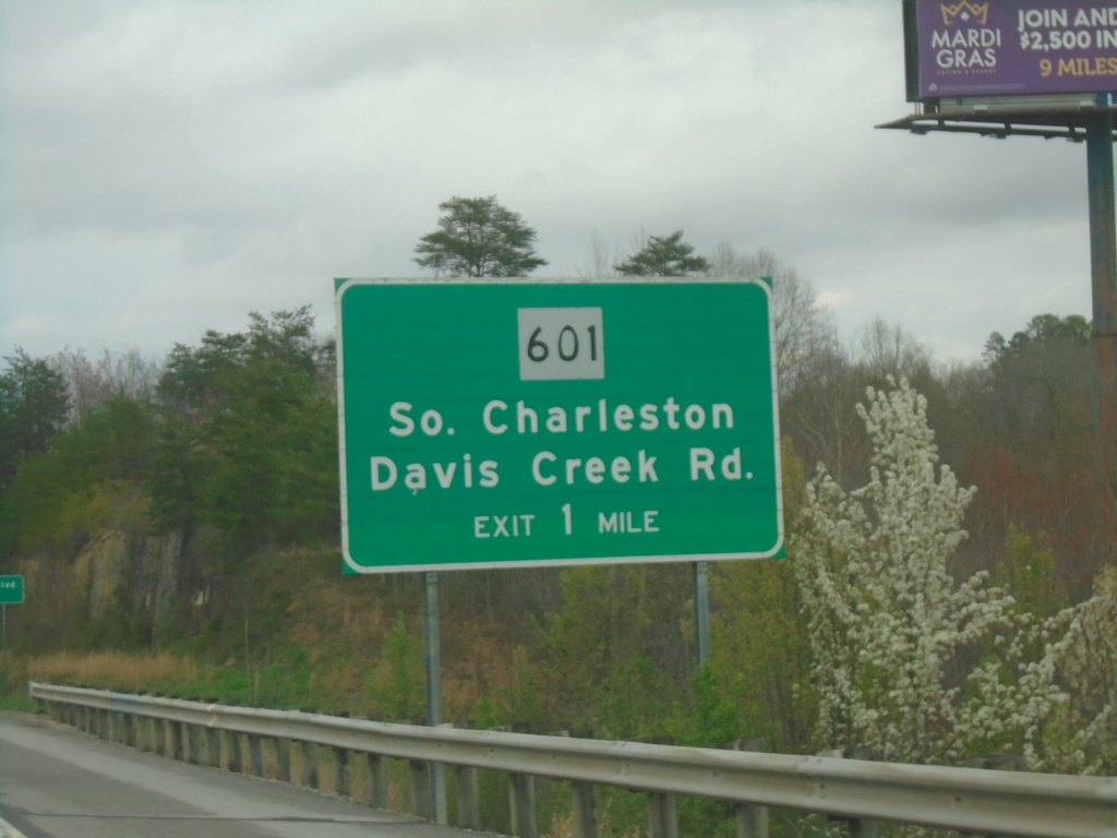
US-119 North Approaching WV-601
US-119 North approaching WV-601/South Charleston/Davis Creek Road interchange.
Taken 03-31-2024
 Charleston
Kanawha County
West Virginia
United States
Charleston
Kanawha County
West Virginia
United States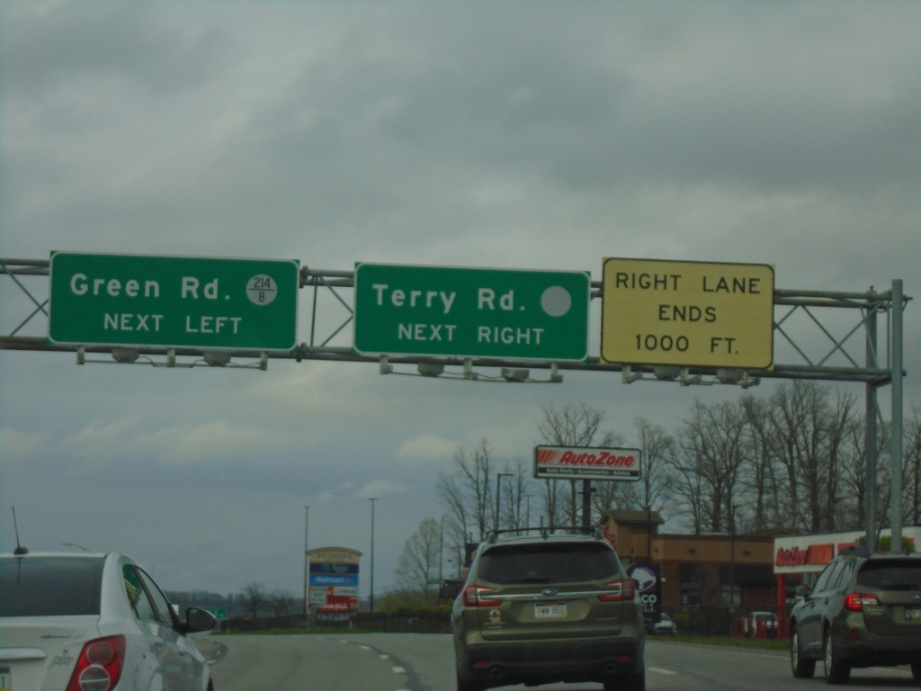
US-119 North at Green Road/Terry Road
US-119 North at Green Road (WVCR-214/8) and Terry Road. The Terry Road sign has a blank county highway shield.
Taken 03-31-2024
 Charleston
Kanawha County
West Virginia
United States
Charleston
Kanawha County
West Virginia
United States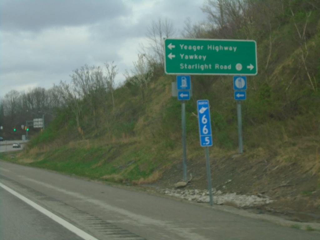
US-119 North at Yeager Highway Junction
US-119 North at Yeager Highway junction. Turn left To WV-214, Yeager Highway, and Yawkey. Turn right for WVCR-119/6 / Starlight Road. Blue mile marker is used for Appalachian Corridor highways. US-119 is part of Corridor G.
Taken 03-31-2024

 Alum Creek
Lincoln County
West Virginia
United States
Alum Creek
Lincoln County
West Virginia
United States