Signs Tagged With Big Green Sign
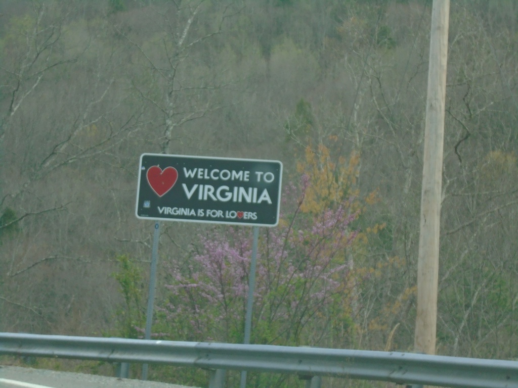
VA-80 East - Welcome To Virginia
Welcome To Virginia - Virginia Is For Lovers on VA-80 East. Taken at the Kentucky/Virginia State Line.
Taken 03-31-2024
 Breaks
Buchanan County
Virginia
United States
Breaks
Buchanan County
Virginia
United States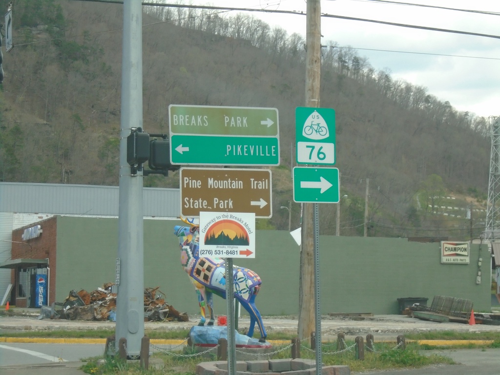
End KY-197 East at KY-80
End KY-197 East at KY-80 in Elkhorn City. Use KY-80 east to Breaks Interstate Park and Pine Mountain Trail State Park. Use KY-80 west to Pikeville. KY-80 west is part of US Bicycle Route 76.
Taken 03-31-2024

 Elkhorn City
Pike County
Kentucky
United States
Elkhorn City
Pike County
Kentucky
United States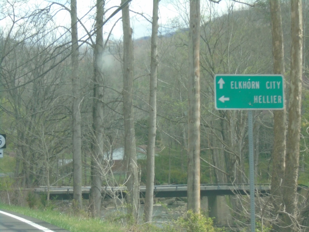
KY-197 East Approaching KY-195
KY-197 East Approaching KY-195 to Hellier. Continue east on KY-197 to Elkhorn City.
Taken 03-31-2024
 Ashcamp
Pike County
Kentucky
United States
Ashcamp
Pike County
Kentucky
United States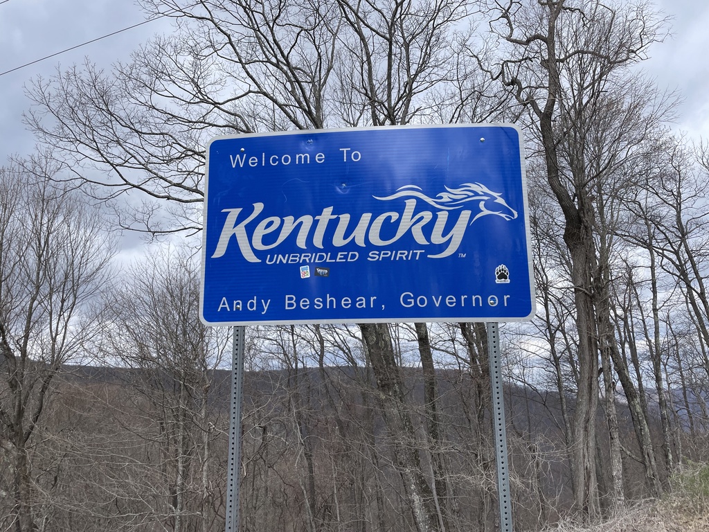
KY-160 West - Welcome To Kentucky
Welcome to Kentucky - Unbridled Spirit on KY-160 West. At the Virginia/Kentucky State Line.
Taken 03-31-2024
 Partridge
Harlan County
Kentucky
United States
Partridge
Harlan County
Kentucky
United States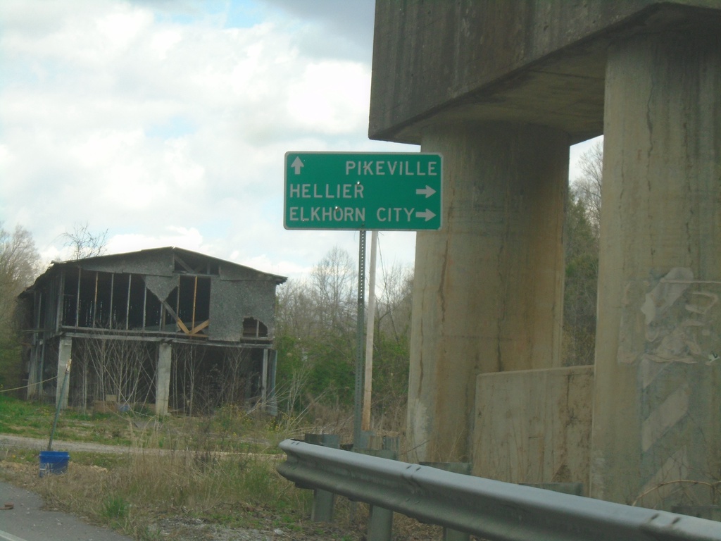
KY-805 East Approaching KY-197
KY-805 East approaching KY-197 to Hellier and Elkhorn City. Continue east on KY-805 to Pikeville.
Taken 03-31-2024
 Jenkins
Pike County
Kentucky
United States
Jenkins
Pike County
Kentucky
United States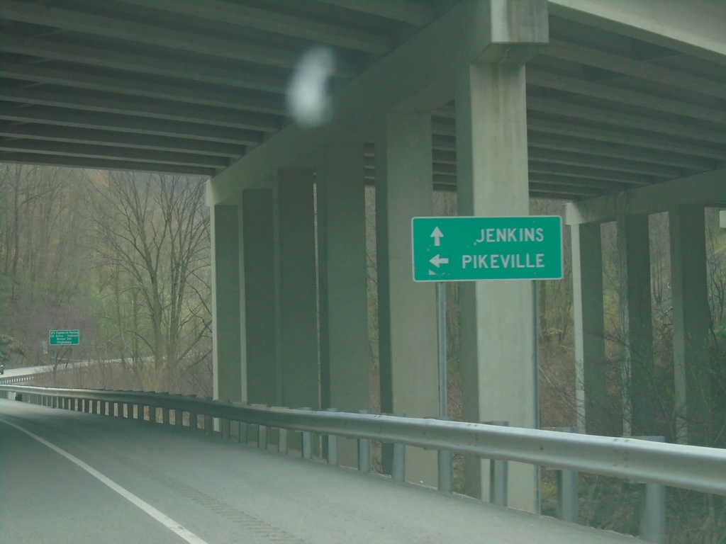
KY-805 East at US-23/US-119 North
KY-805 East at US-23/US-119 North to Pikeville. Continue on KY-805 east to Jenkins.
Taken 03-31-2024

 Jenkins
Letcher County
Kentucky
United States
Jenkins
Letcher County
Kentucky
United States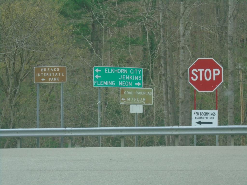
US-23/US-119 Ramp at KY-805
US-23/US-119 Ramp at KY-805. Use KY-805 West to Fleming-Neon; use KY-805 East to Jenkins, Elkhorn City, and Breaks Interstate Park.
Taken 03-31-2024
Jenkins
Letcher County
Kentucky
United States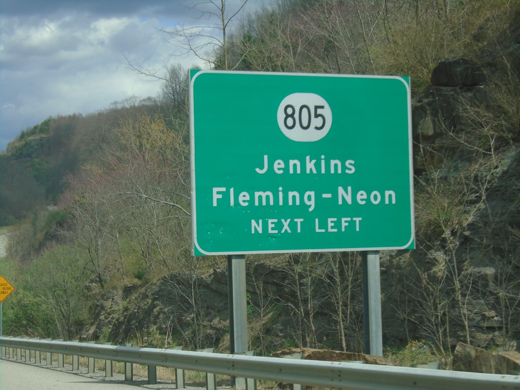
US-23/US-119 North Approaching KY-805
US-23/US-119 North approaching KY-805/Jenkins/Fleming-Neon
Taken 03-31-2024
Jenkins
Letcher County
Kentucky
United States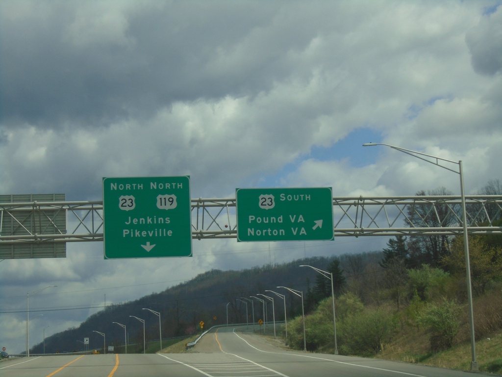
US-119 North at US-23 - Payne Gap
US-119 North at US-23 at Payne Gap. Use US-23 south to Pound, VA and Norton, VA. Use US-23 North/US-119 North to Jenkins and Pikeville.
Taken 03-31-2024
Jenkins
Letcher County
Kentucky
United States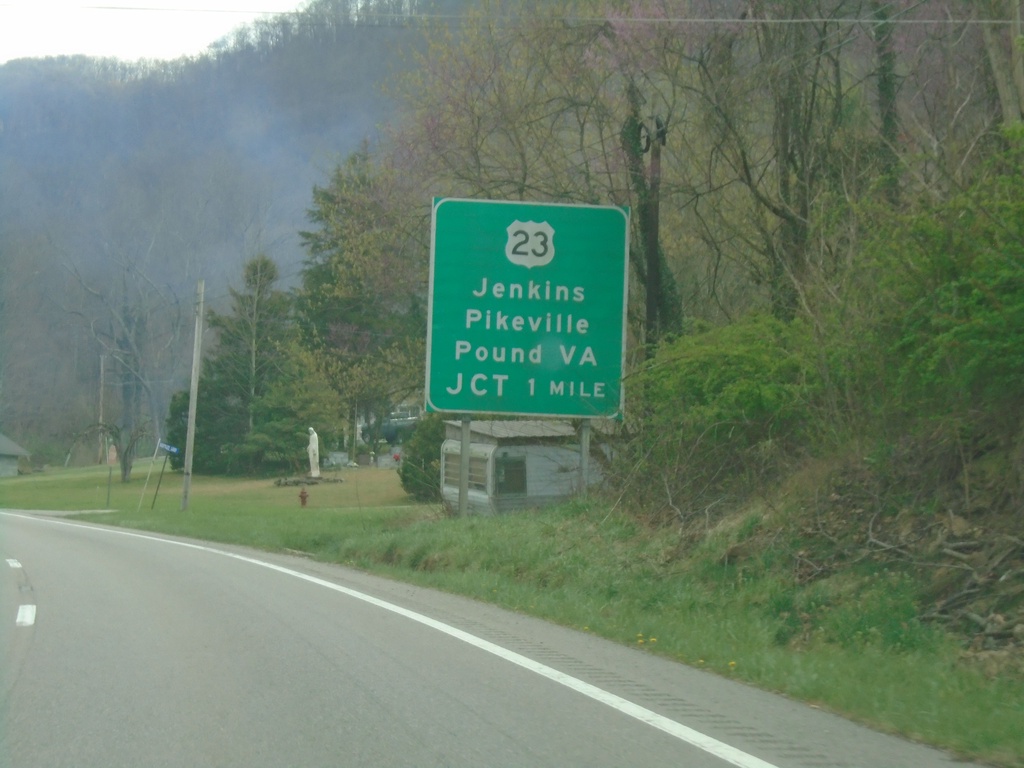
US-119 North Approaching US-23
US-119 North approaching US-23 at Payne Gap. Use US-23 for Jenkins, Pikeville, and Pound, VA. US-119 north joins US-23 northbound.
Taken 03-31-2024
Jenkins
Letcher County
Kentucky
United States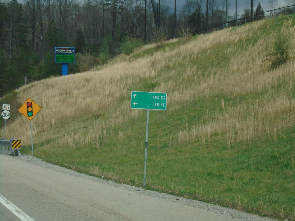
US-119 North Approaching KY-2023
US-119 North approaching KY-2023. Use KY-2023 to Ermine; continue north on US-119 to Jenkins.
Taken 03-31-2024
 Whitesburg
Letcher County
Kentucky
United States
Whitesburg
Letcher County
Kentucky
United States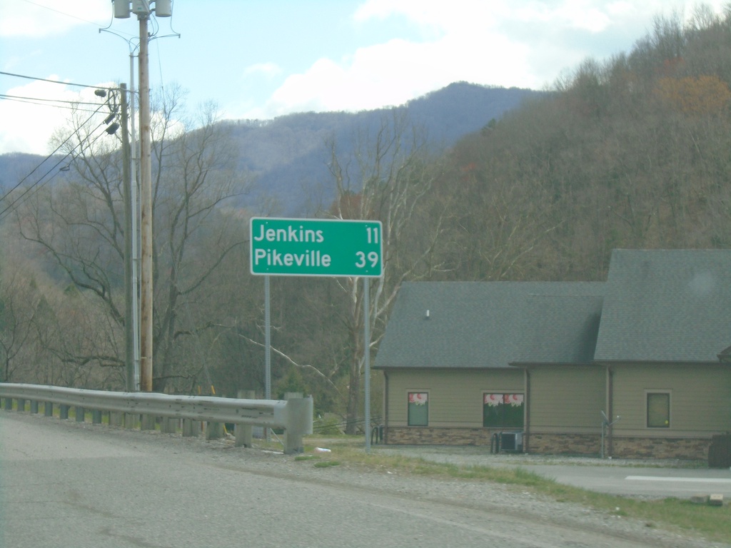
US-119 North - Distance Marker
Distance marker on US-119 north. Distance to Jenkins and Pikeville.
Taken 03-31-2024
Whitesburg
Letcher County
Kentucky
United States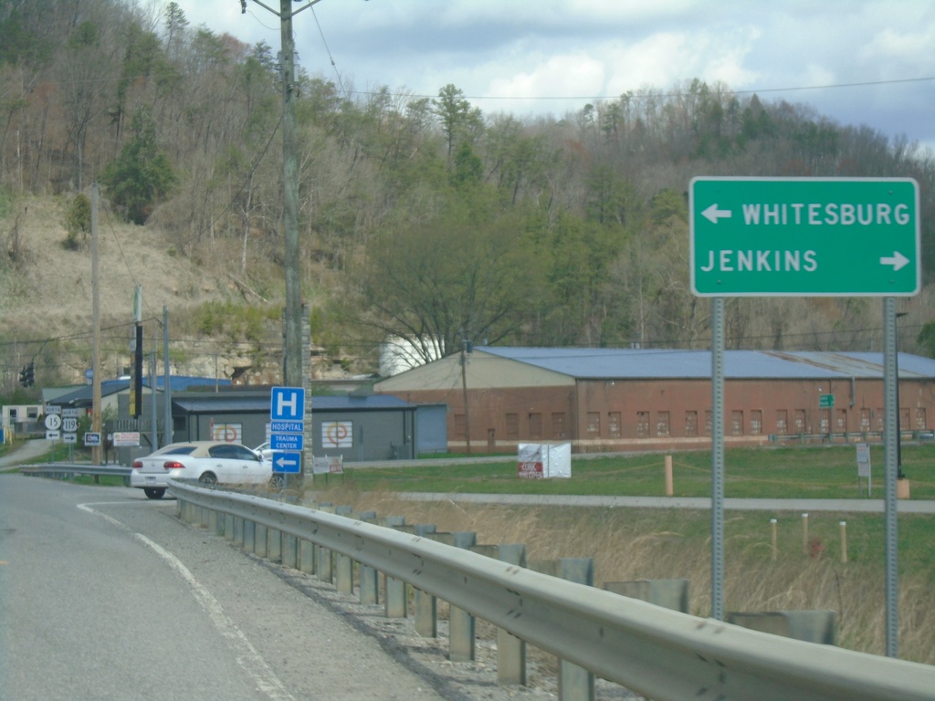
US-119 North at KY-15
US-119 North at KY-15. Use KY-15 west to Whitesburg; turn right to continue north on US-119 to Jenkins.
Taken 03-31-2024
 Whitesburg
Letcher County
Kentucky
United States
Whitesburg
Letcher County
Kentucky
United States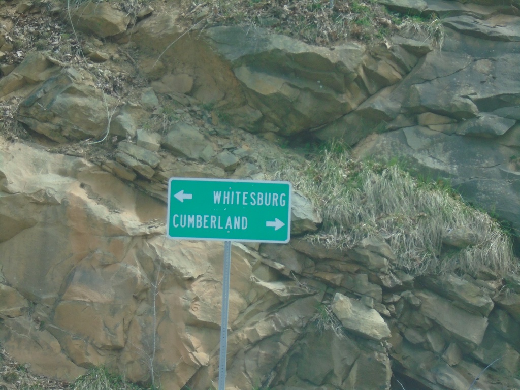
End KY-1679 East at US-119
End KY-1679 East at US-119. Use US-119 South to Cumberland; US-119 North to Whitesburg.
Taken 03-31-2024
 Oven Fork
Letcher County
Kentucky
United States
Oven Fork
Letcher County
Kentucky
United States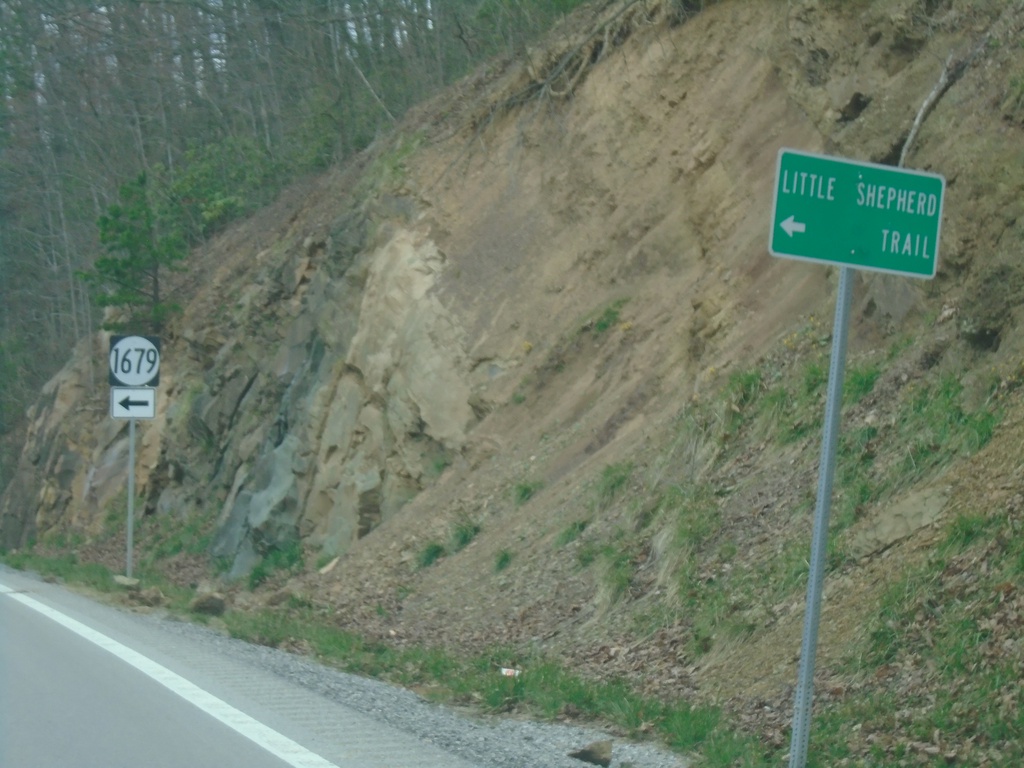
US-119 North Approaching KY-1679
US-119 North approaching KY-1679 to Little Shepherd Trail.
Taken 03-31-2024
Cumberland
Letcher County
Kentucky
United States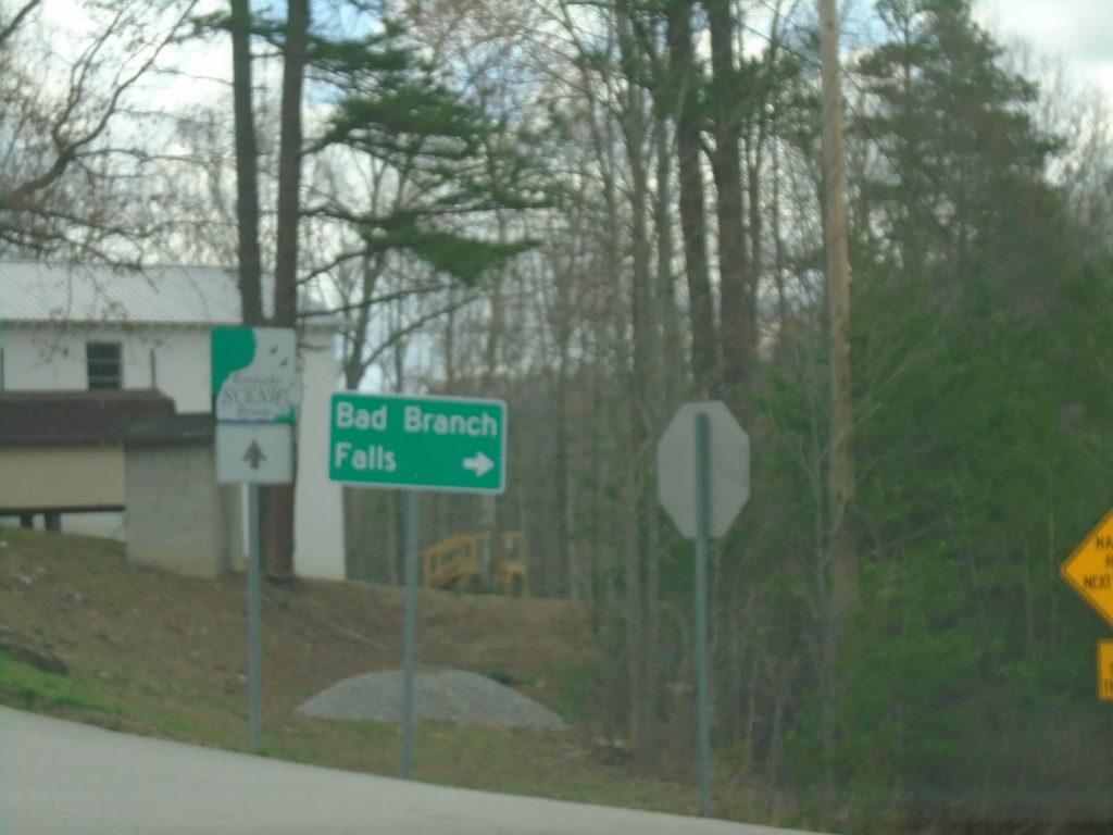
US-119 North at KY-932
US-119 North at KY-932 to Bad Branch Falls.
Taken 03-31-2024
 Cumberland
Letcher County
Kentucky
United States
Cumberland
Letcher County
Kentucky
United States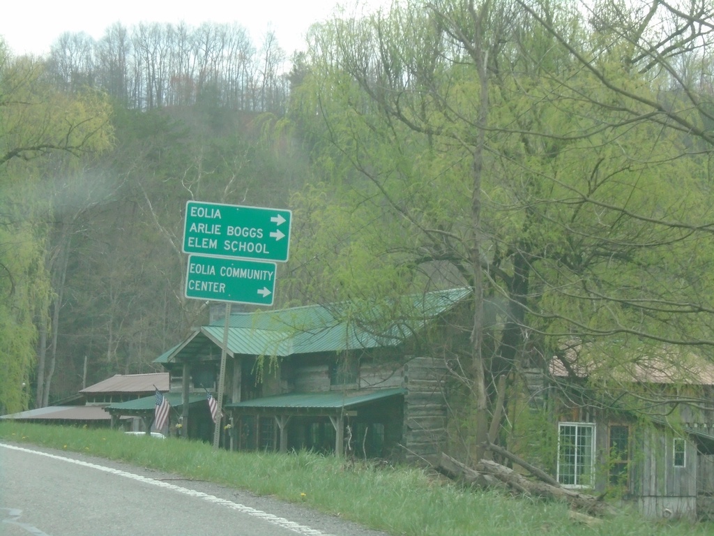
US-119 North Approaching KY-806
US-119 North approaching KY-806 to Eolia, Arlie Boggs Elementary School and Eolia Community Center.
Taken 03-31-2024
 Eolia
Letcher County
Kentucky
United States
Eolia
Letcher County
Kentucky
United States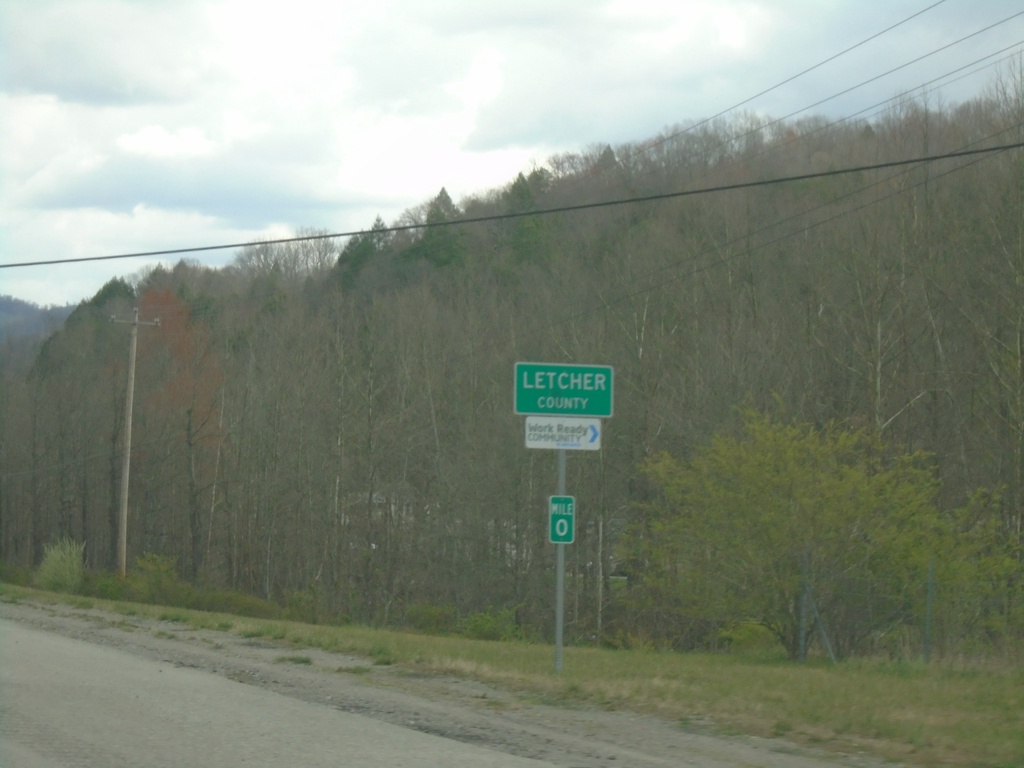
US-119 North - Letcher County
Entering Letcher County on US-119 North. The mile markers in Kentucky reset at county lines, on non interstate highways.
Taken 03-31-2024
Cumberland
Letcher County
Kentucky
United States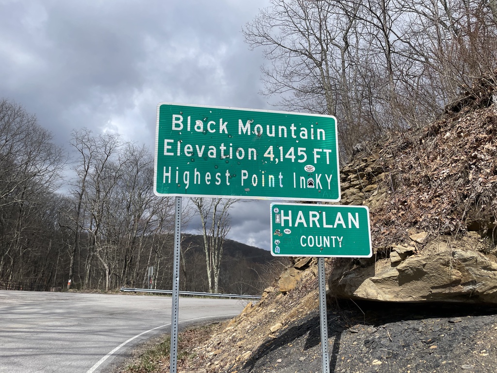
KY-160 West - Harlan County / Black Mountain
KY-160 West at the Kentucky/Virginia State Line. Black Mountain Elevation 4,145 Feet - Highest Point in Kentucky. Entering Harlan County. The actual high point is about 1.5 miles to the south via a trail.
Taken 03-31-2024
Lynch
Harlan County
Kentucky
United States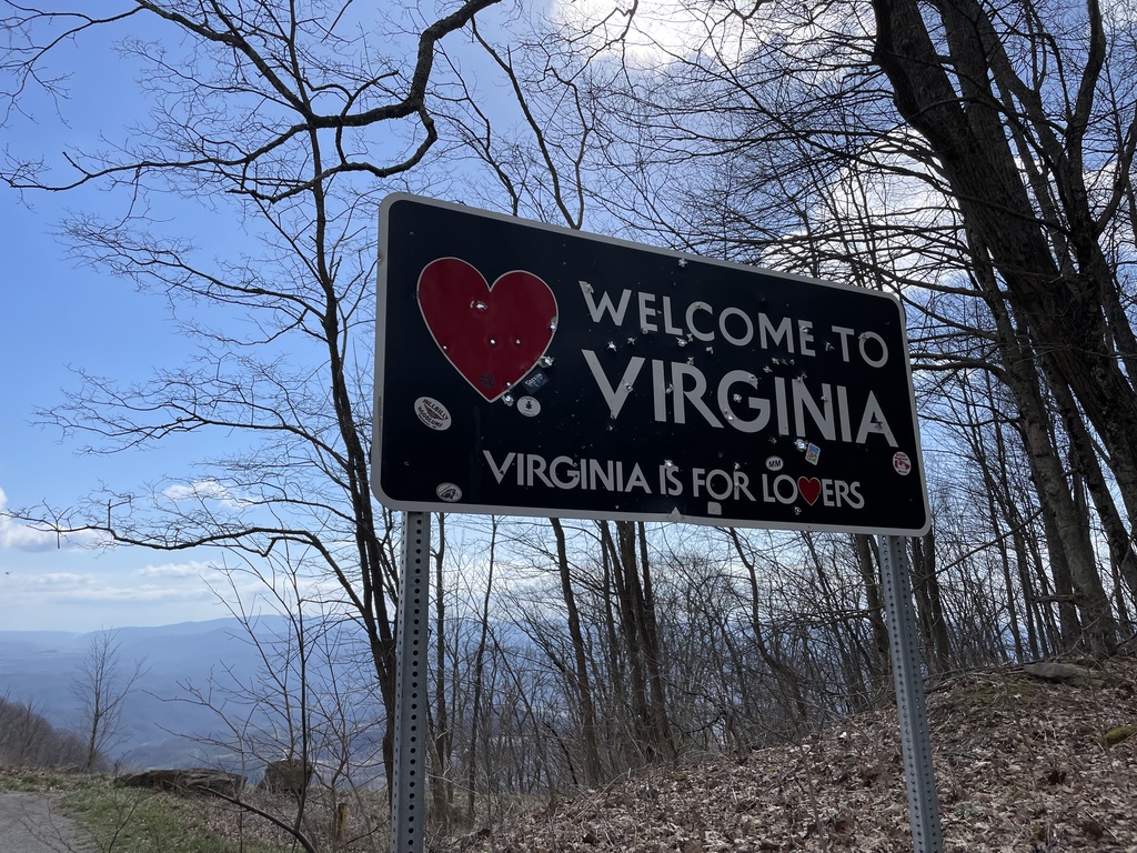
VA-160 East - Welcome To Virginia
Welcome To Virginia - Virginia Is For Lovers on VA-160 East. Taken at the Kentucky/Virginia State Line.
Taken 03-31-2024
 Appalachia
Wise County
Virginia
United States
Appalachia
Wise County
Virginia
United States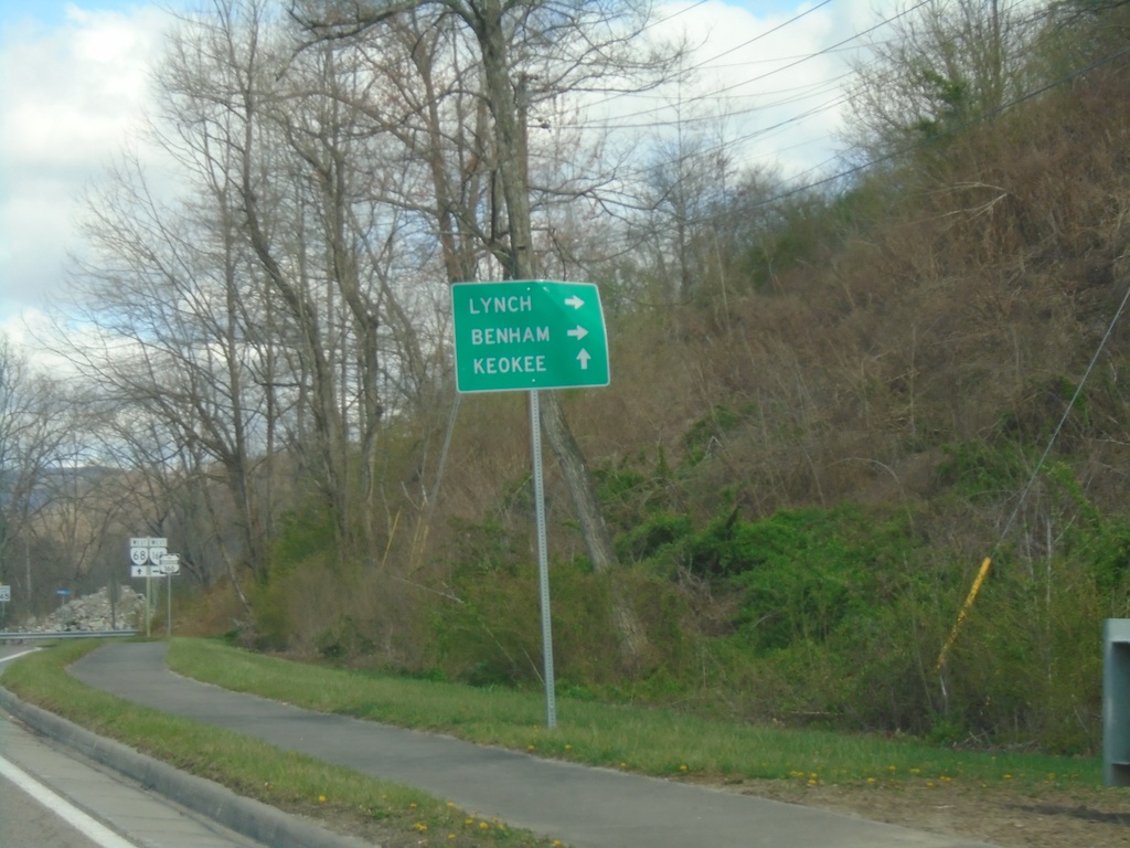
VA-68 West at VA-160
VA-68 West at VA-160. Continue west on VA-68 to Keokee; use VA-160 West to Lynch (KY) and Benham (KY).
Taken 03-31-2024
 Appalachia
Wise County
Virginia
United States
Appalachia
Wise County
Virginia
United States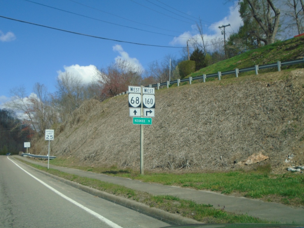
VA-68 West Approaching VA-160 West
VA-68 West approaching VA-160 West. Distance marker to Keokee.
Taken 03-31-2024
Appalachia
Wise County
Virginia
United States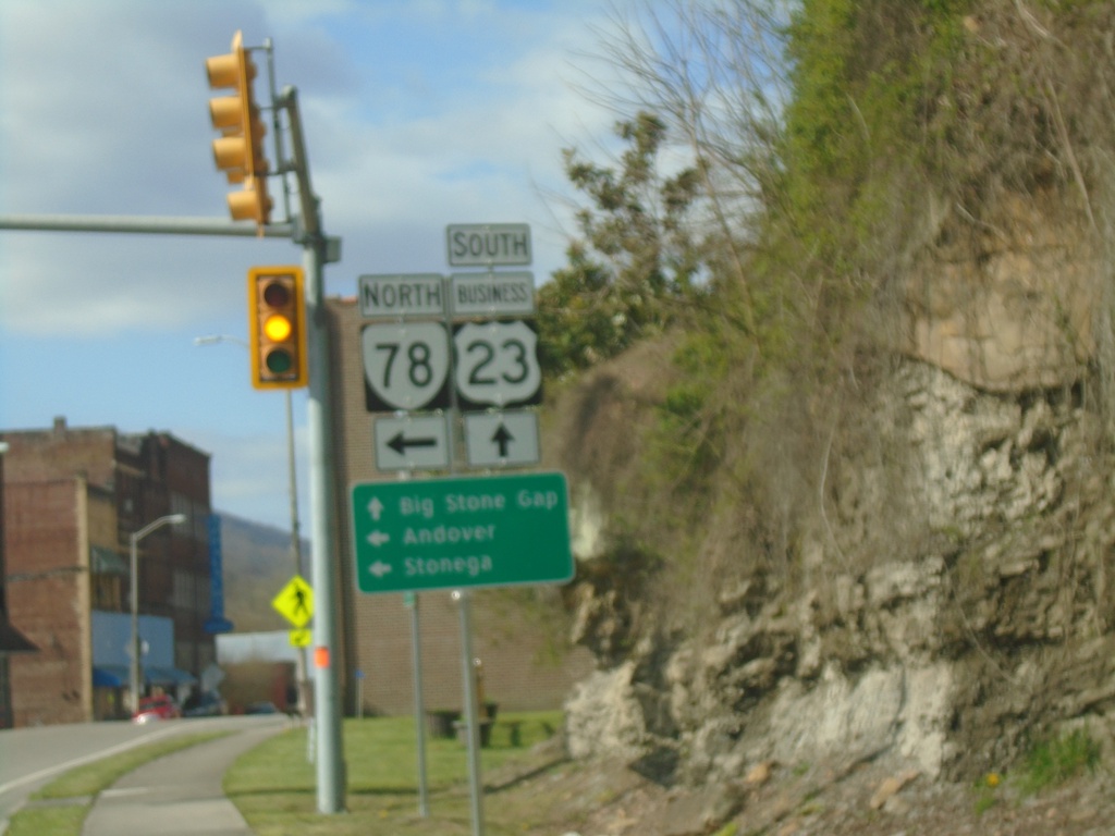
Bus. US-23 South at VA-78 North
Bus. US-23 South at VA-78 North in Norton. Use VA-78 North to Andover and Stonega. Continue south on Bus. US-23 for Big Stone Gap.
Taken 03-31-2024
 Appalachia
Wise County
Virginia
United States
Appalachia
Wise County
Virginia
United States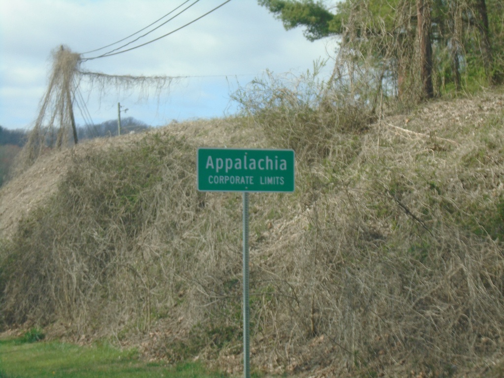
Bus. US-23 South - Appalachia
Bus. US-23 South - Appalachia Corporate Limits
Taken 03-31-2024
Appalachia
Wise County
Virginia
United States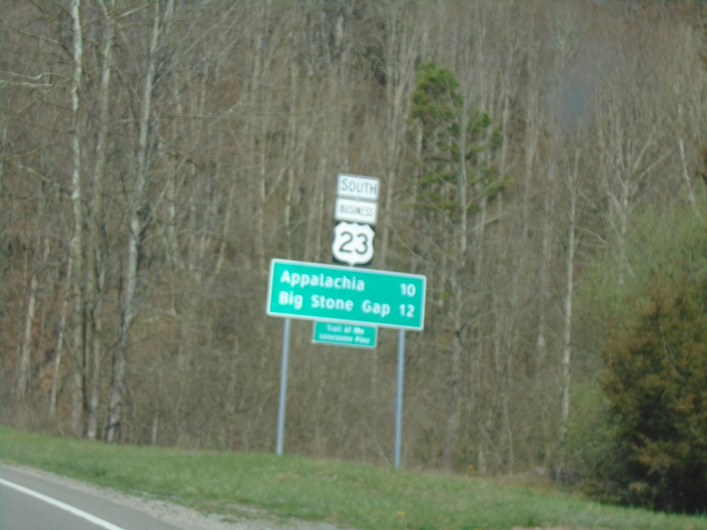
Bus. US-23 South - Distance Marker
Distance Marker on Bus. US-23 South. Distance to Appalachia and Big Stone Gap.
Taken 03-31-2024
Norton
Wise County
Virginia
United States