Signs Tagged With Big Green Sign
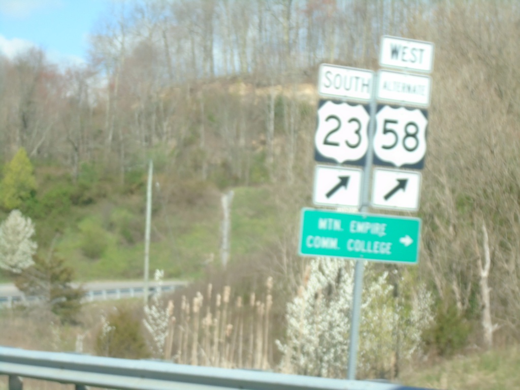
Alt. US-58 West at US-23 South
Alt. US-58 West at US-23 South to Mountain Empire Community College.
Taken 03-31-2024


 Norton
Virginia
United States
Norton
Virginia
United States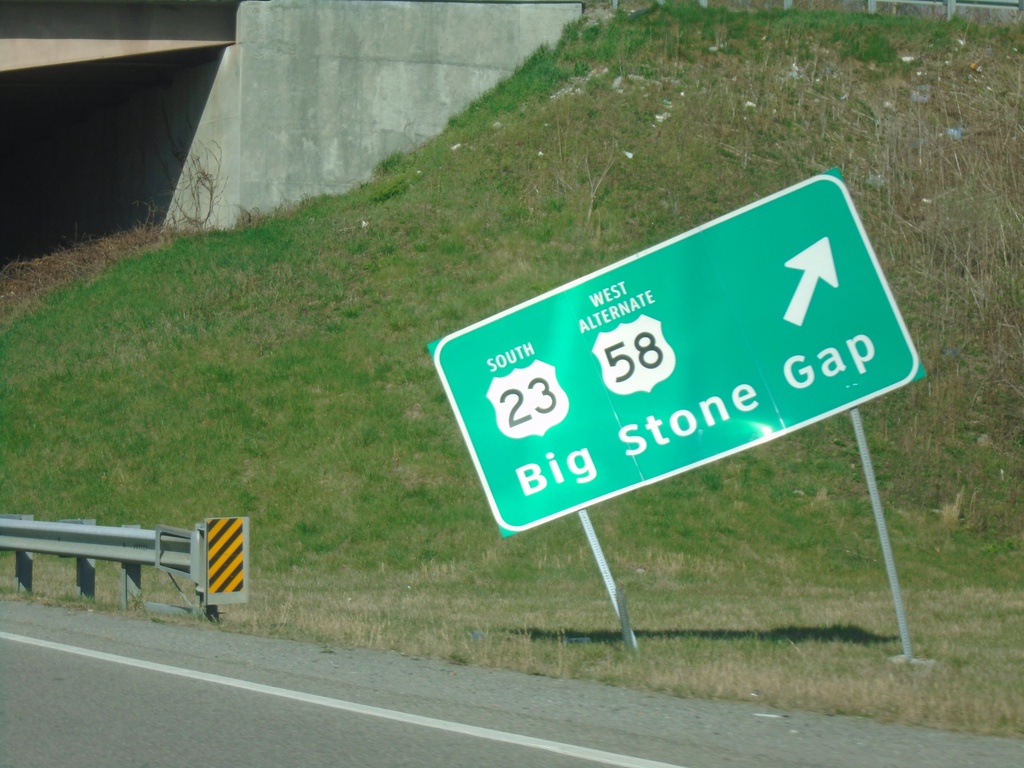
Alt. US-58 West at US-23 South
Alt. US-58 West at US-23 South to Big Stone Gap. Continue straight for Bus. US-23.
Taken 03-31-2024
Norton
Virginia
United States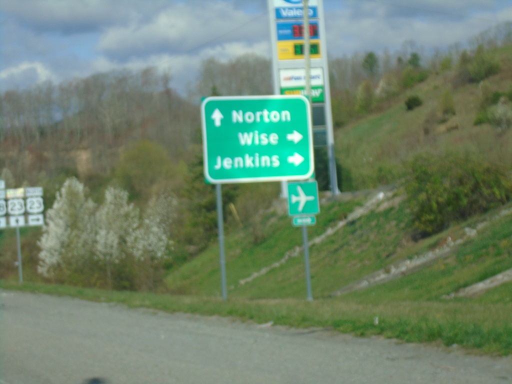
Alt. US-58 West at US-23/Bus. US-23
Alt. US-58 West at US-23/Bus. US-23. Use US-23 north to Wise and Jenkins. Continue under freeway for Bus. US-23 South to Norton. Alt. US-58 West joins US-23 southbound.
Taken 03-31-2024
Norton
Virginia
United States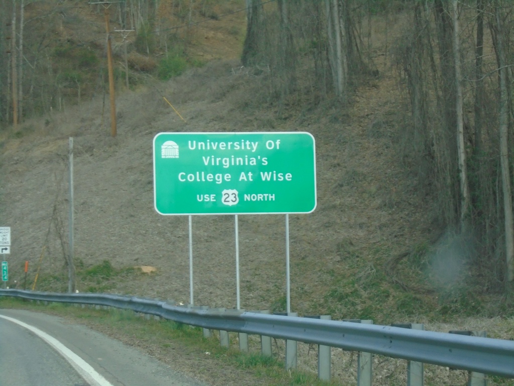
Alt. US-58 West - University of Virginia's College at Wise
Alt. US-58 West - For access to University of Virginia’s College at Wise use US-23 north.
Taken 03-31-2024
Norton
Wise County
Virginia
United States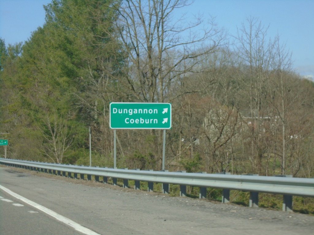
Alt. US-58 West - Exit 2
Alt. US-58 West at Exit 2 to Dungannon and Coeburn.
Taken 03-31-2024
 Coeburn
Wise County
Virginia
United States
Coeburn
Wise County
Virginia
United States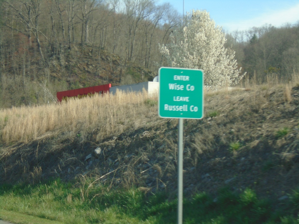
US-58 Alt. West - Wise County
Enter Wise County/Leave Russell County on US-58 Alt. West
Taken 03-31-2024
Saint Paul
Wise County
Virginia
United States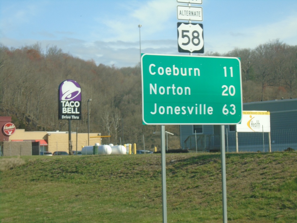
US-58 Alt. West - Distance Marker
Distance marker on US-58 Alt. West. Distance to Coeburn, Norton, and Jonesville.
Taken 03-31-2024
Saint Paul
Russell County
Virginia
United States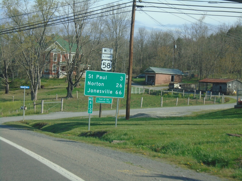
Alt. US-58 West - Distance Marker
Distance marker on Alt. US-58 West. Distance to St Paul, Norton, and Jonesville.
Taken 03-31-2024
Castlewood
Russell County
Virginia
United States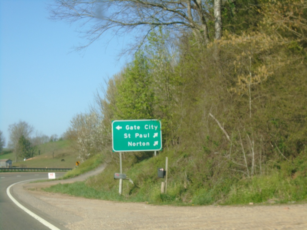
Alt. US-58 West/VA-71 South at Split
Alt. US-58 West/VA-71 South at Alt. US-58/VA-71 split. Use VA-71 south to Gate City; use Alt. US-58 West to St. Paul and Norton.
Taken 03-31-2024
 Castlewood
Russell County
Virginia
United States
Castlewood
Russell County
Virginia
United States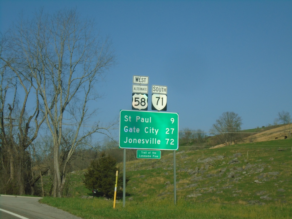
Alt. US-58 West/VA-71 South - Distance Marker
Distance Marker on Alt. US-58 West/VA-71 South. Distance to St. Paul, Gate City, and Jonesville.
Taken 03-31-2024
Castlewood
Russell County
Virginia
United States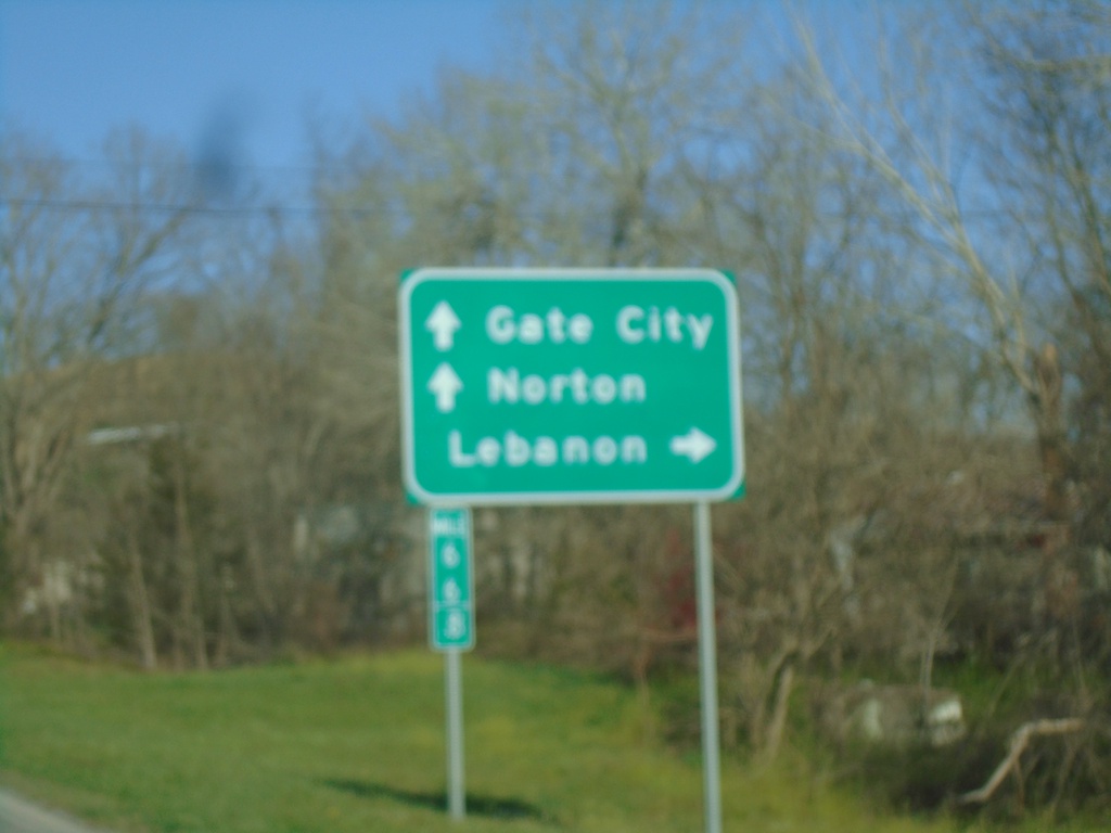
Alt. US-58 West at VA-71
Alt. US-58 West at VA-71. Use VA-71 North to Lebanon. Continue west on Alt. US-58 West/VA-71 South to Gate City and Norton.
Taken 03-31-2024
Castlewood
Russell County
Virginia
United States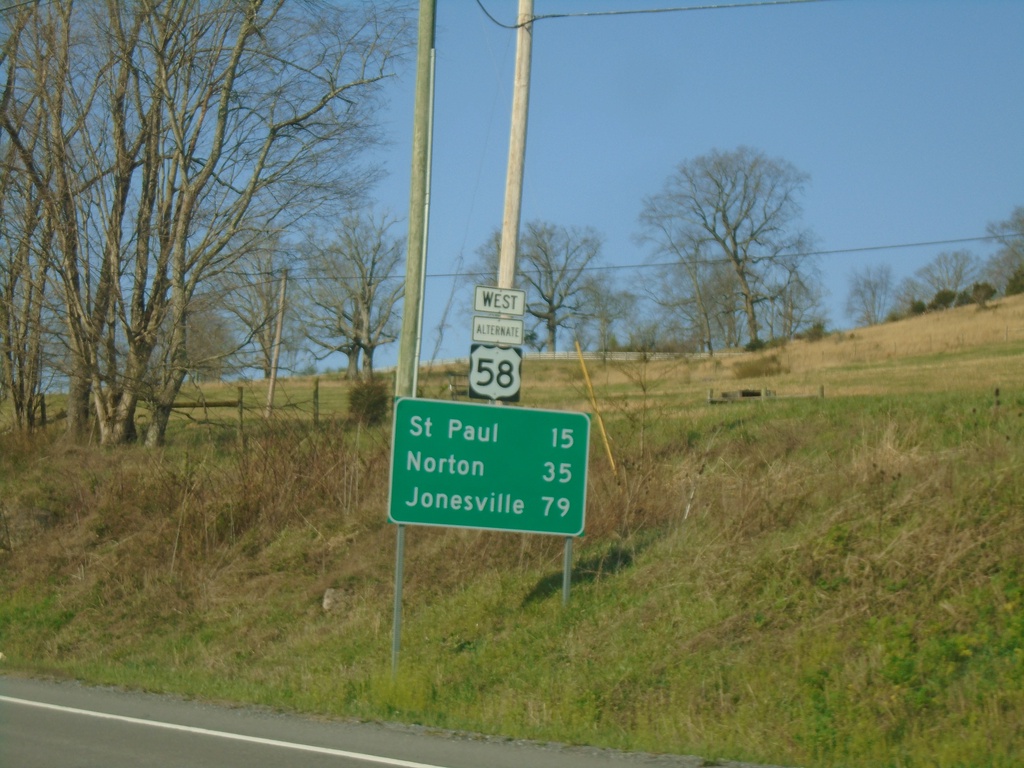
Alt. US-58 West - Distance Marker
Distance marker on Alt. US-58 West. Distance to St. Paul, Norton, and Jonesville.
Taken 03-31-2024
Lebanon
Russell County
Virginia
United States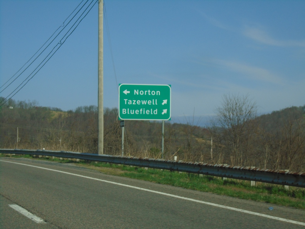
US-19 North/Alt. US-58 West at Split
US-19 North/Alt. US-58 West at US-19/Alt. US-58 split. Continue north on US-19 for Tazewell and Bluefield. Use Alt. US-58 West to Norton.
Taken 03-31-2024
 Lebanon
Russell County
Virginia
United States
Lebanon
Russell County
Virginia
United States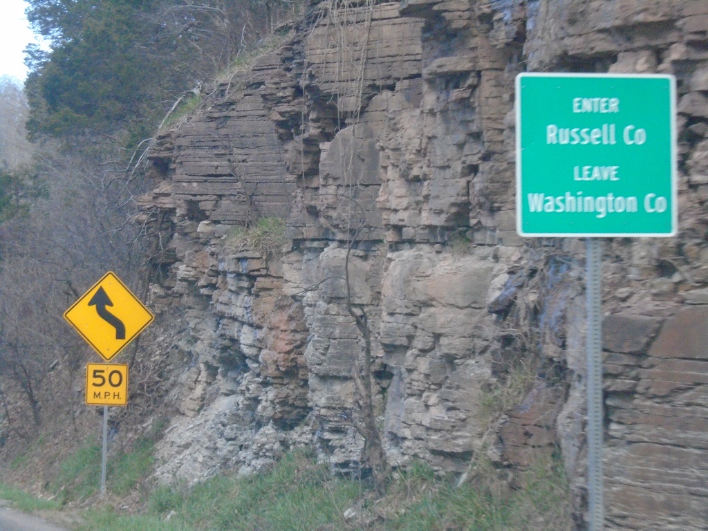
US-19 North/Alt. US-58 West - Enter Russell County
Enter Russell County/Leave Washington County on US-19 North/Alt. US-58 West at Little Moccasin Gap.
Taken 03-31-2024
Lebanon
Russell County
Virginia
United States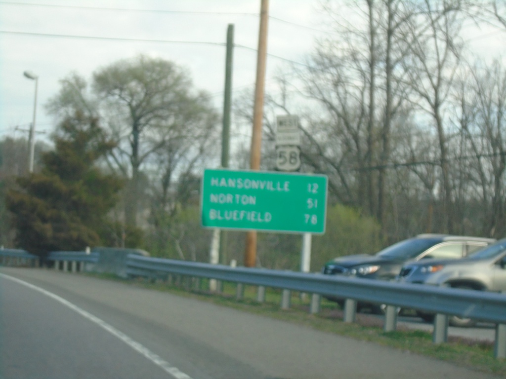
US-19 North/Alt. US-58 West - Distance Marker
Distance Marker on US-19 North/Alt. US-58 West. Distance to Hansonville, Norton, and Bluefield.
Taken 03-31-2024
Abingdon
Washington County
Virginia
United States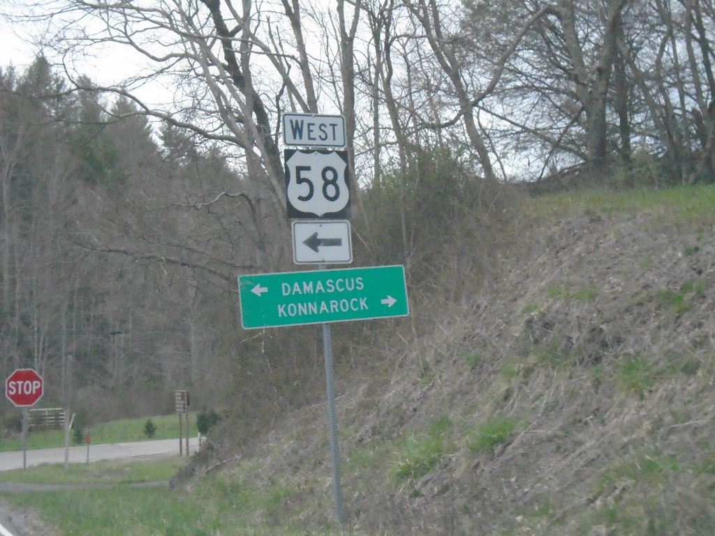
US-58 West at VAS-603
US-58 West at VAS-603. Use VAS-603 east to Konnarock; US-58 west to Damascus.
Taken 03-31-2024
 Damascus
Washington County
Virginia
United States
Damascus
Washington County
Virginia
United States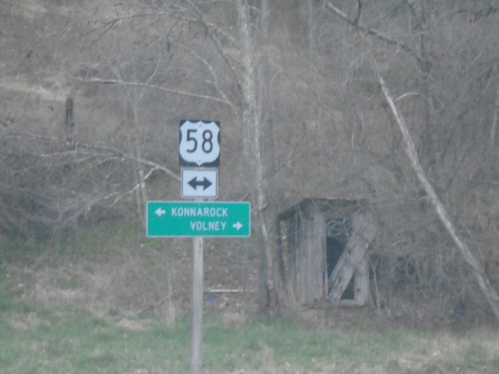
VAS-751 North (Sturgill Road) at US-58
VAS-751 North (Sturgill Road) at US-58. Use US-58 east to Volney; west to Konnarock.
Taken 03-31-2024
 Mouth of Wilson
Grayson County
Virginia
United States
Mouth of Wilson
Grayson County
Virginia
United States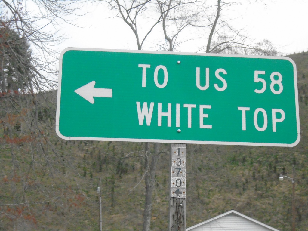
NC-194 South at Helton Creek Road (SR-1370)
NC-194 South at Helton Creek Road (SR-1370) to White Top and US-58
Taken 03-31-2024
 Lansing
Ashe County
North Carolina
United States
Lansing
Ashe County
North Carolina
United States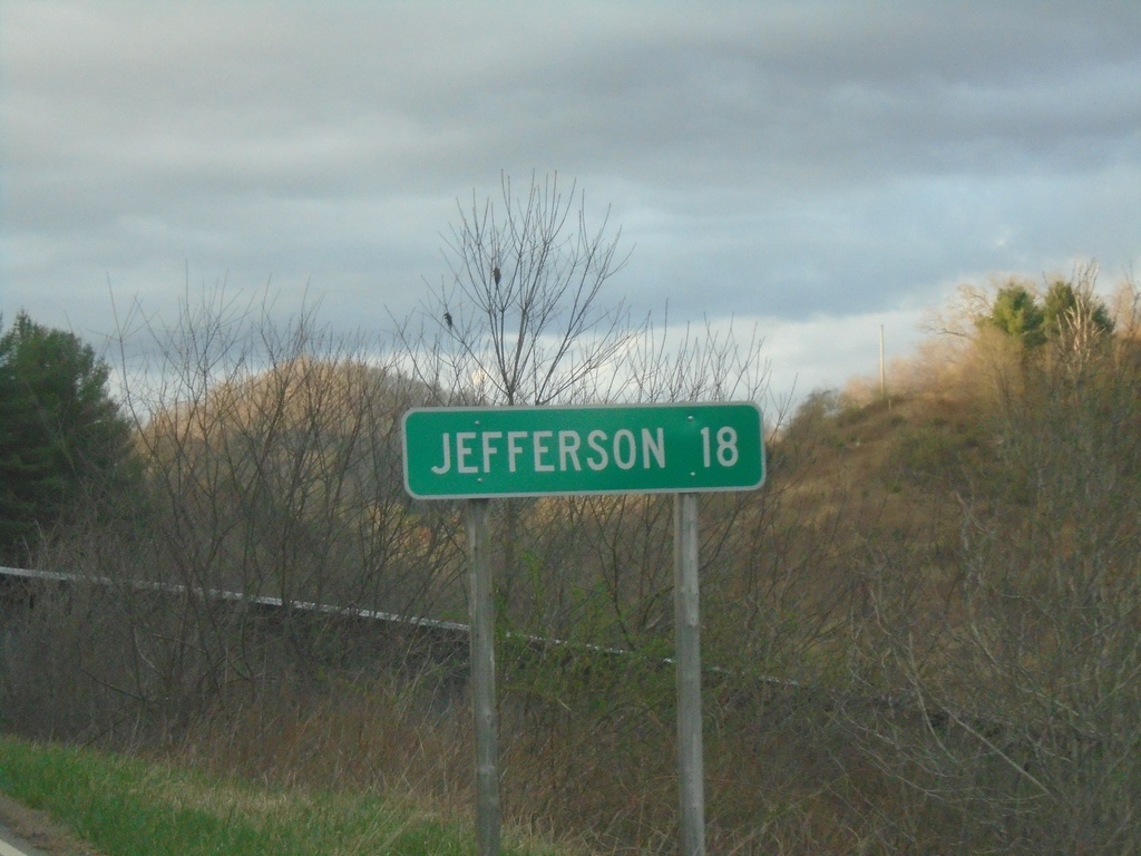
NC-194 South - Distance Marker
Distance marker on NC-194 south. Distance to Jefferson.
Taken 03-31-2024
Grassy Creek
Ashe County
North Carolina
United States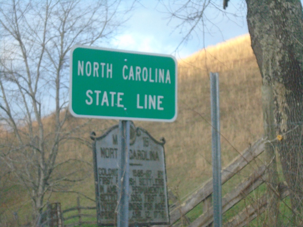
NC-194 South - North Carolina State Line
North Carolina State Line on NC-194 South. Taken at the North Carolina/Virginia State Line.
Taken 03-31-2024
Grassy Creek
Ashe County
North Carolina
United States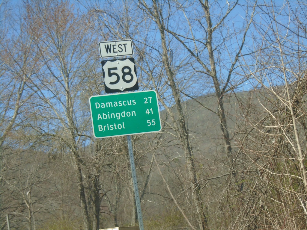
US-58 West - Distance Marker
Distance marker on US-58 west. Distance to Damascus, Abingdon, and Bristol.
Taken 03-30-2024
Mouth of Wilson
Grayson County
Virginia
United States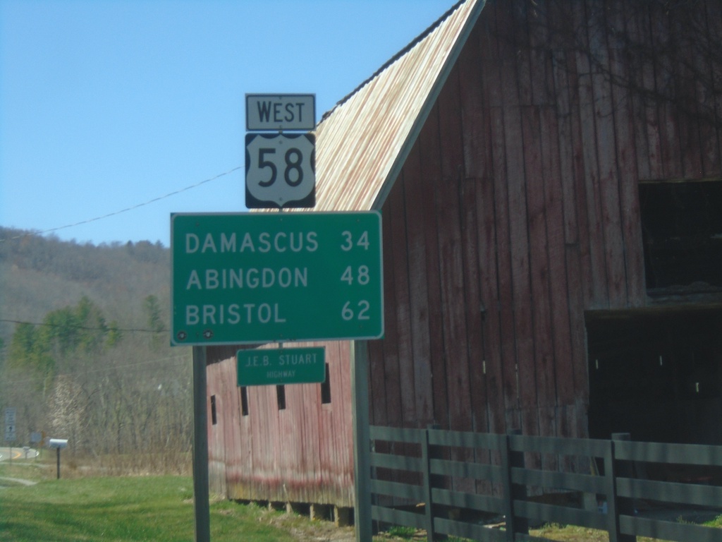
US-58 West - Distance Marker
Distance marker on US-58 west. Distance to Damascus, Abingdon, and Bristol.
Taken 03-30-2024
Mouth of Wilson
Grayson County
Virginia
United States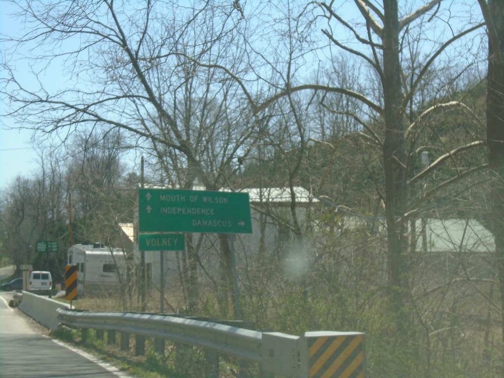
VA-16 South at US-58
VA-16 South at US-58. Use US-58 West to Damascus; US-58 East/VA-16 South to Mouth of Wilson and Independence.
Taken 03-30-2024
 Mouth of Wilson
Grayson County
Virginia
United States
Mouth of Wilson
Grayson County
Virginia
United States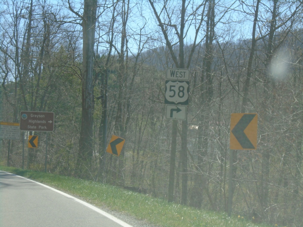
VA-16 South Approaching US-58
VA-16 South Approaching US-58 in Volney. Use US-58 West for Grayson Highlands State Park.
Taken 03-30-2024
Mouth of Wilson
Grayson County
Virginia
United States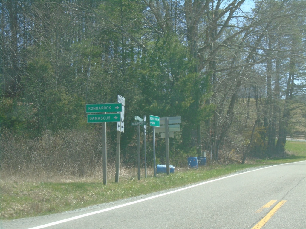
VA-16 South at VAS-603 West
VA-16 South at VAS-603 West to Konnarock and Damascus.
Taken 03-30-2024
Troutdale
Grayson County
Virginia
United States