Signs Tagged With Big Green Sign
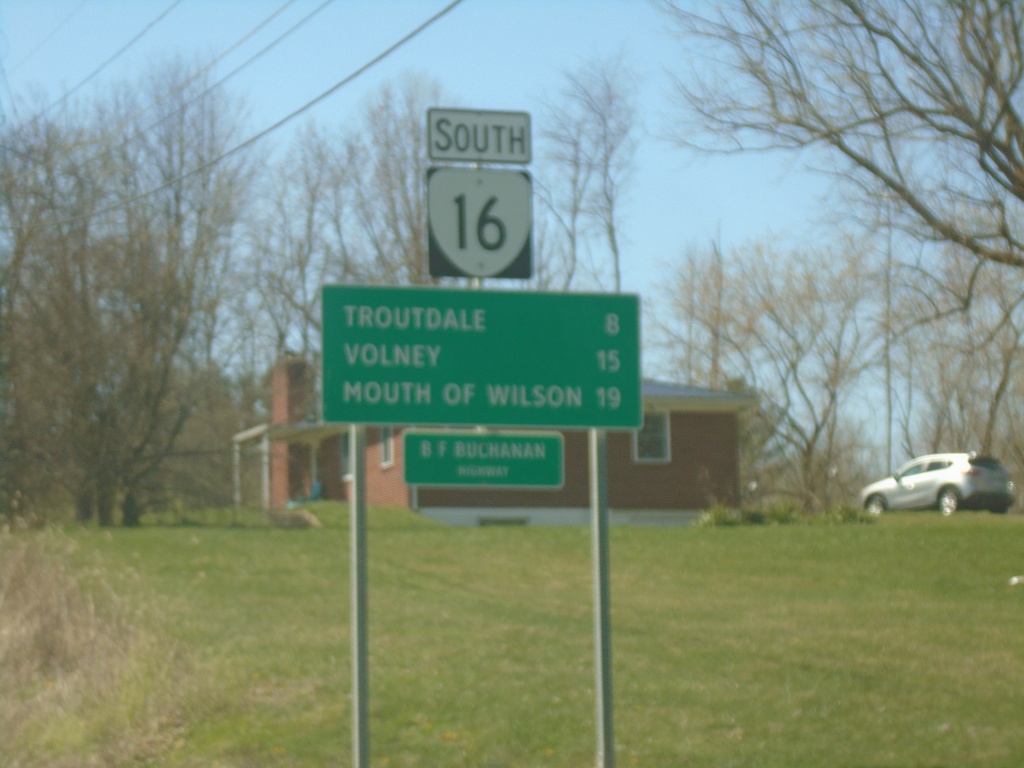
VA-16 South - Distance Marker
Distance marker on VA-16 south. Distance to Troutdale, Volney, and Mouth of Wilson.
Taken 03-30-2024
 Sugar Grove
Smyth County
Virginia
United States
Sugar Grove
Smyth County
Virginia
United States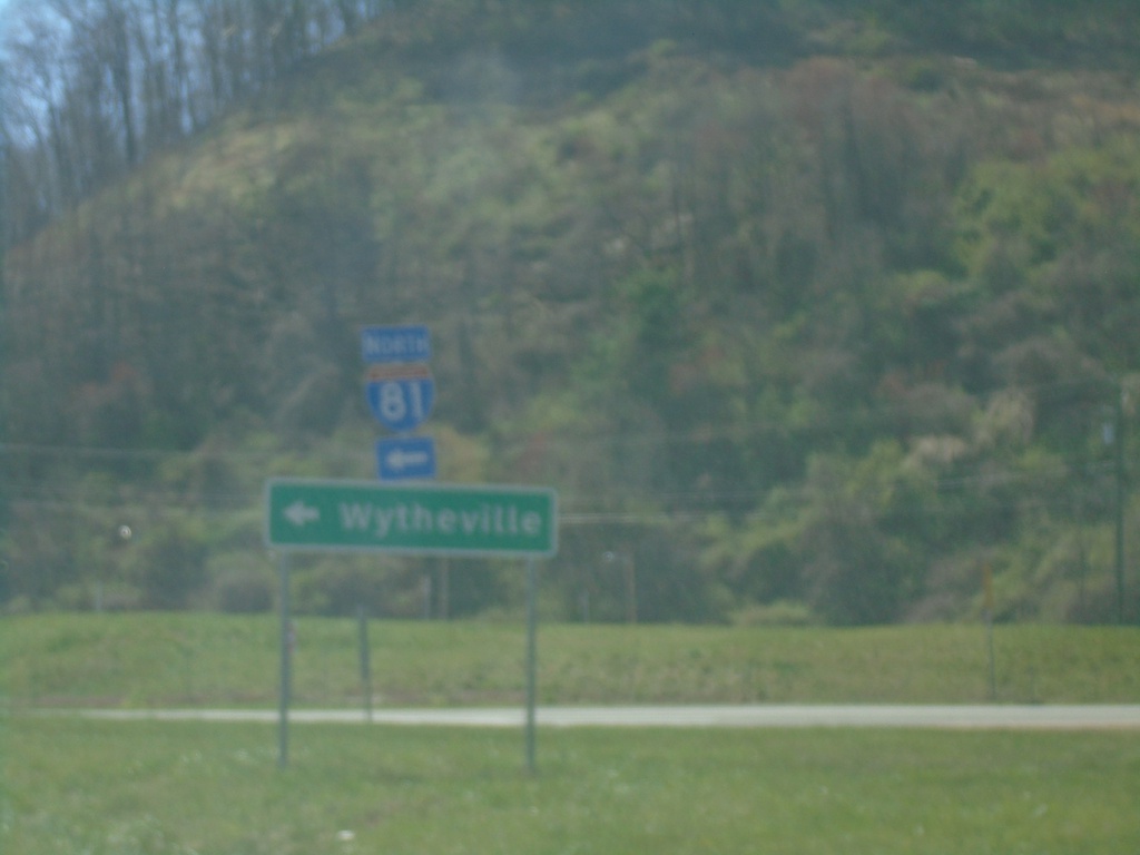
VAS-622 South at I-81 North
VAS-622 South at I-81 North to Wytheville.
Taken 03-30-2024

 Atkins
Smyth County
Virginia
United States
Atkins
Smyth County
Virginia
United States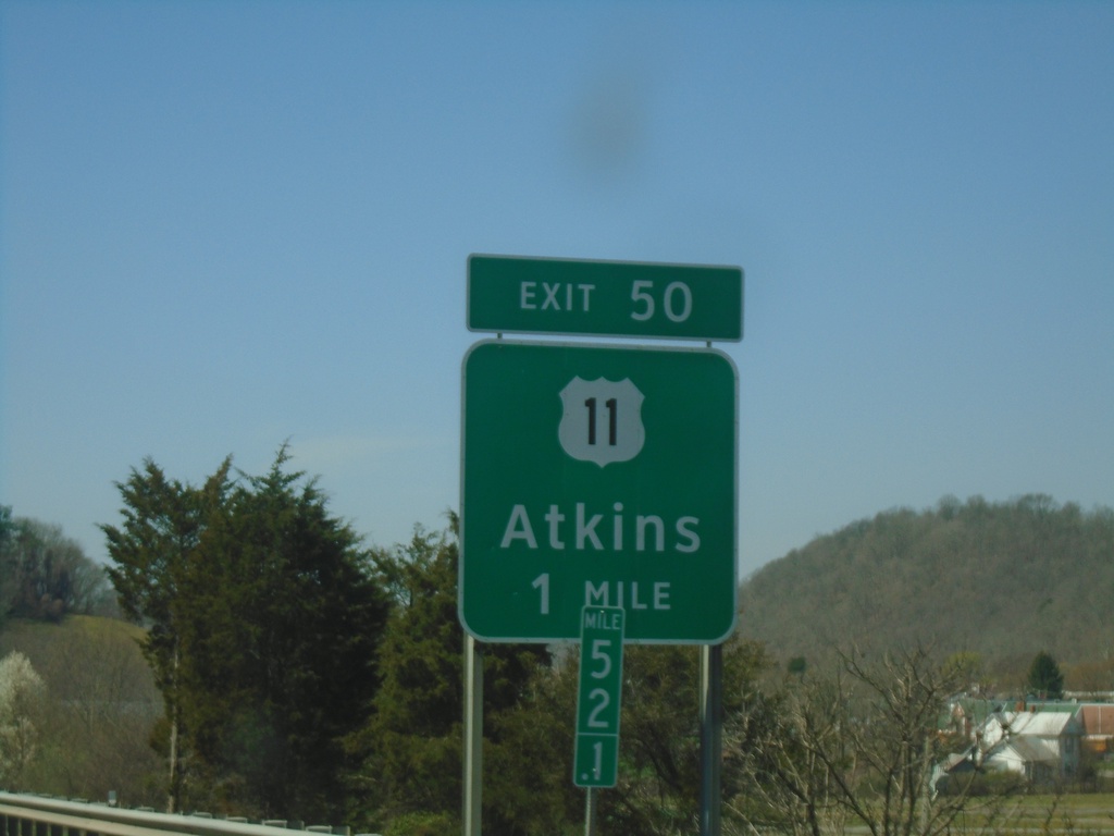
I-81 South - Exit 50
I-81 south approaching Exit 50 - US-11/Atkins.
Taken 03-30-2024
 Marion
Smyth County
Virginia
United States
Marion
Smyth County
Virginia
United States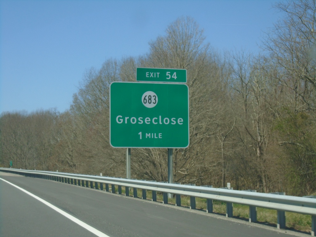
I-81 South - Exit 54
I-81 south approaching Exit 54 - VAS-683/Groseclose
Taken 03-30-2024
 Atkins
Smyth County
Virginia
United States
Atkins
Smyth County
Virginia
United States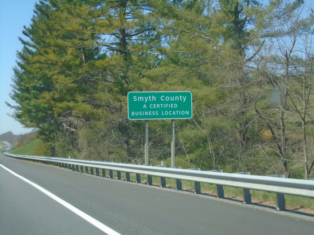
I-81 South - Smythe County
Entering Smythe County on I-81 south.
Taken 03-30-2024
Rural Retreat
Smyth County
Virginia
United States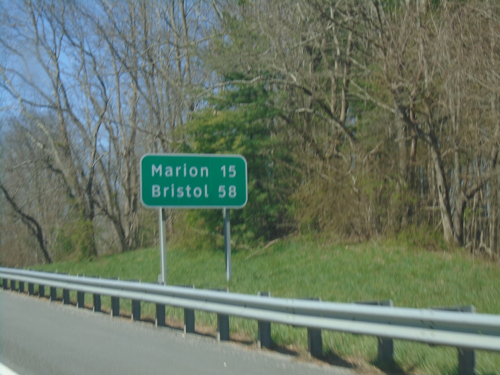
I-81 South - Distance Marker
Distance marker on I-81 south. Distance to Marion, and Bristol.
Taken 03-30-2024
Rural Retreat
Wythe County
Virginia
United States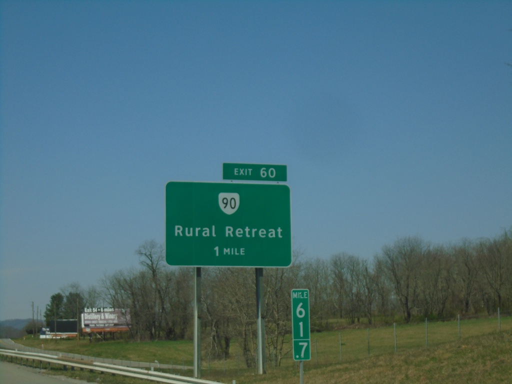
I-81 South - Exit 60
I-81 south approaching Exit 60 - VA-90/Rural Retreat
Taken 03-30-2024
 Rural Retreat
Wythe County
Virginia
United States
Rural Retreat
Wythe County
Virginia
United States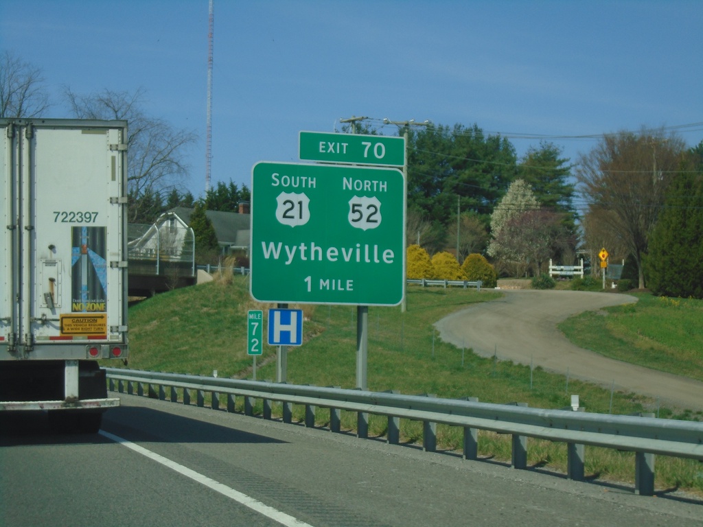
I-81 South - Exit 70
I-81 south approaching Exit 70 - US-52 North/US-21 South/Wytheville.
Taken 03-30-2024

 Wytheville
Wythe County
Virginia
United States
Wytheville
Wythe County
Virginia
United States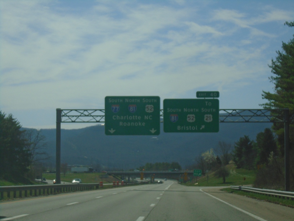
I-77 South - Exit 40
I-77 south at Exit 40 - I-81 South/US-52 North/To US-21/Bristol. Use left lanes for I-77 South/I-81 North/US-52 South/Charlotte, NC/Roanoke. I-77 South joins I-81 northbound.
Taken 03-30-2024
 Wytheville
Wythe County
Virginia
United States
Wytheville
Wythe County
Virginia
United States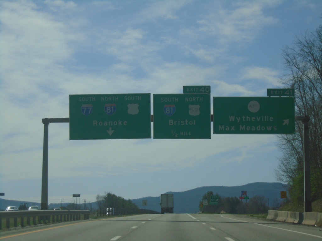
I-77 South - Exits 41 and 40
I-77 south at Exit 41 - VAS-610/Wytheville/Max Meadows. Approaching Exit 40 - I-81 South/US-52 North/Bristol. Use left lanes for I-81 North/I-77 South/US-52 South/Roanoke.
Taken 03-30-2024
 Wytheville
Wythe County
Virginia
United States
Wytheville
Wythe County
Virginia
United States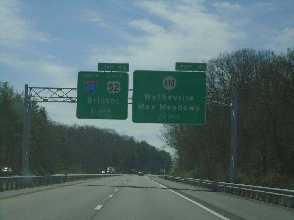
I-77 South - Exits 41 and 40
I-77 south approaching Exit 41 - VAS-610/Wytheville/Max Meadows. Approaching Exit 40 - I-81 South/US-52 North/Bristol.
Taken 03-30-2024
Wytheville
Wythe County
Virginia
United States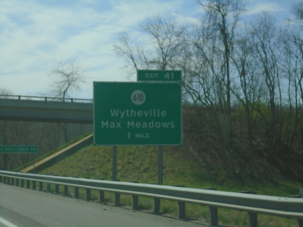
I-77 South - Exit 41
I-77 south approaching Exit 41 - VAS-610/Wytheville/Max Meadows.
Taken 03-30-2024
Wytheville
Wythe County
Virginia
United States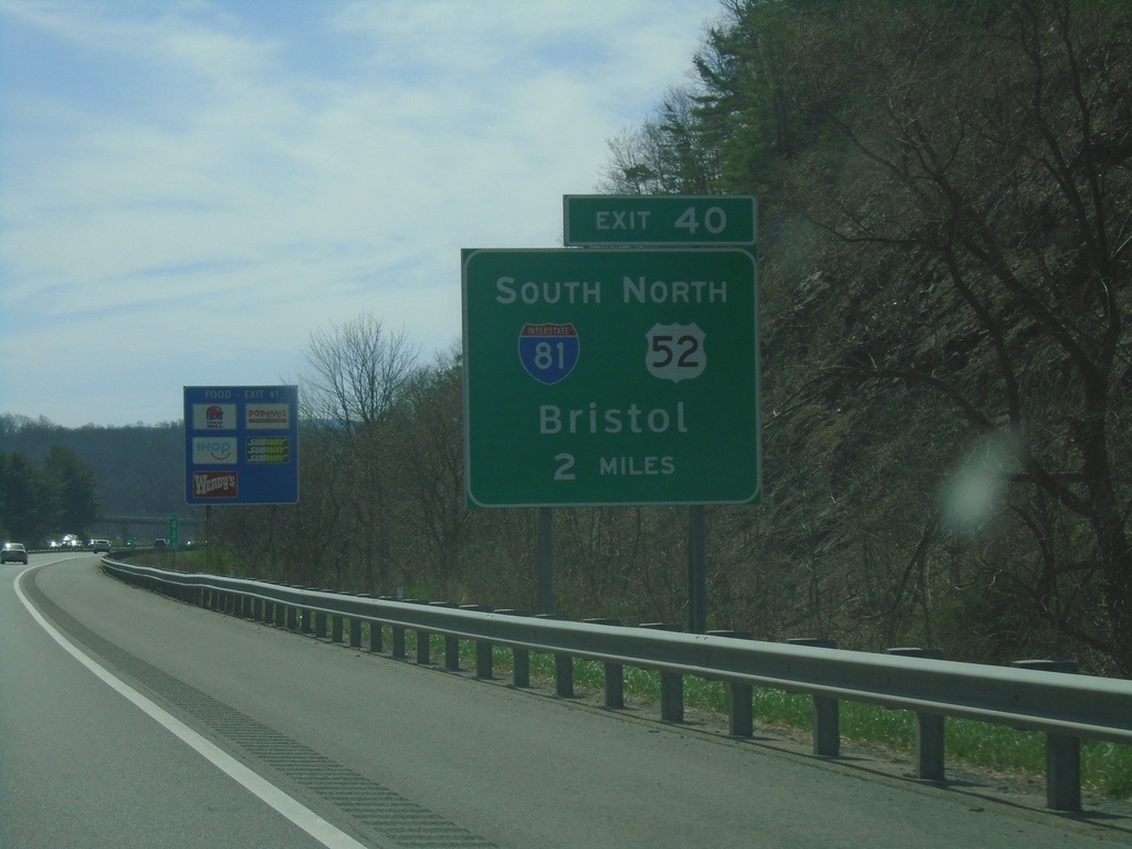
I-77 South - Exit 40
I-77 south approaching Exit 40 - I-81 South/US-52 North/Bristol.
Taken 03-30-2024
Wytheville
Wythe County
Virginia
United States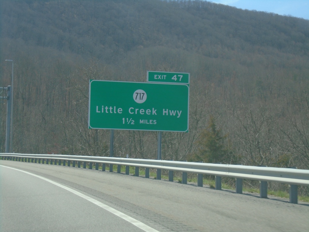
I-77 South - Exit 47
I-77 south approaching Exit 47 - VAS-717/Little Creek Highway.
Taken 03-30-2024
 Bland
Bland County
Virginia
United States
Bland
Bland County
Virginia
United States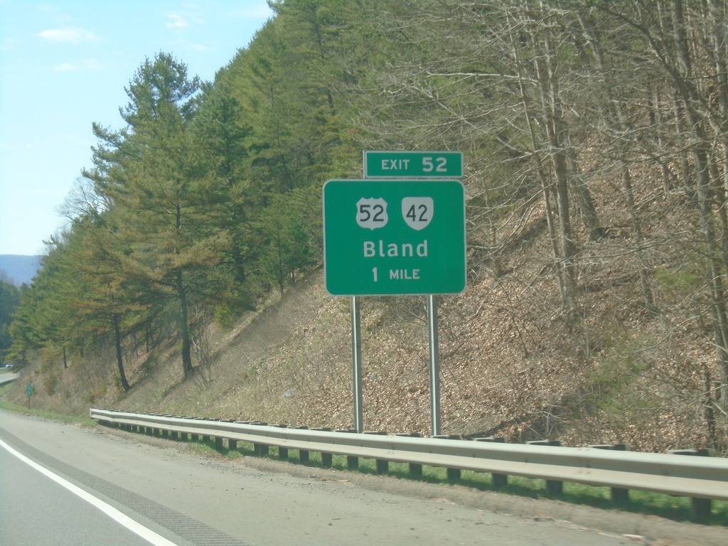
I-77 South - Exit 52
I-77 south approaching Exit 52 - US-52/VA-42/Bland.
Taken 03-30-2024
 Bland
Bland County
Virginia
United States
Bland
Bland County
Virginia
United States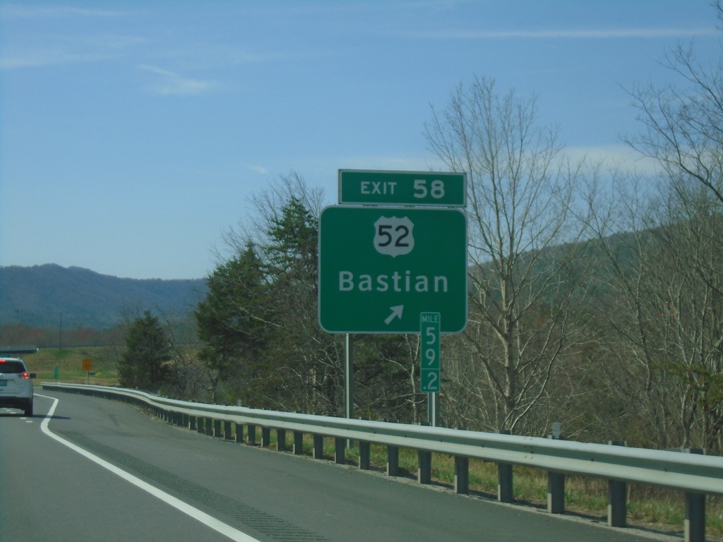
I-77 South - Exit 58
I-77 south at Exit 58 - US-52/Bastian.
Taken 03-30-2024
Bastian
Bland County
Virginia
United States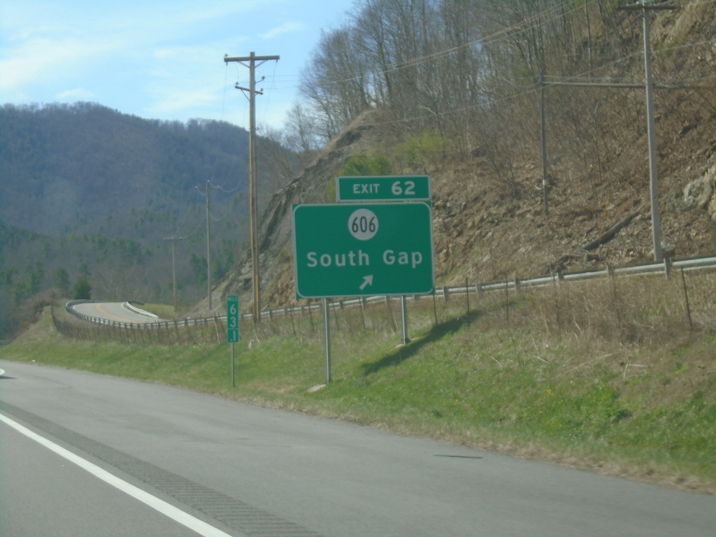
I-77 South - Exit 62
I-77 south at Exit 62 - VAS-606/South Gap.
Taken 03-30-2024
 Bastian
Bland County
Virginia
United States
Bastian
Bland County
Virginia
United States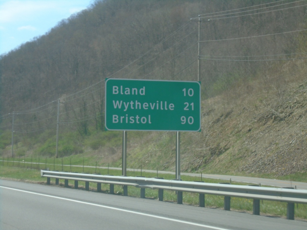
I-77 South - Distance Marker
Distance marker on I-77 south. Distance to Bland, Wytheville, and Bristol (via I-81 south).
Taken 03-30-2024
Rocky Gap
Bland County
Virginia
United States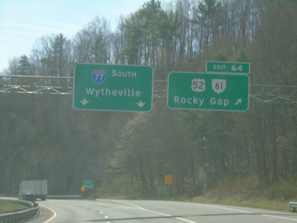
I-77 South - Exit 64
I-77 south at Exit 64 - US-52/VA-61/Rocky Gap. I-77 continues southbound towards Wytheville.
Taken 03-30-2024
 Rocky Gap
Bland County
Virginia
United States
Rocky Gap
Bland County
Virginia
United States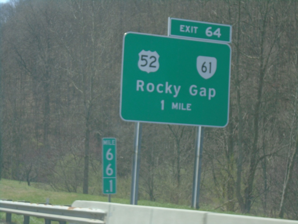
I-77 South - Exit 64
I-77 south approaching Exit 64 - US-52/VA-61/Rocky Gap.
Taken 03-30-2024
Rocky Gap
Bland County
Virginia
United States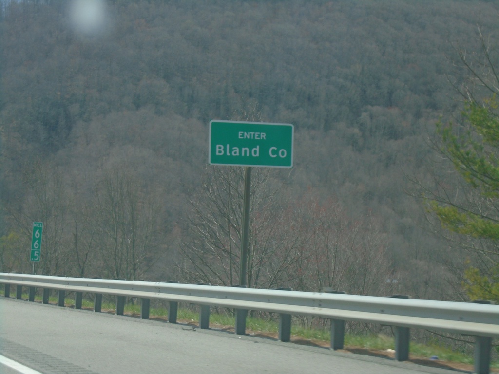
I-77 South - Bland County
Enter Bland County on I-77 south. Just south of the East River Mountain Tunnel that marks the state line between Virginia and West Virginia.
Taken 03-30-2024
Rocky Gap
Bland County
Virginia
United States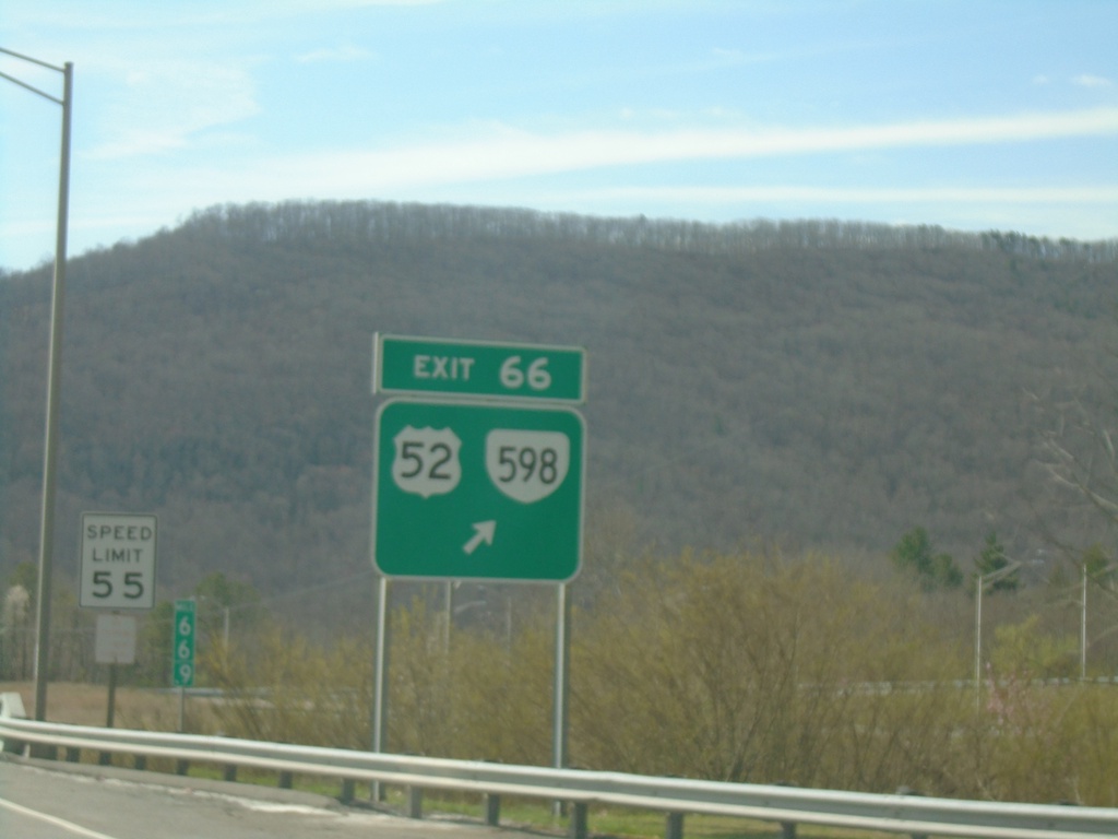
I-77 South - Exit 66
I-77 South at Exit 66 - US-52/VA-598. This is the first exit in Virginia southbound on I-77. US-52 leaves I-77 southbound.
Taken 03-30-2024
 Rocky Gap
Bland County
Virginia
United States
Rocky Gap
Bland County
Virginia
United States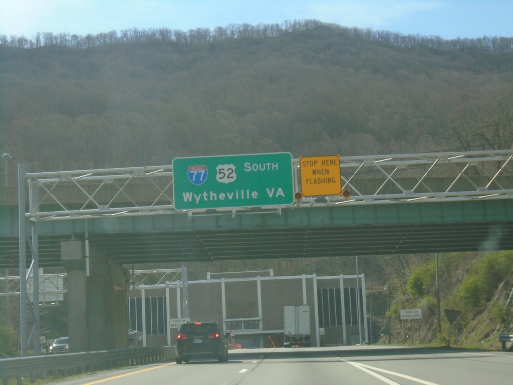
I-77 South Approaching East River Mountain Tunnel
I-77/US-52 South - Wytheville, VA approaching East River Mountain Tunnel.
Taken 03-30-2024
Bluefield
Mercer County
West Virginia
United States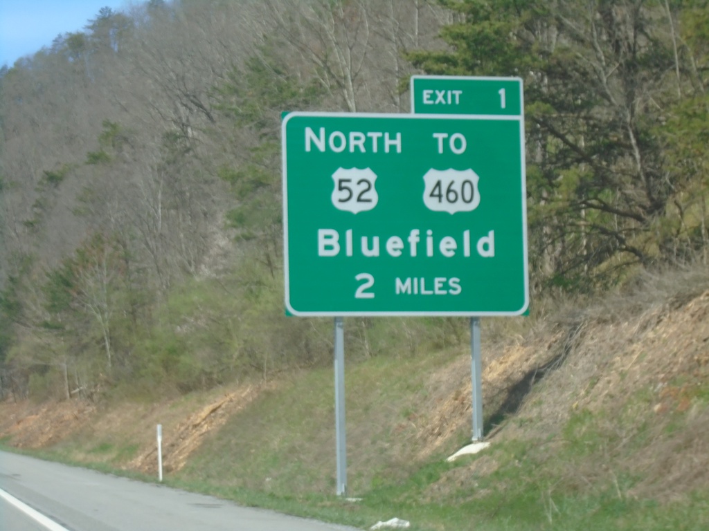
I-77 South - Exit 1
I-77 south approaching Exit 1 - US-52 North/To US-460/Bluefield.
Taken 03-30-2024
 Bluefield
Mercer County
West Virginia
United States
Bluefield
Mercer County
West Virginia
United States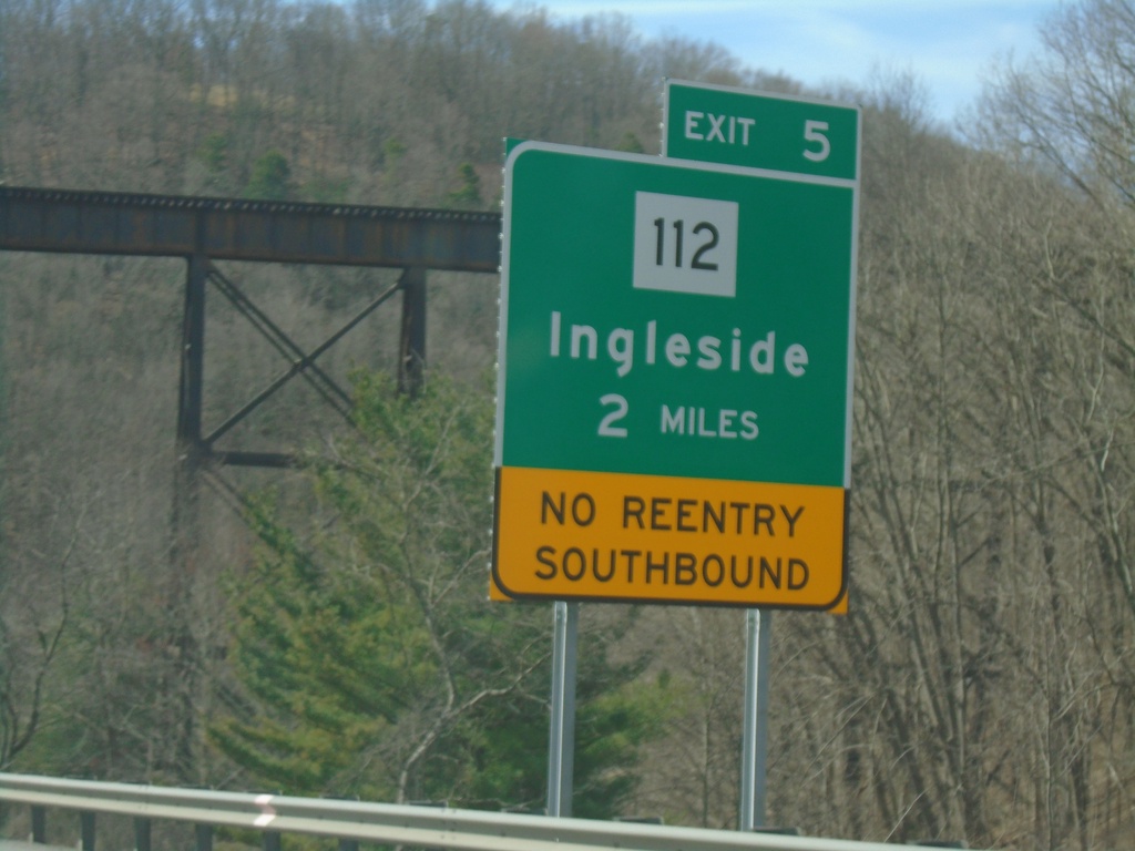
I-77 South - Exit 5
I-77 south approaching Exit 5 - WV-112/Ingleside. No re-entry to I-77 southbound at Exit 5.
Taken 03-30-2024
 Princeton
Mercer County
West Virginia
United States
Princeton
Mercer County
West Virginia
United States