Signs Tagged With Big Green Sign
End UT-130 North at UT-21
End UT-130 North at UT-21 in Minersville. Use UT-21 West to Milford; UT-21 East to Beaver.
Taken 09-09-2023

 Minersville
Beaver County
Utah
United States
Minersville
Beaver County
Utah
United States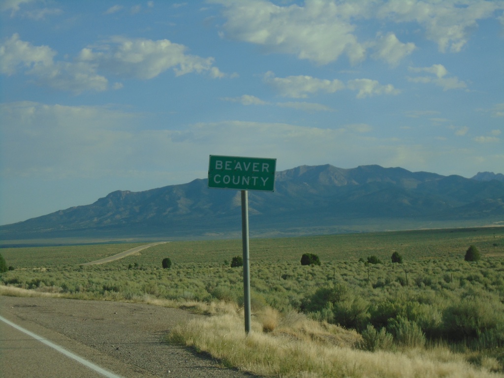
UT-130 North - Beaver County
Entering Beaver County on UT-130 north.
Taken 09-09-2023
Minersville
Beaver County
Utah
United States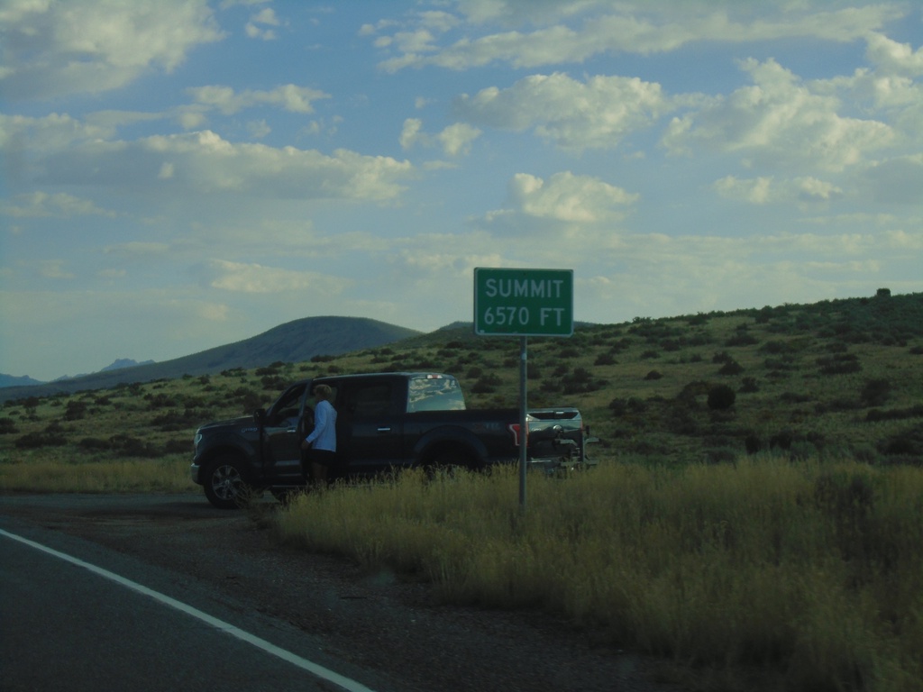
UT-130 North - Summit
Summit - Elevation 6570 Feet on UT-130 North.
Taken 09-09-2023
Iron County
Utah
United States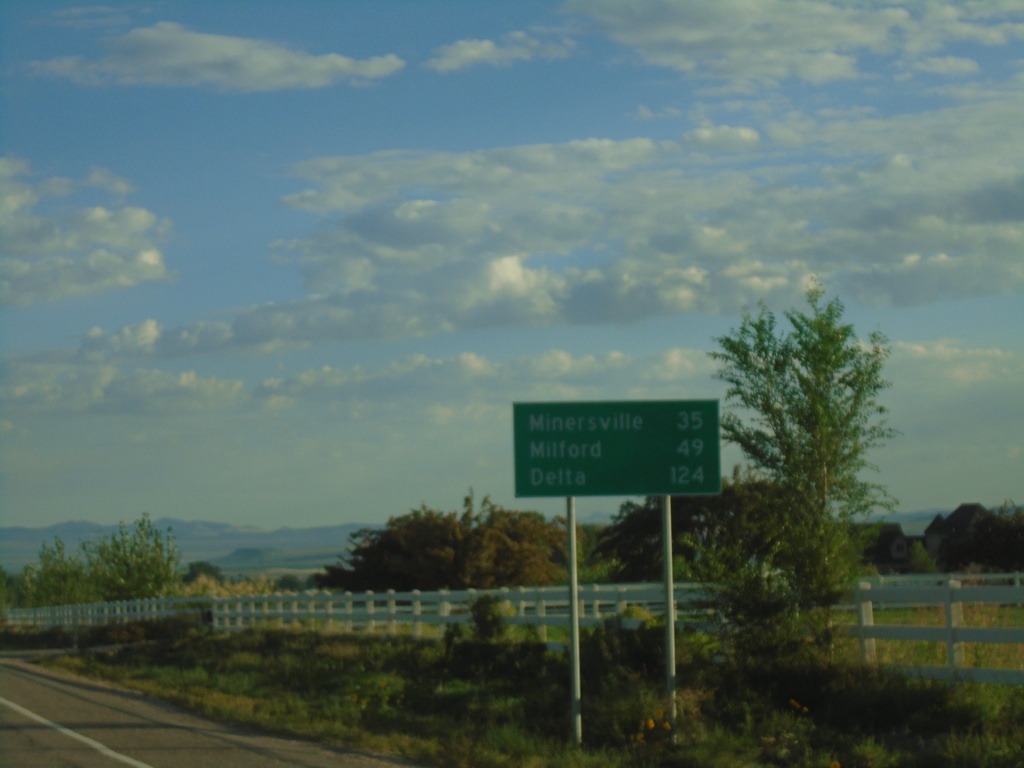
UT-130 North - Distance Marker
Distance marker on UT-130 north. Distance to Minersville, Milford, and Delta.
Taken 09-09-2023
Cedar City
Iron County
Utah
United States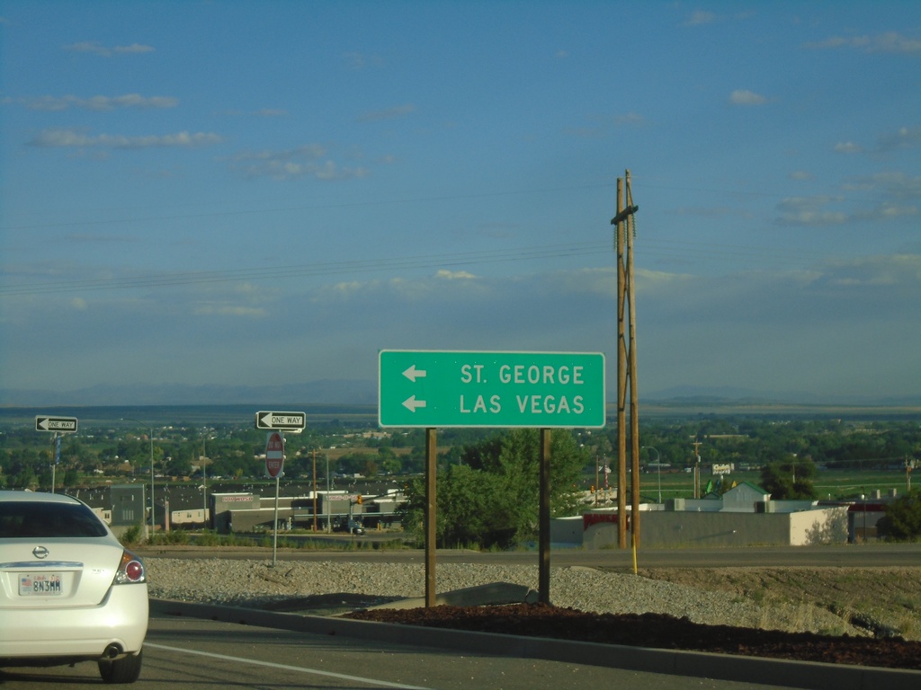
UT-130/BL-15 North at I-15 South
UT-130/BL-15 North at I-15 South. Use I-15 south for St. George and Las Vegas (Nevada). This is the northern end of the Cedar City business loop.
Taken 09-09-2023

 Cedar City
Iron County
Utah
United States
Cedar City
Iron County
Utah
United States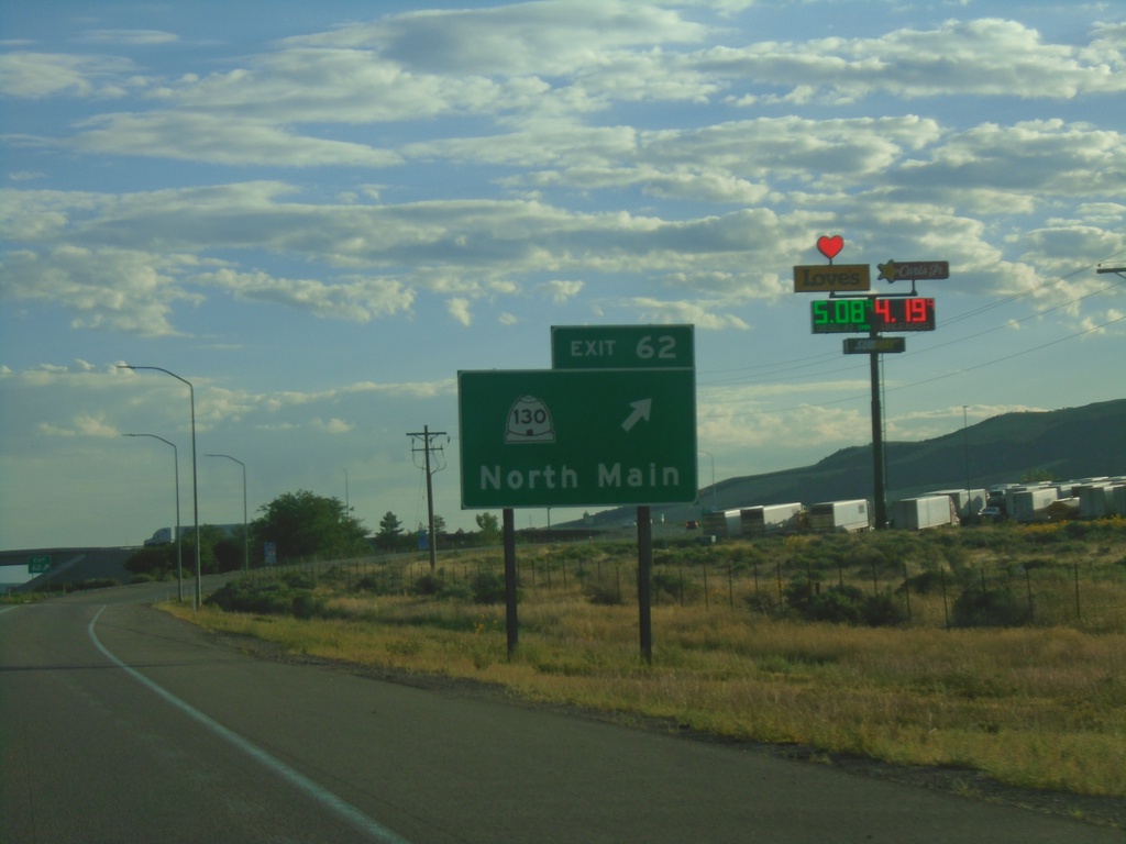
I-15 North - Exit 62
I-15 north at Exit 62 - UT-130/North Main.
Taken 09-09-2023
Cedar City
Iron County
Utah
United States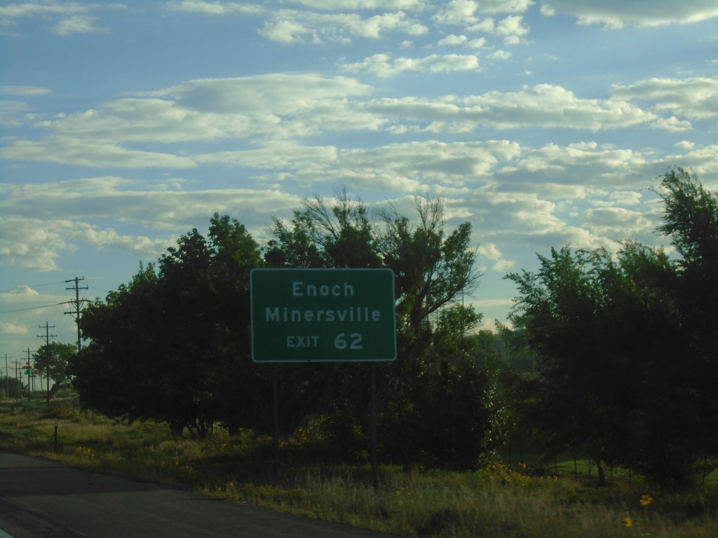
I-15 North - Exit 62
I-15 north approaching Exit 62. Use Exit 62 for Enoch and Minersville.
Taken 09-09-2023
Cedar City
Iron County
Utah
United States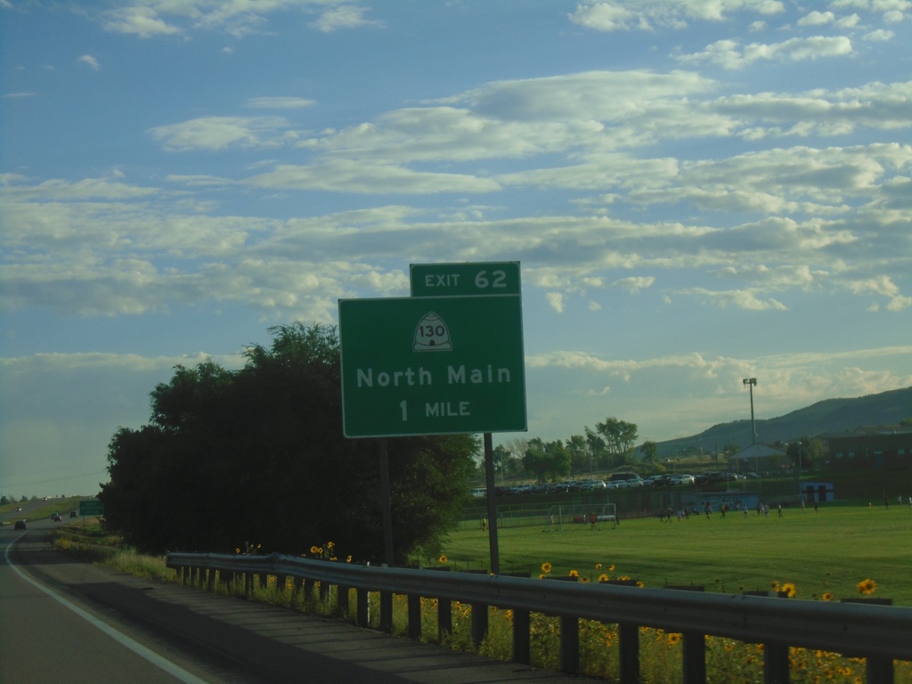
I-15 North - Exit 62
I-15 north approaching Exit 62 - UT-130/North Main.
Taken 09-09-2023
Cedar City
Iron County
Utah
United States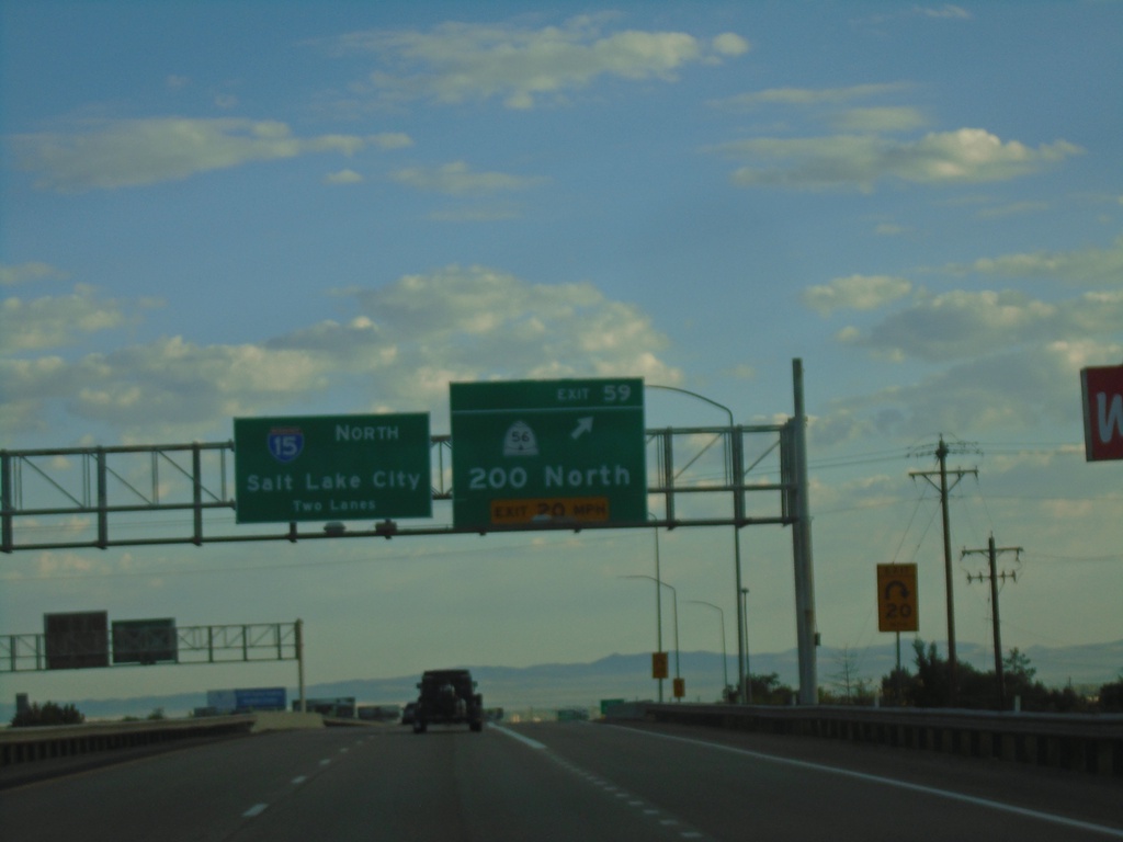
I-15 North - Exit 59
I-15 north at Exit 59 - UT-56/200 North. I-15 continues north towards Salt Lake City.
Taken 09-09-2023
 Cedar City
Iron County
Utah
United States
Cedar City
Iron County
Utah
United States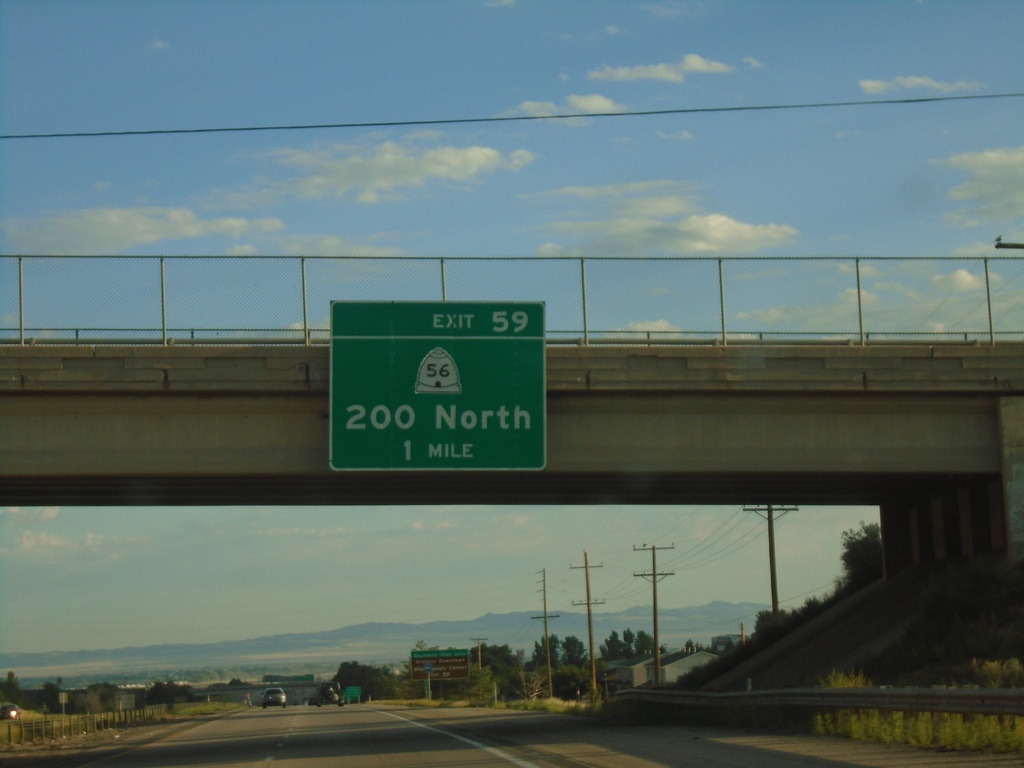
I-15 North - Exit 59
I-15 North approaching Exit 59 - UT-56/200 North.
Taken 09-09-2023
Cedar City
Iron County
Utah
United States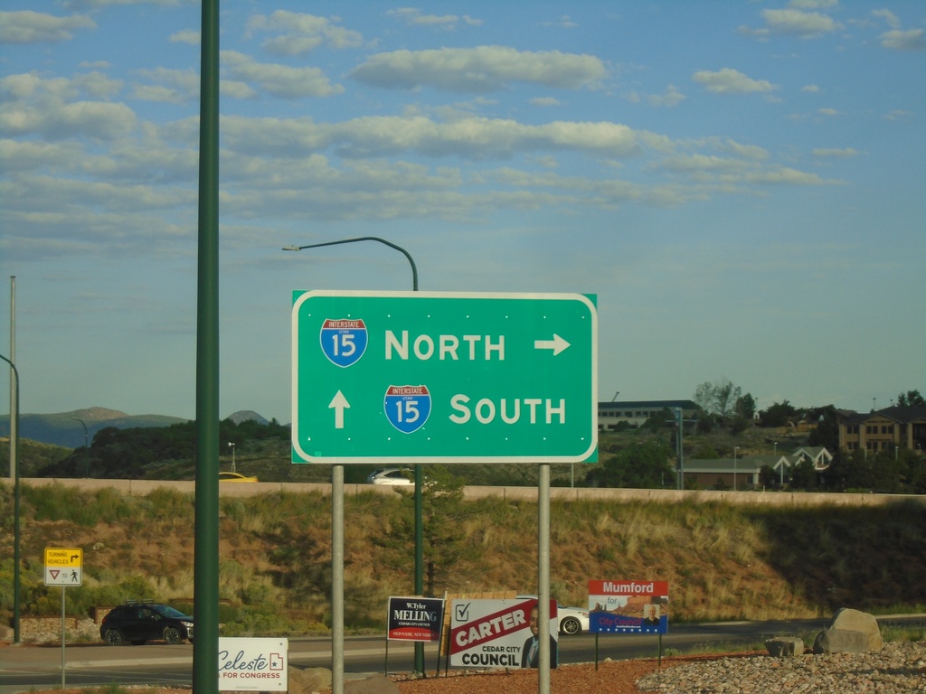
UT-130/BL-15 South at I-15 (Exit 57)
UT-130/BL-15 South at I-15 (Exit 57) in Cedar City.
Taken 09-09-2023
Cedar City
Iron County
Utah
United States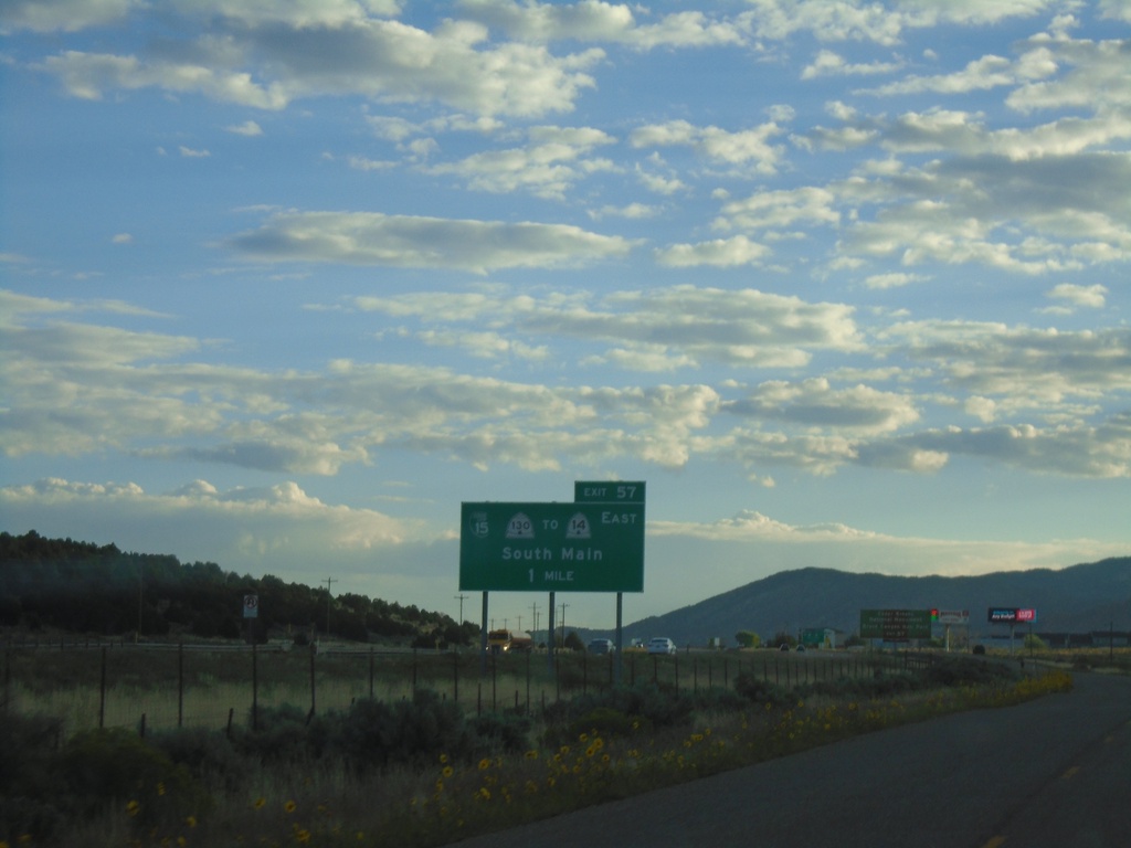
I-15 North - Exit 57
I-15 north approaching Exit 57 - BL-15/UT-130 North/To UT-14 East/Cedar City.
Taken 09-09-2023
 Cedar City
Iron County
Utah
United States
Cedar City
Iron County
Utah
United States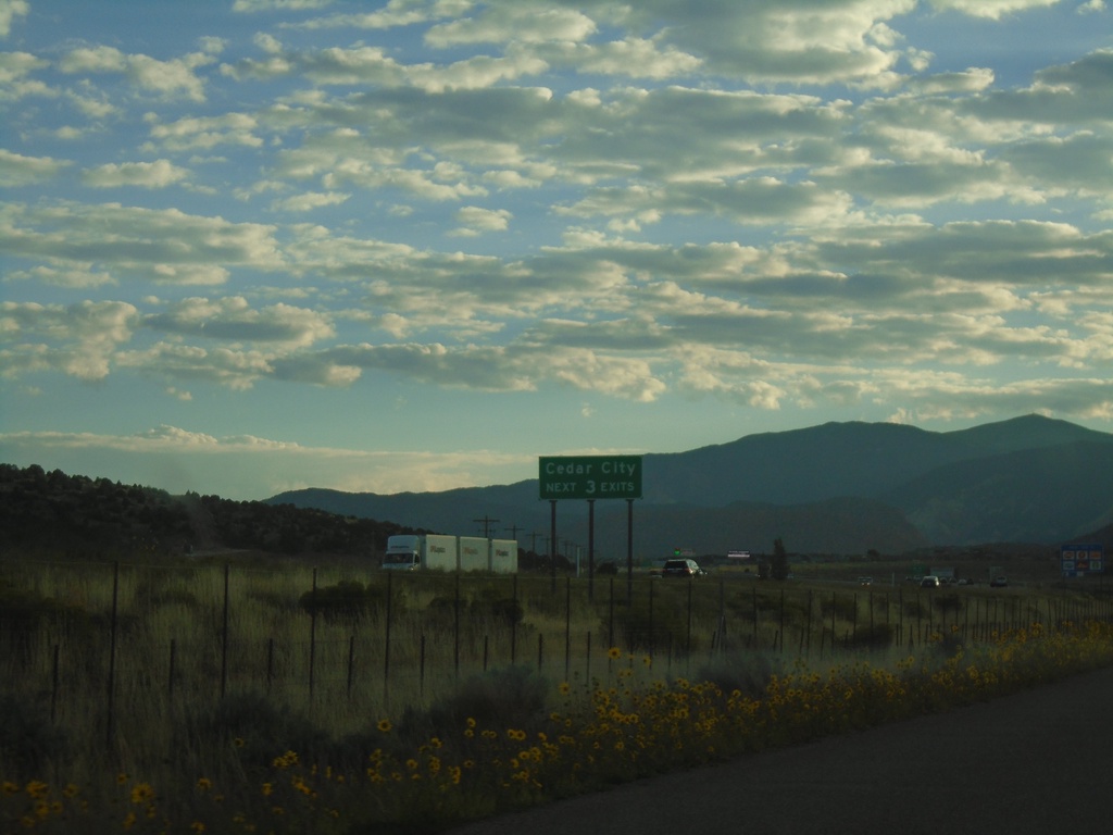
I-15 North - Cedar City
I-15 North - Cedar City Next 3 Exits
Taken 09-09-2023
Cedar City
Iron County
Utah
United States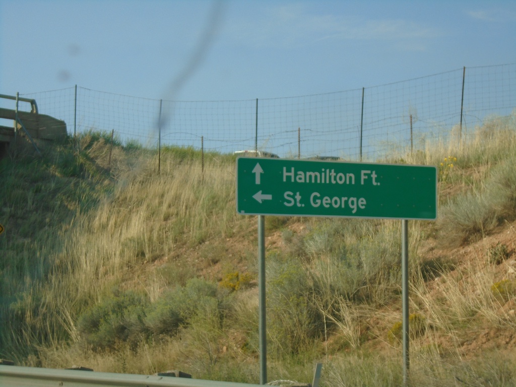
County Road at I-15 South (Exit 51)
County Road at I-15 South (Exit 51). Use I-15 south to St. George; continue north on county road to Hamilton Fort.
Taken 09-08-2023
Hamiltons Fort
Iron County
Utah
United States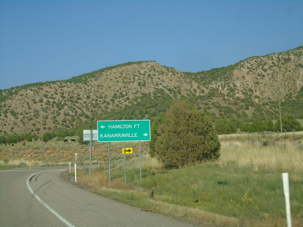
I-15 North - Exit 51 Offramp
I-15 north Exit 51 offramp at county road junction. Turn left for Hamilton Fort; right for Kanarraville.
Taken 09-08-2023
Cedar City
Iron County
Utah
United States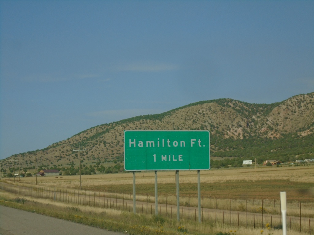
I-15 North - Exit 51
I-15 north approaching Exit 51 - Hamilton Fort. The exit number tab is missing from this sign assembly.
Taken 09-08-2023
Cedar City
Iron County
Utah
United States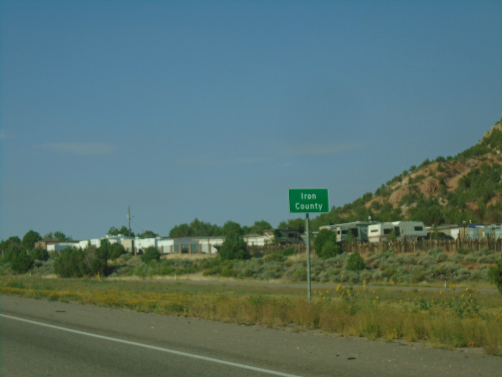
I-15 North - Iron County
Entering Iron County on I-15 north.
Taken 09-08-2023
New Harmony
Iron County
Utah
United States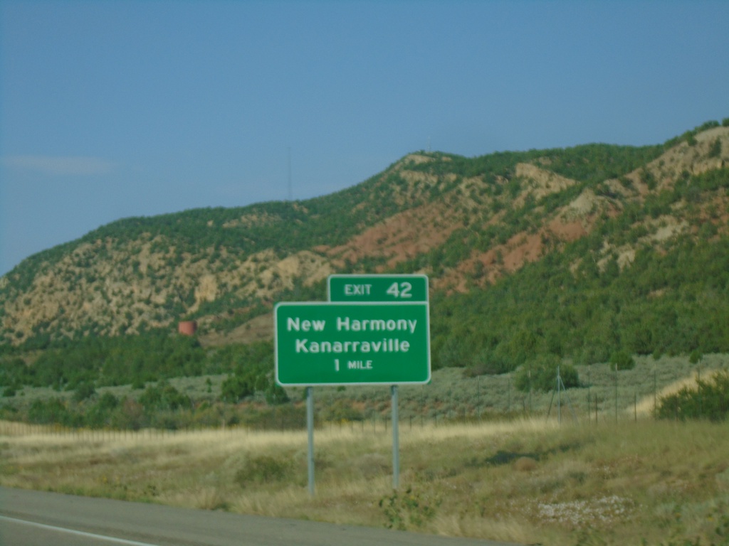
I-15 North - Exit 42
I-15 north approaching Exit 42 - New Harmony/Kanarraville.
Taken 09-08-2023
New Harmony
Washington County
Utah
United States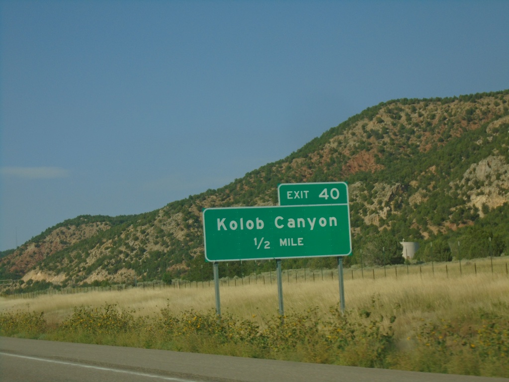
I-15 North - Exit 40
I-15 north approaching Exit 40 - Kolob Canyon. Exit 40 provides access to the Kolob Canyons section of Zion National Park.
Taken 09-08-2023
New Harmony
Washington County
Utah
United States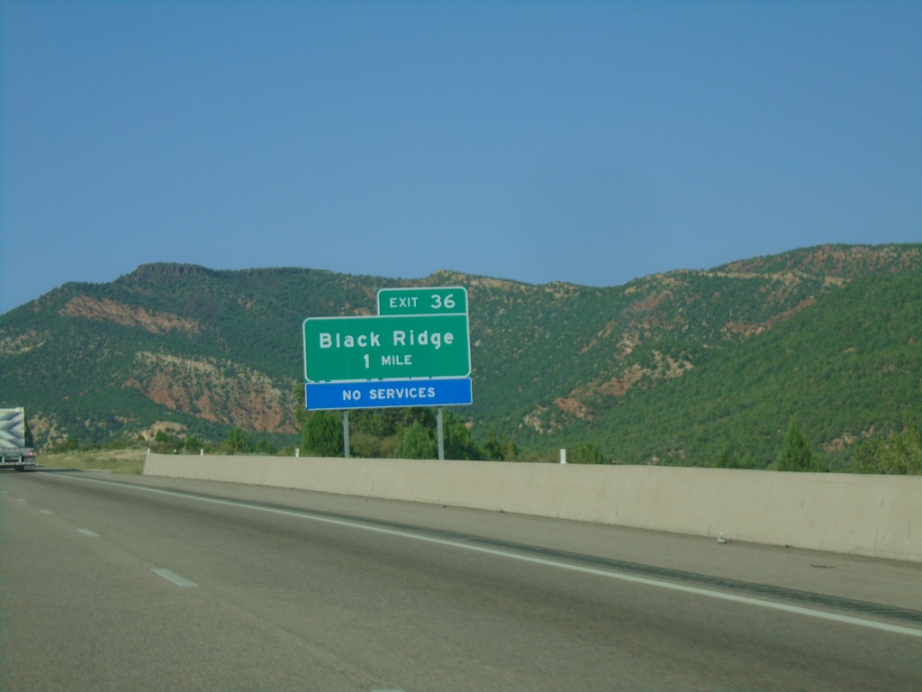
I-15 North - Exit 36
I-15 north approaching Exit 36 - Black Ridge.
Taken 09-08-2023
Pintura
Washington County
Utah
United States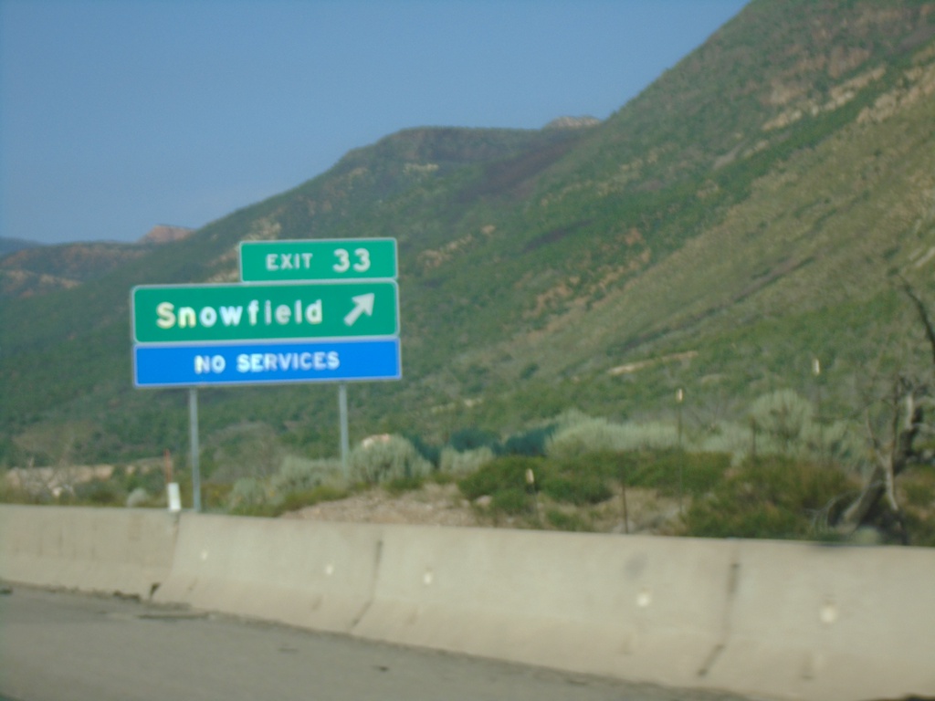
I-15 North - Exit 33
I-15 north at Exit 33 - Snowfield.
Taken 09-08-2023
Pintura
Washington County
Utah
United States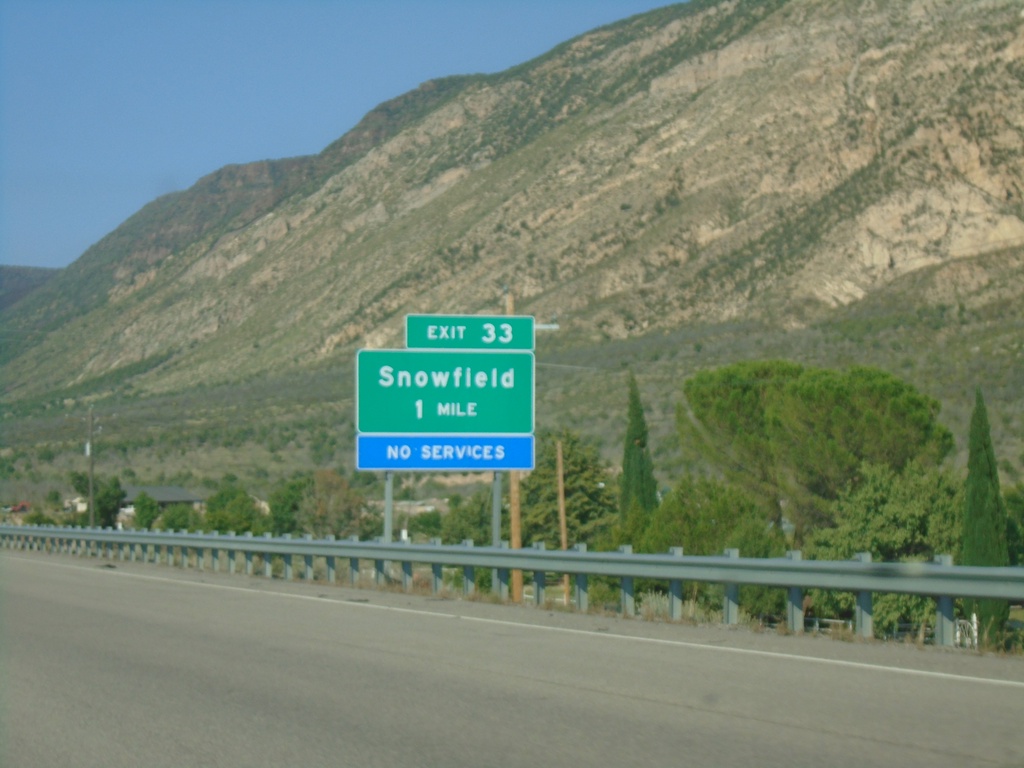
I-15 North - Exit 33
I-15 north approaching Exit 33 - Snowfield.
Taken 09-08-2023
Pintura
Washington County
Utah
United States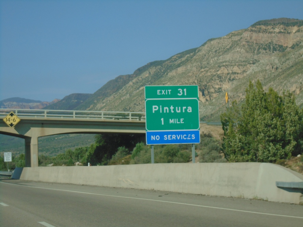
I-15 North - Exit 31
I-15 north approaching Exit 31 - Pintura.
Taken 09-08-2023
Toquerville
Washington County
Utah
United States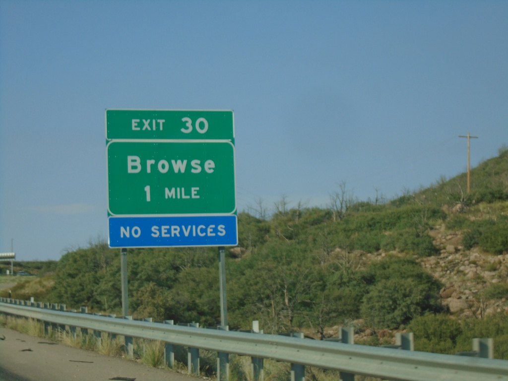
I-15 North - Exit 30
I-15 north approaching Exit 30 - Browse.
Taken 09-08-2023
Toquerville
Washington County
Utah
United States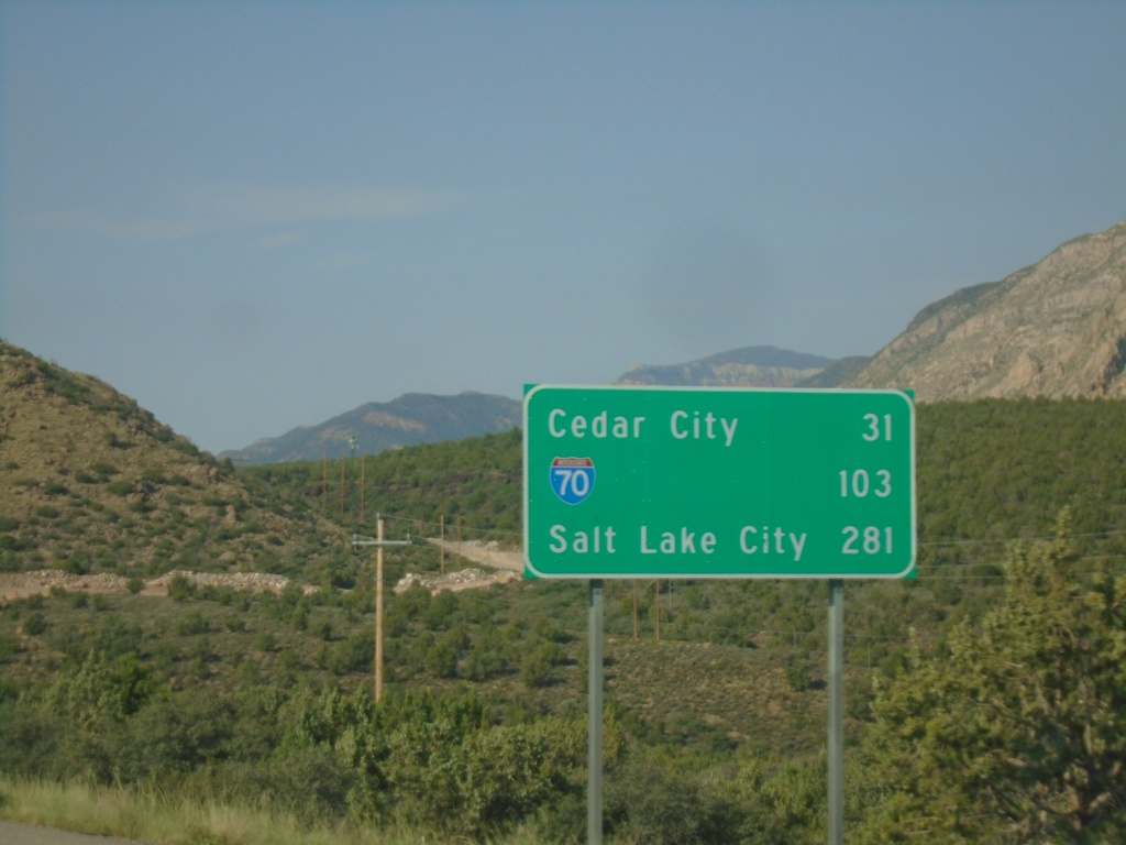
I-15 North - Distance Marker
Distance marker on I-15 north. Distance to Cedar City, I-70 Junction, and Salt Lake City.
Taken 09-08-2023
 Toquerville
Washington County
Utah
United States
Toquerville
Washington County
Utah
United States