Signs Tagged With Big Green Sign
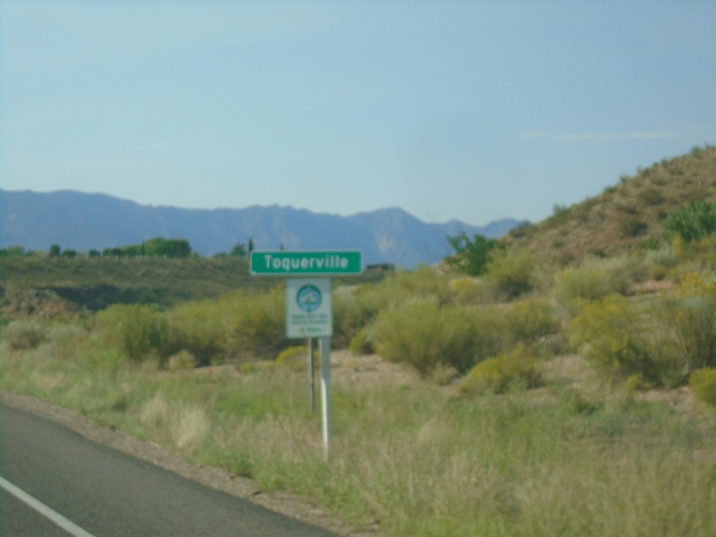
UT-17 North - Toquerville
Entering Toquerville on UT-17 north.
Taken 09-08-2023
 Toquerville
Washington County
Utah
United States
Toquerville
Washington County
Utah
United States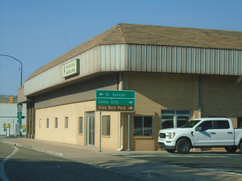
UT-59 West Approaching UT-9
UT-59 West approaching UT-9 in Hurricane. Use UT-9 west for St. George; UT-9 east for Cedar City and Zion National Park.
Taken 09-08-2023

 Hurricane
Washington County
Utah
United States
Hurricane
Washington County
Utah
United States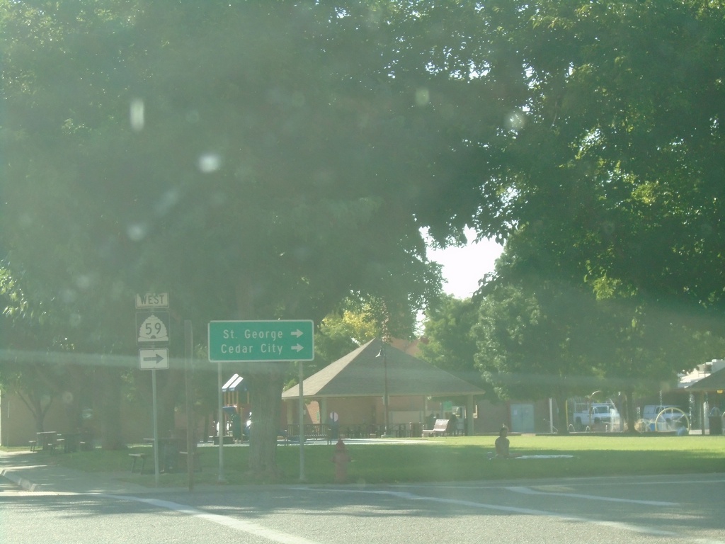
UT-59 West - Hurricane
UT-59 west in Hurricane (E 100 S at Main St.). Turn right to continue west on UT-59 for St. George and Cedar City.
Taken 09-08-2023
Hurricane
Washington County
Utah
United States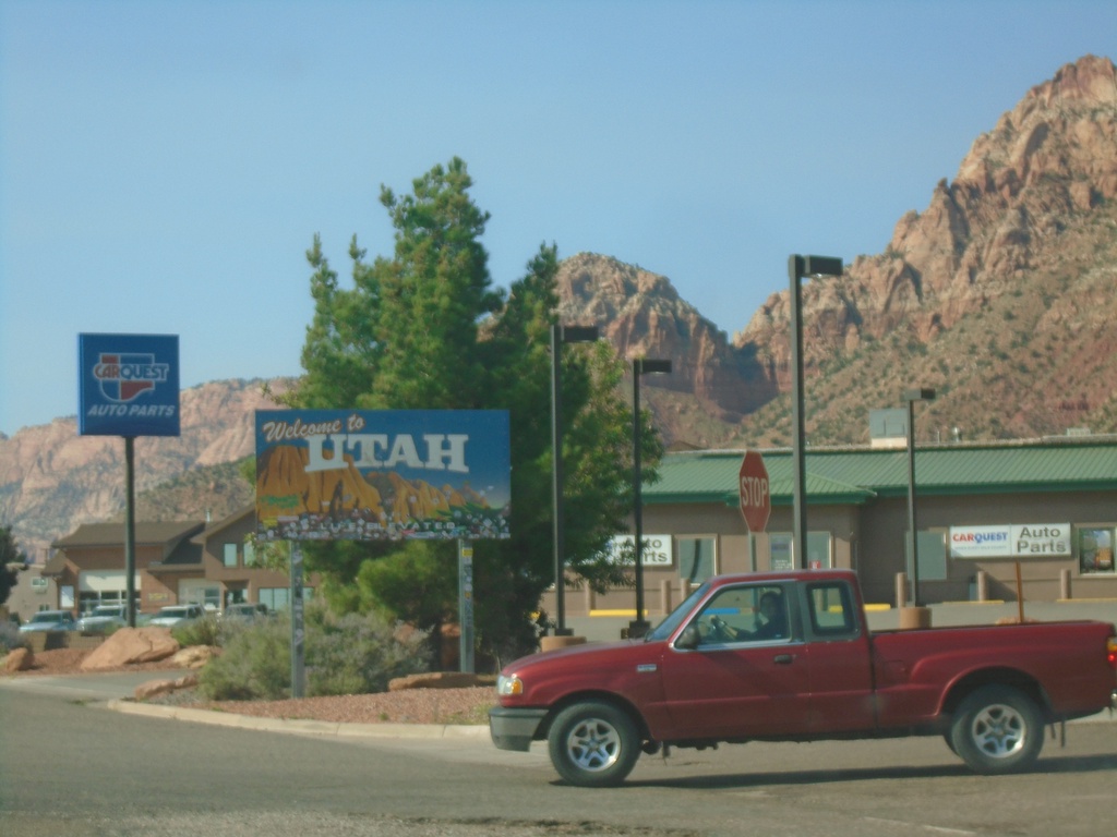
UT-59 West - Welcome To Utah
Welcome To Utah on UT-59 West in Hildale.
Taken 09-08-2023
Hurricane
Washington County
Utah
United States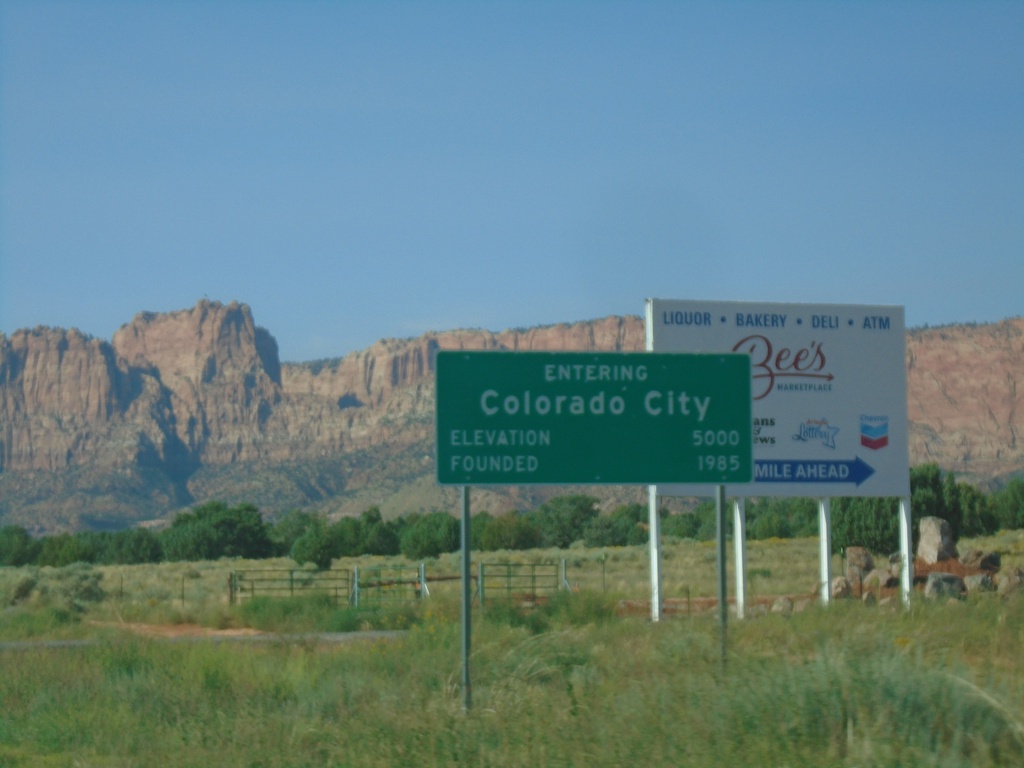
AZ-389 West - Colorado City
Entering Colorado City on AZ-389 West. Elevation 5000. Founded 1985.
Taken 09-08-2023
 Colorado City
Mohave County
Arizona
United States
Colorado City
Mohave County
Arizona
United States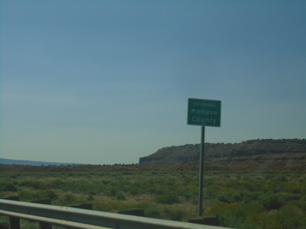
AZ-389 West - Mohave County
Entering Mohave County on AZ-389 West.
Taken 09-08-2023
Fredonia
Mohave County
Arizona
United States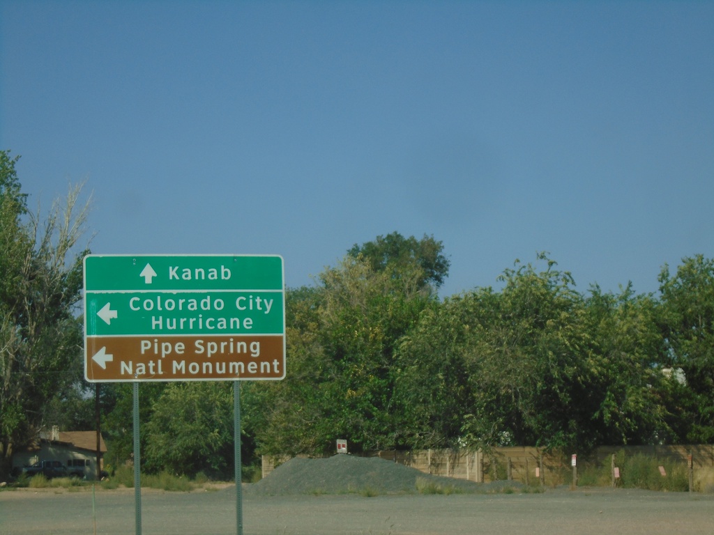
US-89A North at AZ-389
US-89A North at AZ-389 in Fredonia. Continue north on US-89A for Kanab (Utah). Use AZ-389 West to Colorado City, Hurricane (Utah) and Pipe Spring National Monument.
Taken 09-08-2023
 Fredonia
Coconino County
Arizona
United States
Fredonia
Coconino County
Arizona
United States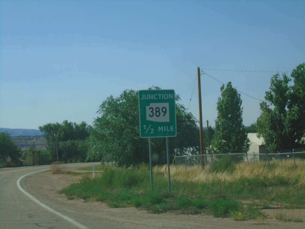
US-89A North Approaching AZ-389
US-89A North approaching AZ-389 in Fredonia.
Taken 09-08-2023
Fredonia
Coconino County
Arizona
United States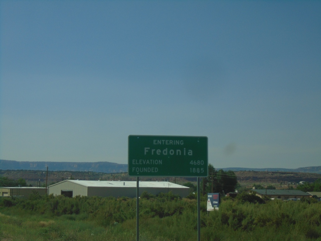
US-89A North - Fredonia
Entering Fredonia on US-89A North. Elevation 4680 Feet. Founded 1885.
Taken 09-08-2023
Fredonia
Coconino County
Arizona
United States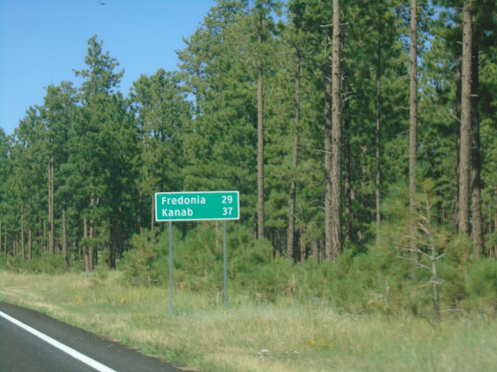
US-89A North - Distance Marker
Distance marker on US-89A North. Distance to Fredonia and Kanab (Utah).
Taken 09-08-2023
Fredonia
Coconino County
Arizona
United States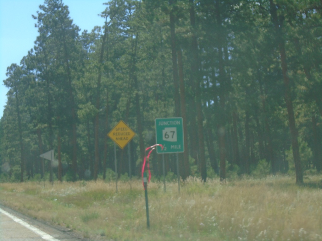
US-89A North Approaching AZ-67
US-89A north approaching AZ-67.
Taken 09-08-2023
 Jacob Lake
Coconino County
Arizona
United States
Jacob Lake
Coconino County
Arizona
United States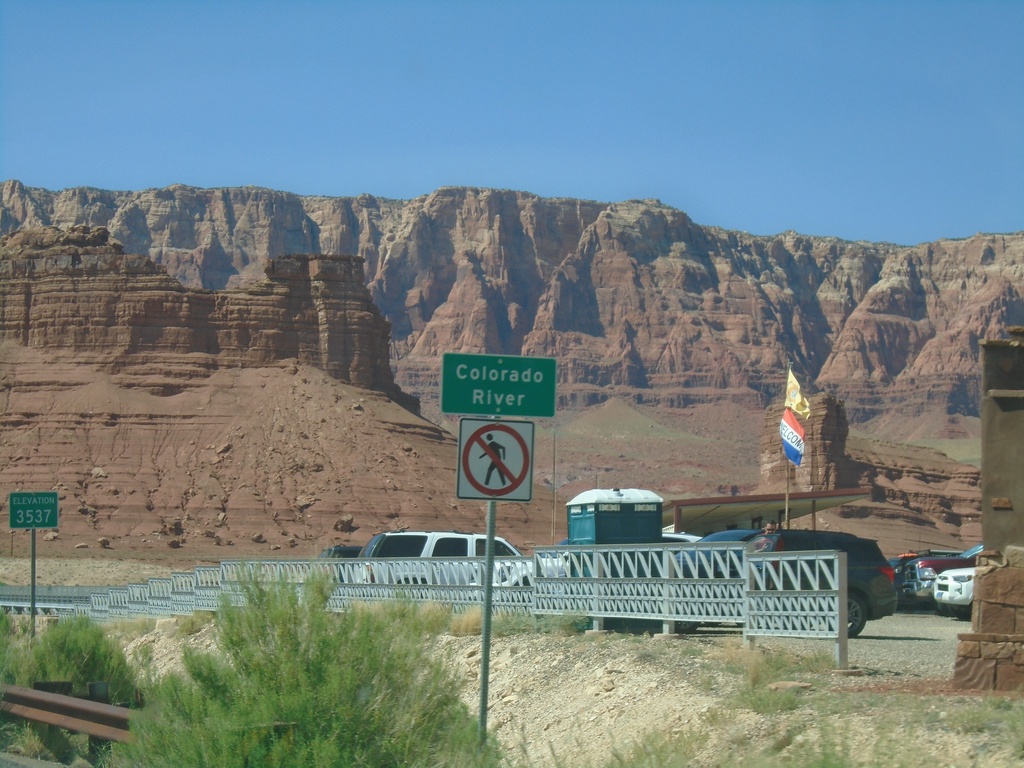
US-89A North - Colorado River
Colorado River (Navajo Bridge) on US-89A north. Elevation 3537 Feet. The Vermillion Cliffs are in the background. The next road crossing of the Colorado River south of here is US-93 below Hoover Dam. Between the Navajo Bridge and Hoover Dam lies the Grand Canyon and Lake Mead.
Taken 09-08-2023
Marble Canyon
Coconino County
Arizona
United States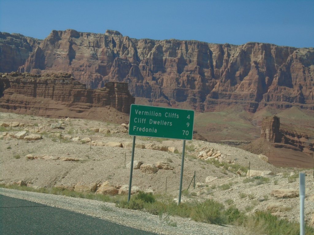
US-89A North - Distance Marker
Distance marker on US-89A North to Vermillion Cliffs, Cliff Dwellers, and Fredonia. Approaching Navajo Bridge where US-89A crosses the Colorado River.
Taken 09-08-2023
Marble Canyon
Coconino County
Arizona
United States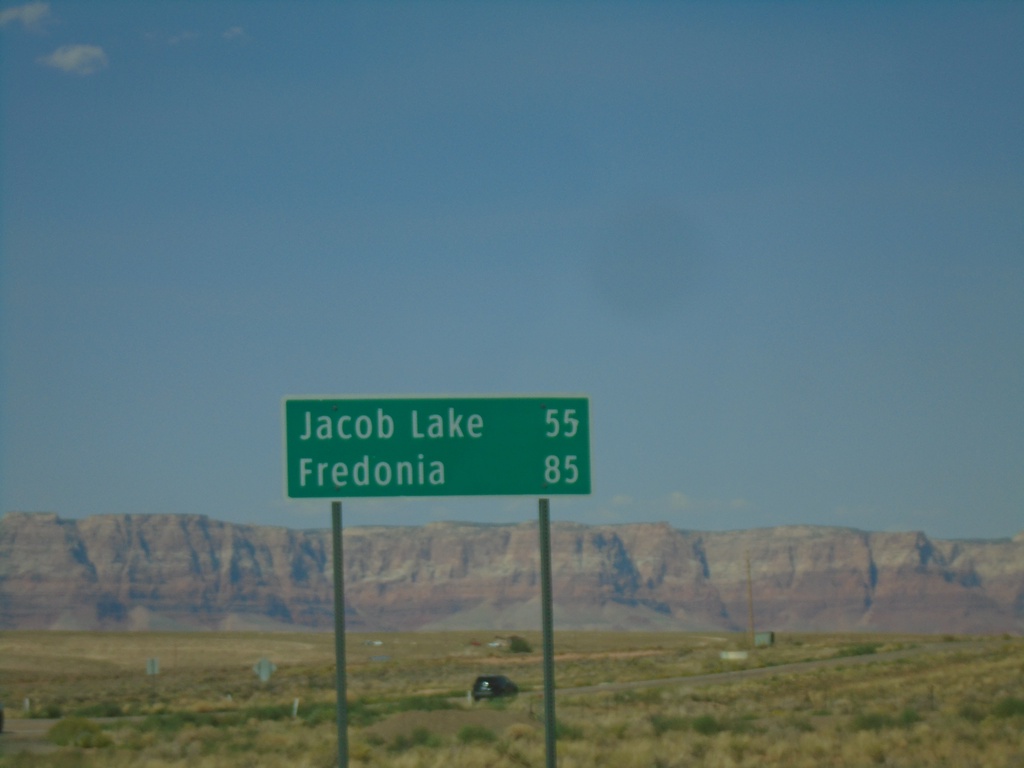
US-89A North - Distance Marker
Distance marker on US-89A north. Distance to Jacob Lake and Fredonia. The Vermilion Cliffs are in the background.
Taken 09-08-2023
Bitter Springs
Coconino County
Arizona
United States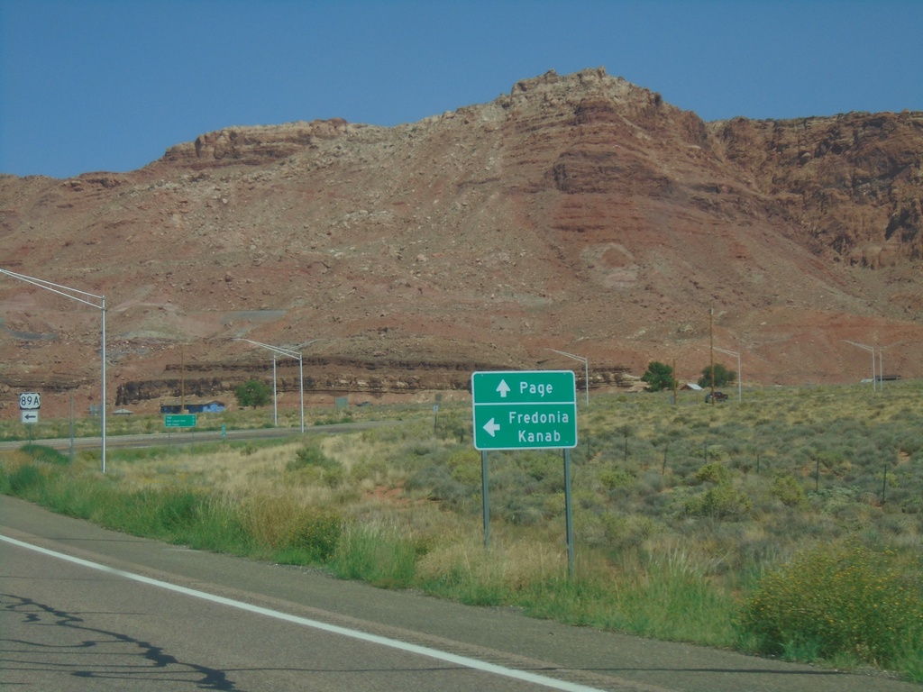
US-89 North at US-89A
US-89 North at US-89A. Use US-89A North to Fredonia and Kanab (Utah). Continue north on US-89 for Page. US-89 and US-89A re-join in Kanab. The shortest travel time between this junction and Kanab would actually be using US-89.
Taken 09-08-2023
 Marble Canyon
Coconino County
Arizona
United States
Marble Canyon
Coconino County
Arizona
United States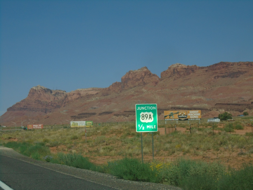
US-89 North Approaching US-89A
US-89 North approaching US-89A in Bitter Springs.
Taken 09-08-2023
Bitter Springs
Coconino County
Arizona
United States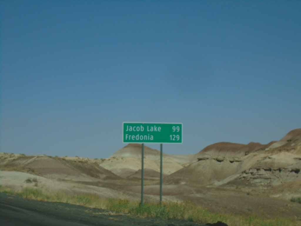
US-89 North - Distance Marker
Distance marker on US-89 north. Distance to Jacob Lake and Fredonia. Both of those destinations are via US-89A.
Taken 09-08-2023
Cameron
Coconino County
Arizona
United States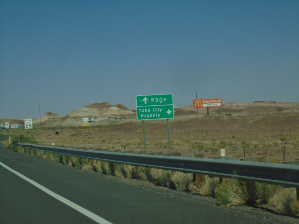
US-89 North Approaching US-160
US-89 North approaching US-160 near Tuba City. Use US-160 East to Tuba City and Kayenta. Continue north on US-89 for Page.
Taken 09-08-2023
 Tuba City
Coconino County
Arizona
United States
Tuba City
Coconino County
Arizona
United States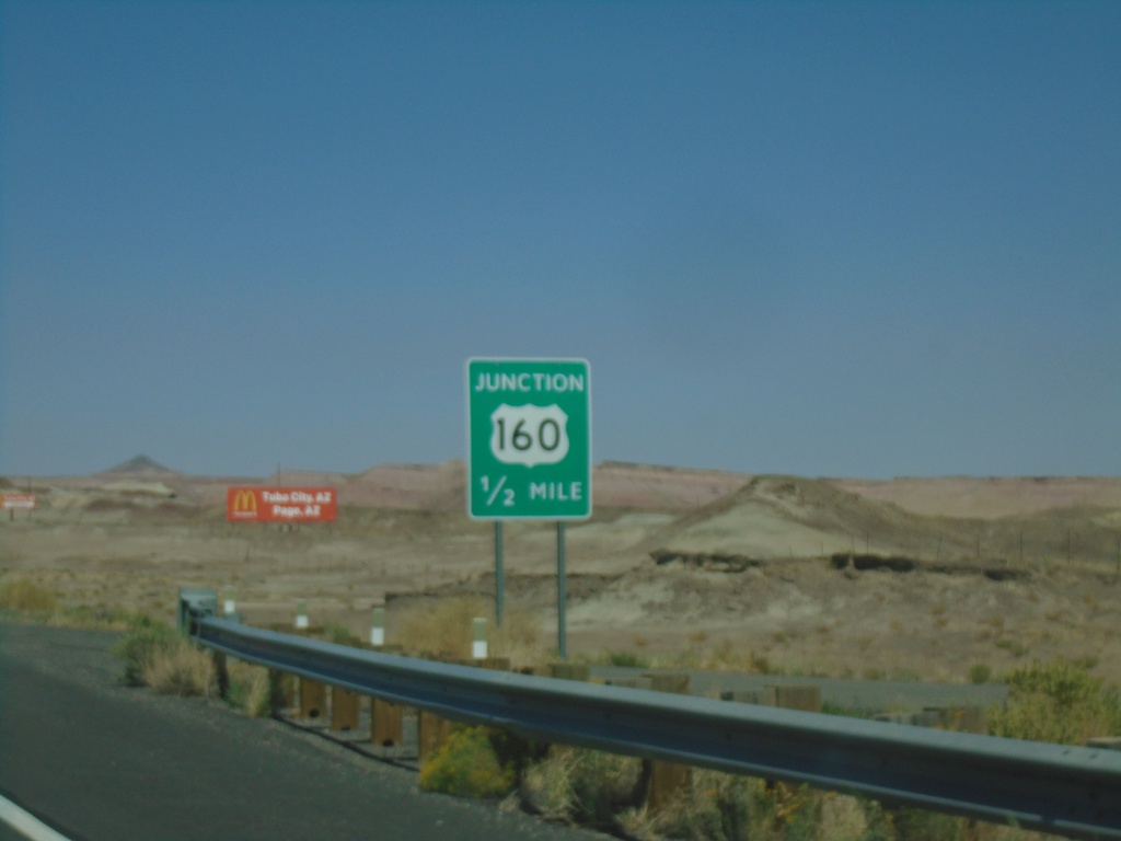
US-89 North Approaching US-160
US-89 North approaching US-160 in Coconino County. This is the western end of US-160.
Taken 09-08-2023
Tuba City
Coconino County
Arizona
United States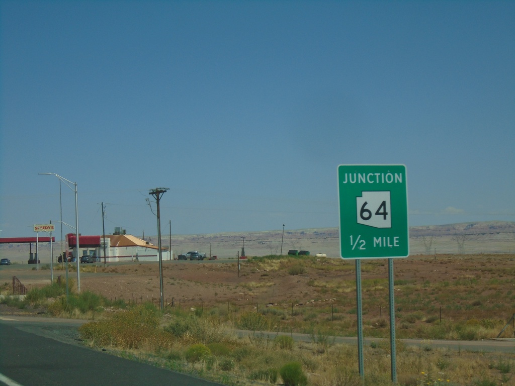
US-89 North Approaching AZ-64
US-89 North approaching AZ-64 in Cameron.
Taken 09-08-2023
 Cameron
Coconino County
Arizona
United States
Cameron
Coconino County
Arizona
United States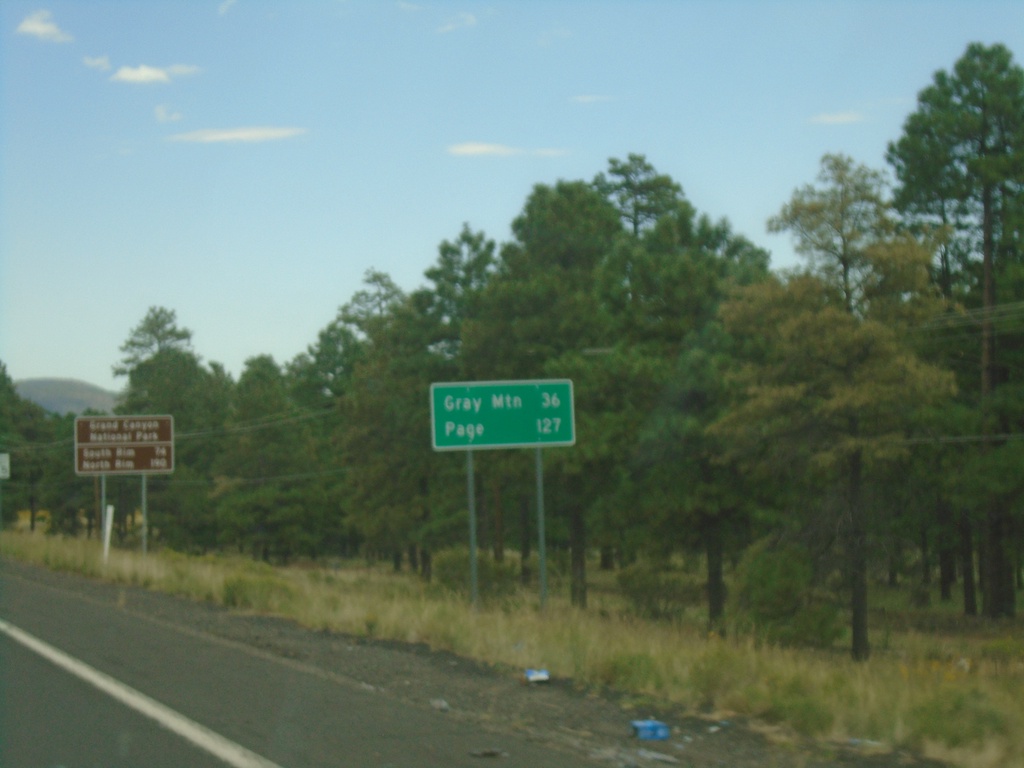
US-89 North - Distance Marker
Distance marker on US-89 north. Distance to Grey Mountain and Page.
Taken 09-08-2023
Flagstaff
Coconino County
Arizona
United States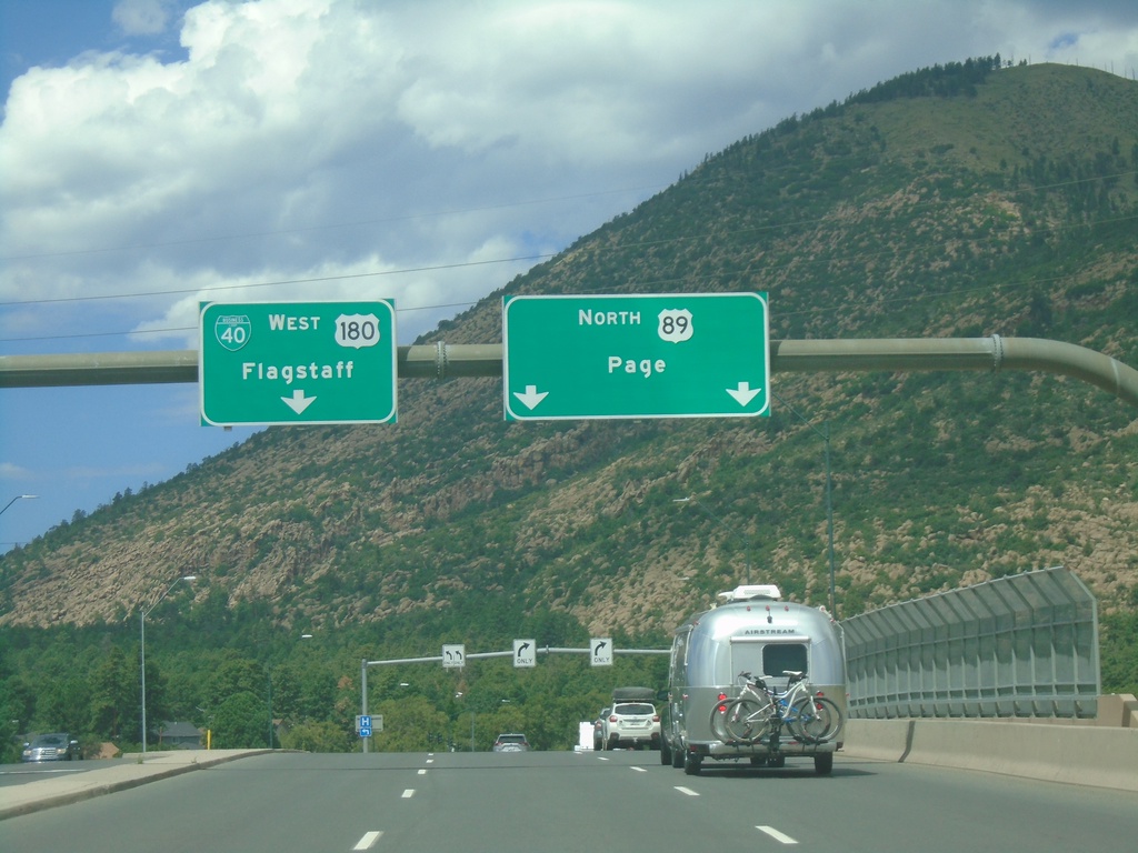
BL-40/US-180 West at US-89
BL-40/US-180 West at US-89 in Flagstaff. Use left lanes to continue west on BL-40/US-180 to Flagstaff. Use right lanes for US-89 North to Page.
Taken 09-08-2023

 Flagstaff
Coconino County
Arizona
United States
Flagstaff
Coconino County
Arizona
United States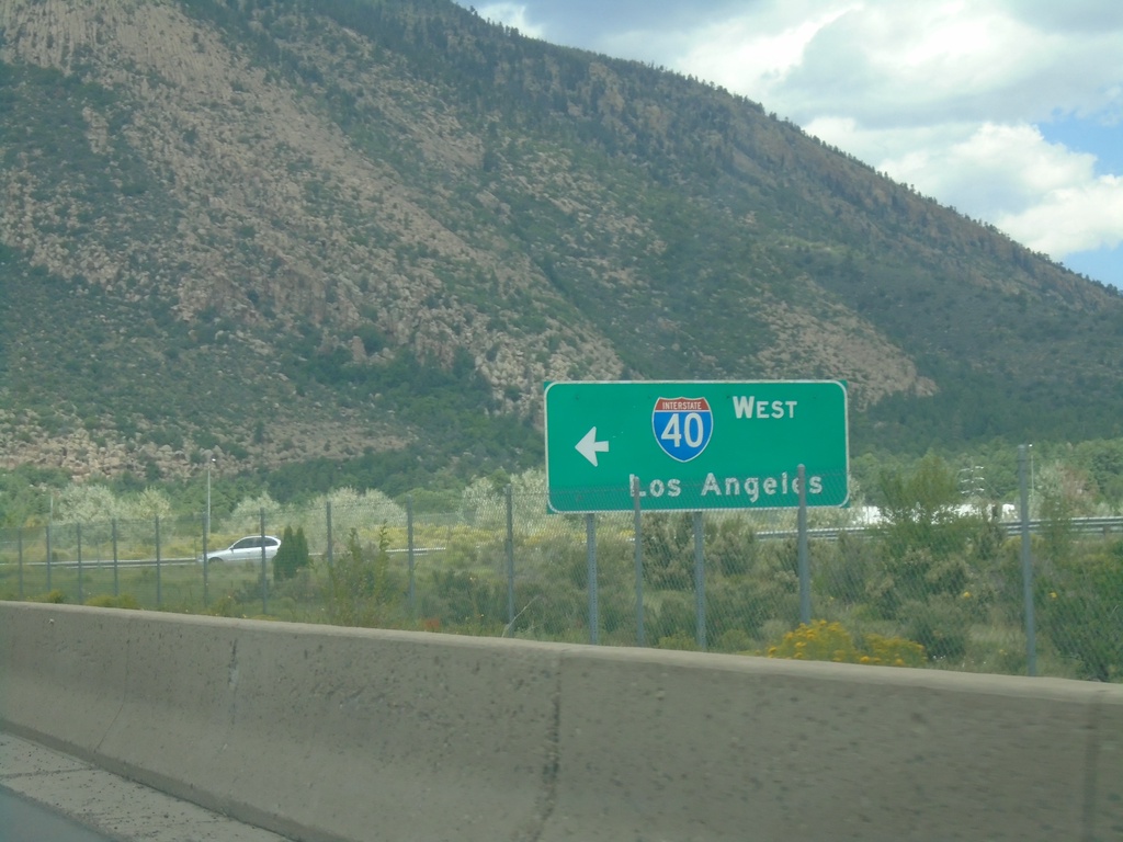
BL-40/US-180 East at I-40 West (Exit 201)
BL-40/US-180 East at I-40 West (Exit 201) in Flagstaff. Use I-40 west for Los Angeles (California).
Taken 09-08-2023
 Flagstaff
Coconino County
Arizona
United States
Flagstaff
Coconino County
Arizona
United States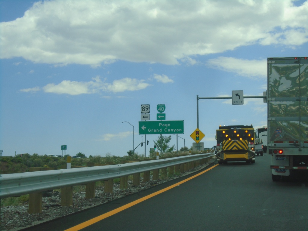
I-40 East - Exit 201 Offramp
I-40 East - Exit 201 offramp at BL-40/(To)US-89 to Page and Grand Canyon.
Taken 09-08-2023
Flagstaff
Coconino County
Arizona
United States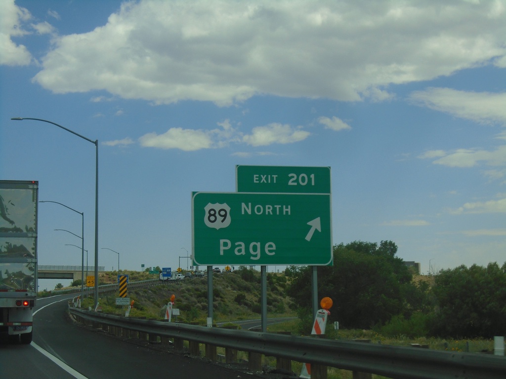
I-40 East - Exit 201
I-40 east at Exit 201 - US-89 North/Page. This is the southern end of US-89, and the eastern end of the Flagstaff business loop.
Taken 09-08-2023
Flagstaff
Coconino County
Arizona
United States