Signs Tagged With Big Green Sign
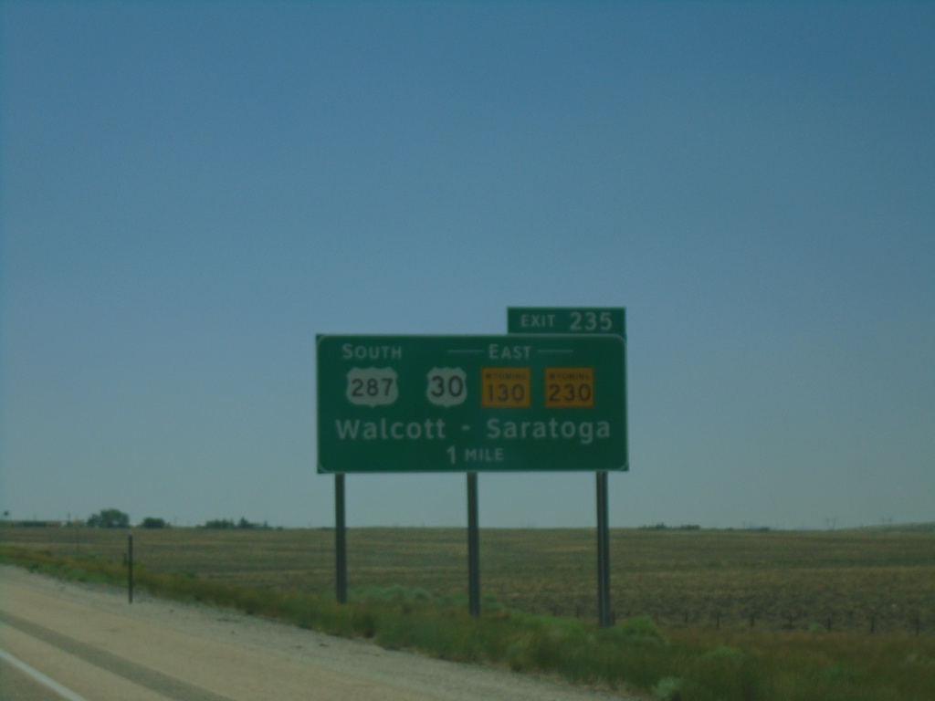
I-80 West - Exit 235
I-80 west approaching Exit 235 - US-287 South/US-30/WY-130/WY-230 East/Walcott/Saratoga.
Taken 07-11-2022


 Walcott
Carbon County
Wyoming
United States
Walcott
Carbon County
Wyoming
United States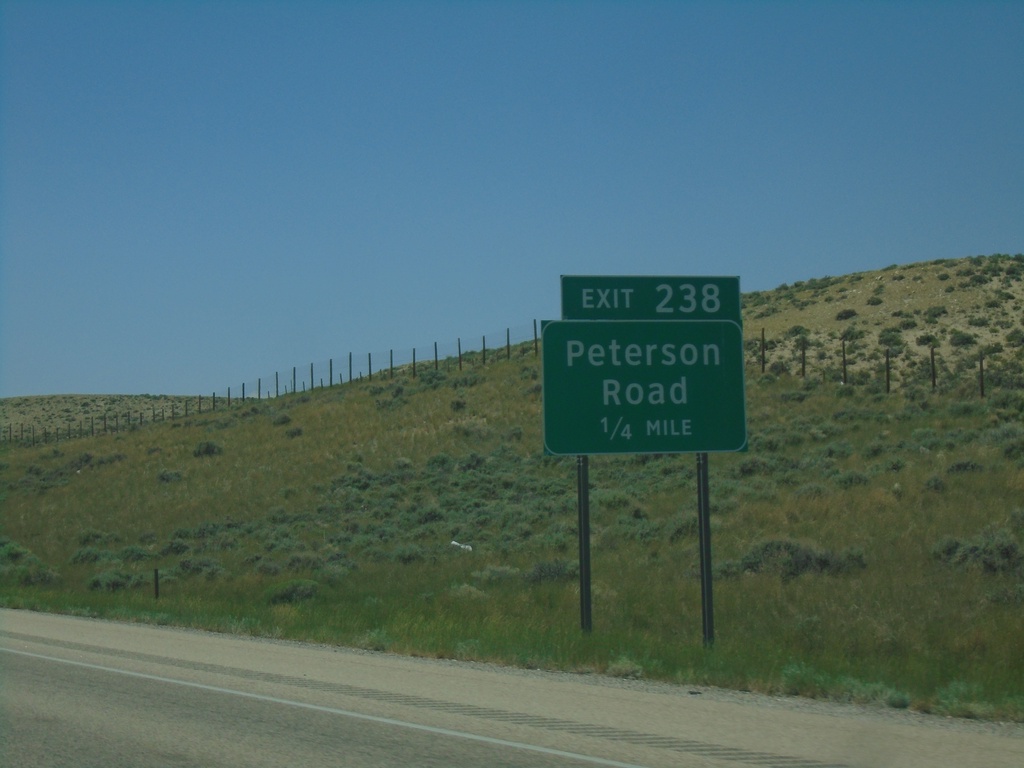
I-80 West - Exit 238
I-80 west approaching Exit 238 - Peterson Road
Taken 07-11-2022
Walcott
Carbon County
Wyoming
United States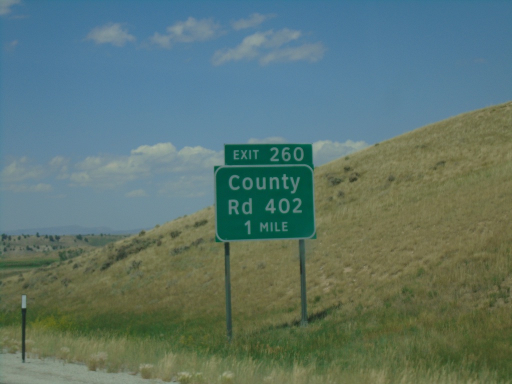
I-80 West - Exit 267
I-80 west approaching Exit 267 - Wagonhound Road.
Taken 07-11-2022
Arlington
Carbon County
Wyoming
United States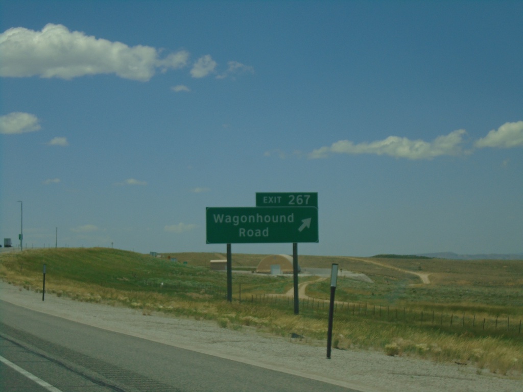
I-80 West - Exit 267
I-80 west at Exit 267 - Wagonhound Road.
Taken 07-11-2022
Arlington
Carbon County
Wyoming
United States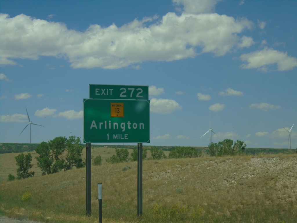
I-80 West - Exit 272
I-80 west approaching Exit 272 - WY-13/Arlington
Taken 07-11-2022
 Rock River
Carbon County
Wyoming
United States
Rock River
Carbon County
Wyoming
United States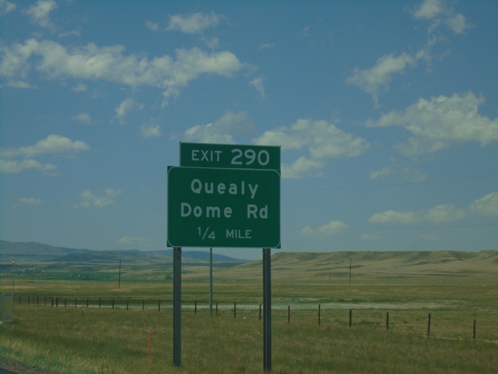
I-80 West - Exit 290
I-80 west approaching Exit 290 - Quealy Dome Road.
Taken 07-11-2022
Laramie
Albany County
Wyoming
United States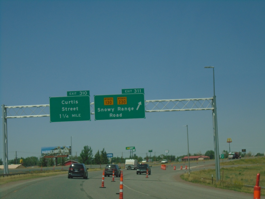
I-80 West Exits 311/Exit 310
I-80 west at Exit 311 - WY-130/WY-230/Snowy Range Road. Approaching Exit 310 - Curtis St.
Taken 07-11-2022
Laramie
Albany County
Wyoming
United States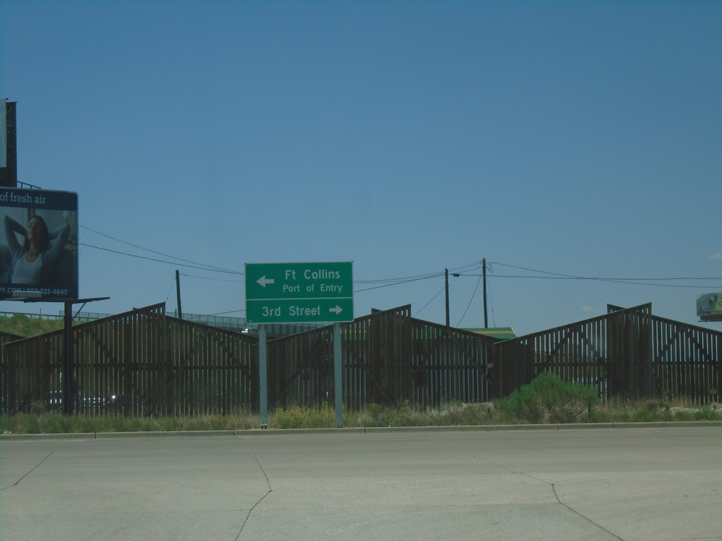
I-80 West - Exit 313 Offramp at US-287
I-80 West Exit 313 Offramp at US-287 in Laramie. Turn right for US-287 North/3rd St. Turn left for US-287 South/Fort Collins (Colorado)/Port of Entry.
Taken 07-11-2022
Laramie
Albany County
Wyoming
United States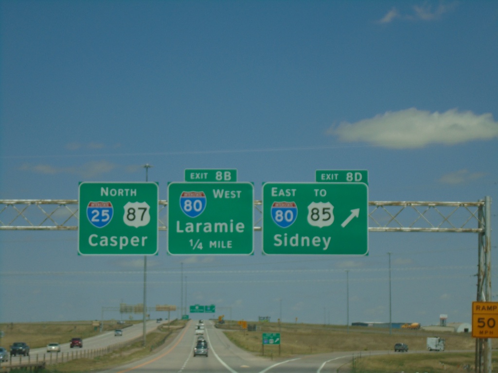
I-25 North - Exits 8D and 8B
I-25 North at Exit 8D - I-80 East/To US-85/Sidney (Nebraska). Approaching Exit 8B - I-80 West/Laramie. I-25/US-87 continues north to Casper.
Taken 07-11-2022


 Cheyenne
Laramie County
Wyoming
United States
Cheyenne
Laramie County
Wyoming
United States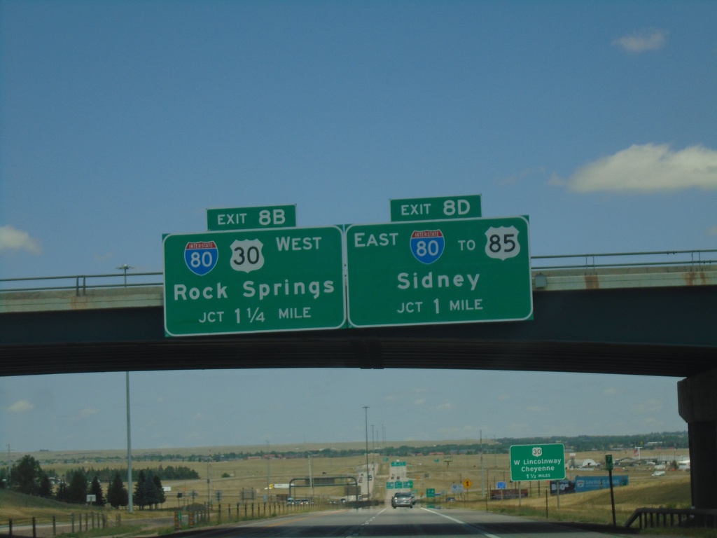
I-25 North - Exits 8B and 8D
I-25 north approaching Exit 8B - I-80/US-30 West/Rock Springs. Approaching Exit 8D - I-80 East/To US-85/Sidney (Nebraska).
Taken 07-11-2022
Cheyenne
Laramie County
Wyoming
United States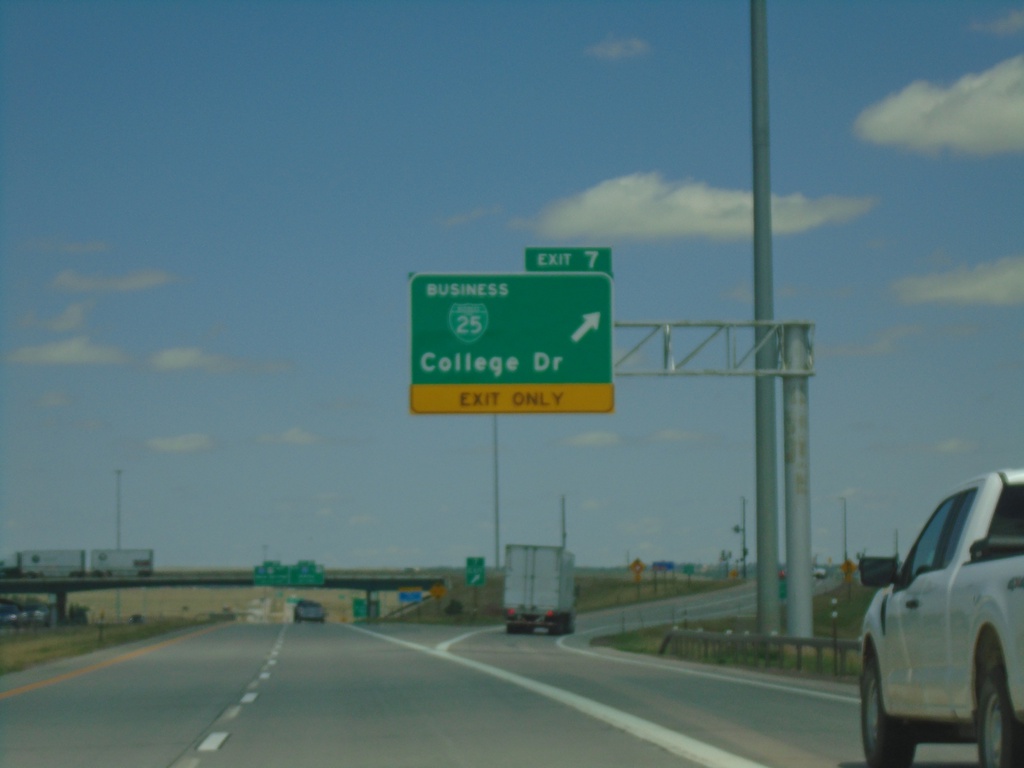
I-25 North - Exit 7
I-25 north at Exit 7 - BL-25/College Drive.
Taken 07-11-2022

 Cheyenne
Laramie County
Wyoming
United States
Cheyenne
Laramie County
Wyoming
United States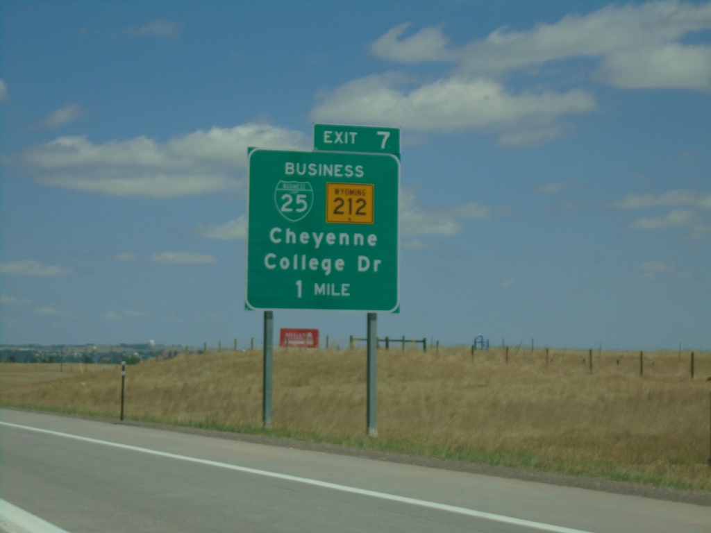
I-25 North - Exit 7
I-25 north approaching Exit 7 - BL-25/WY-212/College Drive.
Taken 07-11-2022
Cheyenne
Laramie County
Wyoming
United States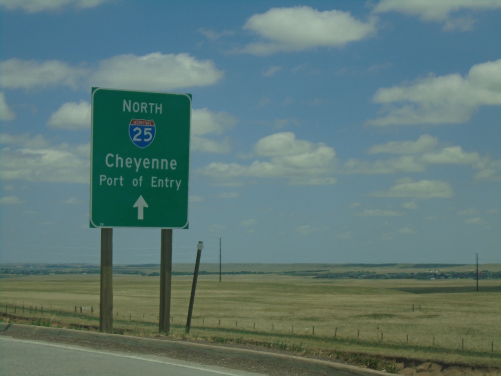
High Plains Road Roundabout At I-25 Onramp
High Plains Road Roundabout at I-25 (Exit 4) onramp at I-25 North/Cheyenne/Port of Entry.
Taken 07-11-2022
Cheyenne
Laramie County
Wyoming
United States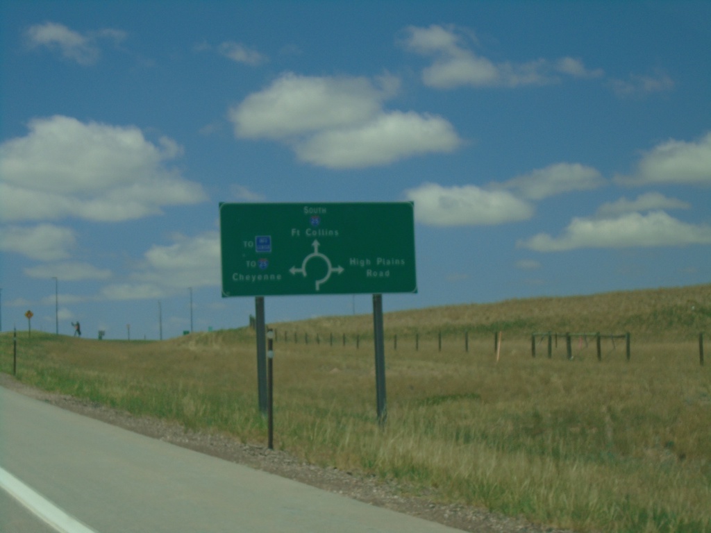
I-25 South - Exit 4 Offramp
I-25 South Exit 4 offramp approaching roundabout. Use roundabout for access to West High Plains Road, I-25 South/Fort Collins, Welcome Center, and I-25 North/Cheyenne.
Taken 07-11-2022
Cheyenne
Laramie County
Wyoming
United States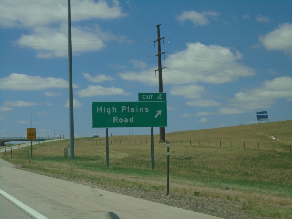
I-25 South - Exit 4
I-25 south at Exit 4 - High Plains Road.
Taken 07-11-2022
Cheyenne
Laramie County
Wyoming
United States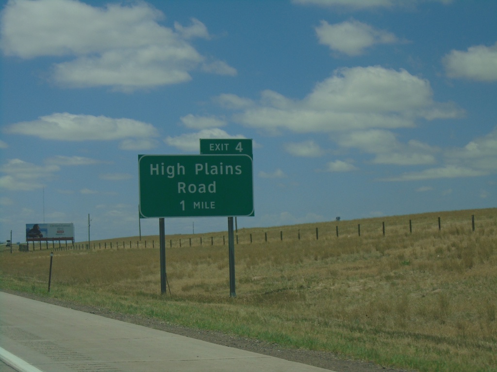
I-25 South - Exit 4
I-25 south approaching Exit 4 - High Plains Road.
Taken 07-11-2022
Cheyenne
Laramie County
Wyoming
United States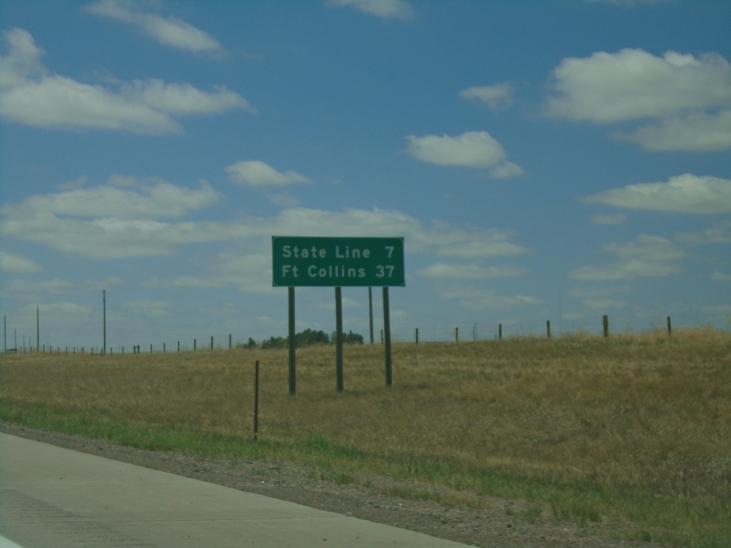
I-25 South - Distance Marker
Distance marker on I-25 south. Distance to State Line (Colorado) and Fort Collins (Colorado).
Taken 07-11-2022
Cheyenne
Laramie County
Wyoming
United States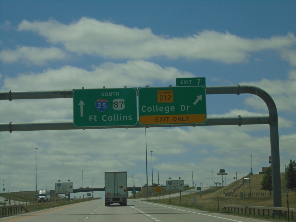
I-25 South - Exit 7
I-25 south at Exit 7 - WY-212/College Drive. I-25/US-87 continues south towards Fort Collins (Colorado).
Taken 07-11-2022
Cheyenne
Laramie County
Wyoming
United States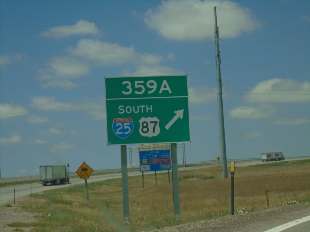
I-80 West - Exit 359A
I-80 West at Exit 359A - I-25/US-87 South.
Taken 07-11-2022
Cheyenne
Laramie County
Wyoming
United States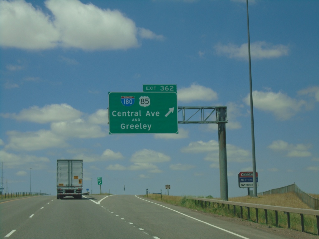
I-80 West - Exit 362
I-80 west at Exit 362 - I-180/US-85/Central Ave./Greeley. I-180 in Cheyenne is the rare interstate highway that is not a freeway, rather a city street with stoplights.
Taken 07-11-2022
 Cheyenne
Laramie County
Wyoming
United States
Cheyenne
Laramie County
Wyoming
United States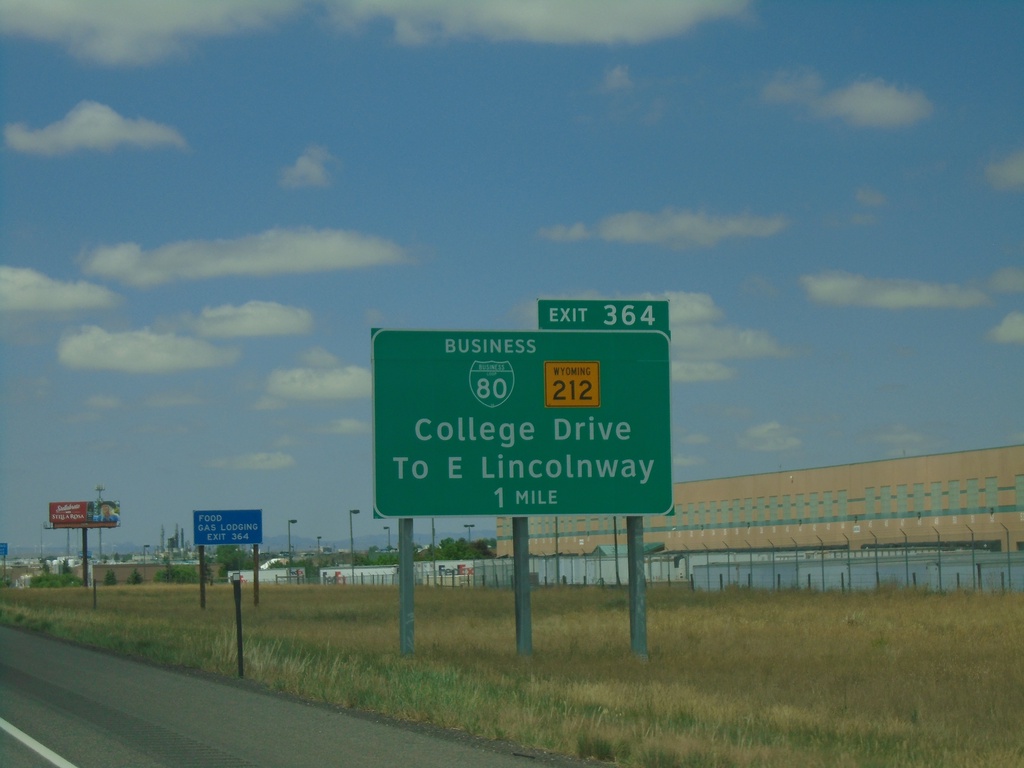
I-80 West - Exit 364
I-80 west approaching Exit 364 - BL-80/WY-212/College Drive/To E Lincolnway.
Taken 07-11-2022
 Cheyenne
Laramie County
Wyoming
United States
Cheyenne
Laramie County
Wyoming
United States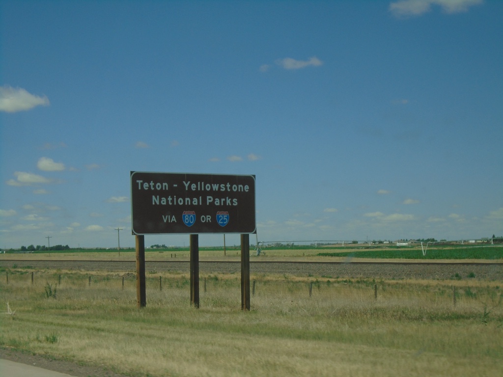
I-80 West - Teton - Yellowstone National Parks
Teton - Yellowstone National Parks via I-80 or I-25. Taken on I-80 west near Pine Bluffs. All major highways entering Wyoming have similar directions to Teton and Yellowstone National Parks.
Taken 07-11-2022
Pine Bluffs
Laramie County
Wyoming
United States
End NE-53C Link South at I-80 East
End NE-53C Link South at I-80 East to Sidney.
Taken 07-11-2022
 Bushnell
Kimball County
Nebraska
United States
Bushnell
Kimball County
Nebraska
United States
NE-53C Link South Approaching I-80
NE-53C Link South approaching I-80. Use I-80 west to Cheyenne, WY; I-80 east to Sidney.
Taken 07-11-2022
Bushnell
Kimball County
Nebraska
United States
NE-53C Link South - Distance Marker
Distance Marker on NE-53C Link South. Distance to I-80.
Taken 07-11-2022
Bushnell
Kimball County
Nebraska
United States