Signs Tagged With Big Green Sign
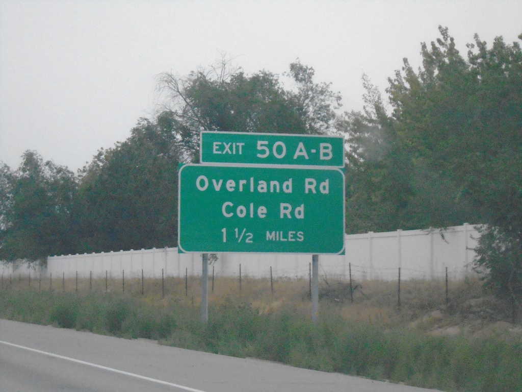
I-84 East Approaching Exits 50A-B
I-84 East approaching Exits 50A-B - Overland Road/Cole Road
Taken 08-20-2023


 Boise
Ada County
Idaho
United States
Boise
Ada County
Idaho
United States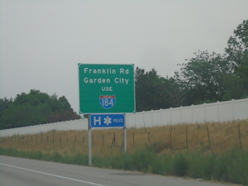
I-84 East Approaching I-184 Junction
I-84 East approaching I-184. Use I-184 for Garden City and Franklin Road.
Taken 08-20-2023
Boise
Ada County
Idaho
United States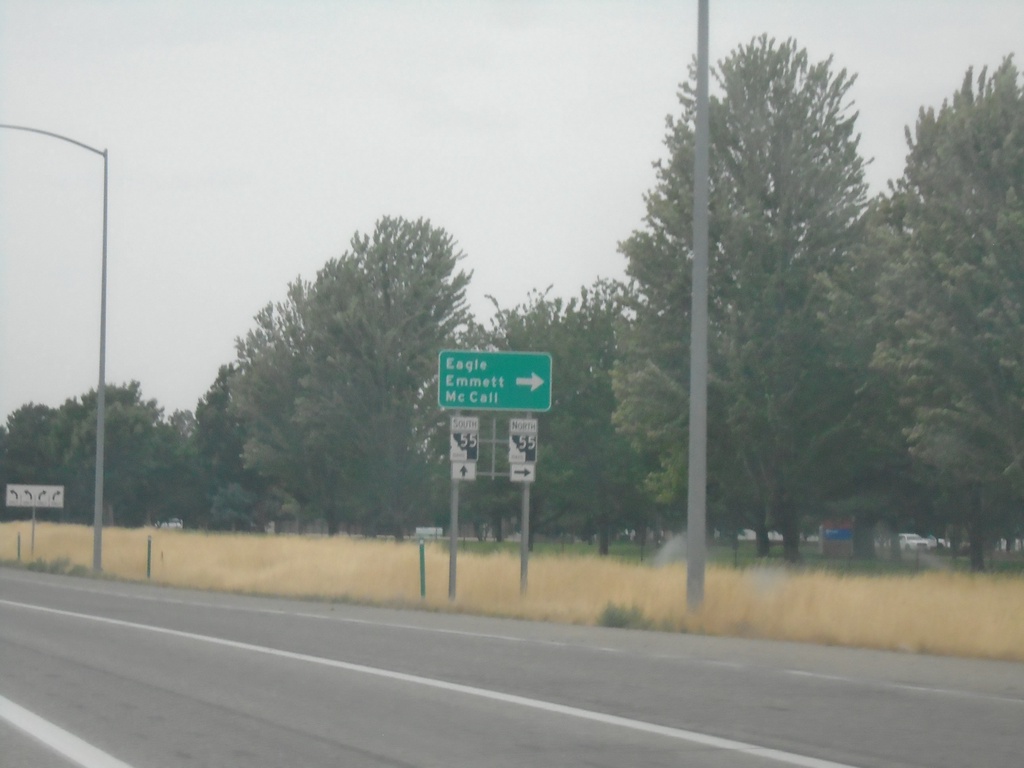
I-84 West - Exit 46 Offramp
I-84 West - Exit 46 Offramp in Meridian. Turn right on ID-55 (Eagle Road) for Eagle, Emmett, and McCall. ID-55 south joins I-84 westbound to Nampa.
Taken 08-20-2023
 Meridian
Ada County
Idaho
United States
Meridian
Ada County
Idaho
United States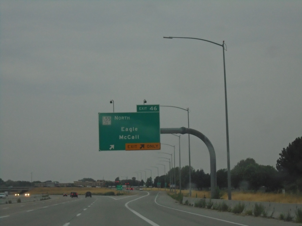
I-84 West - Exit 46
I-84 west at Exit 46 - ID-55 North/Eagle/McCall.
Taken 08-20-2023
Meridian
Ada County
Idaho
United States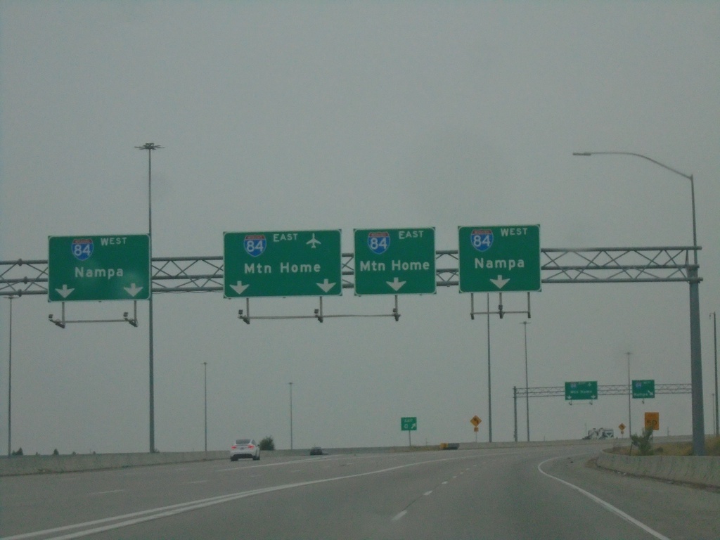
End I-184 Westbound I-84
End I-184 Westbound I-84. Use far left or far right lanes for I-84 West to Nampa; use middle lanes for I-84 East to Mountain Home.
Taken 08-20-2023
Boise
Ada County
Idaho
United States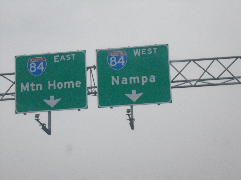
I-184 West - Exit 1A Onramp - Approaching I-84.
I-184 West - Exit 1A Onramp. I-184 immediately ends at the top of this ramp at I-84. Use right lane for I-84 west to Nampa; left lane for I-84 east to Mountain Home.
Taken 08-20-2023
Boise
Ada County
Idaho
United States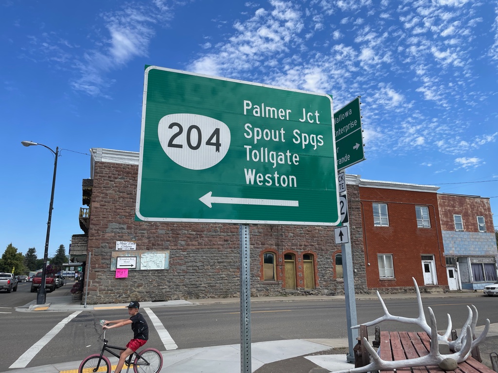
OR-82 East at OR-204 West
OR-82 East at OR-204 West in Elgin. Use OR-204 west to Palmer Junction, Spout Springs, Tollgate, and Weston.
Taken 07-29-2023

 Elgin
Union County
Oregon
United States
Elgin
Union County
Oregon
United States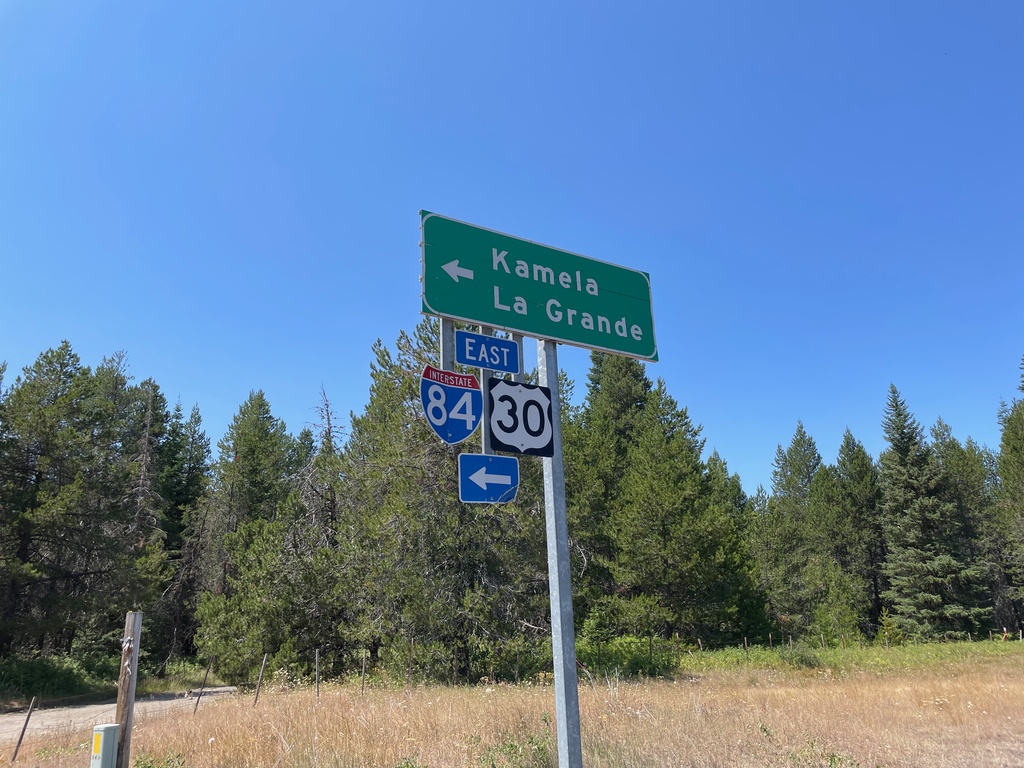
I-84/US-30 East - Exit 238 Onramp
I-84/US-30 East (Exit 238 Onramp) to Kamela and La Grande.
Taken 07-28-2023
Meacham
Umatilla County
Oregon
United States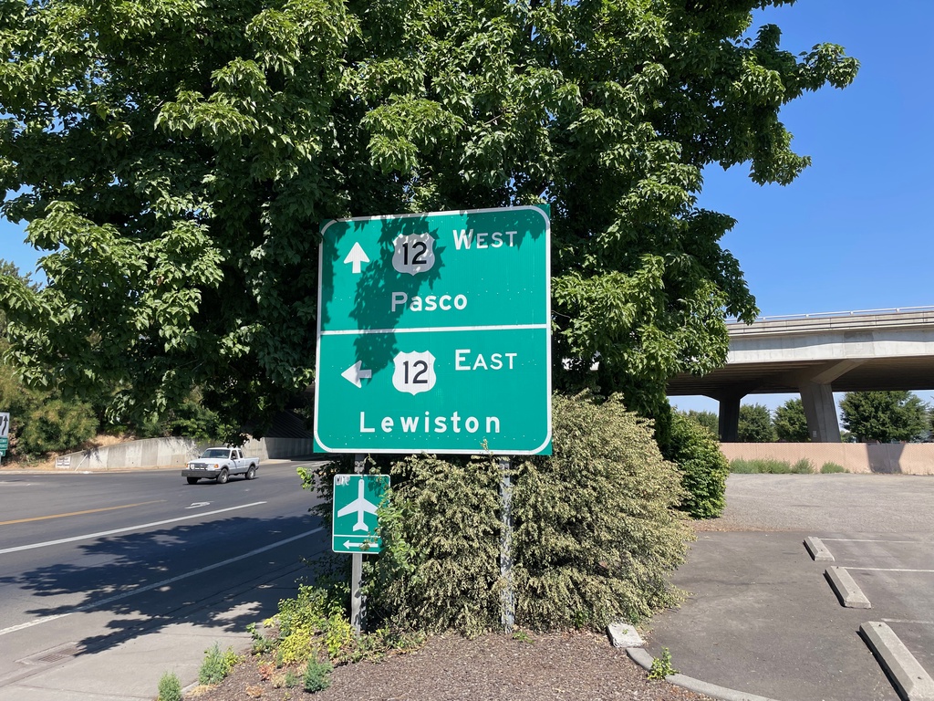
2nd Ave. North at US-12
2nd Ave. North at US-12 in Walla Walla. Use US-12 West to Pasco; US-12 East to Lewiston (Idaho).
Taken 07-28-2023
 Walla Walla
 County
Washington
United States
Walla Walla
Walla Walla County
Washington
United States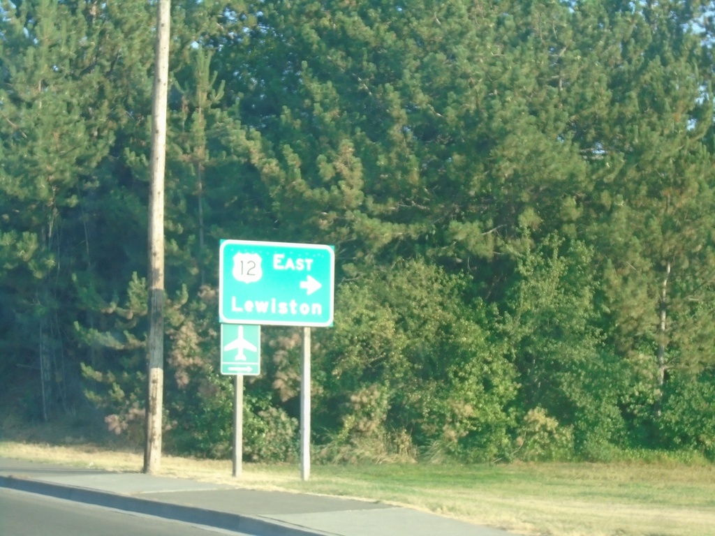
2nd Ave. Southbound At US-12 East
2nd Ave. Southbound At US-12 East to Lewiston (Idaho).
Taken 07-27-2023
Walla Walla
Walla Walla County
Washington
United States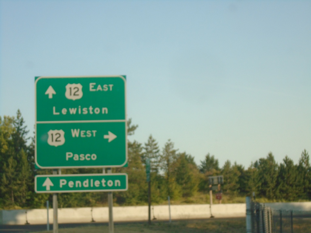
2nd Ave. Southbound at US-12
2nd Ave. southbound at US-12 in Walla Walla. Turn right for US-12 West to Pasco. Continue under freeway for US-12 East to Lewiston (Idaho). Continue on 2nd Ave. through downtown Walla Walla to access WA-125 to Pendleton (Oregon).
Taken 07-27-2023
Walla Walla
Walla Walla County
Washington
United States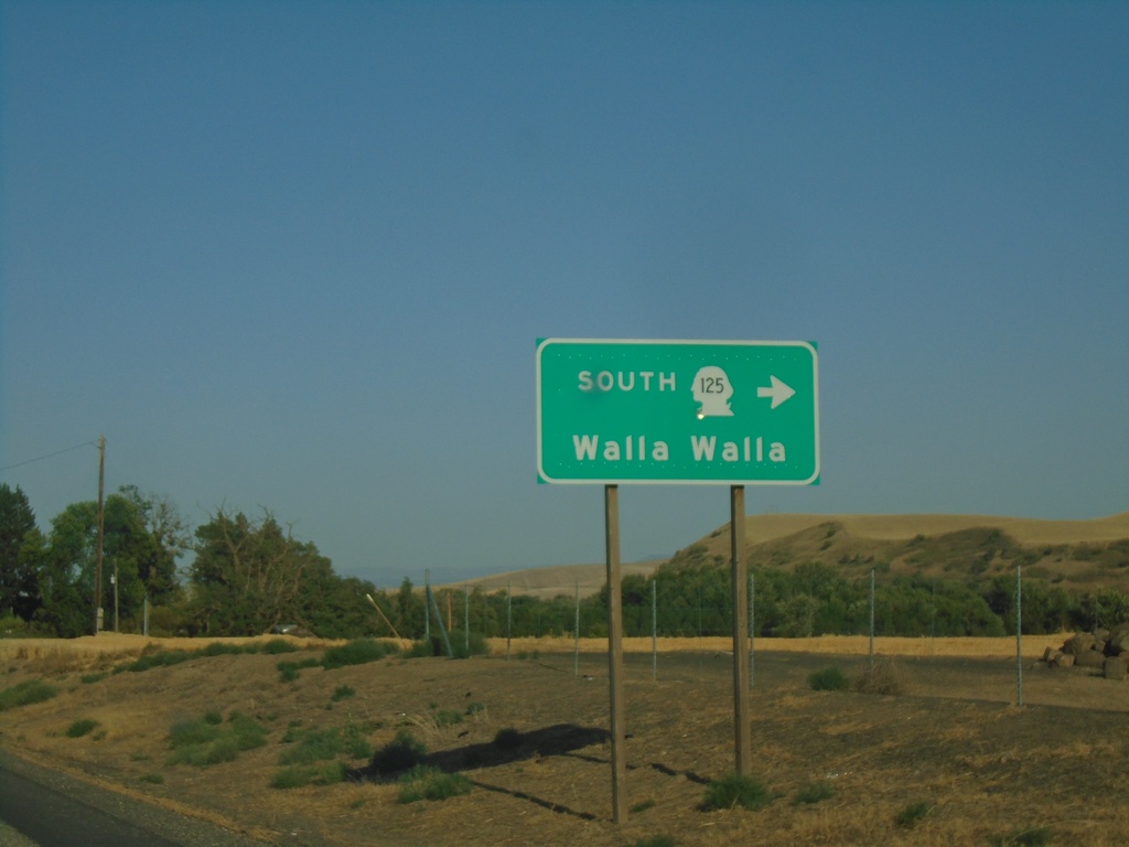
WA-124 East at WA-125 South
WA-124 East at WA-125 South to Walla Walla.
Taken 07-27-2023

 Prescott
Walla Walla County
Washington
United States
Prescott
Walla Walla County
Washington
United States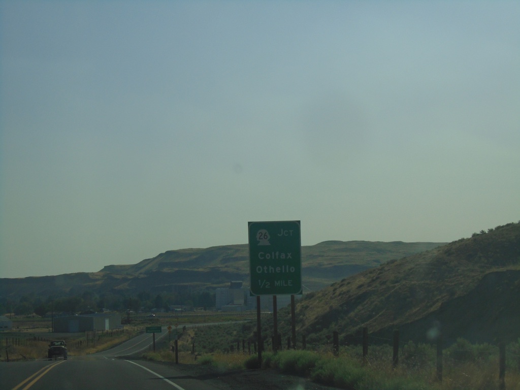
WA-261 South Approaching WA-26 and WA-260
WA-261 South approaching WA-26 and WA-260. Use WA-26 to Colfax and Othello.
Taken 07-27-2023


 Washtucna
Adams County
Washington
United States
Washtucna
Adams County
Washington
United States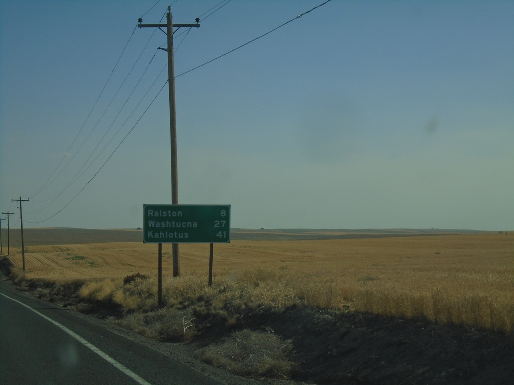
WA-261 South - Distance Marker
Distance marker on WA-261 south. Distance to Ralston, Washtucna, and Kahlotus.
Taken 07-27-2023
Ritzville
Adams County
Washington
United States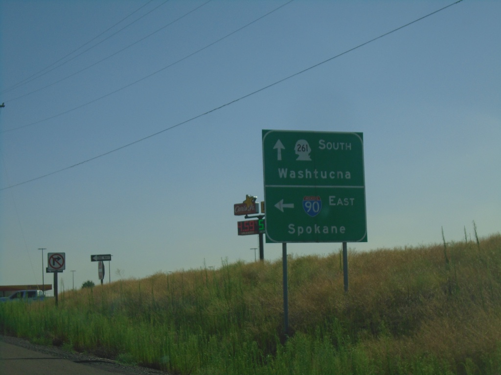
WA-261 South at I-90 East
WA-261 South at I-90 East (Exit 221) to Spokane. Continue south on WA-261 to Washtucna.
Taken 07-27-2023

 Ritzville
Adams County
Washington
United States
Ritzville
Adams County
Washington
United States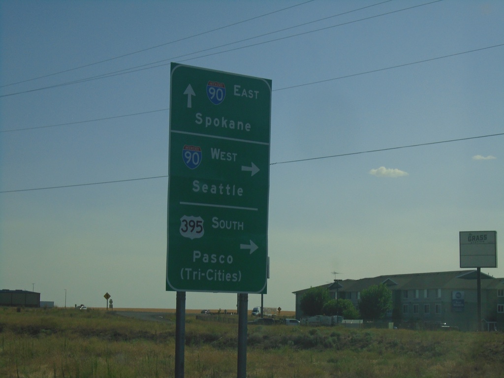
Division St. South at I-90/US-395/WA-261
Division St. South at I-90/US-395/WA-261 in Ritzville. Turn right for I-90 West/Seattle and US-395 South/Pasco (Tri-Cities). Continue under freeway for I-90 East to Spokane. WA-261 southbound begins here.
Taken 07-27-2023
Ritzville
Adams County
Washington
United States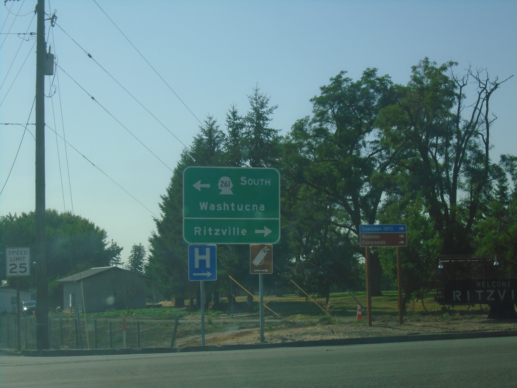
I-90 West - Exit 221 Offramp
I-90 West - Exit 221 Offramp at WA-261. Turn right for Ritzville; left for WA-261 south to Washtucna.
Taken 07-27-2023
Ritzville
Adams County
Washington
United States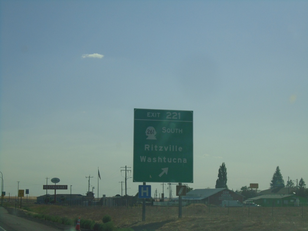
I-90 West - Exit 221
I-90 west at Exit 221 - WA-261 South/Ritzville/Washtucna.
Taken 07-27-2023
Ritzville
Adams County
Washington
United States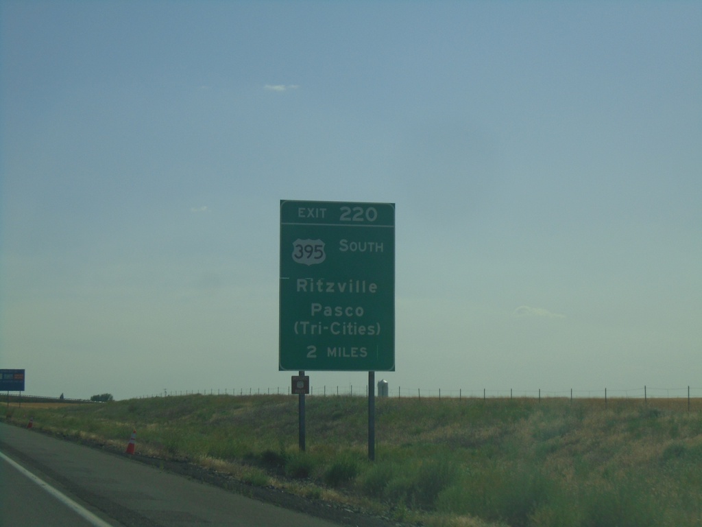
I-90 West - Exit 220
I-90 west approaching Exit 220 - US-395 South/Ritzville/Pasco (Tri-Cities). This sign is in advance of Exit 221 as well. US-395 south leaves I-90 at Exit 220.
Taken 07-27-2023
Ritzville
Adams County
Washington
United States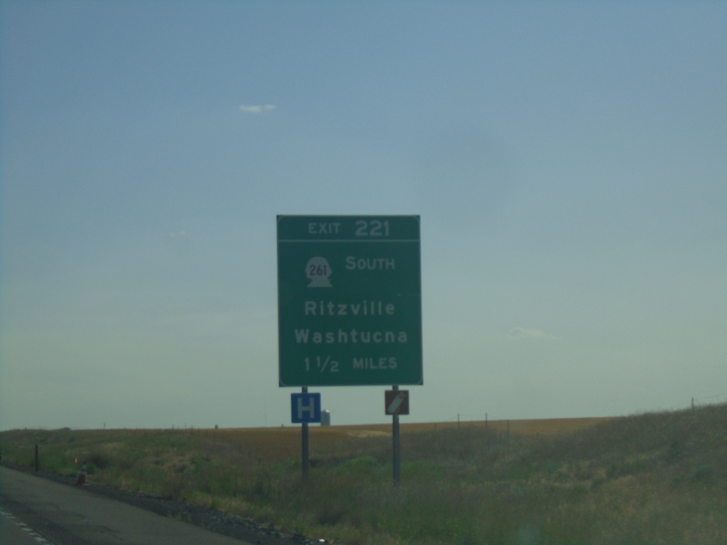
I-90 West - Exit 221
I-90 west approaching Exit 221 - WA-261 South/Ritzville/Washtucna.
Taken 07-27-2023
Ritzville
Adams County
Washington
United States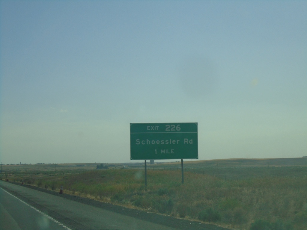
I-90 West - Exit 226
I-90 west approaching Exit 226 - Schoessler Road.
Taken 07-27-2023
Ritzville
Adams County
Washington
United States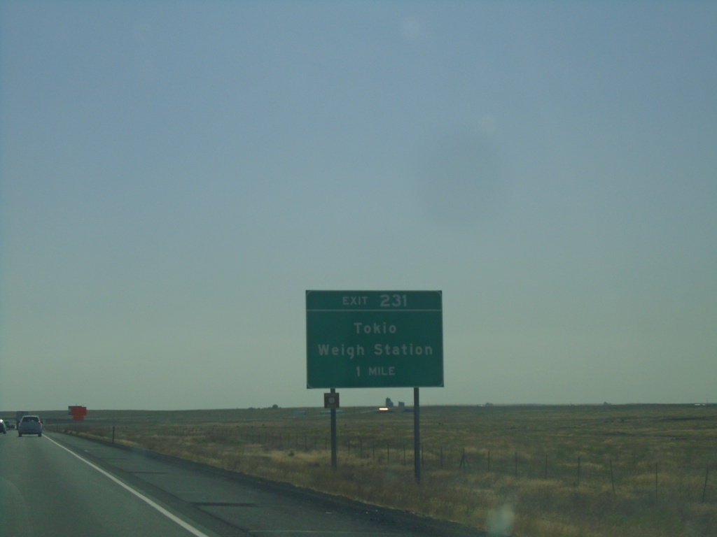
I-90 West - Exit 231
I-90 west approaching Exit 231 - Tokio/Weigh Station.
Taken 07-27-2023
Sprague
Adams County
Washington
United States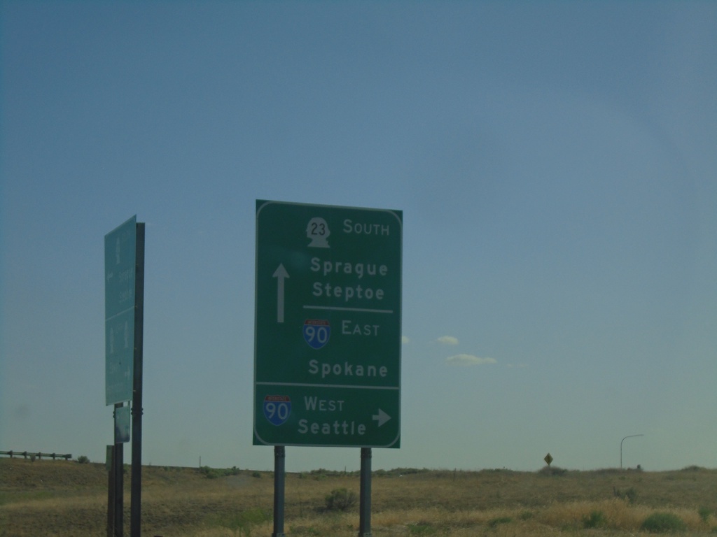
WA-23 East at I-90 Junction
WA-23 East at I-90 Junction (Exit 245). Turn right for I-90 West to Seattle. Continue under freeway for I-90 East to Spokane. Continue south on WA-23 for Sprague and Steptoe.
Taken 07-27-2023
 Sprague
Lincoln County
Washington
United States
Sprague
Lincoln County
Washington
United States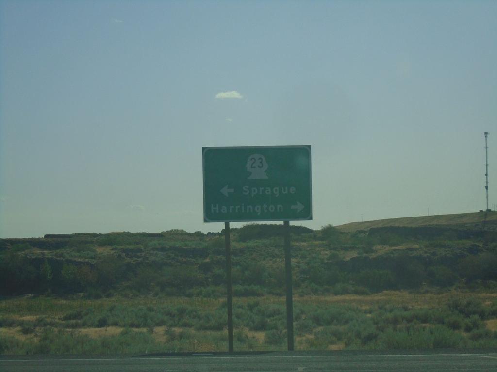
End WA-231 South at WA-23
End WA-231 south at WA-23. Use WA-23 west to Harrington; WA-23 east to Sprague.
Taken 07-27-2023
 Sprague
Lincoln County
Washington
United States
Sprague
Lincoln County
Washington
United States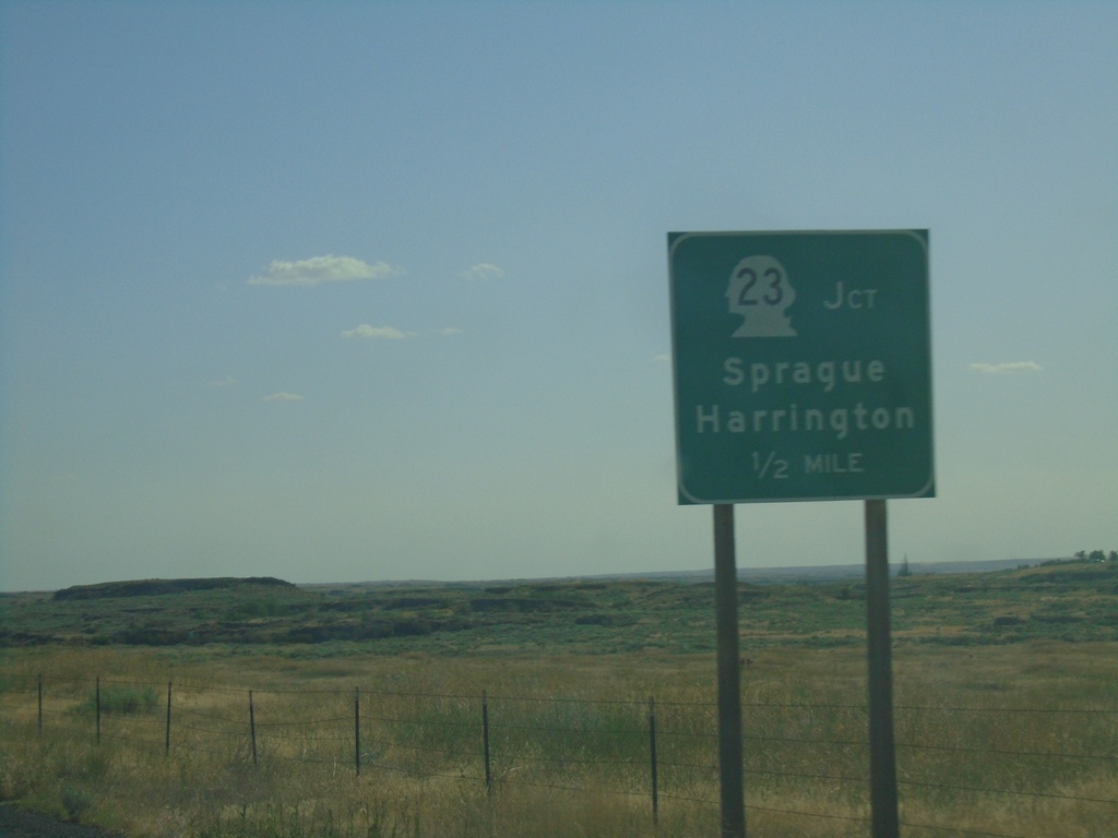
WA-231 South Approaching WA-23
WA-231 South approaching WA-23. Use WA-23 for Sprague and Harrington.
Taken 07-27-2023
Sprague
Lincoln County
Washington
United States