Signs Tagged With Big Green Sign
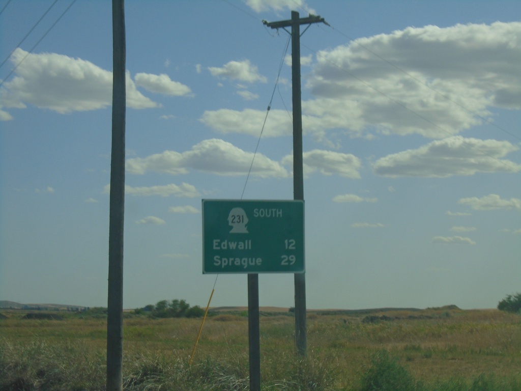
WA-231 South - Distance Marker
Distance marker on WA-231 south. Distance to Edwall and Sprague.
Taken 07-27-2023
 Edwall
Lincoln County
Washington
United States
Edwall
Lincoln County
Washington
United States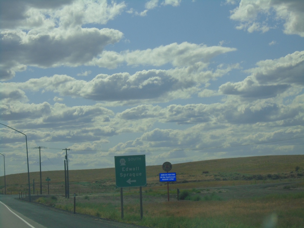
US-2 West/WA-231 South at US-2/WA-231 Split
US-2 West/WA-231 South at US-2/WA-231 split in Lincoln County. Use WA-231 south for Edwall and Sprague.
Taken 07-27-2023
 Reardan
Lincoln County
Washington
United States
Reardan
Lincoln County
Washington
United States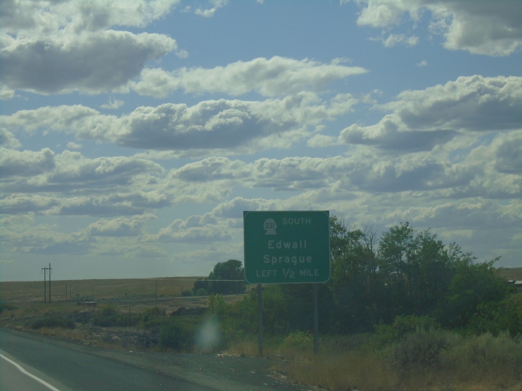
US-2 West/WA-231 South Approaching US-2/WA-231 Split
US-2 West/WA-231 South approaching US-2/WA-231 Split in Lincoln County. Use WA-231 south for Edwall and Sprague.
Taken 07-27-2023
Reardan
Lincoln County
Washington
United States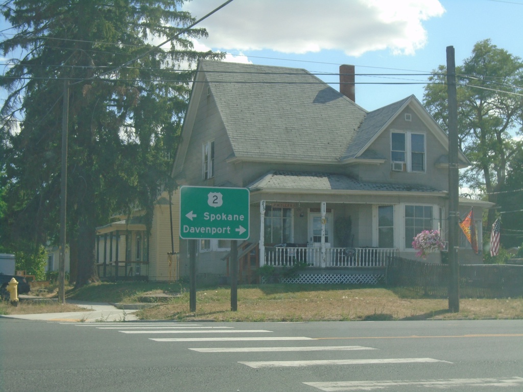
WA-231 South at US-2
WA-231 South at US-2 in Reardan. Use US-2 west for Davenport; US-2 east for Spokane. WA-231 south joins US-2 westbound.
Taken 07-27-2023
Reardan
Lincoln County
Washington
United States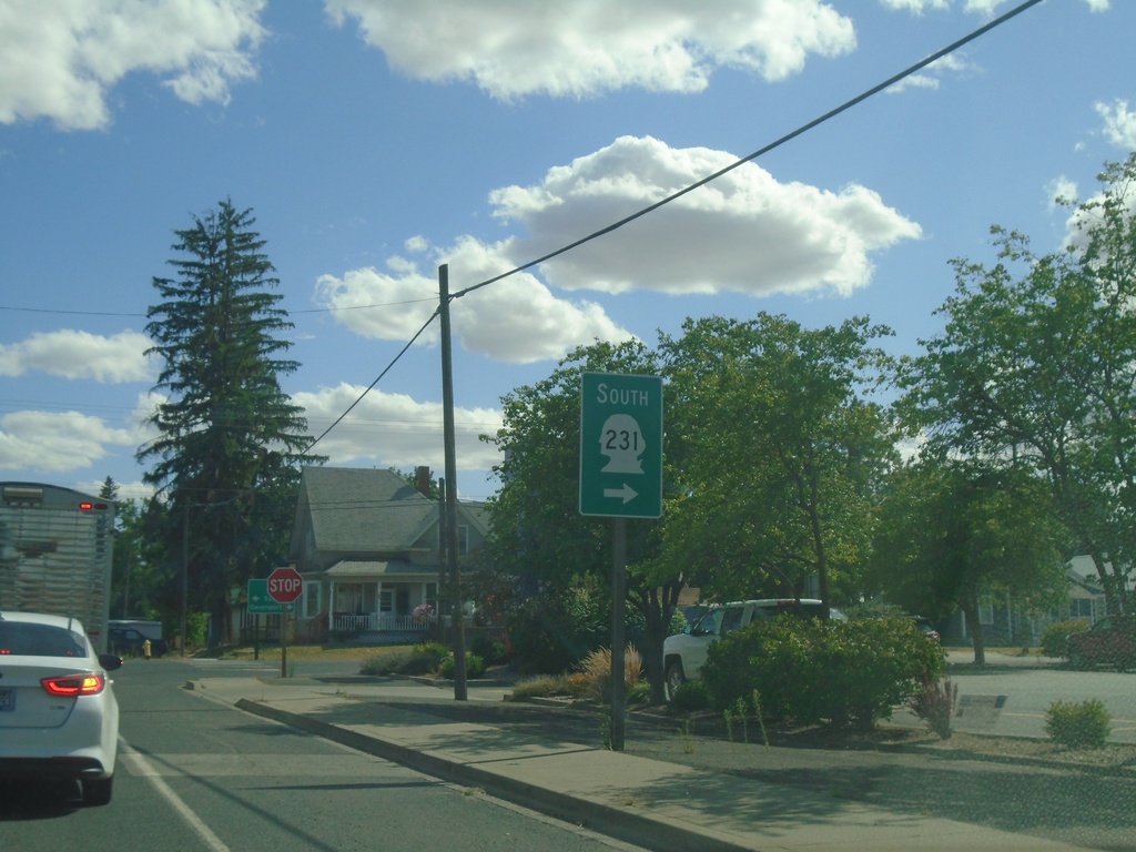
WA-231 South Approaching US-2
WA-231 South approaching US-2 in Reardan. Turn right on US-2 west to continue south on WA-231. WA-231 south joins US-2 west through Reardan.
Taken 07-27-2023
Reardan
Lincoln County
Washington
United States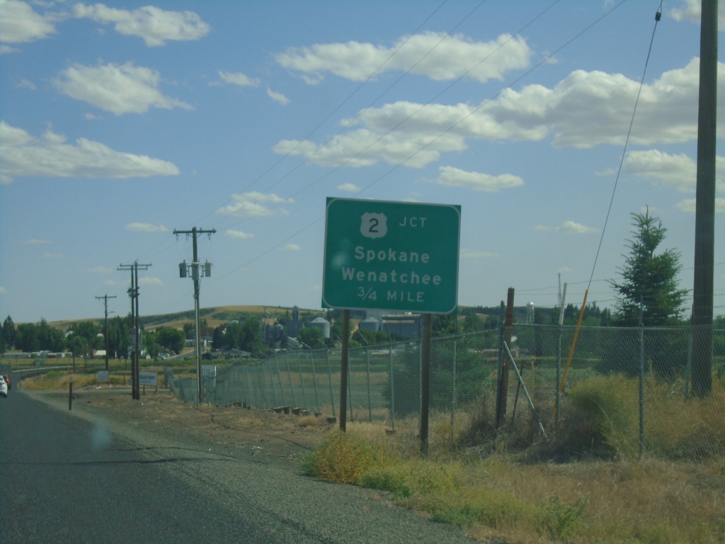
WA-231 South Approaching US-2
WA-231 South approaching US-2 in Reardan. Use US-2 for Spokane and Wenatchee.
Taken 07-27-2023
Reardan
Lincoln County
Washington
United States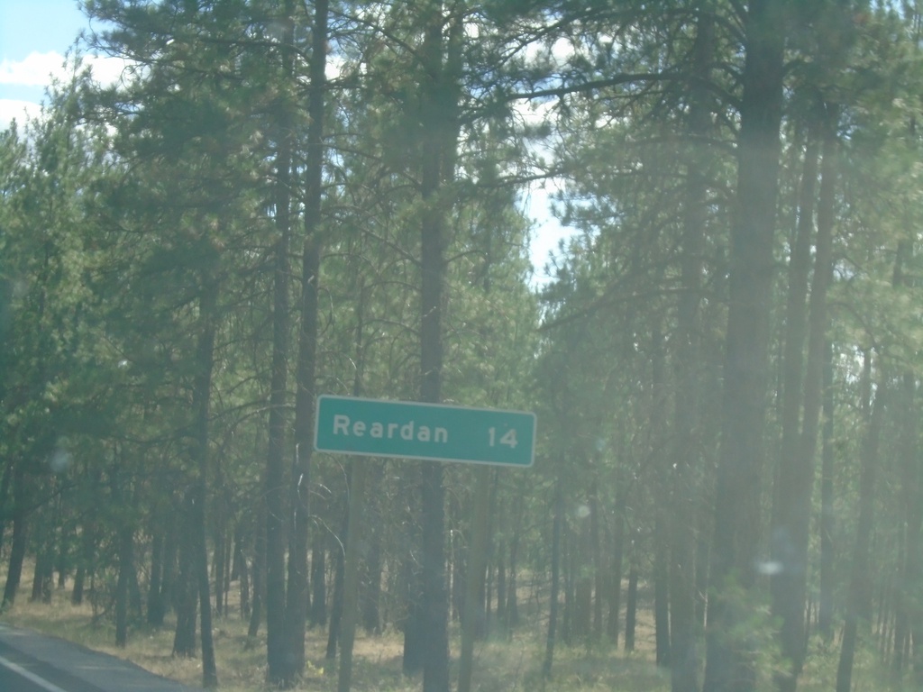
WA-231 South - Distance Marker
Distance marker on WA-231 south. Distance to Reardan.
Taken 07-27-2023
Long Lake
Stevens County
Washington
United States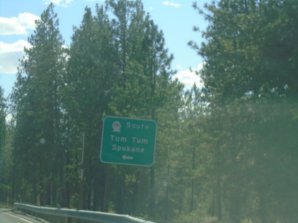
WA-231 South at WA-291 East
WA-231 South at WA-291 East to Tum Tum and Spokane.
Taken 07-27-2023
 Ford
Stevens County
Washington
United States
Ford
Stevens County
Washington
United States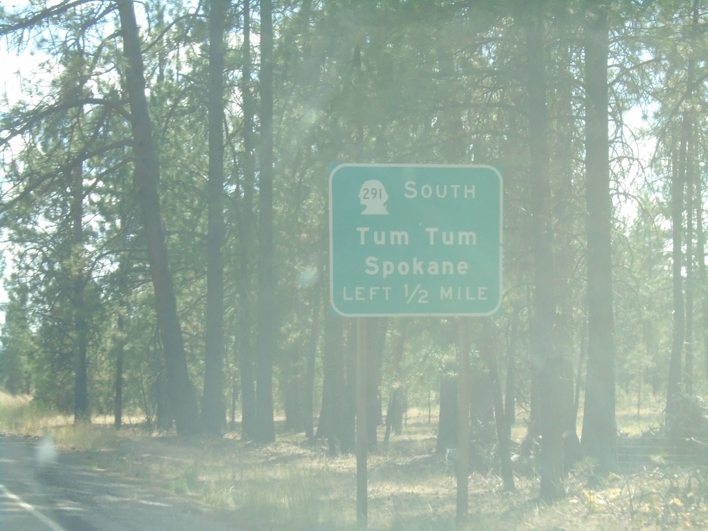
WA-231 South Approaching WA-291
WA-231 South approaching WA-291 East to Tum Tum and Spokane.
Taken 07-27-2023
Ford
Stevens County
Washington
United States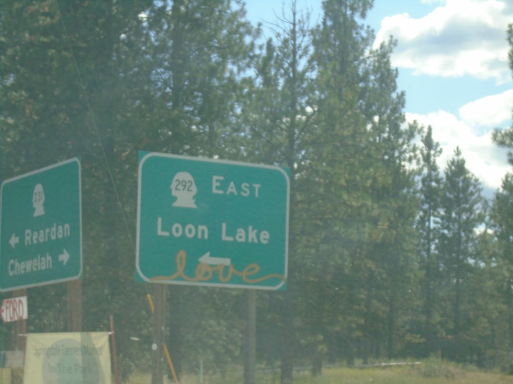
WA-231 South at WA-292 East
WA-231 South at WA-292 East in Springdale. Use WA-292 East to Loon Lake.
Taken 07-27-2023
 Springdale
Stevens County
Washington
United States
Springdale
Stevens County
Washington
United States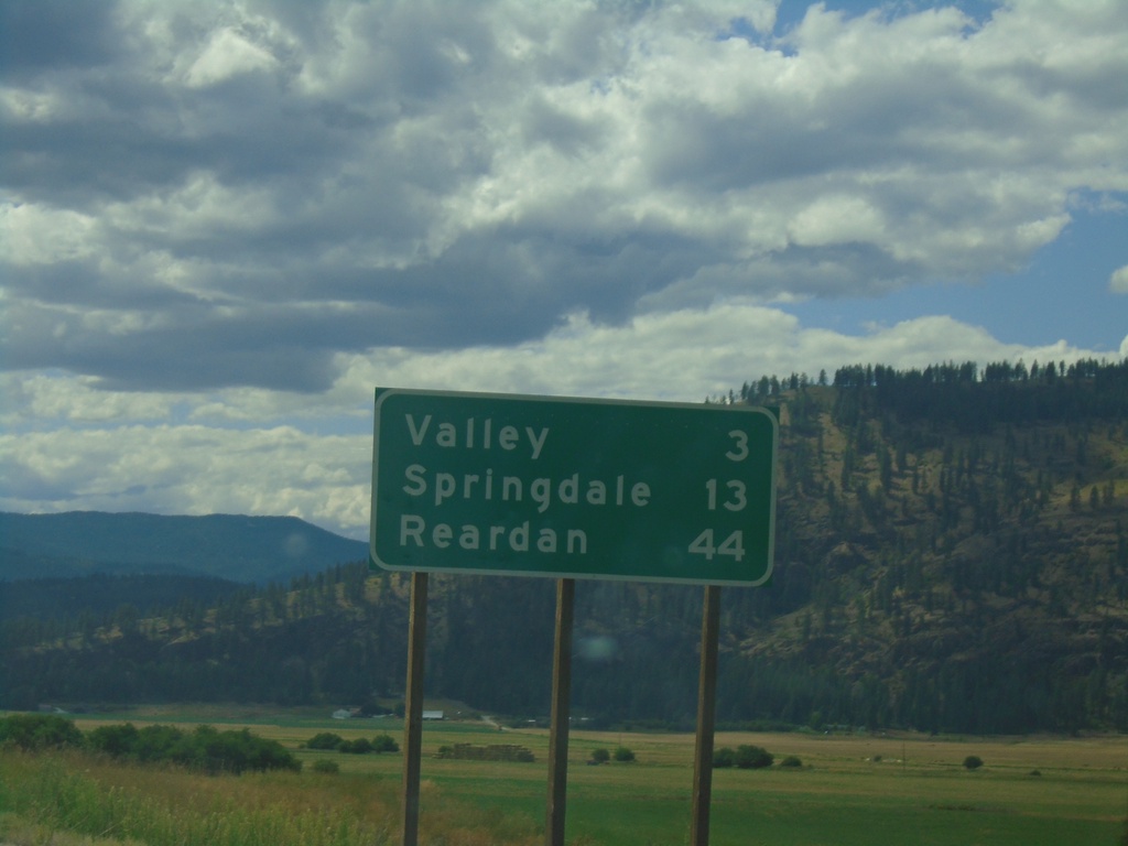
WA-231 South - Distance Marker
Distance marker on WA-231 south. Distance to Valley, Springdale, Reardan.
Taken 07-27-2023
Valley
Stevens County
Washington
United States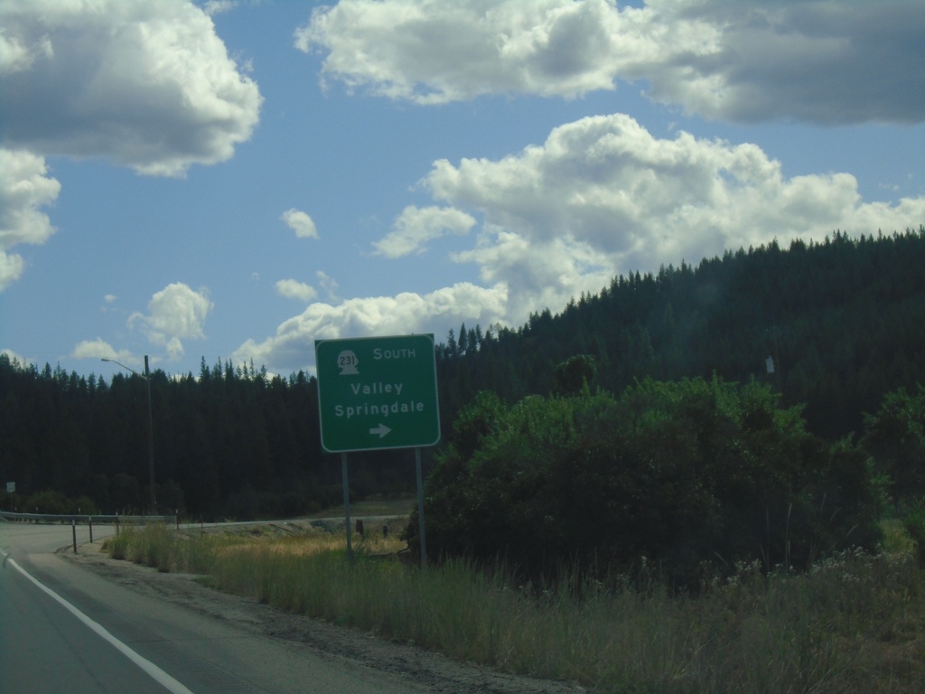
US-395 South at WA-231
US-395 South at WA-231 South to Valley and Springdale.
Taken 07-27-2023
 Valley
Stevens County
Washington
United States
Valley
Stevens County
Washington
United States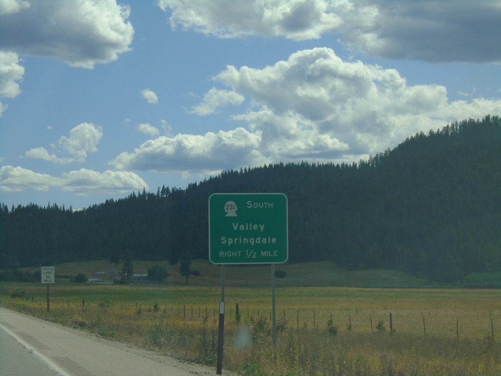
US-395 South Approaching WA-231
US-395 South approaching WA-231 to Valley and Springdale.
Taken 07-27-2023
Chewelah
Stevens County
Washington
United States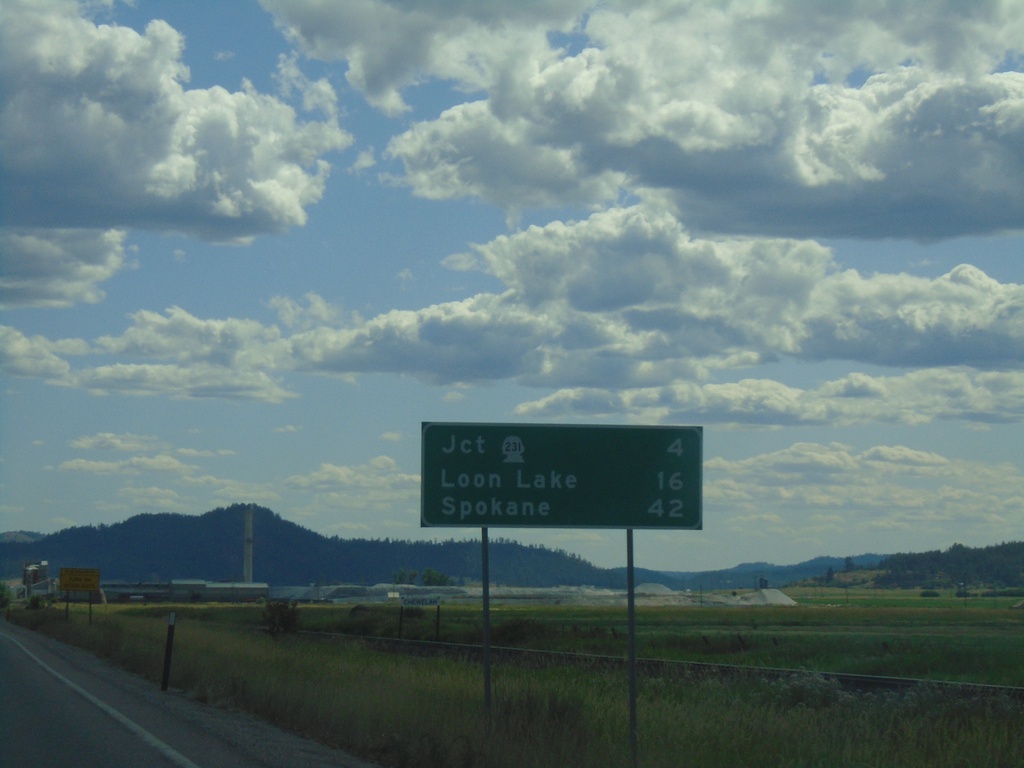
US-395 South - Distance Marker
Distance marker on US-395 south leaving Chewelah. Distance to Jct. WA-231, Loon Lake, and Spokane.
Taken 07-27-2023
Chewelah
Stevens County
Washington
United States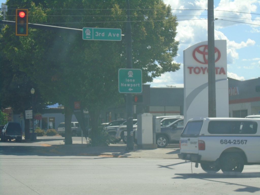
US-395 South/WA-20 East at US-395/WA-20 Split
US-395 South/WA-20 East at US-395/WA-20 Split in Colville. Turn left for WA-20 East (3rd Ave.) to Ione and Newport.
Taken 07-27-2023
 Colville
Stevens County
Washington
United States
Colville
Stevens County
Washington
United States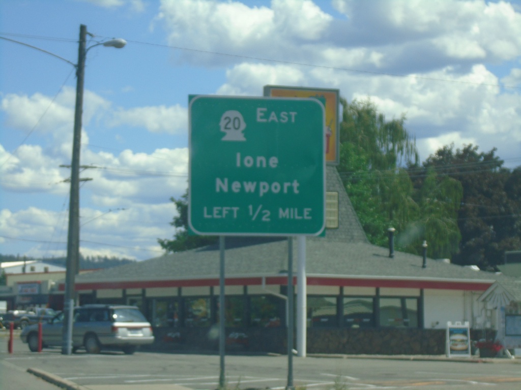
US-395 South/WA-20 East Approaching US-395/WA-20 Split
US-395 South/WA-20 East approaching US-395/WA-20 split. Use WA-20 East for Newport and Ione.
Taken 07-27-2023
Colville
Stevens County
Washington
United States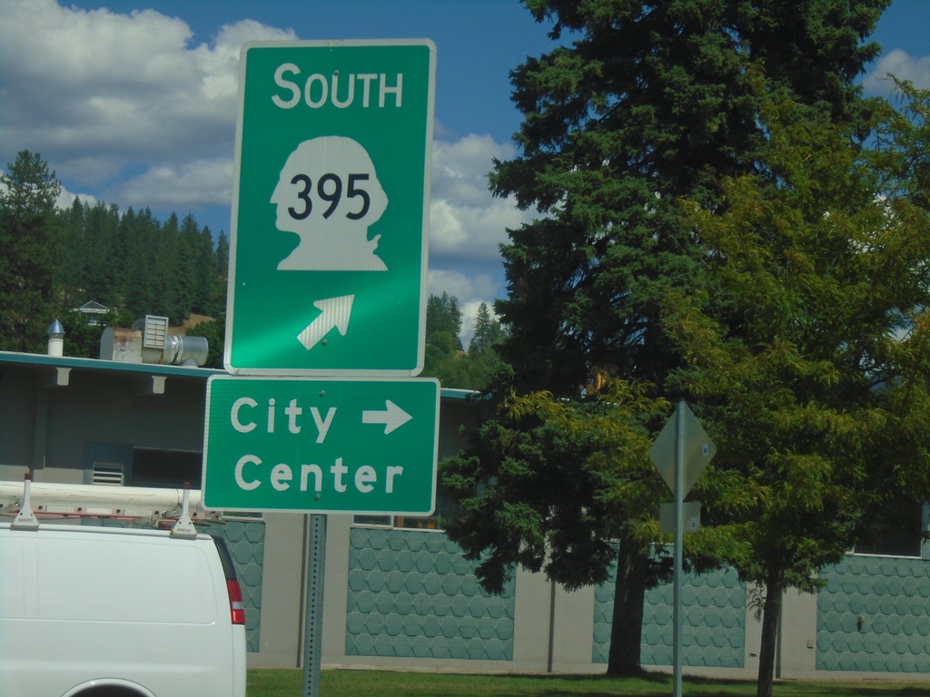
US-395 South/WA-20 East - Railroad St. Roundabout
US-395 South/WA-20 East - Railroad St. Roundabout in Colville. Merge right for Railroad St. south to (Colville) City Center. Merge left to continue on US-395 south, which is incorrectly signed as WA-395.
Taken 07-27-2023
Colville
Stevens County
Washington
United States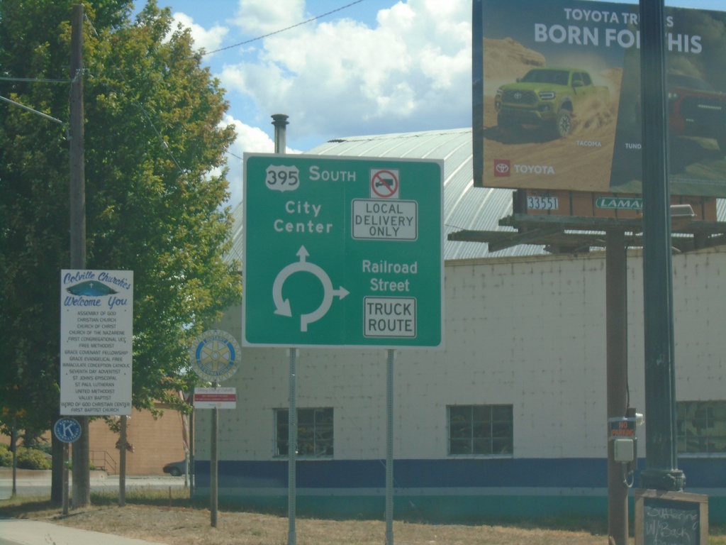
US-395 South/WA-20 East - Railroad St. Junction
US-395 South/WA-20 East at Railroad St. roundabout in Colville. Use Railroad St. southbound for Truck Route. Continue on US-395 South/(WA-20 East) for City Center.
Taken 07-27-2023
Colville
Stevens County
Washington
United States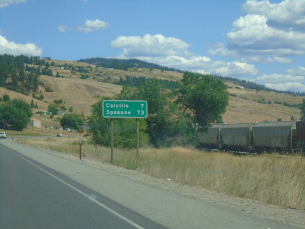
US-395 South/WA-20 East - Distance Marker
Distance Marker on US-395 South/WA-20 East. Distance to Colville and Spokane.
Taken 07-27-2023
Kettle Falls
Stevens County
Washington
United States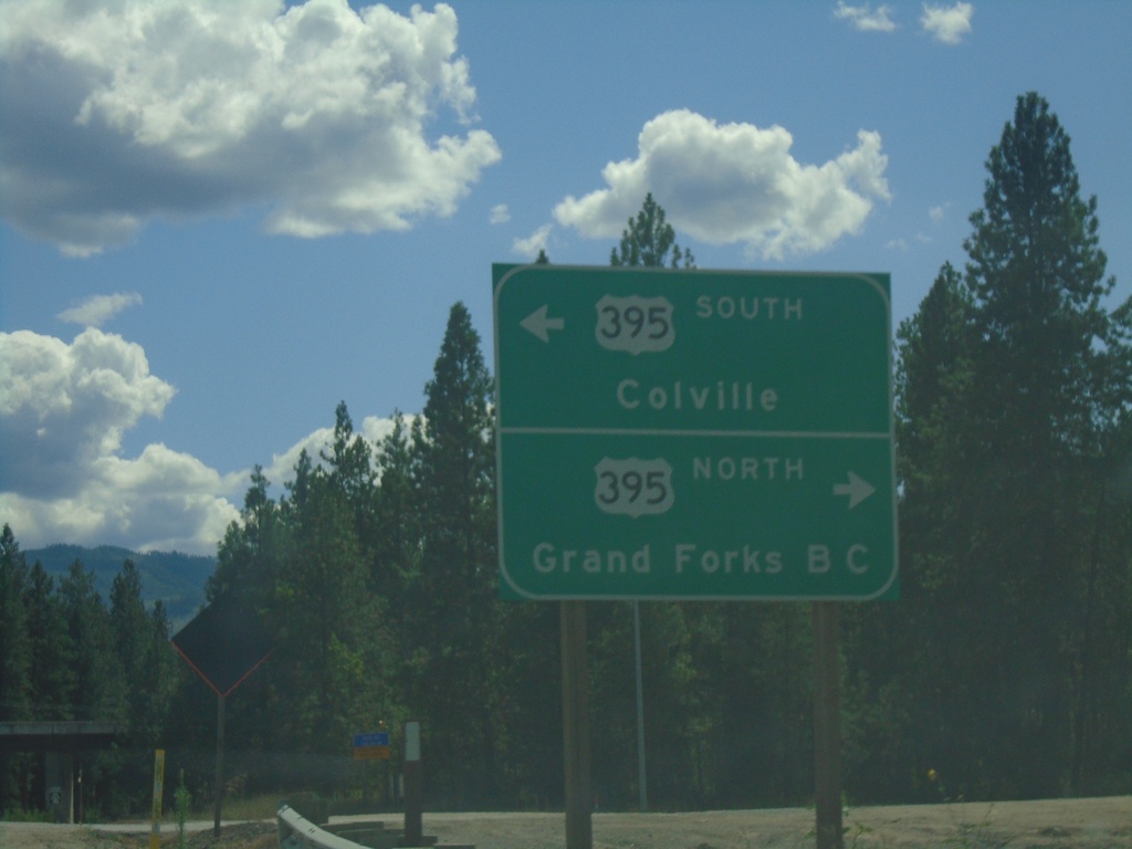
WA-25 South at US-395/WA-20
WA-25 South at US-395/WA-20 near Kettle Falls. Turn right for US-395 North/(WA-20 West) to Grand Forks, BC (Canada). Turn left for US-395 South/(WA-20 East) to Colville.
Taken 07-27-2023
 Kettle Falls
Stevens County
Washington
United States
Kettle Falls
Stevens County
Washington
United States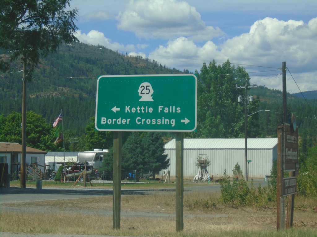
End Northport-Waneta Road at WA-25
End Northport-Waneta Road at WA-25 in Northport. Turn right on WA-25 North to (Port of Patterson) Border Crossing. Turn left on WA-25 South to Kettle Falls.
Taken 07-27-2023
Northport
Stevens County
Washington
United States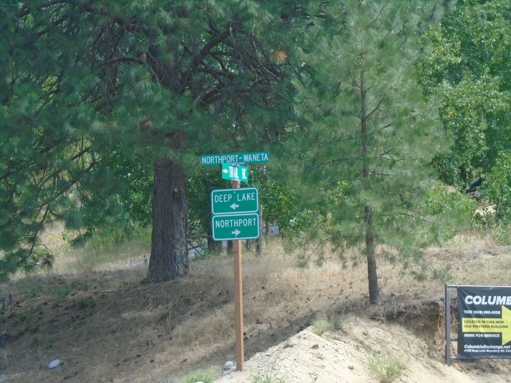
Northport-Waneta Road South at Deep Lake-Boundary Road
Northport-Waneta Road South at Deep Lake-Boundary Road. Turn right to continue south on Northport-Waneta Road to Northport. Turn left for Deep Lake-Boundary Road to Deep Lake.
Taken 07-27-2023
Colville Stevens County Washington United States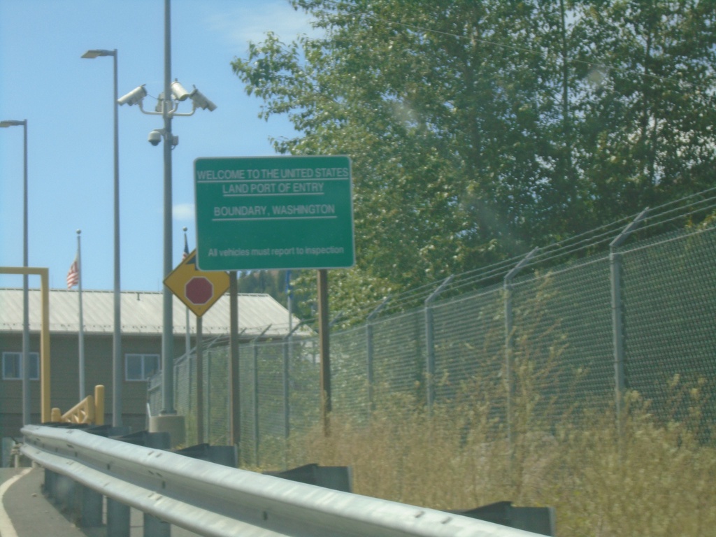
Welcome To The United States - Port of Boundary
Welcome to the United States - Land Port of Entry - Boundary, Washington. Approaching border station on Northport-Waneta Road southbound.
Taken 07-27-2023
Colville Stevens County Washington United States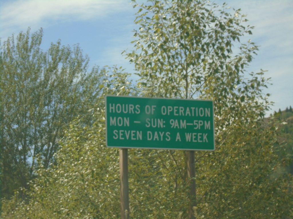
Entering United States - Port of Boundary
Entering the United States at the Port of Boundary. Hours of Operation Mon-Sun 9AM-5PM - Seven Days a Week. The actual port facilities are about a quarter mile to the south up a hill.
Taken 07-27-2023
Colville Stevens County Washington United States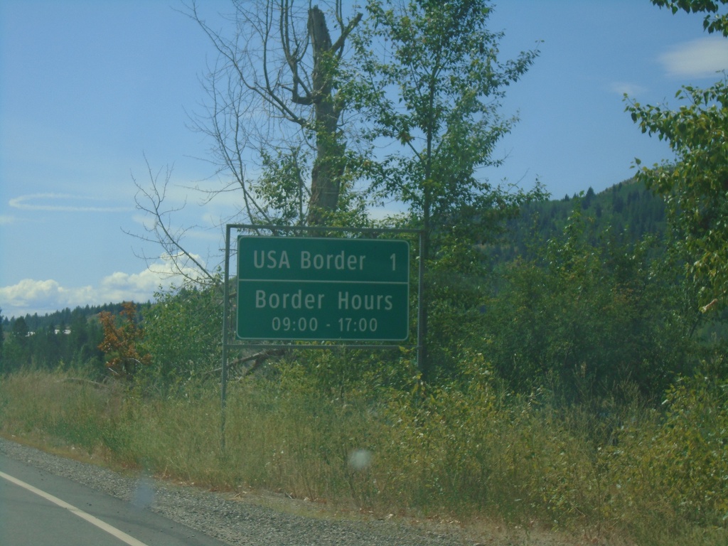
BC-22A South - Distance Marker
Distance marker on BC-22A south. USA Border 1km - Border Hours 09:00 - 17:00. Approaching Port of Waneta (Canada) and Port of Boundary (US).
Taken 07-27-2023
 Trail
Kootenay Boundary
British Columbia
Canada
Trail
Kootenay Boundary
British Columbia
Canada