Signs Tagged With Big Green Sign
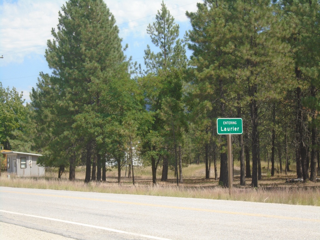
US-395 North - Laurier
Entering Laurier on US-395 North approaching the Canadian border. This is the northern terminus of US-395.
Taken 07-24-2023
 Laurier
Ferry County
Washington
United States
Laurier
Ferry County
Washington
United States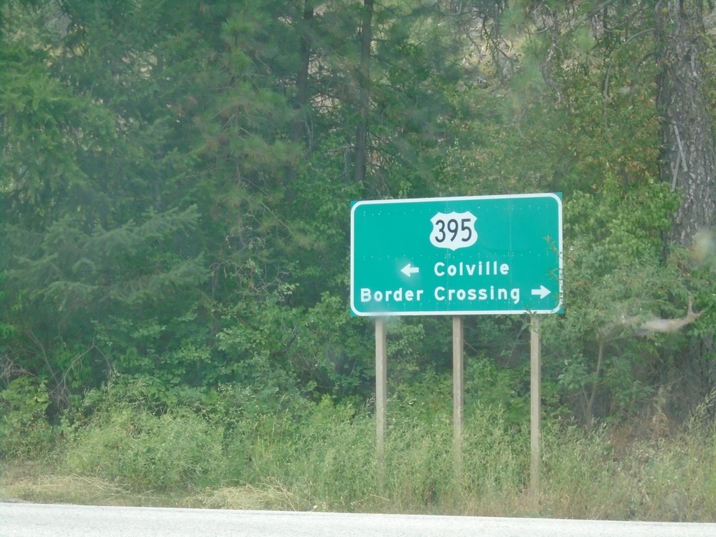
Main St. at US-395 - Orient
Main St. at US-395 in Orient. Use US-395 north to Border Crossing; US-395 south to Colville.
Taken 07-24-2023
Orient
Ferry County
Washington
United States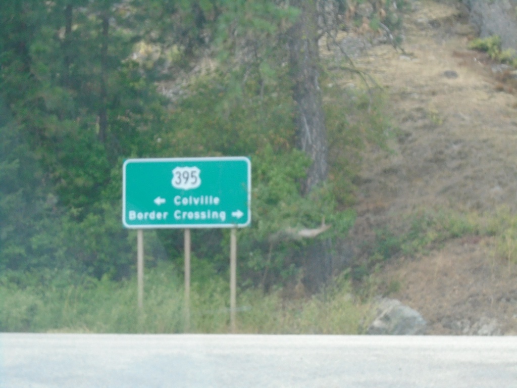
Northport-Flat Creek Road at US-395
Northport-Flat Creek Road at US-395 in Ferry County. Use US-395 north to Border Crossing; US-395 south to Colville.
Taken 07-24-2023
Kettle Falls
Ferry County
Washington
United States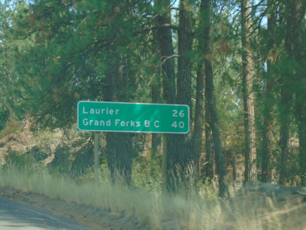
US-395 North - Distance Marker
Distance marker on US-395 north. Distance to Laurier and Grand Forks, BC. Laurier is settlement at the US/Canada Border.
Taken 07-24-2023
Kettle Falls
Ferry County
Washington
United States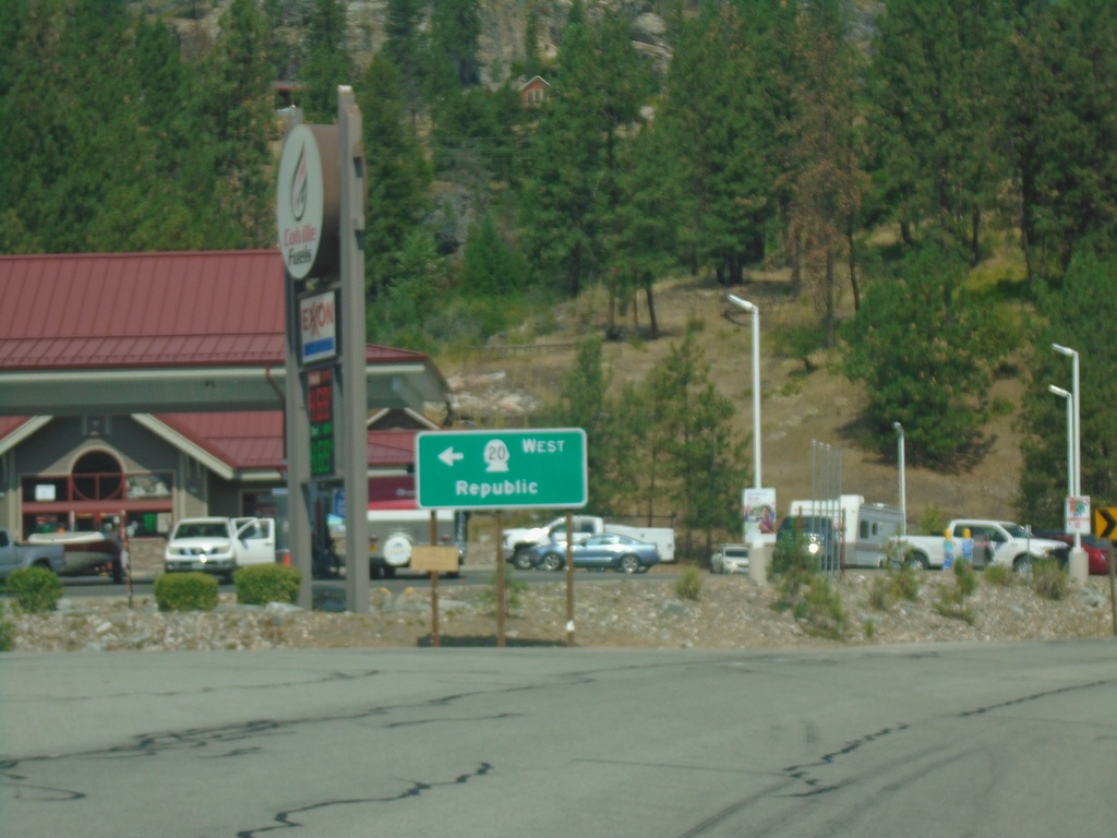
US-395 North/WA-20 West at US-395/WA-20 Split
US-395 North/WA-20 West at US-395/WA-20 split in Ferry County. Use WA-20 west to Republic.
Taken 07-24-2023
 Kettle Falls
Ferry County
Washington
United States
Kettle Falls
Ferry County
Washington
United States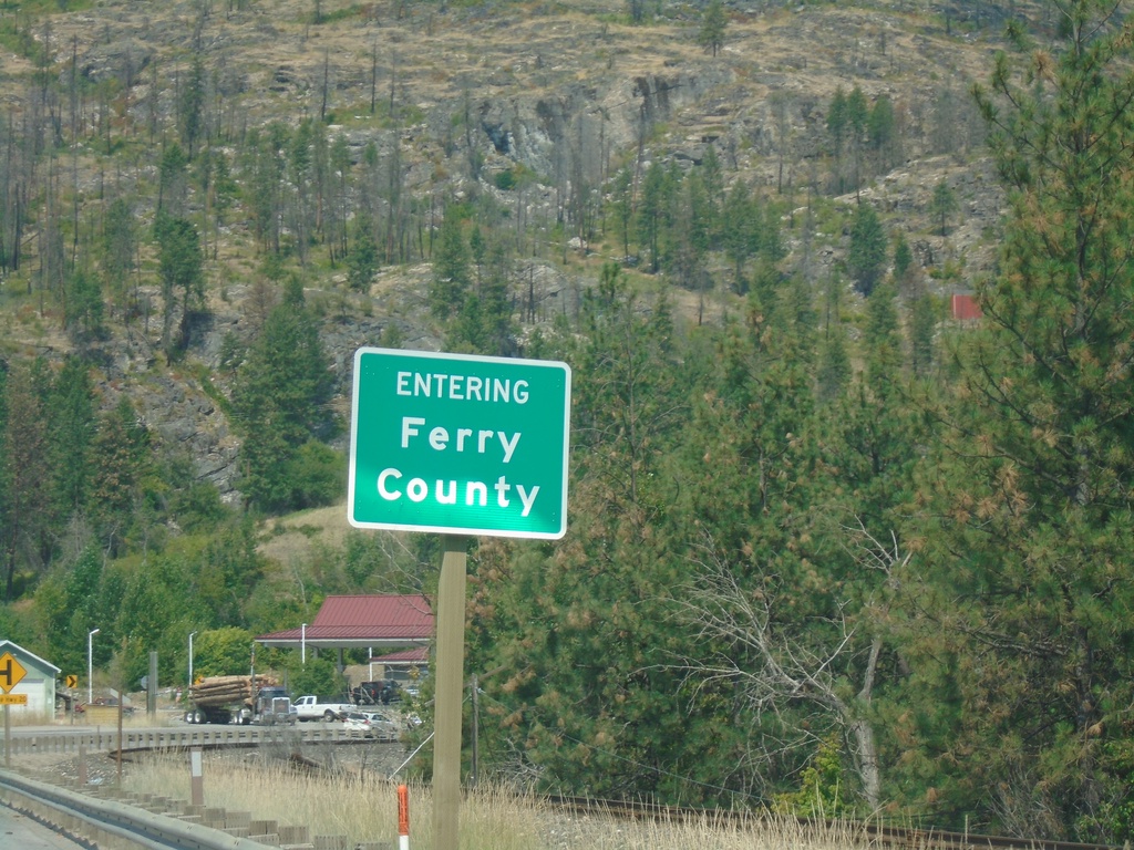
US-395 North/WA-20 West - Ferry County
Entering Ferry County at the foot of the Columbia River bridge on US-395 North/WA-20 West.
Taken 07-24-2023
Kettle Falls
Ferry County
Washington
United States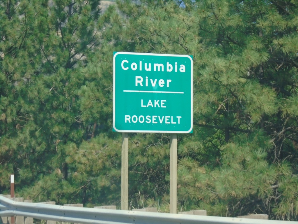
US-395 North/WA-20 West - Columbia River
US-395 North/WA-20 West at Columbia River/Lake Roosevelt Bridge. Lake Roosevelt is created by the Grand Coulee Dam.
Taken 07-24-2023
Kettle Falls
Stevens County
Washington
United States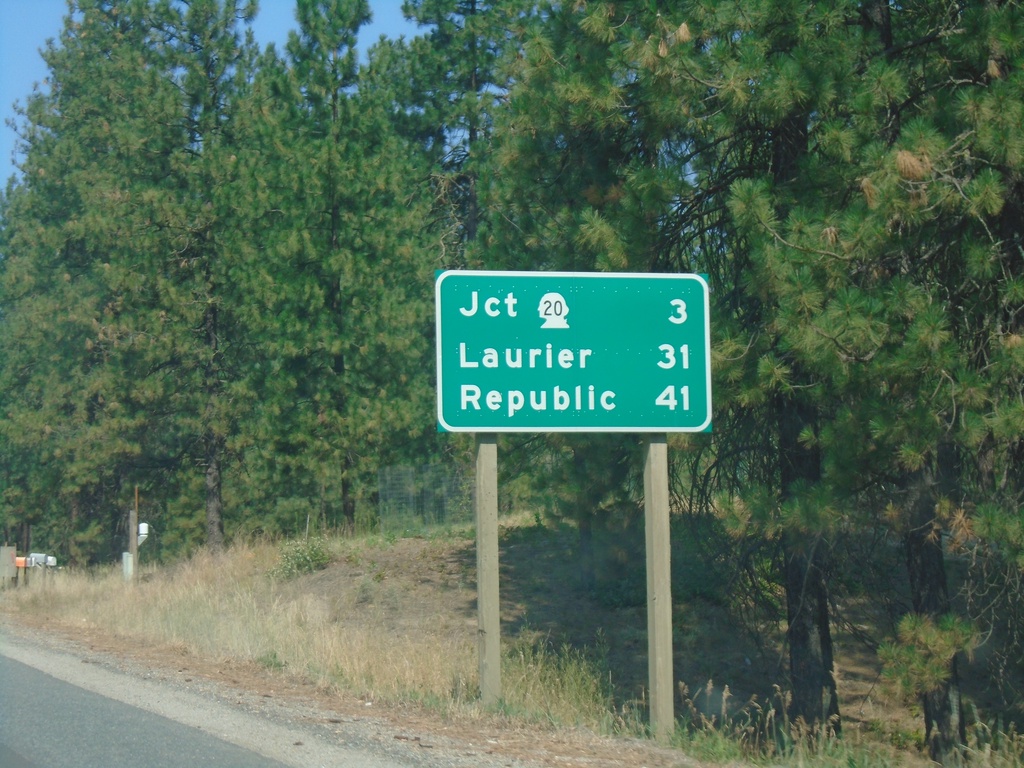
US-395 North/WA-20 West - Distance Marker
Distance Marker on US-395 North/WA-20 West. Distance to WA-20, Laurier (via US-395), and Republic (via WA-20).
Taken 07-24-2023
Kettle Falls
Stevens County
Washington
United States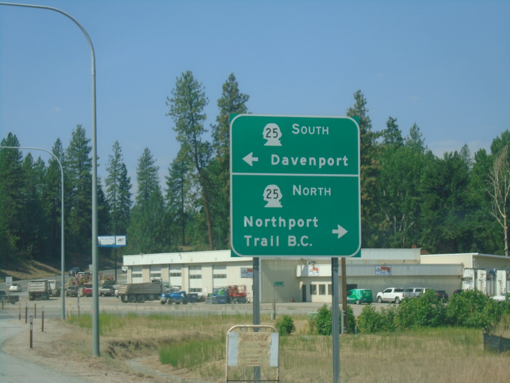
US-395 North/WA-20 West at WA-25
US-395 North/WA-20 West at WA-25. Use WA-25 north to Northport and Trail, BC. Use WA-25 south for Davenport.
Taken 07-24-2023
 Kettle Falls
Stevens County
Washington
United States
Kettle Falls
Stevens County
Washington
United States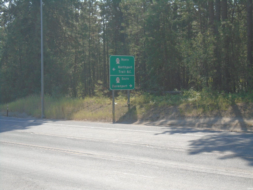
US-395 South at WA-25
US-395 South at WA-25 in Kettle Falls. Use WA-25 north to Northport and Trail, BC. Use WA-25 south for Davenport.
Taken 07-24-2023
Kettle Falls
Stevens County
Washington
United States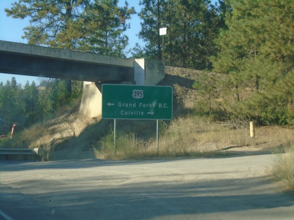
WA-25 North at US-395
WA-25 North at US-395 in Kettle Falls. Use US-395 north to Grand Forks, BC; use US-395 south to Colville.
Taken 07-23-2023
Kettle Falls
Stevens County
Washington
United States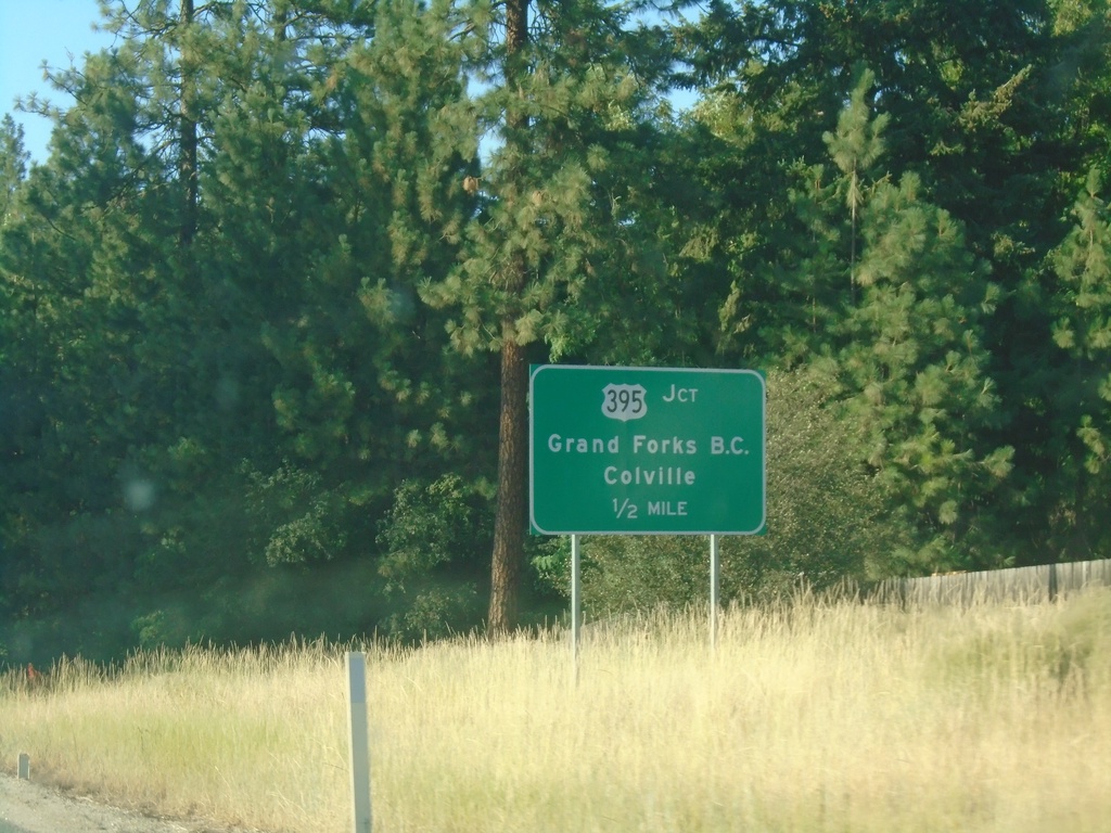
WA-25 North Approaching US-395
WA-25 North approaching US-395 in Kettle Falls. Use US-395 for Grand Forks, BC and Colville.
Taken 07-23-2023
Kettle Falls
Stevens County
Washington
United States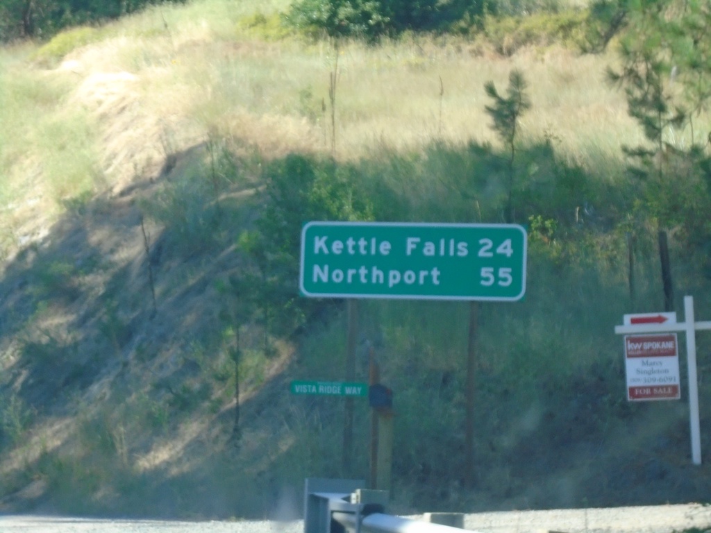
WA-25 North - Distance Marker
Distance marker on WA-25 north. Distance to Kettle Falls and Northport.
Taken 07-23-2023
Gifford
Stevens County
Washington
United States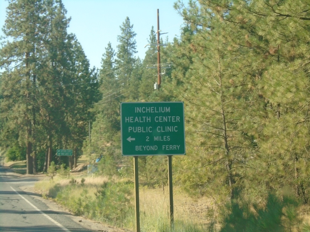
WA-25 North Approaching Gifford Ferry
WA-25 North approaching Gifford Ferry dock. Use the Gifford Ferry for the Inchelium Health Center Public Clinic.
Taken 07-23-2023
Gifford
Stevens County
Washington
United States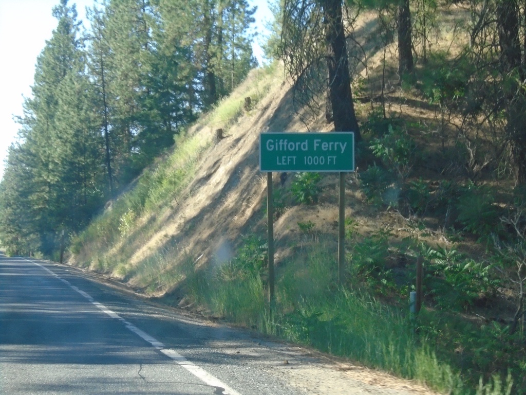
WA-25 North Approaching Gifford Ferry
WA-25 North approaching Gifford Ferry. The Gifford Ferry crosses the Columbia River between Gifford and Inchelium.
Taken 07-23-2023
Gifford
Stevens County
Washington
United States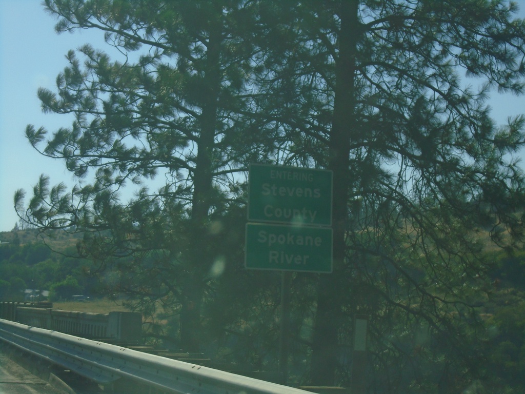
WA-25 North - Stevens County/Spokane River
Entering Stevens County on WA-25 north, crossing the Spokane River.
Taken 07-23-2023
Davenport
Lincoln County
Washington
United States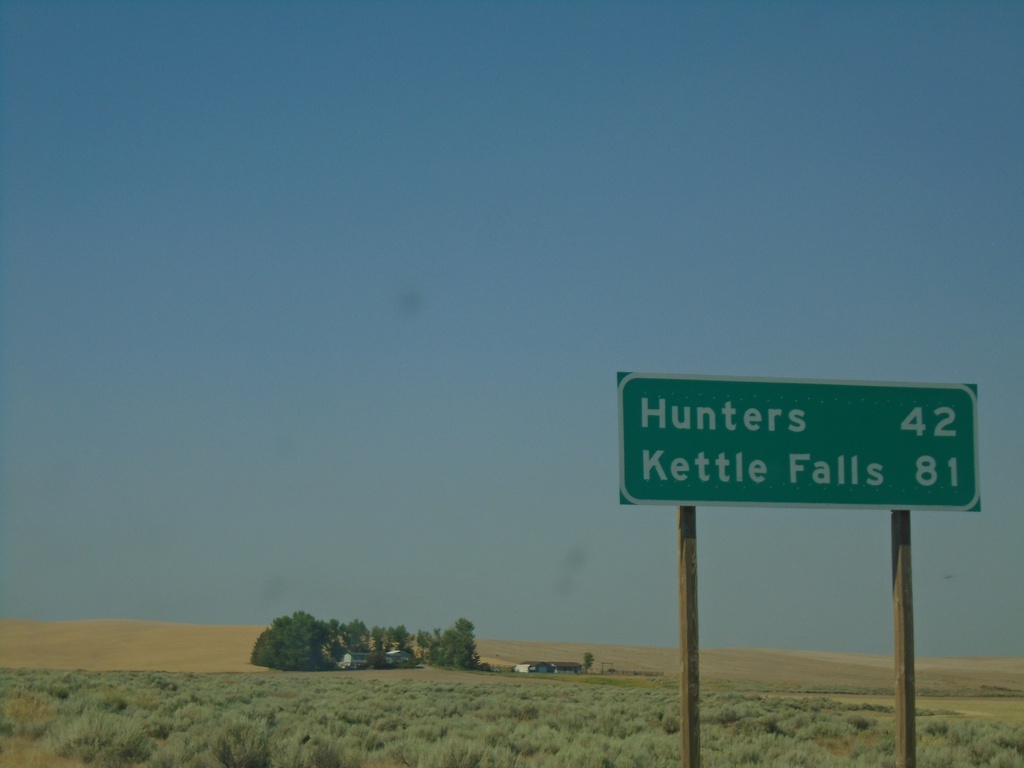
WA-25 North - Distance Marker
Distance marker on WA-25 north. Distance to Hunters and Kettle Falls.
Taken 07-23-2023
Davenport
Lincoln County
Washington
United States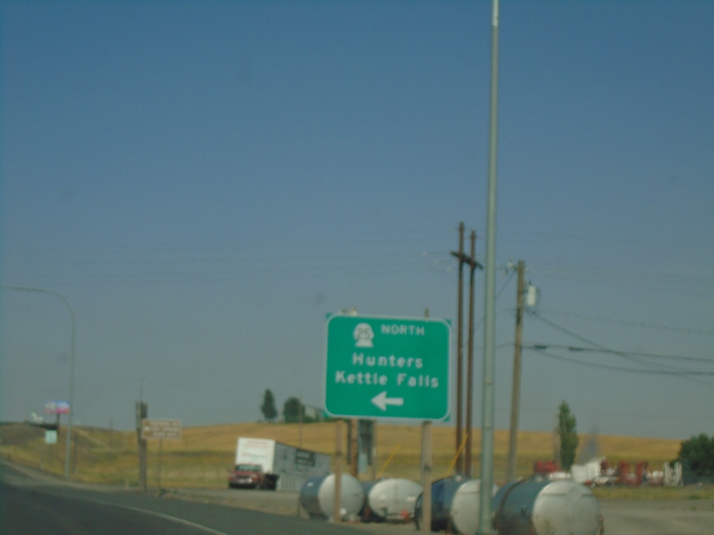
US-2 East at WA-25 North
US-2 East at WA-25 North in Davenport. Use WA-25 north for Hunters and Kettle Falls.
Taken 07-23-2023
 Davenport
Lincoln County
Washington
United States
Davenport
Lincoln County
Washington
United States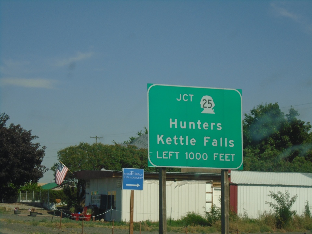
US-2 East Approaching WA-25 North
US-2 East approaching WA-25 North in Davenport. Use WA-25 north to Hunters and Kettle Falls.
Taken 07-23-2023
Davenport
Lincoln County
Washington
United States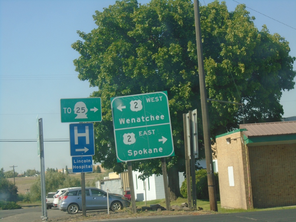
End WA-28 East at US-2
End WA-28 East at US-2 in Davenport. Use US-2 west to Wenatchee; US-2 east to Spokane and WA-25.
Taken 07-23-2023
 Davenport
Lincoln County
Washington
United States
Davenport
Lincoln County
Washington
United States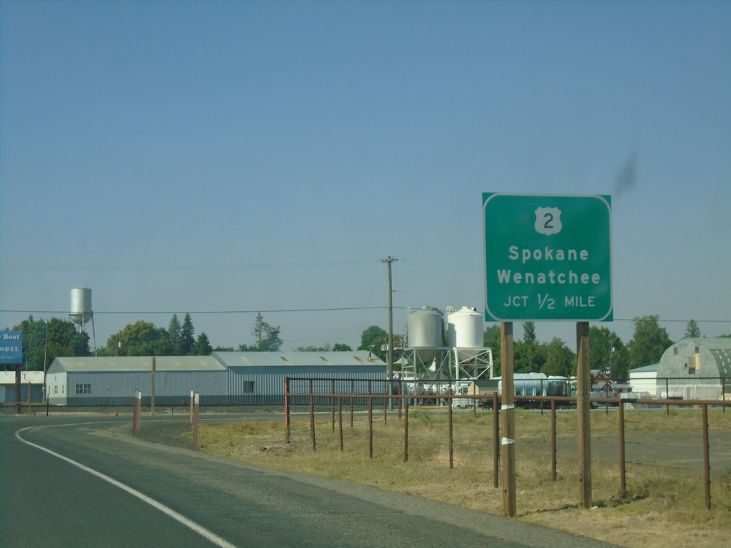
WA-28 East Approaching US-2
WA-28 East approaching US-2 to Wenatchee and Spokane.
Taken 07-23-2023
Davenport
Lincoln County
Washington
United States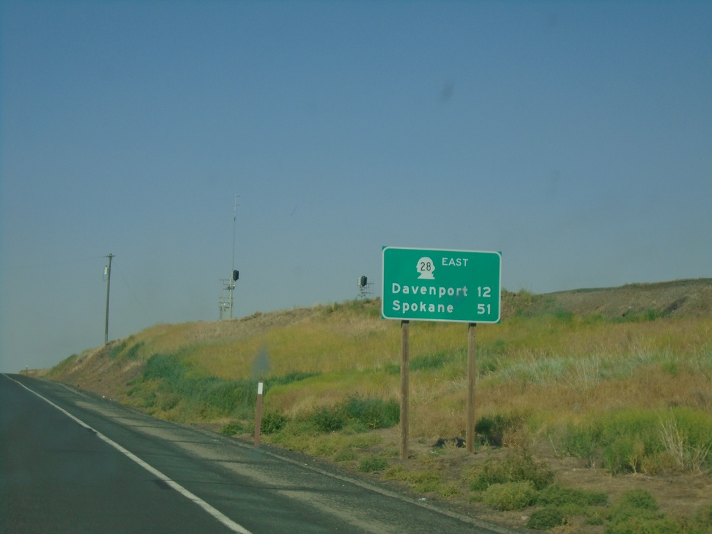
WA-28 East - Distance Marker
Distance marker on WA-28 east. Distance to Davenport and Spokane.
Taken 07-23-2023
Harrington
Lincoln County
Washington
United States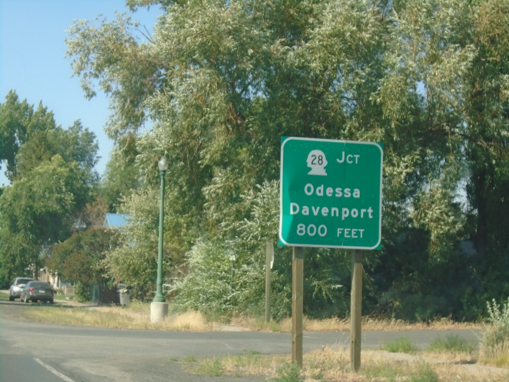
WA-23 North Approaching WA-28
WA-23 North approaching WA-28 to Odessa and Harrington.
Taken 07-23-2023
 Harrington
Lincoln County
Washington
United States
Harrington
Lincoln County
Washington
United States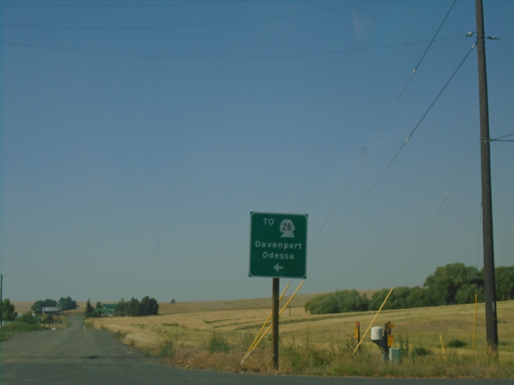
Coal Creek Road North at WA-23
Coal Creek Road North at WA-23 in Harrington. Use WA-23 north to WA-28/Davenport/Odessa.
Taken 07-23-2023
Harrington
Lincoln County
Washington
United States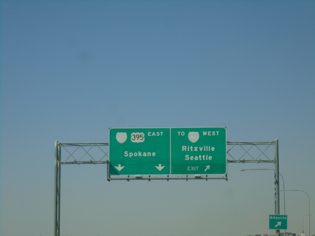
US-395 North at I-90 - Ritzville
US-395 north at I-90 in Ritzville. Exit for To I-90 West/Seattle/Ritzville. Continue on freeway for I-90 East/US-395 North/Spokane. US-395 north joins I-90 east to Spokane.
Taken 07-23-2023
 Ritzville
Adams County
Washington
United States
Ritzville
Adams County
Washington
United States