Signs Tagged With Big Green Sign
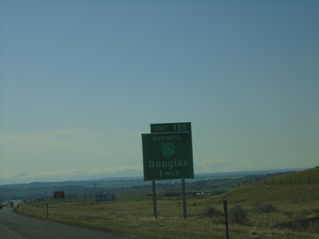
I-25 North - Exit 135
I-25 north approaching Exit 135 - BL-25/Douglas. This is the south end of the Douglas business loop.
Taken 05-02-2022


 Douglas
Converse County
Wyoming
United States
Douglas
Converse County
Wyoming
United States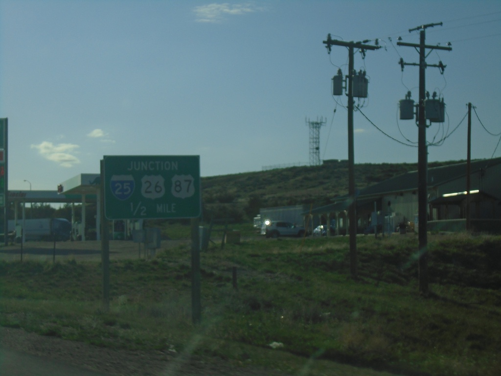
US-18/US-20 East Approaching I-25/US-26/US-87
US-18/US-20 East approaching I-25/US-26/US-87 at Orin Junction. US-20 west joins I-25/US-87 North/US-26 West to Glenrock. US-18 ends here.
Taken 05-02-2022
 Douglas
Converse County
Wyoming
United States
Douglas
Converse County
Wyoming
United States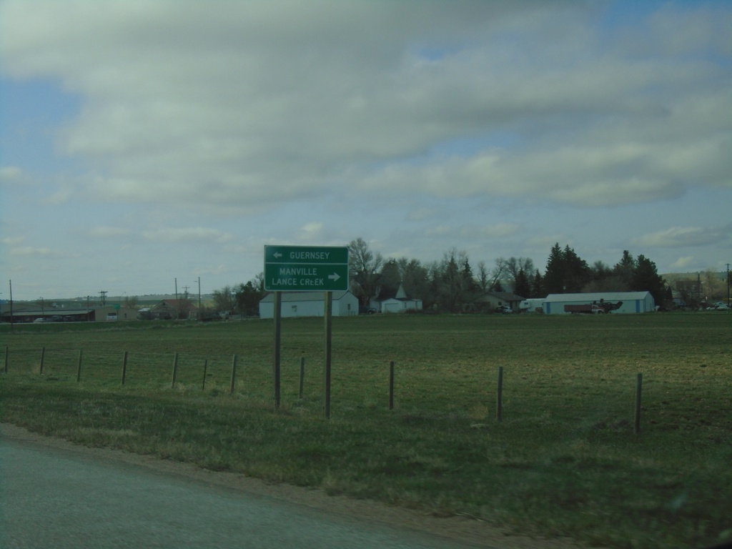
US-20 West/US-18 West at WY-270
US-20 West/US-18 West at WY-270. Use WY-270 north to Lance Creek and Manville. Use WY-270 south to Guernsey.
Taken 05-02-2022
 Lusk
Niobrara County
Wyoming
United States
Lusk
Niobrara County
Wyoming
United States
US-18 West/US-20 West/US-85 South at US-18/US-20 Junction
US-18 West/US-20 West/US-85 South at US-18/US-20 junction in Lusk. Turn right for US-18 West/US-20 West to Douglas. Continue south on US-85 for Torrington.
Taken 05-02-2022
 Lusk
Niobrara County
Wyoming
United States
Lusk
Niobrara County
Wyoming
United States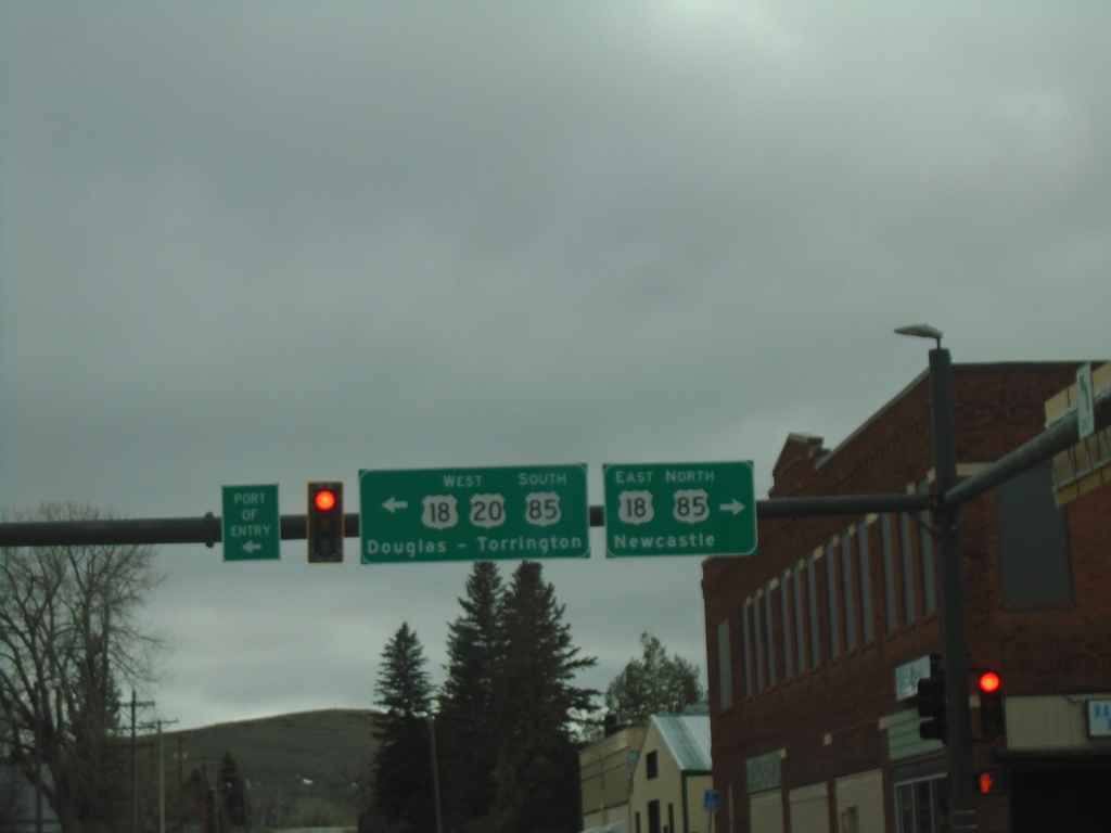
US-20 West at US-18/US-85 - Lusk
US-20 West at US-18/US-85 in Lusk. Use US-18 East/US-85 North to Newcastle. Use US-20 West/US-18-West/US-85 South to Douglas (via US-18/US-20) and Torrington (via US-85).
Taken 05-02-2022
Lusk
Niobrara County
Wyoming
United States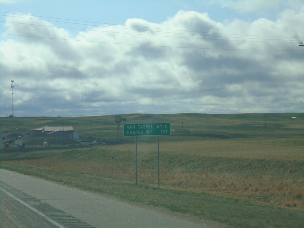
US-20 West - Distance Marker
Distance marker on US-20 west. Distance to Van Tassel, WY and Casper, WY. This is the last distance marker on US-20 westbound in Nebraska.
Taken 05-02-2022
Harrison
Sioux County
Nebraska
United States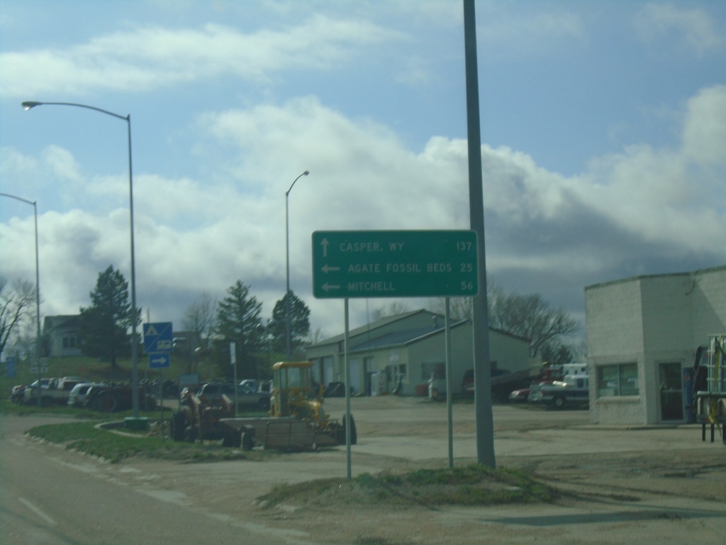
US-20 West Approaching NE-29
US-20 West approaching NE-29 in Harrison. Use US-20 West to Casper, WY. South NE-29 South for Agate Fossil Beds and Mitchell. This is the first appearance of Casper, WY on a distance marker or junction along US-20 in Nebraska.
Taken 05-02-2022
 Harrison
Sioux County
Nebraska
United States
Harrison
Sioux County
Nebraska
United States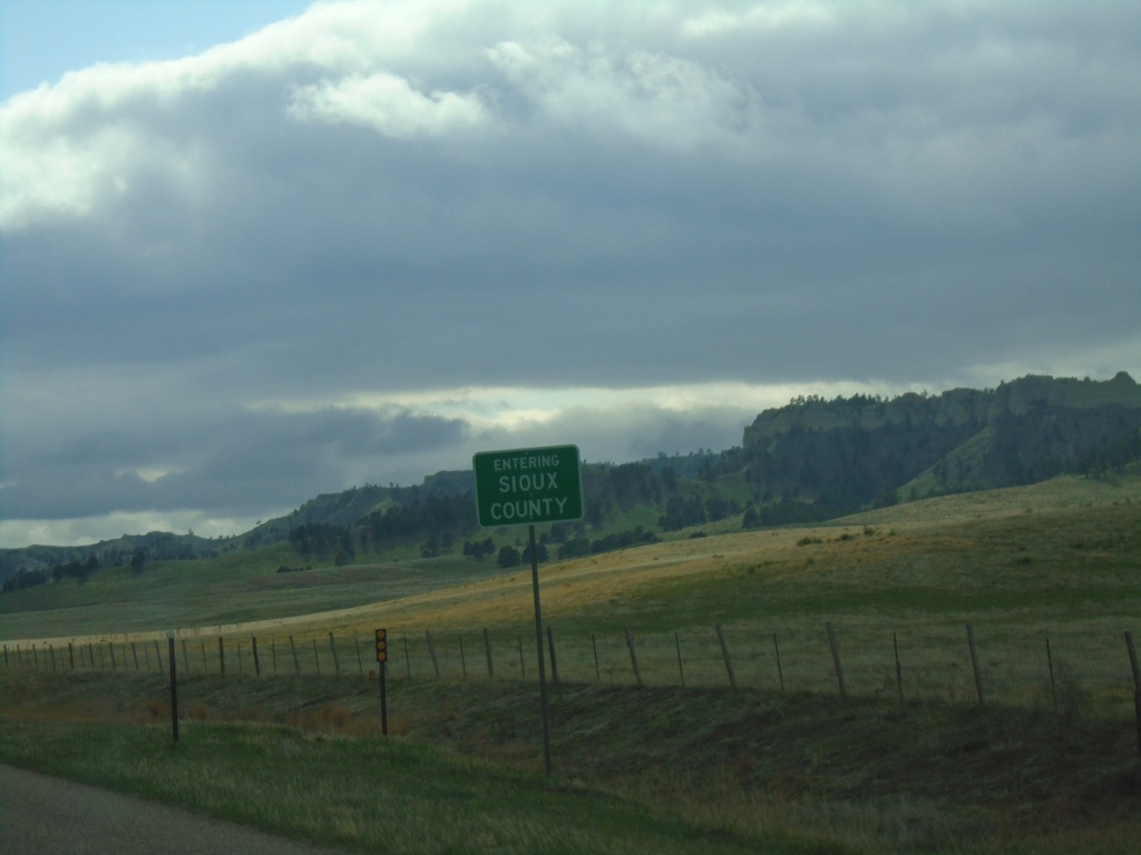
US-20 West - Sioux County
Entering Sioux County on US-20 west. Sioux County is in the northwest corner of Nebraska.
Taken 05-02-2022
Harrison
Sioux County
Nebraska
United States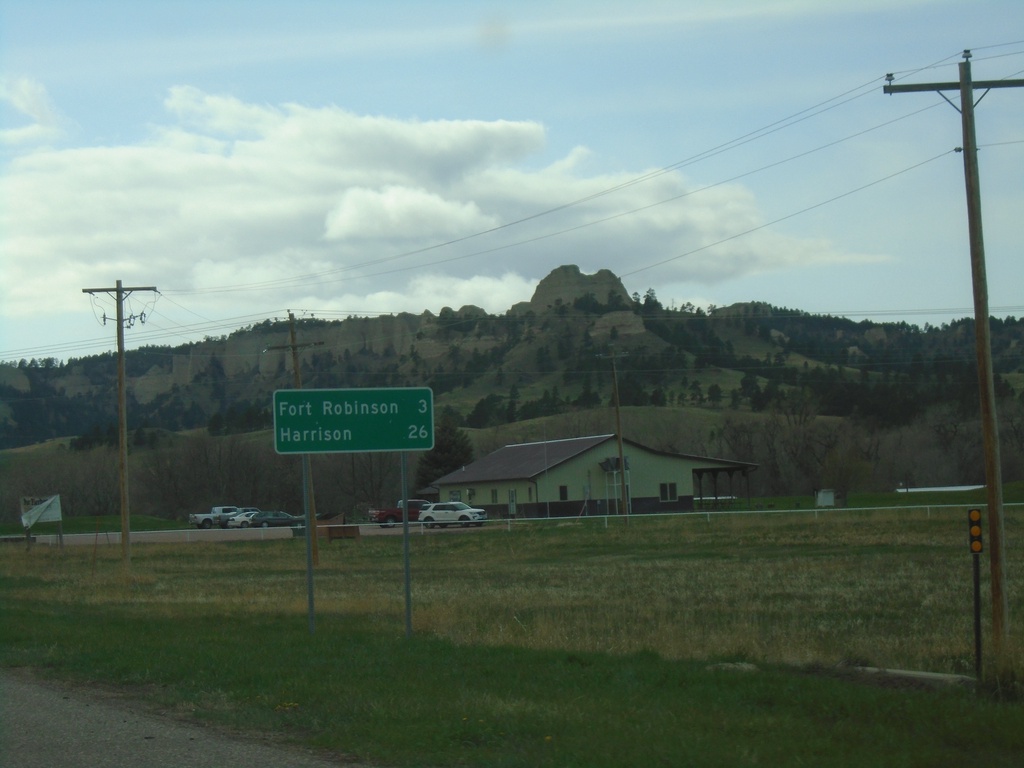
US-20 West - Distance Marker
Distance marker on US-20 west. Distance to Fort Robinson and Harrison. The Red Cloud Buttes are in the background.
Taken 05-02-2022
Crawford
Dawes County
Nebraska
United States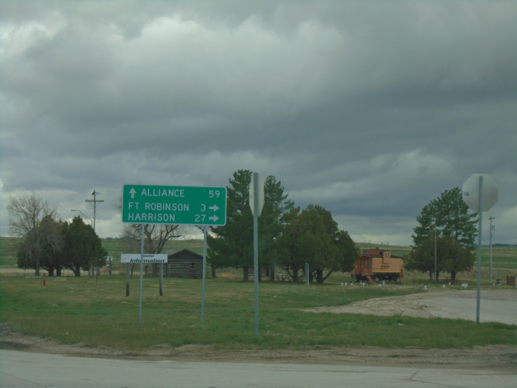
US-20 West/NE-71 South/NE-2 East at NE-71/NE-2
US-20 West/NE-71 South/NE-2 East at NE-71/NE-2 in Crawford. Use NE-71 South/NE-2 East to Alliance; use US-20 West for Fort Robinson and Harrison.
Taken 05-02-2022

 Crawford
Dawes County
Nebraska
United States
Crawford
Dawes County
Nebraska
United States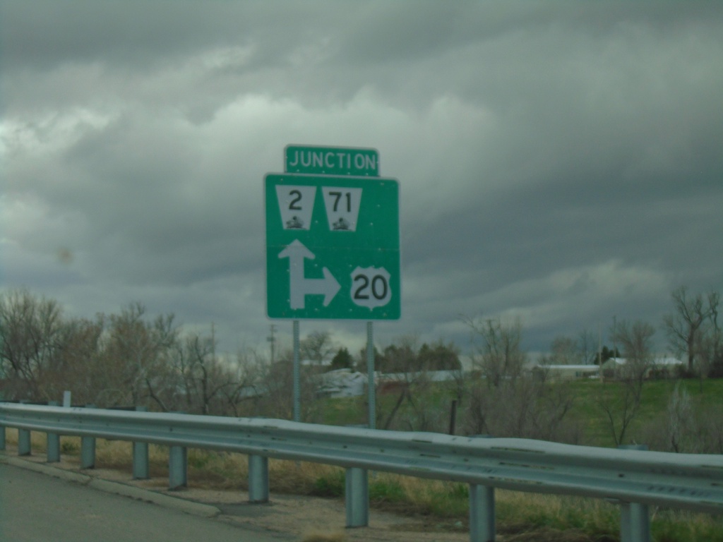
US-20 West/NE-2 East/NE-71 South at NE-2/NE-71
US-20 West/NE-2 East/NE-71 South at NE-2/NE-71 in Crawford.
Taken 05-02-2022
Crawford
Dawes County
Nebraska
United States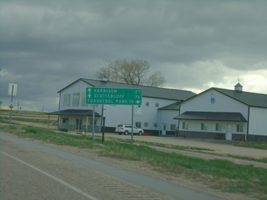
US-20 West Approaching NE-2/NE-71
US-20 West approaching NE-2/NE-71 in Crawford. Use NE-2 West/NE-71 South to Toadstool Park. Continue on US-20 West/NE-2 East/NE-71 South to Harrison (via US-20), and Scotts Bluff (via NE-71/NE-2).
Taken 05-02-2022
Crawford
Dawes County
Nebraska
United States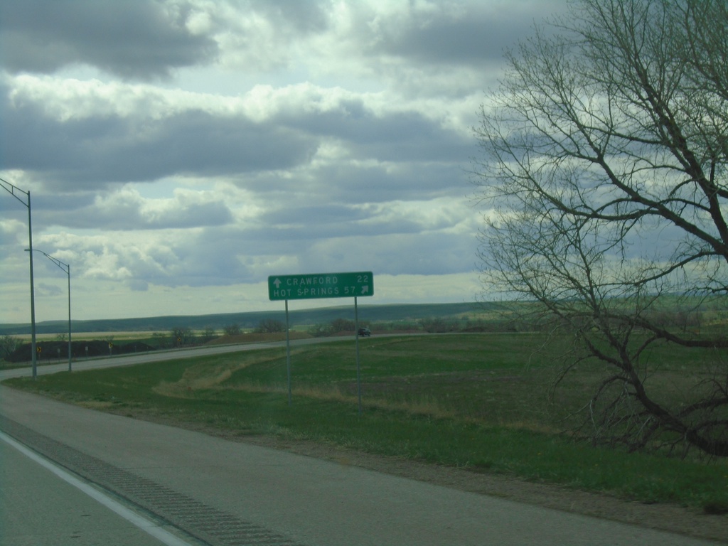
US-20 West/US-385 North at US-20/US-385 Split
US-20 West/US-385 North at US-20/US-385 split in Dawes County. Use US-385 North to Hot Springs, SD; continue west on US-20 for Crawford.
Taken 05-02-2022
 Chadron
Dawes County
Nebraska
United States
Chadron
Dawes County
Nebraska
United States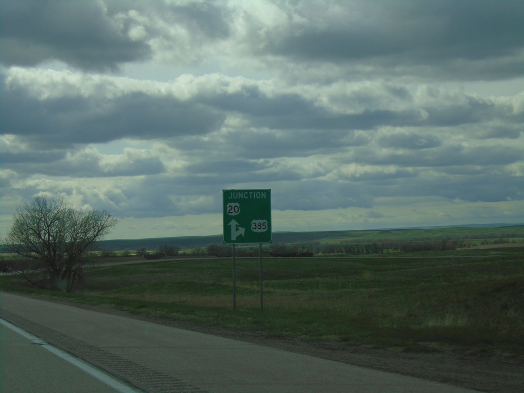
US-20 West/US-385 North Approaching US-20/US-385 Split
US-20 West/US-385 North approaching US-20/US-385 split in Dawes County.
Taken 05-02-2022
Chadron
Dawes County
Nebraska
United States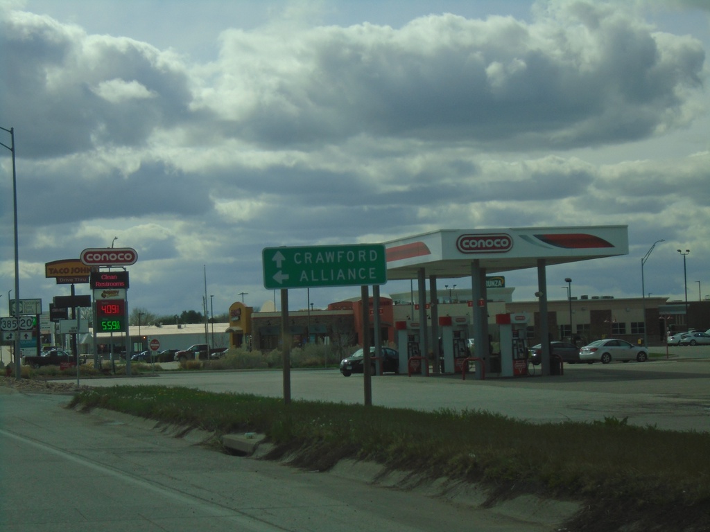
US-20 West Approaching US-385 South to Alliance
US-20 West approaching US-385 South to Alliance. Continue on US-20 west to Crawford. US-385 North joins US-20 westbound.
Taken 05-02-2022
Chadron
Dawes County
Nebraska
United States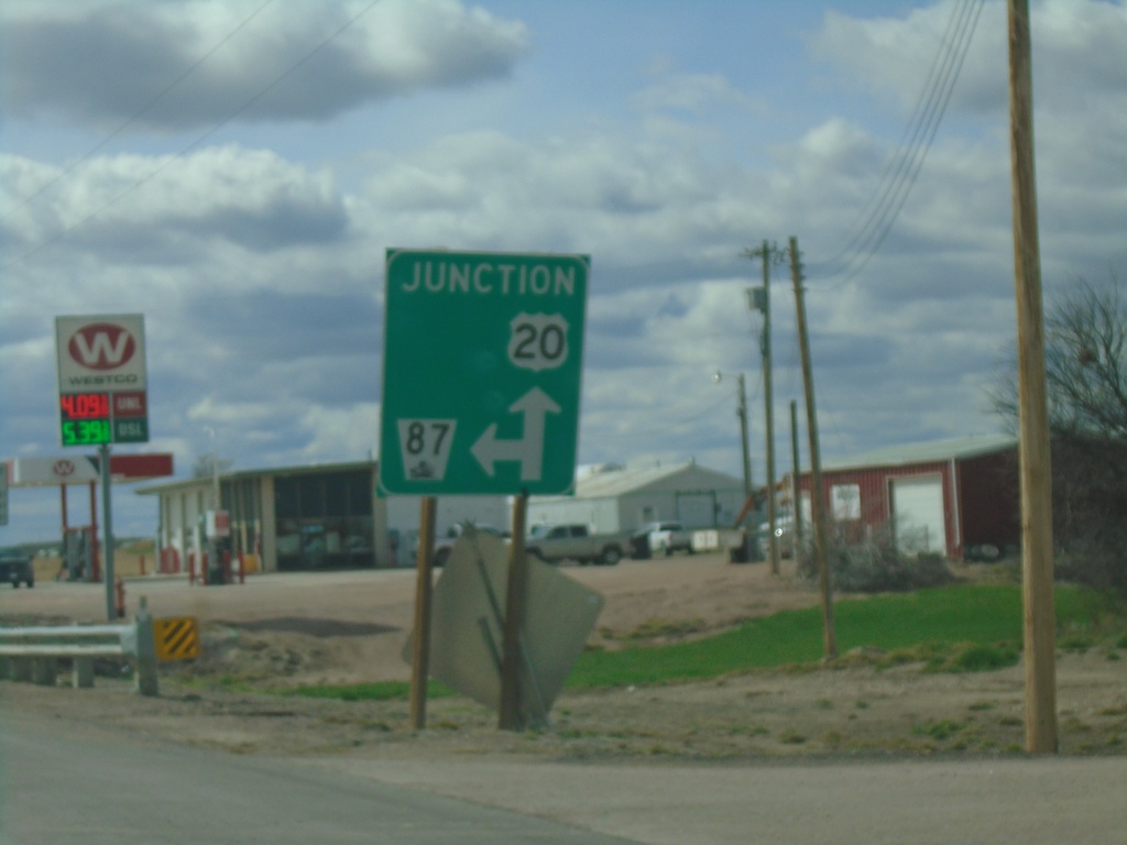
US-20 West/NE-87 South at US-20/NE-87 Split
US-20 West/NE-87 South at US-20/NE-87 split in Hay Springs.
Taken 05-02-2022
 Hay Springs
Sheridan County
Nebraska
United States
Hay Springs
Sheridan County
Nebraska
United States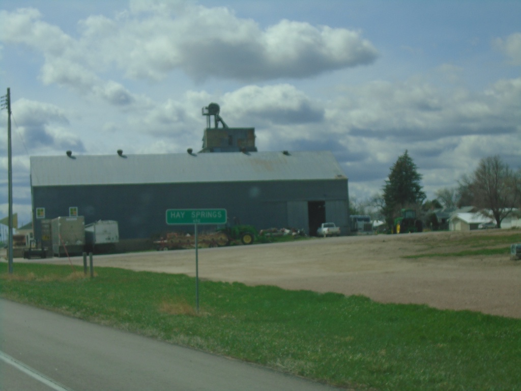
US-20 West/NE-87 South - Hay Springs
Entering Hay Springs on US-20 West/NE-87 South.
Taken 05-02-2022
Hay Springs
Sheridan County
Nebraska
United States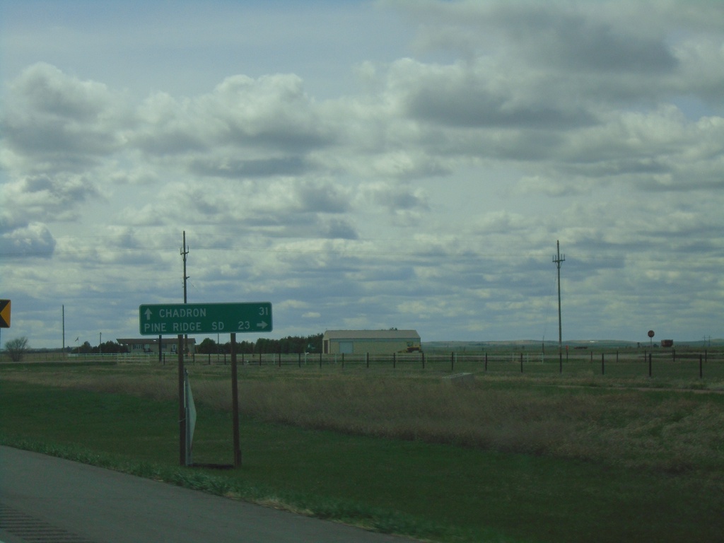
US-20 West at NE-87
US-20 West at NE-87 in Sheridan County. Use NE-87 North to Pine Ridge, SD. Continue west on US-20 to Chadron. NE-87 South joins US-20 West to Hay Springs.
Taken 05-02-2022
Rushville
Sheridan County
Nebraska
United States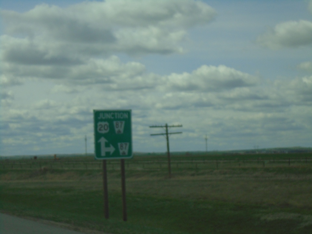
US-20 West Approaching NE-87
US-20 West approaching NE-87 in Sheridan County.
Taken 05-02-2022
Rushville
Sheridan County
Nebraska
United States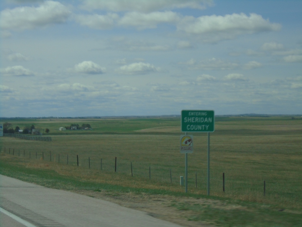
US-20 West - Sheridan County
Entering Sheridan County on US-20 west.
Taken 05-02-2022
Gordon
Sheridan County
Nebraska
United States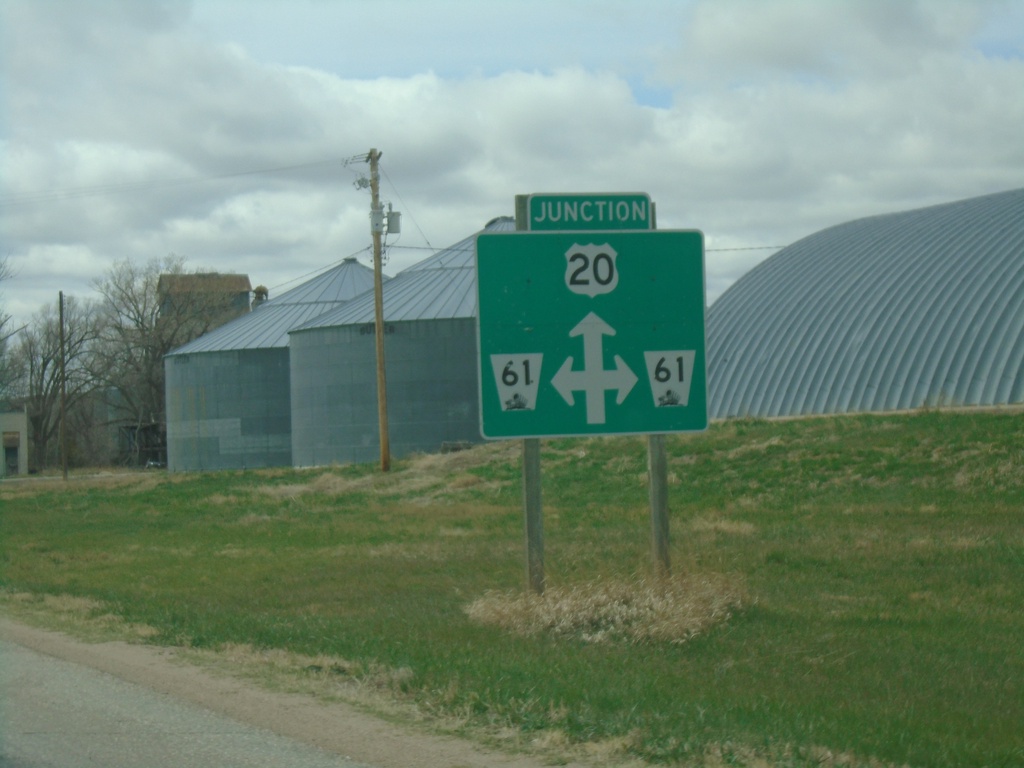
US-20 West Approaching NE-61
US-20 West Approaching NE-61 in Merriman.
Taken 05-02-2022
 Merriman
Cherry County
Nebraska
United States
Merriman
Cherry County
Nebraska
United States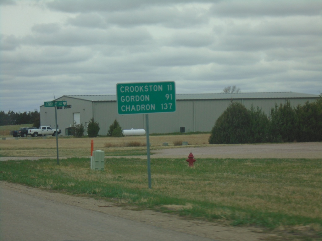
US-20 West - Distance Marker
Distance marker on US-20 west. Distance to Crookston, Gordon, and Chadron.
Taken 05-02-2022
Valentine
Cherry County
Nebraska
United States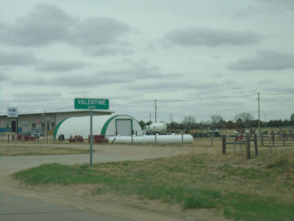
US-20 West/US-83 North - Valentine
Entering Valentine on US-20 West/US-83 North. Valentine is the county seat of Cherry County.
Taken 05-02-2022
 Valentine
Cherry County
Nebraska
United States
Valentine
Cherry County
Nebraska
United States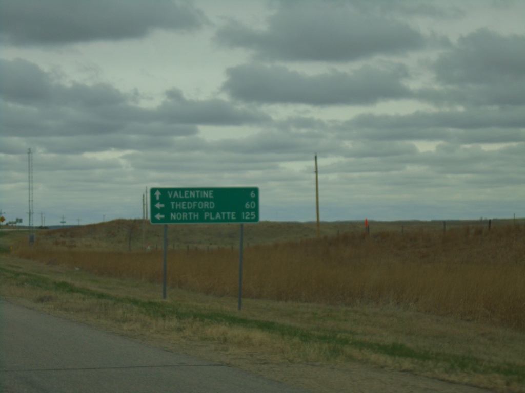
US-20 West at US-83
US-20 West at US-83 in Cherry County. Use US-83 south to North Platte and Thedford. Continue on US-20 West/US-83 North to Valentine.
Taken 05-02-2022
Valentine
Cherry County
Nebraska
United States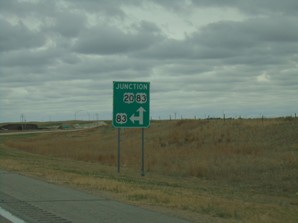
US-20 West Approaching US-83
US-20 West approaching US-83 in Cherry County. US-83 North joins US-20 West to Valentine.
Taken 05-02-2022
Valentine
Cherry County
Nebraska
United States