Signs Tagged With Big Green Sign
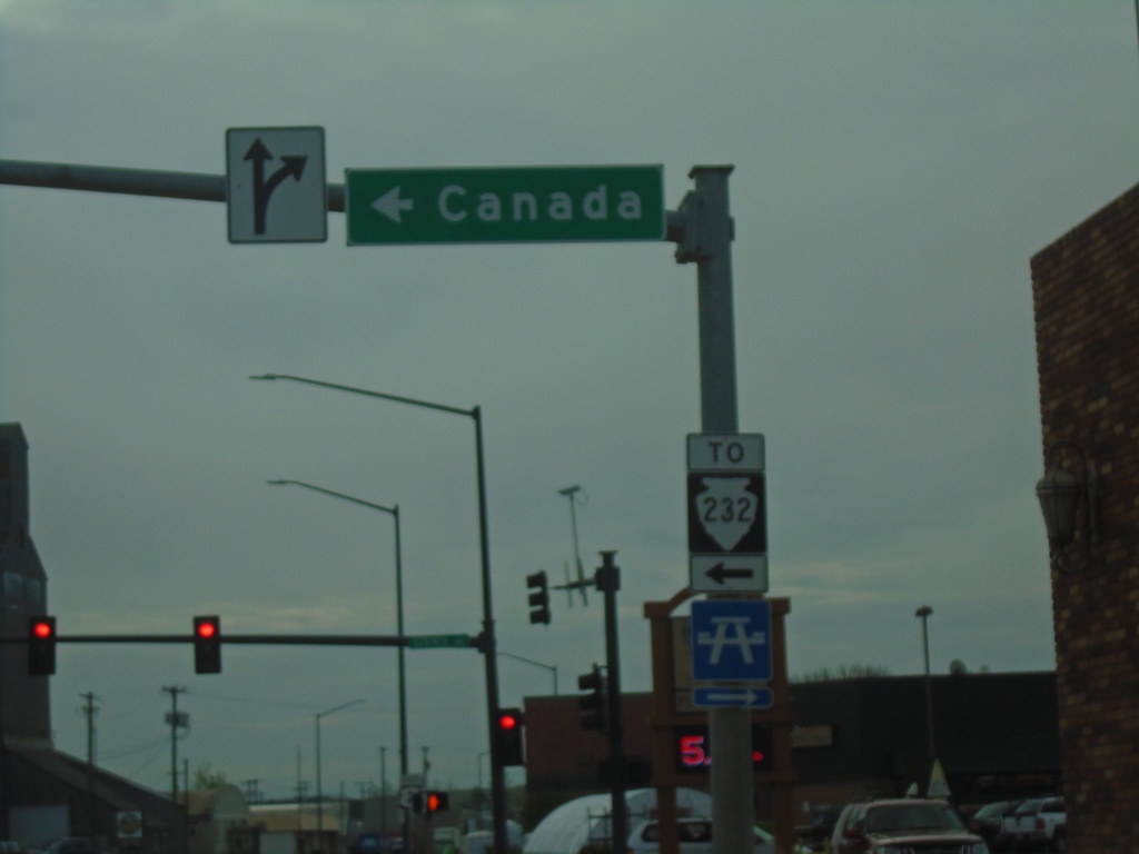
US-2 East at MTS-232
US-2 East at MTS-232 in Havre. Use MTS-232 north to Canada. MTS-232 is shown here with a TO banner on the shield, although the signage along the route through Havre seems to indicate it is part of the state highway system.
Taken 05-12-2023

 Havre
Hill County
Montana
United States
Havre
Hill County
Montana
United States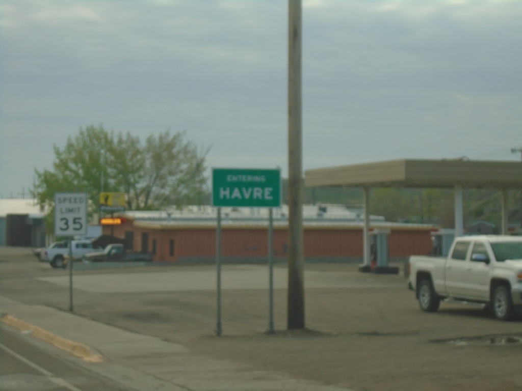
US-2 East - Entering Havre
Entering Havre on US-2 east. Havre is the county seat of Hill County and the 10th biggest city in Montana (2020 Census).
Taken 05-12-2023
Havre
Hill County
Montana
United States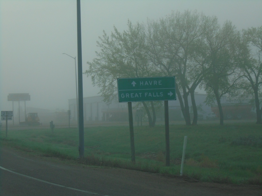
US-2 East at US-87 Junction
US-2 East at US-87 south to Great Falls. Continue east on US-2 for Havre.
Taken 05-12-2023
 Havre
Hill County
Montana
United States
Havre
Hill County
Montana
United States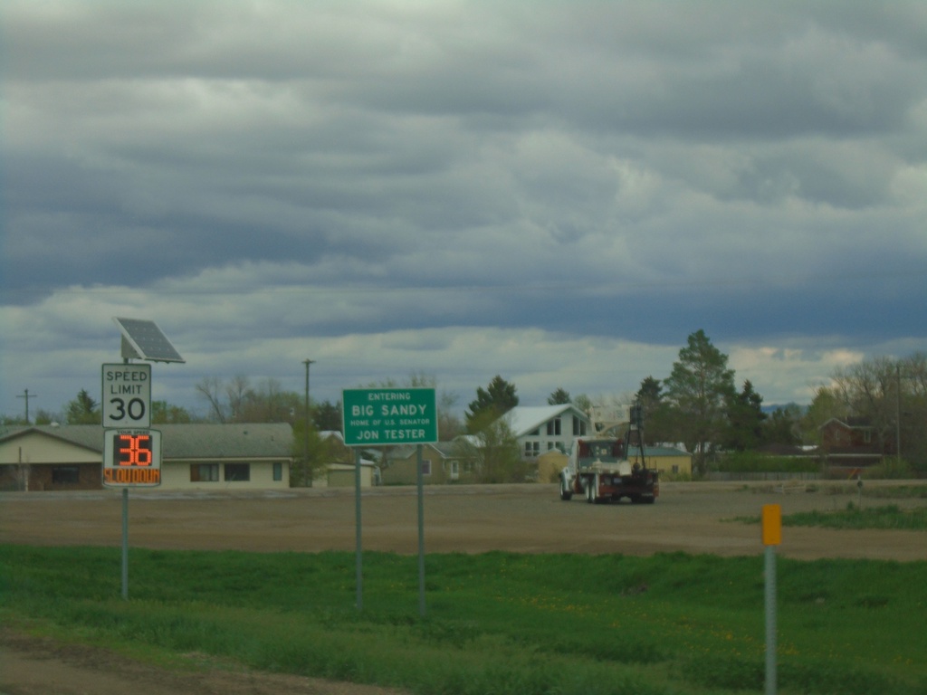
US-87 - Entering Big Sandy
Entering Big Sandy - Home of US Senator Jon Tester
Taken 05-11-2023
Big Sandy
Chouteau County
Montana
United States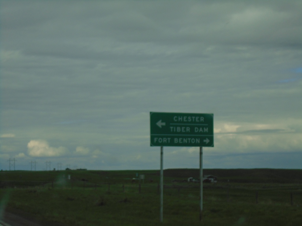
US-87 North at MT-80/MTS-223
US-87 north at MT-80 to Fort Benton and MTS-223 to Chester and Tiber Dam.
Taken 05-11-2023

 Fort Benton
Chouteau County
Montana
United States
Fort Benton
Chouteau County
Montana
United States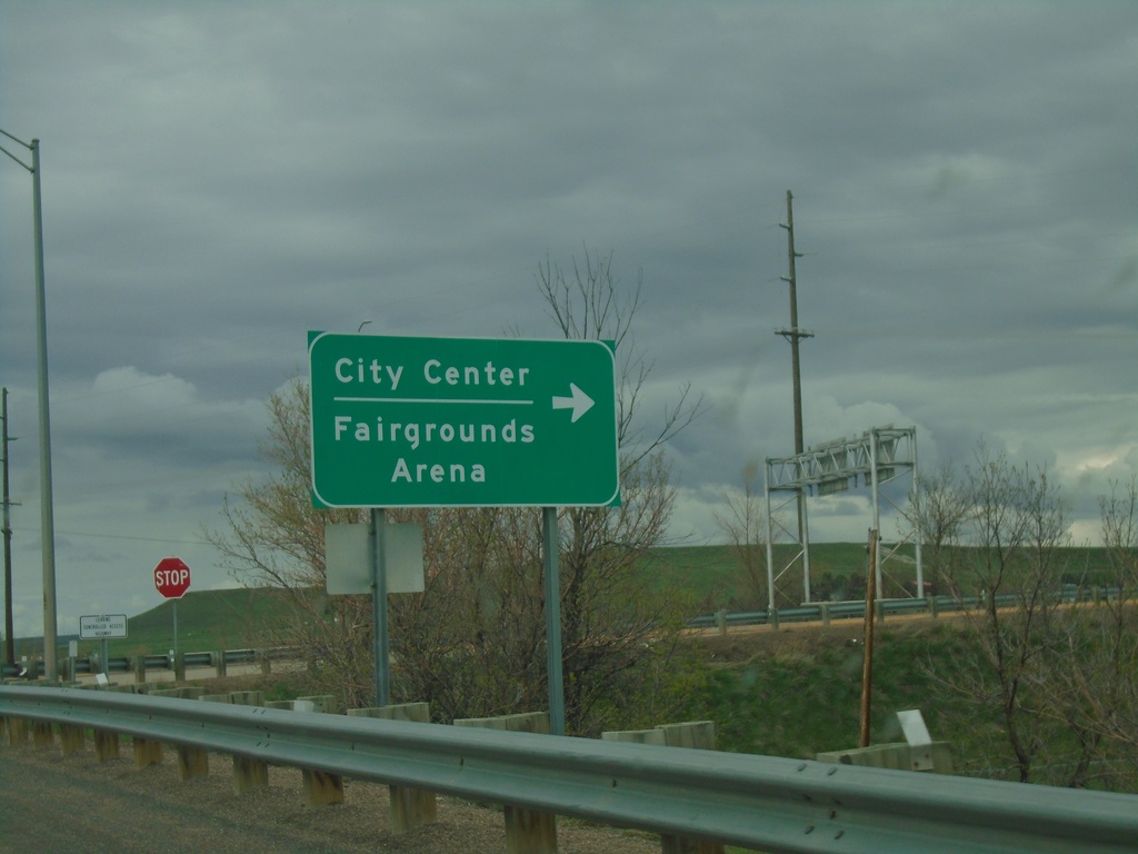
I-15 North Exit 280 Offramp
I-15 North Exit 280 offramp at BL-15/Central Ave West. Turn right on BL-15 South for (Great Falls)City Center/Fairgrounds/Arena.
Taken 05-11-2023


 Great Falls
Cascade County
Montana
United States
Great Falls
Cascade County
Montana
United States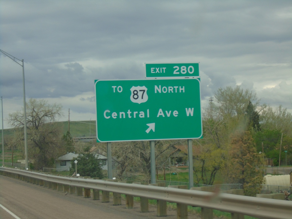
I-15 North - Exit 280
I-15 north at Exit 280 - To US-87 North/Central Ave. West
Taken 05-11-2023
Great Falls
Cascade County
Montana
United States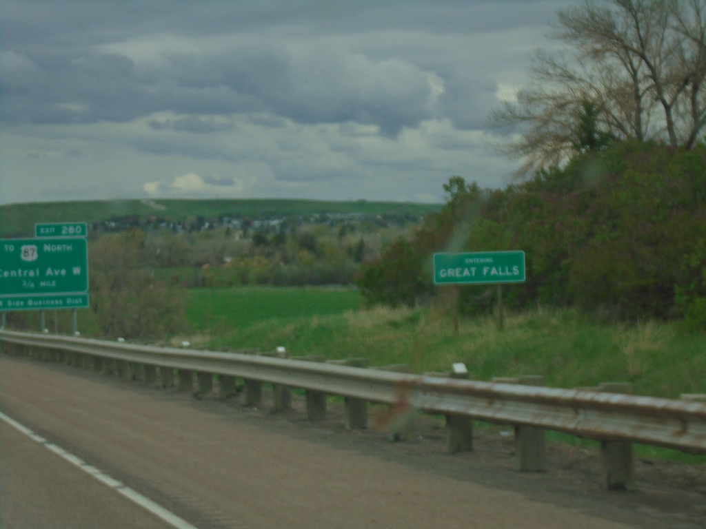
I-15 North - Entering Great Falls
Entering Great Falls on I-15 North. Great Falls is the 3rd largest city in Montana and the county seat of Cascade County.
Taken 05-11-2023
Great Falls
Cascade County
Montana
United States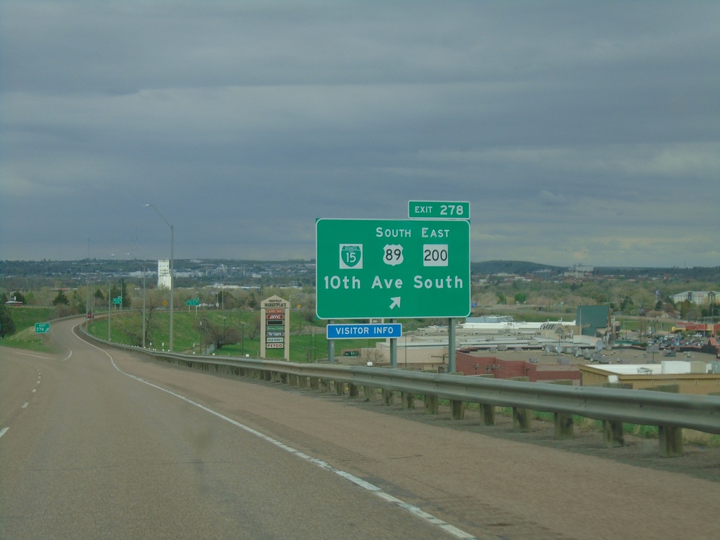
I-15 North - Exit 278
I-15 North at Exit 278 - BL-15/US-89 South/MT-200 East/10th Ave. South. US-89 North/MT-200 West join I-15 northbound.
Taken 05-11-2023
 Great Falls
Cascade County
Montana
United States
Great Falls
Cascade County
Montana
United States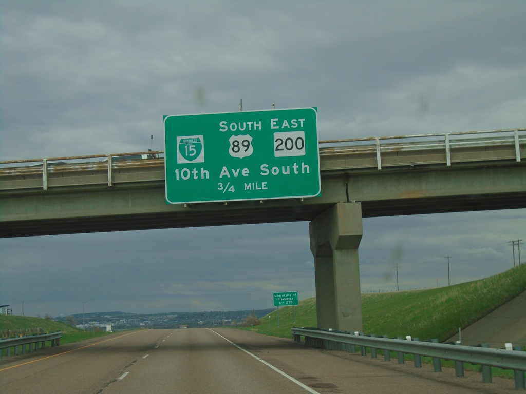
I-15 North - Exit 278
I-15 north approaching Exit 278 - BL-15/US-89 South/MT-200 East/10th Ave. South. US-89 North/MT-200 West join I-15 northbound to Vaughn.
Taken 05-11-2023
Great Falls
Cascade County
Montana
United States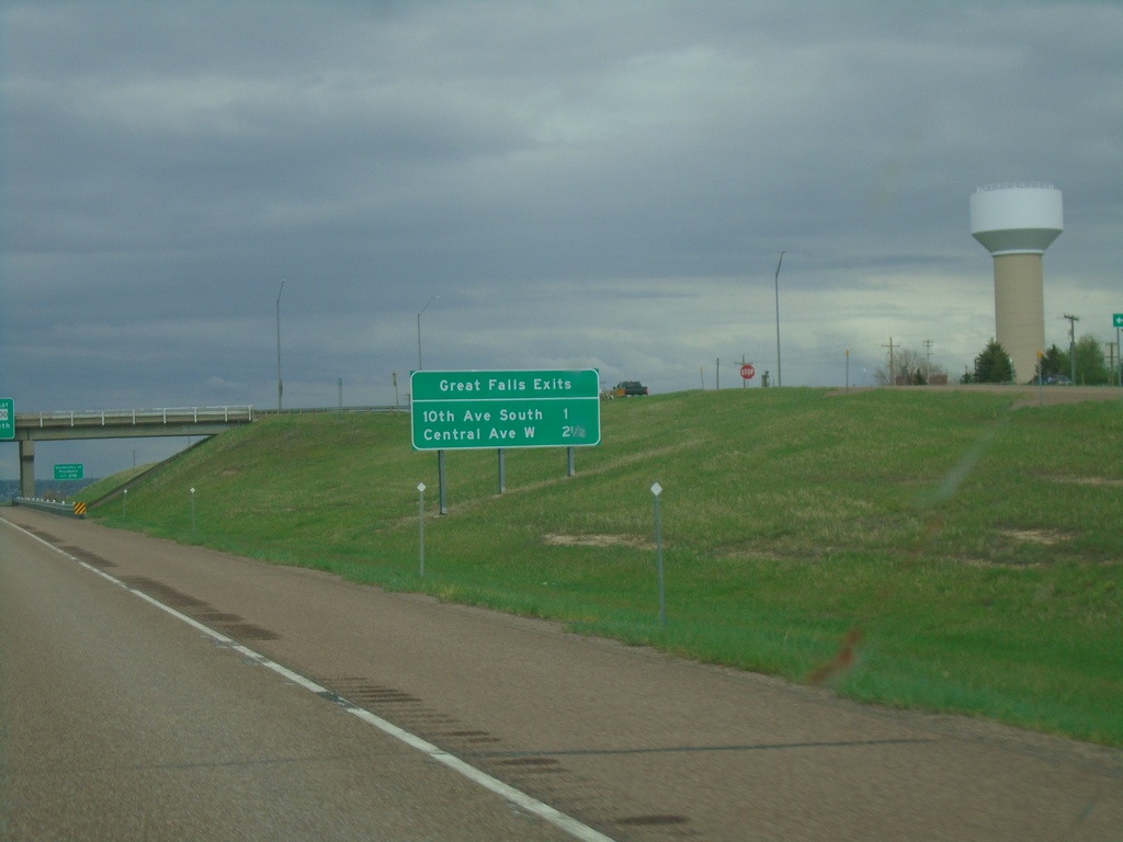
I-15 North - Great Falls Exits
Great Falls Exits on I-15 North: 10th Ave South and Central Ave West
Taken 05-11-2023
Great Falls
Cascade County
Montana
United States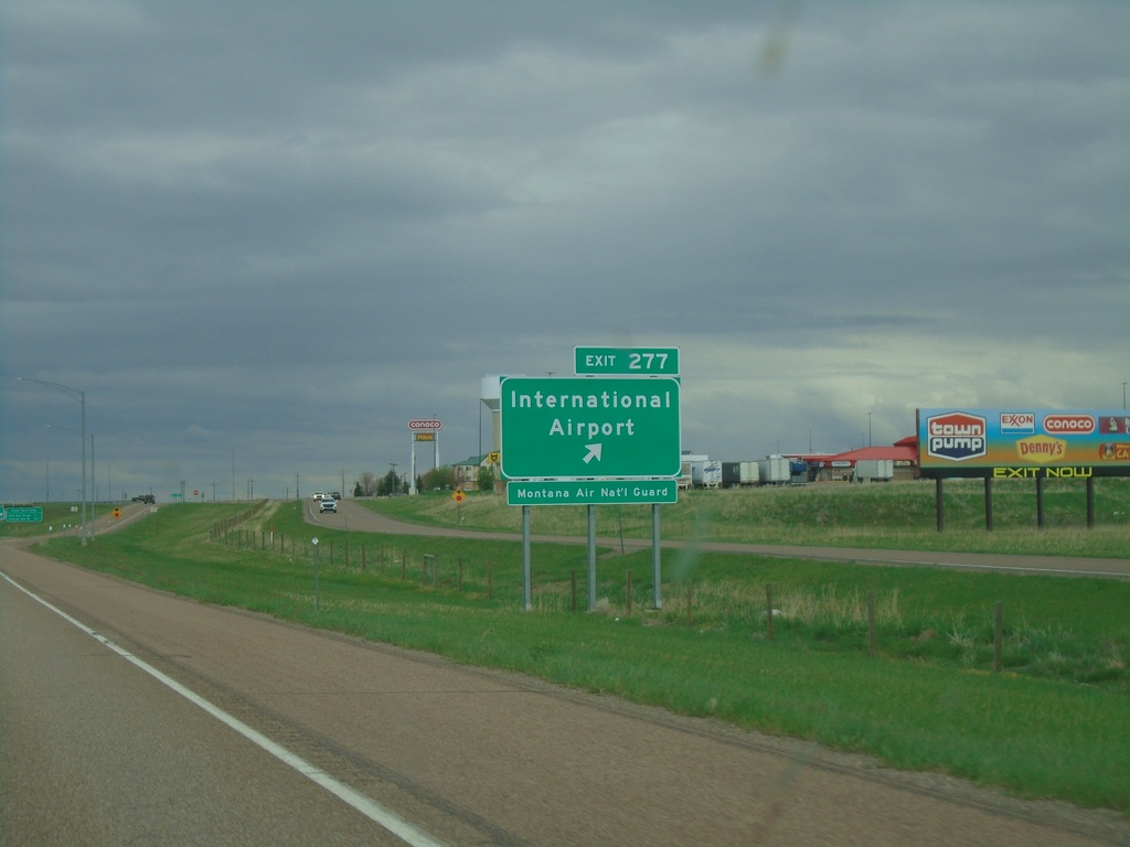
I-15 North - Exit 277
I-15 north at Exit 277 - (Great Falls) International Airport.
Taken 05-11-2023
Great Falls
Cascade County
Montana
United States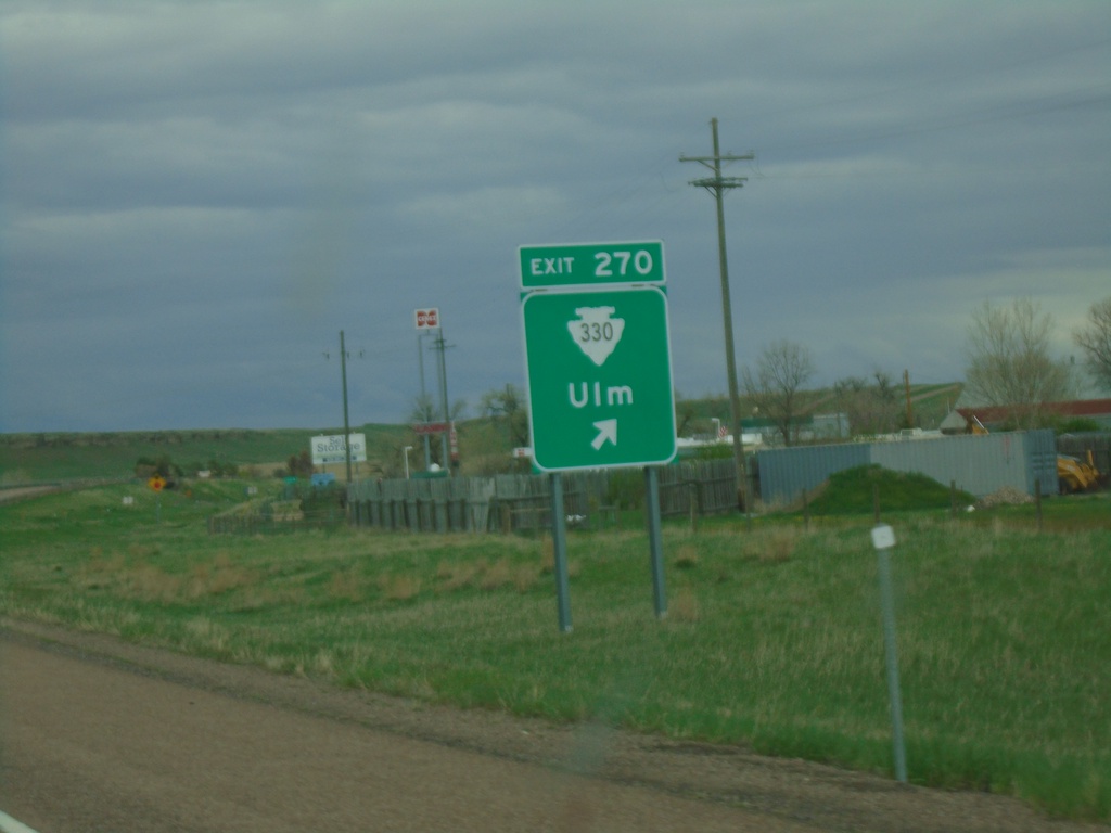
I-15 North - Exit 270
I-15 North at Exit 270 - MTS-330/Ulm
Taken 05-11-2023
 Great Falls
Cascade County
Montana
United States
Great Falls
Cascade County
Montana
United States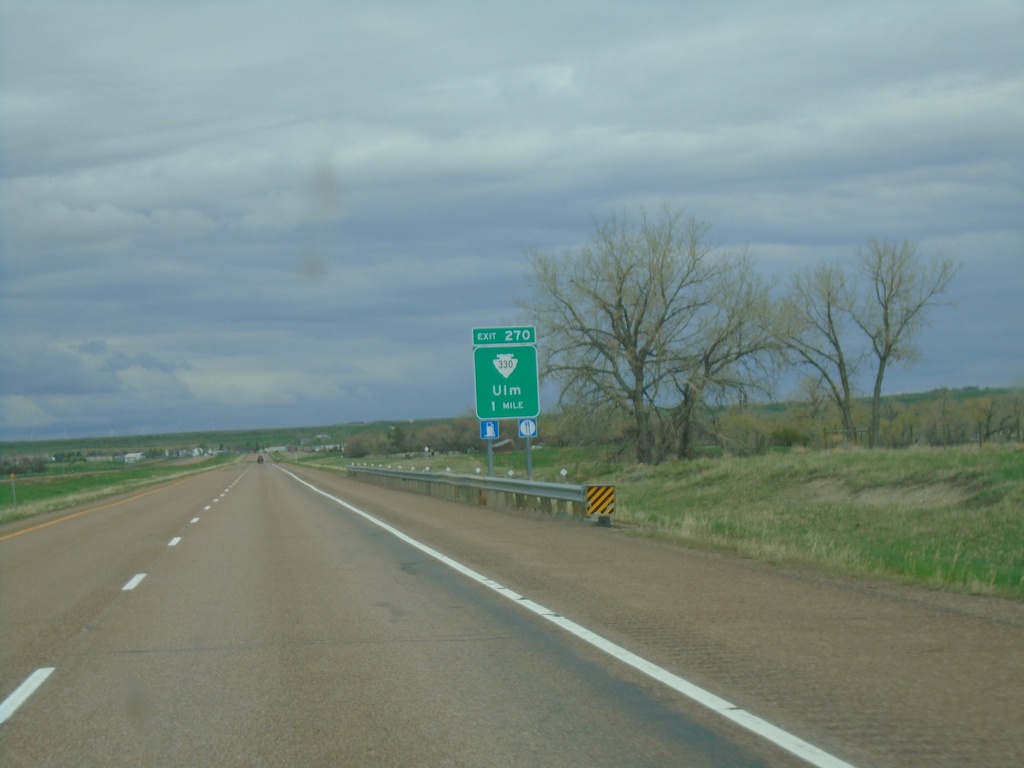
I-15 North - Exit 270
I-15 north approaching Exit 270 - MTS-330/Ulm.
Taken 05-11-2023
Cascade
Cascade County
Montana
United States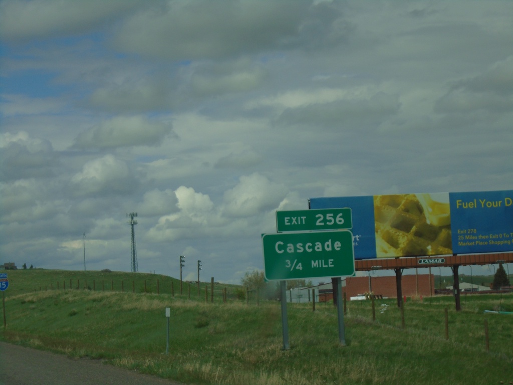
I-15 North - Exit 256
I-15 north approaching Exit 256 - Cascade.
Taken 05-11-2023
 Cascade
 County
Montana
United States
Cascade
Cascade County
Montana
United States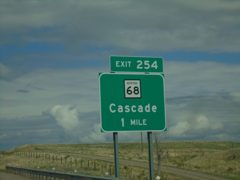
I-15 North - Exit 254
I-15 north approaching Exit 254 - MT-68/Cascade. The MT-68 shield has the full Montana state highway shield with the state name and the black outline. Normally on freeway signs the state route markers are just simple white squares.
Taken 05-11-2023
Cascade
Cascade County
Montana
United States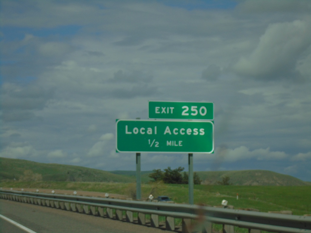
I-15 North - Exit 250
I-15 north approaching Exit 250 - Local Access
Taken 05-11-2023
Cascade
Cascade County
Montana
United States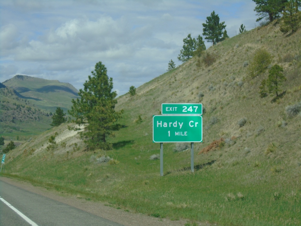
I-15 North - Exit 247
I-15 north approaching Exit 247 - Hardy Creek
Taken 05-11-2023
Cascade
Cascade County
Montana
United States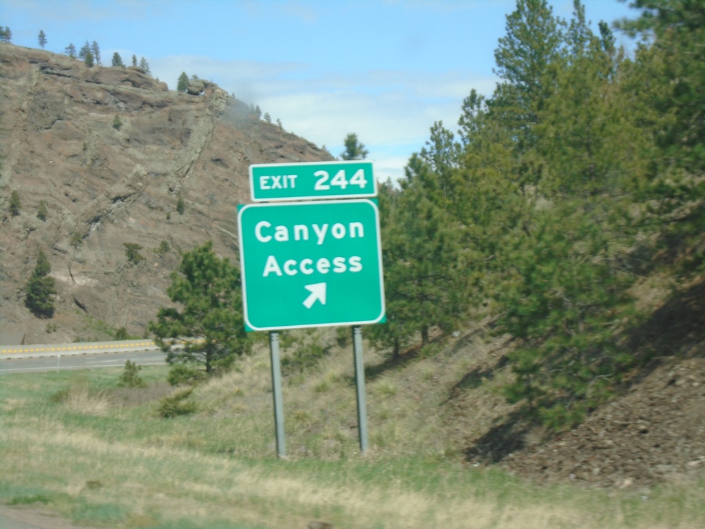
I-15 North - Exit 244
I-15 north at Exit 244 - Canyon Access
Taken 05-11-2023
Cascade
Cascade County
Montana
United States
I-15 North - Exit 244
I-15 north approaching Exit 244 - Canyon Access
Taken 05-11-2023
Cascade
Cascade County
Montana
United States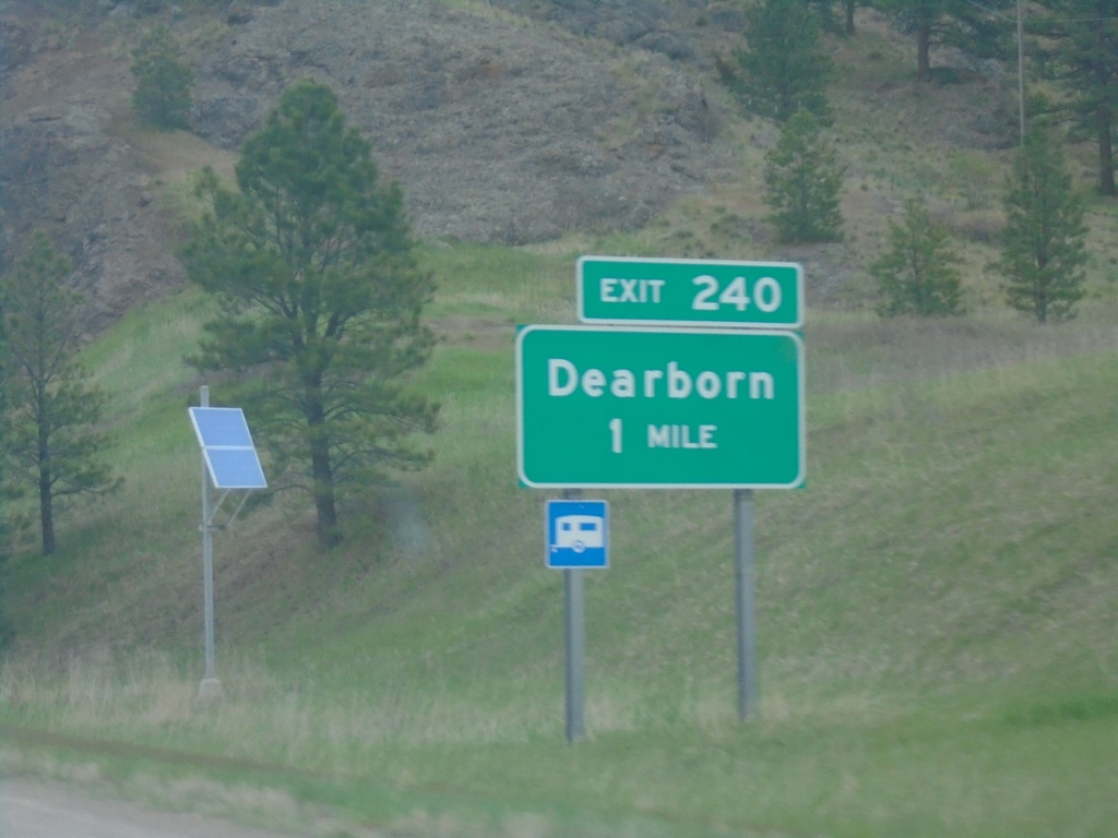
I-15 North - Exit 240
I-15 north approaching Exit 240 - Dearborn
Taken 05-11-2023
Cascade
Lewis and Clark County
Montana
United States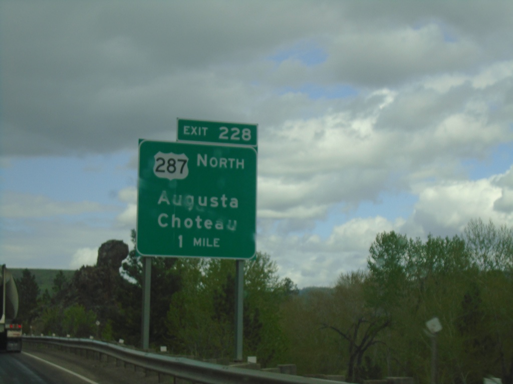
I-15 North - Exit 228
I-15 north approaching Exit 228 - US-287 North/Augusta/Choteau. US-287 leaves I-15 northbound here.
Taken 05-11-2023
 Wolf Creek
Lewis and Clark County
Montana
United States
Wolf Creek
Lewis and Clark County
Montana
United States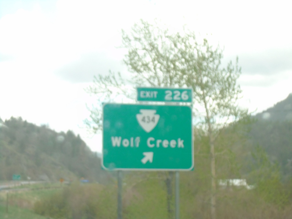
I-15 North - Exit 226
I-15 north at Exit 226 - MTS-434/Wolf Creek.
Taken 05-11-2023
 Wolf Creek
Lewis and Clark County
Montana
United States
Wolf Creek
Lewis and Clark County
Montana
United States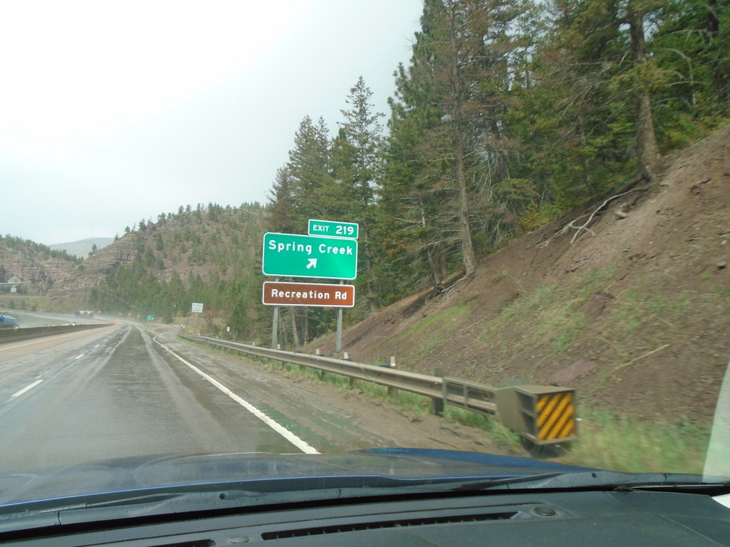
I-15 North - Exit 219
I-15 north at Exit 219 - Spring Creek. Access to Recreation Road.
Taken 05-11-2023
Wolf Creek
Lewis and Clark County
Montana
United States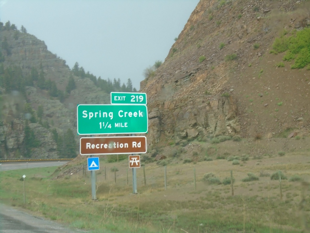
I-15 North - Exit 219
I-15 north approaching Exit 219 - Spring Creek. Access to Recreation Road that follows the Missouri River.
Taken 05-11-2023
Sieben
Lewis and Clark County
Montana
United States