Signs Tagged With Big Green Sign
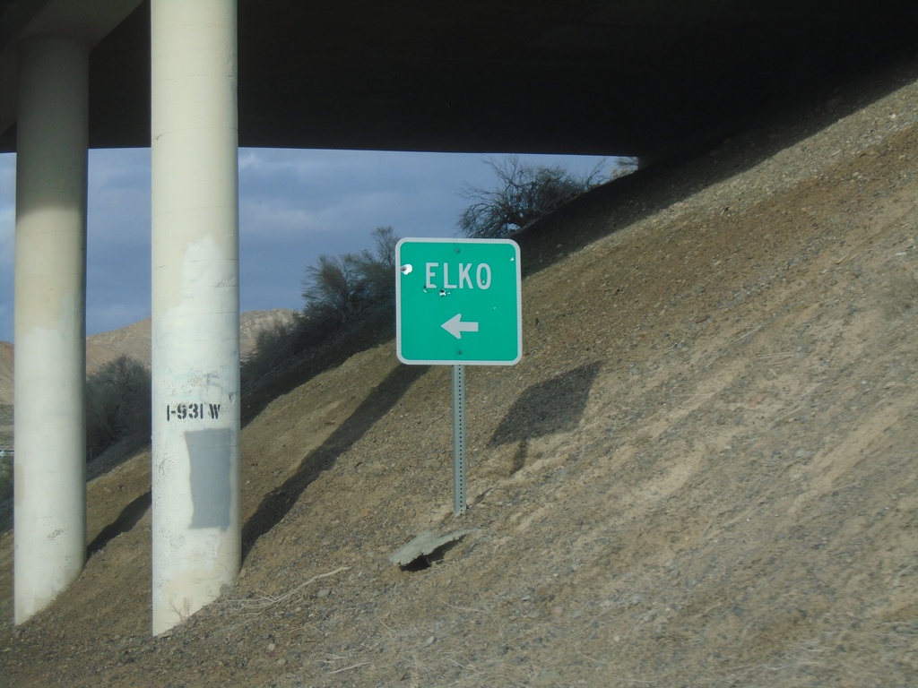
Ola Interchange at I-80 West
Ola Interchange at I-80 West to Elko.
Taken 04-01-2023

 West Wendover
Elko County
Nevada
United States
West Wendover
Elko County
Nevada
United States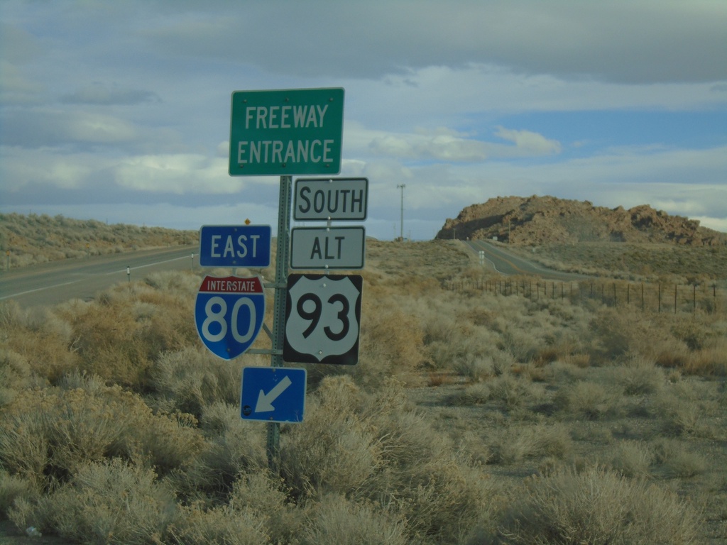
Ola Interchange at I-80 East/US-93 Alt. South
Ola Interchange at I-80 East/US-93 Alt. South onramp.
Taken 04-01-2023
West Wendover
Elko County
Nevada
United States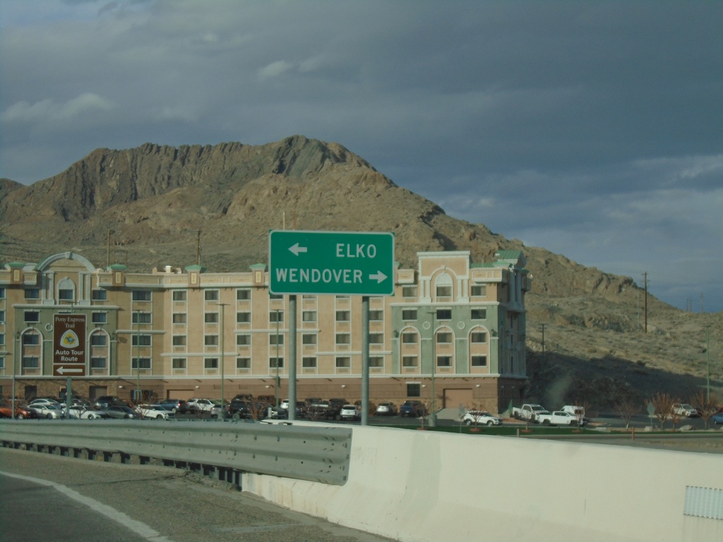
US-93 Alt. North at BL-80 - West Wendover
US-93 Alt. North at BL-80 in West Wendover. Turn right on BL-80 East for Wendover (Utah). Turn left for BL-80 West/US-93 Alt. North to Elko.
Taken 04-01-2023
 West Wendover
Elko County
Nevada
United States
West Wendover
Elko County
Nevada
United States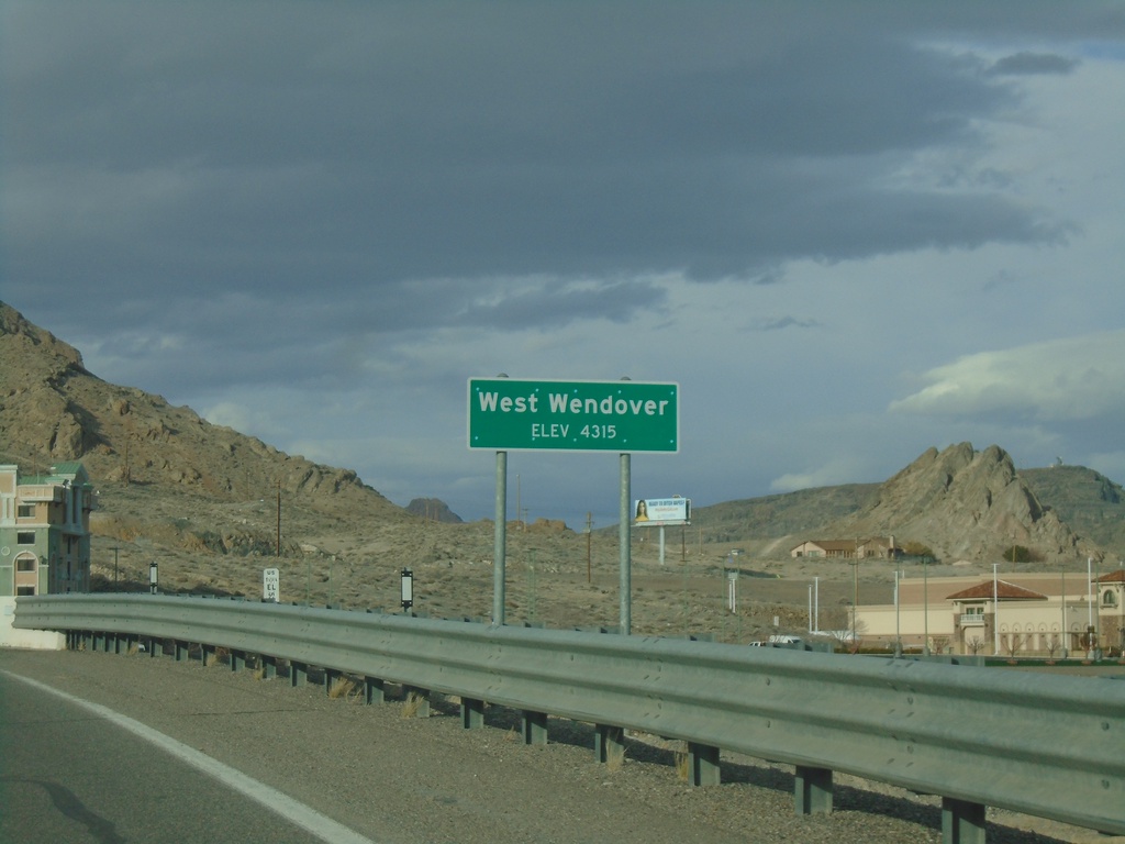
US-93 Alt. North - West Wendover
West Wendover - Elevation 4315 Feet on US-93 Alt. North.
Taken 04-01-2023
West Wendover
Elko County
Nevada
United States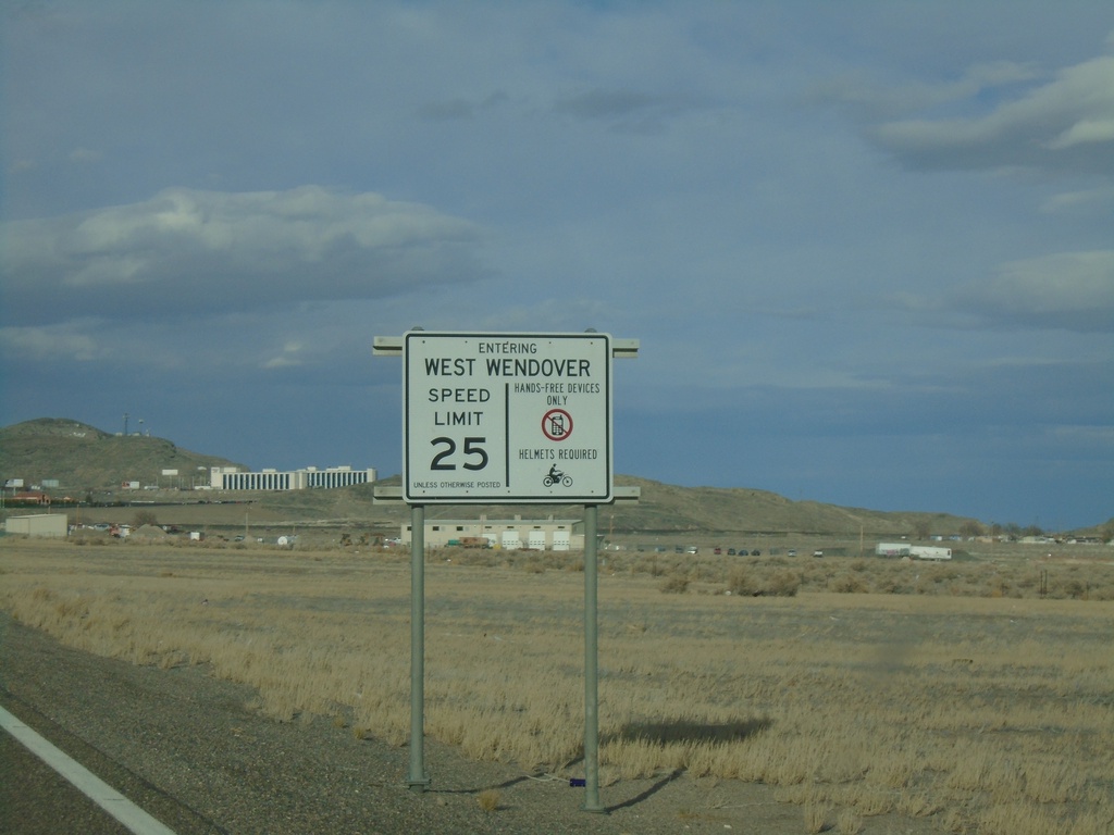
Alt. US-93 North - Entering West Wendover
Entering West Wendover on US-93 Alt. north. Sign also lists the default speed limit, helmet laws, and cell phone laws.
Taken 04-01-2023
West Wendover
Elko County
Nevada
United States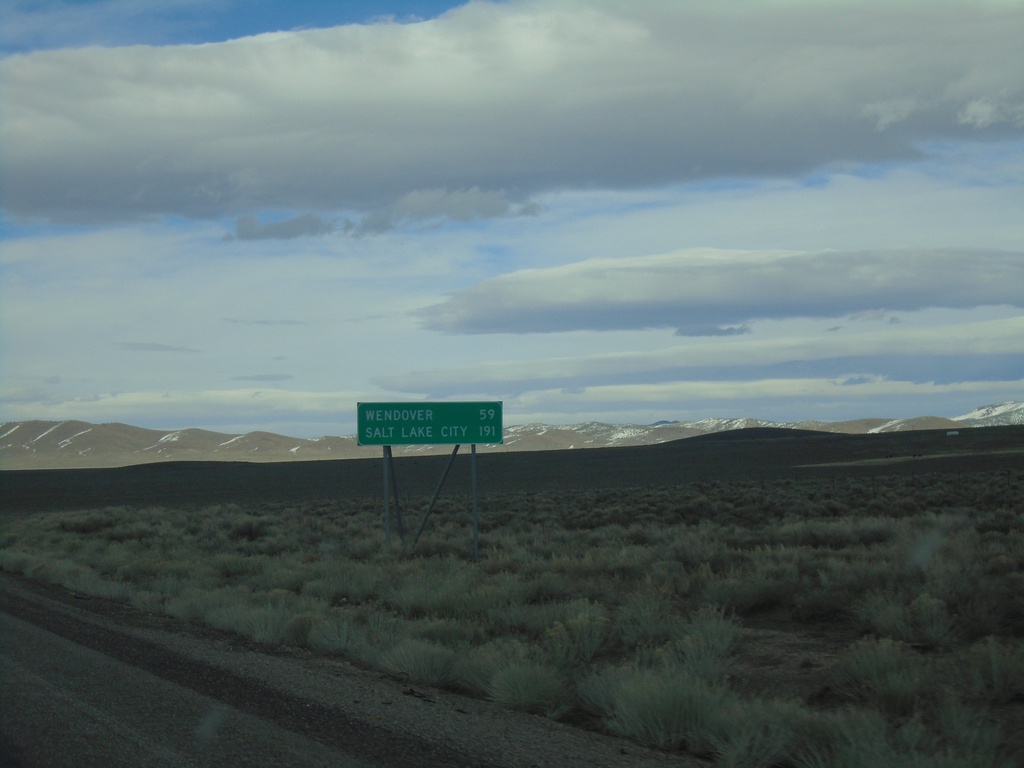
Alt. US-93 North - Distance Marker
Distance Marker on Alt. US-93 North. Distance to Wendover and Salt Lake City (Utah).
Taken 04-01-2023
Ely
White Pine County
Nevada
United States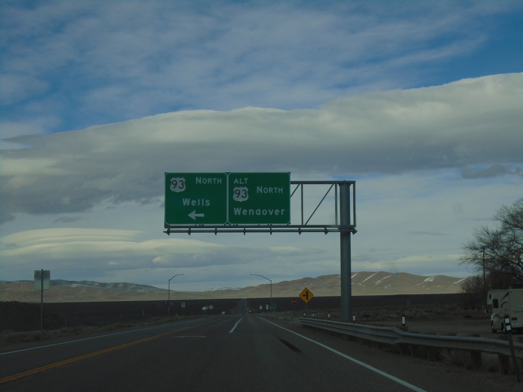
US-93 North at US-93 Alt. North
US-93 North at US-93 Alt. North. Continue straight for US-93 Alt. north to Wendover; turn left for US-93 north to Wells.
Taken 04-01-2023
 Ely
White Pine County
Nevada
United States
Ely
White Pine County
Nevada
United States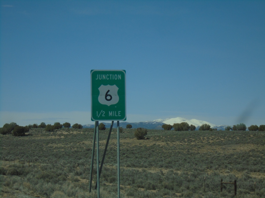
NV-318 North Approaching US-6
NV-318 North approaching US-6 in White Pine County. NV-318 northbound ends at US-6.
Taken 04-01-2023

 Lund
White Pine County
Nevada
United States
Lund
White Pine County
Nevada
United States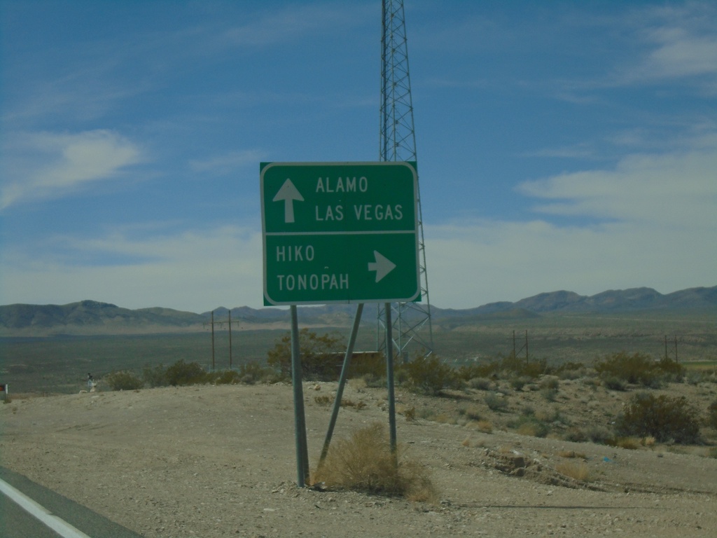
US-93 South at NV-318
US-93 South at NV-318 in Lincoln County. Continue south on US-93 for Alamo and Las Vegas. Turn right for NV-318 north to Hiko and Tonopah (via NV-375).
Taken 04-01-2023
Hiko
Lincoln County
Nevada
United States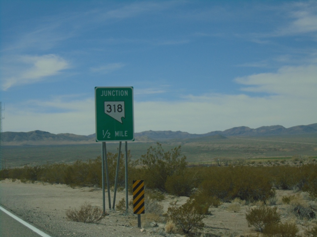
US-93 South Approaching NV-318
US-93 South approaching NV-318 in Lincoln County.
Taken 04-01-2023
Hiko
Lincoln County
Nevada
United States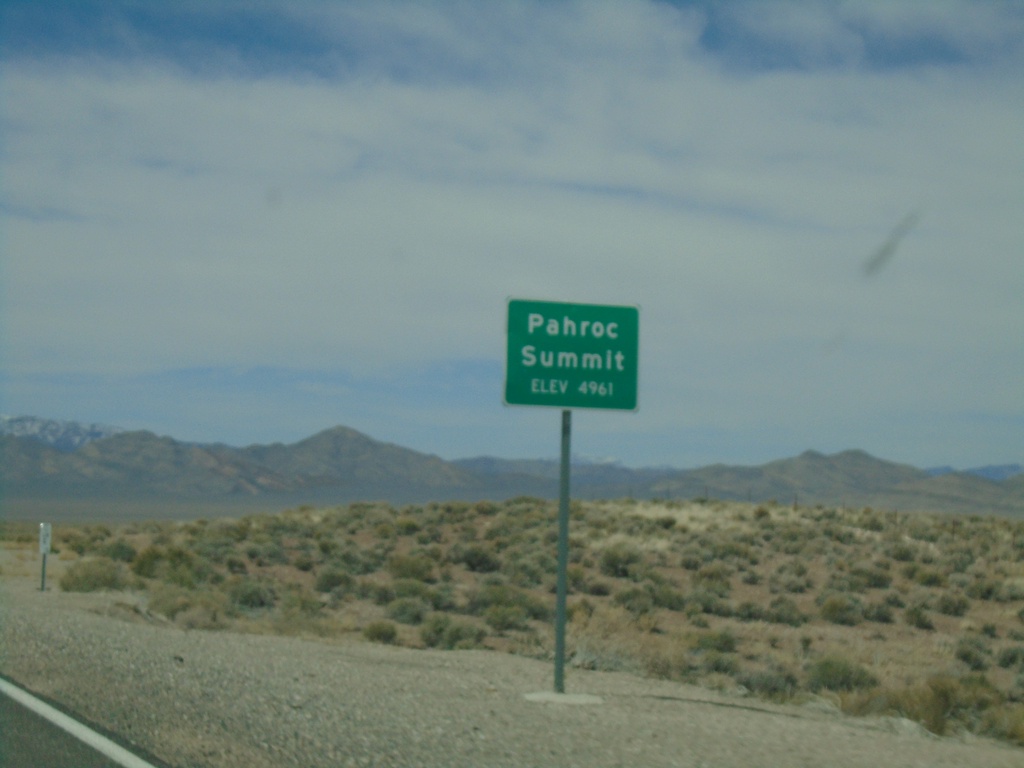
US-93 South - Pahroc Summit
Pahroc Summit - Elevation 4961 Feet on US-93 South.
Taken 04-01-2023
Hiko
Lincoln County
Nevada
United States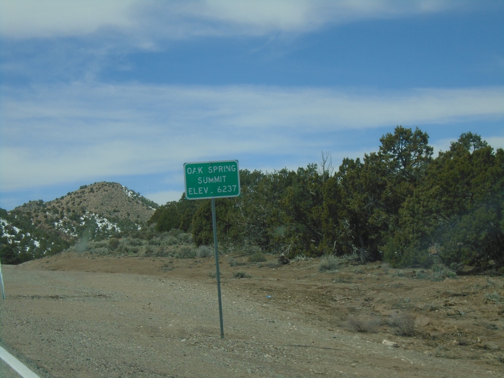
US-93 South - Oak Spring Summit
Oak Spring Summit - Elevation 6237 Feet on US-93 south.
Taken 04-01-2023
Caliente
Lincoln County
Nevada
United States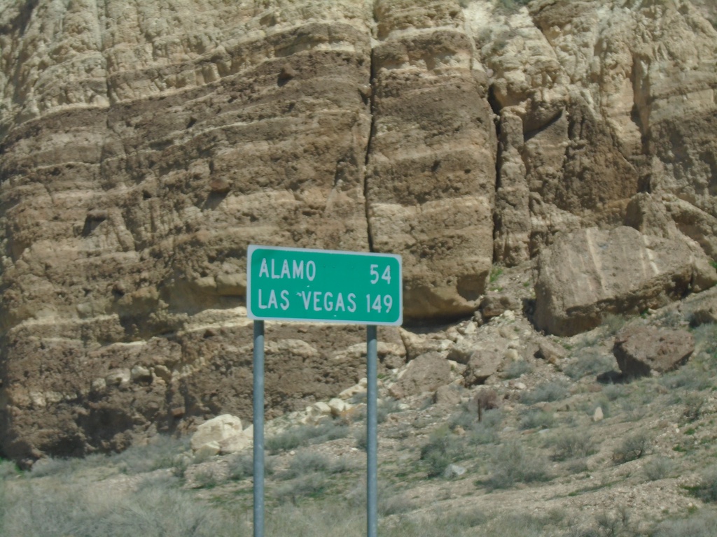
US-93 South - Distance Marker
Distance marker on US-93 south. Distance to Alamo and Las Vegas.
Taken 04-01-2023
Caliente
Lincoln County
Nevada
United States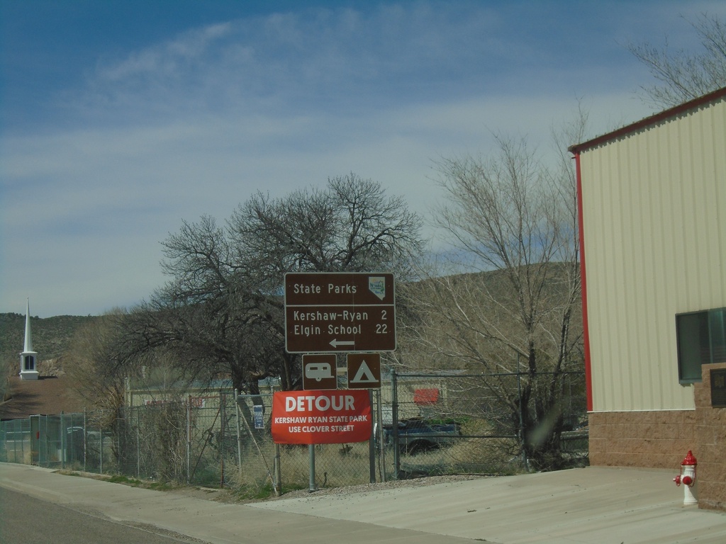
US-93 South approaching NV-317 - Caliente
US-93 South approaching NV-317 south to Kershaw-Ryan State Park and Elgin School State Park.
Taken 04-01-2023
 Caliente
Lincoln County
Nevada
United States
Caliente
Lincoln County
Nevada
United States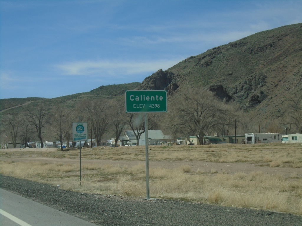
US-93 South - Caliente
Entering Caliente - Elevation 4398 Feet on US-93 south.
Taken 04-01-2023
Caliente
Lincoln County
Nevada
United States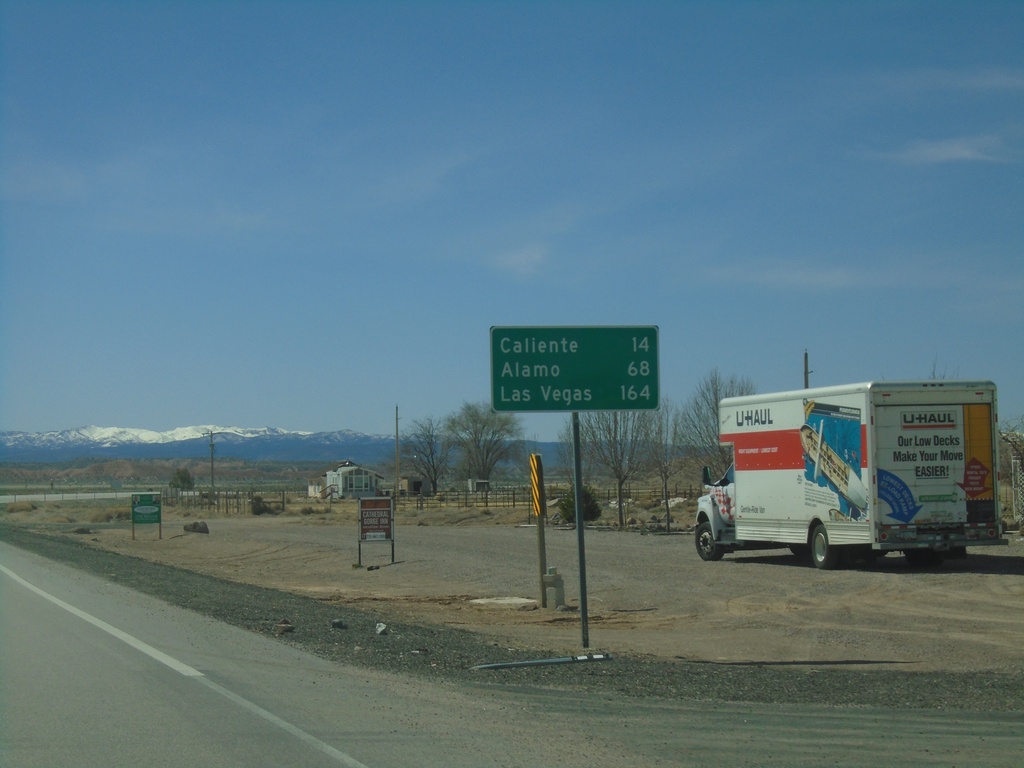
US-93 South - Distance Marker
Distance marker on US-93 south. Distance to Caliente, Alamo, and Las Vegas.
Taken 04-01-2023
Panaca
Lincoln County
Nevada
United States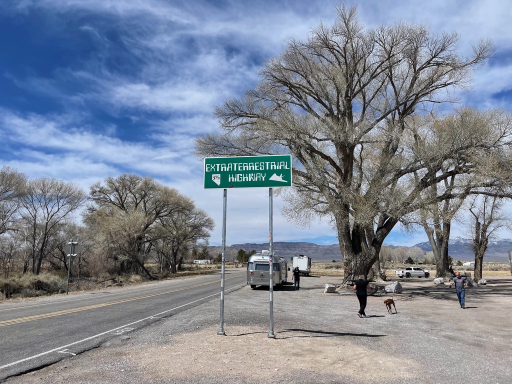
NV-375 West- Extraterrestrial Highway
NV-375 West- Extraterrestrial Highway. The highway sign is posted very high, so that no one can deface it with stickers, or steal it.
Taken 04-01-2023
 Hiko
Lincoln County
Nevada
United States
Hiko
Lincoln County
Nevada
United States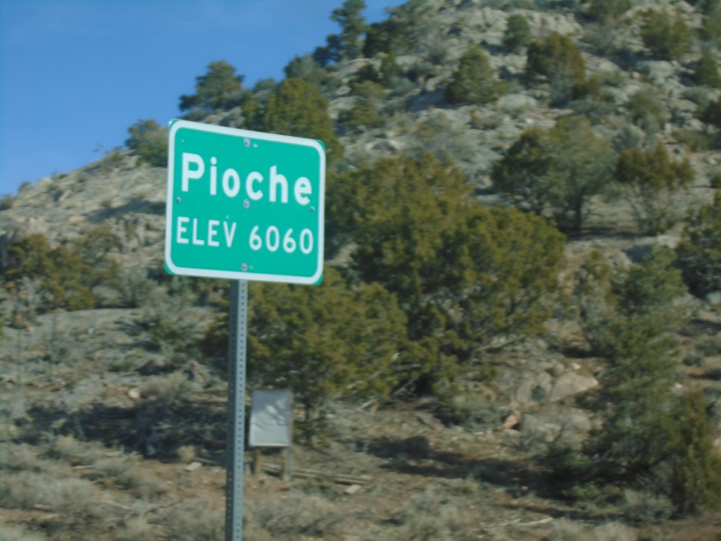
Bus. US-93/NV-321 - Pioche
Entering Pioche on Bus. US-93/NV-321 north. Pioche is the county seat of Lincoln County.
Taken 04-01-2023

 Pioche
Lincoln County
Nevada
United States
Pioche
Lincoln County
Nevada
United States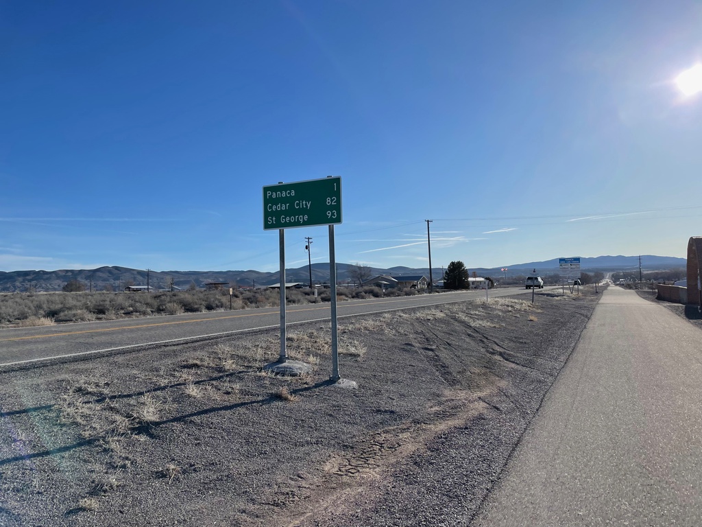
NV-319 East - Distance Marker
Distance marker on NV-319 east. Distance to Panaca, Cedar City (Utah) and St. George (Utah).
Taken 04-01-2023
 Panaca
Lincoln County
Nevada
United States
Panaca
Lincoln County
Nevada
United States
US-93 South at NV-319 East
US-93 South at NV-319 East to Panaca. Continue south on US-93 to Caliente and Las Vegas.
Taken 03-31-2023
Panaca
Lincoln County
Nevada
United States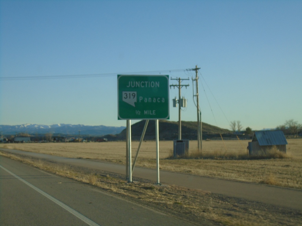
US-93 South Approaching NV-319
US-93 South approaching NV-319 to Panaca.
Taken 03-31-2023
Panaca
Lincoln County
Nevada
United States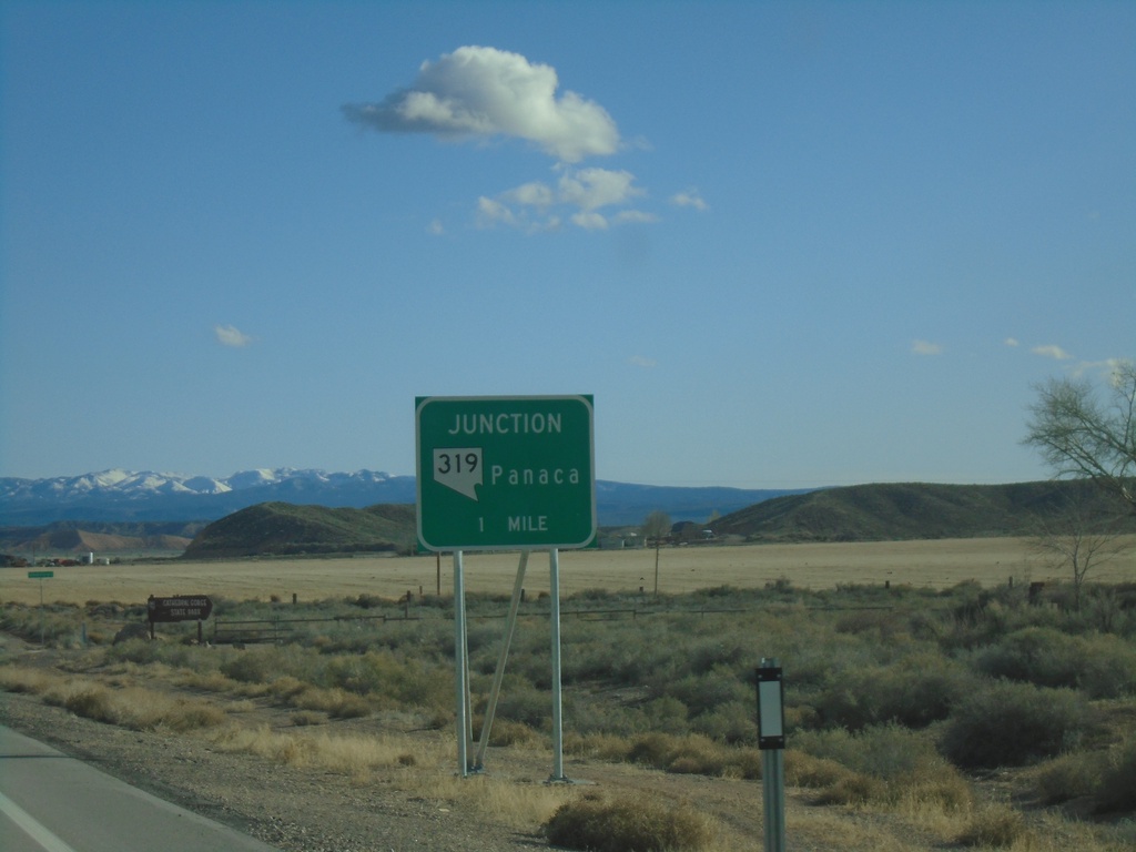
US-93 South Approaching NV-319
US-93 South approaching NV-319 to Panaca.
Taken 03-31-2023
Pioche
Lincoln County
Nevada
United States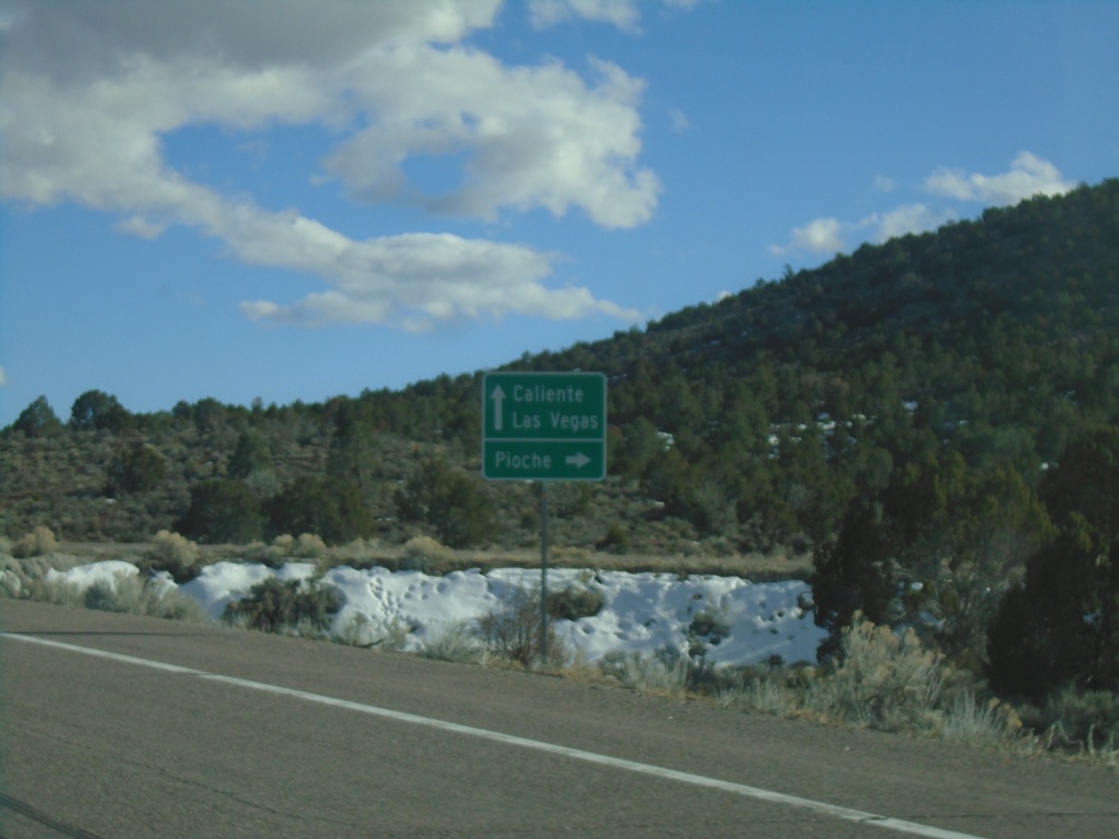
US-93 South at Bus. US-93/NV-321
US-93 South at Bus. US-93/NV-321 at the south side of Pioche. Use Bus. US-93/NV-321 north for Pioche; continue south US-93 for Caliente and Las Vegas.
Taken 03-31-2023
Pioche
Lincoln County
Nevada
United States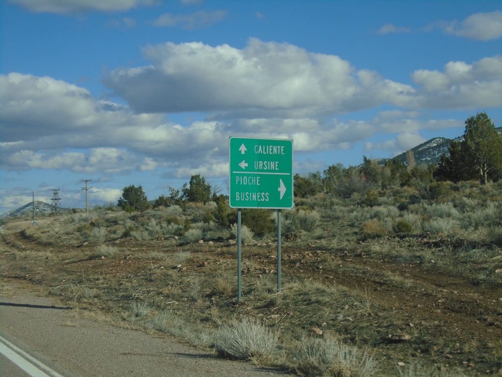
US-93 South at NV-322
US-93 South at NV-322 in Pioche. Use NV-322 west for Pioche Business; use NV-322 east for Ursine. Continue south on US-93 to Caliente.
Taken 03-31-2023
 Pioche
Lincoln County
Nevada
United States
Pioche
Lincoln County
Nevada
United States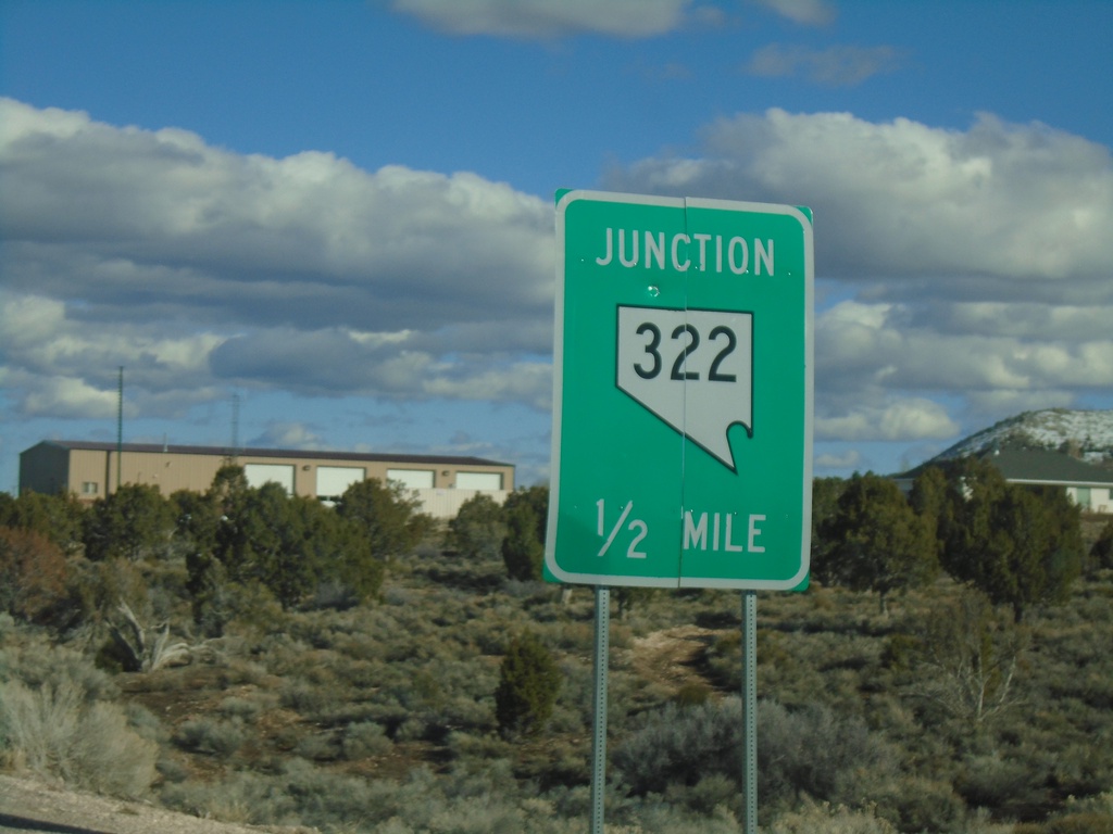
US-93 South Approaching NV-322
US-93 South approaching NV-322 in Pioche.
Taken 03-31-2023
Pioche
Lincoln County
Nevada
United States