Signs Tagged With Big Green Sign
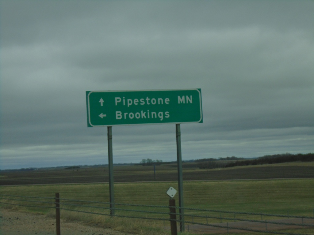
SD-34 East at I-29 North
SD-34 East at I-29 North to Brookings. Continue east on SD-34 for Pipestone, MN.
Taken 05-01-2022

 Egan
Moody County
South Dakota
United States
Egan
Moody County
South Dakota
United States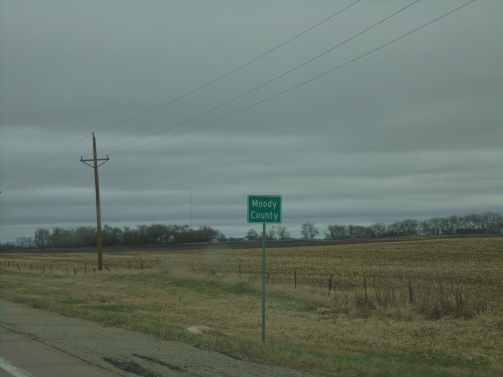
SD-34 East - Moody County
Moody County on SD-34 east.
Taken 05-01-2022
Colman
Moody County
South Dakota
United States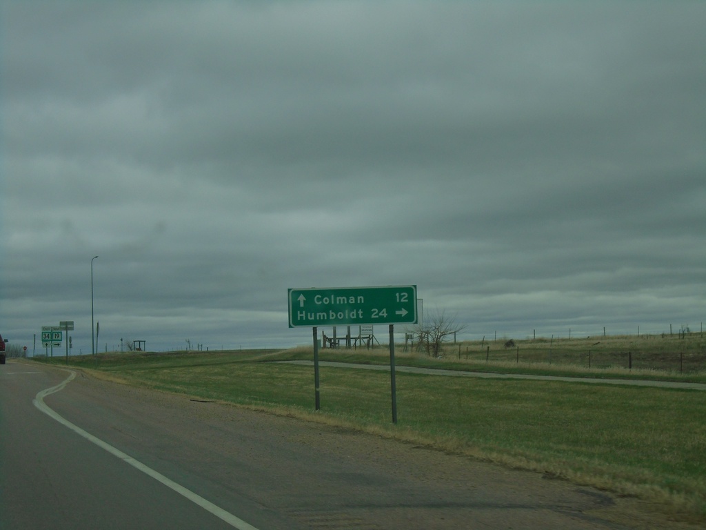
SD-34 East at SD-19
SD-34 East at SD-19 south to Humboldt. Continue east on SD-34 for Colman.
Taken 05-01-2022
 Madison
Lake County
South Dakota
United States
Madison
Lake County
South Dakota
United States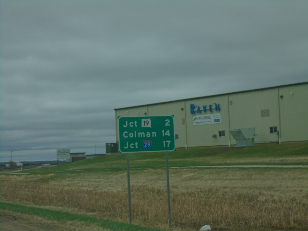
SD-34 East - Distance Marker
Distance marker on SD-34 east. Distance to Jct SD-19, Colman, and Jct. I-29.
Taken 05-01-2022
Madison
Lake County
South Dakota
United States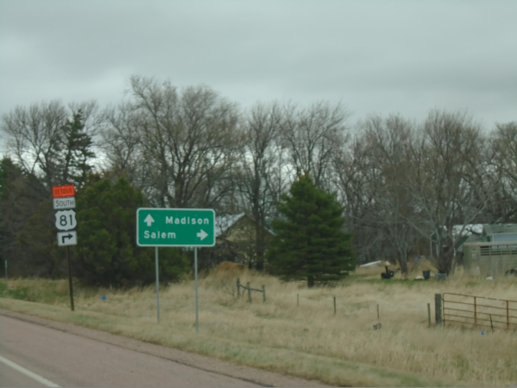
SD-34 East Approaching US-81
SD-34 East approaching US-81 in Miner County. Use US-81 south to Salem. US-81 North joins SD-34 East to Madison.
Taken 05-01-2022
 Howard
Miner County
South Dakota
United States
Howard
Miner County
South Dakota
United States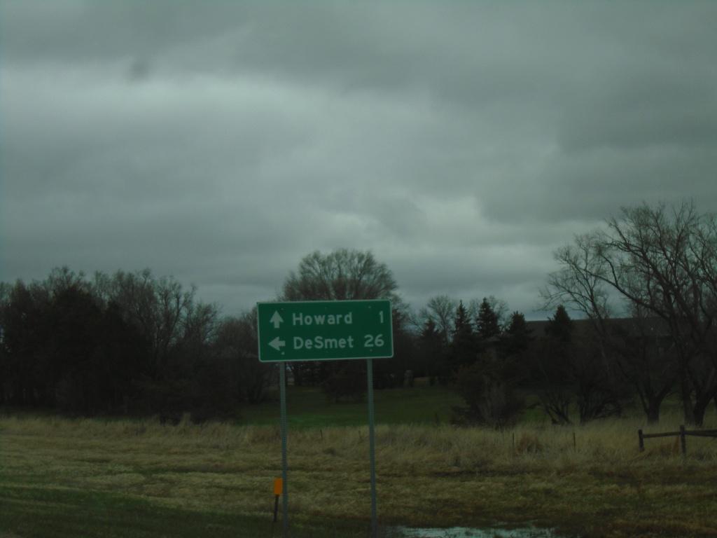
SD-34 East/SD-25 North at SD-34/SD-25 Split
SD-34 East/SD-25 North at SD-34/SD-25 split in Miner County. Use SD-25 North to De Smet; SD-34 East to Howard.
Taken 05-01-2022
 Howard
Miner County
South Dakota
United States
Howard
Miner County
South Dakota
United States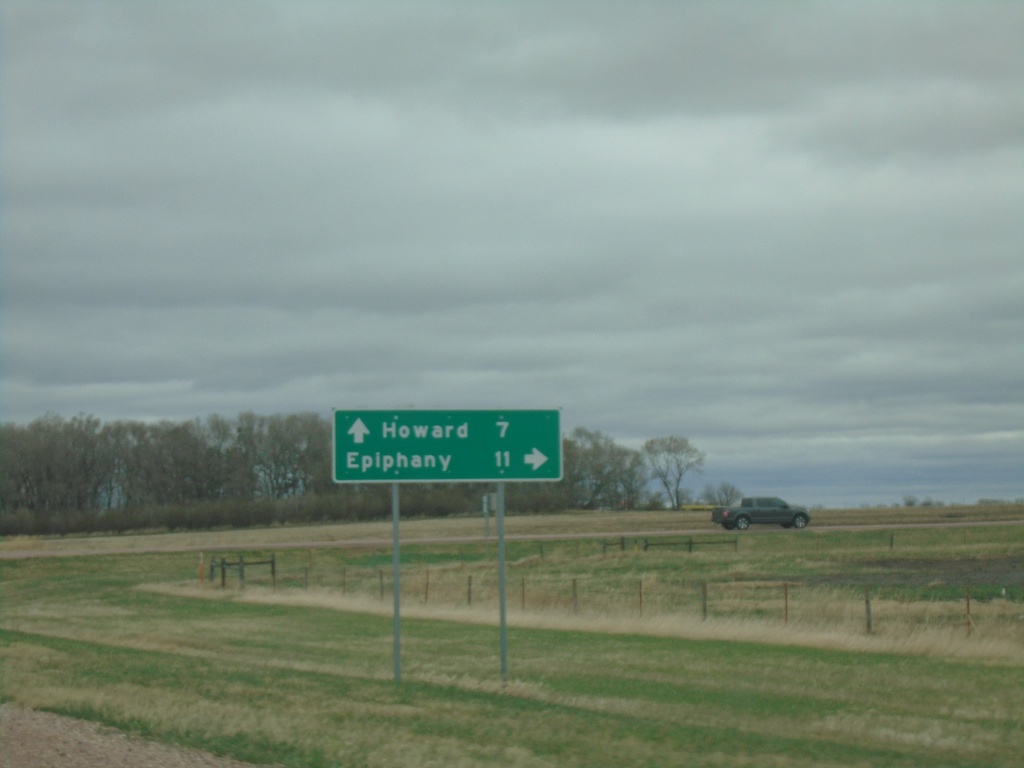
SD-34 East at SD-25 South
SD-34 East at SD-25 South to Epiphany. Continue on SD-34 East/SD-25 North to Howard. SD-25 North joins SD-34 eastbound.
Taken 05-01-2022
Howard
Miner County
South Dakota
United States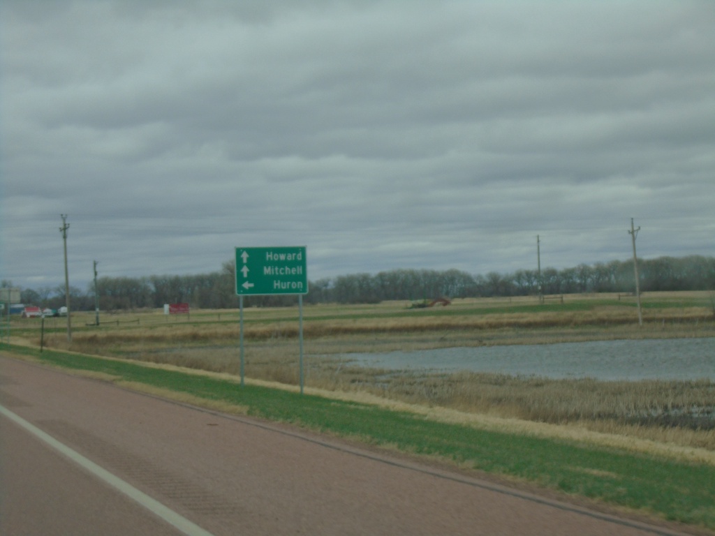
SD-34 East Approaching SD-37
SD-34 East approaching SD-37 in Sanborn County. Use SD-37 North to Huron. Continue on SD-34 East/SD-37 south for Howard and Mitchell. SD-37 South joins SD-34 East.
Taken 05-01-2022
 Woonsocket
Sanborn County
South Dakota
United States
Woonsocket
Sanborn County
South Dakota
United States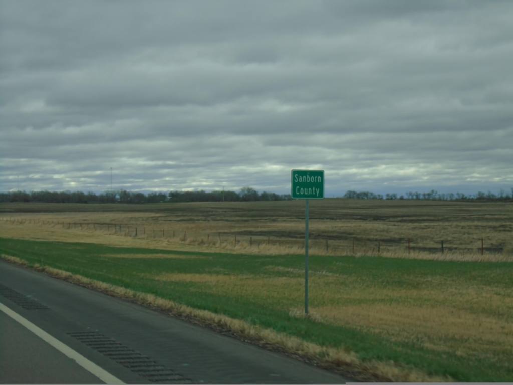
SD-34 East - Sanborn County
Entering Sanborn County on SD-34 east.
Taken 05-01-2022
Woonsocket
Sanborn County
South Dakota
United States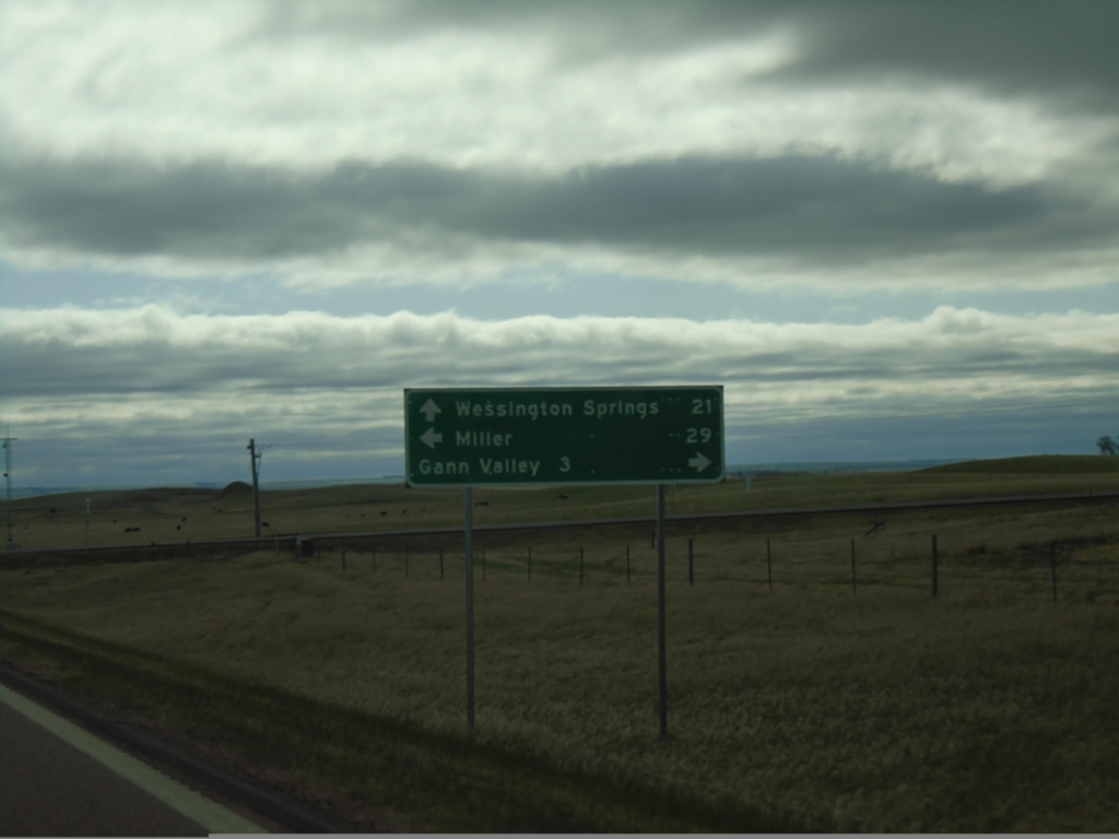
SD-34 East Approaching SD-45
SD-34 East approaching SD-45. Use SD-45 south for Gann Valley; SD-45 north for Miller. Continue east on SD-34 for Wessington Springs.
Taken 05-01-2022
 Gann Valley
Buffalo County
South Dakota
United States
Gann Valley
Buffalo County
South Dakota
United States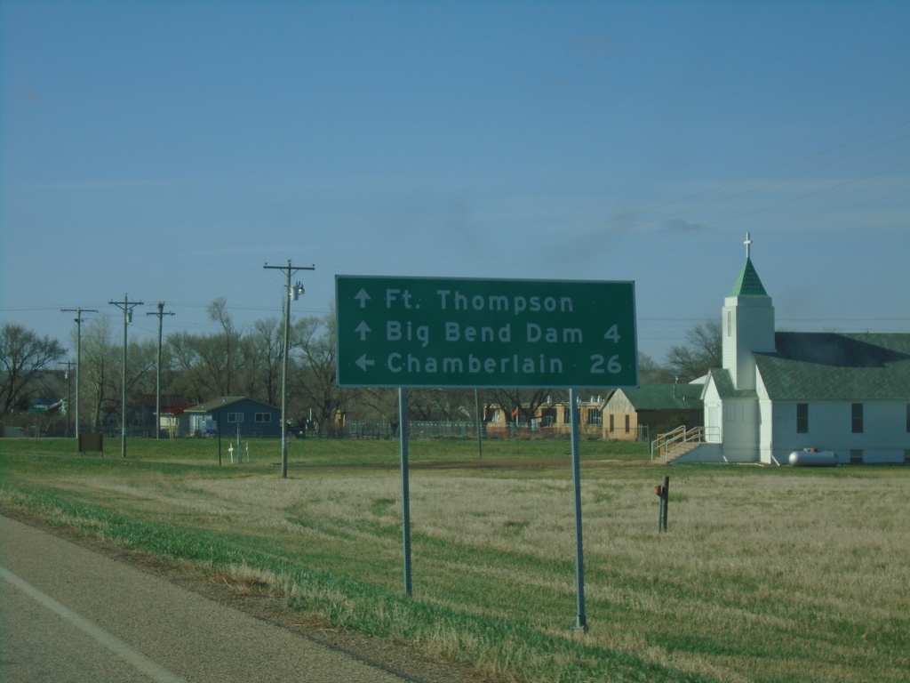
SD-34 East/SD-47 South Approaching SD-34/SD-47 Split
SD-34 East/SD-47 South approaching SD-34/SD-47 split in Fort Thompson. Continue south on SD-47 for Fort Thompson and Big Bend Dam. Turn left for SD-34 east to Chamberlain.
Taken 05-01-2022
 Fort Thompson
Buffalo County
South Dakota
United States
Fort Thompson
Buffalo County
South Dakota
United States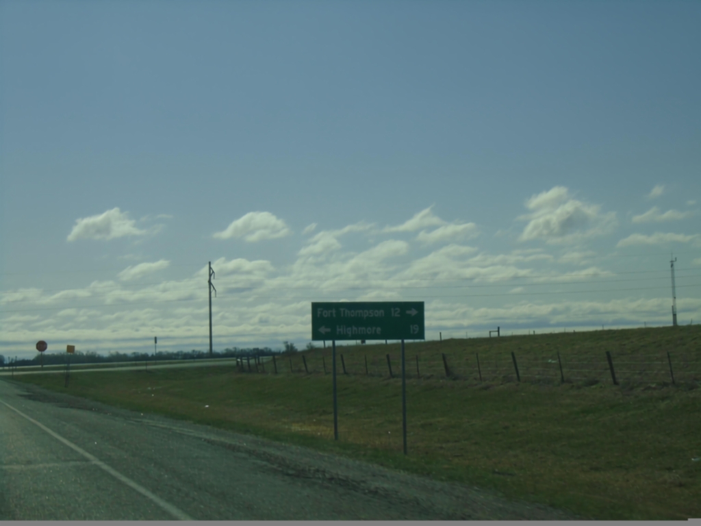
SD-34 East at SD-47 - Hyde County
SD-34 East at SD-47 in Hyde County. Use SD-47 north for Highmore; SD-34 East/SD-47 South for Fort Thompson. SD-47 South joins SD-34 East to Fort Thompson.
Taken 05-01-2022
Highmore
Hyde County
South Dakota
United States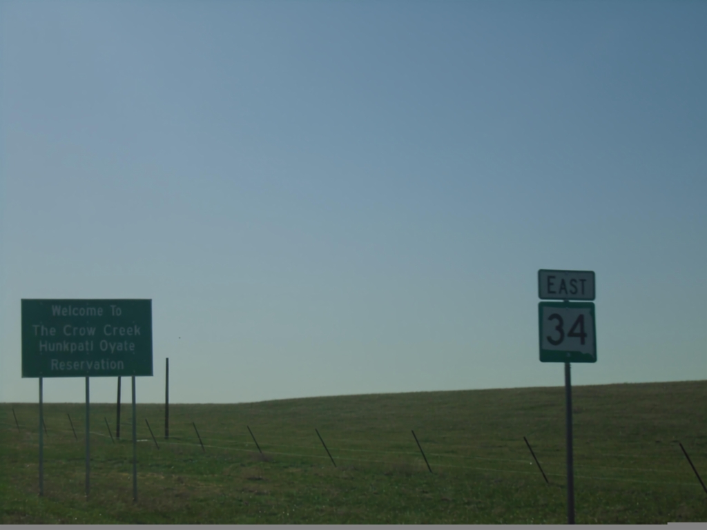
SD-34 East - Crow Creek Reservation
Entering Crow Creek/Hunkpati Oyate Reservation on SD-34 north. The Crow Creek Reservation is home to the Crow Creek Sioux Tribe.
Taken 05-01-2022
Harrold
Hughes County
South Dakota
United States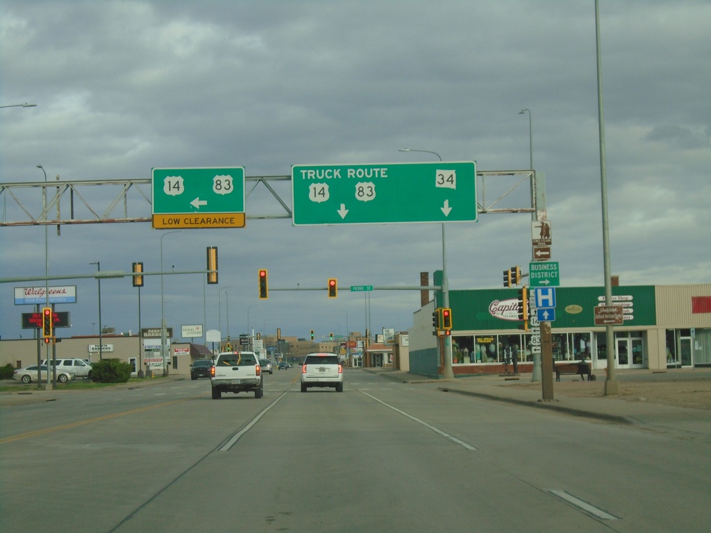
US-14/SD-34 East/US-83 North at US-14/US-83 Truck Route
US-14/SD-34 East/US-83 North (Sioux Ave.) at US-14/US-83 Truck Route (Pierre St.). Turn left on Pierre St. for US-14 East/US-83 North. Continue east on Sioux St. for SD-34/US-14 Truck/US-83 Truck. The truck route bypasses a low railroad bridge just north of this intersection.
Taken 04-30-2022


 Pierre
Hughes County
South Dakota
United States
Pierre
Hughes County
South Dakota
United States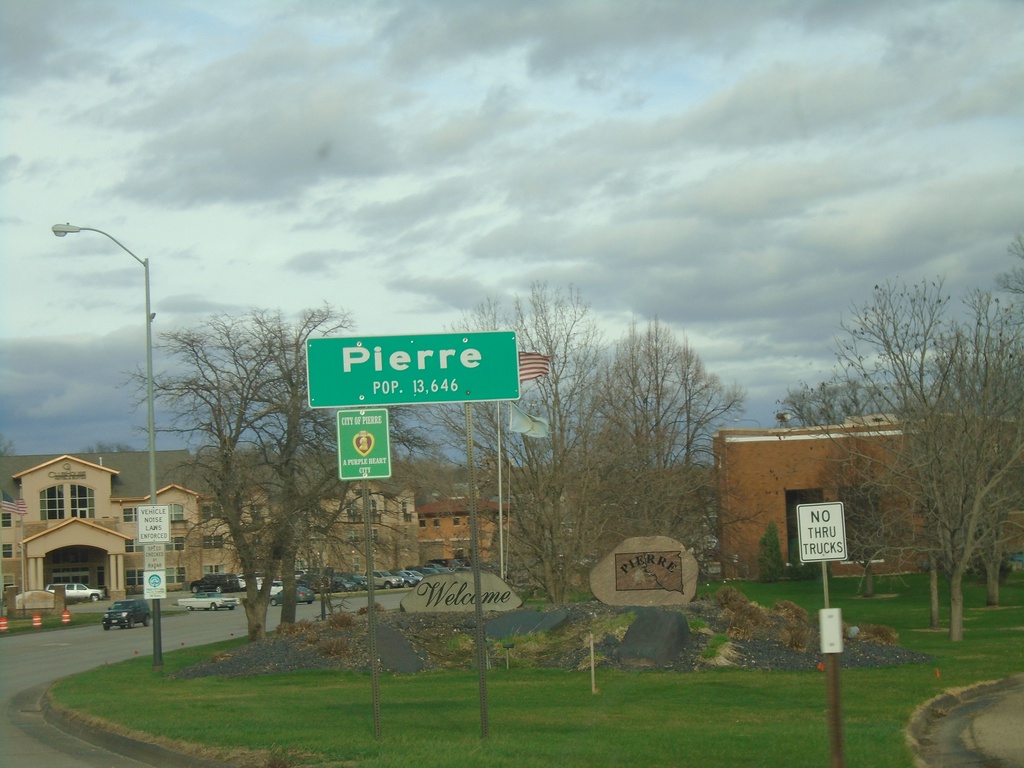
US-14/SD-34 East/US-83 North - Pierre
Entering Pierre on US-14/SD-34 East/US-83 North. Pierre is the capital of South Dakota and is the 9th largest city in the state. Pierre is pronounced PEER.
Taken 04-30-2022
Pierre
Hughes County
South Dakota
United States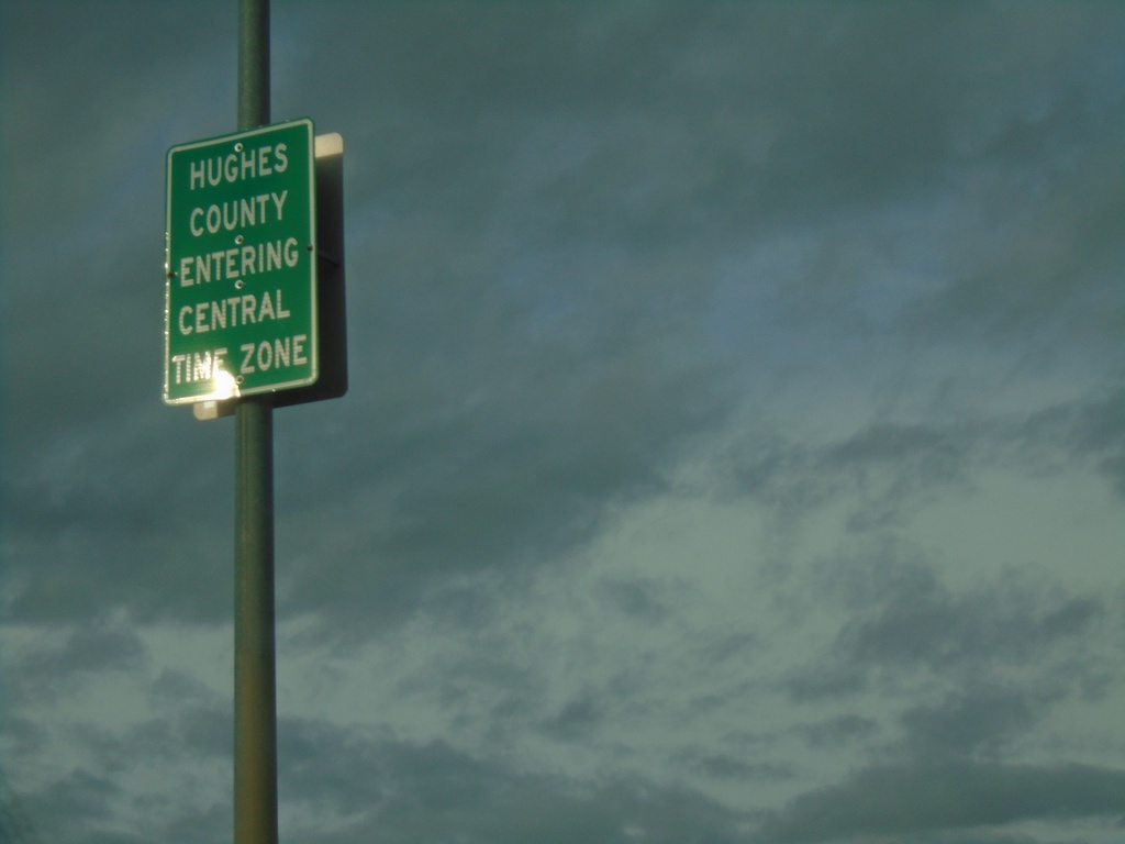
US-14/SD-34 East/US-83 North - Entering Hughes County/Central Time Zone
Entering Hughes County/Central Time Zone on US-14/SD-34 East/US-83 North. The county/time zone boundary is on the Missouri River bridge.
Taken 04-30-2022
Fort Pierre
Stanley County
South Dakota
United States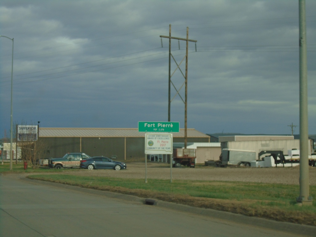
US-14/SD-34 East - Fort Pierre
Entering Fort Pierre on US-14/SD-34 East. Fort Pierre is the county seat of Stanley County, and is directly across the Missouri River from Pierre. Fort Pierre is also in Mountain Time, while across the river the city of Pierre is in Central Time.
Taken 04-30-2022
Fort Pierre
Stanley County
South Dakota
United States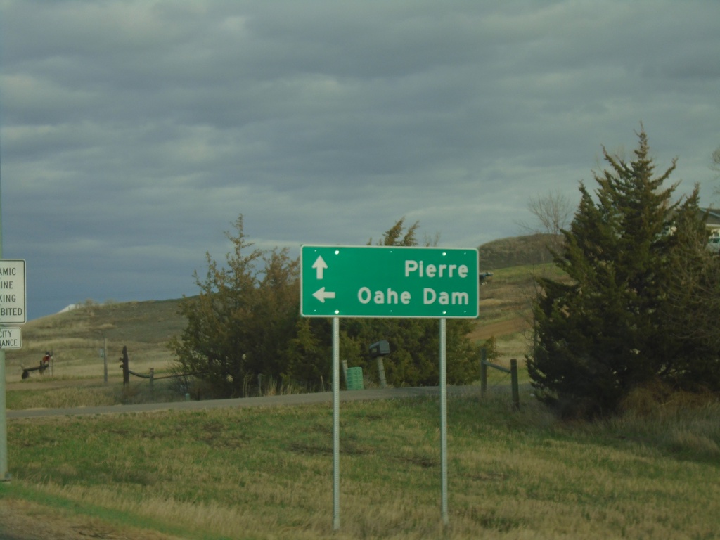
US-14/SD-34 East Approaching at SD-1806
US-14/SD-34 East approaching at SD-1806 North to Oahe Dam. Continue east on US-14/SD-34 to Pierre.
Taken 04-30-2022
 Fort Pierre
Stanley County
South Dakota
United States
Fort Pierre
Stanley County
South Dakota
United States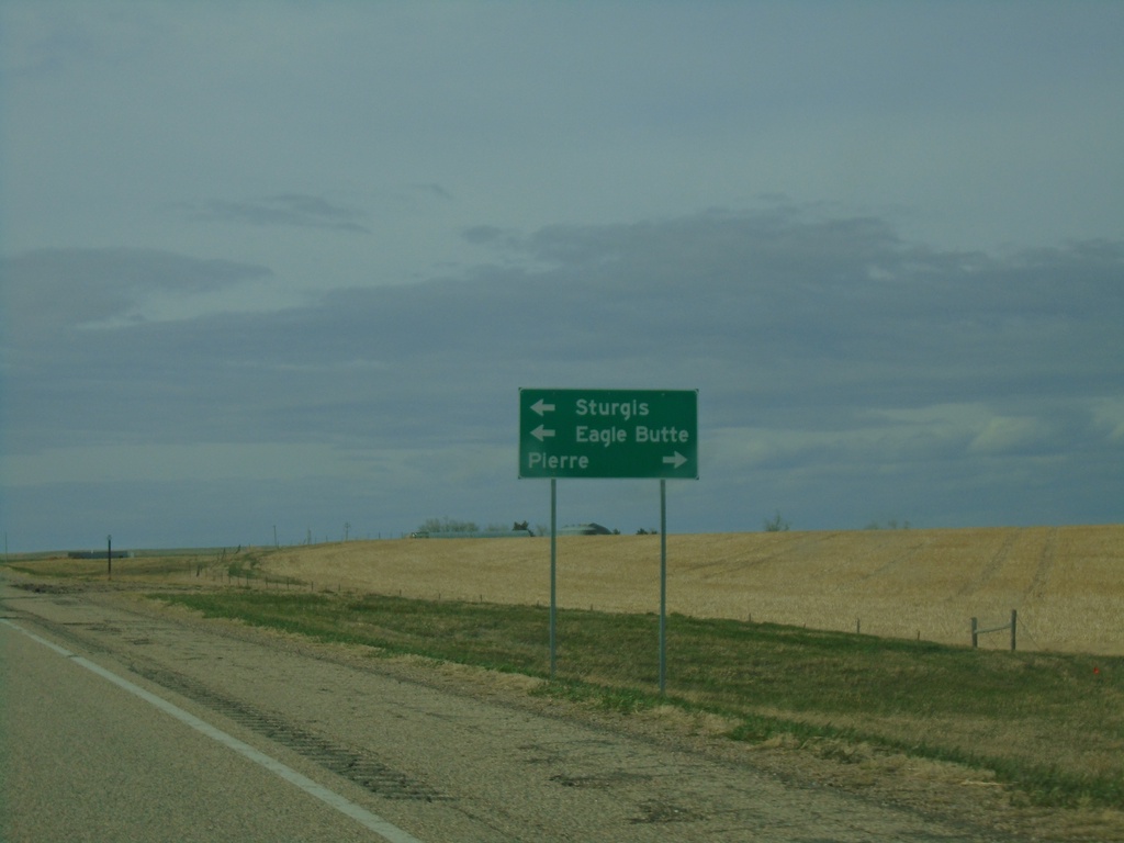
US-14 East/SD-63 North Approaching SD-34
US-14 East/SD-63 North approaching SD-34. Use US-14 East/SD-34 East to Pierre; SD-34 East/SD-64 north to Sturgis (via SD-34) and Eagle Butte (via SD-63).
Taken 04-30-2022
 Hayes
Stanley County
South Dakota
United States
Hayes
Stanley County
South Dakota
United States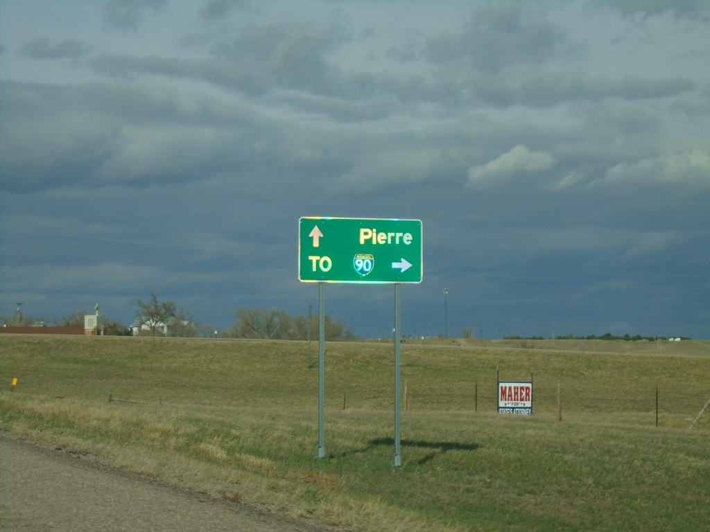
US-14 East at SD-63
US-14 East at SD-63 in Midland. Use SD-63 south to I-90 junction. Continue on US-14/SD-63 for Pierre. SD-63 north joins US-14 eastbound.
Taken 04-30-2022
 Midland
Haakon County
South Dakota
United States
Midland
Haakon County
South Dakota
United States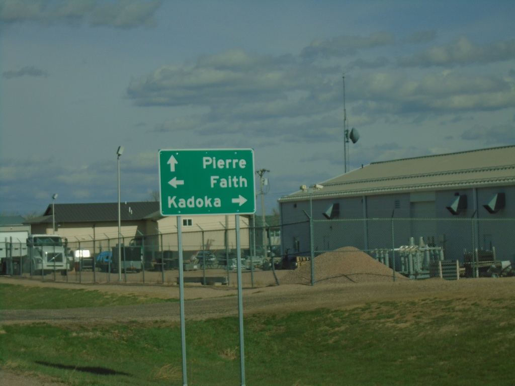
US-14 East at SD-73
US-14 East at SD-73 in Phillip. Use SD-73 south to Kadoka; SD-73 north to Faith. Continue east on US-14 for Pierre.
Taken 04-30-2022
 Philip
Haakon County
South Dakota
United States
Philip
Haakon County
South Dakota
United States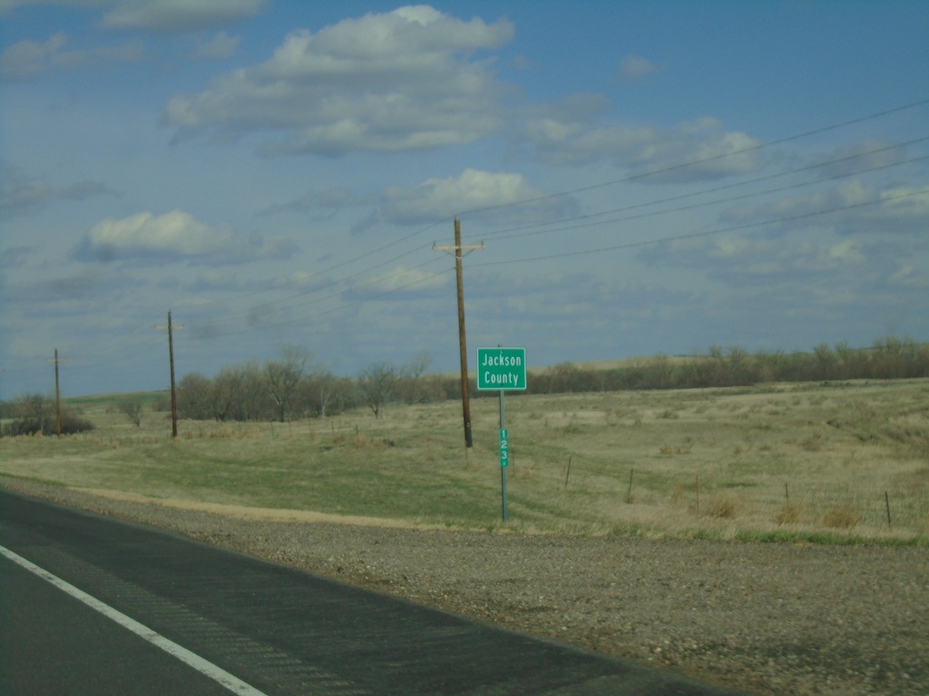
US-14 East - Jackson County
Entering Jackson County on US-14 east.
Taken 04-30-2022
Quinn
Jackson County
South Dakota
United States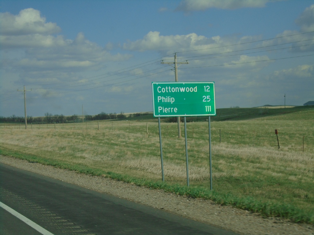
US-14 East - Distance Marker
Distance marker on US-14 east. Distance to Cottonwood, Phillip, and Pierre.
Taken 04-30-2022
Quinn
Pennington County
South Dakota
United States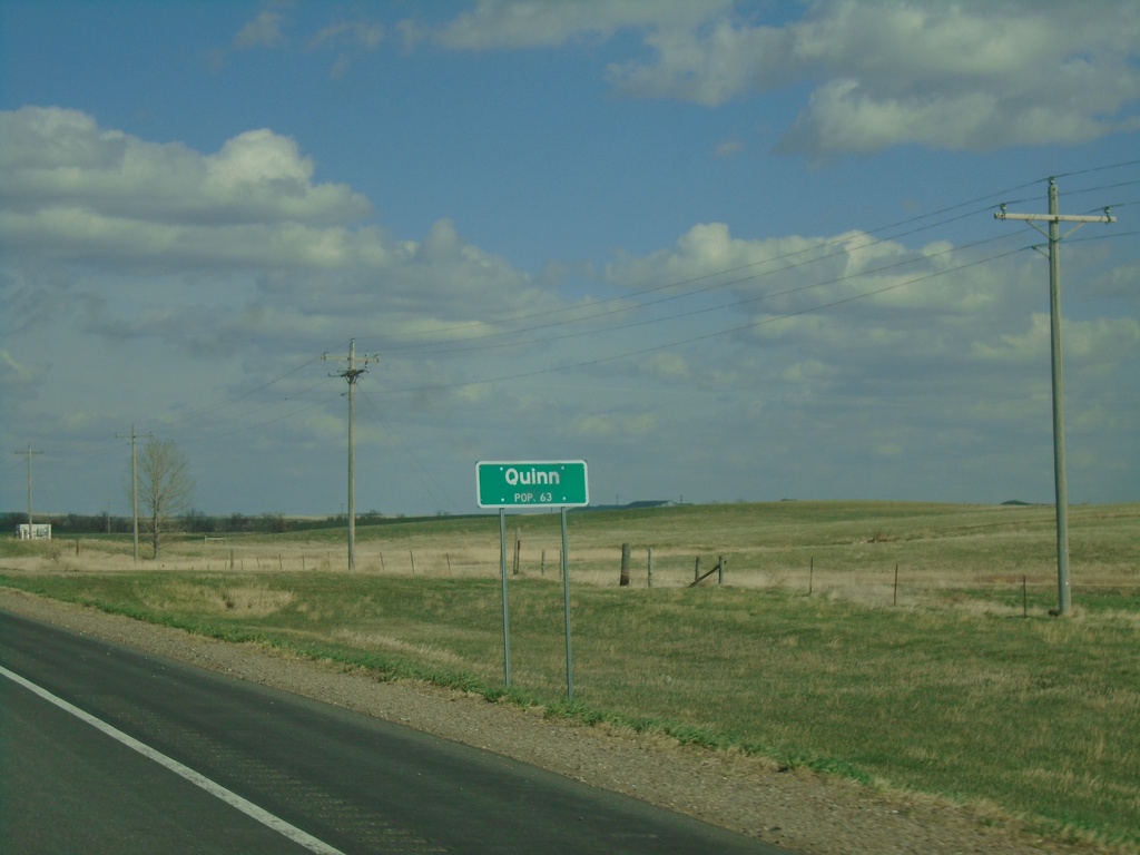
US-14 East - Quinn
Entering Quinn - Population 63 on US-14 east.
Taken 04-30-2022
Quinn
Pennington County
South Dakota
United States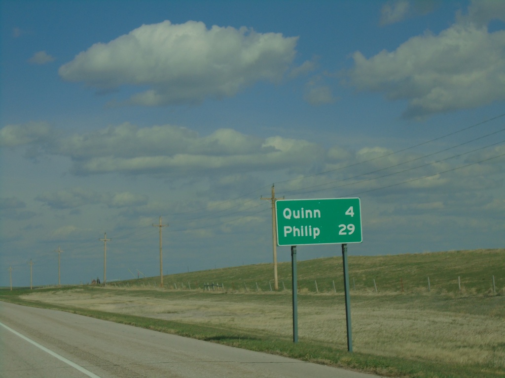
US-14 East - Distance Marker
Distance marker on US-14. Distance to Quinn and Phillip.
Taken 04-30-2022
Quinn
Pennington County
South Dakota
United States