Signs Tagged With Big Green Sign
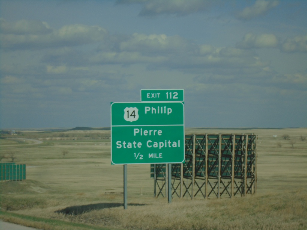
I-90 East - Exit 112
I-90 east approaching Exit 112 - US-14/Phillip/Pierre/State Capital. US-14 leaves I-90 eastbound here.
Taken 04-30-2022

 Wall
Pennington County
South Dakota
United States
Wall
Pennington County
South Dakota
United States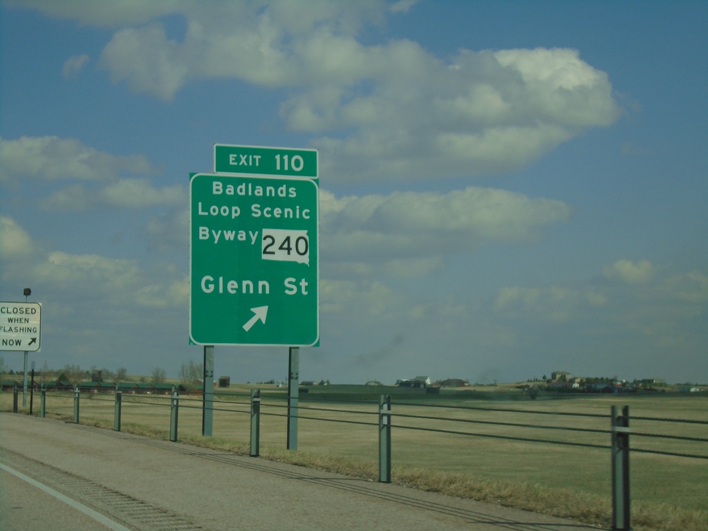
I-90 East - Exit 110
I-90 east at Exit 110 - SD-240/Badlands Loop Scenic Byway/Glenn St. This is the eastern end of the Wall business loop.
Taken 04-30-2022

 Wall
Pennington County
South Dakota
United States
Wall
Pennington County
South Dakota
United States
I-90 East - Exit 110
I-90 east approaching Exit 110 - SD-240/Badlands Loop Scenic Byway/Glenn St.
Taken 04-30-2022
Wall
Pennington County
South Dakota
United States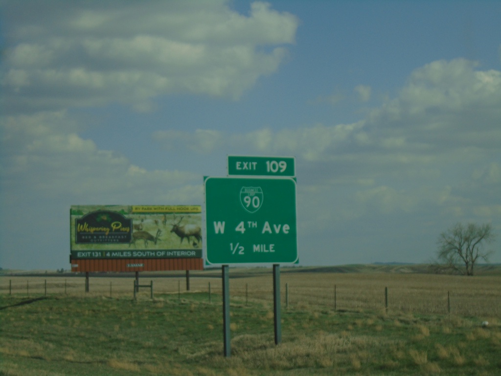
I-90 East - Exit 109
I-90 east approaching Exit 109 - BL-90/W 4th Ave. This is the western end of the Wall business loop.
Taken 04-30-2022
Wall
Pennington County
South Dakota
United States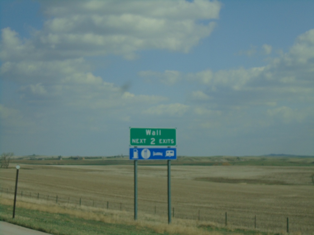
I-90 East - Wall Next 2 Exits
Wall Next 2 Exits on I-90 East
Taken 04-30-2022
Wall
Pennington County
South Dakota
United States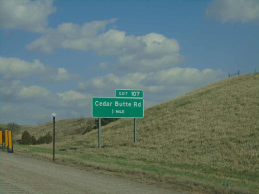
I-90 East - Exit 107
I-90 east approaching Exit 107 - Cedar Butte Road.
Taken 04-30-2022
Wall
Pennington County
South Dakota
United States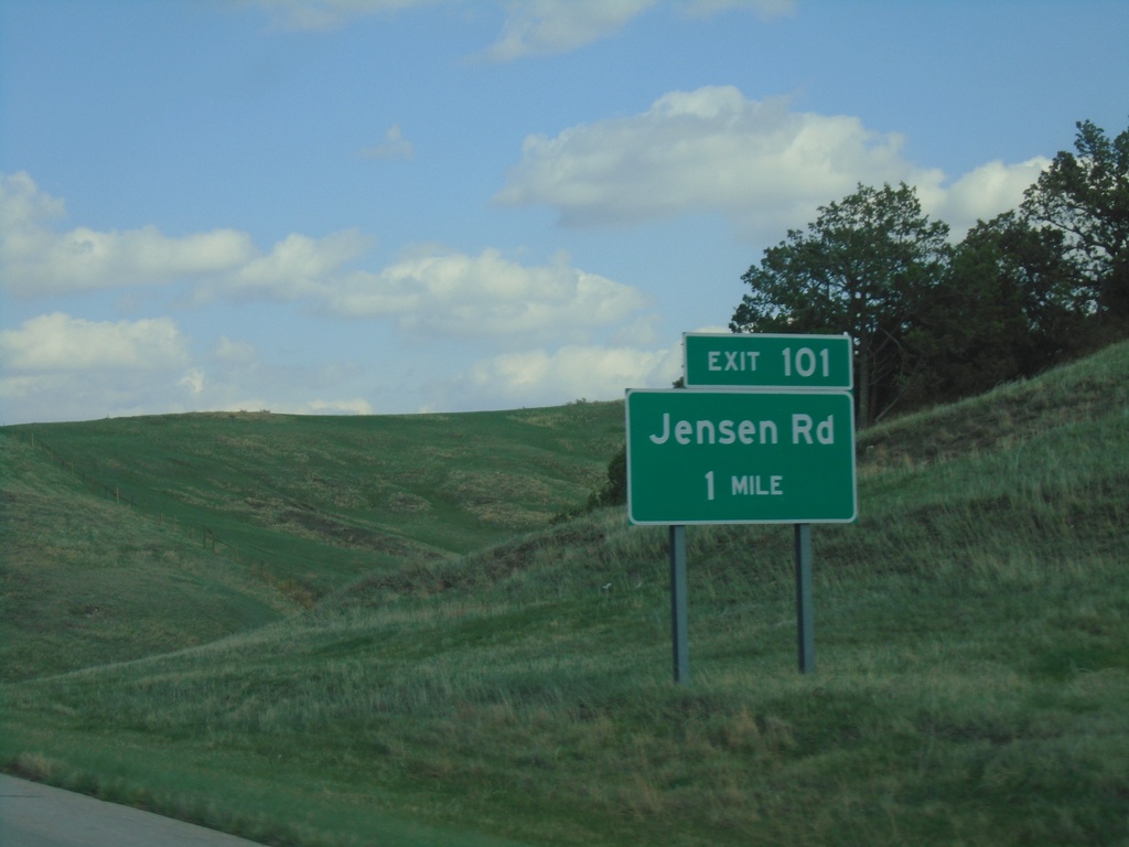
I-90 East - Exit 101
I-90 east approaching Exit 101 - Jensen Road.
Taken 04-30-2022
Wall
Pennington County
South Dakota
United States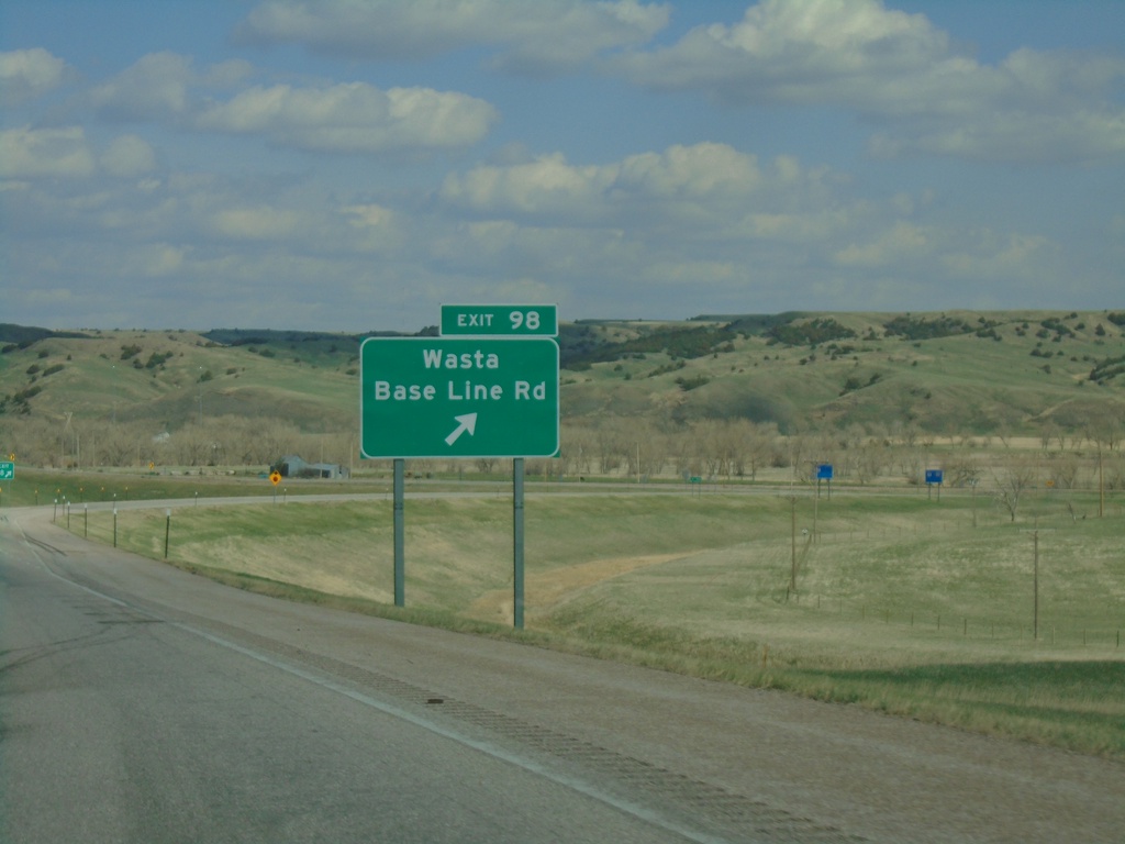
I-90 East - Exit 98
I-90 east at Exit 90 - Wasta/Base Line Road.
Taken 04-30-2022
Wasta
Pennington County
South Dakota
United States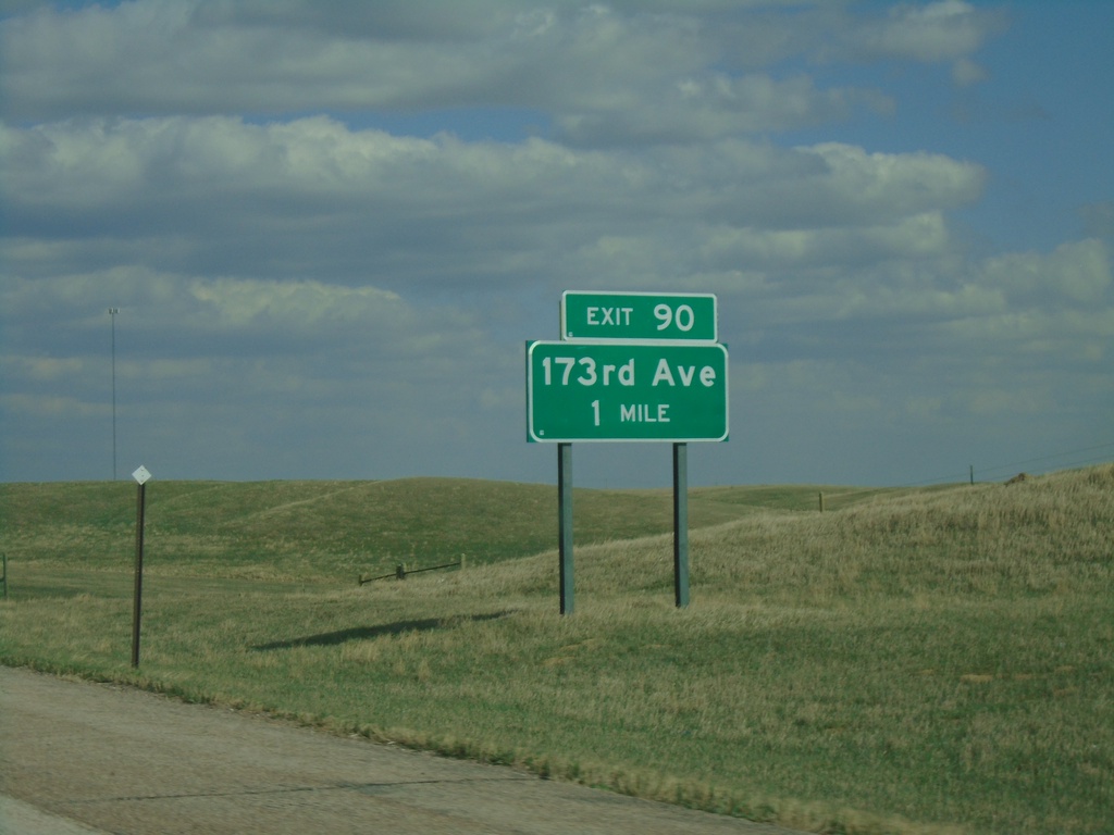
I-90 East - Exit 90
I-90 east approaching Exit 90 - 173rd Ave.
Taken 04-30-2022
Owanka
Pennington County
South Dakota
United States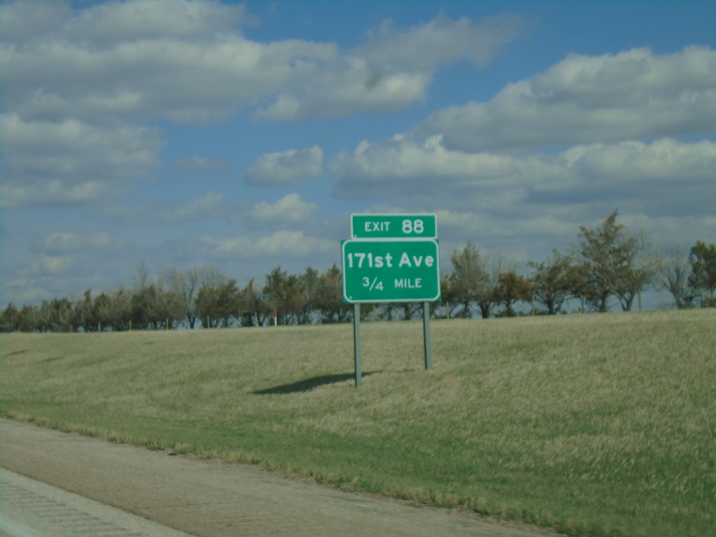
I-90 East - Exit 88
I-90 east approaching Exit 88 - 171st Ave.
Taken 04-30-2022
Owanka
Pennington County
South Dakota
United States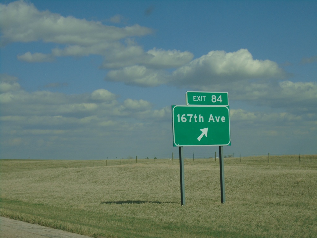
I-90 East - Exit 84
I-90 east at Exit 84 - 167th Ave.
Taken 04-30-2022
New Underwood
Pennington County
South Dakota
United States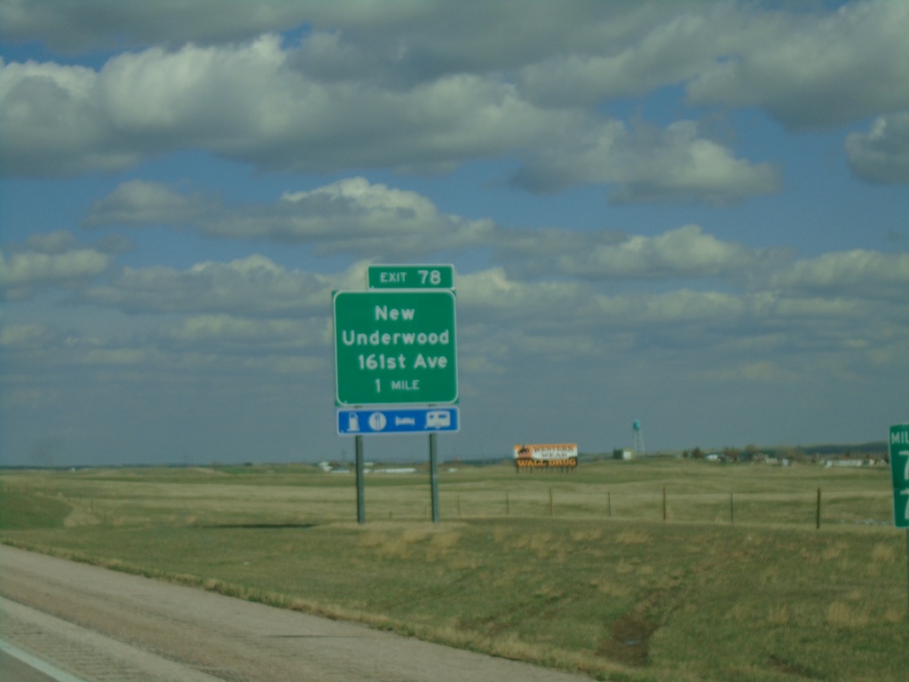
I-90 East - Exit 78
I-90 east approaching Exit 78 - New Underwood/161st Ave.
Taken 04-30-2022
New Underwood
Pennington County
South Dakota
United States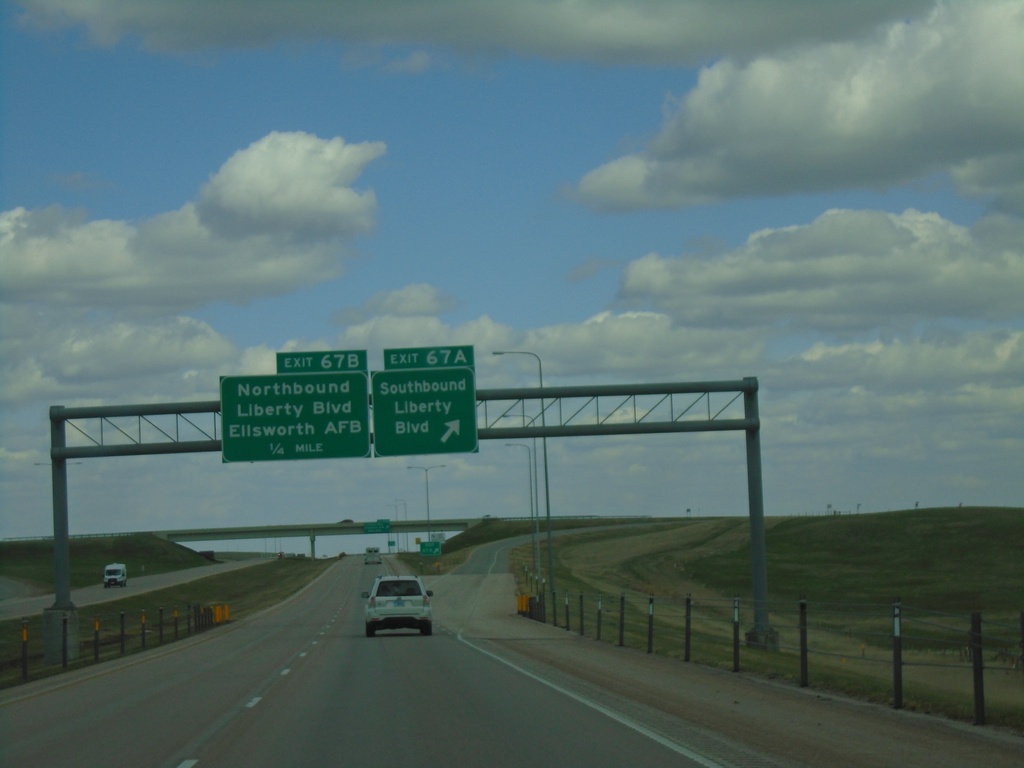
I-90 East - Exits 67A and 67B
I-90 east at Exit 67A - Southbound Liberty Blvd. Approaching Exit 67B - Northbound Liberty Blvd./Ellsworth AFB.
Taken 04-30-2022
Box Elder
Pennington County
South Dakota
United States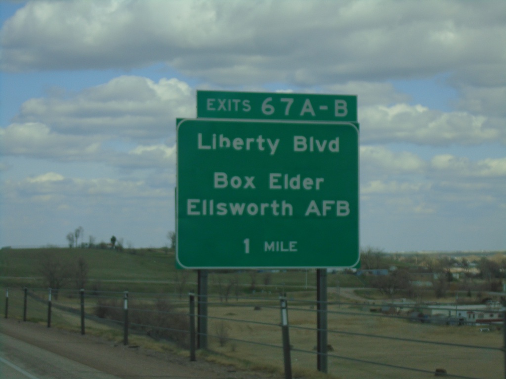
I-90 East - Exit 67A-B
I-90 East approaching Exit 67A-B - Liberty Blvd/Box Elder/Ellsworth AFB
Taken 04-30-2022
Box Elder
Pennington County
South Dakota
United States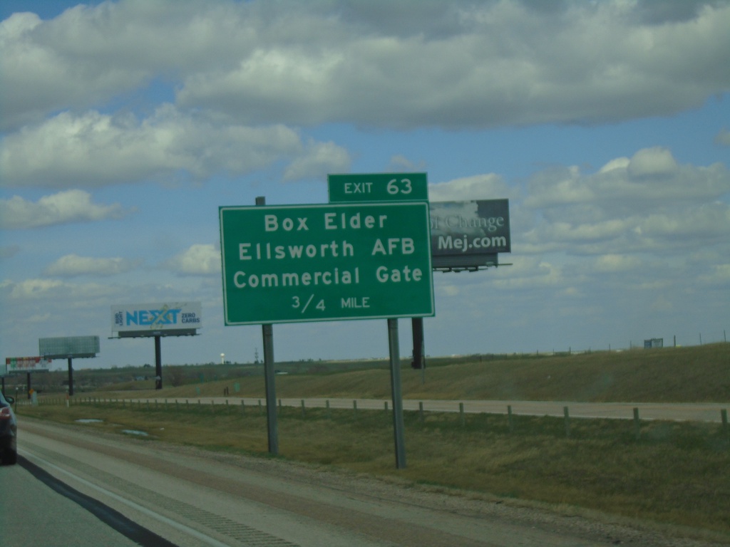
I-90 East - Exit 63
I-90 east approaching Exit 62 - Box Elder/Ellsworth AFB/Commercial Gate.
Taken 04-30-2022
Box Elder
Pennington County
South Dakota
United States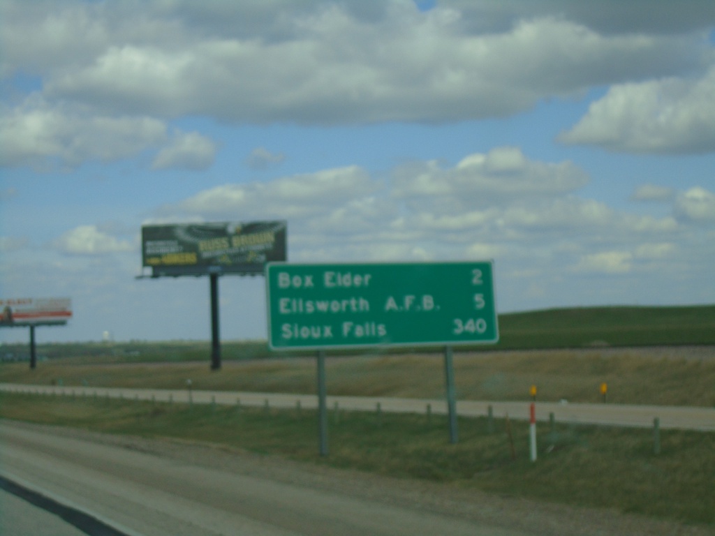
I-90 East - Distance Marker
Distance marker on I-90 east. Distance to Box Elder, Ellsworth AFB, and Sioux Falls.
Taken 04-30-2022
Rapid City
Pennington County
South Dakota
United States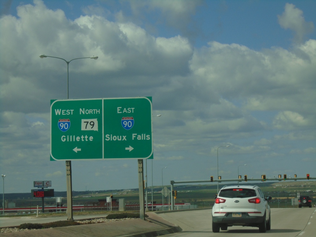
US-16 East Truck/SD-79 North at I-90/US-14
US-16 East Truck/SD-79 North at I-90/US-14 (Exit 61). Use I-90/US-14 West/SD-79 North to Gillette (Wyoming). Use I-90/US-14 East to Sioux Falls. SD-79 North joins I-90/US-14 West to Sturgis. This is the eastern end of US-16 Truck.
Taken 04-30-2022

 Rapid City
Pennington County
South Dakota
United States
Rapid City
Pennington County
South Dakota
United States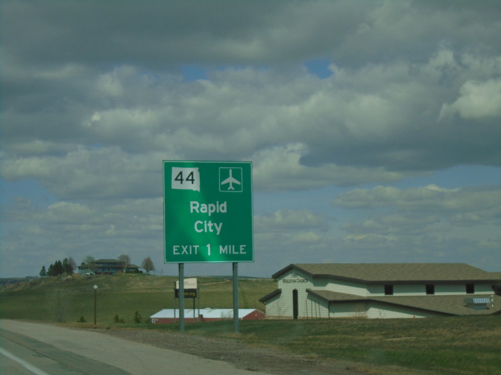
US-16 Truck East/SD-79 North Approaching SD-44
US-16 Truck East/SD-79 North approaching SD-44 to Rapid City.
Taken 04-30-2022
 Rapid City
Pennington County
South Dakota
United States
Rapid City
Pennington County
South Dakota
United States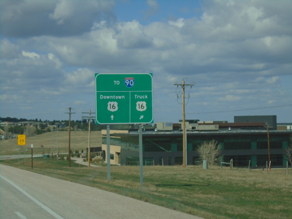
US-16 East Approaching US-16 Truck
US-16 East Approaching US-16 Truck in Rapid City. Use either US-16 or US-16 Truck for access to I-90.
Taken 04-30-2022
 Rapid City
Pennington County
South Dakota
United States
Rapid City
Pennington County
South Dakota
United States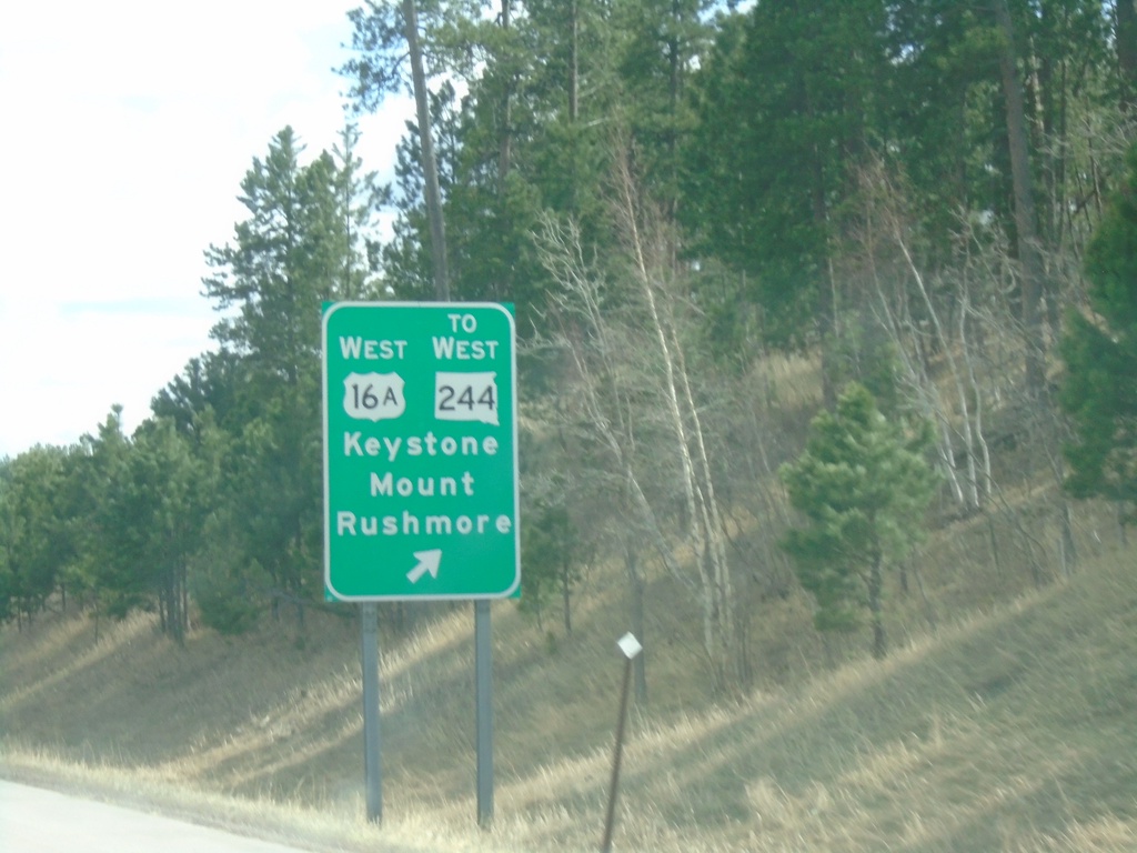
US-16 East at US-16A/To SD-244
US-16 East at US-16A West/To SD-244 West/Keystone/Mount Rushmore.
Taken 04-30-2022

 Rapid City
Pennington County
South Dakota
United States
Rapid City
Pennington County
South Dakota
United States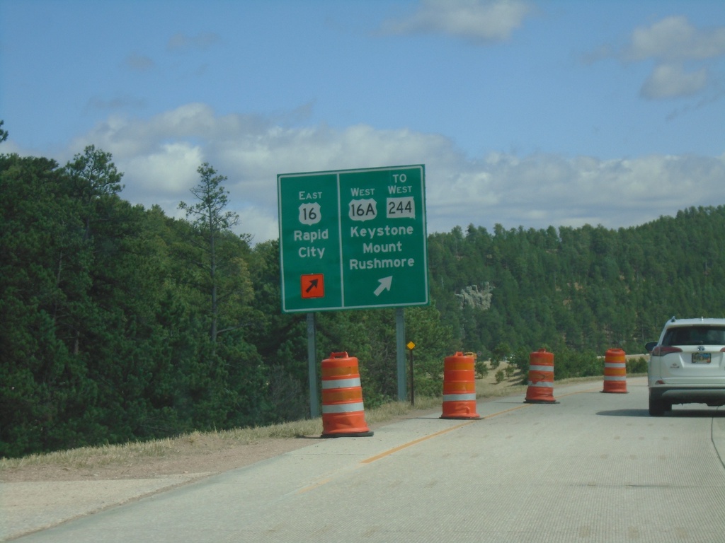
US-16 East at US-16A/To SD-244
US-16 East at US-16A/To SD-244/Keystone/Mount Rushmore. Continue east on US-16 for Rapid City.
Taken 04-30-2022
Keystone
Pennington County
South Dakota
United States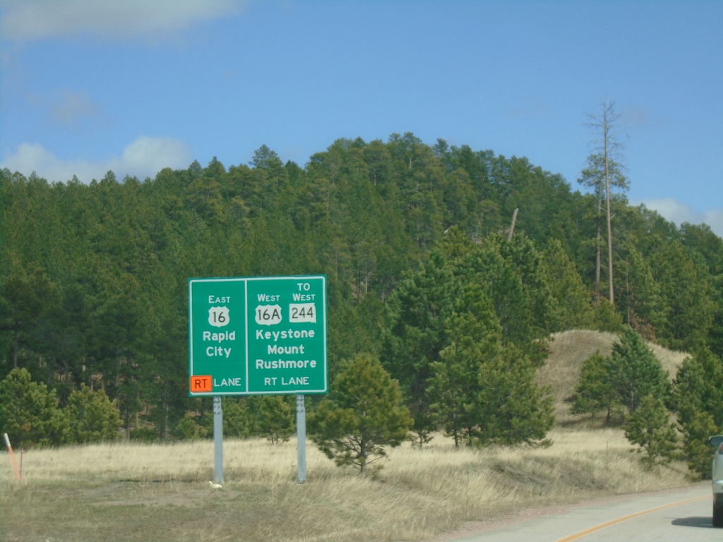
US-16 East Approaching US-16A/To SD-244
US-16 East Approaching US-16A/To SD-244 to Keystone and Mount Rushmore. Continue east on US-16 for Rapid City.
Taken 04-30-2022
Keystone
Pennington County
South Dakota
United States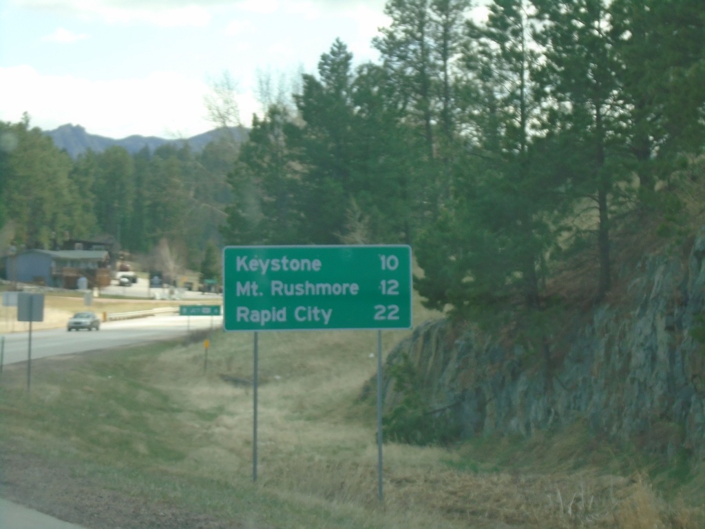
US-16 East - Distance Marker
Distance Marker on US-16 East. Distance to Keystone, Mount Rushmore, and Rapid City.
Taken 04-30-2022
Rapid City
Pennington County
South Dakota
United States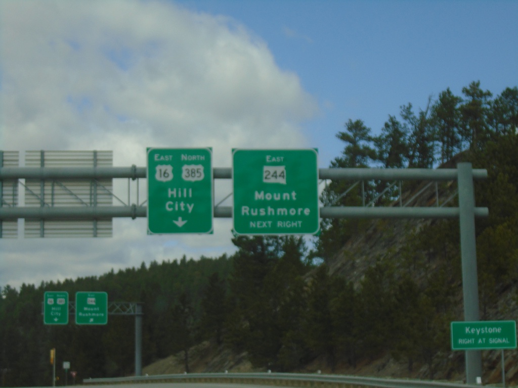
US-385 North/US-16 East at SD-244
US-385 North/US-16 East at SD-244 East to Mount Rushmore. Continue on US-385 North/US-16 East to Hill City.
Taken 04-30-2022
 Custer
Pennington County
South Dakota
United States
Custer
Pennington County
South Dakota
United States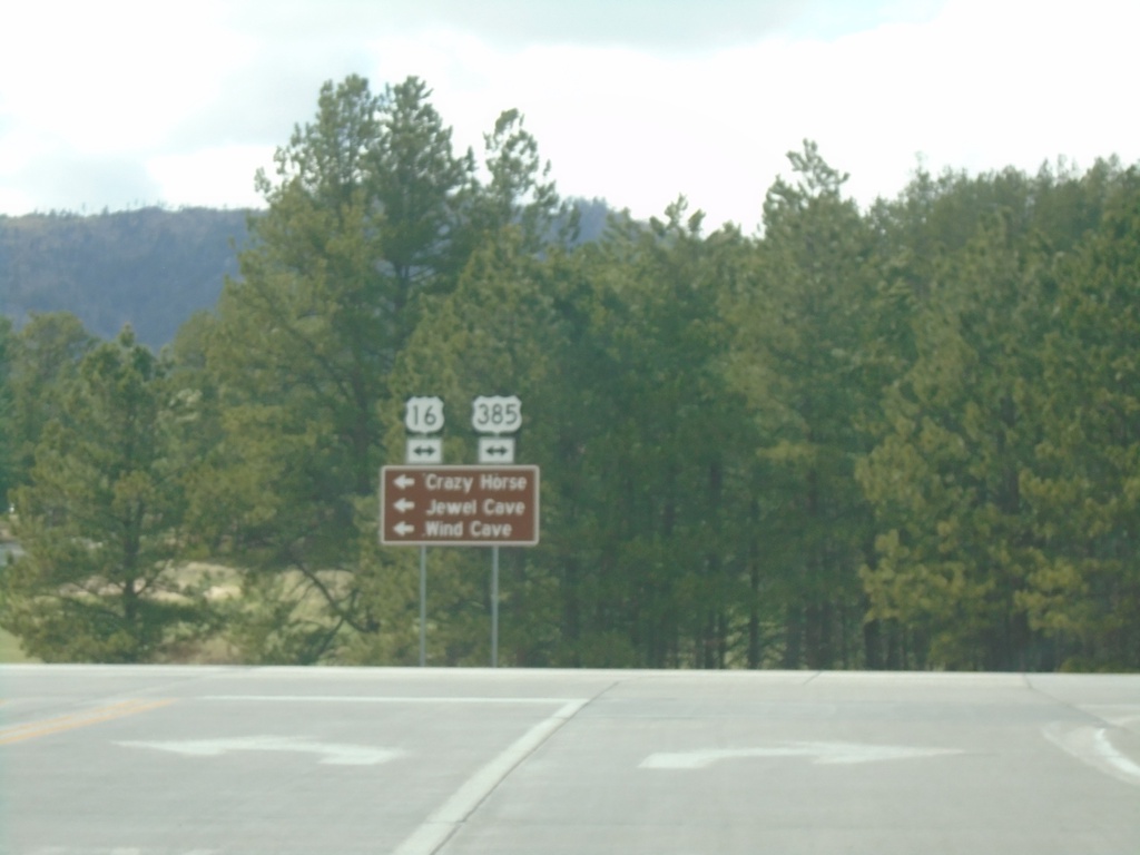
End SD-87 North at US-16/US-385
End SD-87 North at US-16/US-385. Use US-16 West/US-385 South to Crazy Horse, Jewel Cave, and Wind Cave.
Taken 04-30-2022
 Custer
Pennington County
South Dakota
United States
Custer
Pennington County
South Dakota
United States