Signs Tagged With Big Green Sign
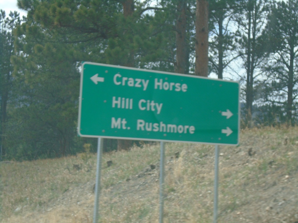
End SD-87 North at US-16/US-385
End SD-87 North at US-16/US-385 in Pennington County. Use US-16 East/US-385 North to Hill City and Mount Rushmore. Use US-16 West/US-385 South to Crazy Horse.
Taken 04-30-2022


 Custer
Pennington County
South Dakota
United States
Custer
Pennington County
South Dakota
United States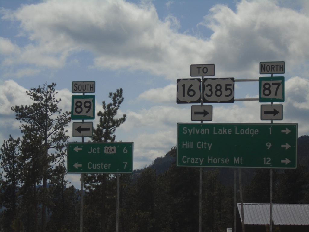
SD-87 North at SD-89
SD-87 North at SD-89 in Custer County. Use SD-89 South to Jct. US-16A and Custer. Use SD-87 North for US-16/US-385, Sylvan Lake Lodge, Hill City, and Crazy Horse Mountain.
Taken 04-30-2022

 Custer
 County
South Dakota
United States
Custer
Custer County
South Dakota
United States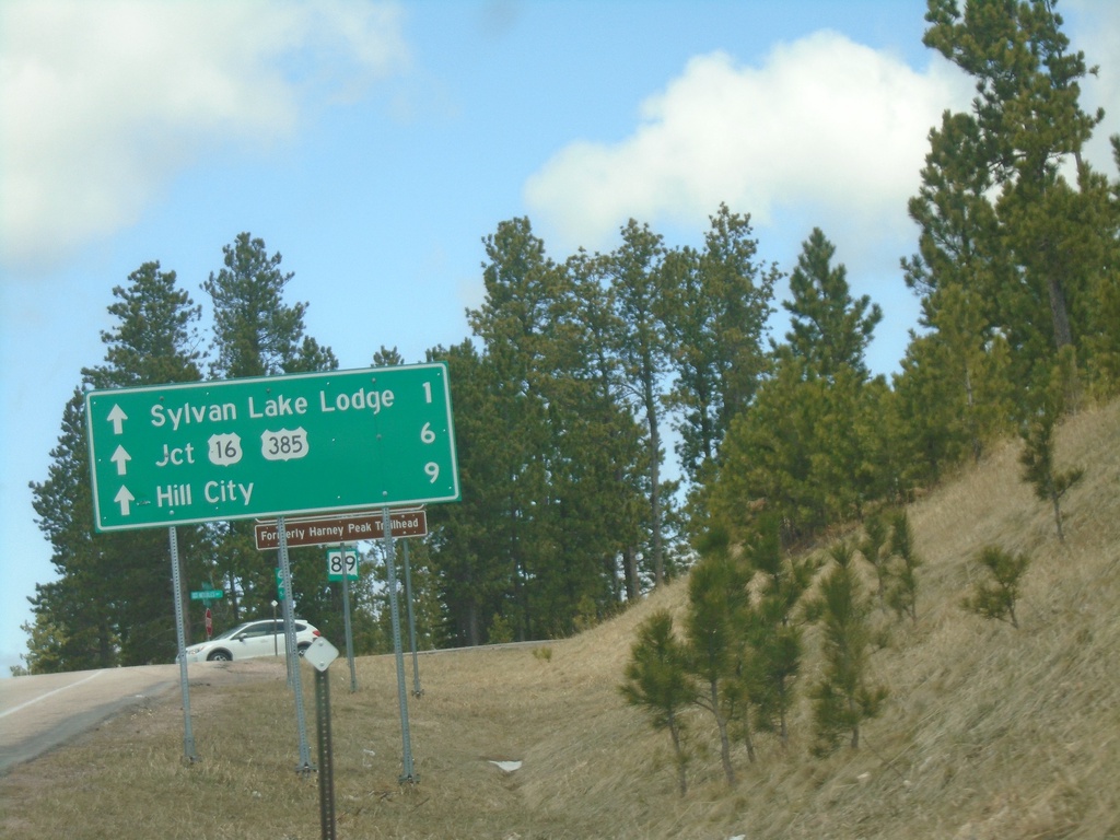
Distance Marker on SD-89 North Approaching SD-87
Distance Marker at end of SD-89 North approaching SD-87. Distance via SD-87 North to Sylvan Lake Lodge, Jct. US-16/US-385, and Hill City.
Taken 04-30-2022
Custer
Custer County
South Dakota
United States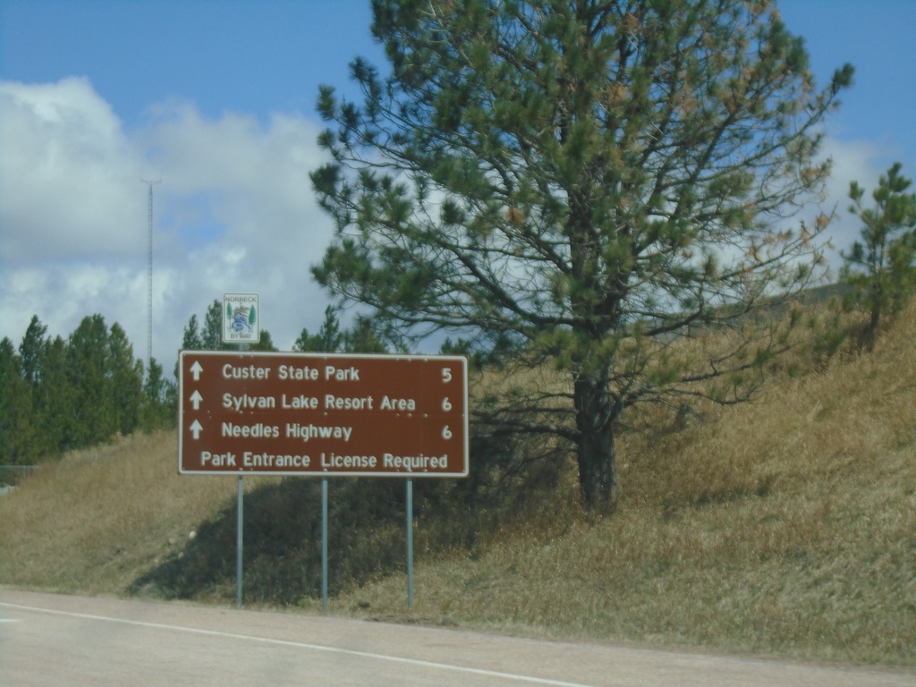
SD-89 North - Distance Marker
Distance marker on SD-89 (Sylvan Lake Road) North. Distance to Custer State Park, Sylvan Lake Resort Area, Needles Highway.
Taken 04-30-2022
Custer
Custer County
South Dakota
United States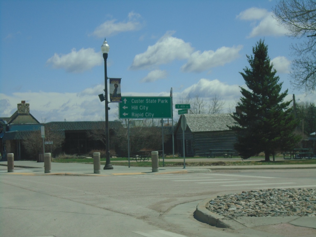
US-385/SD-89 North/US-16 East at US-16A
US-385/SD-89 North/US-16 East at US-16A in Custer. Use US-395 North/US-16 East to Hill City and Rapid City. Use US-16A East/SD-89 North to Custer State Park.
Taken 04-30-2022
Custer
Custer County
South Dakota
United States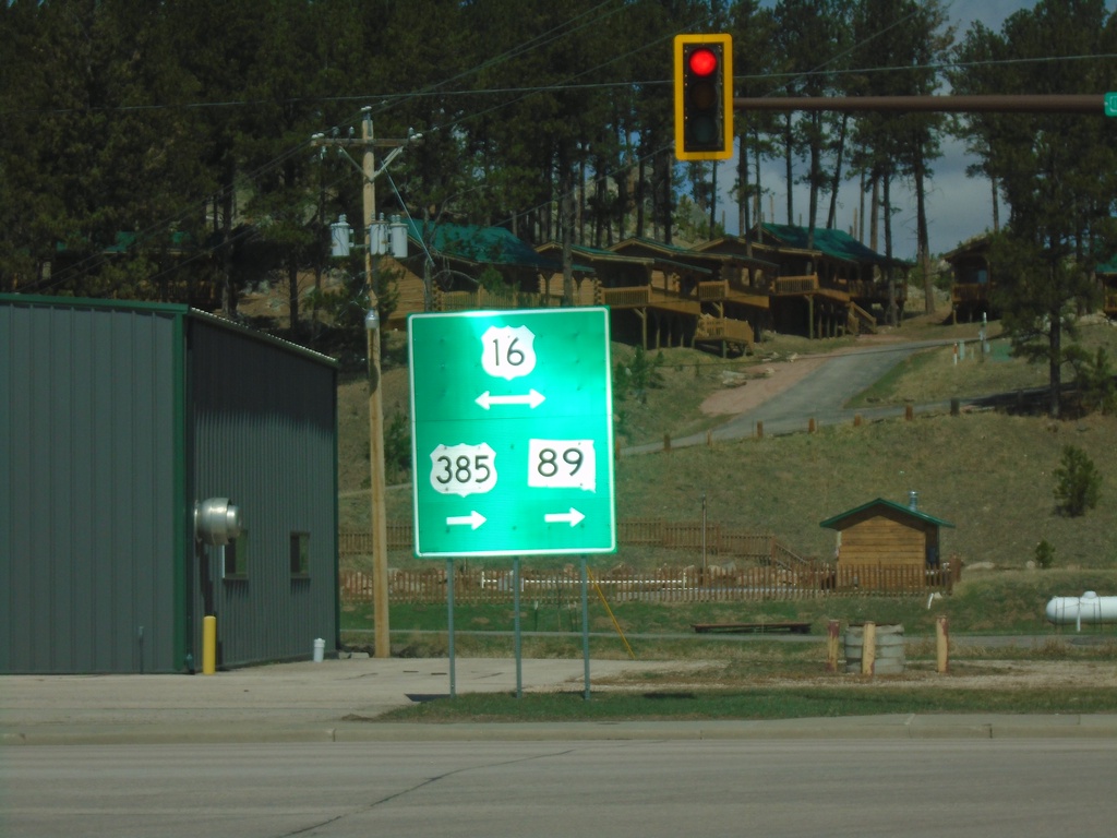
US-385/SD-89 North at US-16
US-385/SD-89 North at US-16 in Custer. US-385 north joins US-16 east through Hill City. SD-89 joins US-16 east through Custer.
Taken 04-30-2022
Custer
Custer County
South Dakota
United States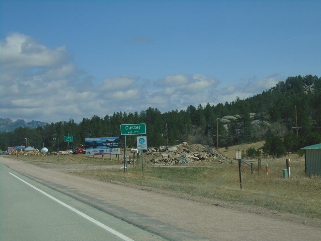
US-385/SD-89 North - Custer
Entering Custer on US-385/SD-89 North. Custer is the county seat of Custer County.
Taken 04-30-2022
Custer
Custer County
South Dakota
United States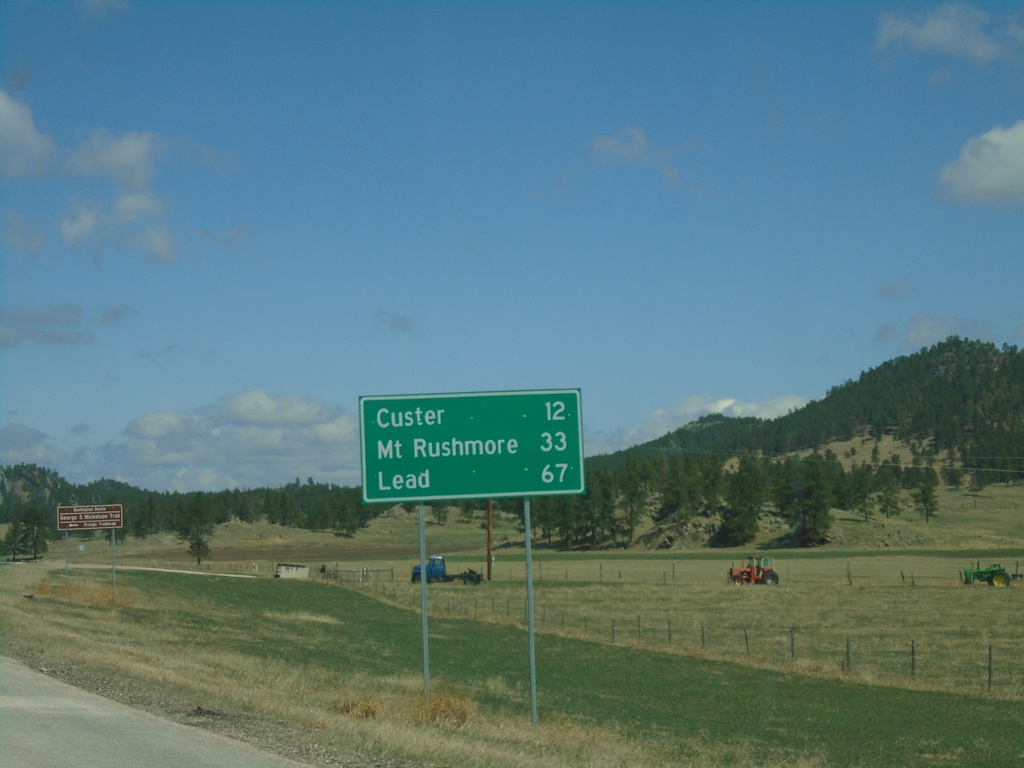
US-385/SD-89 North - Distance Marker
Distance marker on US-385/SD-89 North. Distance to Custer, Mount Rushmore, and Lead.
Taken 04-30-2022
Pringle
Custer County
South Dakota
United States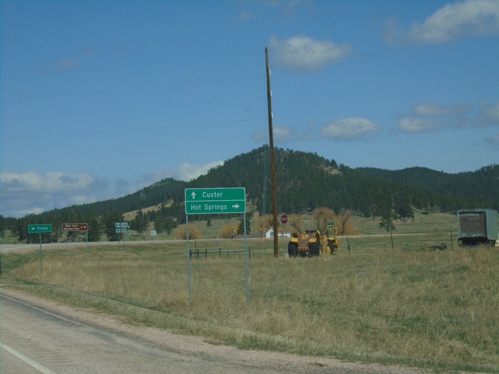
SD-89 North at US-385
SD-89 North at US-385 in Pringle. Use US-385 south to Hot Springs; US-385/SD-89 North to Custer.
Taken 04-30-2022
Pringle
Custer County
South Dakota
United States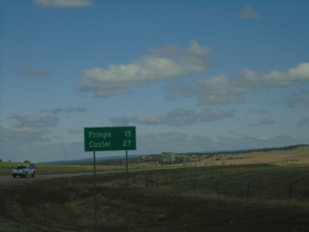
SD-89 North - Distance Marker
Distance marker on SD-89 North. Distance to Pringle and Custer.
Taken 04-30-2022
Hot Springs
Fall River County
South Dakota
United States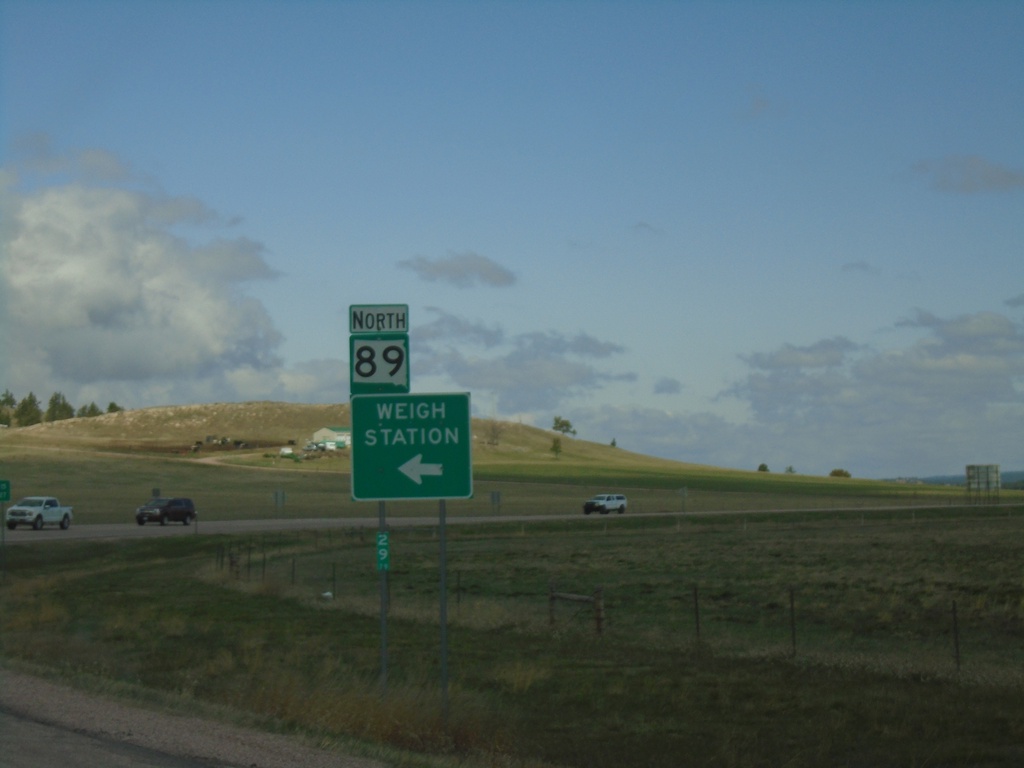
SD-89 North - Weigh Station
SD-89 north at Weigh Station entrance.
Taken 04-30-2022
Hot Springs
Fall River County
South Dakota
United States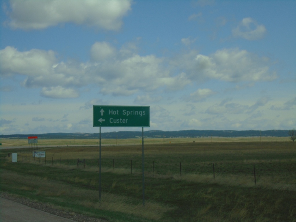
US-18 East at SD-89 North
US-18 East at SD-89 North to Custer. Continue east on US-18 for Hot Springs.
Taken 04-30-2022
 Hot Springs
Fall River County
South Dakota
United States
Hot Springs
Fall River County
South Dakota
United States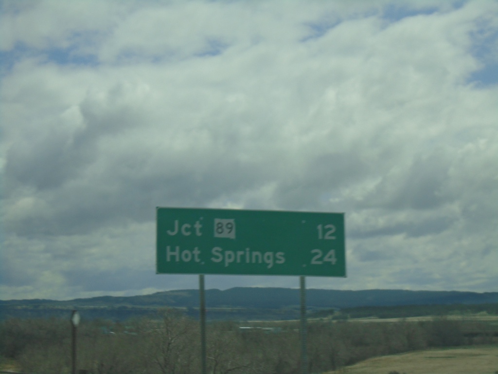
US-18 East - Distance Marker
Distance marker on US-18 east. Distance to SD-89, and Hot Springs.
Taken 04-30-2022
Edgemont
Fall River County
South Dakota
United States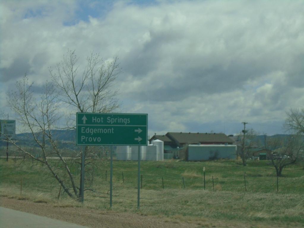
US-18 East Approaching SD-471
US-18 East approaching SD-471 south to Edgemont and Provo. Continue east on US-18 for Hot Springs.
Taken 04-30-2022
 Edgemont
Fall River County
South Dakota
United States
Edgemont
Fall River County
South Dakota
United States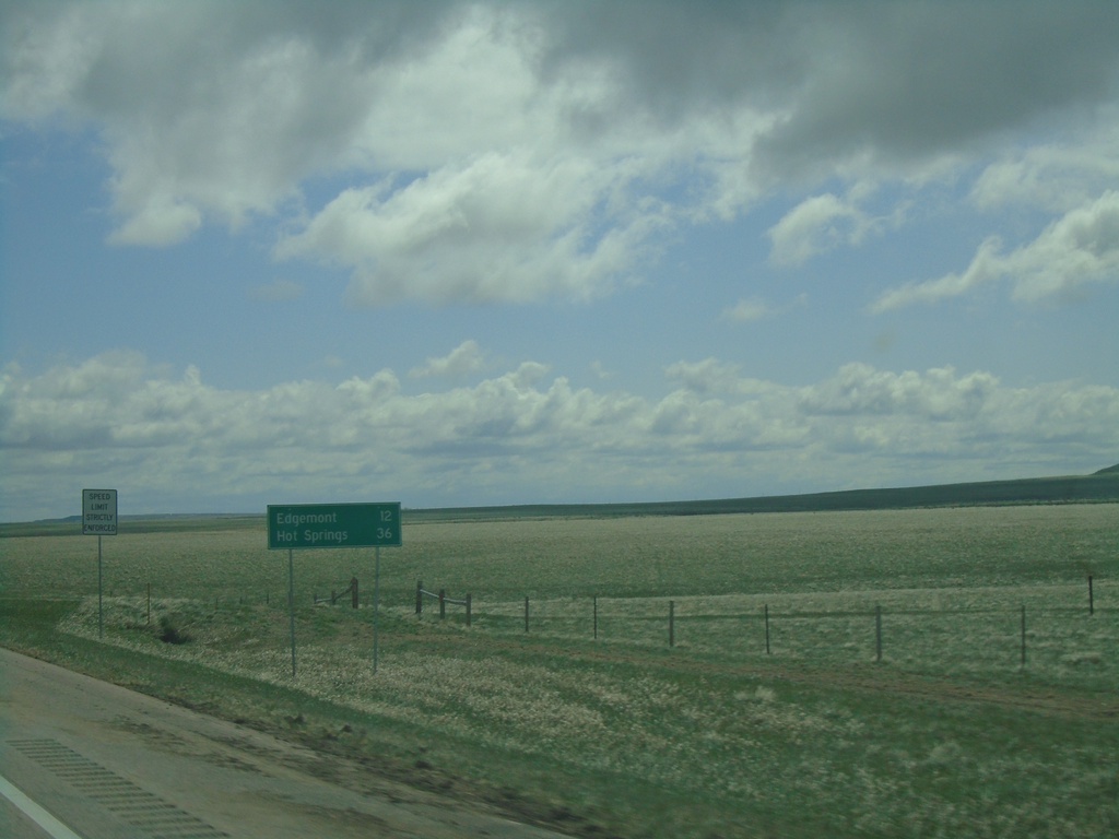
US-18 East - Distance Marker
Distance marker on US-18 east. Distance to Edgemont and Hot Springs. This is the first distance marker on US-18 in South Dakota.
Taken 04-30-2022
Edgemont
Fall River County
South Dakota
United States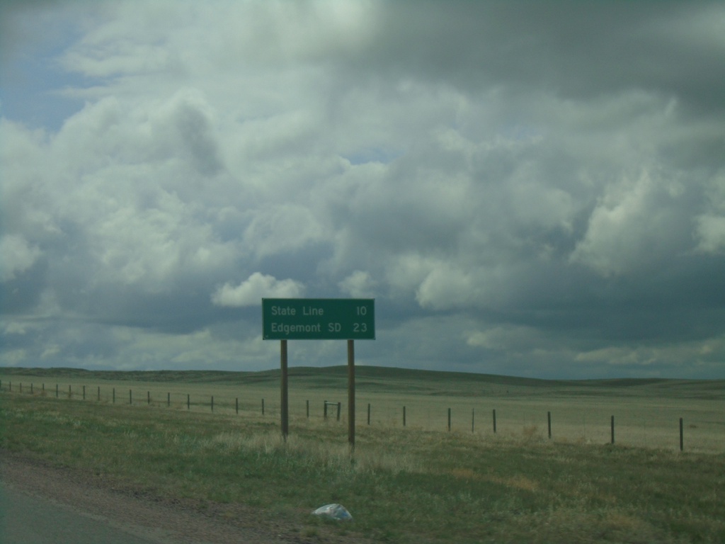
US-18 East - Distance Marker
Distance marker on US-18 east. Distance to State Line (South Dakota) and Edgemont SD.
Taken 04-30-2022
Lusk
Niobrara County
Wyoming
United States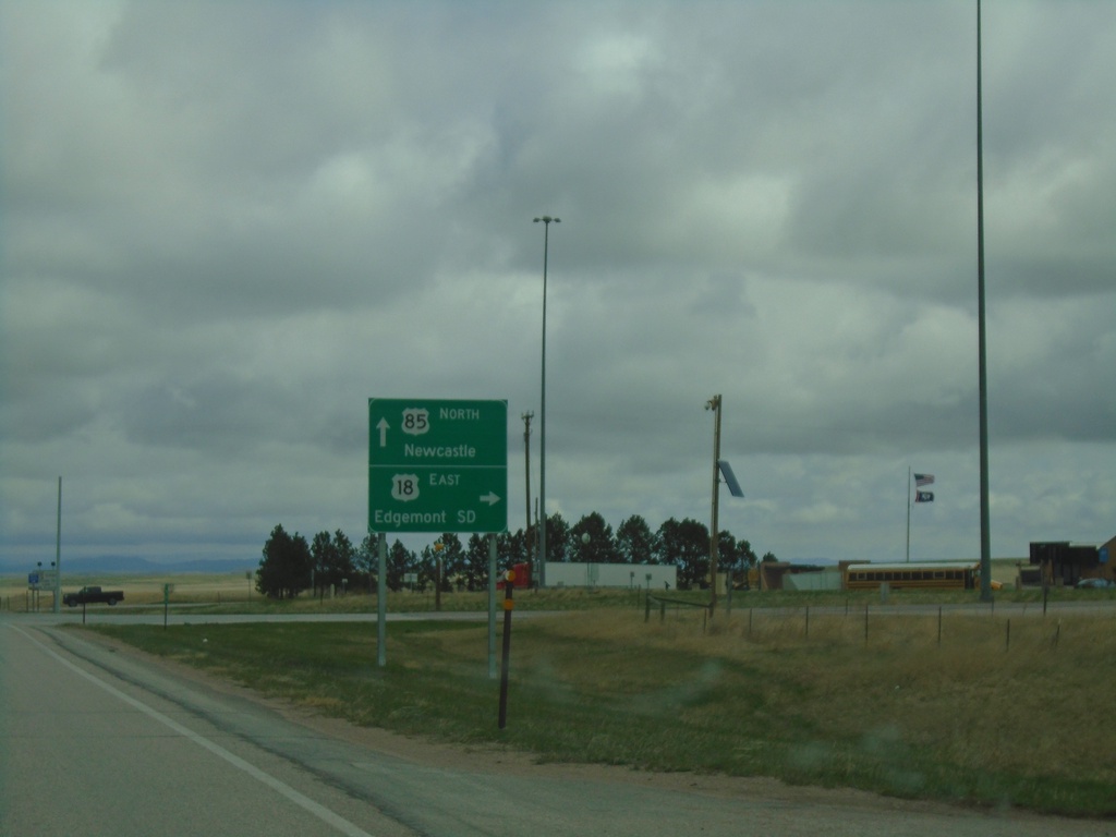
US-18 East/US-85 North - Mule Creek Junction
US-18 East/US-85 North at Mule Creek Junction. Turn right for US-18 East to Edgemont, SD. Continue north on US-85 for Newcastle.
Taken 04-30-2022
 Lusk
Niobrara County
Wyoming
United States
Lusk
Niobrara County
Wyoming
United States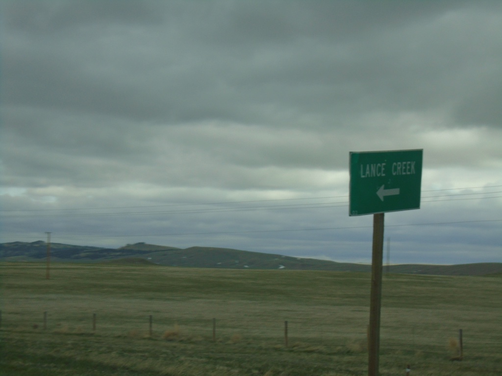
US-18 East/US-85 North at WY-270
US-18 East/US-85 North at WY-270 south to Lance Creek.
Taken 04-30-2022
 Lusk
Niobrara County
Wyoming
United States
Lusk
Niobrara County
Wyoming
United States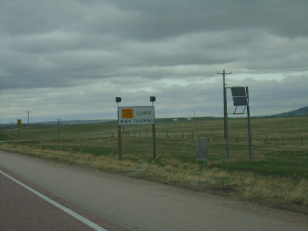
US-85 North/US-18 East Approaching WY-270
US-85 North/US-18 East approaching WY-270. WY-270 is closed when lights flashing.
Taken 04-30-2022
Lusk
Niobrara County
Wyoming
United States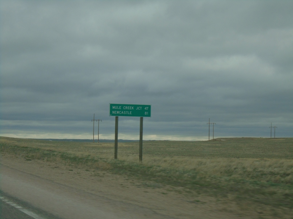
US-18 East/US-85 North - Distance Marker
Distance Marker on US-18 East/US-85 North. Distance to Mule Creek Junction and Newcastle.
Taken 04-30-2022
Lusk
Niobrara County
Wyoming
United States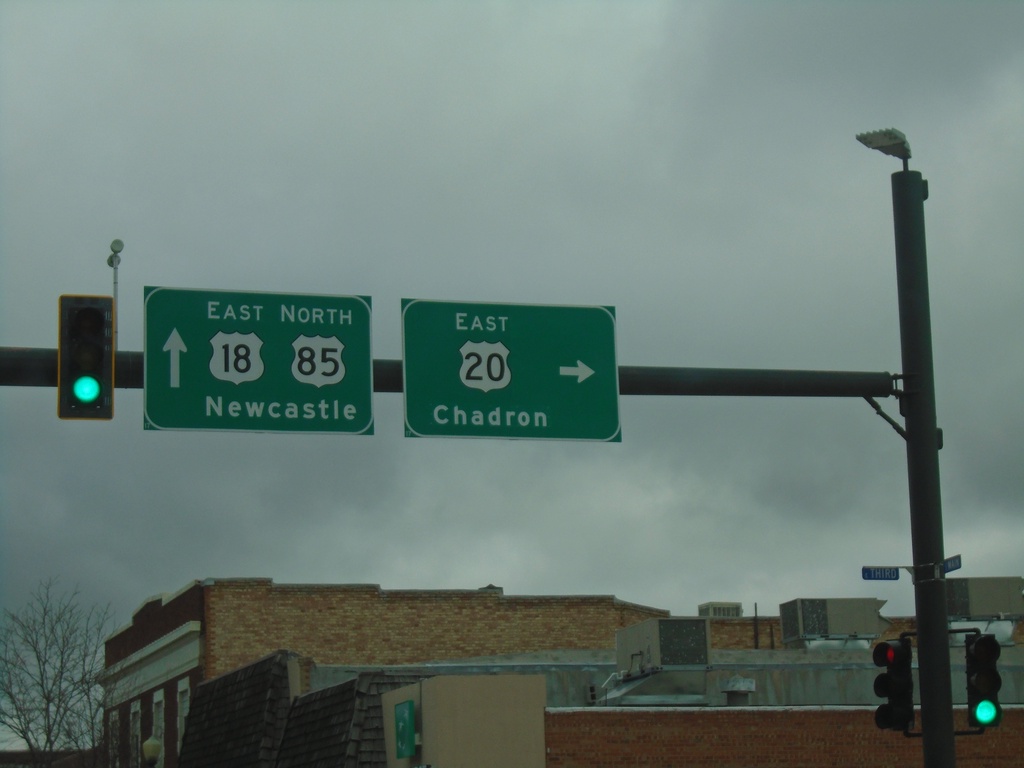
US-18/US-20 East/US-85 North at US-20
US-18/US-20 East/US-85 North at US-20 East in Lusk. Continue on US-85 North/US-18 East for Newcastle; turn right for US-20 east to Chadron (Nebraska).
Taken 04-30-2022
 Lusk
Niobrara County
Wyoming
United States
Lusk
Niobrara County
Wyoming
United States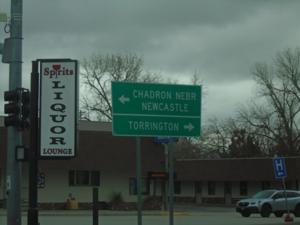
US-18/US-20 East at US-85
US-18/US-20 East at US-85 in Lusk. Use US-85 south to Torrington; US-85 North/US-20/US-18 East to Chadron, Nebraska (via US-20) and Newcastle (via US-85 North). US-85 joins US-20/US-18 East through Lusk.
Taken 04-30-2022
Lusk
Niobrara County
Wyoming
United States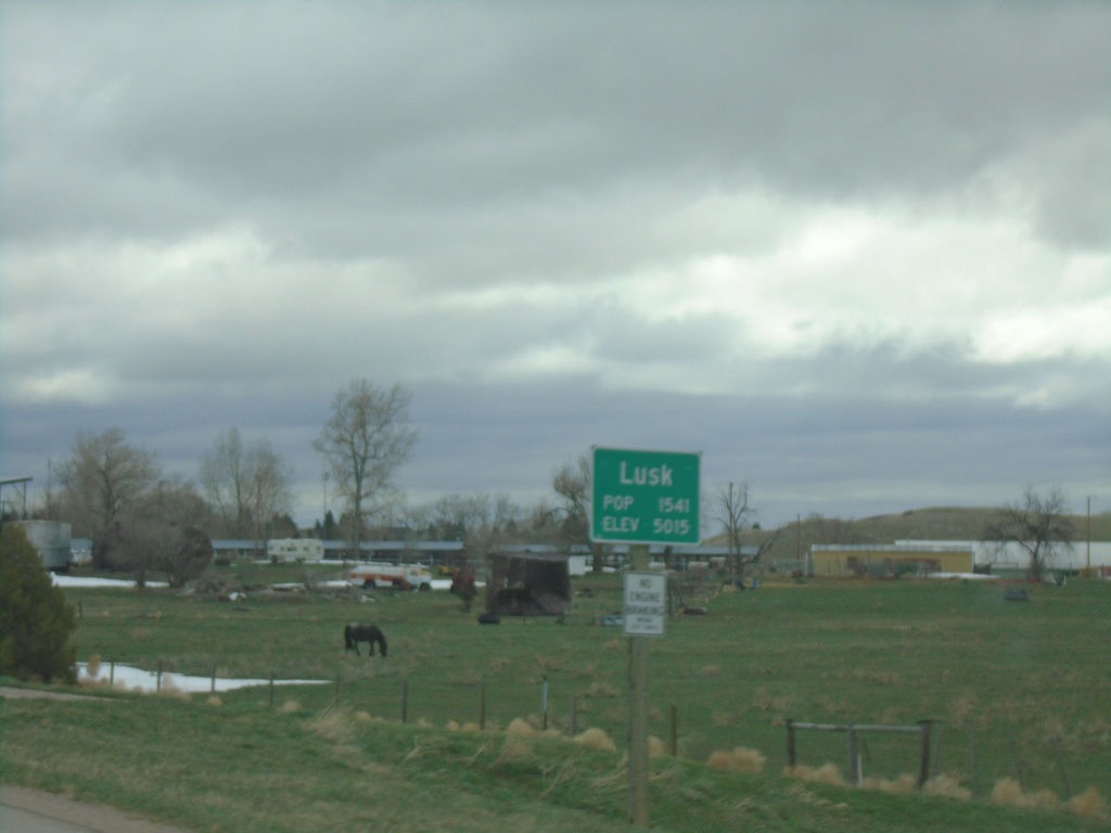
US-18/US-20 West - Lusk
Entering Lusk on US-18/US-20 West. Lusk is the county seat of Niobrara County.
Taken 04-30-2022
Lusk
Niobrara County
Wyoming
United States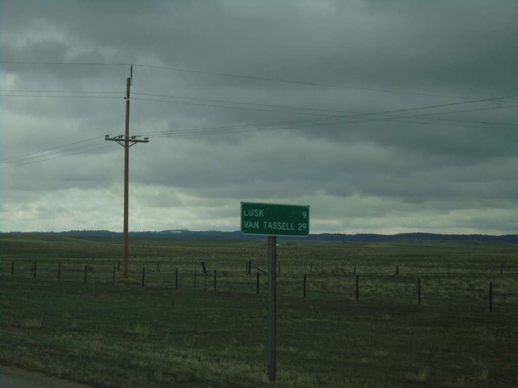
US-18/US-20 East - Distance Marker
Distance Marker on US-18/US-20 East. Distance to Lusk and Van Tassell (via US-20).
Taken 04-30-2022
Lusk
Niobrara County
Wyoming
United States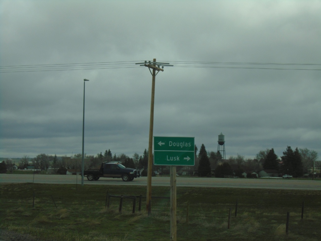
WY-270 North at US-18/US-20
WY-270 North at US-18/US-20 in Manville. Use US-18/US-20 East to Lusk; US-18/US-20 West to Douglas (via I-25).
Taken 04-30-2022
Manville
Niobrara County
Wyoming
United States