Signs Tagged With Big Green Sign
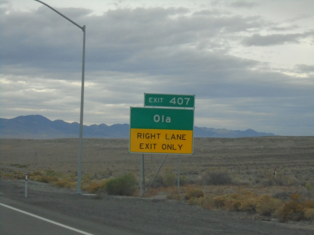
I-80 West - Exit 407
I-80 west approaching Exit 407 - Ola.
Taken 10-25-2025

 West Wendover
Elko County
Nevada
United States
West Wendover
Elko County
Nevada
United States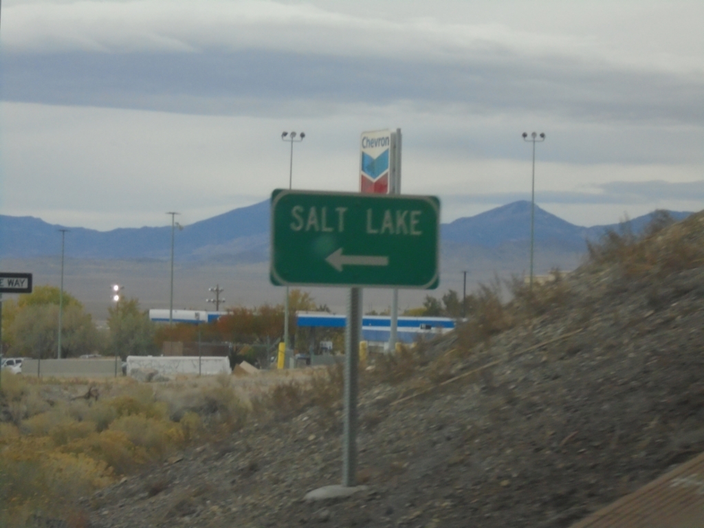
US-93 Alt. South at I-80 East Onramp
US-93 Alt. South at I-80 East (Exit 410) Onramp to Salt Lake (Utah).
Taken 10-25-2025
 West Wendover
Elko County
Nevada
United States
West Wendover
Elko County
Nevada
United States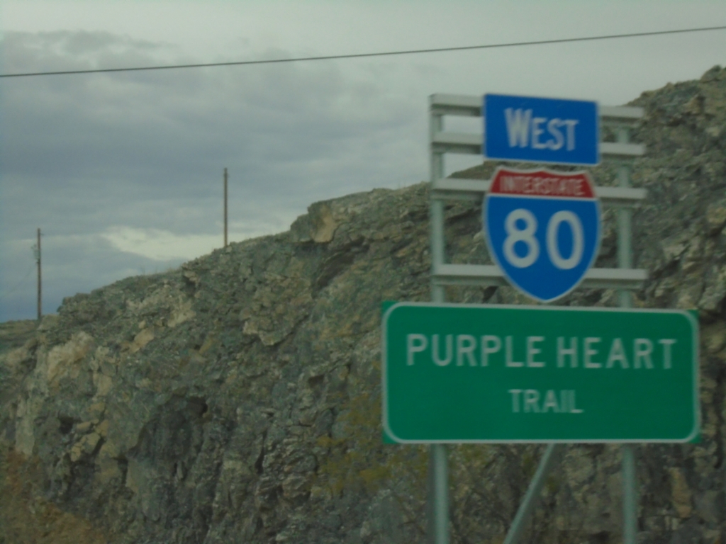
I-80 West - Purple Heart Trail
I-80 West - Purple Heart Trail in West Wendover, Nevada. This is the first I-80 shield westbound in Nevada.
Taken 10-25-2025
West Wendover
Elko County
Nevada
United States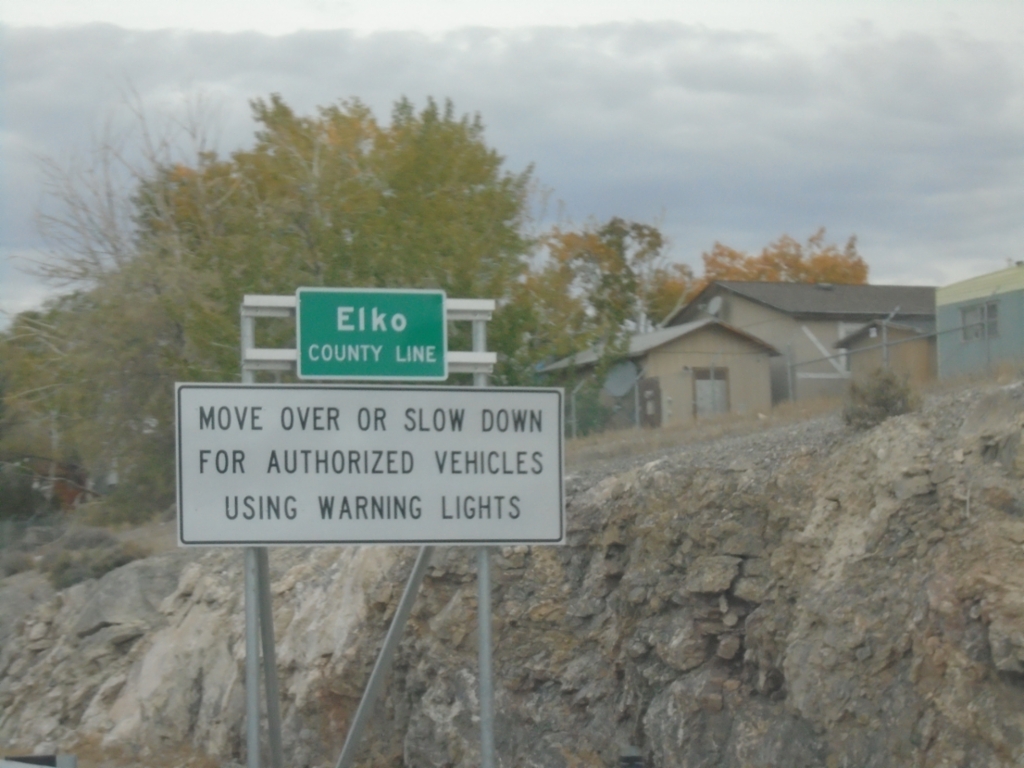
I-80 West - Elko County Line / Emergency Vehicle Law
Elko County Line on I-80 west at the Nevada-Utah state line. Move over or slow down for authorized vehicles using warning lights.
Taken 10-25-2025
West Wendover
Elko County
Nevada
United States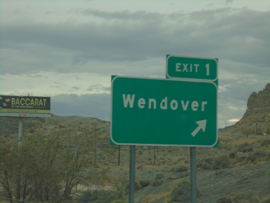
I-80 West - Exit 1
I-80 west at Exit 1 - Wendover. This is the last Utah exit on I-80 westbound.
Taken 10-25-2025
Wendover
Tooele County
Utah
United States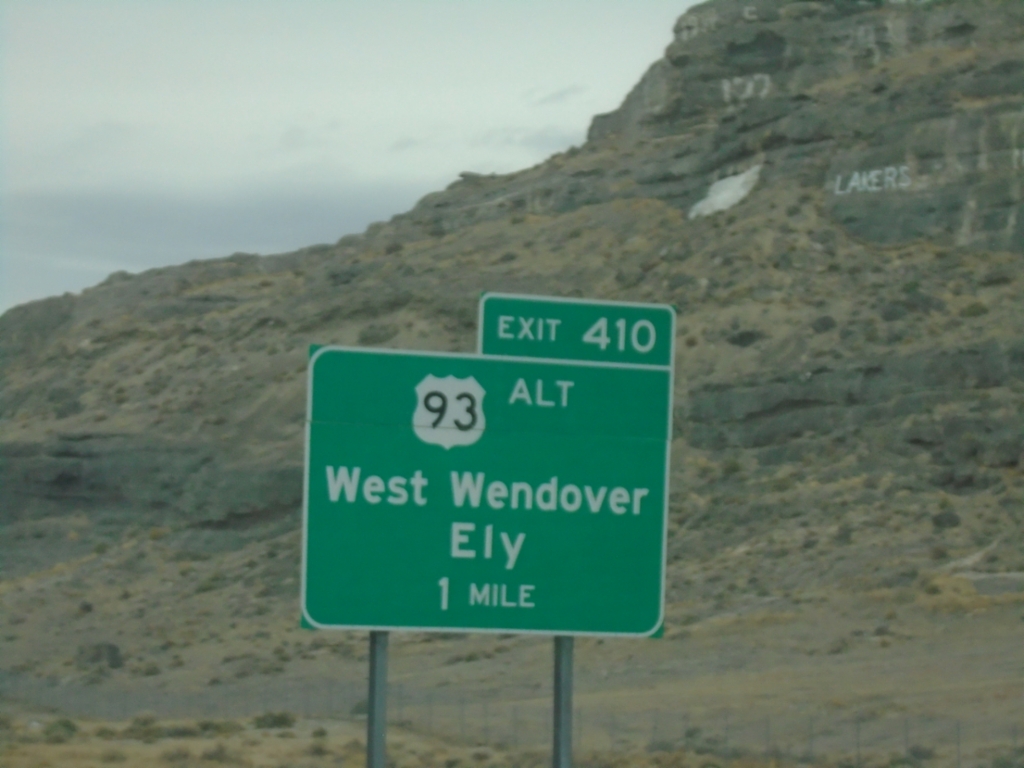
I-80 West Exit 410 (Nevada Exit)
I-80 before the Utah-Nevada stateline at Exit 410 - US-93 Alt/West Wendover/Ely. Exit 410 is a Nevada Interchange
Taken 10-25-2025
Wendover
Tooele County
Utah
United States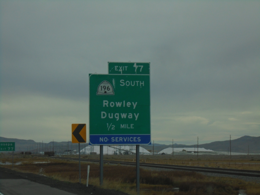
I-80 West - Exit 77
I-80 west approaching Exit 77 - UT-196 South/Rowley/Dugway.
Taken 10-25-2025
 Dugway
Tooele County
Utah
United States
Dugway
Tooele County
Utah
United States
End UT-179 North - Exit 3A-B
End UT-179 North (Midvalley Highway) at I-80. Exit 3B - I-80 East/Salt Lake City; Exit 3A - I-80 West/Reno (Nevada).
Taken 10-25-2025
 Tooele County
Utah
United States
Tooele County
Utah
United States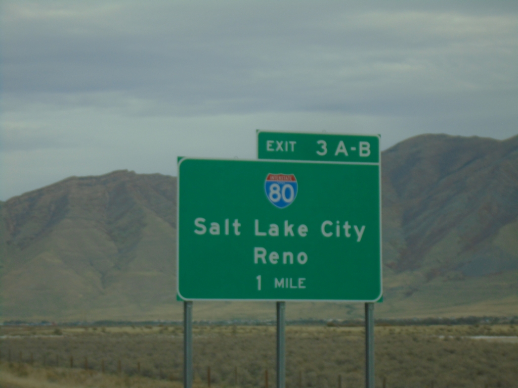
UT-179 North - Exit 3
UT-179 North (Midvalley Highway) approaching Exit 3A-B - I-80/Salt Lake City/Reno (Nevada).
Taken 10-25-2025
Tooele County
Utah
United States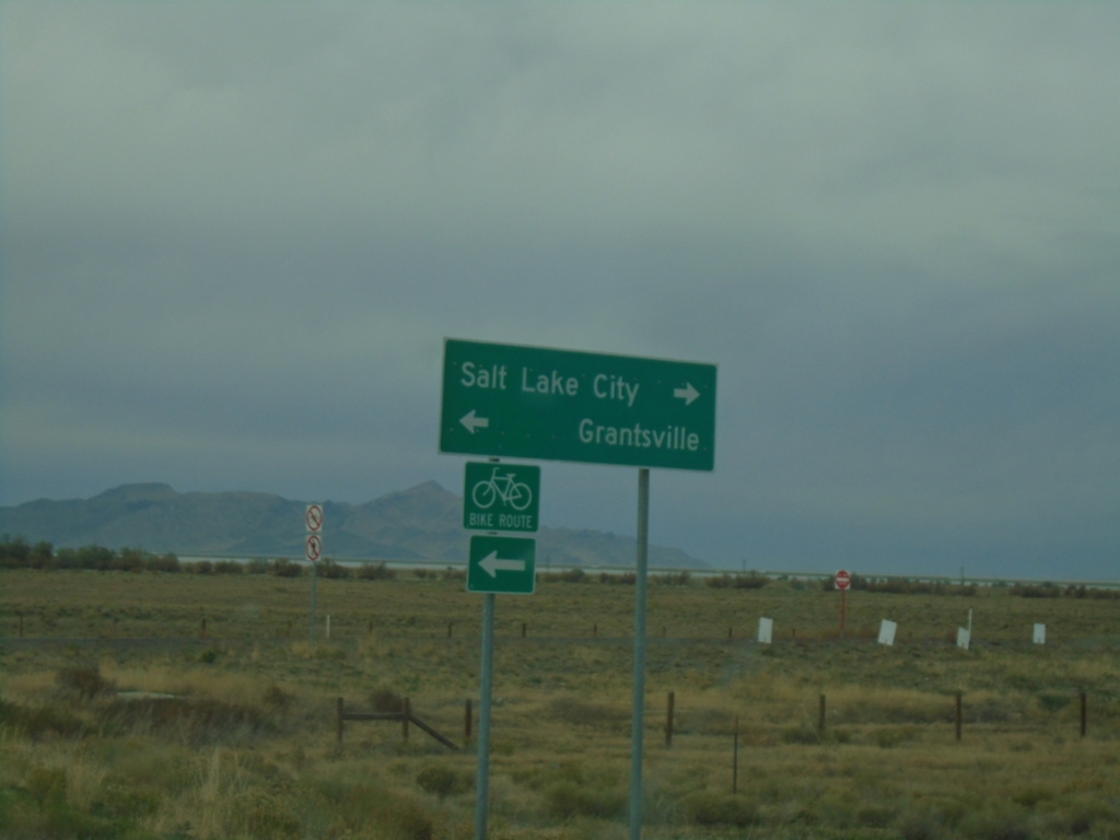
Pole Canyon Road at Midvalley Highway
Pole Canyon Road at Midvalley Highway junction. Turn right for UT-179 North to Salt Lake City; left for UT-138 west to Grantsville.
Taken 10-25-2025
 Tooele
 County
Utah
United States
Tooele
Tooele County
Utah
United States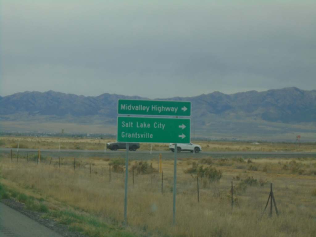
Pole Canyon Road at UT-138/UT-179 Access Road
Pole Canyon Road at access road to UT-138/UT-179. Turn right for Midvalley Highway, Salt Lake City and Grantsville.
Taken 10-25-2025
Tooele
Tooele County
Utah
United States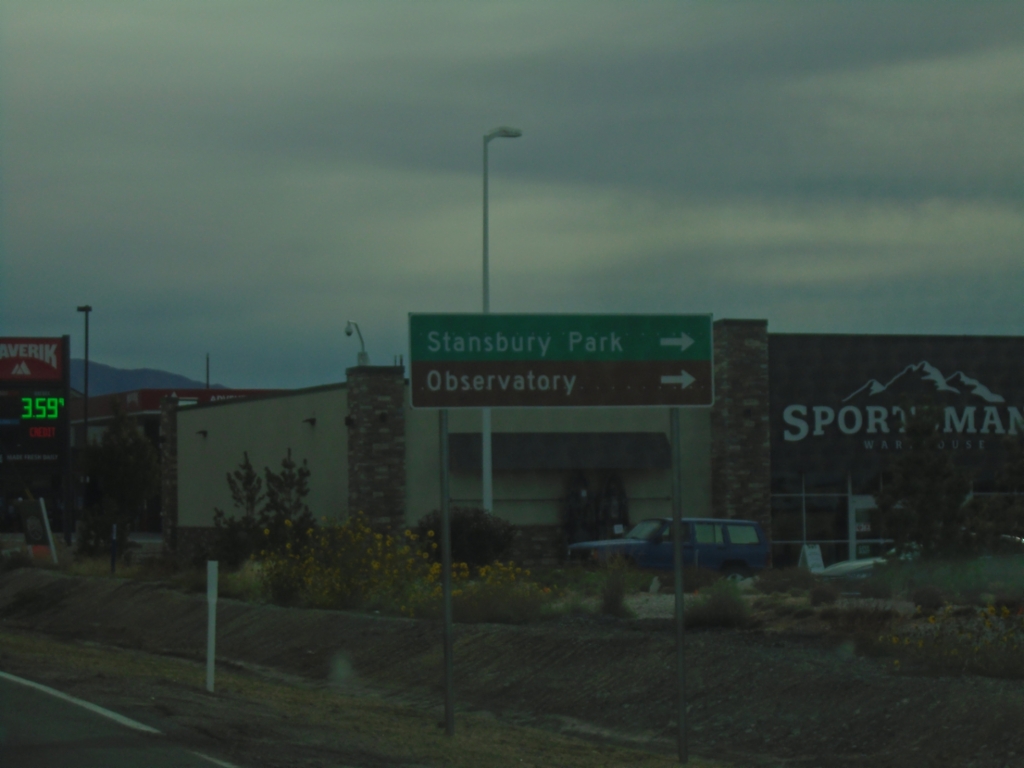
UT-36 South at Village Drive
UT-36 south at Village Drive in Stansbury Park. Turn right for Stansbury Park and Observatory (Stansbury Park Observatory Complex).
Taken 10-25-2025
 Tooele
 County
Utah
United States
Tooele
Tooele County
Utah
United States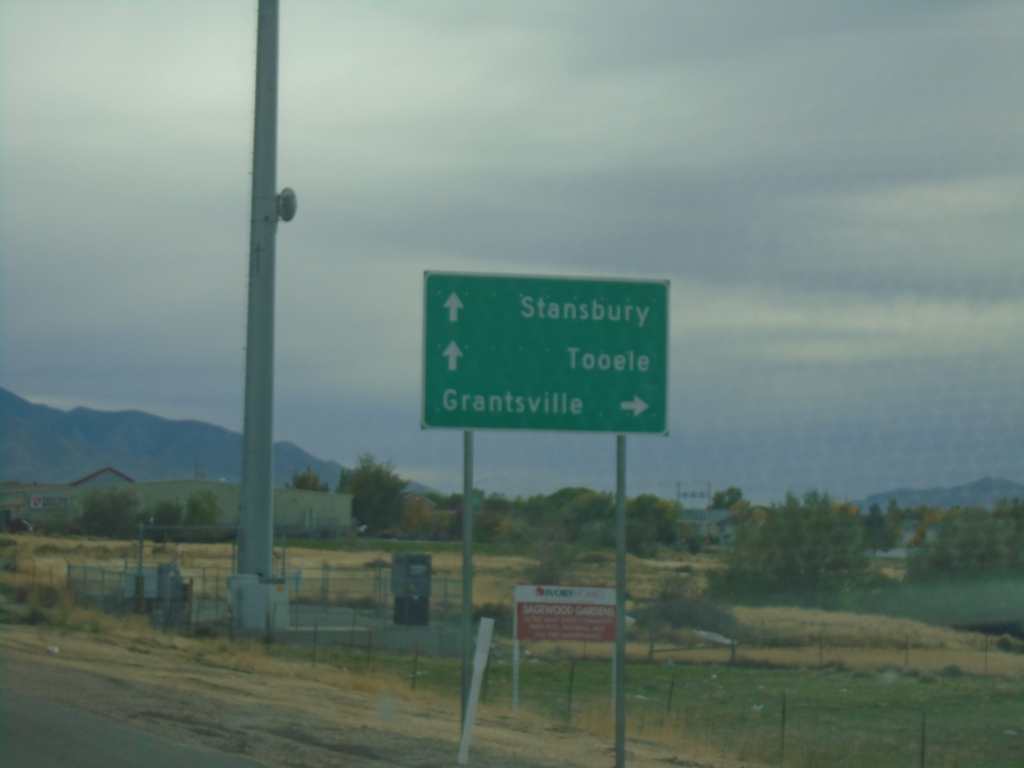
UT-36 South - Pole Canyon Road
UT-36 south at Pole Canyon Road (former UT-138) junction. Use Pole Canyon Road west to Grantsville. Continue south on UT-36 for Stansbury and Tooele.
Taken 10-25-2025
Stansbury Park
Tooele County
Utah
United States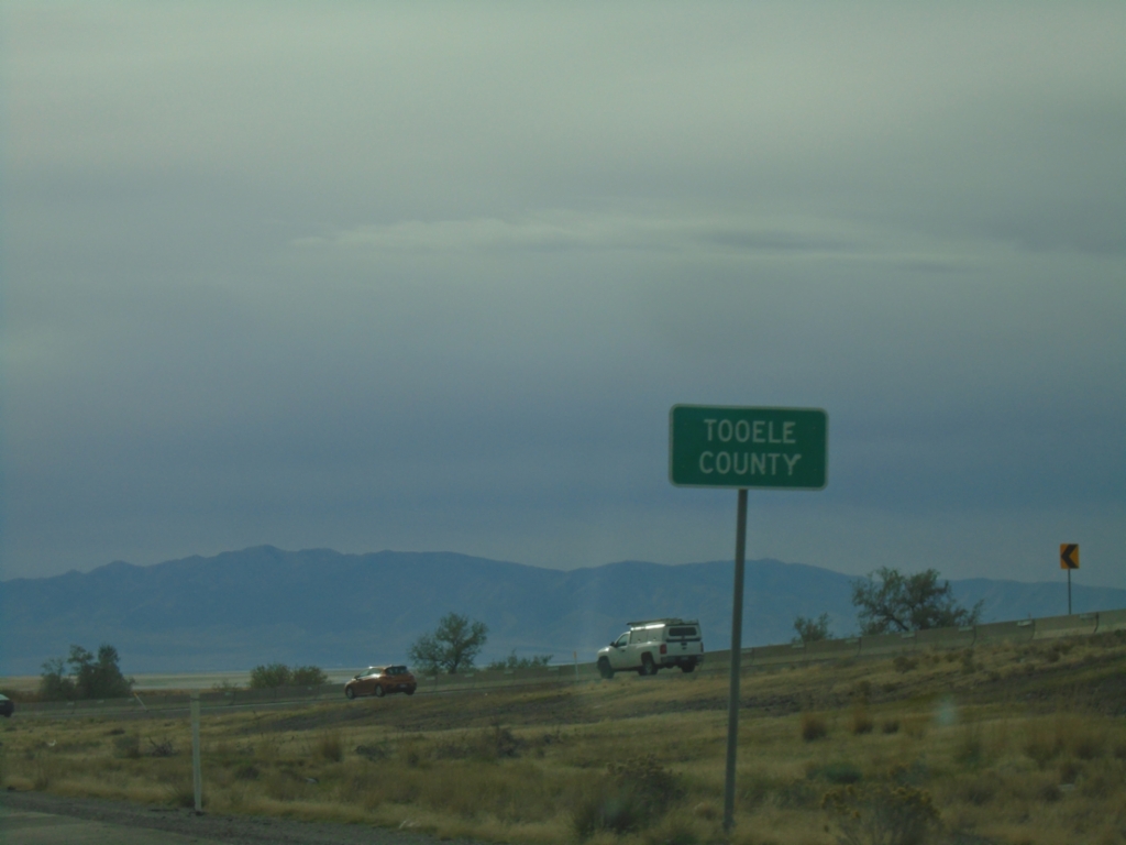
I-80 East - Tooele County
Tooele County on I-80 east.
Taken 10-25-2025
Tooele County
Utah
United States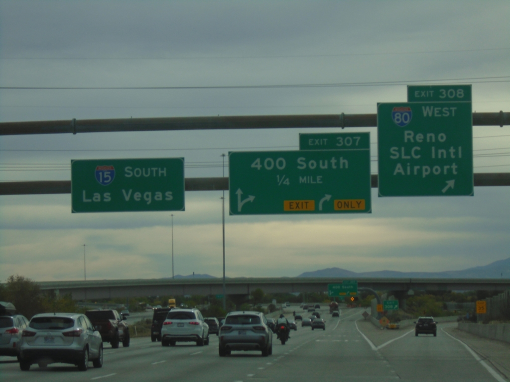
I-15 South - Exits 308 and 307
I-15 south at Exit 308 - I-80 West/Reno (Nevada)/Salt Lake City International Airport. I-15 south approaching Exit 307 - 400 South. I-15 South/Las Vegas (Nevada) overhead.
Taken 10-25-2025
 Salt Lake City
Salt Lake County
Utah
United States
Salt Lake City
Salt Lake County
Utah
United States
I-15 South - Exits 308 and 307
I-15 south approaching Exit 308 - I-80 West/Reno and Exit 307 - 400 South.
Taken 10-25-2025
Salt Lake City
Salt Lake County
Utah
United States
I-15 South - Exit 308
I-15 south approaching Exit 308 - I-80 West/Reno (Nevada)/Salt Lake City International Airport.
Taken 10-25-2025
Salt Lake City
Salt Lake County
Utah
United States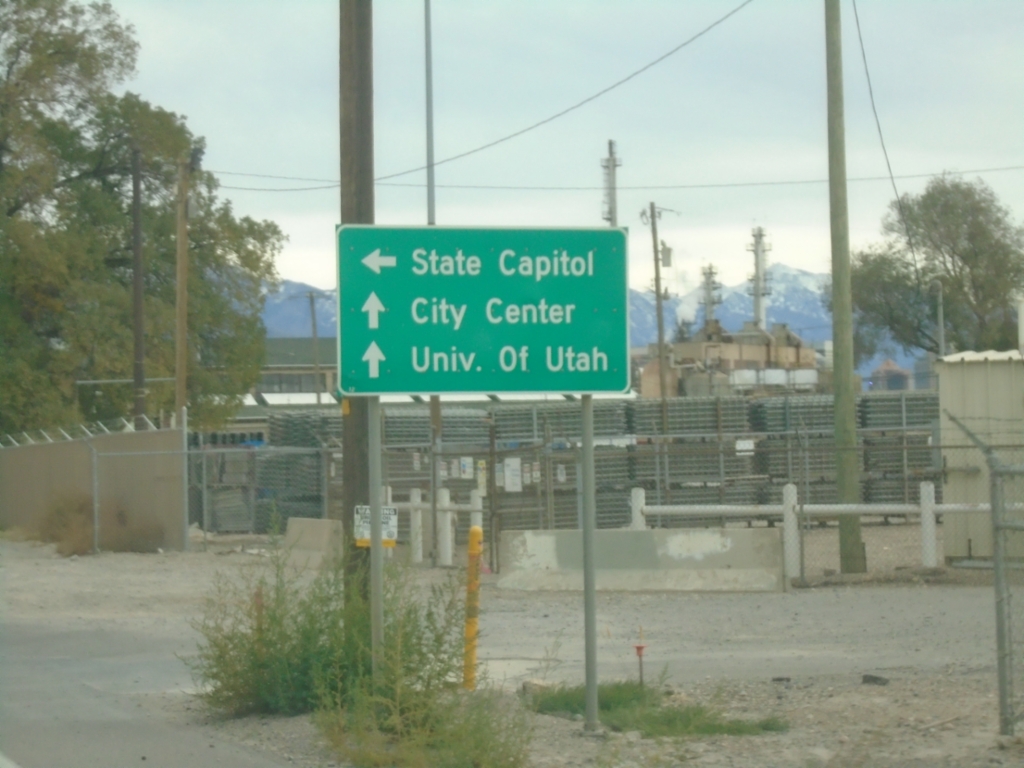
US-89 South at UT-186
US-89 South (Beck St.) at UT-186 (Victory Road) to State Capitol. Continue south on US-89 for (Salt Lake) City Center and University of Utah.
Taken 10-25-2025

 Salt Lake City
Salt Lake County
Utah
United States
Salt Lake City
Salt Lake County
Utah
United States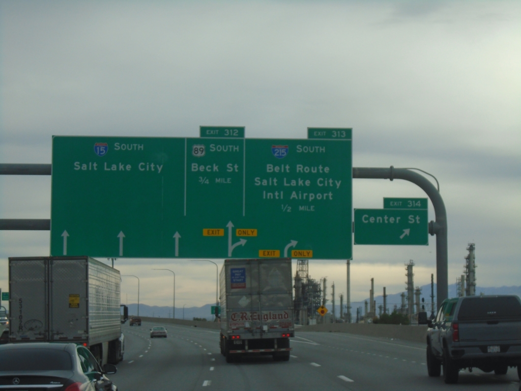
I-15 South - Exits 314, 313, and 312
I-15 south at Exit 314 - Center St. Approaching Exit 313 - I-215 South/Belt Route/Salt Lake City International Airport. Approaching Exit 312 - US-89 South/Beck St. I-15 continues south to Salt Lake City.
Taken 10-25-2025
 North Salt Lake
Davis County
Utah
United States
North Salt Lake
Davis County
Utah
United States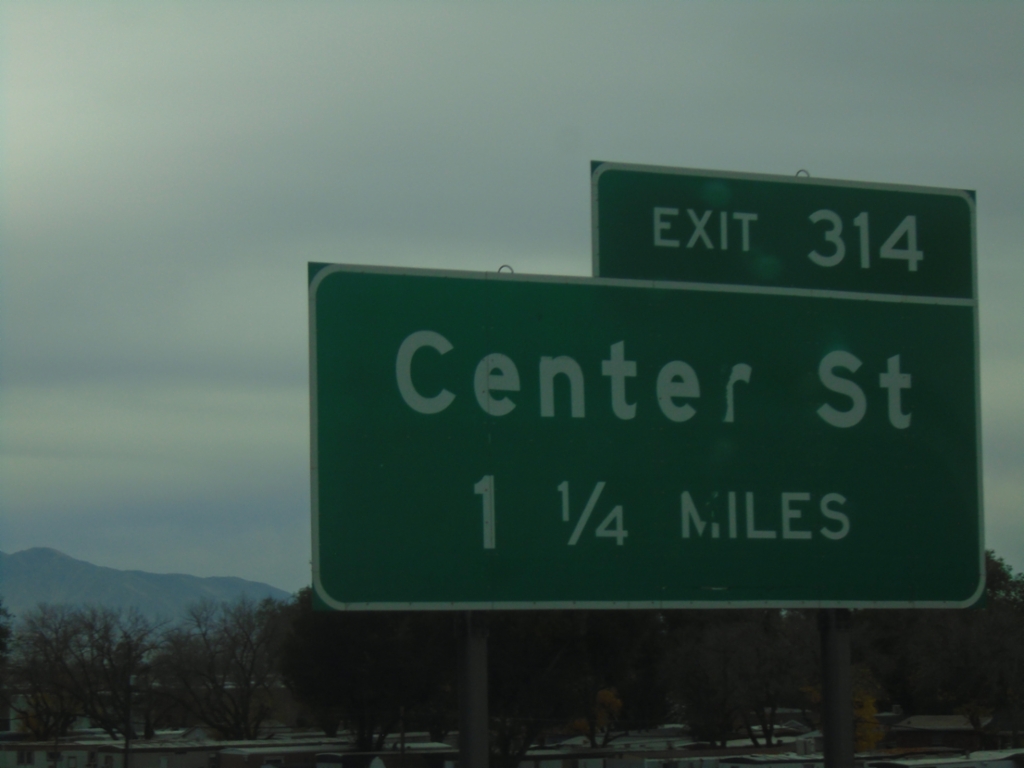
I-15 South - Exit 314
I-15 south approaching Exit 314 - Center St.
Taken 10-25-2025
North Salt Lake
Davis County
Utah
United States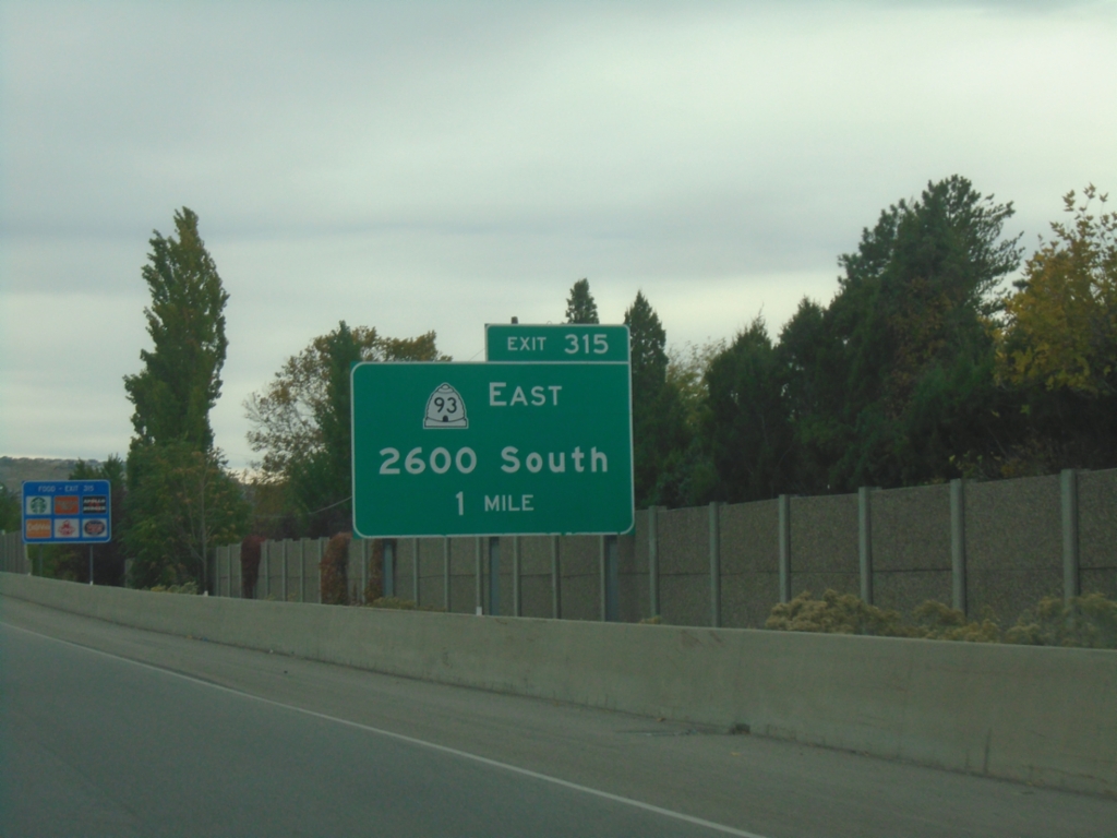
I-15 South - Exit 315
I-15 south approaching Exit 315 - UT-93/2600 South.
Taken 10-25-2025
 Woods Cross
Davis County
Utah
United States
Woods Cross
Davis County
Utah
United States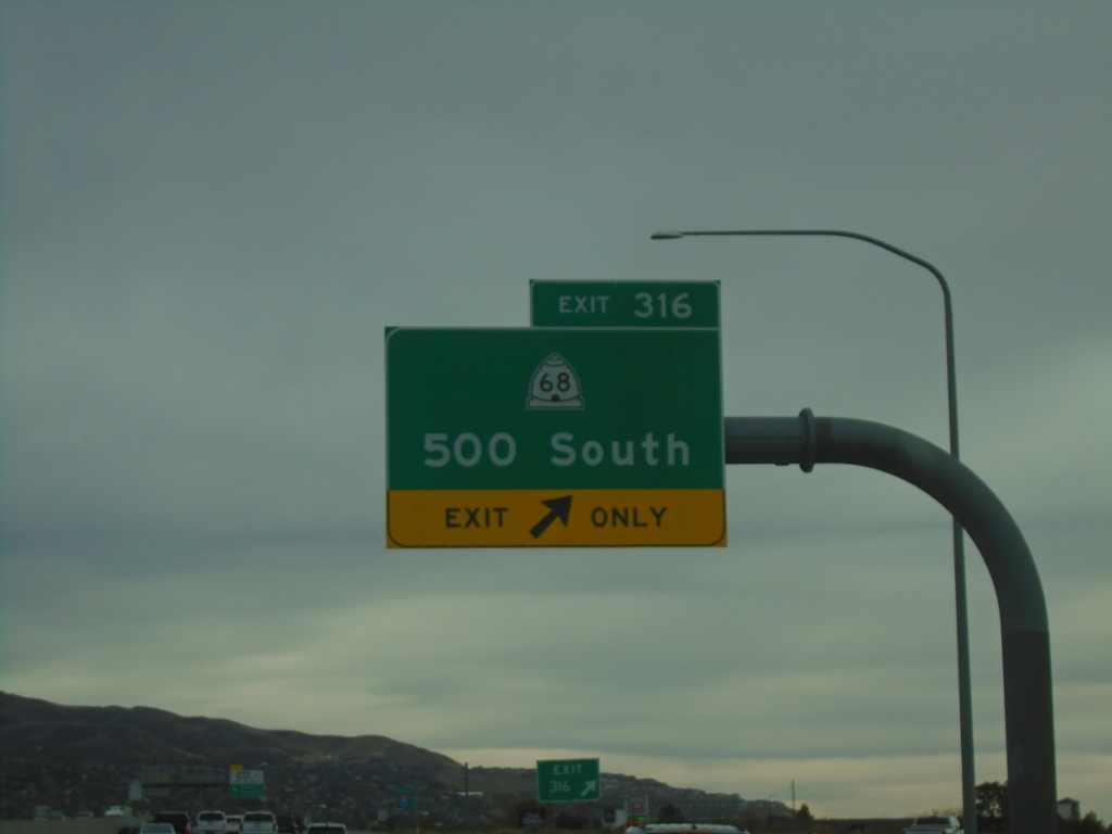
I-15 South - Exit 316
I-15 south at Exit 316 - UT-68/500 South.
Taken 10-25-2025
 Woods Cross
Davis County
Utah
United States
Woods Cross
Davis County
Utah
United States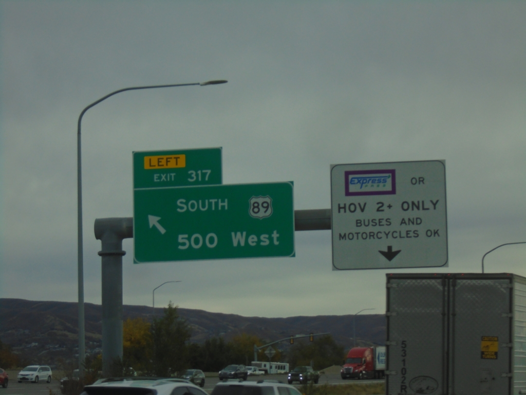
I-15 South - Exit 317
I-15 South at Exit 317 - US-89 South/500 West. Use left lane for HOV.
Taken 10-25-2025
Bountiful
Davis County
Utah
United States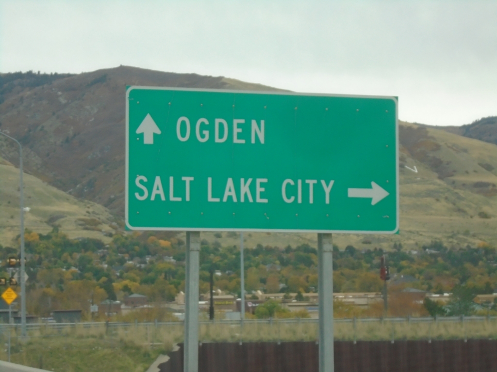
UT-105 East at I-15
UT-105 East (Parrish Lane) at I-15. Use I-15 south to Salt Lake City; I-15 north to Ogden.
Taken 10-25-2025
 Centerville
Davis County
Utah
United States
Centerville
Davis County
Utah
United States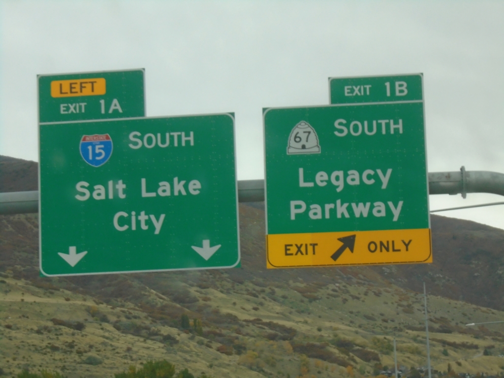
End UT-177 South at Exits 1A and 1B
End UT-177 South at Exit 1B - UT-67 South/Legacy Parkway and Exit 1A - I-15 South/Salt Lake City.
Taken 10-25-2025

 Farmington
Davis County
Utah
United States
Farmington
Davis County
Utah
United States