Signs Tagged With Big Green Sign
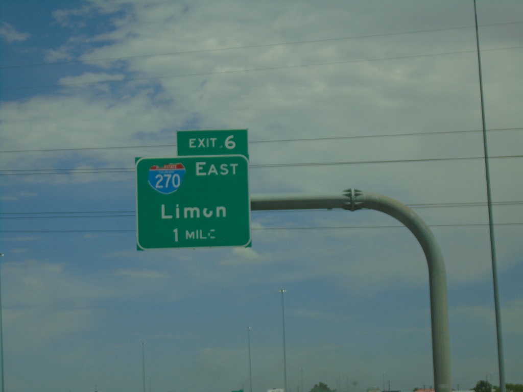
I-76 East - Exit 6
I-76 east approaching Exit 6 - I-270 East/Limon.
Taken 07-10-2022

 Denver
Adams County
Colorado
United States
Denver
Adams County
Colorado
United States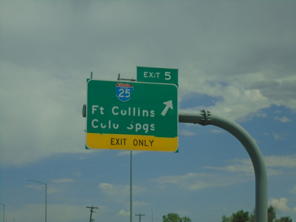
I-76 East - Exit 5
I-76 east at Exit 5 - I-25/Fort Collins/Colorado Springs.
Taken 07-10-2022

 Denver
Adams County
Colorado
United States
Denver
Adams County
Colorado
United States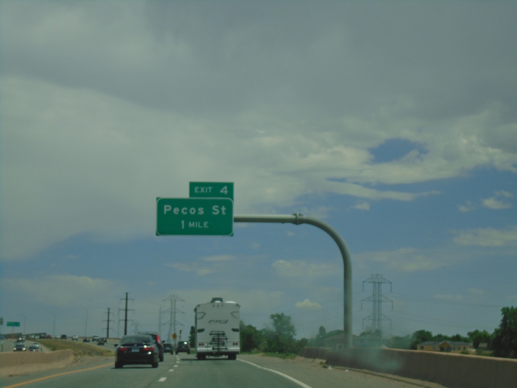
I-76 East - Exit 4
I-76 east approaching Exit 4 - Pecos St.
Taken 07-10-2022
Denver
Adams County
Colorado
United States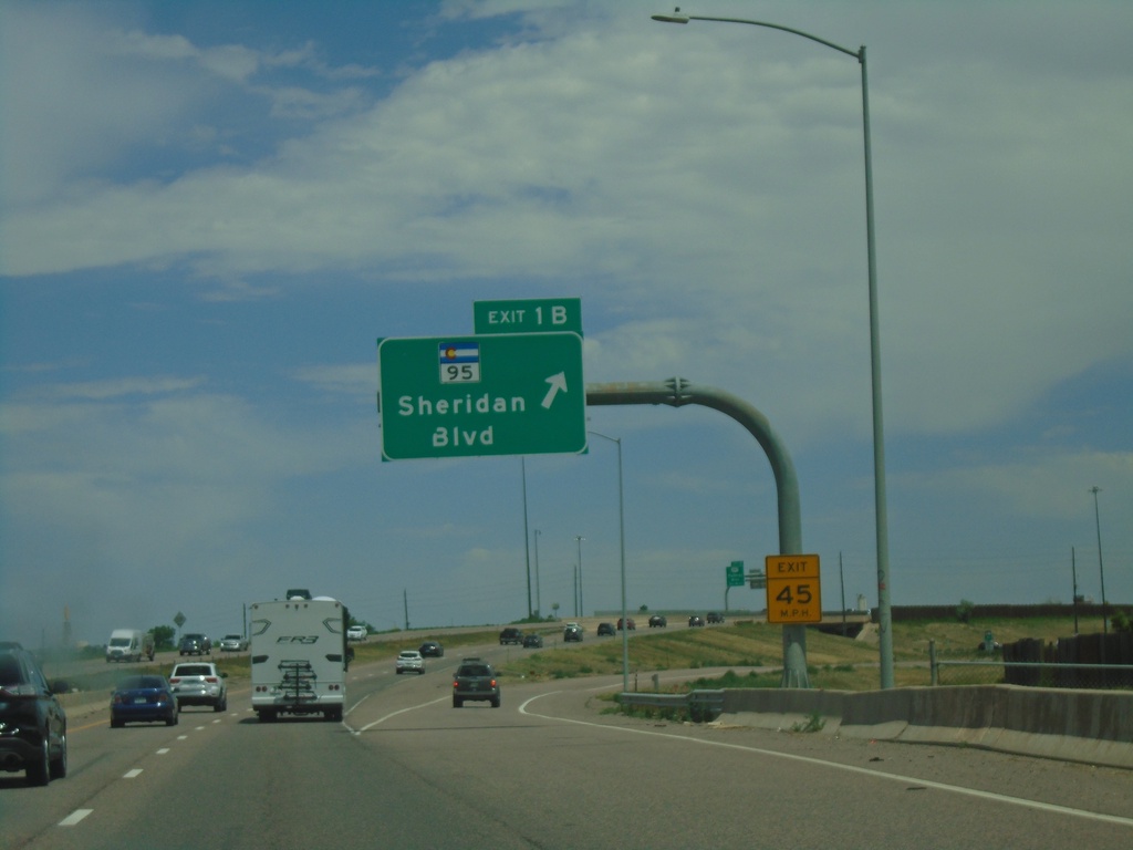
I-76 East - Exit 1B
I-76 east at Exit 1B - CO-95/Sheridan Blvd.
Taken 07-10-2022
 Arvada
Jefferson County
Colorado
United States
Arvada
Jefferson County
Colorado
United States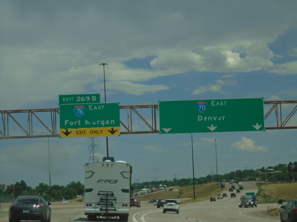
I-70 East - Exit 269B
I-70 east at Exit 269B - I-76 East/Fort Morgan. Continue on I-70 East to Denver. This is the beginning of I-76 eastbound.
Taken 07-10-2022
 Wheat Ridge
Jefferson County
Colorado
United States
Wheat Ridge
Jefferson County
Colorado
United States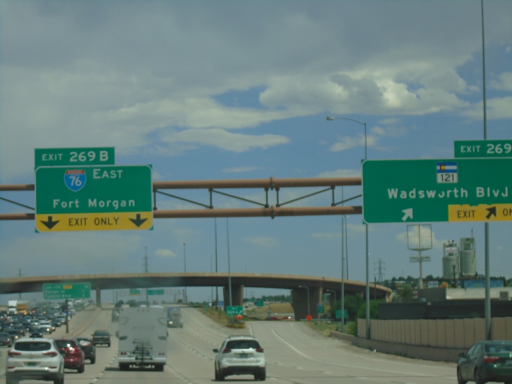
I-70 East - Exit 269B
I-70 east at Exit 269A - CO-121/Wadsworth Blvd. Approaching Exit 269B - I-76 East/Fort Morgan. This is the western end of I-76.
Taken 07-10-2022
 Wheat Ridge
Jefferson County
Colorado
United States
Wheat Ridge
Jefferson County
Colorado
United States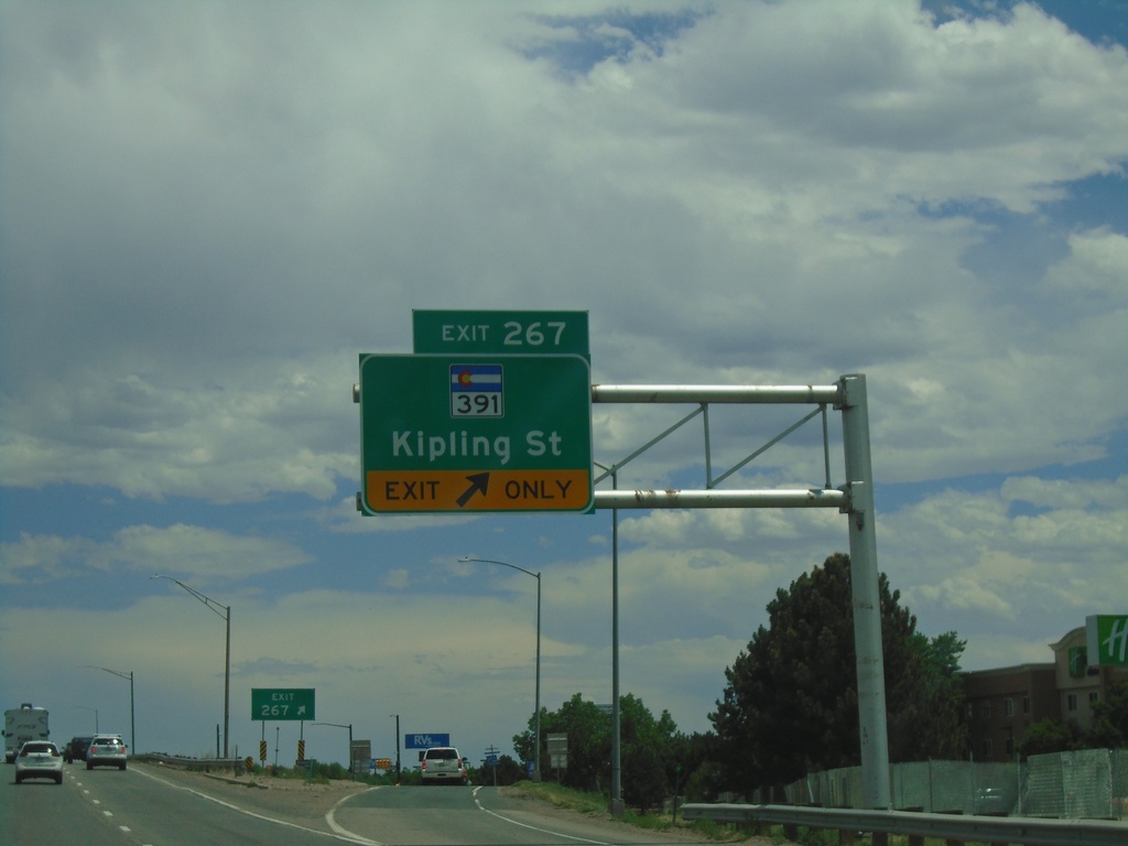
I-70 East - Exit 267
I-70 east at Exit 267 - CO-391/Kipling St.
Taken 07-10-2022
 Wheat Ridge
Jefferson County
Colorado
United States
Wheat Ridge
Jefferson County
Colorado
United States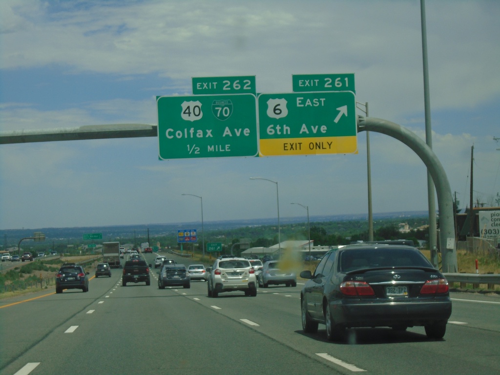
I-70 East - Exits 261 and 262
I-70 East at Exit 261 - US-6 East/6th Ave. Approaching Exit 262 - BL-70/US-40/Colfax Ave.
Taken 07-10-2022


 Golden
Jefferson County
Colorado
United States
Golden
Jefferson County
Colorado
United States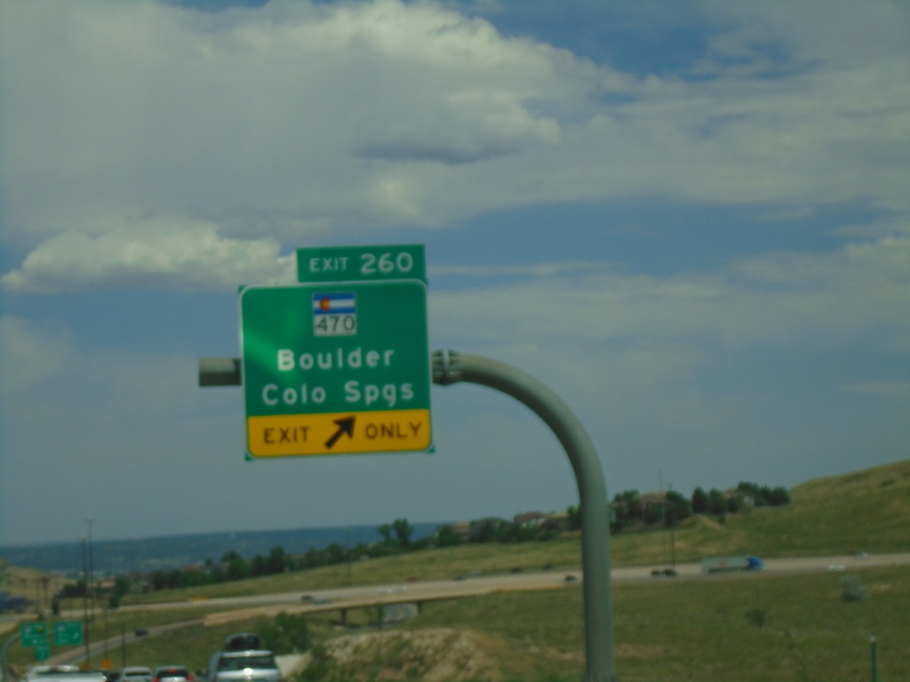
I-70 East - Exit 260
I-70 east at Exit 260 - CO-470/Boulder/Colorado Springs.
Taken 07-10-2022
 Morrison
Jefferson County
Colorado
United States
Morrison
Jefferson County
Colorado
United States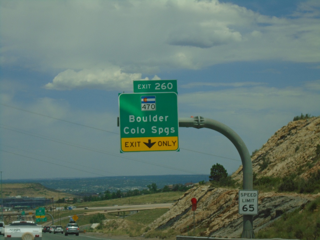
I-70 East - Exit 260
I-70 east approaching Exit 260 - CO-470/Boulder/Colorado Springs. CO-470 is part of the beltway around the Denver area.
Taken 07-10-2022
Morrison
Jefferson County
Colorado
United States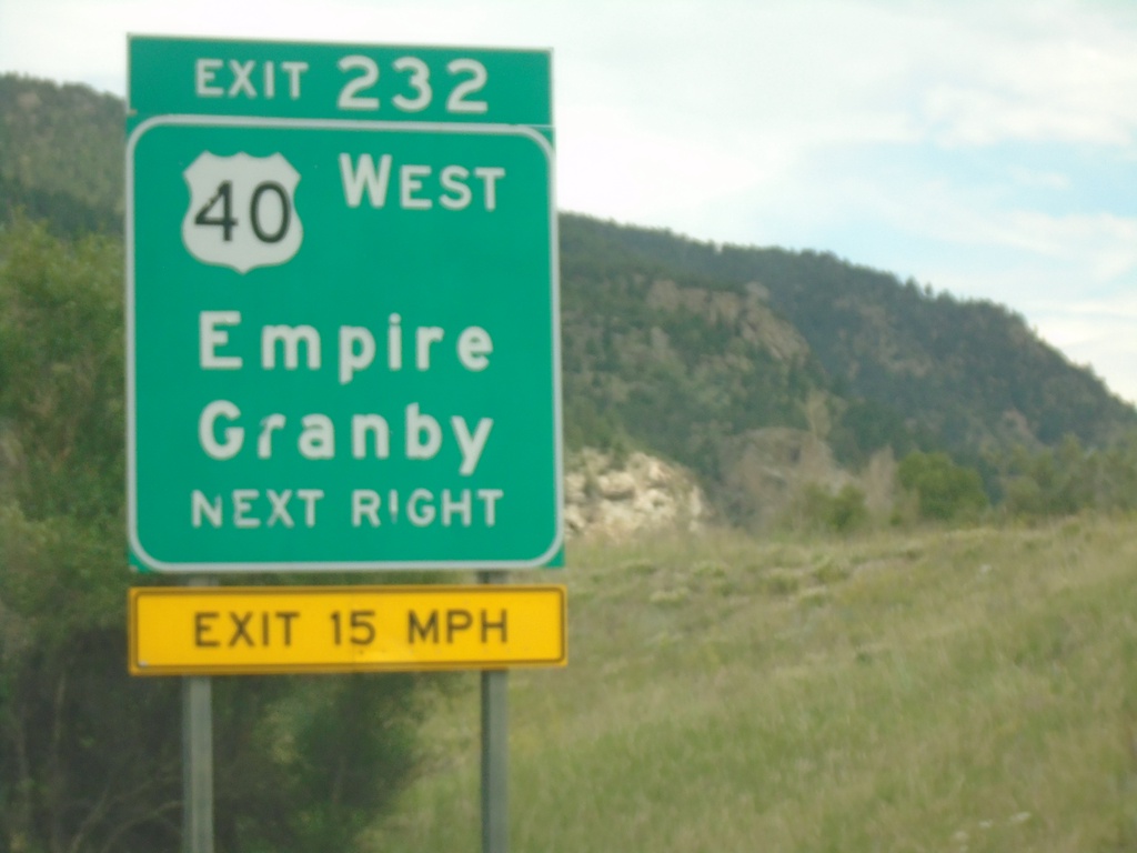
I-70 East - Exit 232
I-70 east at Exit 232 - US-40 West/Empire/Granby. US-40 east joins I-70/US-6 eastbound.
Taken 07-10-2022
Empire
Clear Creek County
Colorado
United States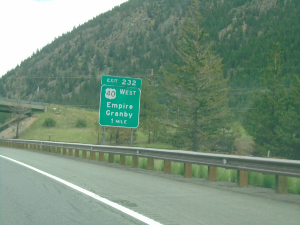
I-70 East - Exit 232
I-70 east approaching Exit 232 - US-40 West/Empire/Granby. US-40 east joins I-70 east to Golden.
Taken 07-10-2022
Idaho Springs
Clear Creek County
Colorado
United States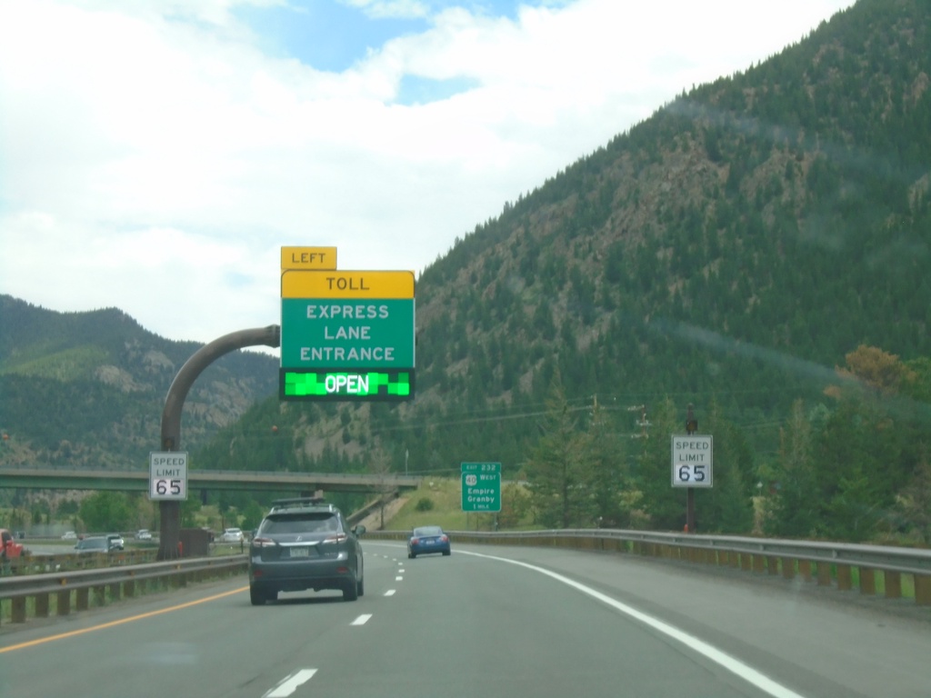
I-70 East - Express Toll Lanes
I-70 East approaching entrance Express Toll Lanes. This lane is the left most lane and runs to US-6 junction above Golden.
Taken 07-10-2022
Empire
Clear Creek County
Colorado
United States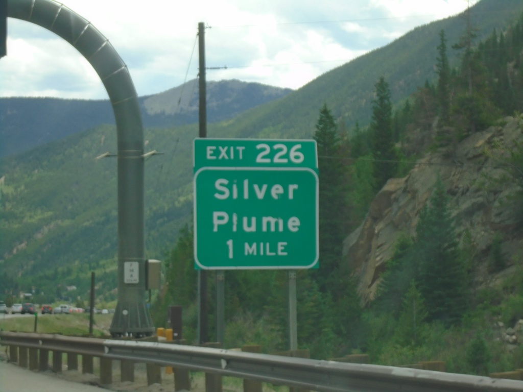
I-70 East - Exit 226
I-70 east approaching Exit 226 - Silver Plume.
Taken 07-10-2022
Silver Plume
Clear Creek County
Colorado
United States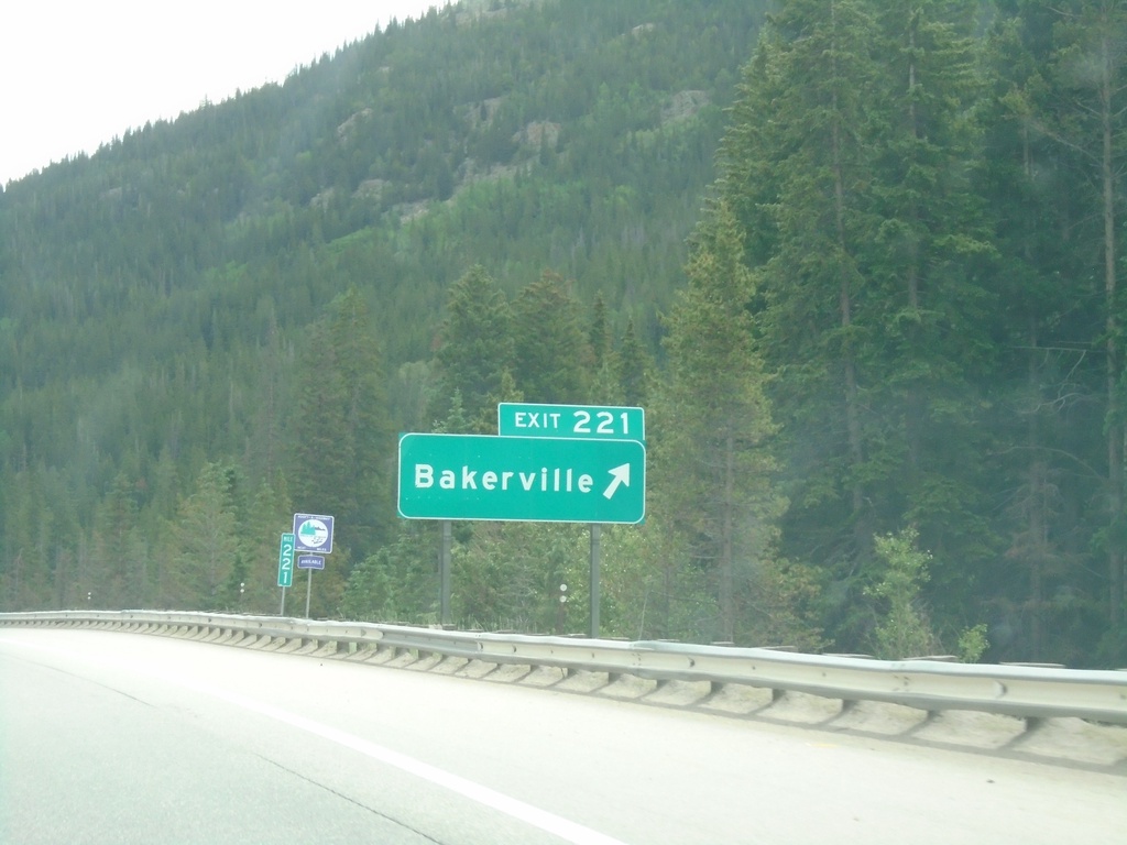
I-70 East - Exit 221
I-70 east at Exit 221 - Bakerville
Taken 07-10-2022
Dillon
Clear Creek County
Colorado
United States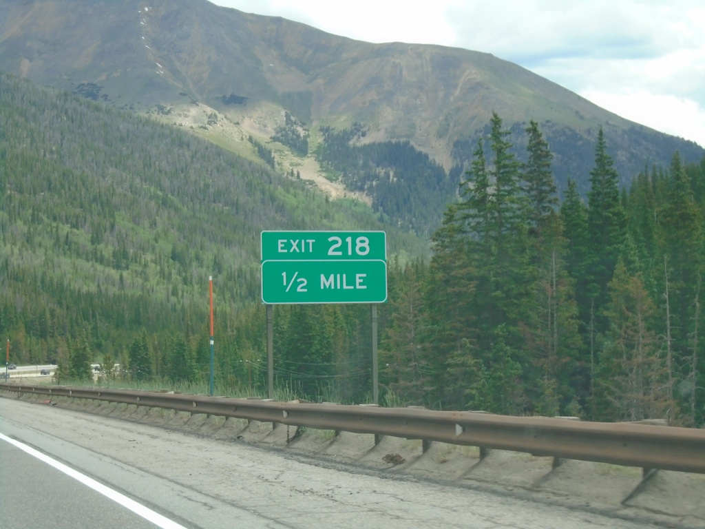
I-70 East - Exit 218
I-70 east approaching Exit 218
Taken 07-10-2022
Dillon
Clear Creek County
Colorado
United States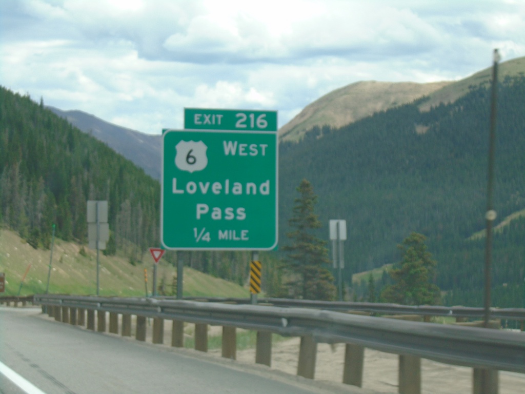
I-70 East - Exit 216
I-70 east approaching Exit 216 - US-6 West/Loveland Pass. US-6 East joins I-70 East through Idaho Springs.
Taken 07-10-2022
Keystone
Summit County
Colorado
United States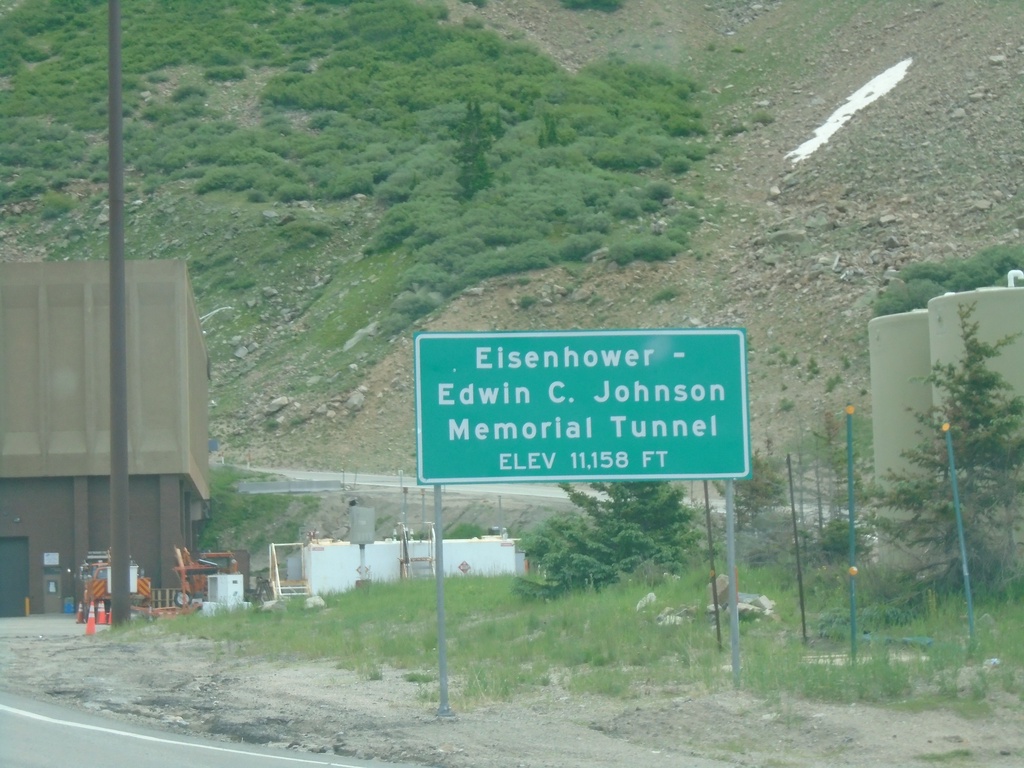
I-70 East - Eisenhower Tunnel
I-70 East - Eisenhower-Edwin C. Johnson Memorial Tunnel. Elevation 11,158 Feet.
Taken 07-10-2022
Dillon
Summit County
Colorado
United States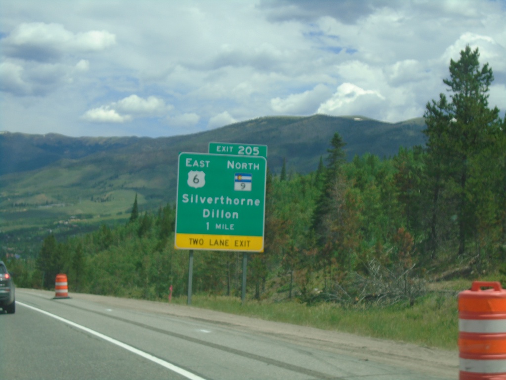
I-70 East - Exit 205
I-70/US-6 East/CO-9 North at Exit 205 - US-6 East/CO-9 North/Silverthorne/Dillon. US-6 East and CO-9 North leave I-70 eastbound here.
Taken 07-10-2022
 Silverthorne
Summit County
Colorado
United States
Silverthorne
Summit County
Colorado
United States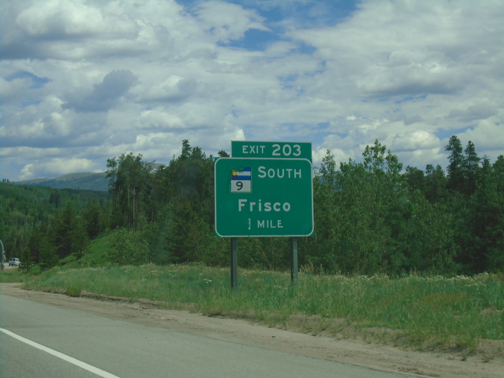
I-70 East - Exit 203
I-70 east approaching Exit 203 - CO-9 South/Frisco. CO-9 North joins I-70/US-6 Eastbound.
Taken 07-10-2022
Frisco
Summit County
Colorado
United States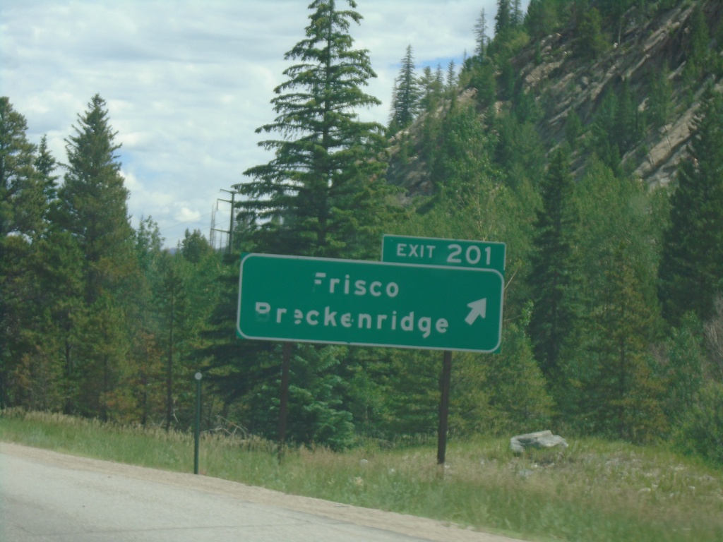
I-70 East - Exit 201
I-70 east at Exit 201 - Frisco/Breckenridge
Taken 07-10-2022
Frisco
Summit County
Colorado
United States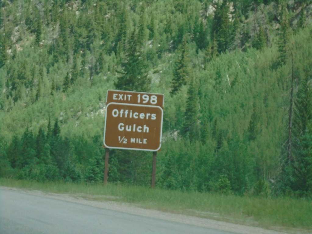
I-70 East - Exit 198
I-70 east approaching Exit 198 - Officers Gulch.
Taken 07-10-2022
Frisco
Summit County
Colorado
United States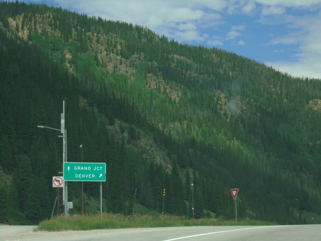
End CO-91 North at I-70/US-6
End CO-91 North at I-70/US-6 (Exit 195) in Summit County. Use I-70/US-6 West to Grand Junction; I-70/US-6 East to Denver.
Taken 07-10-2022
 Frisco
Summit County
Colorado
United States
Frisco
Summit County
Colorado
United States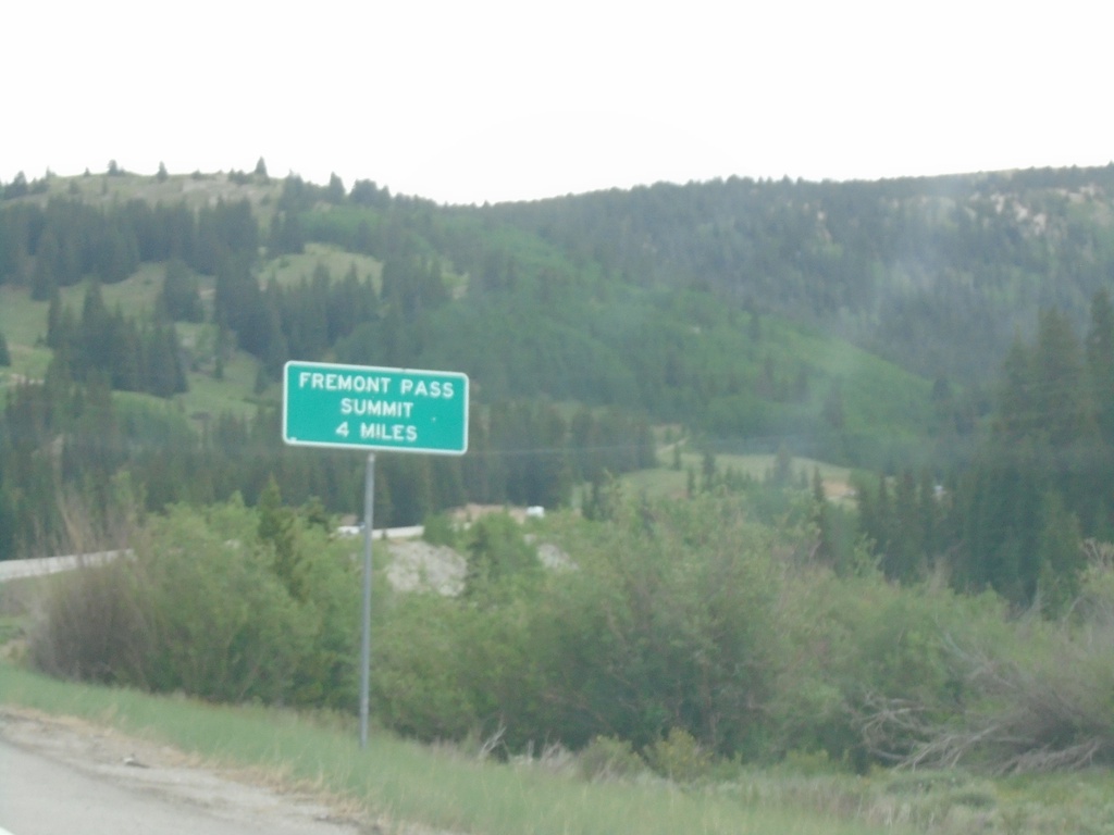
CO-91 North - Fremont Pass Summit - 4 Miles
CO-91 North - Fremont Pass Summit - 4 Miles in Lake County.
Taken 07-10-2022
Leadville
Lake County
Colorado
United States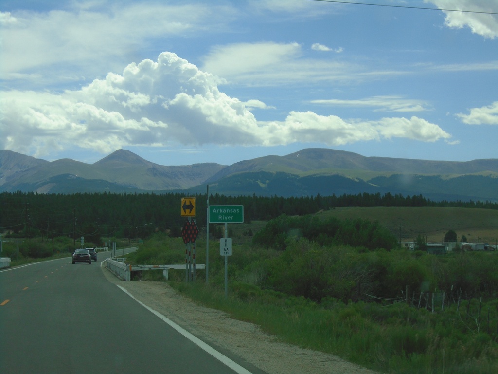
CO-300 East - Arkansas River
CO-300 east crossing the Arkansas River. This is near the headwaters of the Arkansas River. The Mosquito Range is in the background.
Taken 07-10-2022
 Leadville
Lake County
Colorado
United States
Leadville
Lake County
Colorado
United States