Signs Tagged With Big Green Sign
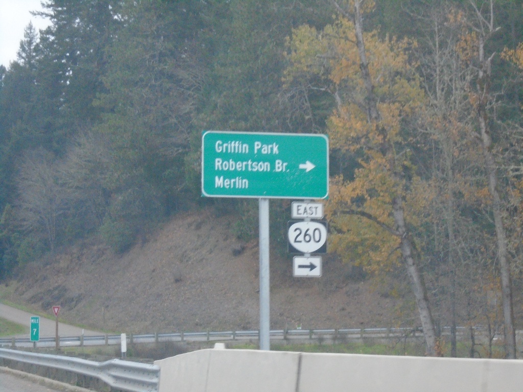
US-199 South at OR-260
US-199 South at OR-260 East to Merlin, Griffin Park, and Robertson Bridge.
Taken 11-20-2021

 Grants Pass
Josephine County
Oregon
United States
Grants Pass
Josephine County
Oregon
United States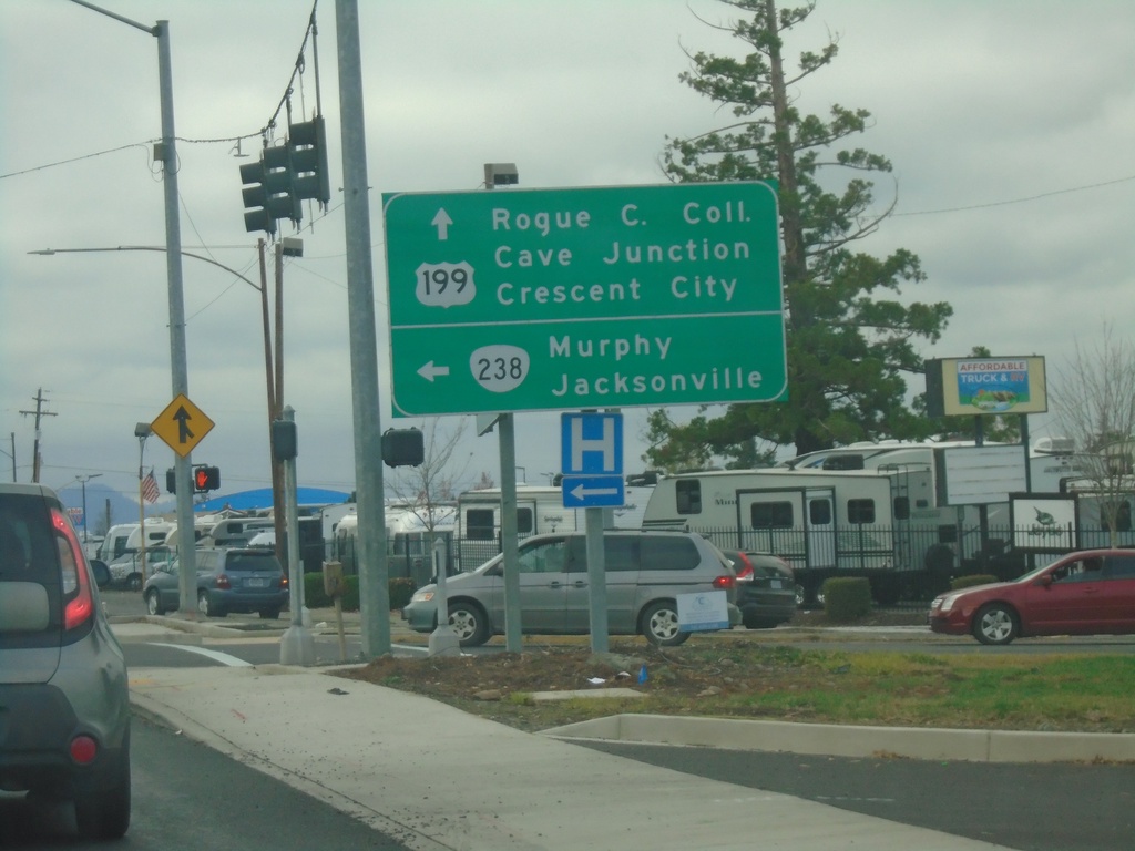
US-199 South at OR-238
US-199 south at OR-238. Turn left on OR-238 for Murphy and Jacksonville. Continue south on US-199 for Rogue Community College, Cave Junction, and Crescent City (California).
Taken 11-20-2021
 Grants Pass
Josephine County
Oregon
United States
Grants Pass
Josephine County
Oregon
United States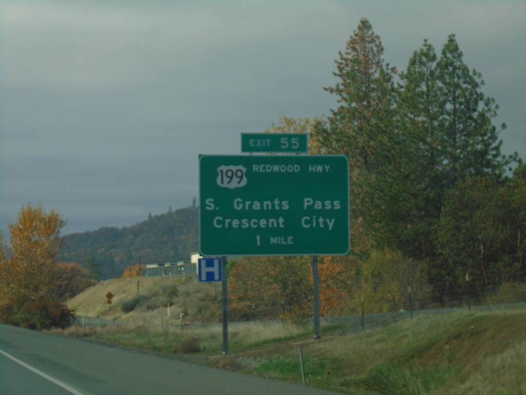
I-5 North - Exit 55
I-5 north approaching Exit 55 - US-199/Redwood Highway/South Grants Pass/Crescent City (California).
Taken 11-20-2021
 Grants Pass
Josephine County
Oregon
United States
Grants Pass
Josephine County
Oregon
United States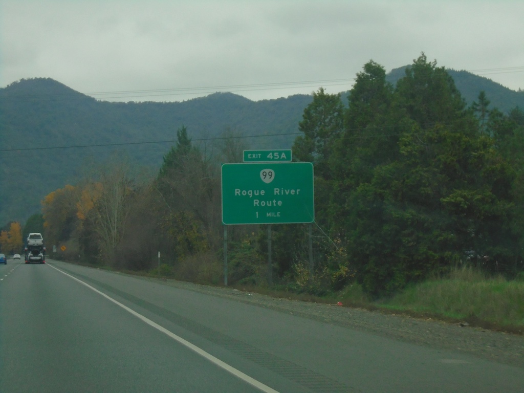
I-5 North Approaching Exit 45A
I-5 north approaching Exit 45A - OR-99/Rouge River Route.
Taken 11-20-2021
 Gold Hill
Jackson County
Oregon
United States
Gold Hill
Jackson County
Oregon
United States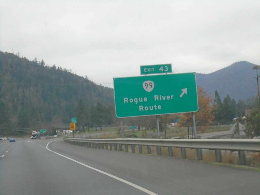
I-5 North - Exit 43
I-5 north at Exit 43 - OR-99/Rogue River Route. This exit also provides access to OR-234.
Taken 11-20-2021
Rock Point
Jackson County
Oregon
United States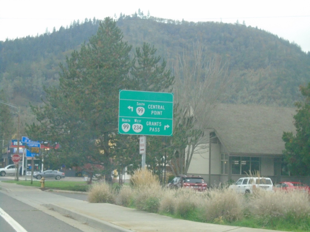
OR-234 West at OR-99 - Gold Hill
OR-234 West at OR-99 in Gold Hill. Use OR-99 South to Central Point; OR-234 West/OR-99 North to Grants Pass.
Taken 11-20-2021
 Gold Hill
Jackson County
Oregon
United States
Gold Hill
Jackson County
Oregon
United States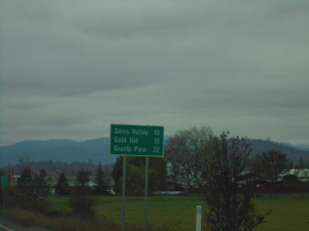
OR-234 West - Distance Marker
Distance marker on OR-234 west. Distance to Sams Valley, Gold Hill, and Grants Pass (via I-5 North).
Taken 11-20-2021
Eagle Point
Jackson County
Oregon
United States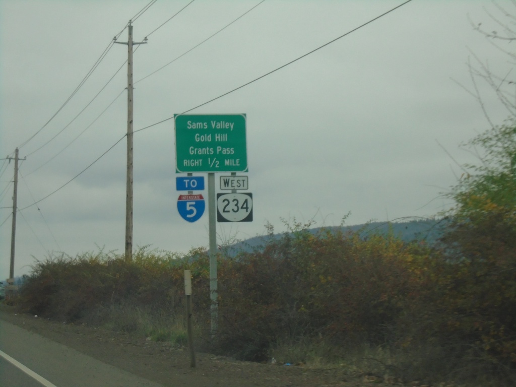
OR-62 South Approaching OR-234
OR-62 south approaching OR-234 to I-5, Sams Valley, Gold Hill, and Grants Pass.
Taken 11-20-2021
 Eagle Point
Jackson County
Oregon
United States
Eagle Point
Jackson County
Oregon
United States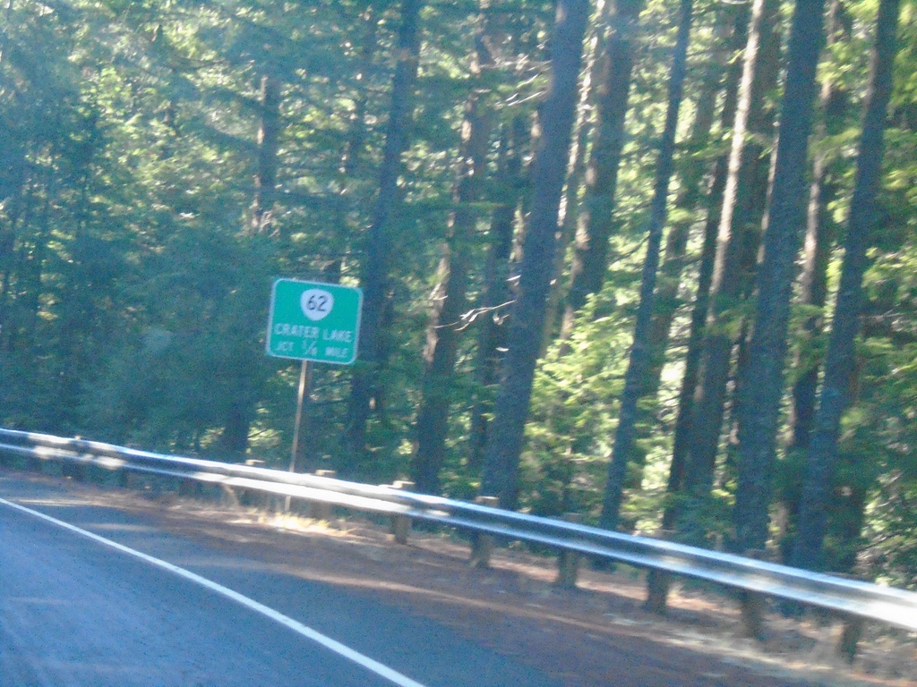
OR-230 West Approaching OR-62
OR-230 West approaching OR-62. Use OR-62 North to Crater Lake.
Taken 11-20-2021
 Prospect
Jackson County
Oregon
United States
Prospect
Jackson County
Oregon
United States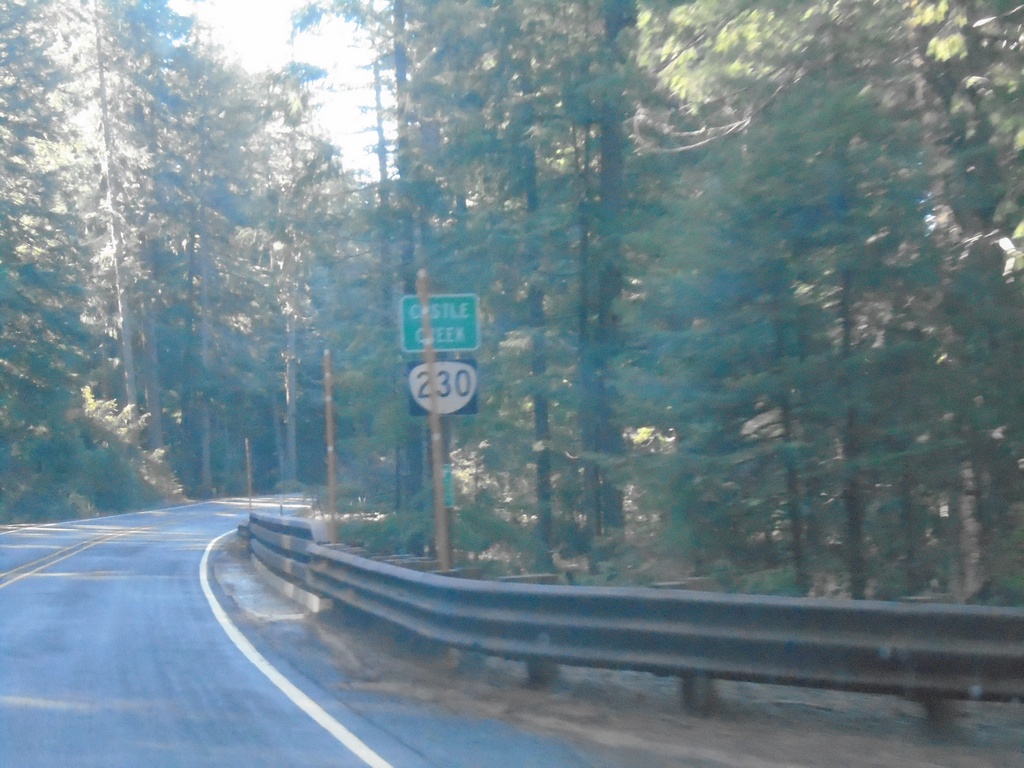
OR-230 West - Castle Creek
OR-230 west crossing Castle Creek.
Taken 11-20-2021
Prospect
Jackson County
Oregon
United States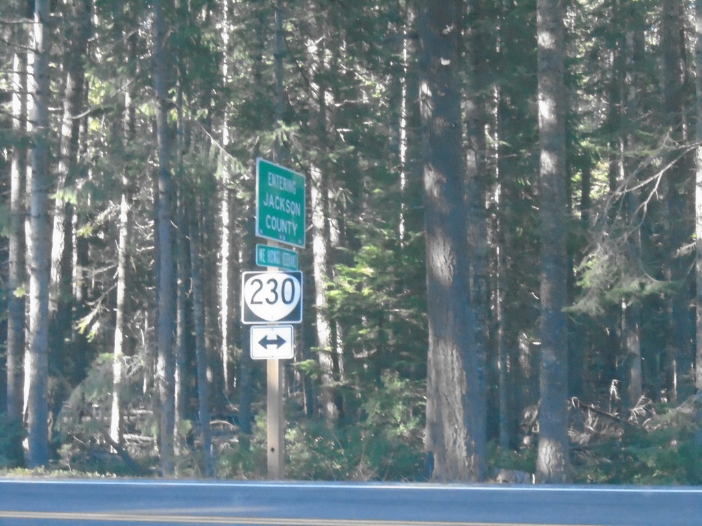
End Forest Road 6530 at OR-230
End Forest Road 6530 at OR-230 at the Jackson/Douglas County Line.
Taken 11-20-2021
Prospect
Jackson County
Oregon
United States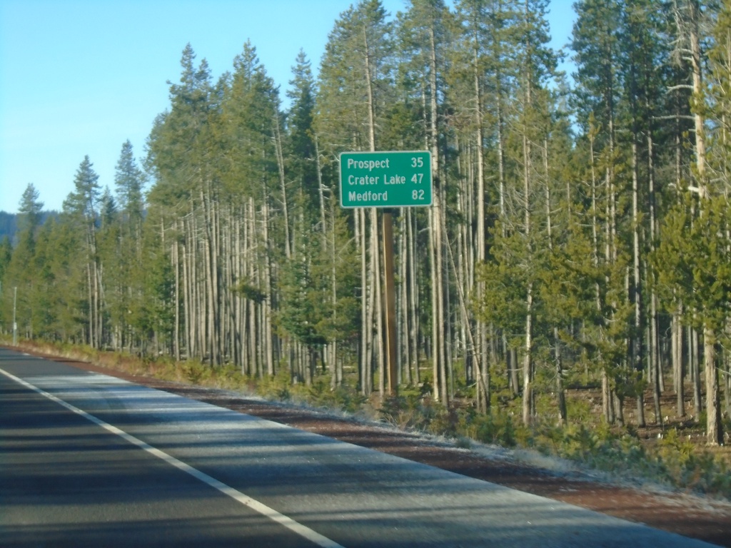
OR-230 West - Distance Marker
Distance marker on OR-230 west. Distance to Prospect, Crater Lake (via OR-62 North) and Medford (via OR-62 South).
Taken 11-20-2021
Diamond Lake
Douglas County
Oregon
United States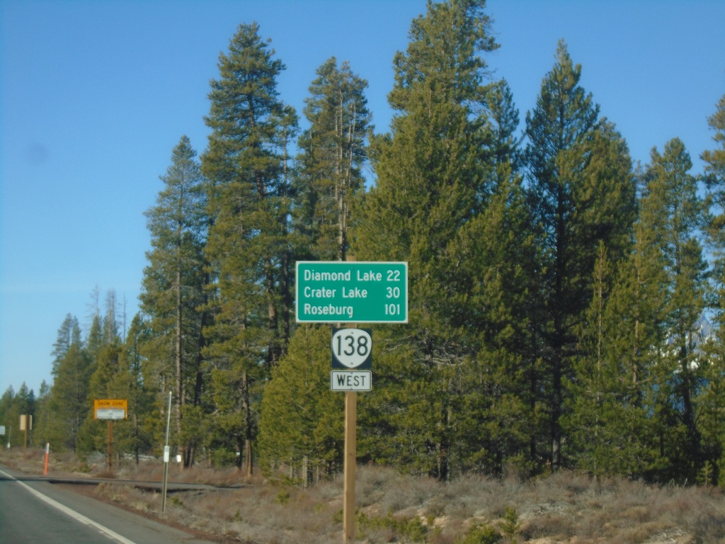
Distance Marker on OR-138 West
Distance marker on OR-138 west to Diamond Lake, Crater Lake, and Roseburg. Taken just west of Diamond Lake Junction.
Taken 11-20-2021
 Chemult
Klamath County
Oregon
United States
Chemult
Klamath County
Oregon
United States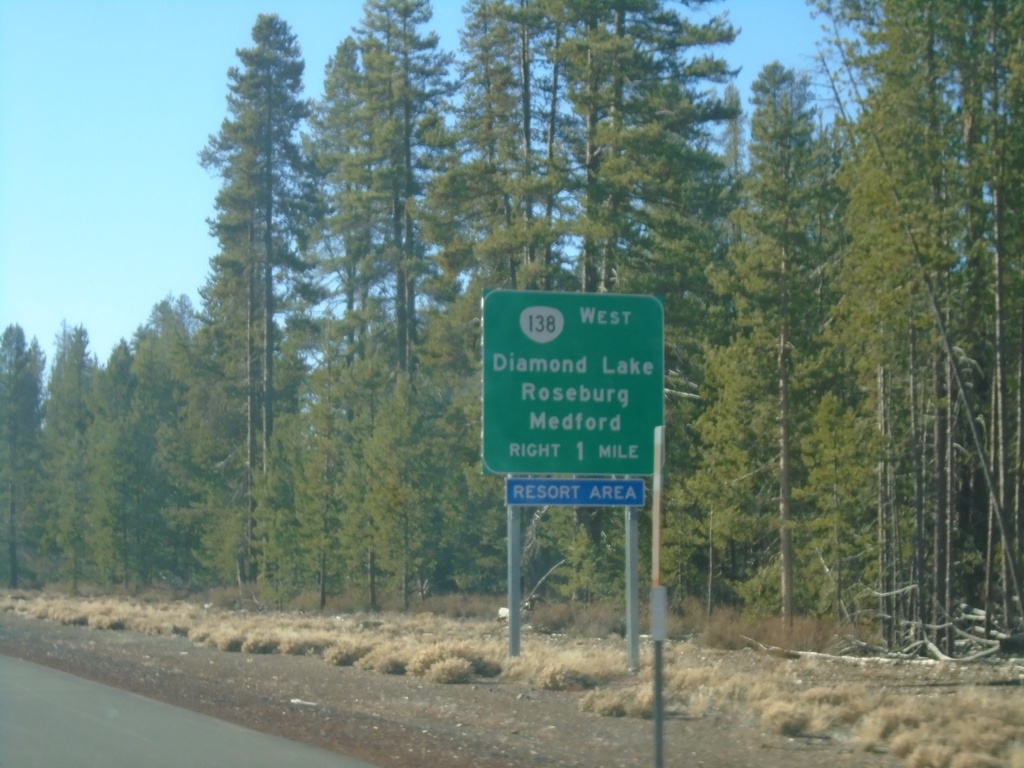
US-97 South Approaching OR-138
US-97 south approaching OR-138 (North Umpqua Highway) to Diamond Lake, Roseburg, and Medford.
Taken 11-20-2021
 Chemult
Klamath County
Oregon
United States
Chemult
Klamath County
Oregon
United States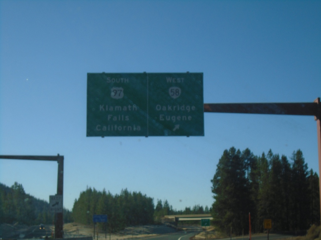
US-97 South at OR-58
US-97 South at OR-58 in Klamath County. Use OR-58 west to Eugene and Oakridge (via Willamette Pass). Continue south on US-97 for Klamath Falls and California.
Taken 11-20-2021
 Crescent
Klamath County
Oregon
United States
Crescent
Klamath County
Oregon
United States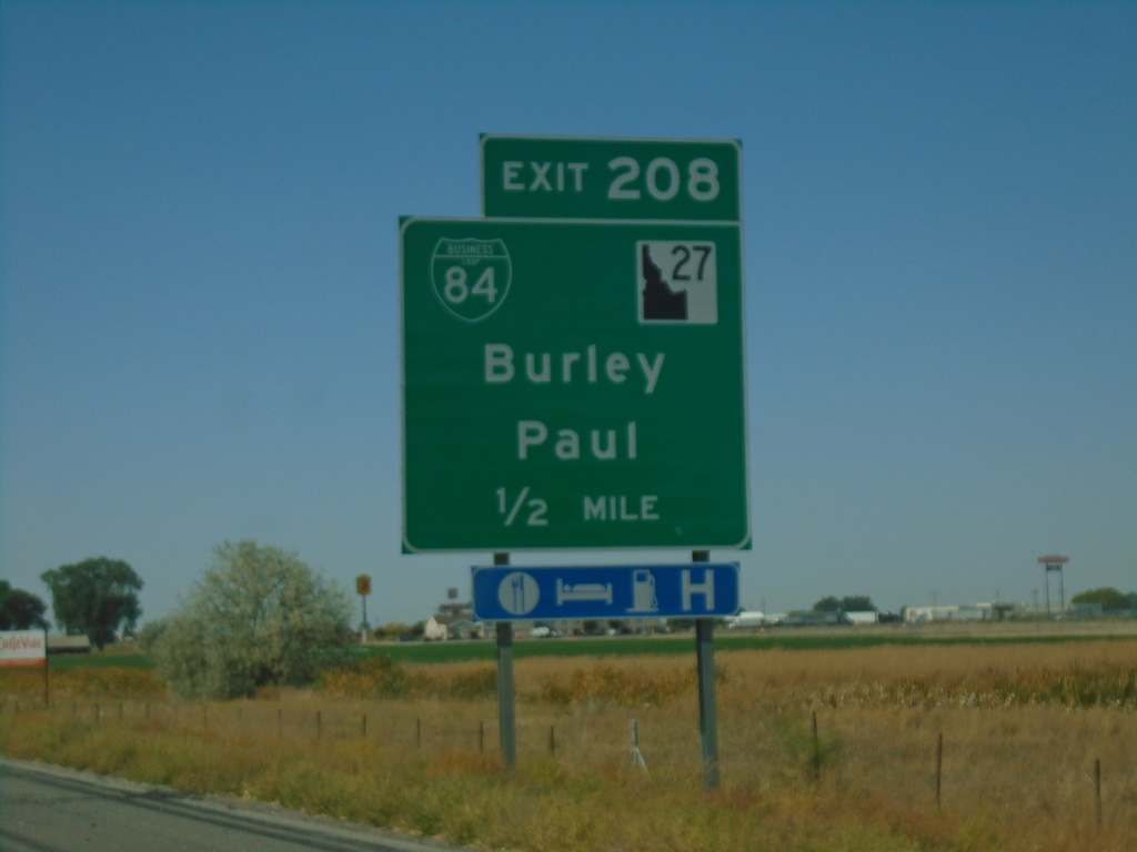
I-84 West - Exit 208
I-84 west approaching Exit 208 - BL-84/ID-27/Burley/Paul.
Taken 09-25-2021


 Heyburn
Minidoka County
Idaho
United States
Heyburn
Minidoka County
Idaho
United States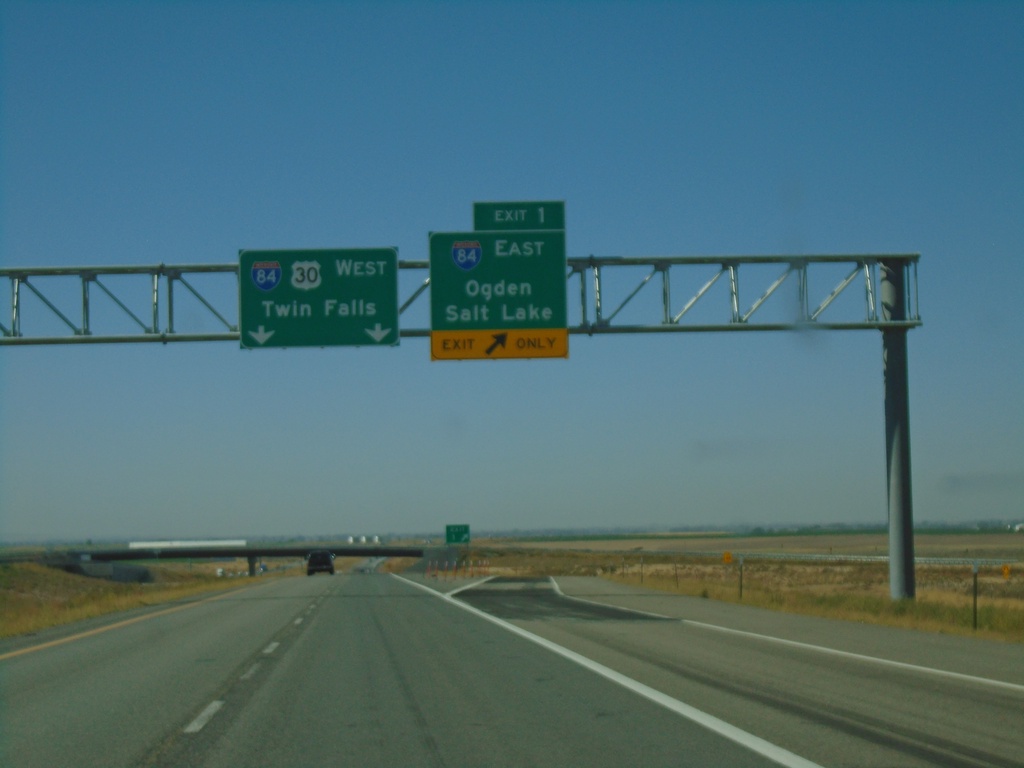
End I-86 West at I-84
End I-86 west at I-84. Merge right onto Exit 1 for I-84 East/Ogden/Salt Lake. Continue ahead for I-84/US-30 West/Twin Falls. This is the western end of I-86.
Taken 09-25-2021

 Cotterel
Cassia County
Idaho
United States
Cotterel
Cassia County
Idaho
United States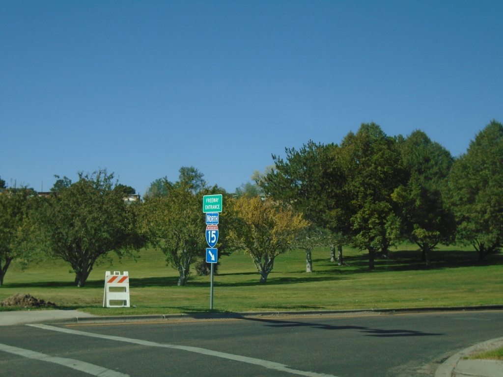
Pocatello Creek Road at I-15 North
Pocatello Creek Road at I-15 North. This type of sign assembly with the Freeway Entrance sign mounted on the shield is not very common in Idaho.
Taken 09-25-2021

 Pocatello
Bannock County
Idaho
United States
Pocatello
Bannock County
Idaho
United States
Pocatello Creek Road West at I-15
Pocatello Creek Road west at I-15. Use I-15 North for I-86, Twin Falls and Idaho Falls. Continue straight on Pocatello Creek Road for I-15 South and BL-15 to City Center.
Taken 09-25-2021
Pocatello
Bannock County
Idaho
United States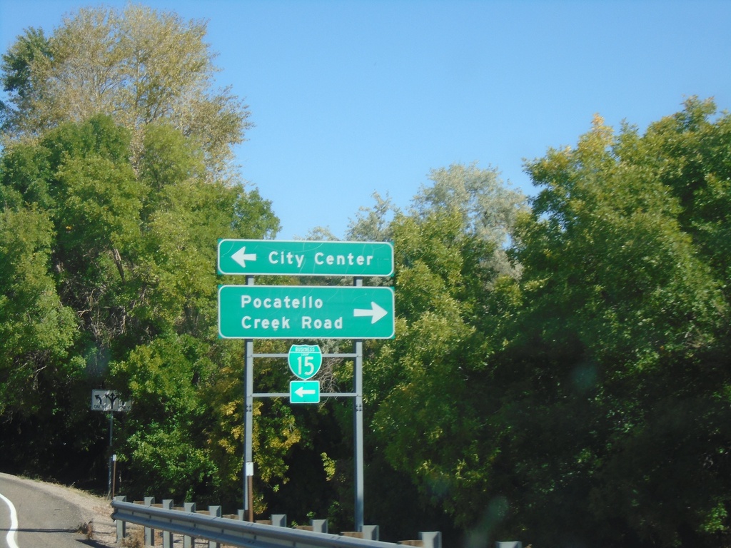
I-15 North Exit 71 Offramp
I-15 North Exit 71 Offramp at BL-15/Pocatello Creek Road. Turn right for Pocatello Creek Road; left for I-15 and City Center.
Taken 09-25-2021
Pocatello
Bannock County
Idaho
United States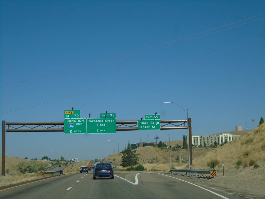
I-15 North - Exits 69, 71, and 72
I-15 north at Exit 69 - Clark St/Center St. Approaching Exit 71 - Pocatello Creek Road, and Exit 72 - Junction I-86 West.
Taken 09-25-2021
Pocatello
Bannock County
Idaho
United States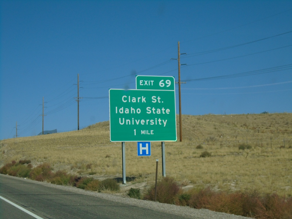
I-15 North - Exit 69
I-15 north approaching Exit 69 - Clark St./Idaho State University.
Taken 09-25-2021
Pocatello
Bannock County
Idaho
United States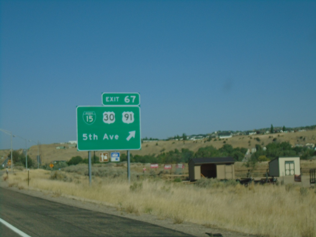
I-15 North - Exit 67
I-15 north at Exit 67 - BL-15/US-30/US-91/5th Ave. US-91 and US-30 leave I-15 northbound. This is the southern end of the Pocatello business loop.
Taken 09-25-2021
 Pocatello
Bannock County
Idaho
United States
Pocatello
Bannock County
Idaho
United States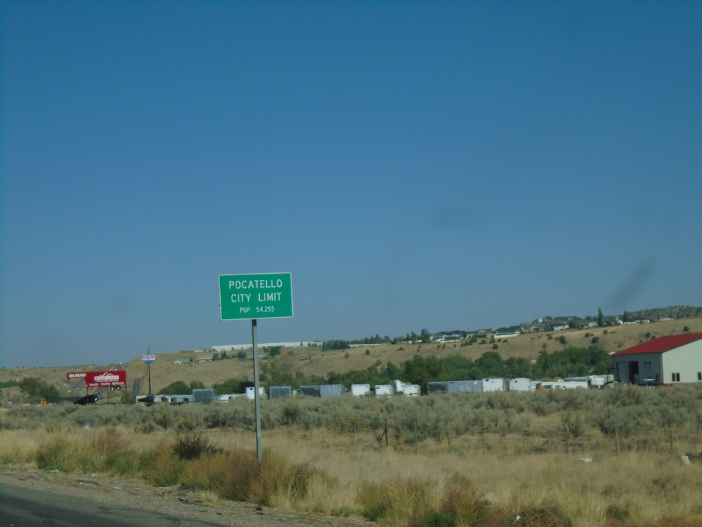
I-15 North - Pocatello City Limit
Entering Pocatello on I-15 north. Pocatello is the 6rd largest city in Idaho according to the 2020 Census.
Taken 09-25-2021
Pocatello
Bannock County
Idaho
United States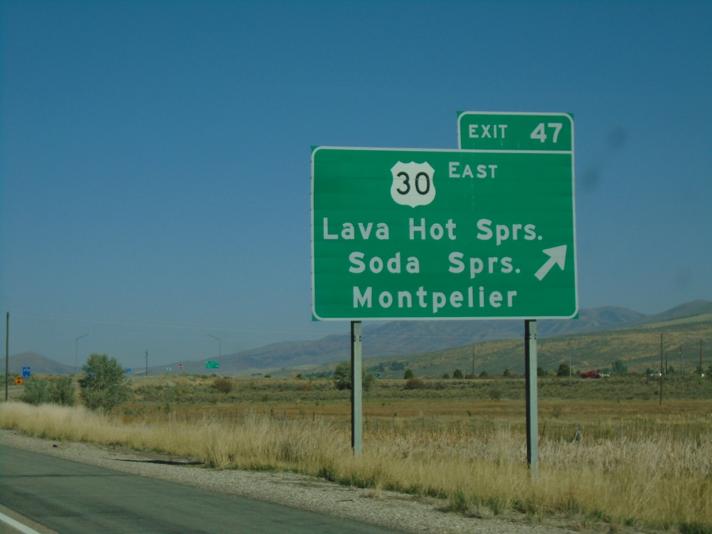
I-15 North - Exit 47
I-15 north at Exit 47 - US-30 East/Lava Hot Springs/Soda Springs/Montpelier. US-30 west joins I-15 and US-91 north to Pocatello.
Taken 09-25-2021
McCammon
Bannock County
Idaho
United States