Signs Tagged With Big Green Sign
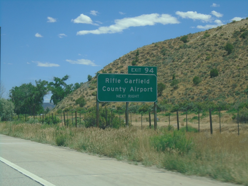
I-70 East - Exit 94
I-70 east approaching Exit 94 - Rifle Garfield County Airport.
Taken 07-09-2022
 Silt
Garfield County
Colorado
United States
Silt
Garfield County
Colorado
United States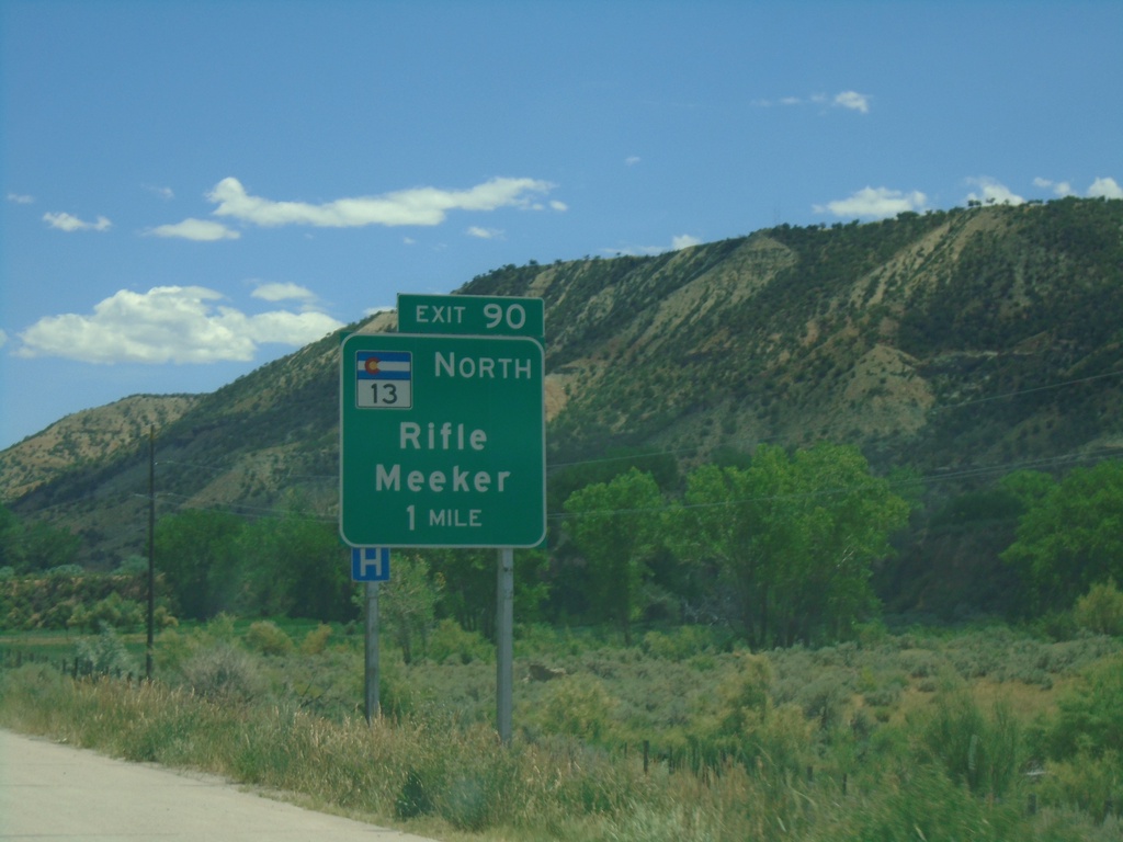
I-70 East - Exit 90
I-70 east approaching Exit 90 - CO-13 North/Rifle/Meeker.
Taken 07-09-2022
 Rifle
Garfield County
Colorado
United States
Rifle
Garfield County
Colorado
United States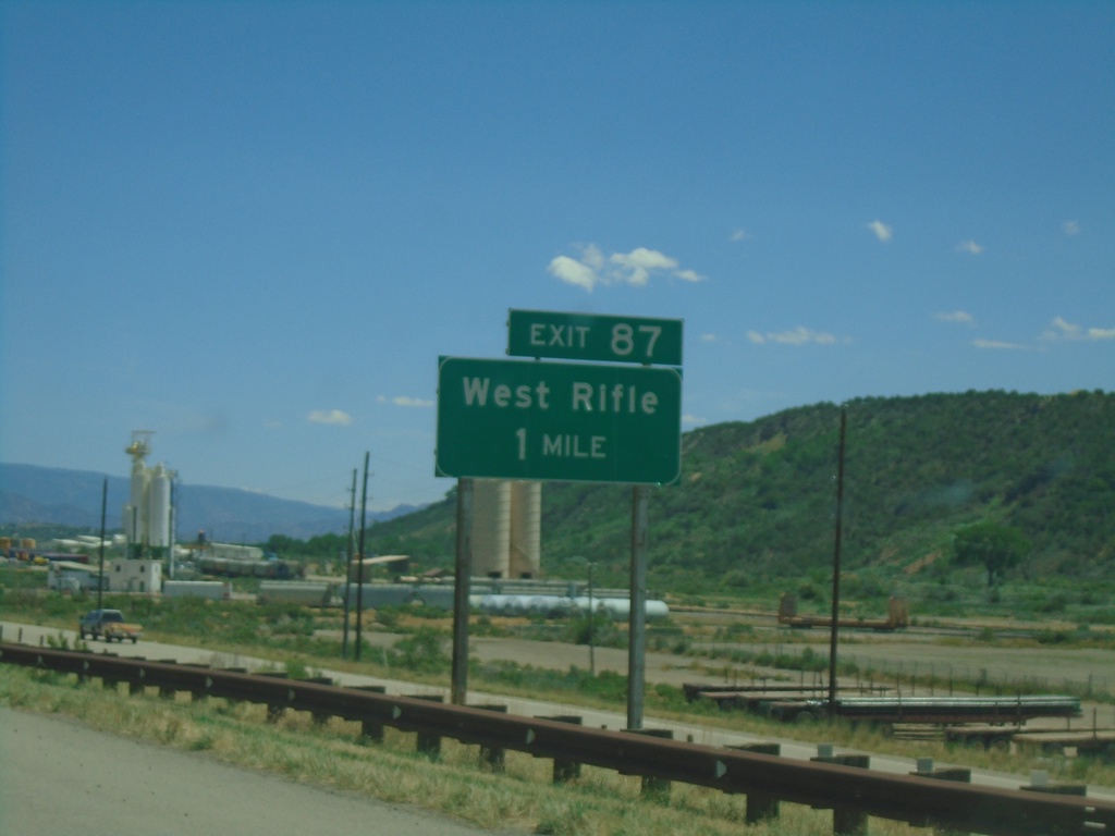
I-70 East - Exit 87
I-70 East approaching Exit 87 - West Rifle
Taken 07-09-2022
 Rifle
Garfield County
Colorado
United States
Rifle
Garfield County
Colorado
United States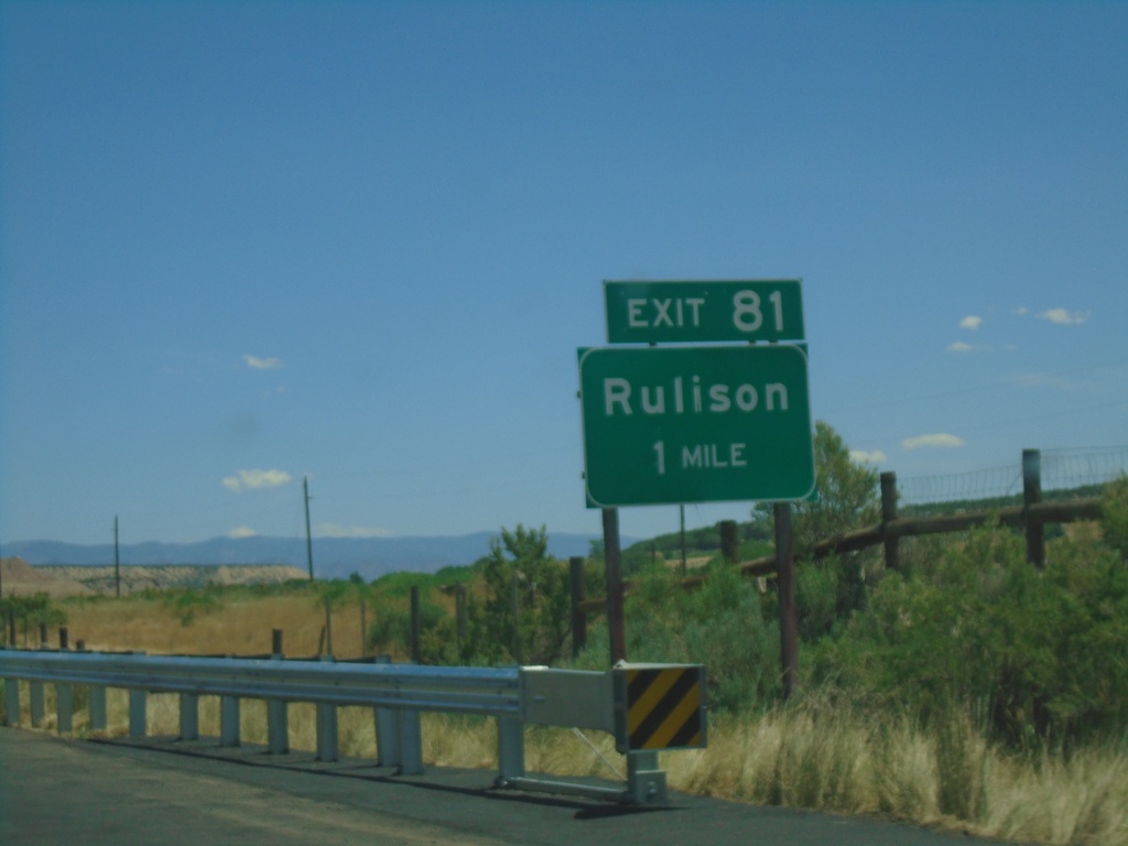
I-70 East - Exit 81
I-70 east approaching Exit 81 - Rulison
Taken 07-09-2022
Rifle
Garfield County
Colorado
United States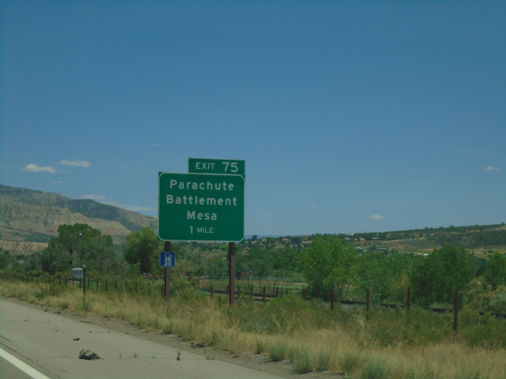
I-70 East - Exit 74
I-70 east approaching Exit 74 - Parachute/Battlement Mesa
Taken 07-09-2022
Parachute
Garfield County
Colorado
United States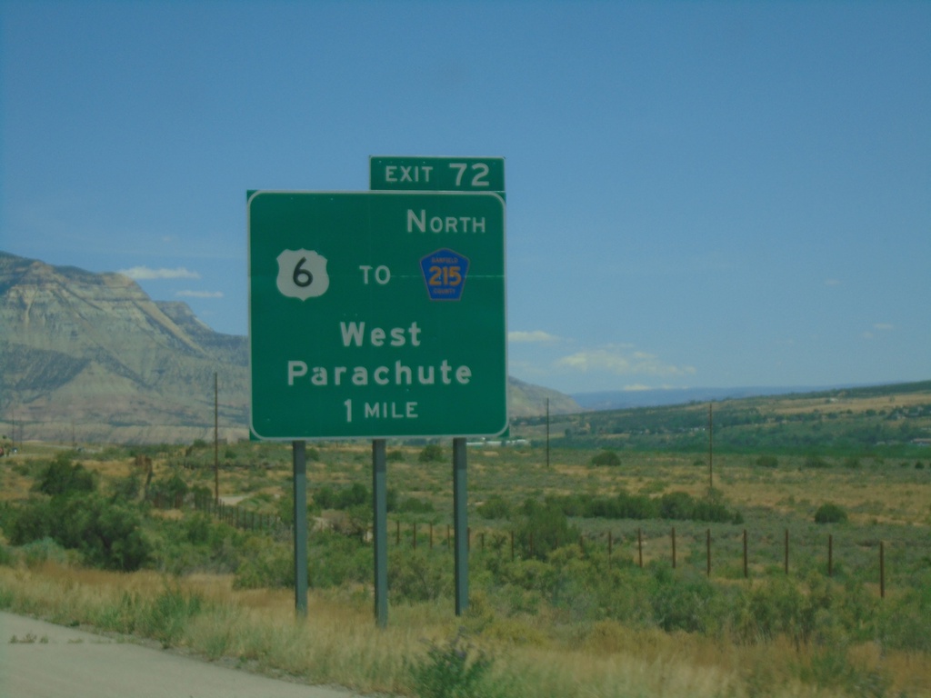
I-70 East - Exit 72
I-70 east approaching Exit 72 - US-6/To CH-215 North/West Parachute.
Taken 07-09-2022
 Parachute
Garfield County
Colorado
United States
Parachute
Garfield County
Colorado
United States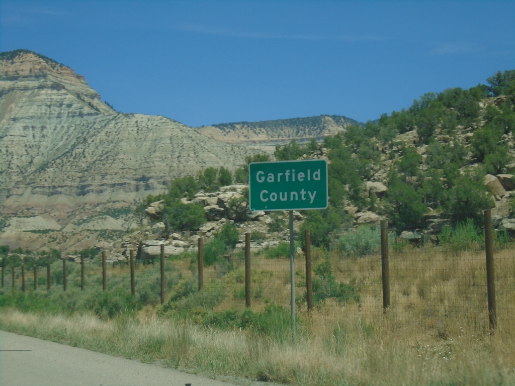
I-70 East - Garfield County
Entering Garfield County on I-70 east.
Taken 07-09-2022
De Beque
Garfield County
Colorado
United States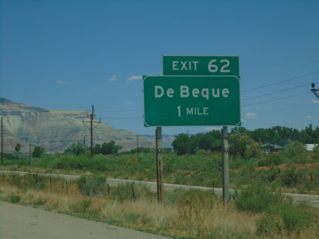
I-70 East - Exit 62
I-70 east approaching Exit 62 - De Beque
Taken 07-09-2022
De Beque
Mesa County
Colorado
United States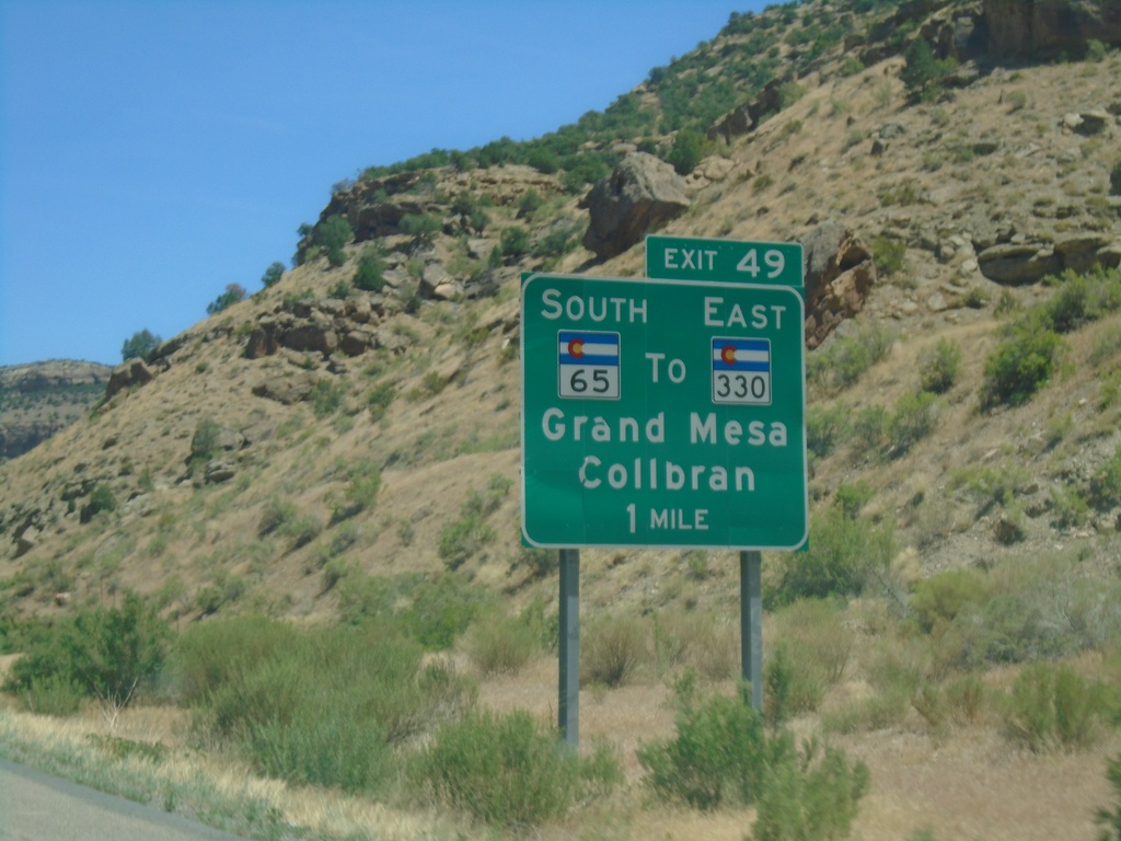
I-70 East - Exit 49
I-70 east approaching Exit 49 - CO-65 South/To CO-330 East/Grand Mesa/Colbran.
Taken 07-09-2022

 Palisade
Mesa County
Colorado
United States
Palisade
Mesa County
Colorado
United States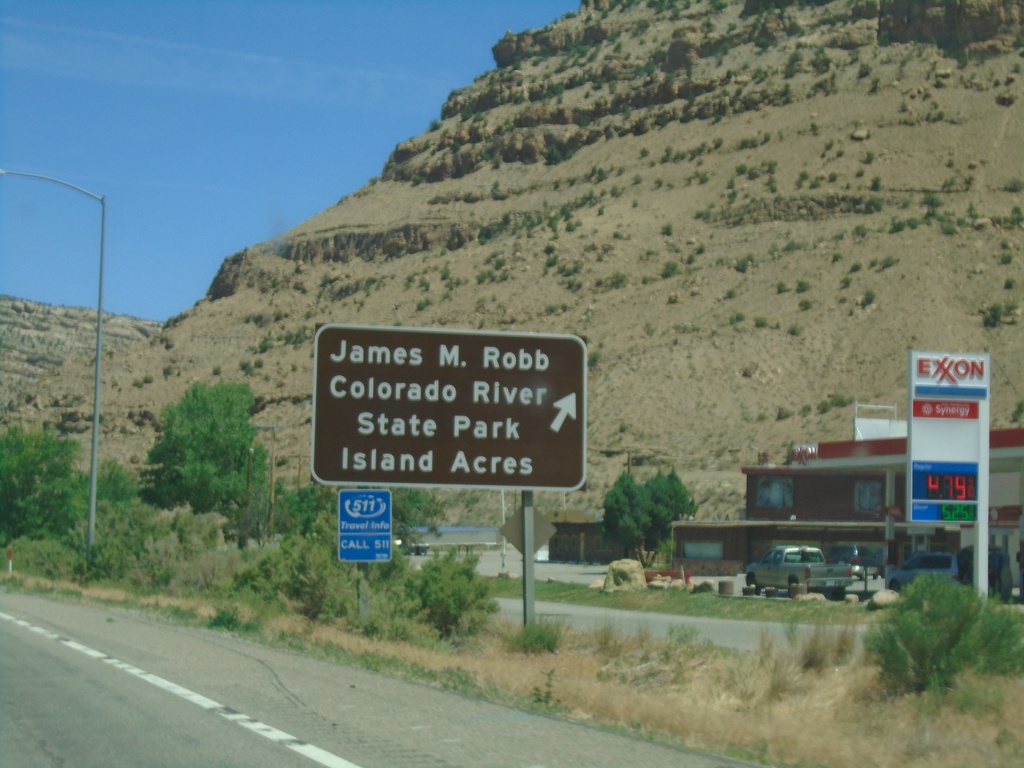
I-70 East - Exit 47
I-70 East (Exit 47) - James M Robb Colorado River State Park - Island Acres
Taken 07-09-2022
Palisade
Mesa County
Colorado
United States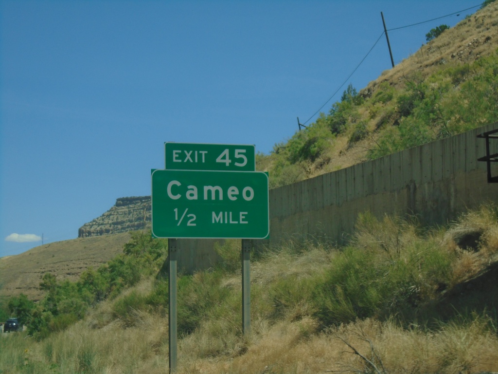
I-70 East - Exit 45
I-70 east approaching Exit 45 - Cameo
Taken 07-09-2022
Palisade
Mesa County
Colorado
United States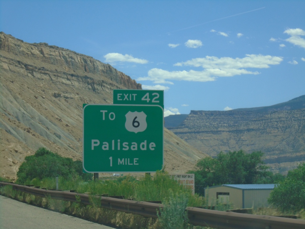
I-70 East - Exit 42
I-70 east approaching Exit 42 - To US-6/Palisade.
Taken 07-09-2022
Palisade
Mesa County
Colorado
United States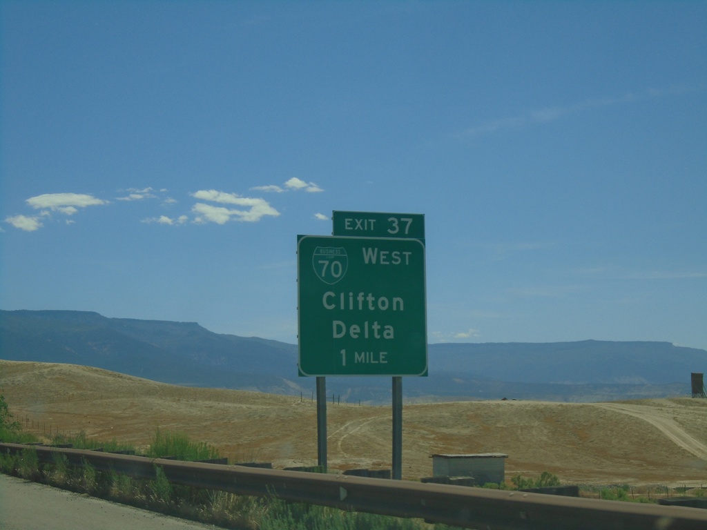
I-70 East - Exit 37
I-70 east approaching Exit 37 - BL-70/Clifton/Delta. This is the eastern end of the Grand Junction business loop.
Taken 07-09-2022
 Grand Junction
Mesa County
Colorado
United States
Grand Junction
Mesa County
Colorado
United States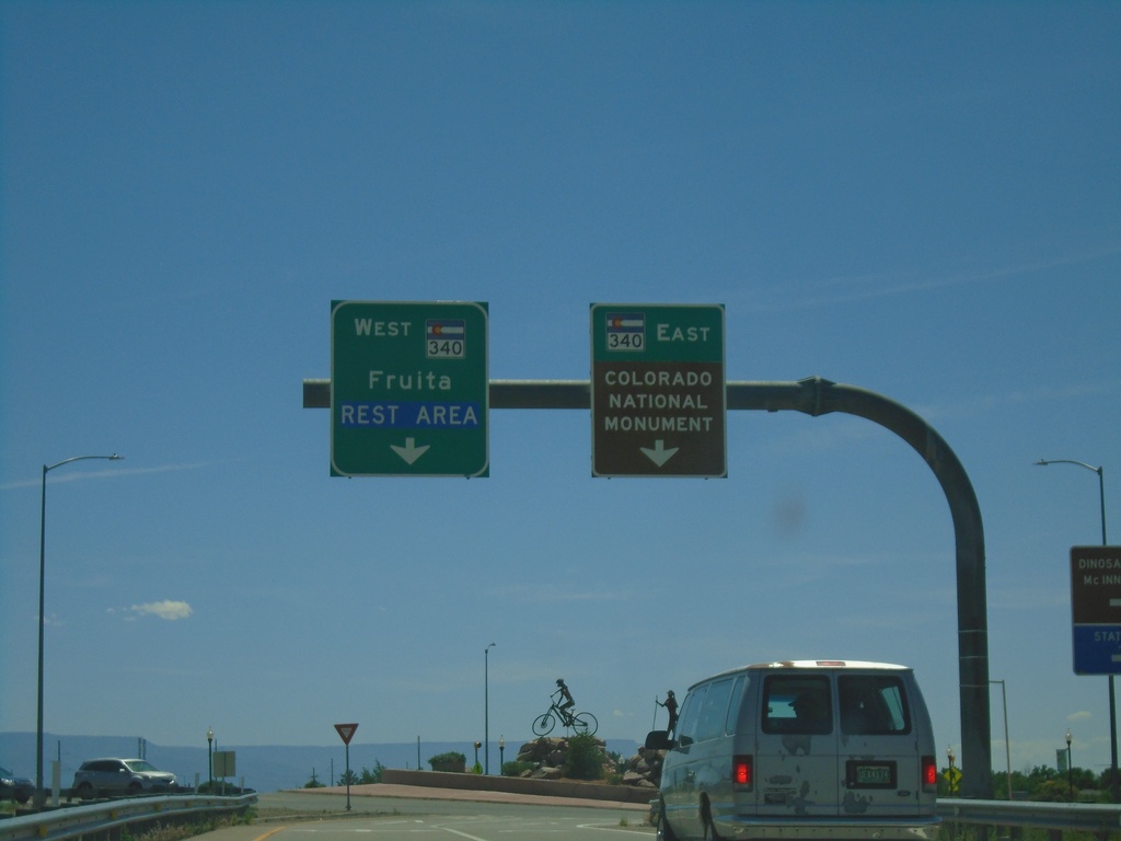
I-70 East Exit 19 Offramp at CO-340
I-70 East Exit 19 Offramp at CO-340 in Fruita. Use CO-340 West to Fruita and Rest Area. Use CO-340 East to Colorado National Monument.
Taken 07-09-2022

 Fruita
Mesa County
Colorado
United States
Fruita
Mesa County
Colorado
United States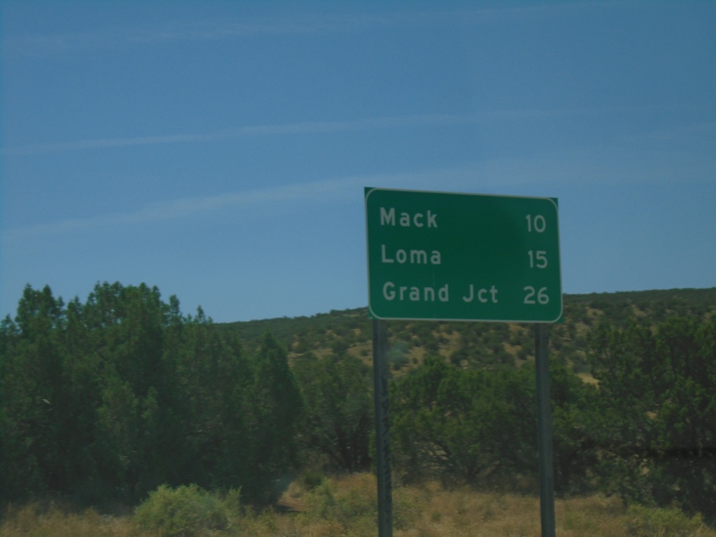
I-70 East - Distance Marker
Distance marker on I-70 east. Distance to Mack, Loma, and Grand Junction. This is the first distance marker in Colorado on I-70 east.
Taken 07-09-2022
Mack
Mesa County
Colorado
United States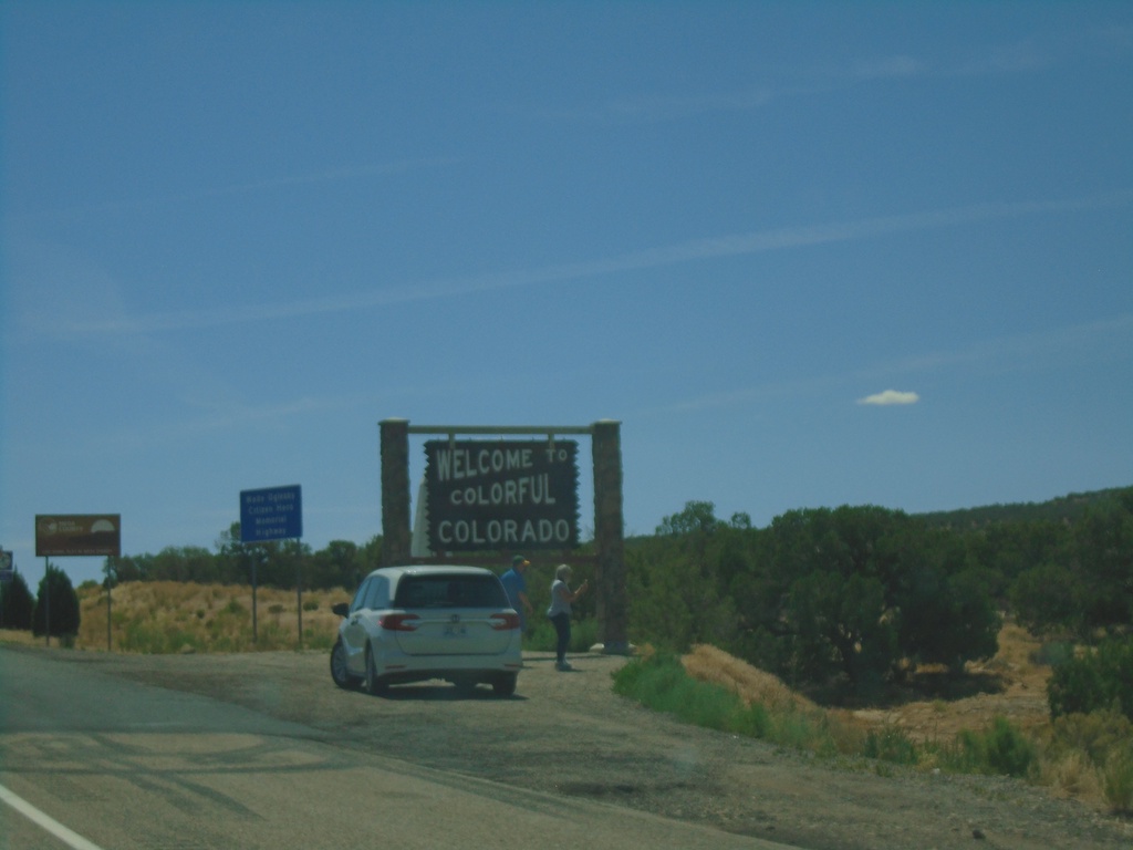
I-70 East - Entering Colorado
Welcome to colorful Colorado on I-70 east. Taken at the Utah-Colorado line.
Taken 07-09-2022
Mack
Mesa County
Colorado
United States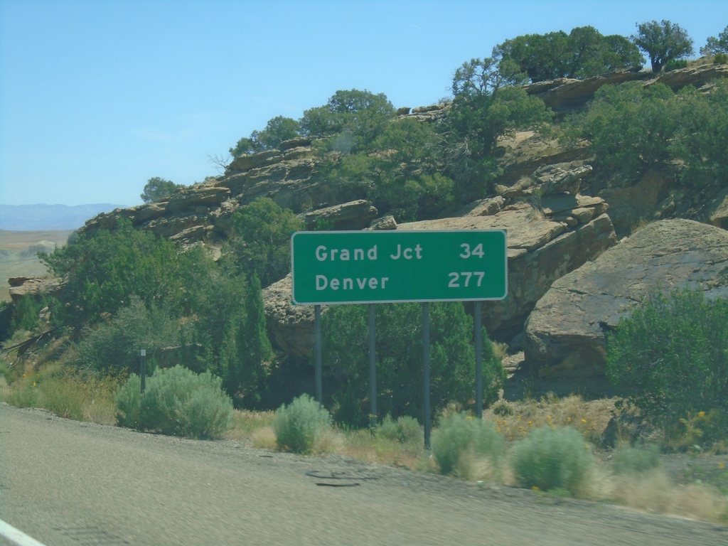
I-70 East - Distance Marker
Distance marker on I-70 west. Distance to Grand Junction and Denver. This is the last distance marker along I-70 in Utah.
Taken 07-09-2022
Cisco
Grand County
Utah
United States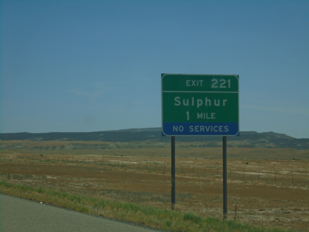
I-70 East - Exit 221
I-70 east approaching Exit 221 - Sulphur.
Taken 07-09-2022
Thompson Springs
Grand County
Utah
United States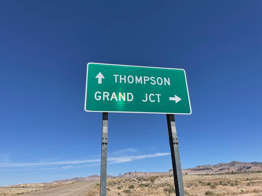
Yellowcat Road at I-70 - Grand County
Yellowcat Road at I-70 in Grand County. Use I-70 East for Grand Junction (Colorado); I-70 East for Thompson.
Taken 07-09-2022
Thompson Springs
Grand County
Utah
United States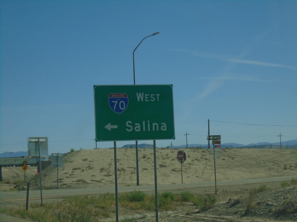
BL-70/UT-19 East at I-70 West
BL-70/UT-19 East at I-70 West to Salina.
Taken 07-09-2022

 Green River
Emery County
Utah
United States
Green River
Emery County
Utah
United States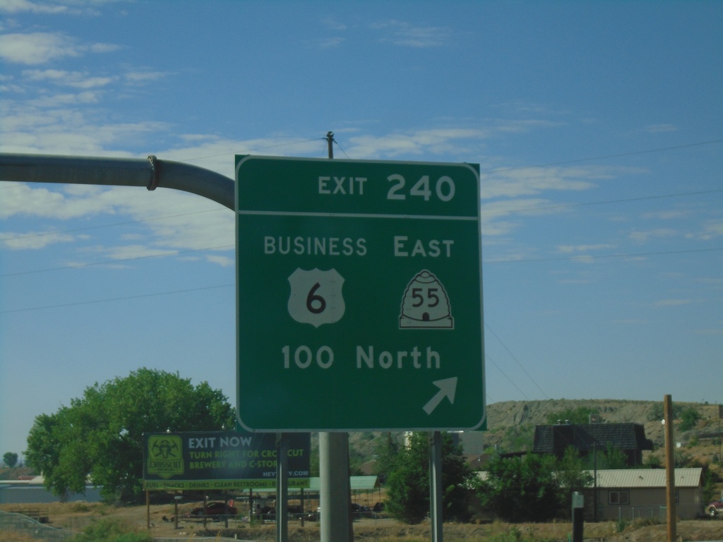
US-6 East/US-191 South - Exit 240
US-6 East/US-191 South at Exit 240 - Business Loop US-6/UT-55 East/100 North. This is the western end of the Price business loop.
Taken 07-09-2022

 Price
Carbon County
Utah
United States
Price
Carbon County
Utah
United States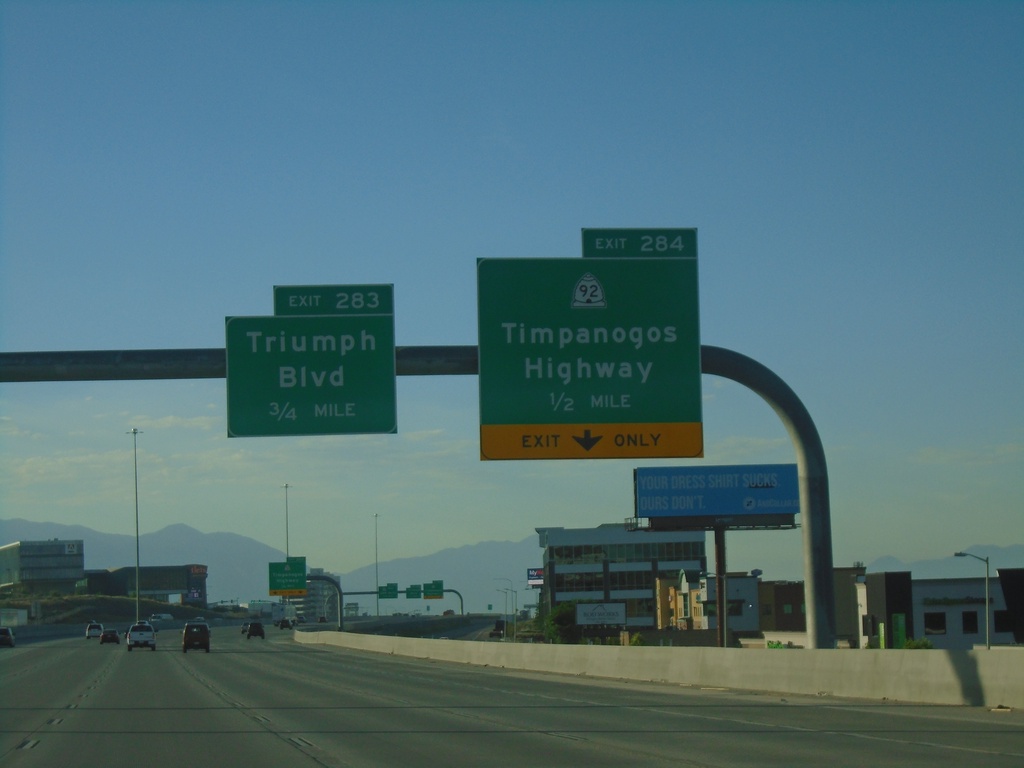
I-15 South - Exits 284 and 283
I-15 south approaching Exit 284 - UT-92/Timpanogos Highway. Approaching Exit 283 - Triumph Blvd.
Taken 07-09-2022

 Lehi
Utah County
Utah
United States
Lehi
Utah County
Utah
United States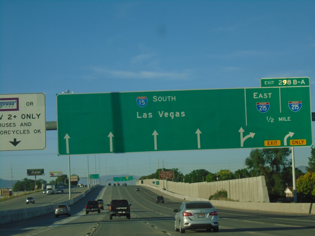
I-15 South Approaching Exit 298B-A
I-15 South approaching Exit 298B-A - I-215. Continue south on I-15 for Las Vegas (Nevada). I-215 is the Salt Lake City area belt route, and this is the southern part of the loop.
Taken 07-09-2022
 Murray
Salt Lake County
Utah
United States
Murray
Salt Lake County
Utah
United States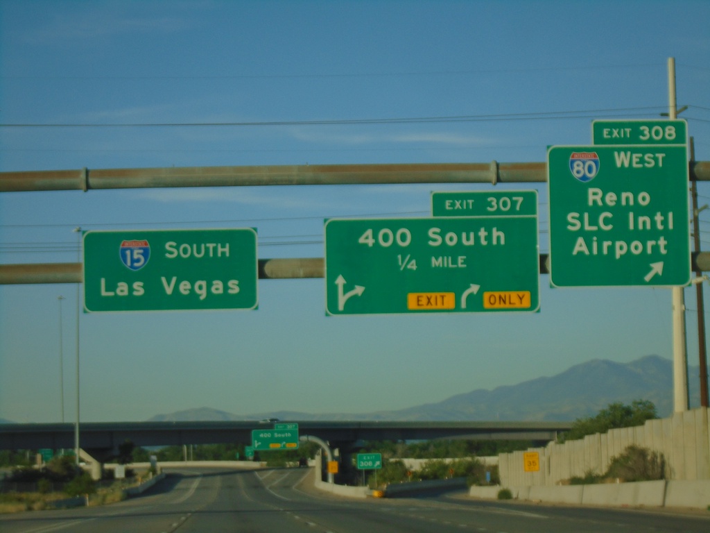
I-15 South Exits 308 and 307
I-15 south at Exit 308 - I-80 West/Reno (Nevada)/SLC International Airport. I-15 south approaching Exit 307 - 400 South. Continue on I-15 south to Las Vegas (Nevada). I-80 joins I-15 through downtown Salt Lake City.
Taken 07-09-2022
 Salt Lake City
Salt Lake County
Utah
United States
Salt Lake City
Salt Lake County
Utah
United States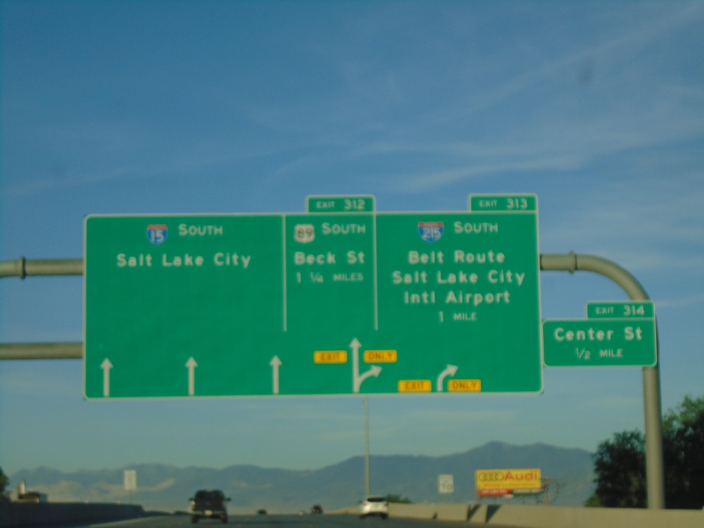
I-15 South - Exits 312, 313 and 314
I-15 South approaching Exit 314 - Center St. Approaching Exit 313 - I-215 South/Belt Route/Salt Lake City International Airport. Approaching Exit 312 - US-89 South/Beck St. Continue south on I-15 to Salt Lake City.
Taken 07-09-2022
 North Salt Lake
Davis County
Utah
United States
North Salt Lake
Davis County
Utah
United States