Signs Tagged With County Boundary
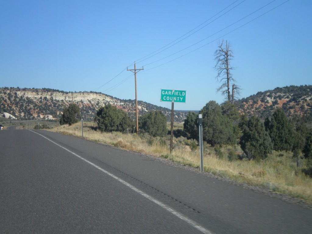
US-89 North - Garfield County
Entering Garfield County on US-89 north.
Taken 10-13-2011
 Alton
Kane County
Utah
United States
Alton
Kane County
Utah
United States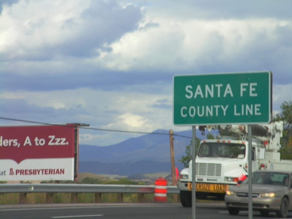
US-84/US-285 South - Santa Fe County Line
Santa Fe County Line on US-84/US-285 South. Taken on the south side of Española, which spans Rio Arriba and Santa Fe Counties.
Taken 10-03-2011

 Santa Cruz
Santa Fe County
New Mexico
United States
Santa Cruz
Santa Fe County
New Mexico
United States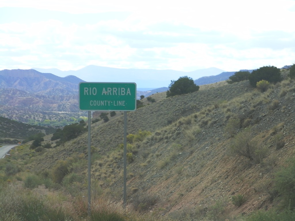
NM-75 West - Rio Arriba County Line
Rio Arriba County Line on NM-75 west.
Taken 10-03-2011
 Dixon
Rio Arriba County
New Mexico
United States
Dixon
Rio Arriba County
New Mexico
United States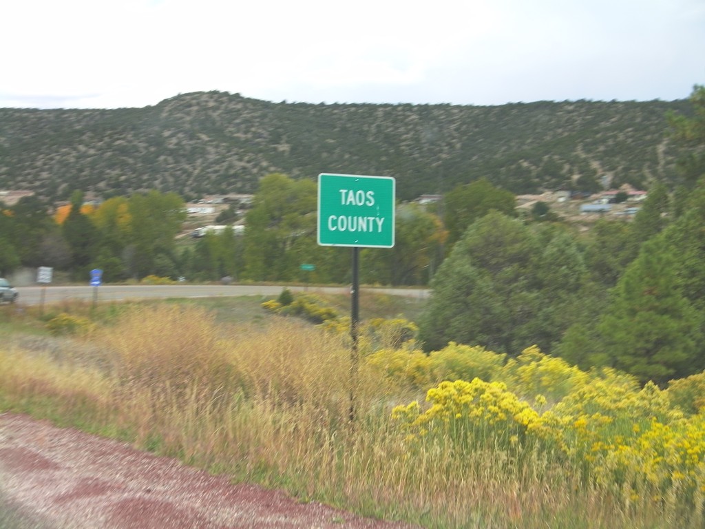
NM-76 North - Taos County
Entering Taos County on NM-76 north. County line signs in New Mexico tend to have the words "County Line" in all capital letters in a smaller font below the county name.
Taken 10-03-2011
 Chamisal
Rio Arriba County
New Mexico
United States
Chamisal
Rio Arriba County
New Mexico
United States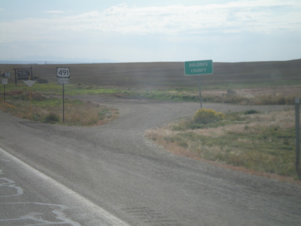
US-491 South - Dolores County
Dolores County on US-491 south. The Colorado welcome sign can be seen in the background. Taken at the Utah-Colorado state line.
Taken 10-02-2011
 Dove Creek
Dolores County
Colorado
United States
Dove Creek
Dolores County
Colorado
United States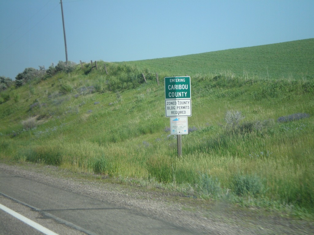
US-30 West - Entering Caribou County
Entering Caribou County on US-30 west.
Taken 07-05-2011
 Soda Springs
Bear Lake County
Idaho
United States
Soda Springs
Bear Lake County
Idaho
United States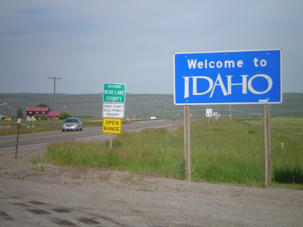
Welcome To Idaho - US-30 West
Welcome to Idaho on US-30 west. Entering Bear Lake County. Taken at the Wyoming-Idaho Border.
Taken 07-05-2011
Montpelier
Bear Lake County
Idaho
United States
US-12 West - Walla Walla County
Entering Walla Walla County on US-12 west.
Taken 04-28-2011
 Dayton
Walla Walla County
Washington
United States
Dayton
Walla Walla County
Washington
United States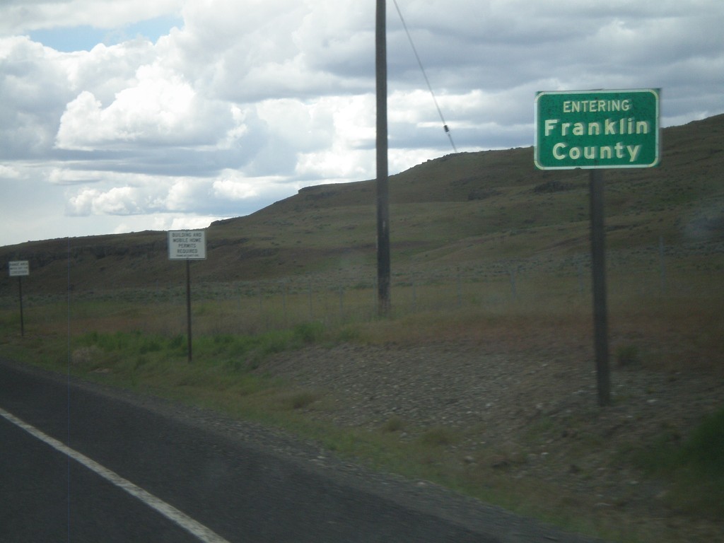
WA-260 West/WA-261 South - Franklin County
Entering Franklin County on WA-260 West/WA-261 south.
Taken 04-28-2011

 Washtucna
Franklin County
Washington
United States
Washtucna
Franklin County
Washington
United States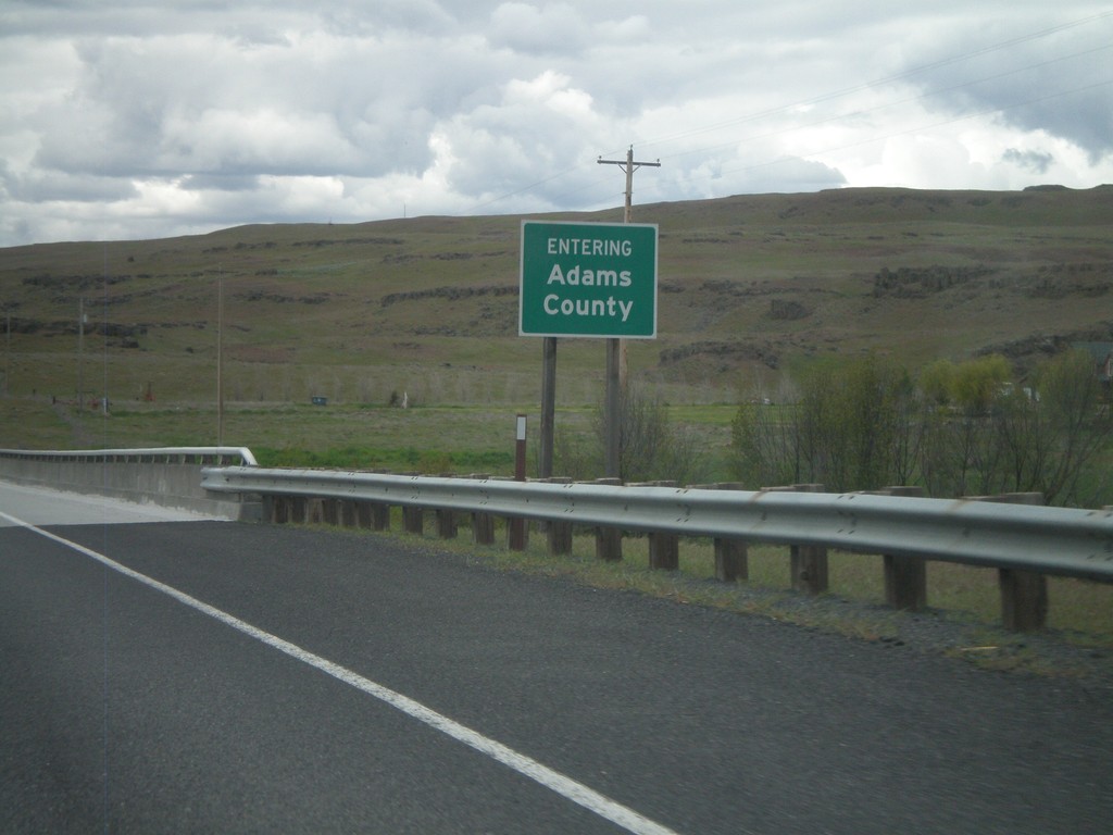
WA-26 - Adams County
Entering Adams County on WA-26 west crossing the Palouse River.
Taken 04-28-2011
 Benge
Adams County
Washington
United States
Benge
Adams County
Washington
United States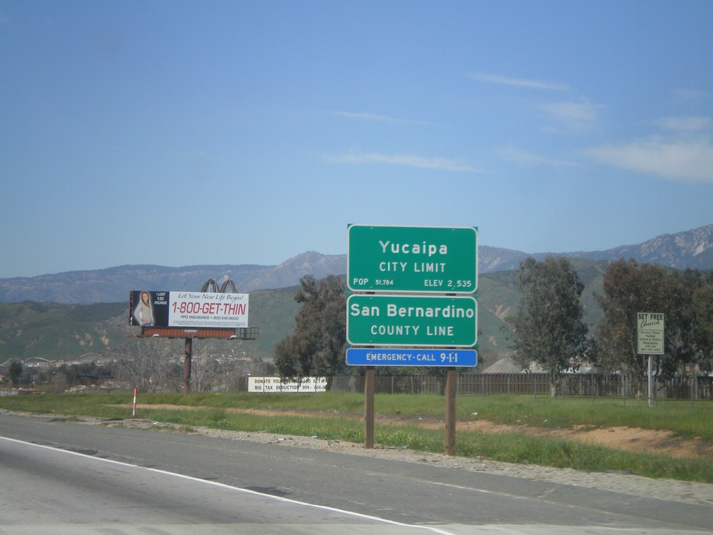
I-10 West - San Bernardino County Line
I-10 west at San Bernardino County Line, and Yucaipa City Limits.
Taken 02-28-2011
 Calimesa
San Bernardino County
California
United States
Calimesa
San Bernardino County
California
United States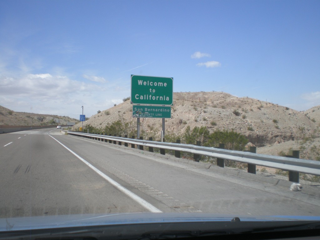
Welcome To California - I-40 West
Welcome to California on I-40 west at the Arizona-California state line crossing the Colorado River. San Bernardino County line.
Taken 02-25-2011
 Needles
San Bernardino County
California
United States
Needles
San Bernardino County
California
United States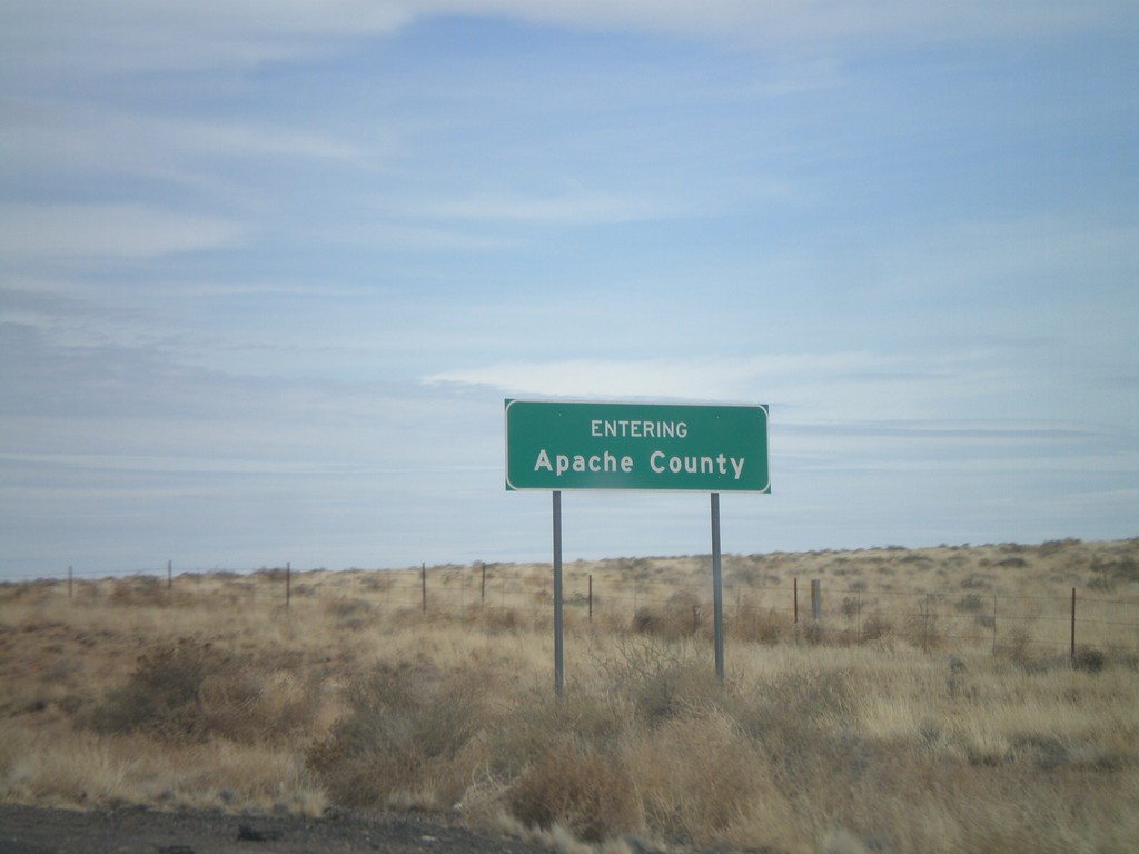
I-40 East - Entering Apache County
Entering Apache County on I-40 east.
Taken 02-24-2011
Adamana
Apache County
Arizona
United States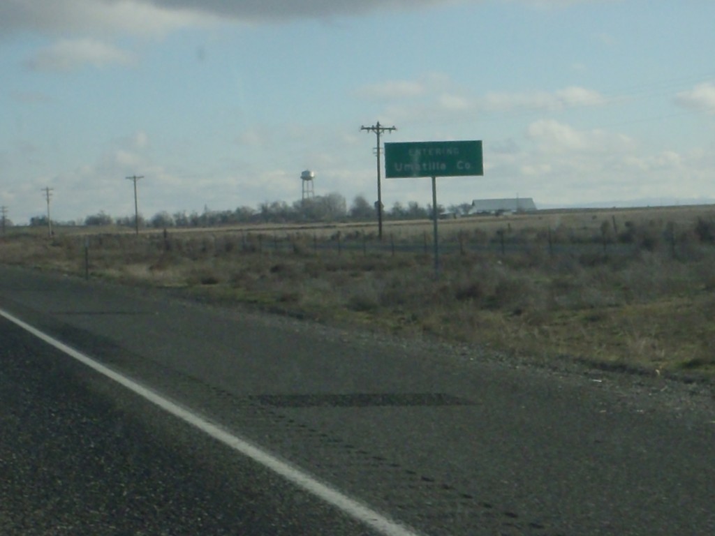
I-84 East - Entering Umatilla County
Entering Umatilla County on I-84 east.
Taken 01-19-2011
 Hermiston
Umatilla County
Oregon
United States
Hermiston
Umatilla County
Oregon
United States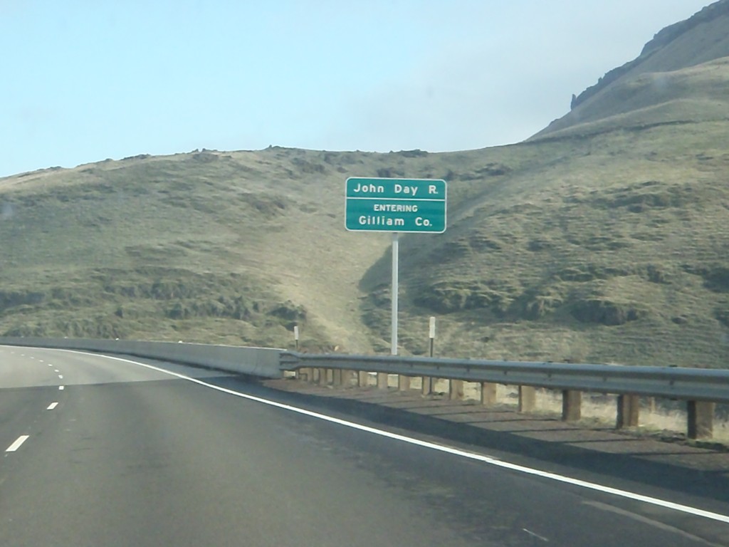
I-84 East - Entering Gilliam County
Entering Gilliam County on I-84 west, crossing the John Day River.
Taken 01-19-2011
Arlington
Sherman County
Oregon
United States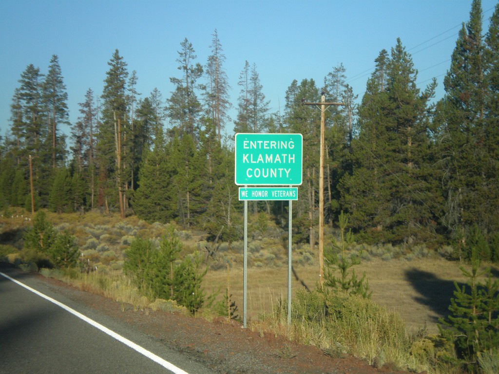
Silver Lake Road - Entering Klamath County
Entering Klamath County on Silver Lake Road west. All Klamath County welcome signs display the text, We Honor Veterans.
Taken 09-25-2010
Silver Lake Klamath County Oregon United States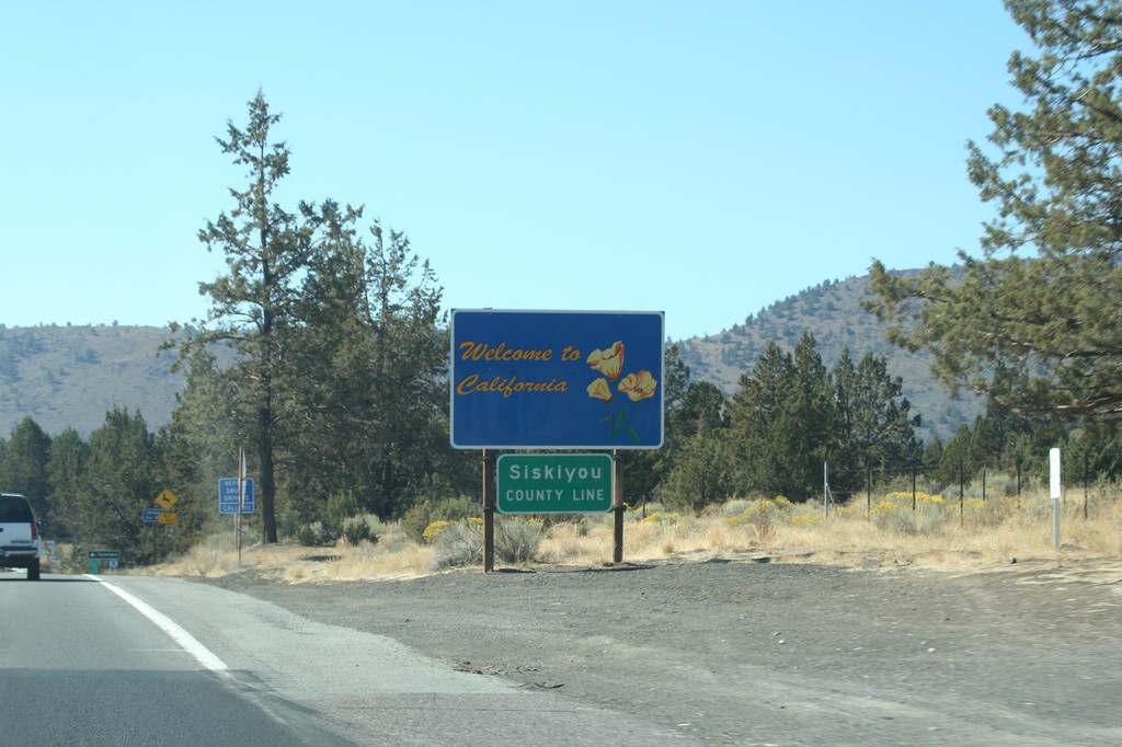
Welcome To California - US-97 South
Welcome to California on US-97 south. Siskiyou County Line. Taken at the Oregon-California border.
Taken 09-25-2010
 Dorris
Siskiyou County
California
United States
Dorris
Siskiyou County
California
United States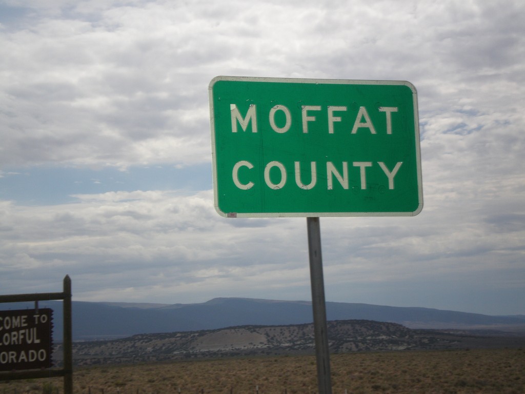
Entering Moffat County
Entering Moffat County Colorado at the Utah-Colorado State Line.
Taken 08-01-2010
 Moffat County
Colorado
United States
Moffat County
Colorado
United States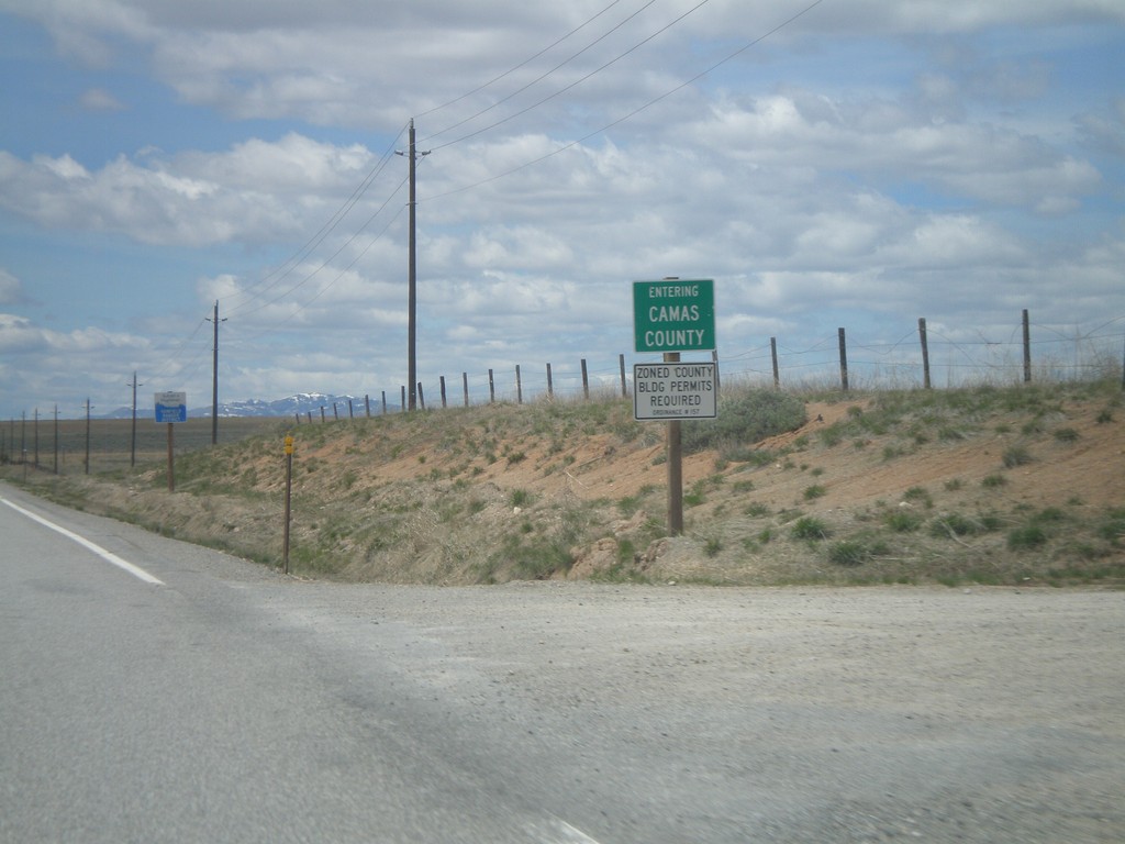
US-20 West - Entering Camas County
Entering Camas County on US-20 west at the Blaine-Camas County Line.
Taken 05-02-2010
 Fairfield
Camas County
Idaho
United States
Fairfield
Camas County
Idaho
United States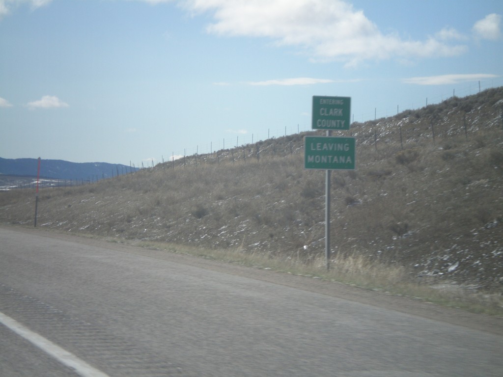
I-15 South - Entering Clark County
I-15 south Entering Clark Count and Leaving Montana. Taken on Monida Pass on the Continental Divide between Idaho and Montana.
Taken 05-02-2010
 Humphrey
Clark County
Idaho
United States
Humphrey
Clark County
Idaho
United States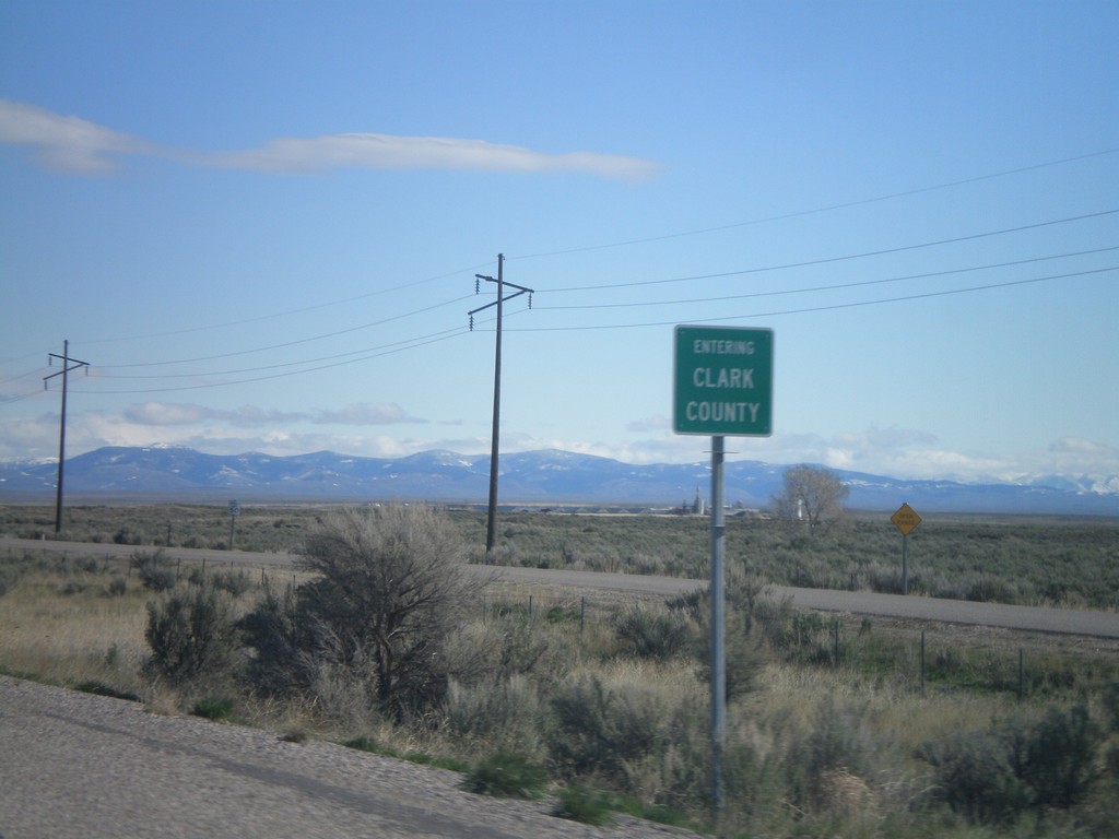
I-15 North - Entering Clark County
Entering Clark County on I-15 north at the Jefferson - Clark County line.
Taken 05-02-2010
Hamer
Clark County
Idaho
United States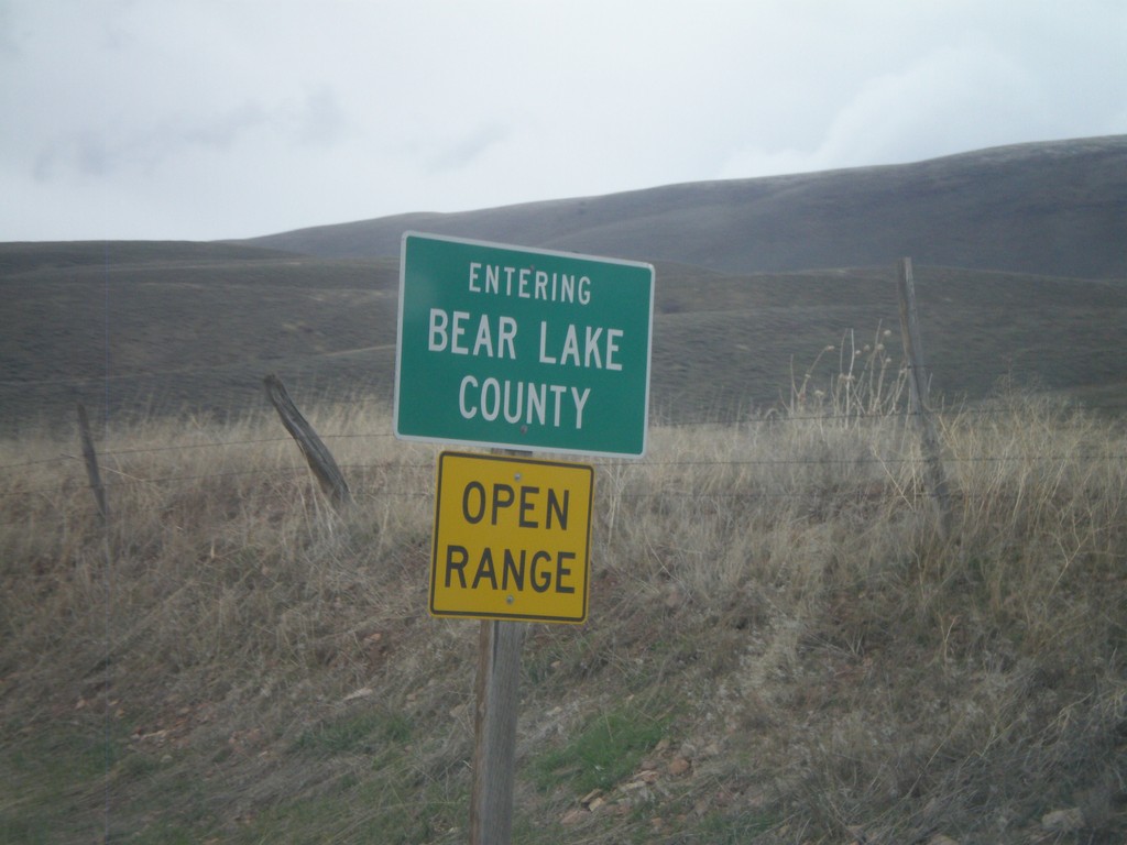
ID-61 North - Entering Bear Lake County
Entering Bear Lake County on ID-61 north at the Idaho-Wyoming state line.
Taken 05-01-2010
 Geneva
Bear Lake County
Idaho
United States
Geneva
Bear Lake County
Idaho
United States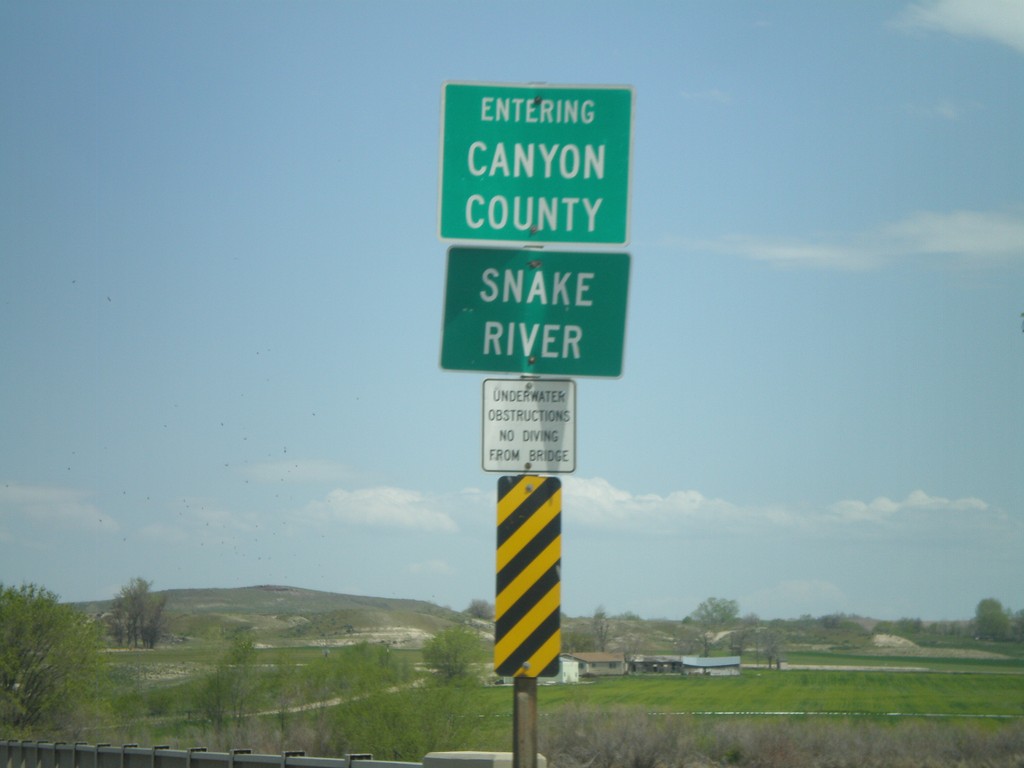
ID-55 North at Canyon County Line
ID-55 north crossing the Snake River and entering Canyon County.
Taken 04-20-2010
 Marsing
Owyhee County
Idaho
United States
Marsing
Owyhee County
Idaho
United States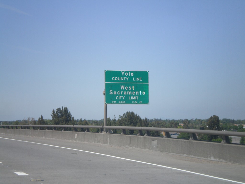
US-50/BL-80 West - Yolo-Sacramento County Line
US-50/BL-80 west at the Yolo-Sacramento County Line at the Sacramento River. Also entering the city of West Sacramento.
Taken 04-16-2010

 Sacramento
 County
California
United States
Sacramento
Sacramento County
California
United States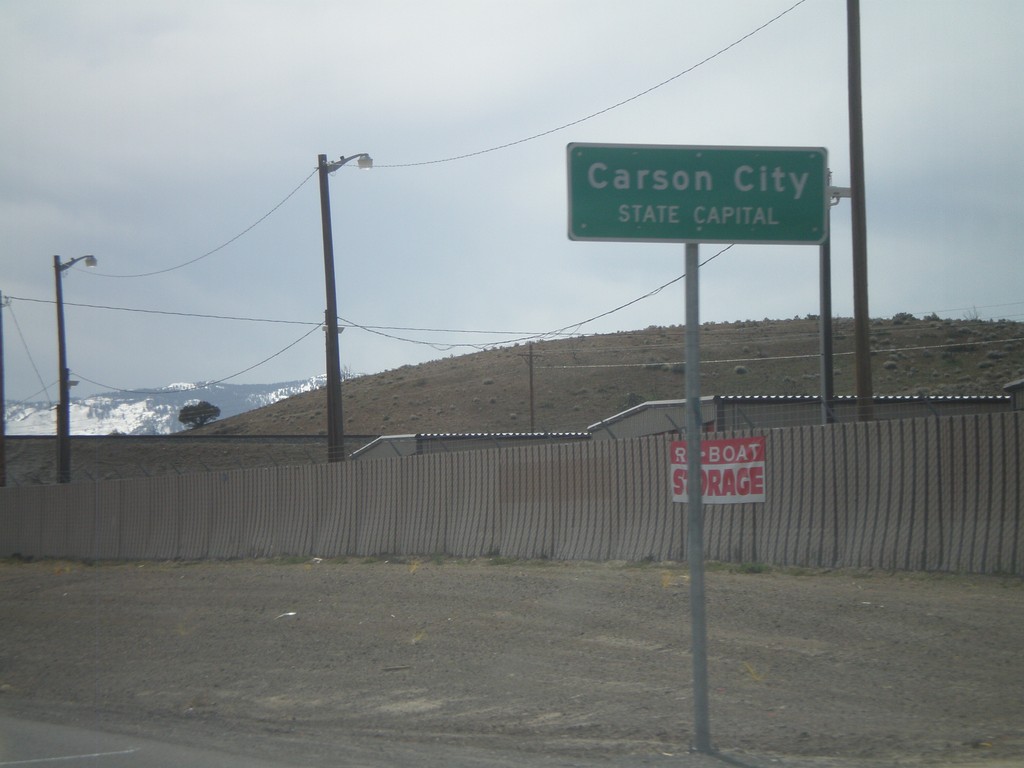
US-50 West - Entering Carson City
US-50 west at the Lyon County - Carson City line. When entering all other counties in Nevada, the county name is above the words County Line. In Carson City, the County Line is replaced with State Capitol.
Taken 04-15-2010
Mound House
Lyon County
Nevada
United States