Signs Tagged With County Boundary
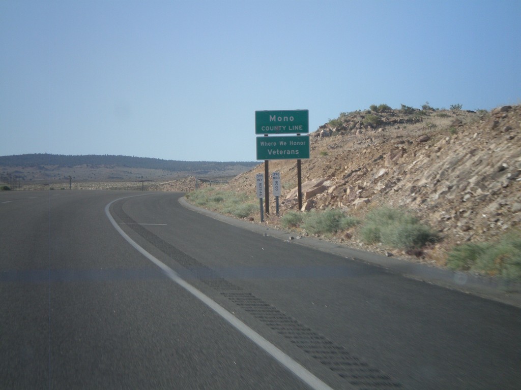
US-395 North - Mono County
Mono County Line on US-395 north.
Taken 05-06-2012
 Mesa
Inyo County
California
United States
Mesa
Inyo County
California
United States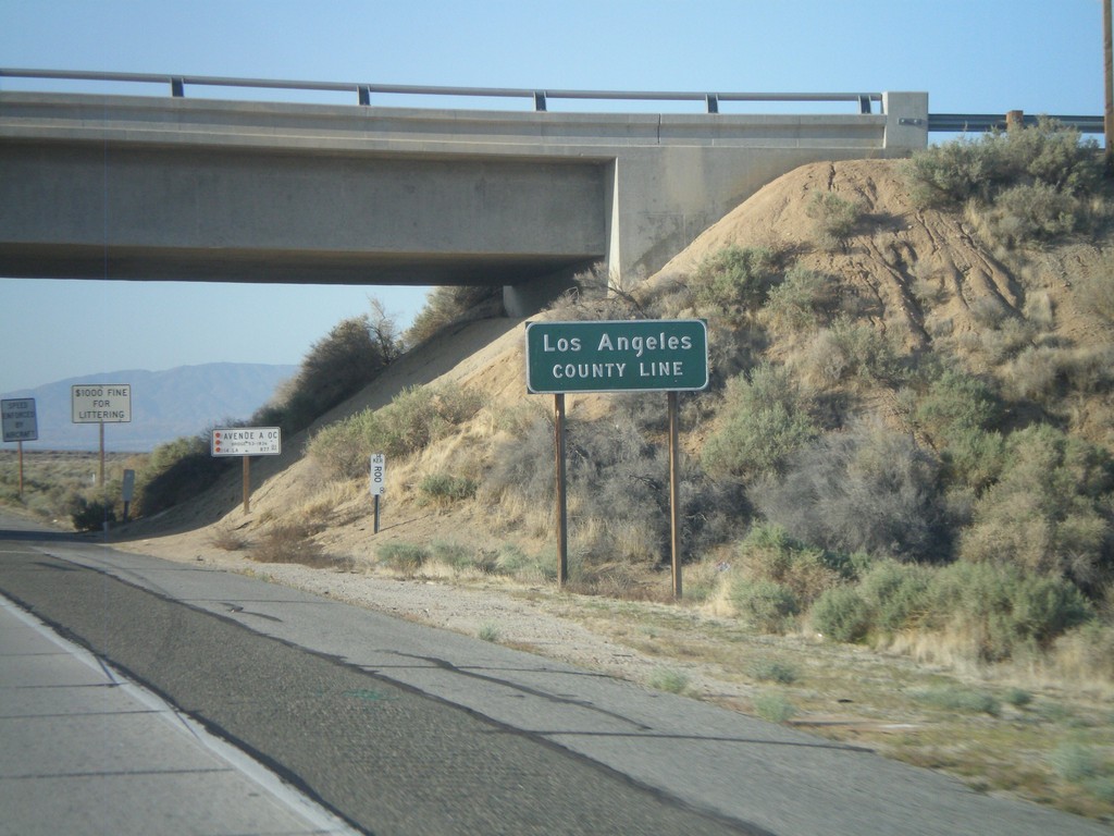
CA-14 South - Los Angeles County Line
Los Angeles County Line on CA-14 south. Los Angeles County is the most populous county in the United States according to the 2010 US Census.
Taken 05-05-2012
 Rosamond
Los Angeles County
California
United States
Rosamond
Los Angeles County
California
United States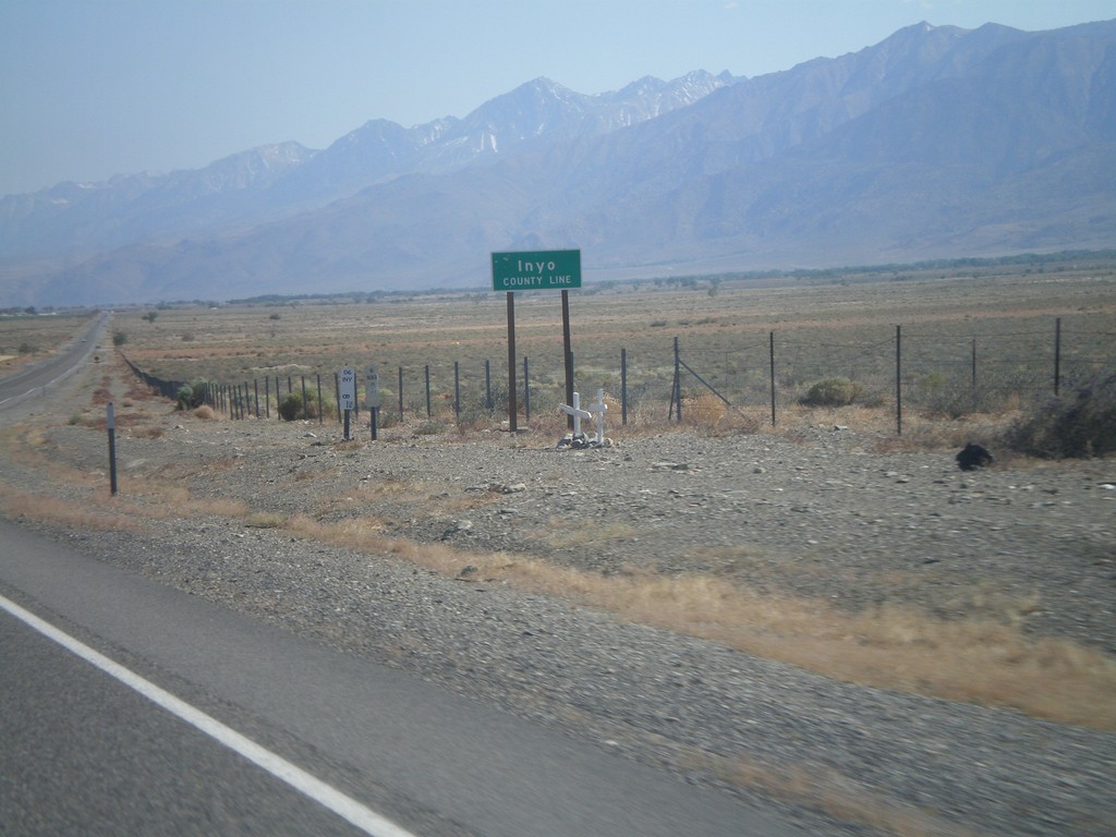
US-6 West - Inyo County Line
Inyo County Line on US-6 west. Taken at the Mono-Inyo county line.
Taken 05-04-2012
 Bishop
Inyo County
California
United States
Bishop
Inyo County
California
United States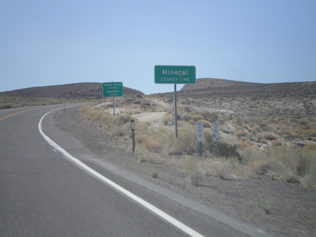
US-6 West - Mineral County Line
US-6 West at Mineral County Line. Taken at the Mineral - Esmeralda County Line.
Taken 05-04-2012
Esmeralda County
Nevada
United States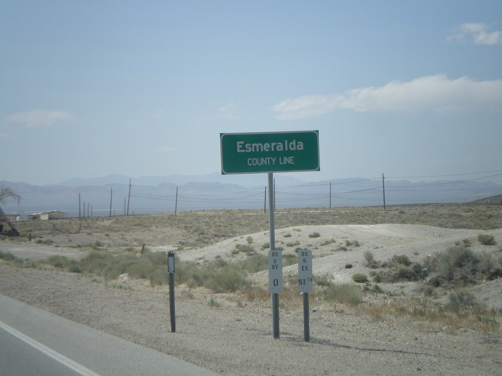
US-6 West/US-95 North - Esmeralda County Line
Esmeralda County Line on US-6 West/US-95 North leaving Tonopah. Taken at the Esmeralda-Nye County Line.
Taken 05-04-2012
 Tonopah
Esmeralda County
Nevada
United States
Tonopah
Esmeralda County
Nevada
United States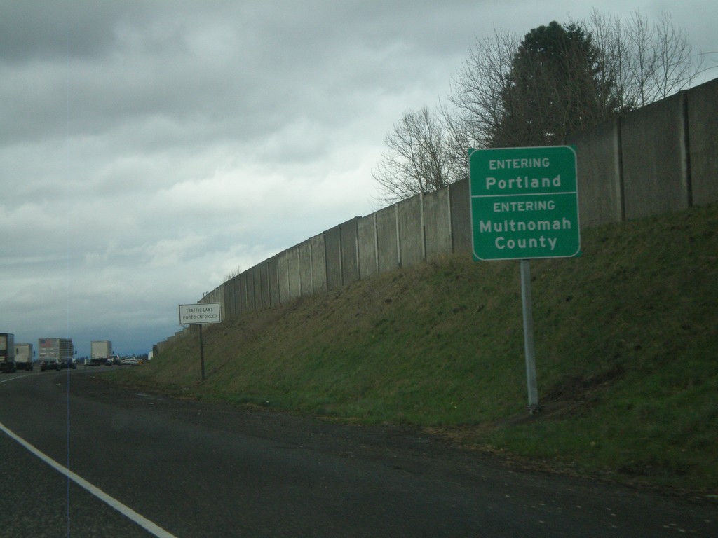
I-205 North - Entering Portland and Multnomah County
Entering Portland on I-205 North. Also entering Multnomah County.
Taken 02-21-2012
 Portland
Multnomah County
Oregon
United States
Portland
Multnomah County
Oregon
United States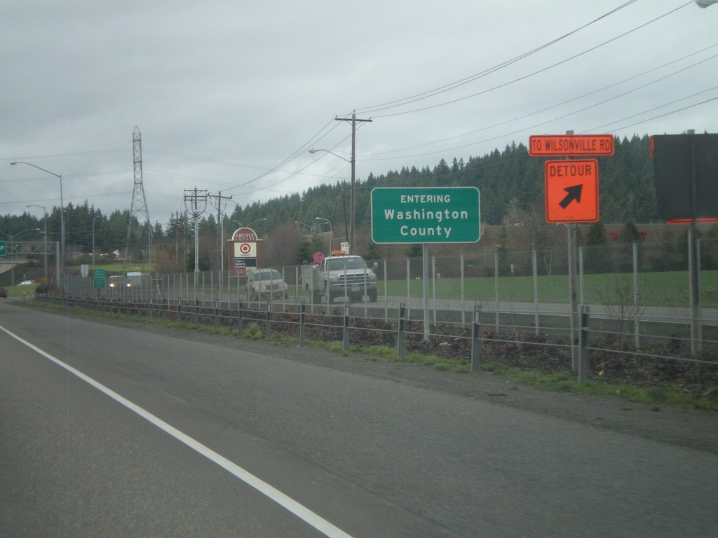
I-5 North - Entering Washington County
Entering Washington County on I-5 north in Wilsonville.
Taken 02-21-2012
 Wilsonville
Clackamas County
Oregon
United States
Wilsonville
Clackamas County
Oregon
United States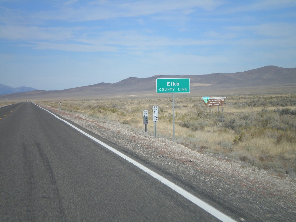
US-93 North - Elko County
Entering Elko County on US-93 north. Elko County is the fourth largest county by area in the lower 48 states.
Taken 10-15-2011
 Ely
Elko County
Nevada
United States
Ely
Elko County
Nevada
United States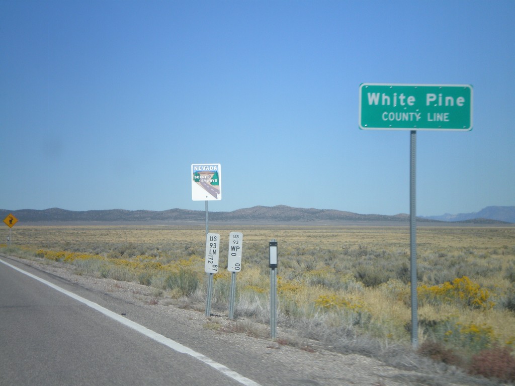
US-93 North - White Pine County Line
White Pine County Line on US-93 north. The sign behind the county line designates this stretch of US-93 as a Nevada Scenic Byway.
Taken 10-14-2011
Pioche
White Pine County
Nevada
United States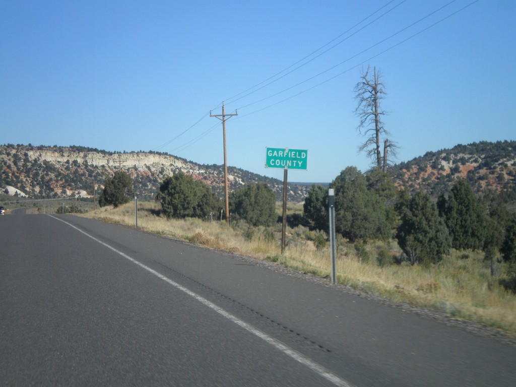
US-89 North - Garfield County
Entering Garfield County on US-89 north.
Taken 10-13-2011
 Alton
Kane County
Utah
United States
Alton
Kane County
Utah
United States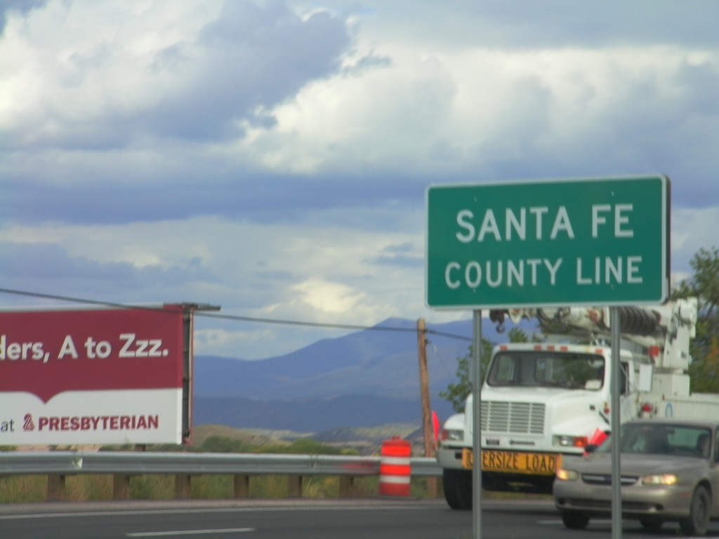
US-84/US-285 South - Santa Fe County Line
Santa Fe County Line on US-84/US-285 South. Taken on the south side of Española, which spans Rio Arriba and Santa Fe Counties.
Taken 10-03-2011

 Santa Cruz
Santa Fe County
New Mexico
United States
Santa Cruz
Santa Fe County
New Mexico
United States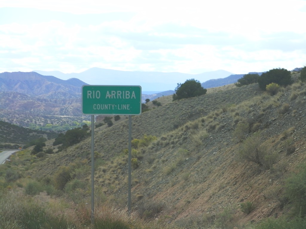
NM-75 West - Rio Arriba County Line
Rio Arriba County Line on NM-75 west.
Taken 10-03-2011
 Dixon
Rio Arriba County
New Mexico
United States
Dixon
Rio Arriba County
New Mexico
United States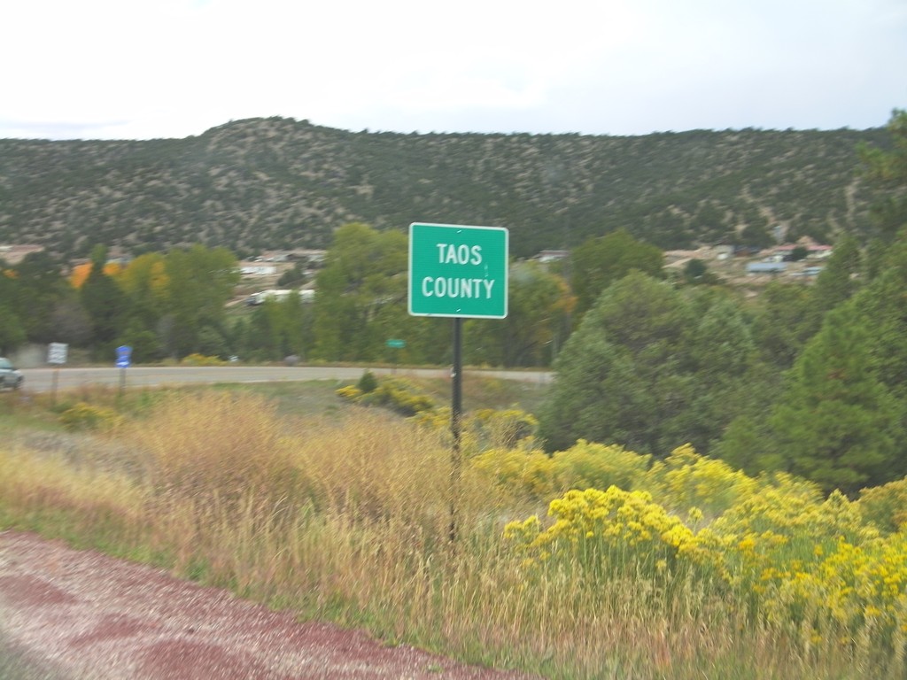
NM-76 North - Taos County
Entering Taos County on NM-76 north. County line signs in New Mexico tend to have the words "County Line" in all capital letters in a smaller font below the county name.
Taken 10-03-2011
 Chamisal
Rio Arriba County
New Mexico
United States
Chamisal
Rio Arriba County
New Mexico
United States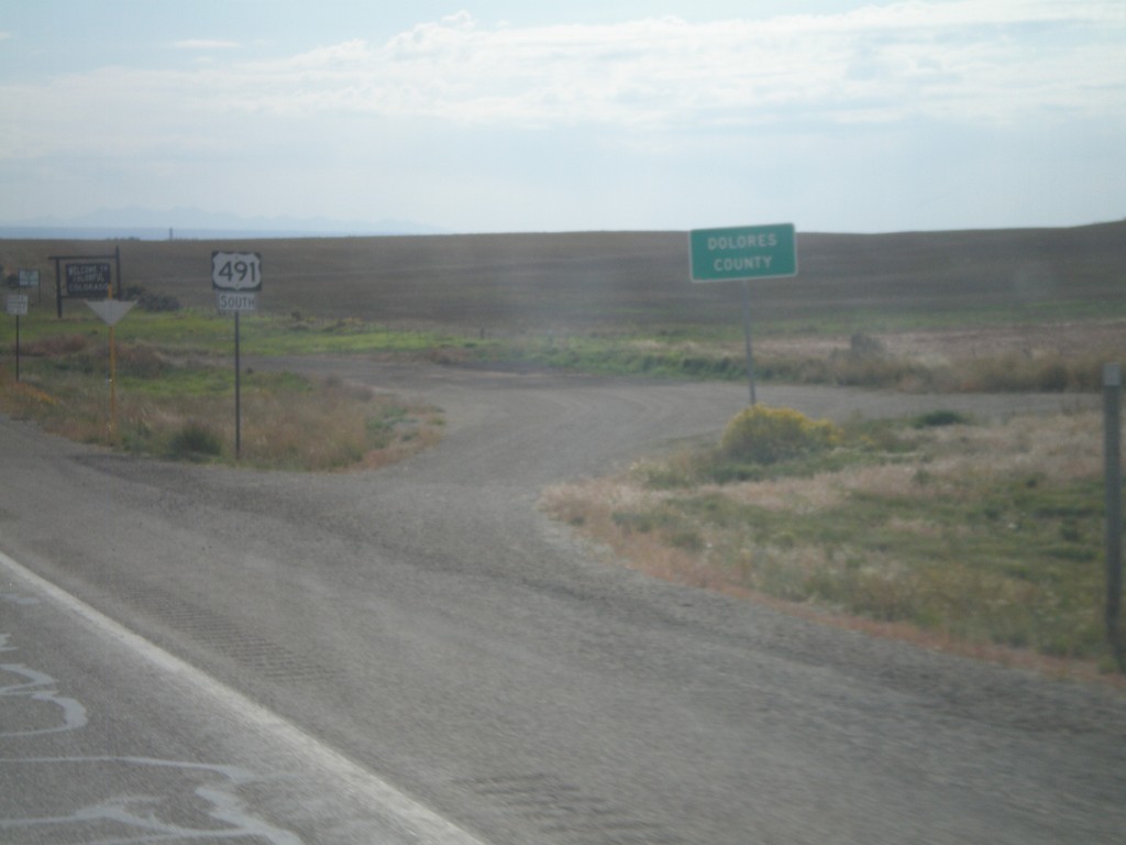
US-491 South - Dolores County
Dolores County on US-491 south. The Colorado welcome sign can be seen in the background. Taken at the Utah-Colorado state line.
Taken 10-02-2011
 Dove Creek
Dolores County
Colorado
United States
Dove Creek
Dolores County
Colorado
United States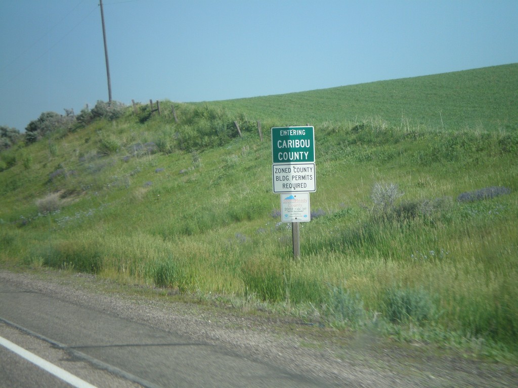
US-30 West - Entering Caribou County
Entering Caribou County on US-30 west.
Taken 07-05-2011
 Soda Springs
Bear Lake County
Idaho
United States
Soda Springs
Bear Lake County
Idaho
United States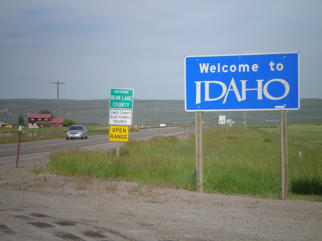
Welcome To Idaho - US-30 West
Welcome to Idaho on US-30 west. Entering Bear Lake County. Taken at the Wyoming-Idaho Border.
Taken 07-05-2011
Montpelier
Bear Lake County
Idaho
United States
US-12 West - Walla Walla County
Entering Walla Walla County on US-12 west.
Taken 04-28-2011
 Dayton
Walla Walla County
Washington
United States
Dayton
Walla Walla County
Washington
United States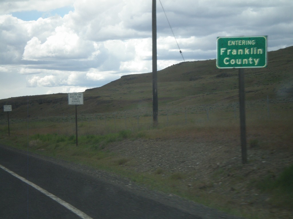
WA-260 West/WA-261 South - Franklin County
Entering Franklin County on WA-260 West/WA-261 south.
Taken 04-28-2011

 Washtucna
Franklin County
Washington
United States
Washtucna
Franklin County
Washington
United States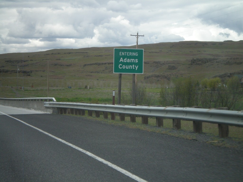
WA-26 - Adams County
Entering Adams County on WA-26 west crossing the Palouse River.
Taken 04-28-2011
 Benge
Adams County
Washington
United States
Benge
Adams County
Washington
United States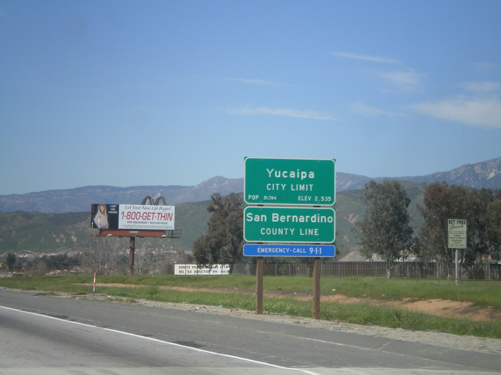
I-10 West - San Bernardino County Line
I-10 west at San Bernardino County Line, and Yucaipa City Limits.
Taken 02-28-2011
 Calimesa
San Bernardino County
California
United States
Calimesa
San Bernardino County
California
United States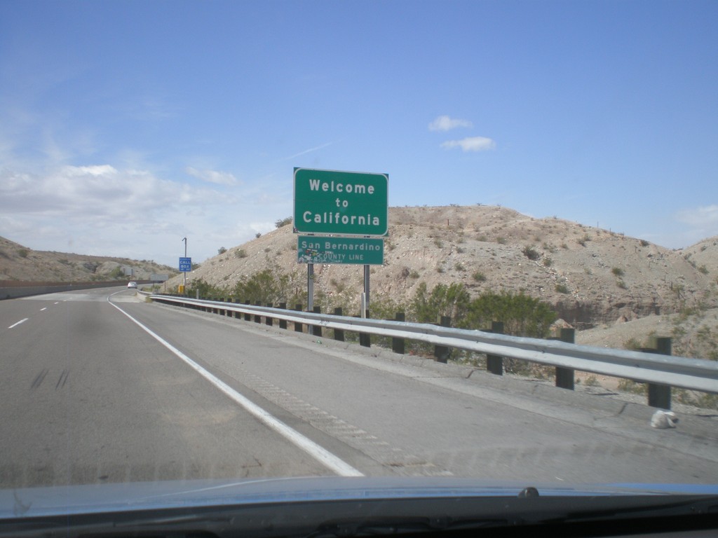
Welcome To California - I-40 West
Welcome to California on I-40 west at the Arizona-California state line crossing the Colorado River. San Bernardino County line.
Taken 02-25-2011
 Needles
San Bernardino County
California
United States
Needles
San Bernardino County
California
United States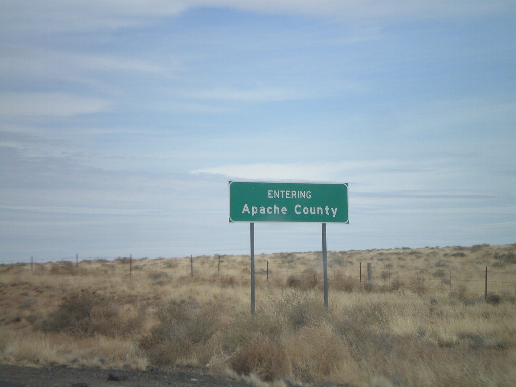
I-40 East - Entering Apache County
Entering Apache County on I-40 east.
Taken 02-24-2011
Adamana
Apache County
Arizona
United States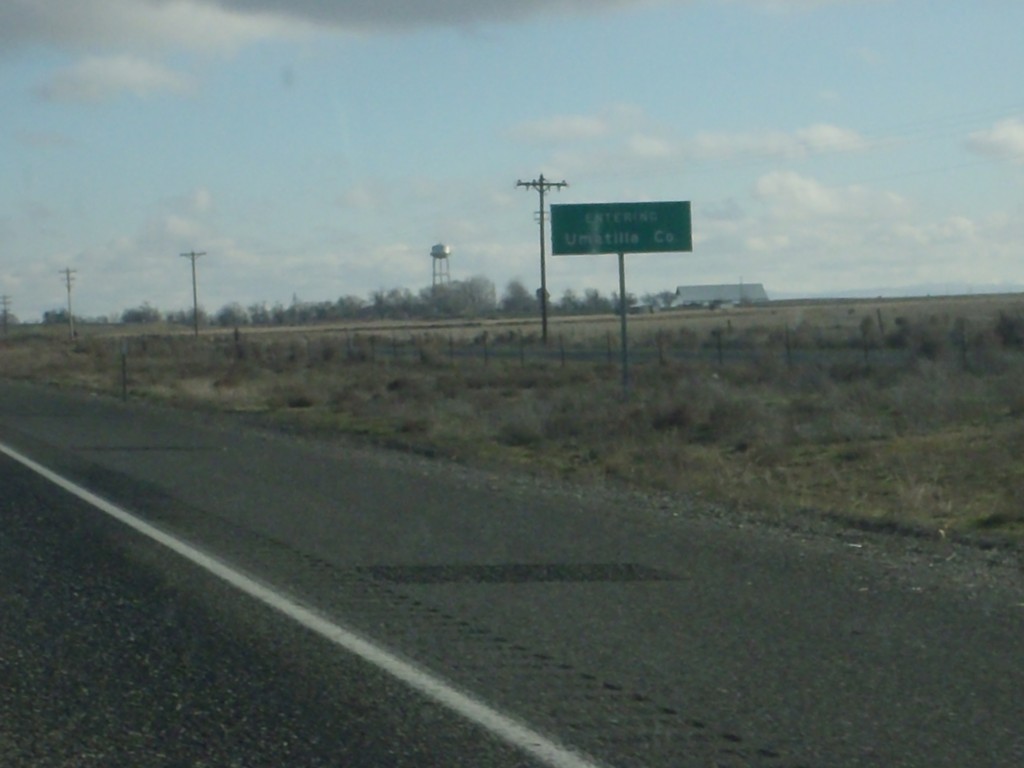
I-84 East - Entering Umatilla County
Entering Umatilla County on I-84 east.
Taken 01-19-2011
 Hermiston
Umatilla County
Oregon
United States
Hermiston
Umatilla County
Oregon
United States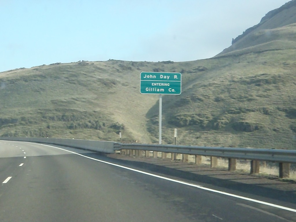
I-84 East - Entering Gilliam County
Entering Gilliam County on I-84 west, crossing the John Day River.
Taken 01-19-2011
Arlington
Sherman County
Oregon
United States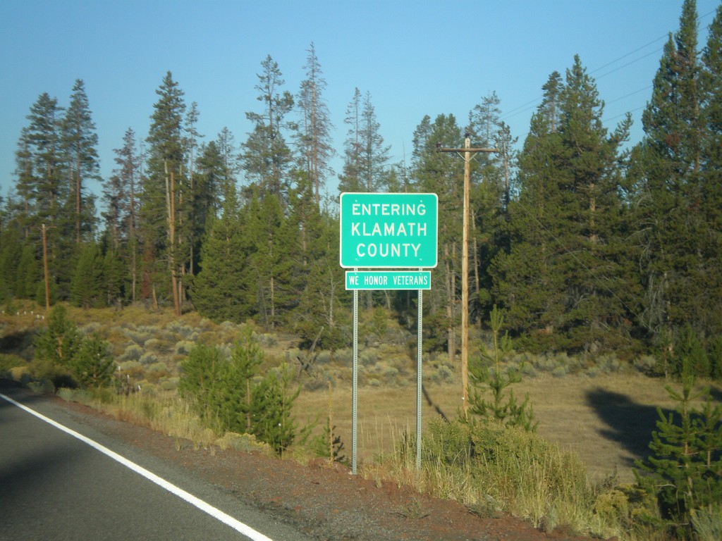
Silver Lake Road - Entering Klamath County
Entering Klamath County on Silver Lake Road west. All Klamath County welcome signs display the text, We Honor Veterans.
Taken 09-25-2010
Silver Lake Klamath County Oregon United States