Signs Tagged With County Boundary
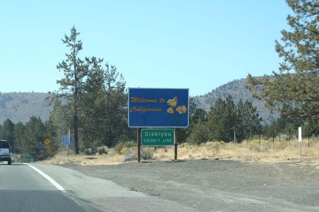
Welcome To California - US-97 South
Welcome to California on US-97 south. Siskiyou County Line. Taken at the Oregon-California border.
Taken 09-25-2010
 Dorris
Siskiyou County
California
United States
Dorris
Siskiyou County
California
United States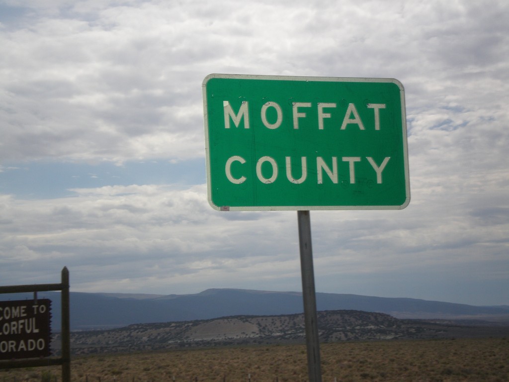
Entering Moffat County
Entering Moffat County Colorado at the Utah-Colorado State Line.
Taken 08-01-2010
 Moffat County
Colorado
United States
Moffat County
Colorado
United States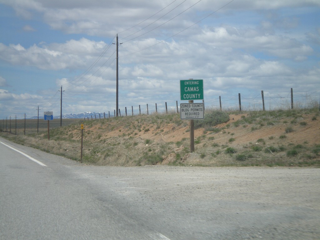
US-20 West - Entering Camas County
Entering Camas County on US-20 west at the Blaine-Camas County Line.
Taken 05-02-2010
 Fairfield
Camas County
Idaho
United States
Fairfield
Camas County
Idaho
United States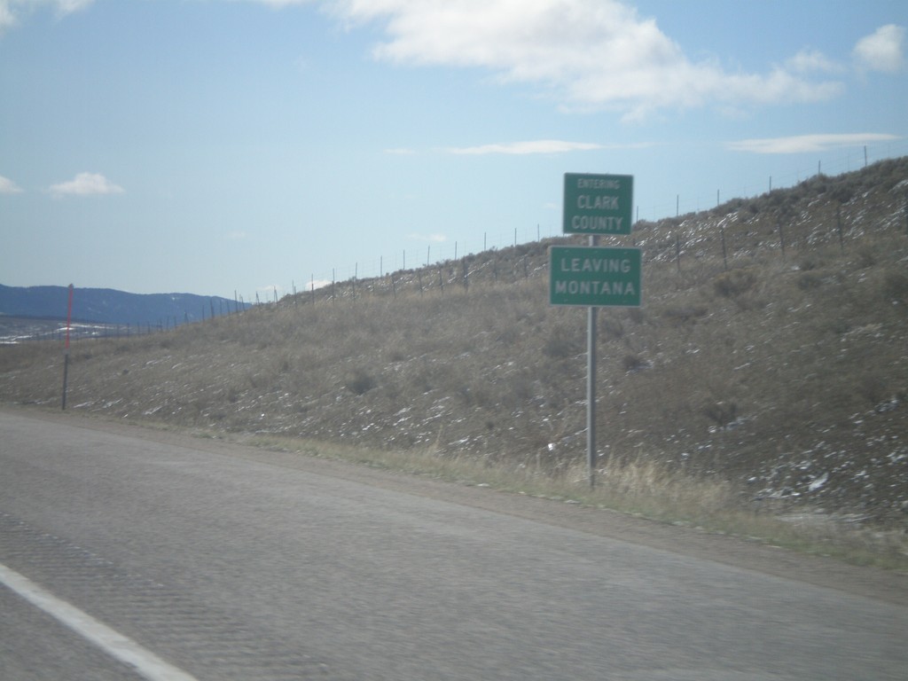
I-15 South - Entering Clark County
I-15 south Entering Clark Count and Leaving Montana. Taken on Monida Pass on the Continental Divide between Idaho and Montana.
Taken 05-02-2010
 Humphrey
Clark County
Idaho
United States
Humphrey
Clark County
Idaho
United States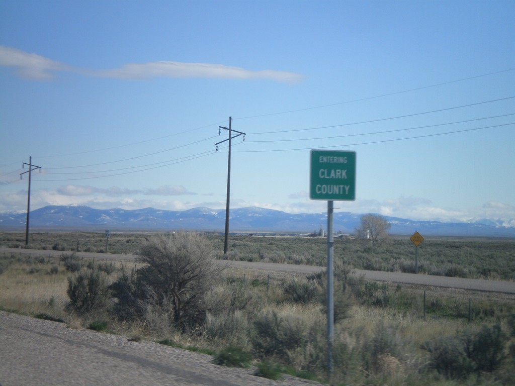
I-15 North - Entering Clark County
Entering Clark County on I-15 north at the Jefferson - Clark County line.
Taken 05-02-2010
Hamer
Clark County
Idaho
United States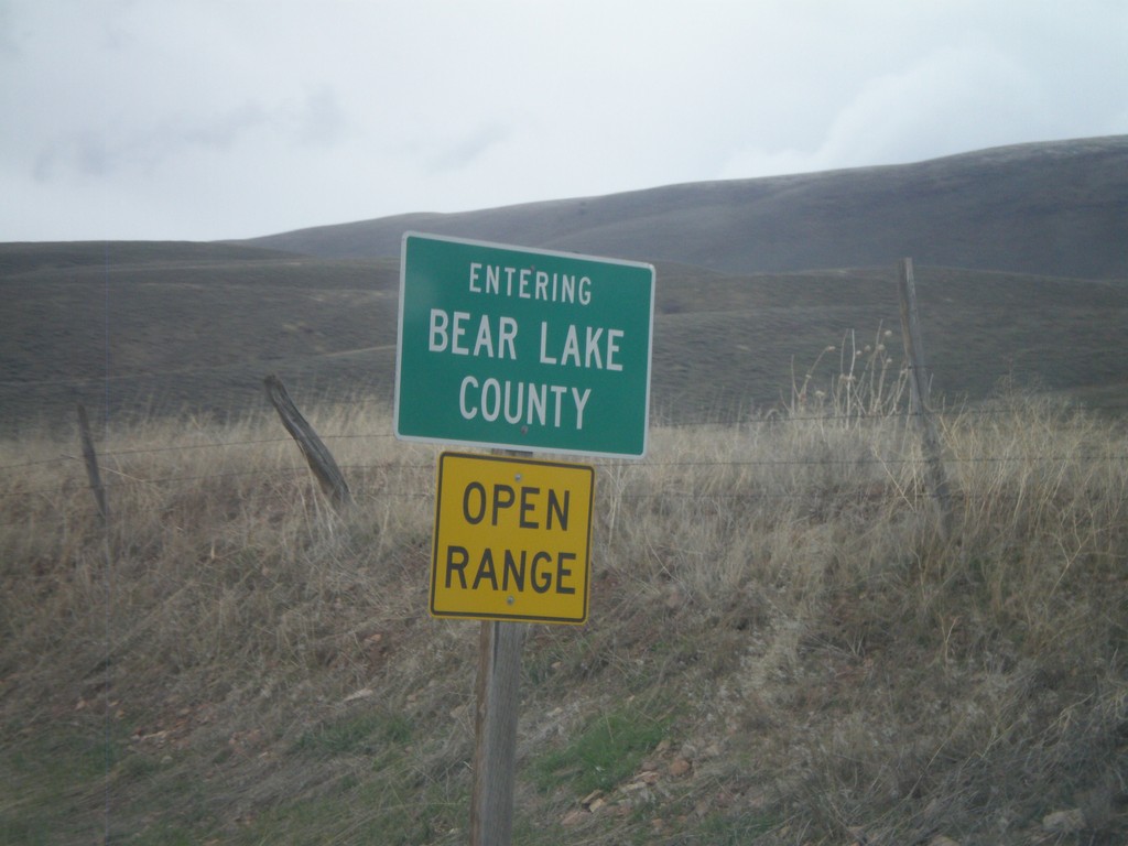
ID-61 North - Entering Bear Lake County
Entering Bear Lake County on ID-61 north at the Idaho-Wyoming state line.
Taken 05-01-2010
 Geneva
Bear Lake County
Idaho
United States
Geneva
Bear Lake County
Idaho
United States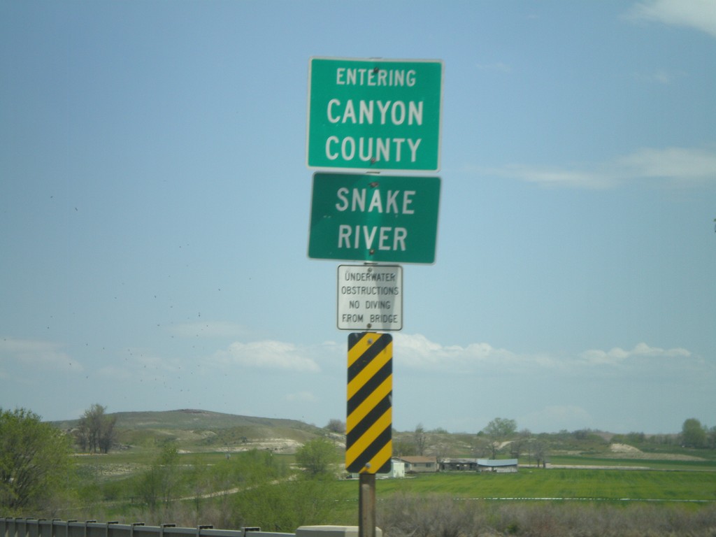
ID-55 North at Canyon County Line
ID-55 north crossing the Snake River and entering Canyon County.
Taken 04-20-2010
 Marsing
Owyhee County
Idaho
United States
Marsing
Owyhee County
Idaho
United States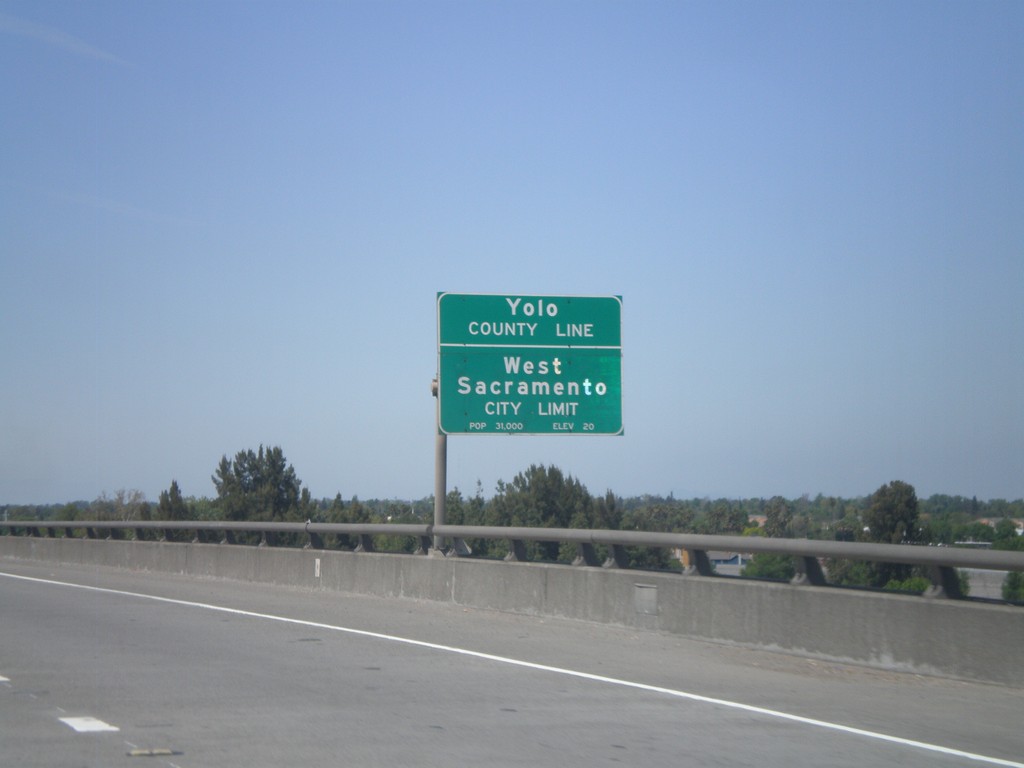
US-50/BL-80 West - Yolo-Sacramento County Line
US-50/BL-80 west at the Yolo-Sacramento County Line at the Sacramento River. Also entering the city of West Sacramento.
Taken 04-16-2010

 Sacramento
 County
California
United States
Sacramento
Sacramento County
California
United States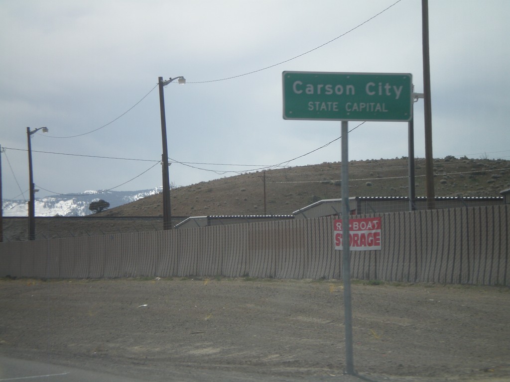
US-50 West - Entering Carson City
US-50 west at the Lyon County - Carson City line. When entering all other counties in Nevada, the county name is above the words County Line. In Carson City, the County Line is replaced with State Capitol.
Taken 04-15-2010
Mound House
Lyon County
Nevada
United States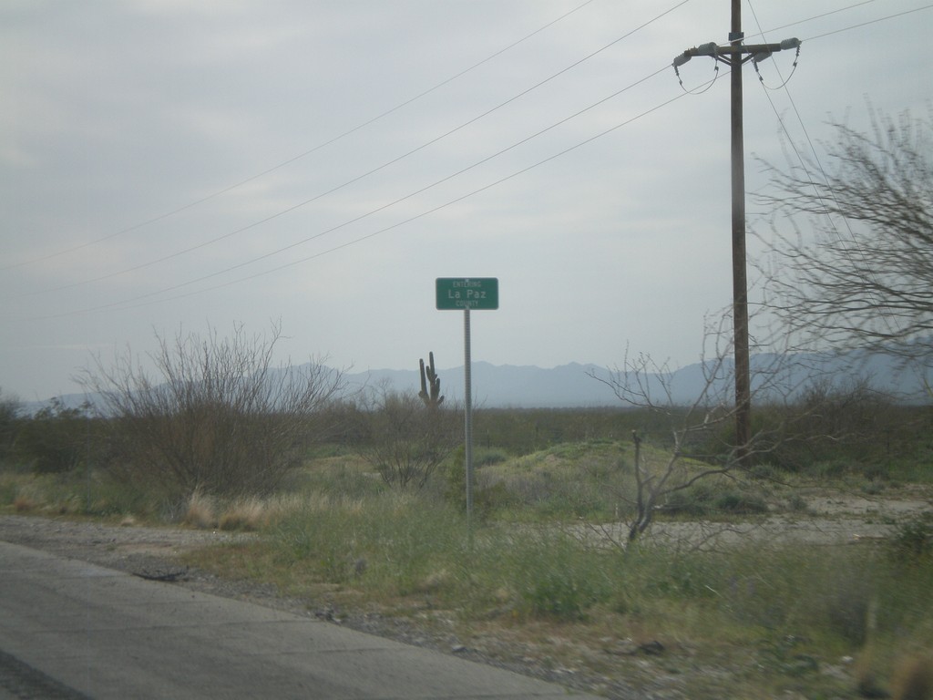
US-60 West - Entering La Paz County
Entering La Paz County on US-60 west at the La Paz - Maricopa County Line.
Taken 03-22-2010
 Aguila
Maricopa County
Arizona
United States
Aguila
Maricopa County
Arizona
United States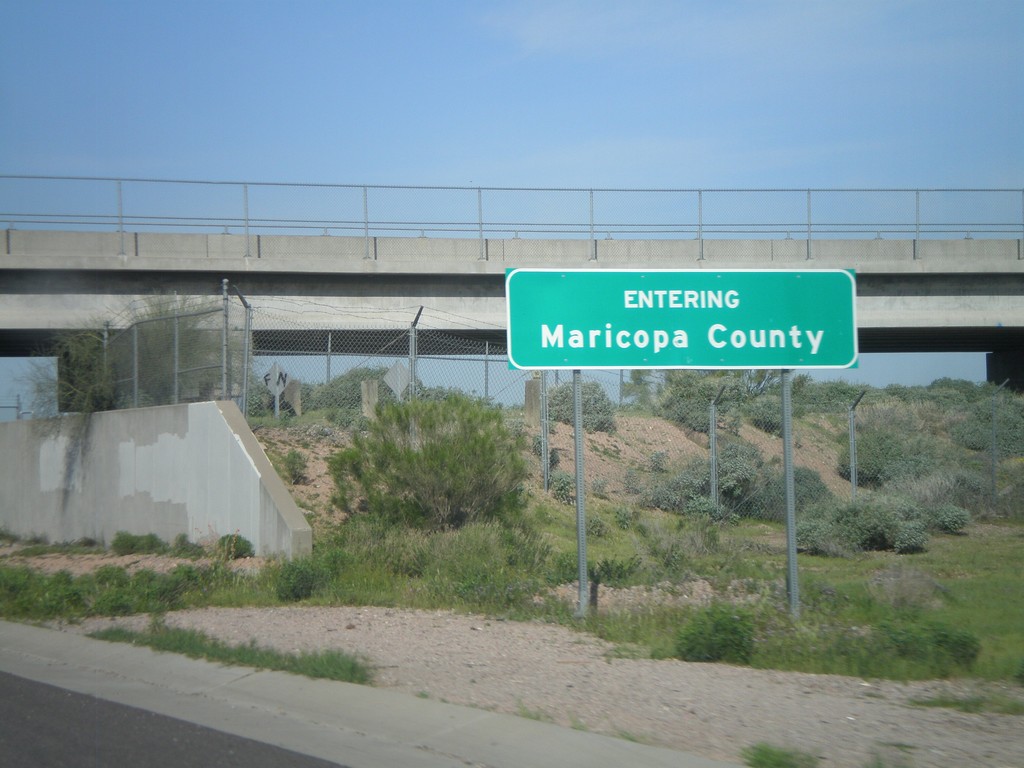
US-60 West - Entering Maricopa County
Entering Maricopa County on US-60 west at the Maricopa-Pinal County Line.
Taken 03-22-2010
Apache Junction
Pinal County
Arizona
United States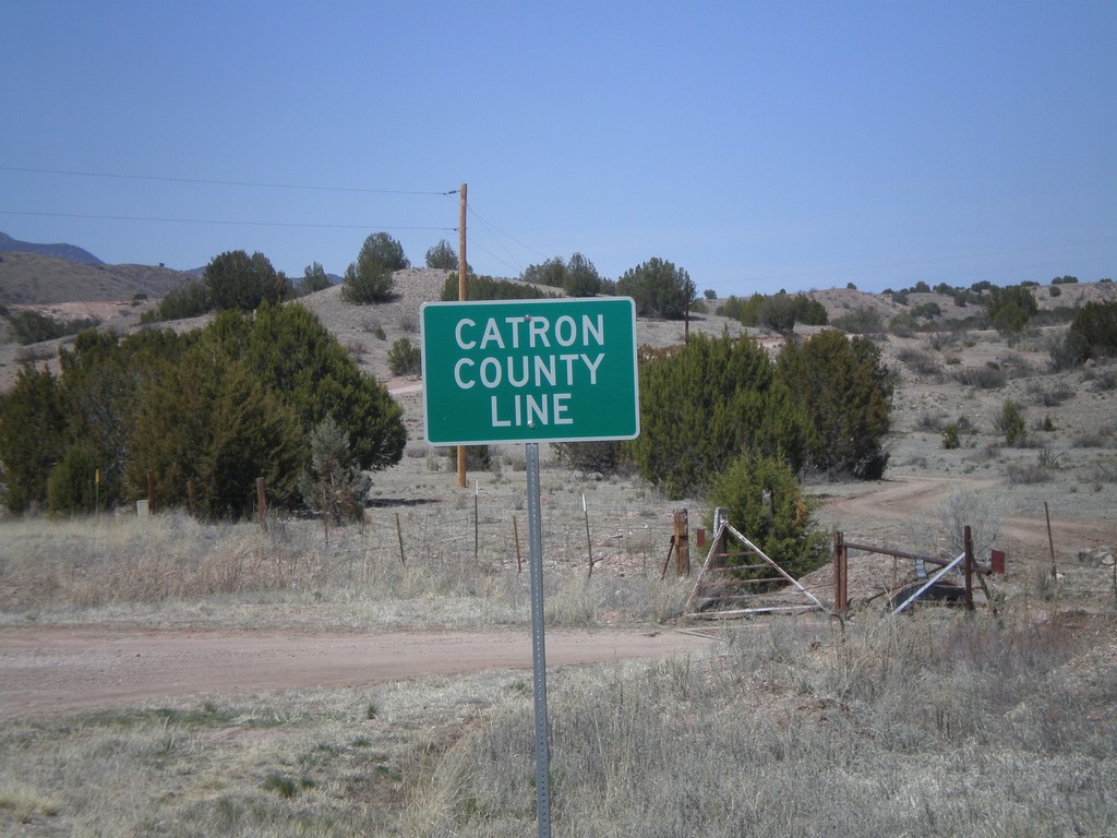
US-180 West - Catron County Line
Catron County Line on US-180 west at the Grant-Catron County Line.
Taken 03-21-2010
 Buckhorn
Catron County
New Mexico
United States
Buckhorn
Catron County
New Mexico
United States
I-10 East - Entering Cochise County
Entering Cochise County on I-10 east at the Pima-Cochise County Line.
Taken 03-21-2010
 Benson
Cochise County
Arizona
United States
Benson
Cochise County
Arizona
United States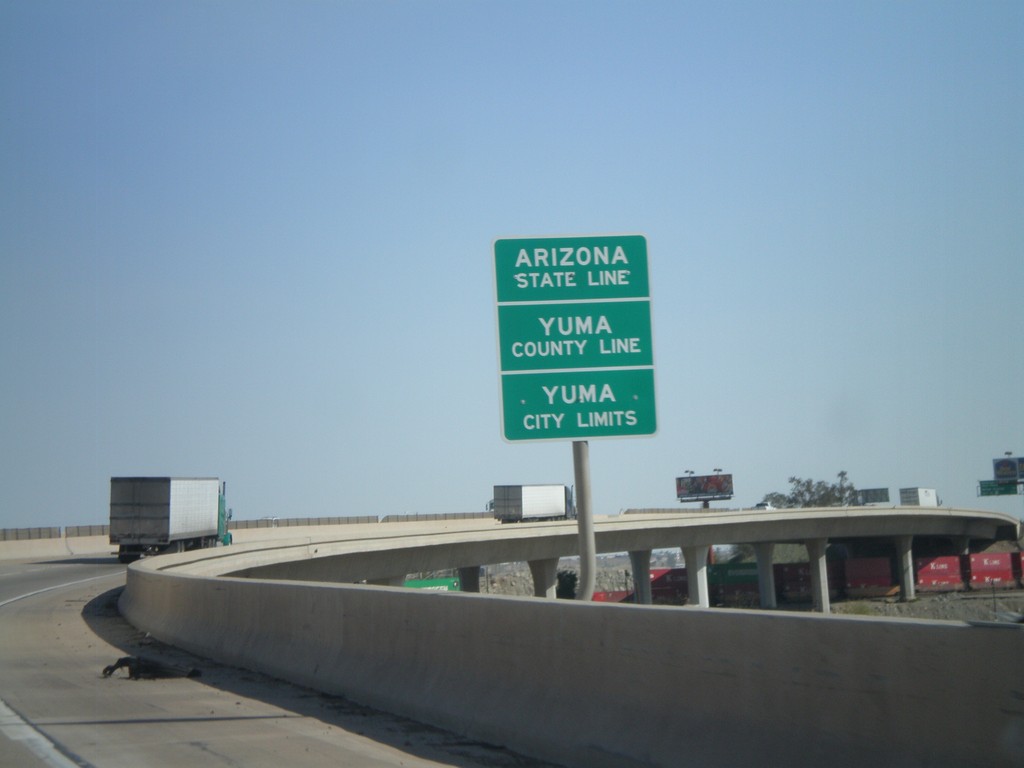
I-8 East - Arizona State Line
Arizona State Line, Yuma County Line, and Yuma City Limits on the Colorado River bridge at the Arizona-California State Line.
Taken 03-20-2010
 Yuma
Yuma County
Arizona
United States
Yuma
Yuma County
Arizona
United States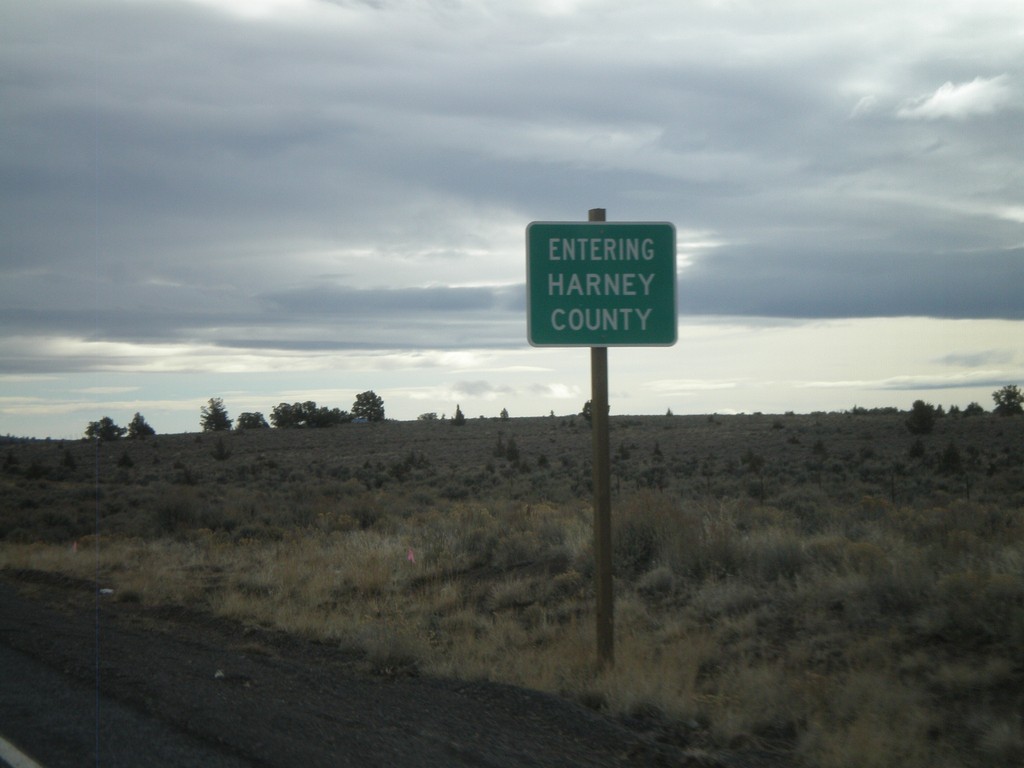
US-20 East - Entering Harney County
Entering Harney County on US-20 east at the Lake-Harney County Line.
Taken 01-18-2010
Harney County
Oregon
United States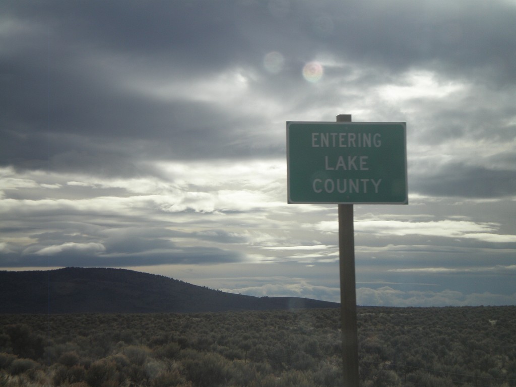
US-20 East - Entering Lake County
Entering Lake County on US-20 east at the Deschutes-Lake County Line.
Taken 01-18-2010
Hampton
Deschutes County
Oregon
United States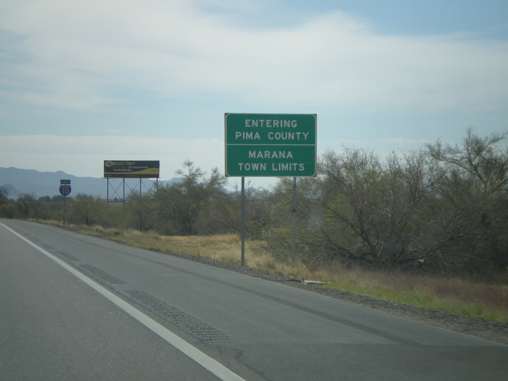
I-10 East - Pima County Line
Entering Pima County on I-10 east. Also entering the town of Marana. Taken on the Pima-Pinal County Line.
Taken 03-22-2009
Marana
Pinal County
Arizona
United States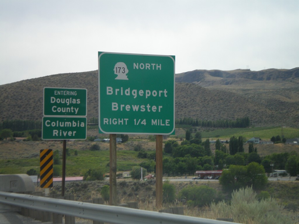
WA-17 South Approaching WA-173 North
WA-17 south approaching WA-173 North/Bridgeport/Brewster. Crossing the Columbia River into Douglas County.
Taken 07-26-2008

 Bridgeport
Okanogan County
Washington
United States
Bridgeport
Okanogan County
Washington
United States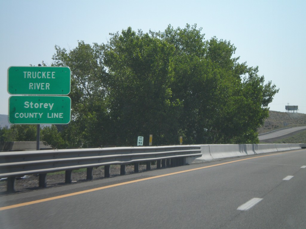
I-80 East - Storey County Line
I-80 east at Storey County Line and Truckee River.
Taken 07-07-2008
 Wadsworth
Washoe County
Nevada
United States
Wadsworth
Washoe County
Nevada
United States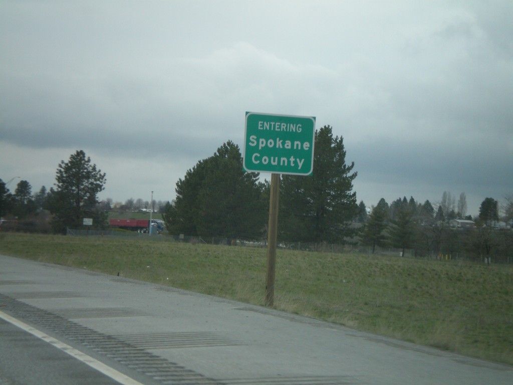
I-90 West - Spokane County
Entering Spokane County on I-90 west. Taken just west of the State Line exit near the Idaho state line.
Taken 04-14-2008
 Liberty Lake
Spokane County
Washington
United States
Liberty Lake
Spokane County
Washington
United States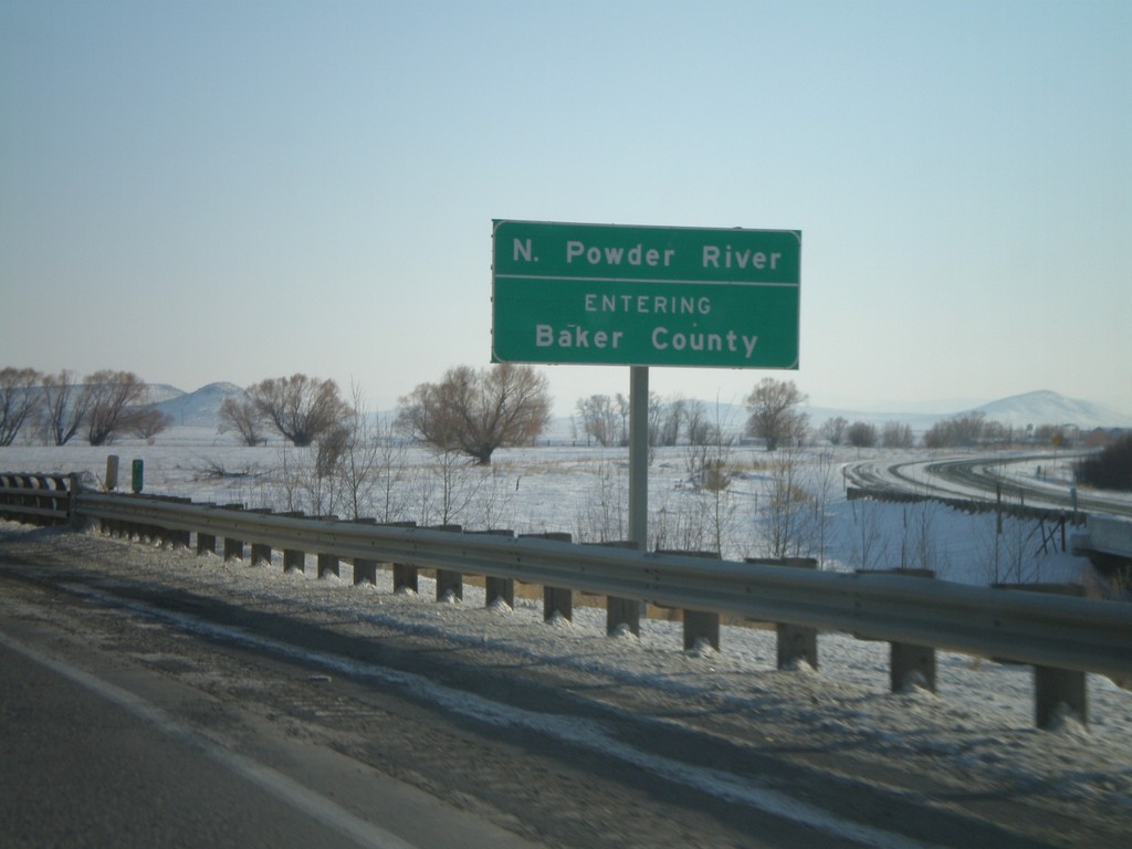
I-84 East - Entering Baker County
I-84 east at the North Powder River. Entering Baker County.
Taken 01-22-2008
 North Powder
Union County
Oregon
United States
North Powder
Union County
Oregon
United States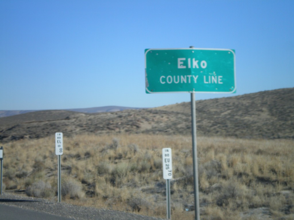
I-80 East - Elko County Line
Elko County Line on I-80 east.
Taken 11-24-2007
Carlin
Elko County
Nevada
United States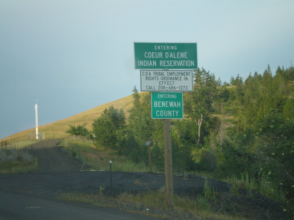
US-95 North - Benewah County and Coeur d'Alene Indian Res.
US-95 north - Entering Benewah County and Coeur d’Alene Indian Reservation.
Taken 07-13-2007
 De Smet
Benewah County
Idaho
United States
De Smet
Benewah County
Idaho
United States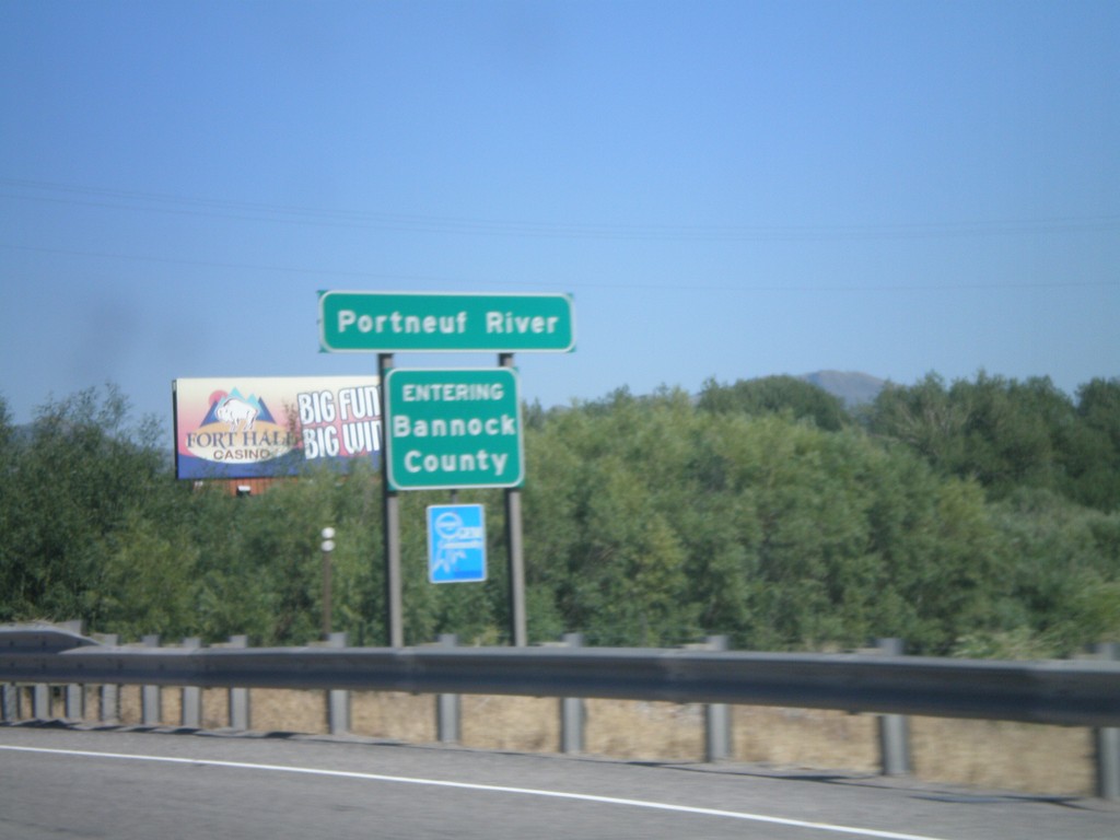
I-86 East - Entering Bannock County
I-86 east at Bannock county line at the Portneuf River.
Taken 06-22-2007
 Pocatello
Bannock County
Idaho
United States
Pocatello
Bannock County
Idaho
United States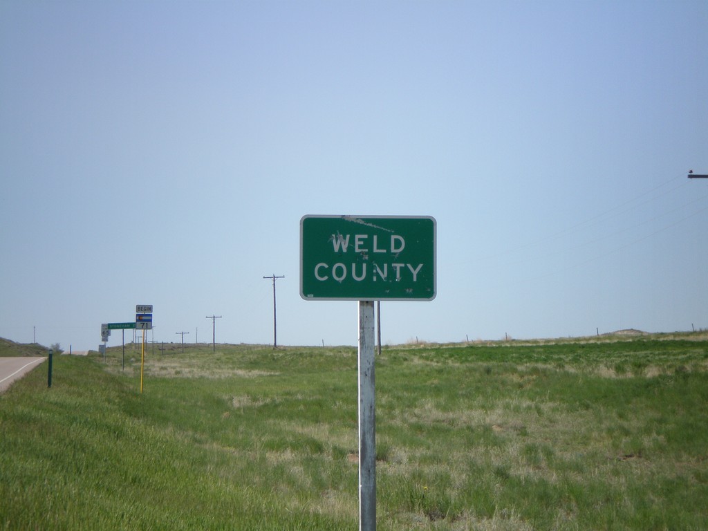
CO-71 South - Weld County
Entering Weld County at the Colorado-Nebraska State Line on CO-71 south.
Taken 05-27-2007
 Raymer
Weld County
Colorado
United States
Raymer
Weld County
Colorado
United States