Signs Tagged With County Boundary
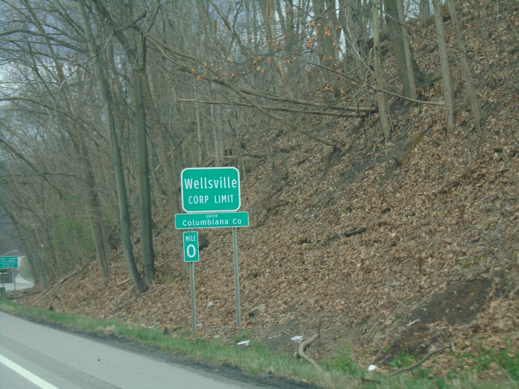
OH-7 North - Enter Columbiana County / Wellsville
OH-7 North - Enter Columbiana County / Wellsville Corporation Limit.
Taken 04-01-2024
 Wellsville
Columbiana County
Ohio
United States
Wellsville
Columbiana County
Ohio
United States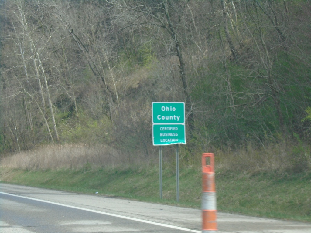
US-250 West/WV-2 North - Ohio County
Entering Ohio County on US-250 West/WV-2 North.
Taken 04-01-2024

 Wheeling
Ohio County
West Virginia
United States
Wheeling
Ohio County
West Virginia
United States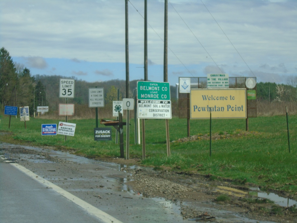
OH-7 North - Enter Belmont County
Enter Belmont County/Leave Monroe County on OH-7 North. Welcome to Powhatan Point.
Taken 04-01-2024
Powhatan Point
Belmont County
Ohio
United States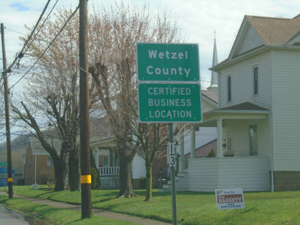
WV-2 North - Wetzel County
Entering Wetzel County on WV-2 North.
Taken 04-01-2024
Paden City
Wetzel County
West Virginia
United States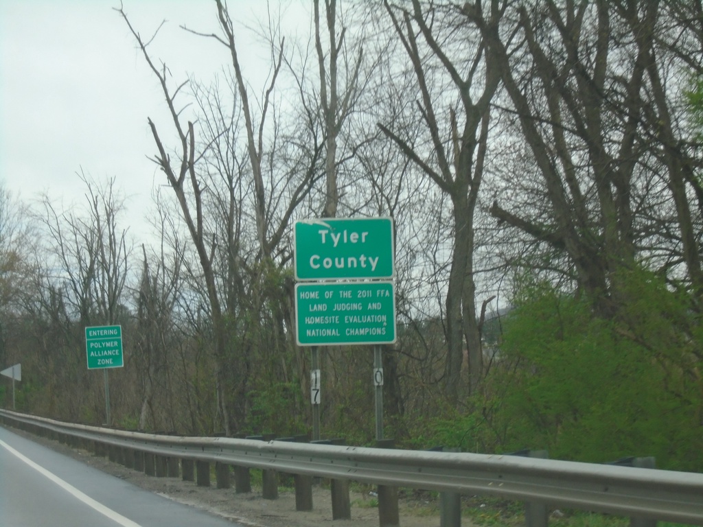
WV-2 North - Tyler County
Entering Tyler County on WV-2 north. Tyler County is part of the Polymer Alliance Zone.
Taken 04-01-2024
Friendly
Tyler County
West Virginia
United States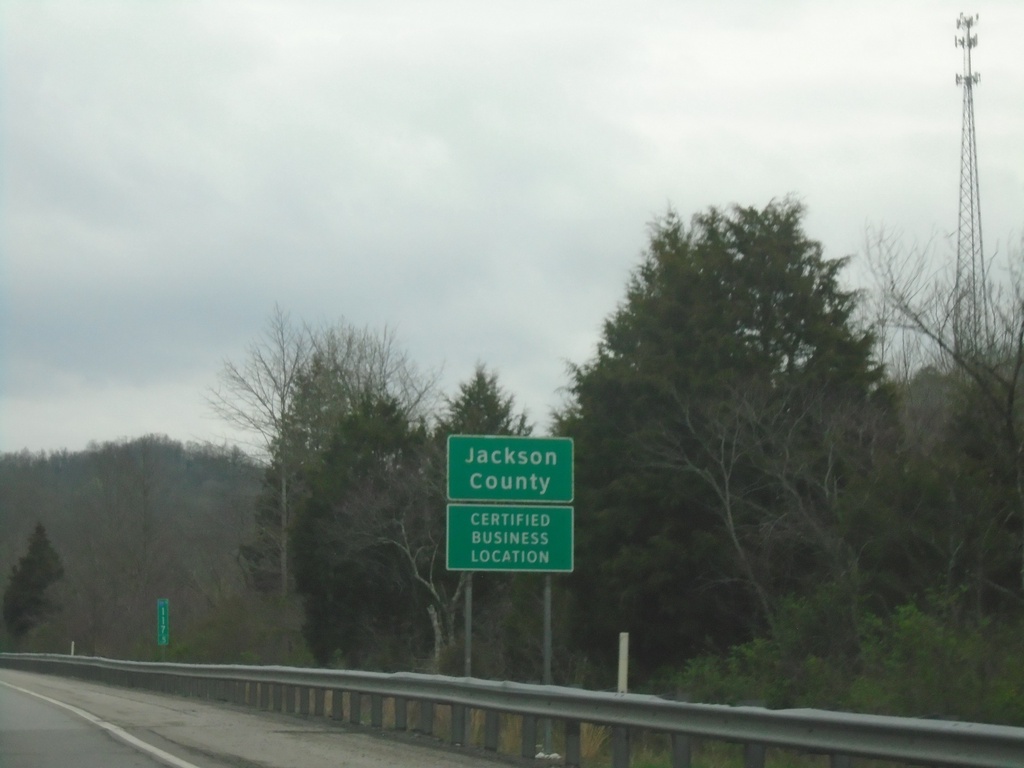
I-77 North - Jackson County
Entering Jackson County on I-77 North.
Taken 04-01-2024
 Kenna
Jackson County
West Virginia
United States
Kenna
Jackson County
West Virginia
United States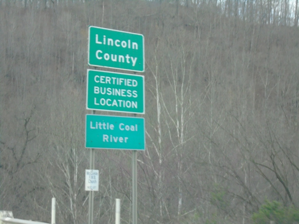
US-119 North - Lincoln County
Lincoln County on US-119 North. Crossing the Little Coal River.
Taken 03-31-2024
 Alum Creek
Lincoln County
West Virginia
United States
Alum Creek
Lincoln County
West Virginia
United States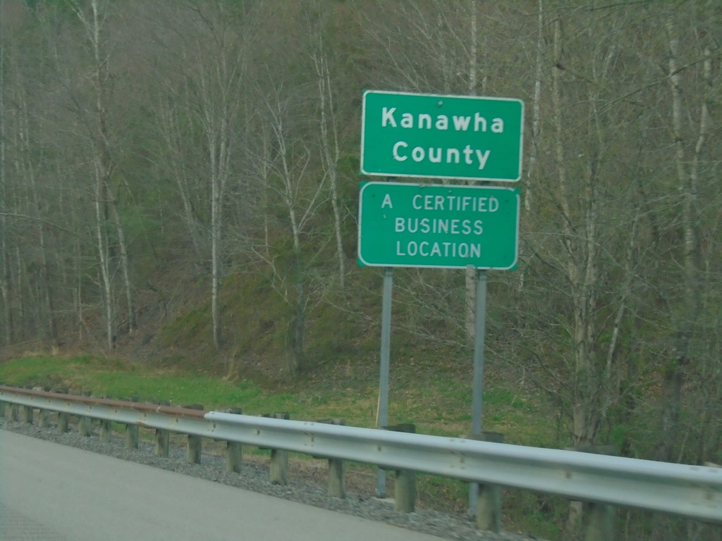
US-119 North - Kanawah County
Kanawah County on US-119 North. Kanawah County is the largest county in West Virginia and is home to the state capitol, Charleston.
Taken 03-31-2024
Sod
Kanawha County
West Virginia
United States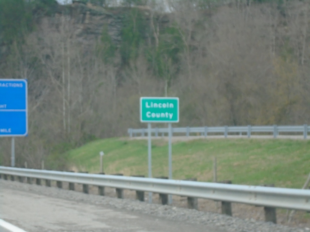
US-119 North - Lincoln County
Lincoln County on US-119 North crossing the Little Coal River. The highway briefly enters Lincoln County and then re-enters Boone County.
Taken 03-31-2024
Julian
Lincoln County
West Virginia
United States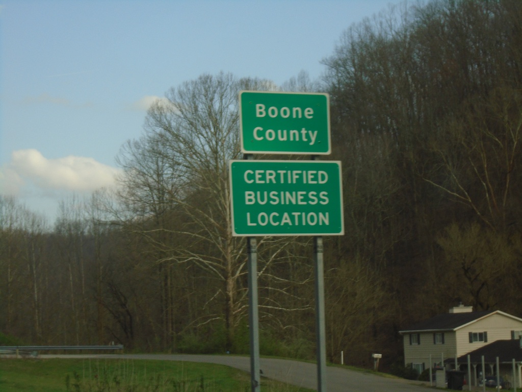
US-119 North - Boone County
Entering Boone County on US-119 north.
Taken 03-31-2024
Chapmanville
Boone County
West Virginia
United States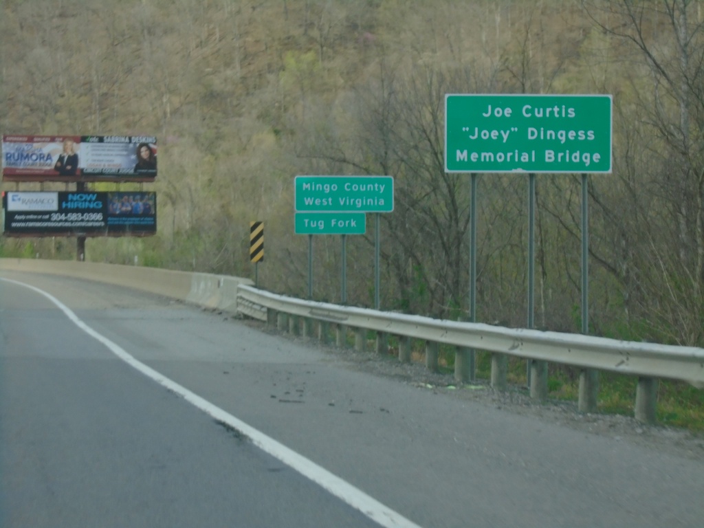
US-119/US-52 - Entering Mingo County West Virginia
Entering Mingo County West Virginia on US-119/US-52 north. At the Kentucky/West Virginia State Line crossing the Tug Fork.
Taken 03-31-2024
 Williamson
Mingo County
West Virginia
United States
Williamson
Mingo County
West Virginia
United States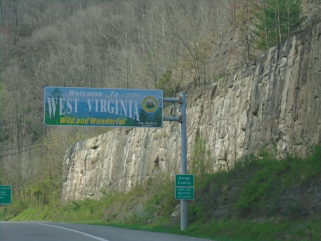
US-119/US-52 North - Welcome To West Virginia
Welcome To West Virginia/Wild and Wonderful on US-119/US-52 North. Entering Mingo County.
Taken 03-31-2024
Williamson
Mingo County
West Virginia
United States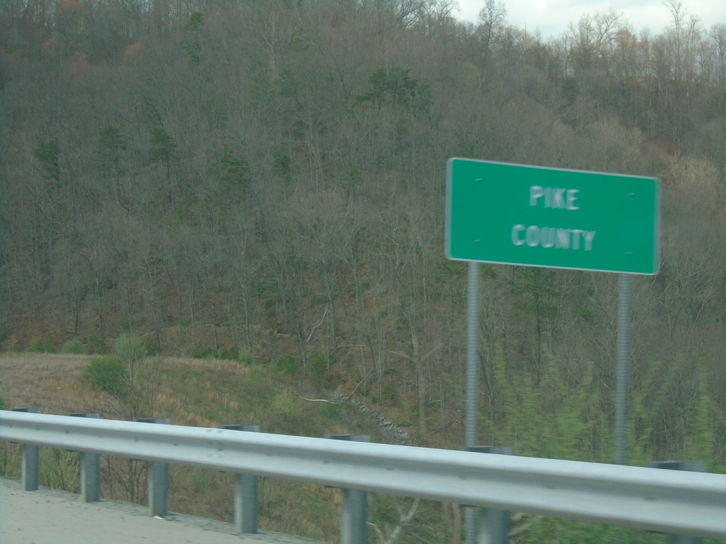
KY-3174 West - Pike County
Entering Pike County on KY-3174 west. At the Kentucky/Virginia State Line.
Taken 03-31-2024
 Elkhorn City
Pike County
Kentucky
United States
Elkhorn City
Pike County
Kentucky
United States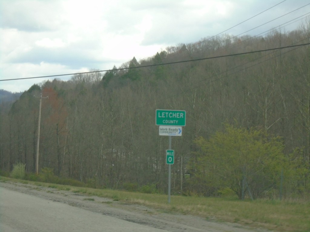
US-119 North - Letcher County
Entering Letcher County on US-119 North. The mile markers in Kentucky reset at county lines, on non interstate highways.
Taken 03-31-2024
Cumberland
Letcher County
Kentucky
United States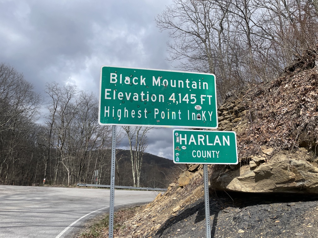
KY-160 West - Harlan County / Black Mountain
KY-160 West at the Kentucky/Virginia State Line. Black Mountain Elevation 4,145 Feet - Highest Point in Kentucky. Entering Harlan County. The actual high point is about 1.5 miles to the south via a trail.
Taken 03-31-2024
 Lynch
Harlan County
Kentucky
United States
Lynch
Harlan County
Kentucky
United States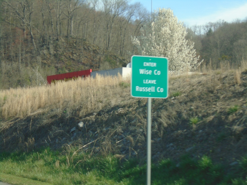
US-58 Alt. West - Wise County
Enter Wise County/Leave Russell County on US-58 Alt. West
Taken 03-31-2024
 Saint Paul
Wise County
Virginia
United States
Saint Paul
Wise County
Virginia
United States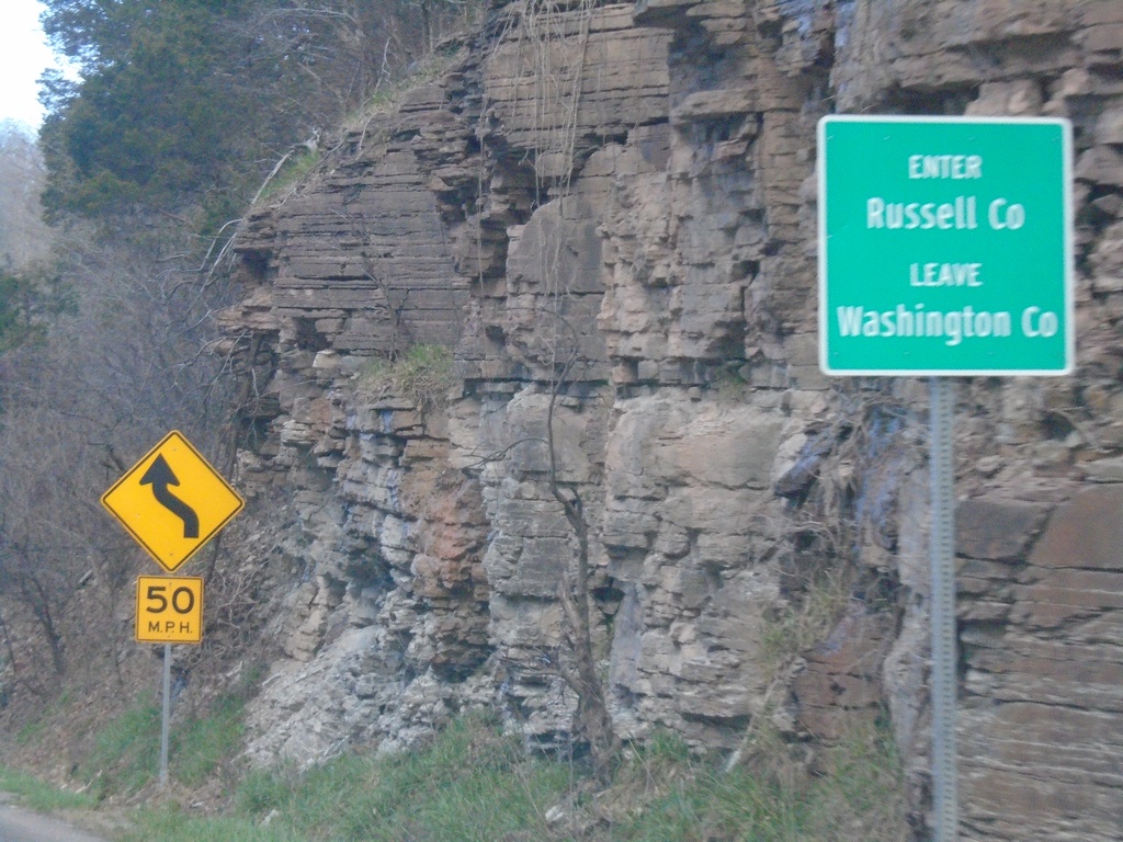
US-19 North/Alt. US-58 West - Enter Russell County
Enter Russell County/Leave Washington County on US-19 North/Alt. US-58 West at Little Moccasin Gap.
Taken 03-31-2024
 Lebanon
Russell County
Virginia
United States
Lebanon
Russell County
Virginia
United States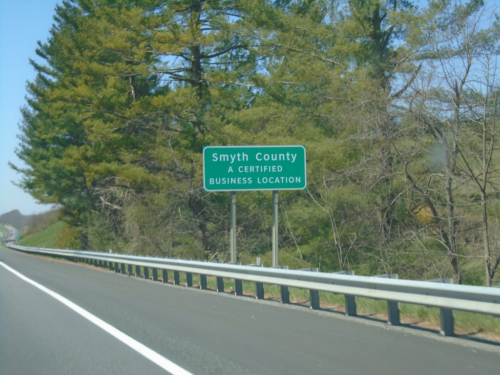
I-81 South - Smythe County
Entering Smythe County on I-81 south.
Taken 03-30-2024
 Rural Retreat
Smyth County
Virginia
United States
Rural Retreat
Smyth County
Virginia
United States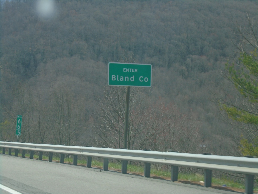
I-77 South - Bland County
Enter Bland County on I-77 south. Just south of the East River Mountain Tunnel that marks the state line between Virginia and West Virginia.
Taken 03-30-2024
Rocky Gap
Bland County
Virginia
United States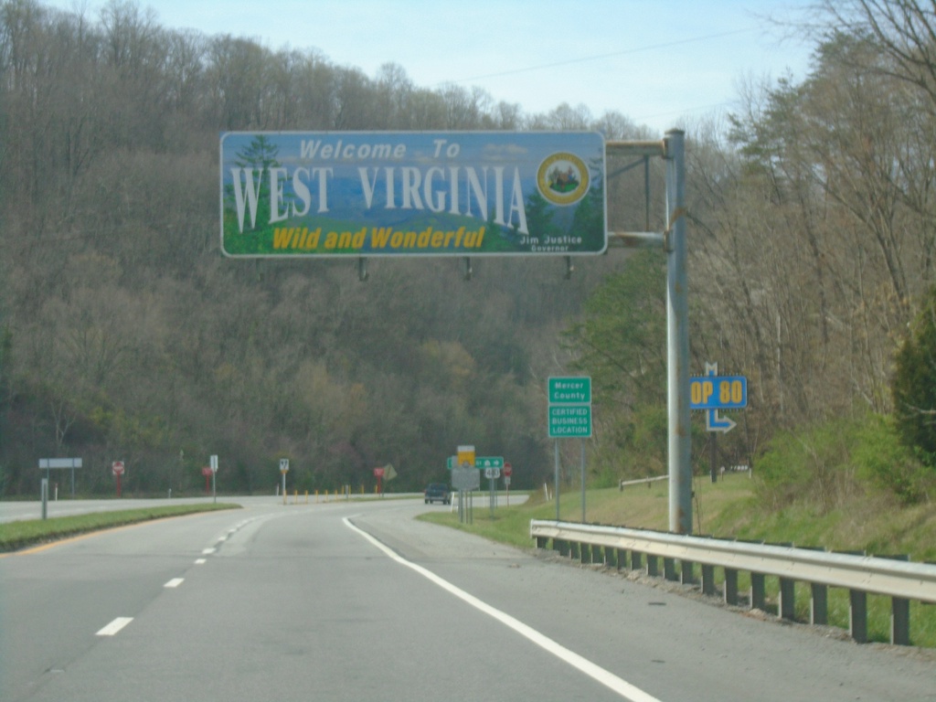
US-460 West - Entering West Virginia
Welcome To West Virginia - Wild and Wonderful on US-460 West. Taken at the Virginia/West Virginia State Line.
Taken 03-30-2024
 Princeton
Mercer County
West Virginia
United States
Princeton
Mercer County
West Virginia
United States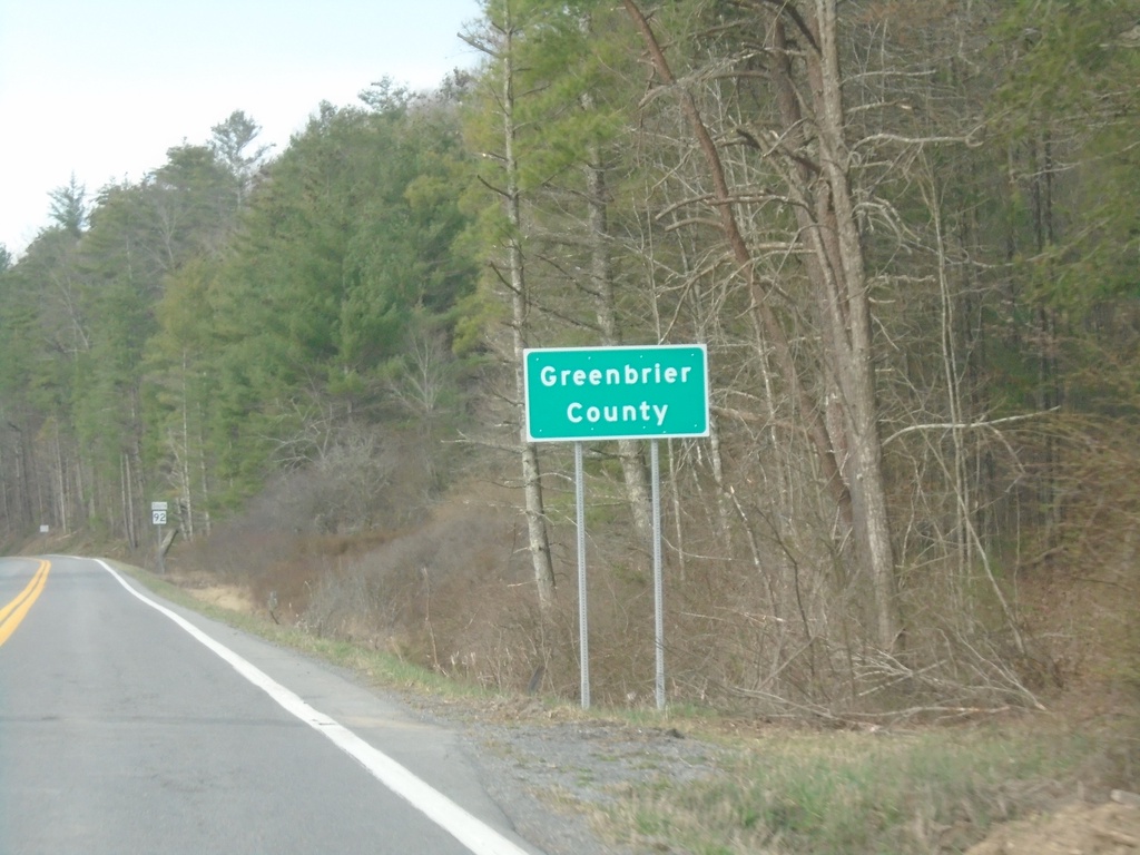
WV-92 South - Greenbrier County
Greenbrier County on WV-92 south.
Taken 03-30-2024
 WHT SULPHUR S
Greenbrier County
West Virginia
United States
WHT SULPHUR S
Greenbrier County
West Virginia
United States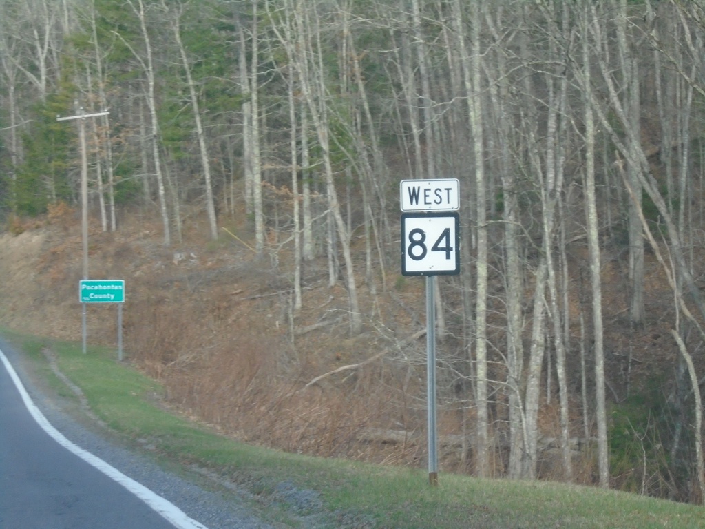
WV-84 West - Pocahontas County
WV-84 West in Pocahontas County
Taken 03-30-2024
 Marlinton
Pocahontas County
West Virginia
United States
Marlinton
Pocahontas County
West Virginia
United States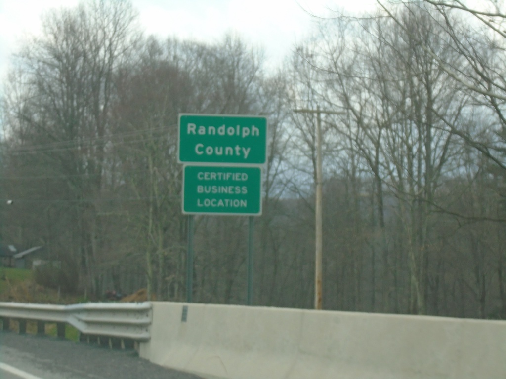
WV-32 South - Randolph County
Randolph County on WV-32 south.
Taken 03-29-2024
 Dryfork
Randolph County
West Virginia
United States
Dryfork
Randolph County
West Virginia
United States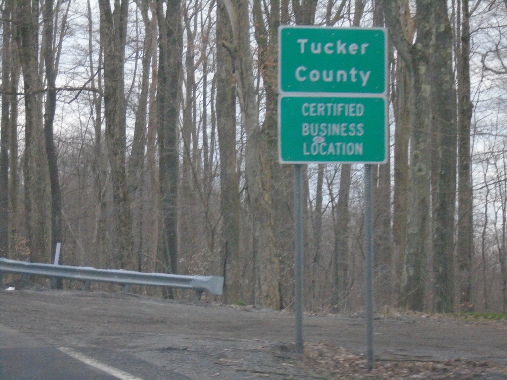
US-219 South - Tucker County
Tucker County on US-219 South.
Taken 03-29-2024
 Eglon
Tucker County
West Virginia
United States
Eglon
Tucker County
West Virginia
United States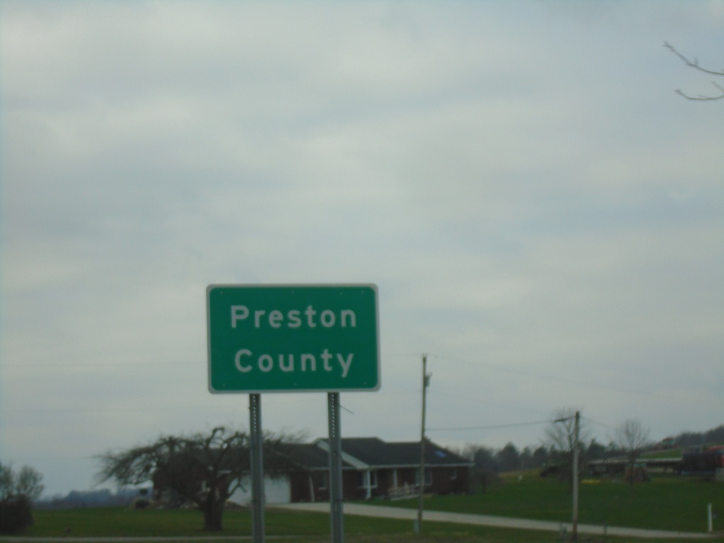
US-219 South - Preston County
Preston County on US-219 south. Taken at the West Virginia/Maryland State Line.
Taken 03-29-2024
Eglon
Preston County
West Virginia
United States