Signs Tagged With Municipality Boundary
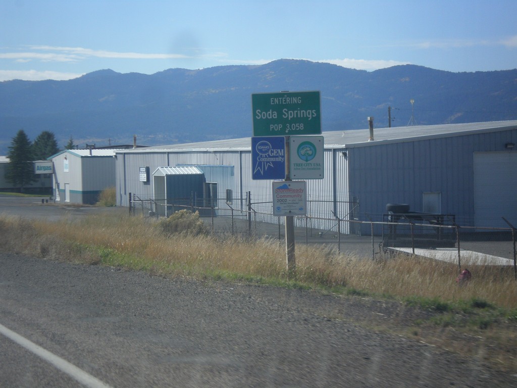
ID-34 South - Soda Springs
Entering Soda Springs on ID-34 south. Population 3058. Soda Springs is the county seat of Caribou County.
Taken 10-04-2015
 Soda Springs
Caribou County
Idaho
United States
Soda Springs
Caribou County
Idaho
United States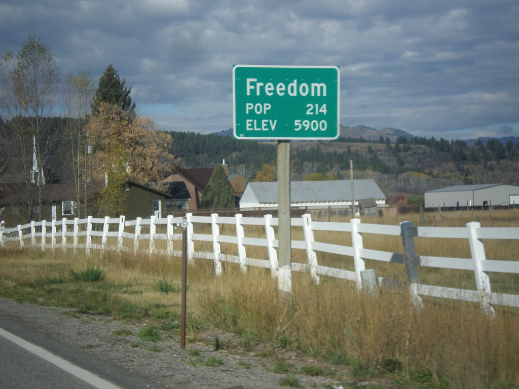
WY-239 West - Entering Freedom
Entering Freedom on WY-239 west - Elevation 5900; Population 214. Freedom is the oldest community in the Star Valley, and is named because of the settlers who were free to practice polygamy in Wyoming. The western boundary of the town is the Idaho stateline, where at the time had banned polygamy.
Taken 10-04-2015
 Freedom
Lincoln County
Wyoming
United States
Freedom
Lincoln County
Wyoming
United States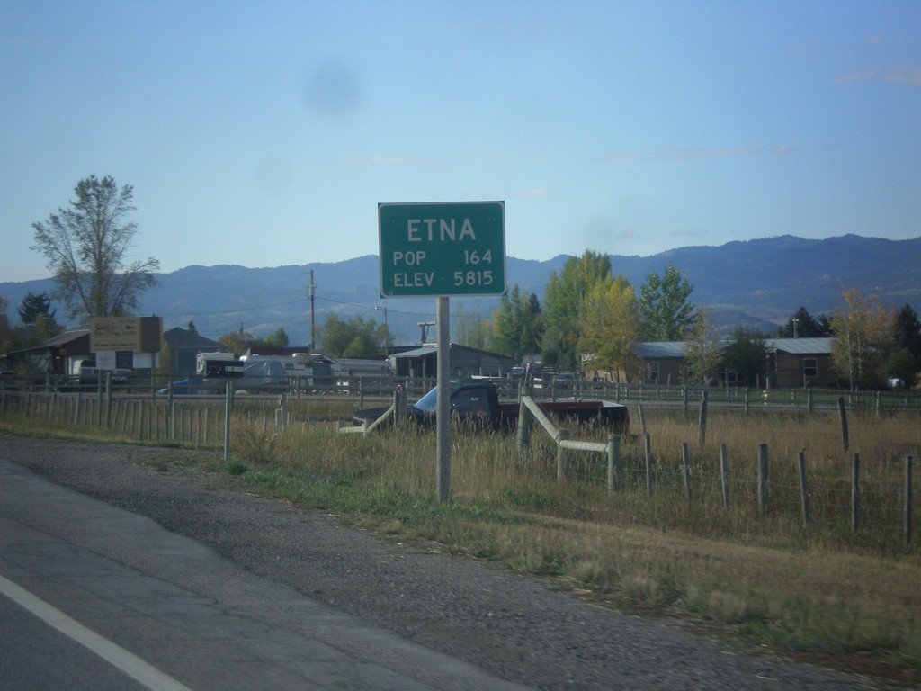
US-89 South - Entering Etna
Entering Etna on US-89 south. Elevation 5815 Feet; Population 164.
Taken 10-04-2015
 Freedom
Lincoln County
Wyoming
United States
Freedom
Lincoln County
Wyoming
United States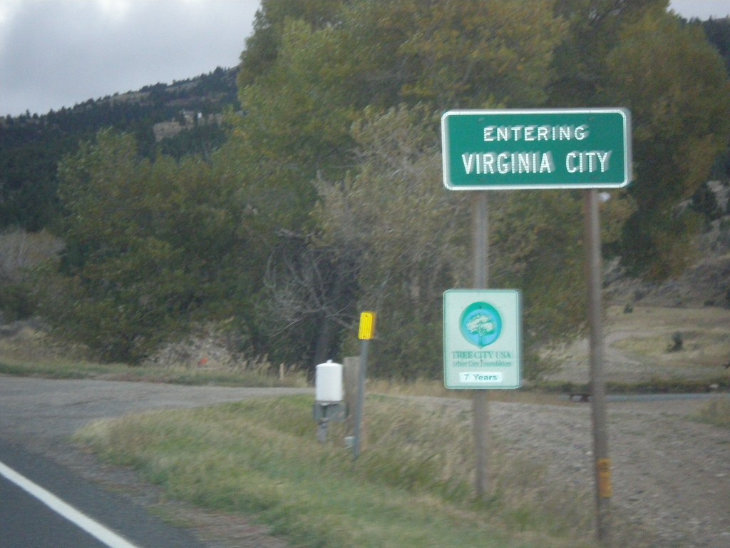
MT-287 South - Virginia City
Entering Virginia City on MT-287 south. Virginia City is the county seat of Madison County, and was the capitol of Montana Territory from 1865 to 1875.
Taken 10-03-2015
 Ennis
Madison County
Montana
United States
Ennis
Madison County
Montana
United States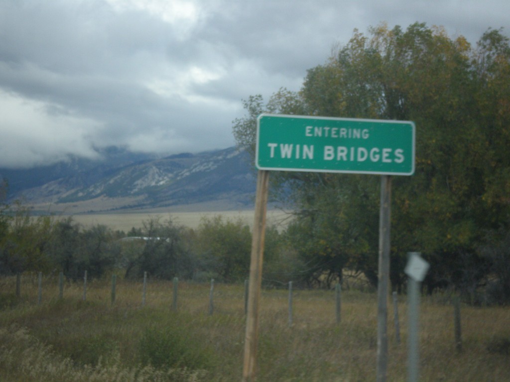
MT-41 North - Twin Bridges
Entering Twin Bridges on MT-41 north.
Taken 10-03-2015
 Twin Bridges
Madison County
Montana
United States
Twin Bridges
Madison County
Montana
United States
ID-28 South - Leadore
Entering Leadore - Population 105 on ID-28 south.
Taken 10-03-2015
 Leadore
Lemhi County
Idaho
United States
Leadore
Lemhi County
Idaho
United States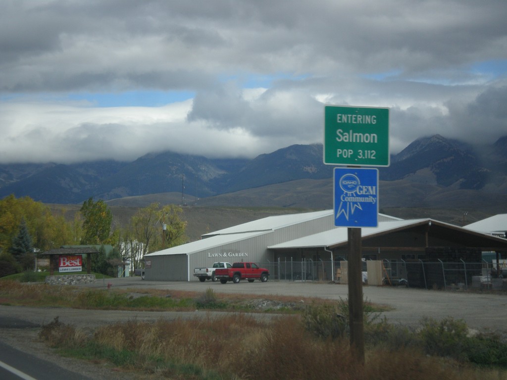
US-93 North - Entering Salmon
Entering Salmon - Population 3,112 on US-93 north. Salmon is the county seat of Lemhi County.
Taken 10-03-2015
 Salmon
Lemhi County
Idaho
United States
Salmon
Lemhi County
Idaho
United States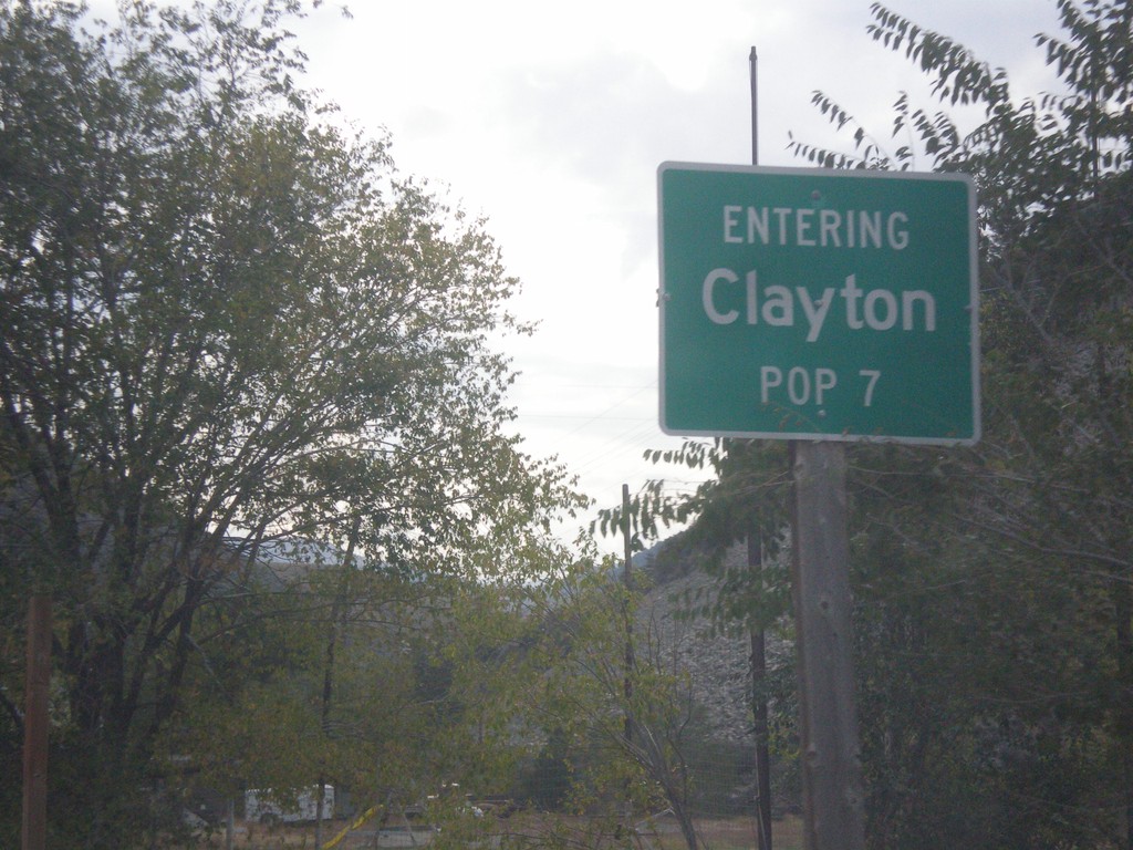
ID-75 North - Entering Clayton
Entering Clayton on ID-75 North. Clayton has a population of 7, making it the second smallest city in the state behind Warm River.
Taken 10-03-2015
 Clayton
Custer County
Idaho
United States
Clayton
Custer County
Idaho
United States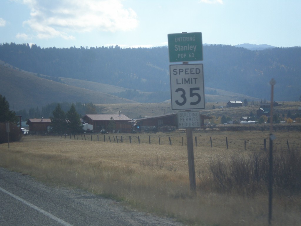
ID-21 East - Entering Stanley
Entering Stanley on ID-21 East - Population 63. Speed Limit 35 MPH.
Taken 10-03-2015
 Stanley
Custer County
Idaho
United States
Stanley
Custer County
Idaho
United States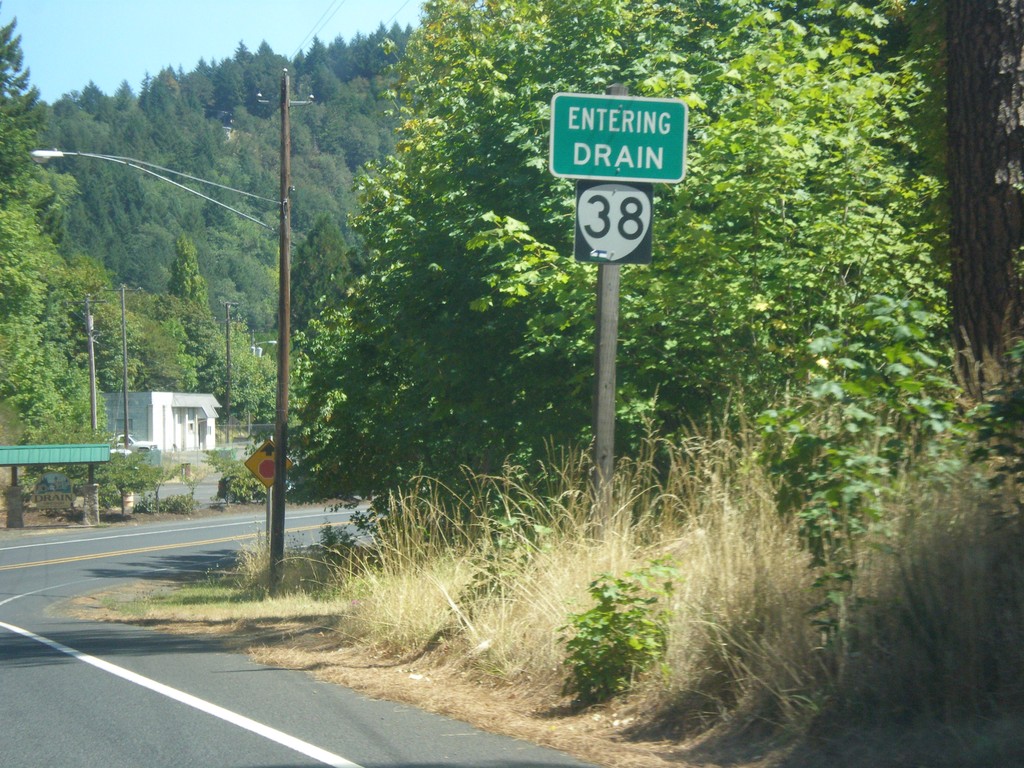
OR-38 East - Drain
Entering Drain on OR-38 east.
Taken 08-22-2015
 Drain
Douglas County
Oregon
United States
Drain
Douglas County
Oregon
United States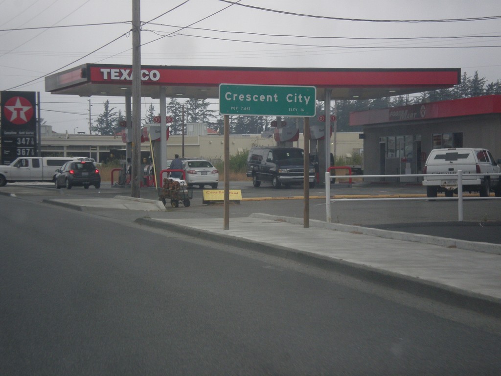
US-101 South - Crescent City
US-101 South - Entering Crescent City. Crescent City is the county seat of Del Norte County.
Taken 08-19-2015
 Crescent City
Del Norte County
California
United States
Crescent City
Del Norte County
California
United States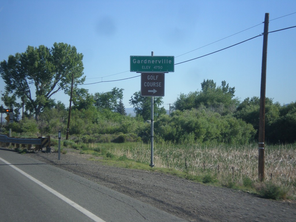
NV-88 North - Gardnerville
Gardnerville - Elevation 4750 Feet on NV-88 North. Approaching NV-756 junction (Centerville Lane) for access to Golf Course.
Taken 06-15-2015

 Gardnerville
Douglas County
Nevada
United States
Gardnerville
Douglas County
Nevada
United States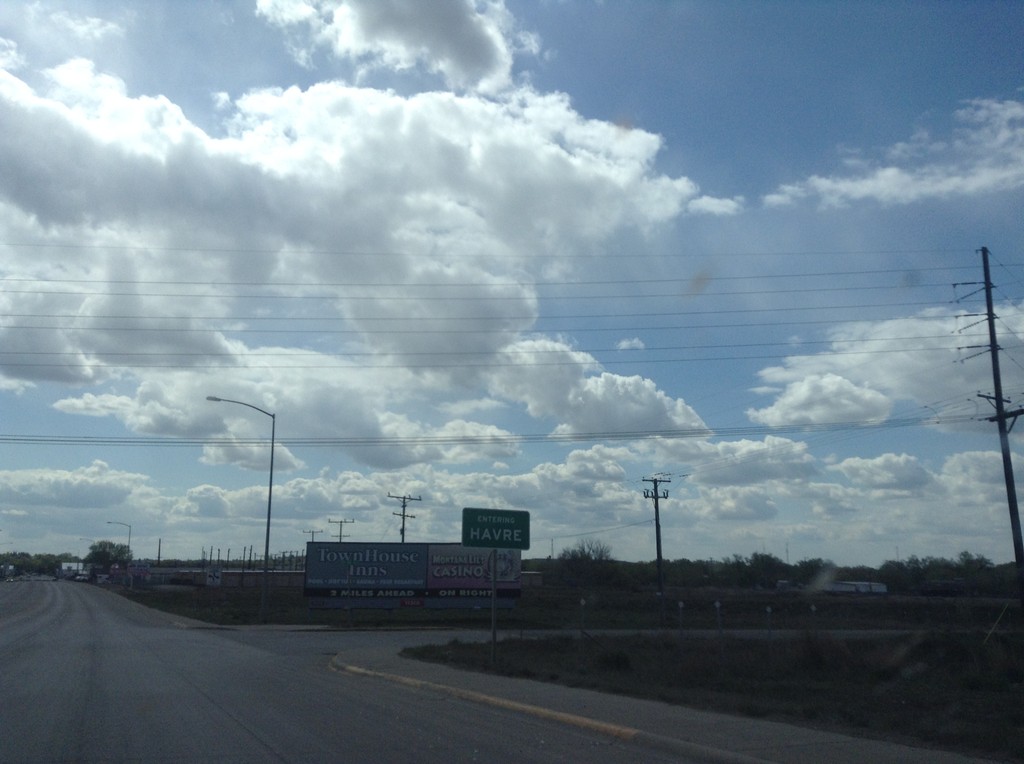
US-2 West - Entering Havre
Entering Havre on US-2 west. Havre is the county seat of Hill County, and the 8th largest city in Montana (as of 2015). Is the largest city on the hi-line in Montana.
Taken 05-09-2015
 Havre
Hill County
Montana
United States
Havre
Hill County
Montana
United States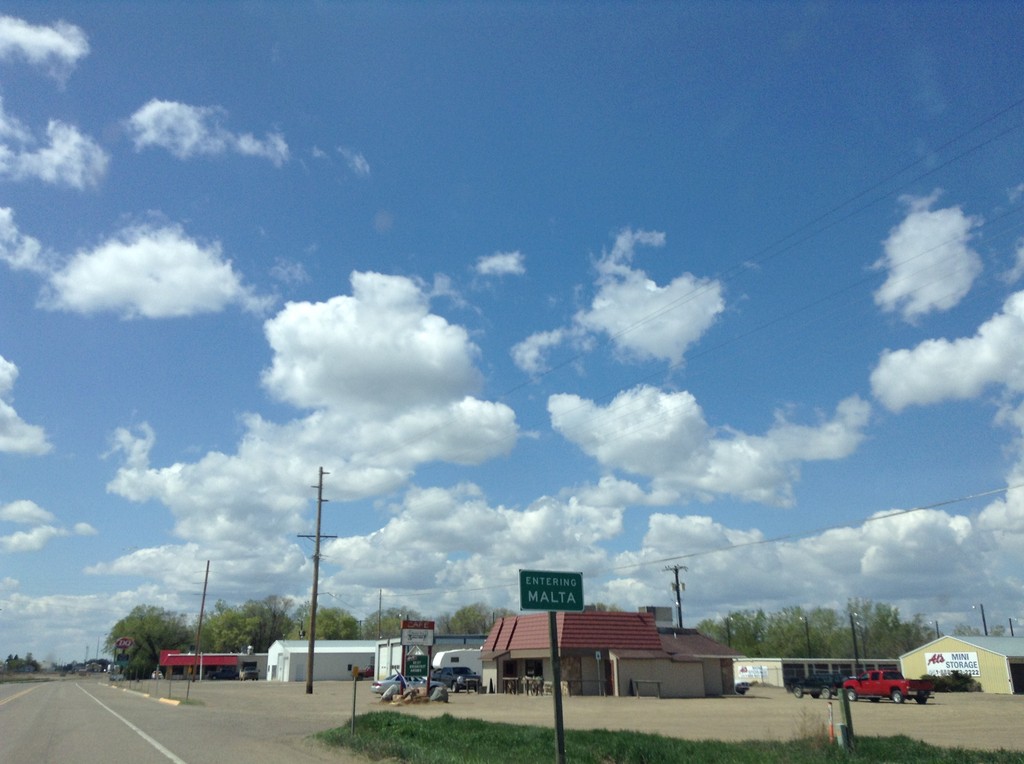
US-2 West - Malta
Entering Malta on US-2 west. Malta is the county seat of Phillips County.
Taken 05-09-2015
Malta
Phillips County
Montana
United States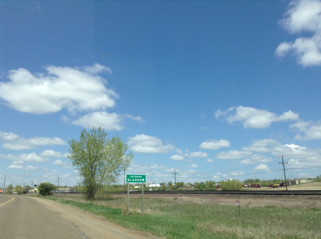
MT-42 West - Entering Glasgow
Entering Glasgow on MT-42 west. Glasgow is the county seat of Valley County.
Taken 05-09-2015
 Glasgow
Valley County
Montana
United States
Glasgow
Valley County
Montana
United States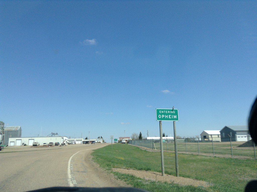
MT-24 North - Entering Opheim
Entering Opheim on MT-24 North.
Taken 05-09-2015
 Opheim
Valley County
Montana
United States
Opheim
Valley County
Montana
United States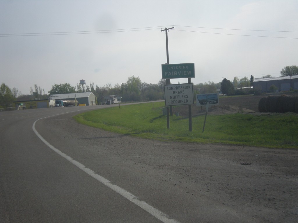
MT-200 East - Entering Fairview
Entering Fairview on MT-200 east. Fairview is on the Montana - North Dakota line.
Taken 05-09-2015
 Fairview
Richland County
Montana
United States
Fairview
Richland County
Montana
United States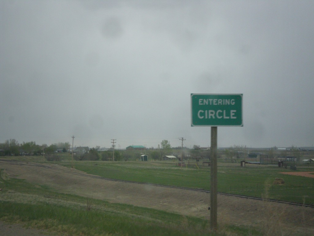
MT-200 East - Entering Circle
Entering Circle on MT-200 east. Circle is the county seat of McCone County.
Taken 05-08-2015
Circle
McCone County
Montana
United States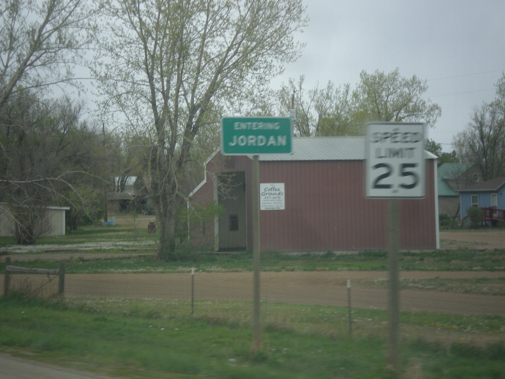
MT-200 East - Entering Jordan
Entering Jordan on MT-200 East. Jordan is the county seat of Garfield County, and one of the more isolated towns in the United States. It is 85 miles to Miles City, the nearest sizable city.
Taken 05-08-2015
Jordan
Garfield County
Montana
United States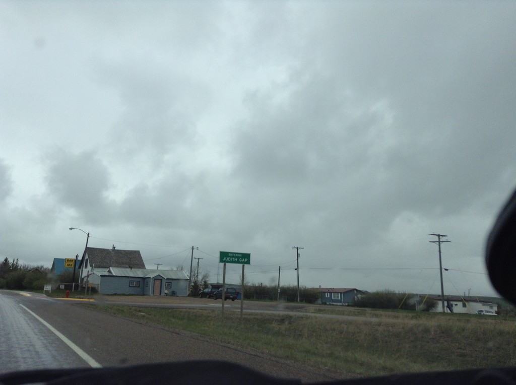
US-191 North - Entering Judith Gap
Entering Judith Gap on US-191 north.
Taken 05-08-2015
 Judith Gap
Wheatland County
Montana
United States
Judith Gap
Wheatland County
Montana
United States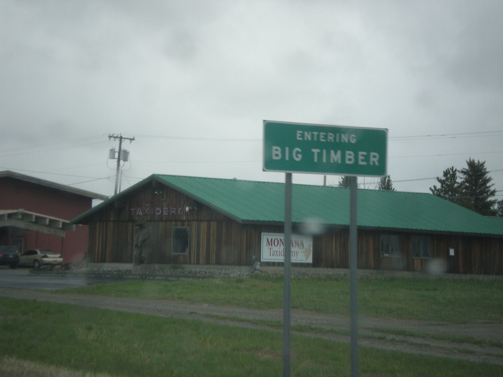
US-191 North/BL-90 East - Big Timber
Entering Big Timber on US-191 North/BL-90 East. Big Timber is the county seat of Sweet Grass County and is situated on the Yellowstone River.
Taken 05-08-2015
 Big Timber
Sweet Grass County
Montana
United States
Big Timber
Sweet Grass County
Montana
United States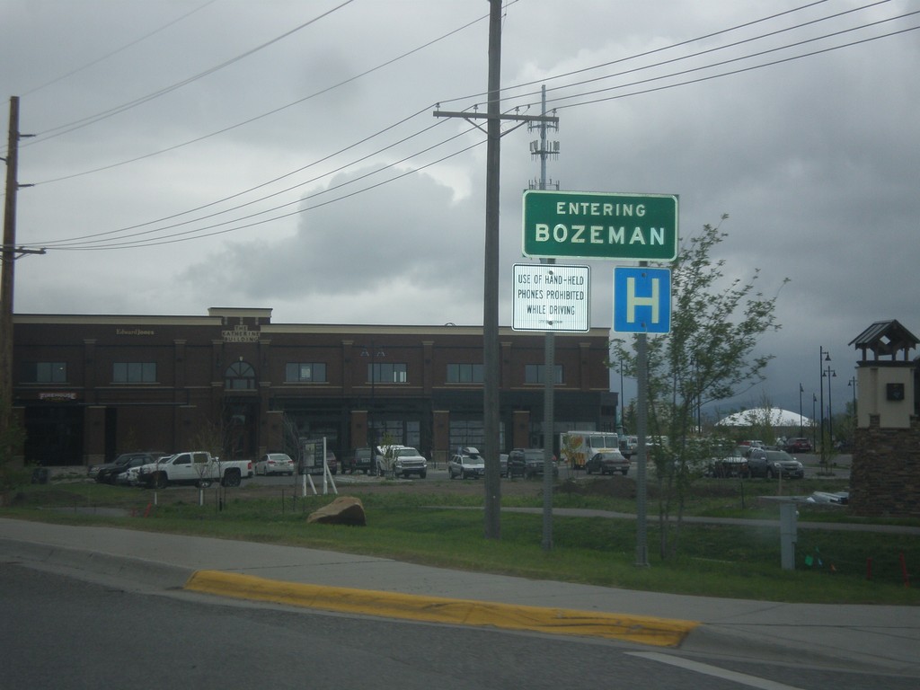
US-191 North - Bozeman
Entering Bozeman on US-191 north. Bozeman is the home of Montana State University and the fourth largest city in Montana.
Taken 05-08-2015
Bozeman
Gallatin County
Montana
United States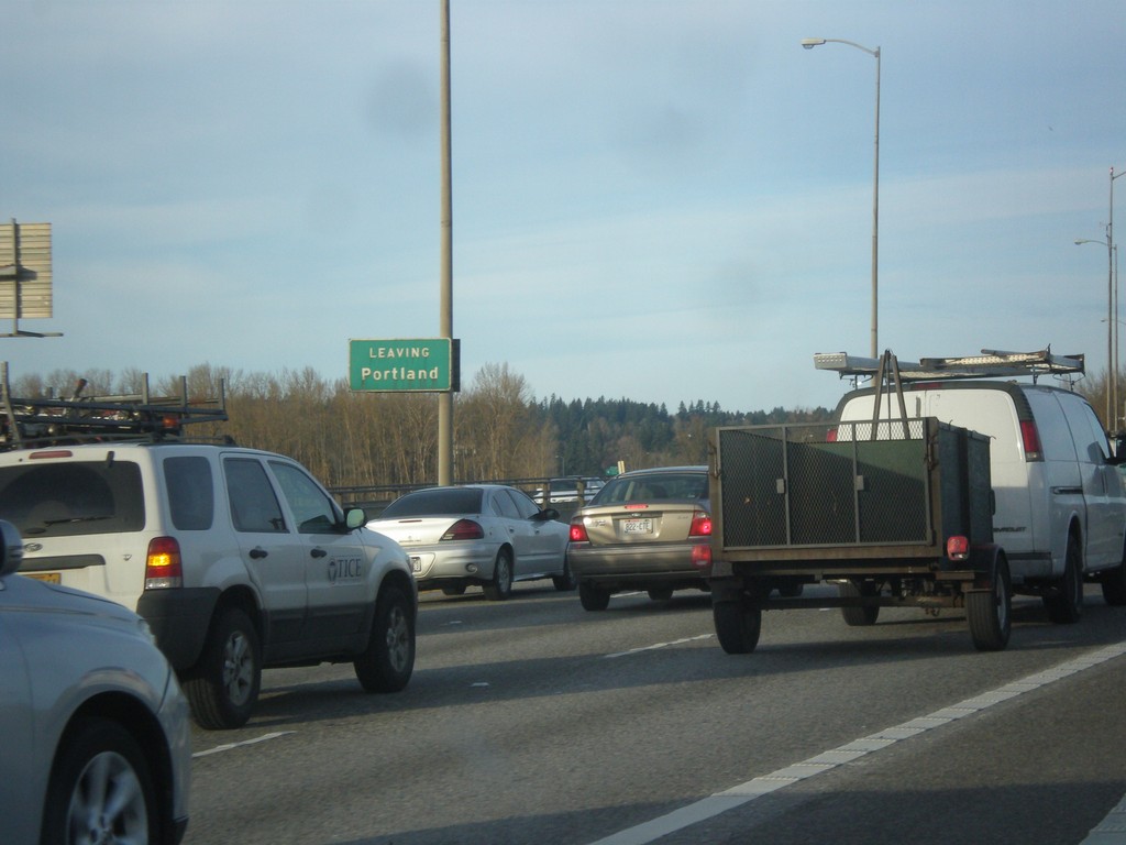
I-205 North - Leaving Portland
Leaving Portland on I-205 north, on bridge over Columbia River.
Taken 02-16-2015
 Portland
Multnomah County
Oregon
United States
Portland
Multnomah County
Oregon
United States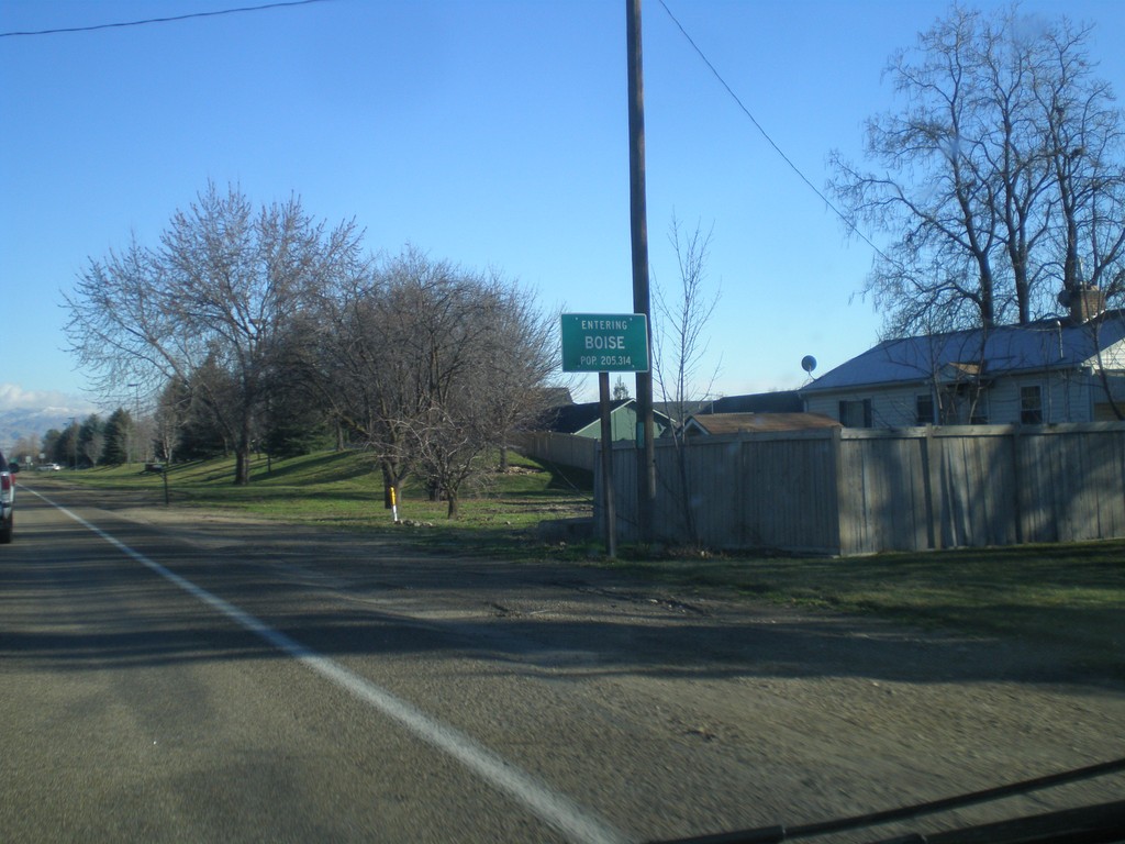
US-20/US-26 East - Entering Boise
Entering Boise on US-20/US-26 East. Boise is the capital and largest city in Idaho.
Taken 12-14-2014

 Boise
Ada County
Idaho
United States
Boise
Ada County
Idaho
United States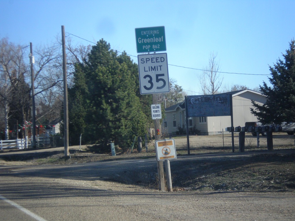
ID-19 East - Greenleaf
Entering Greenleaf, Population 862 on ID-19 east.
Taken 12-14-2014
 Greenleaf
Canyon County
Idaho
United States
Greenleaf
Canyon County
Idaho
United States