Signs Tagged With Municipality Boundary
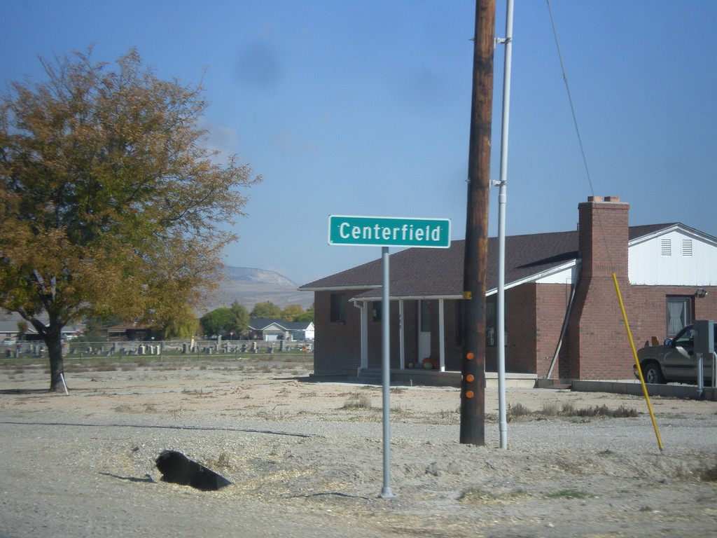
US-89 North - Centerfield
Entering Centerfield on US-89 north.
Taken 10-18-2013
 Centerfield
Sanpete County
Utah
United States
Centerfield
Sanpete County
Utah
United States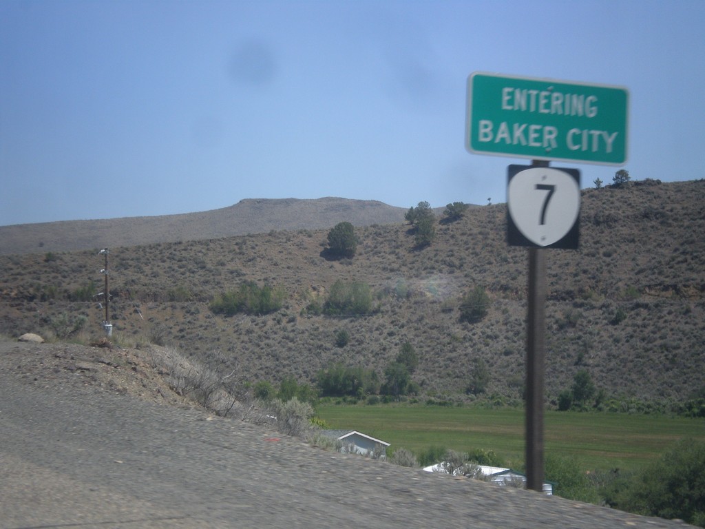
OR-7 East - Entering Baker City
Entering Baker City on OR-7 East.
Taken 07-15-2013
 Baker City
Baker County
Oregon
United States
Baker City
Baker County
Oregon
United States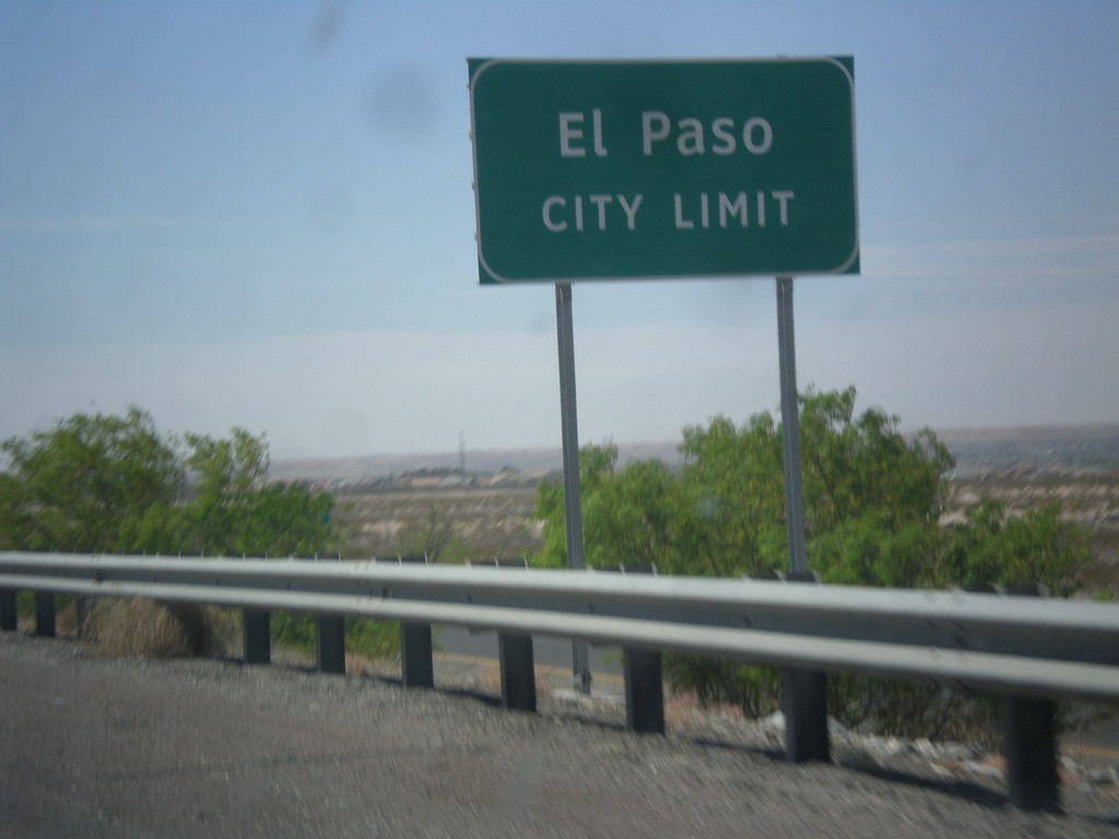
I-10 East - El Paso City Limit
Entering El Paso, Texas on I-10 east.
Taken 04-15-2013
 Canutillo
El Paso County
Texas
United States
Canutillo
El Paso County
Texas
United States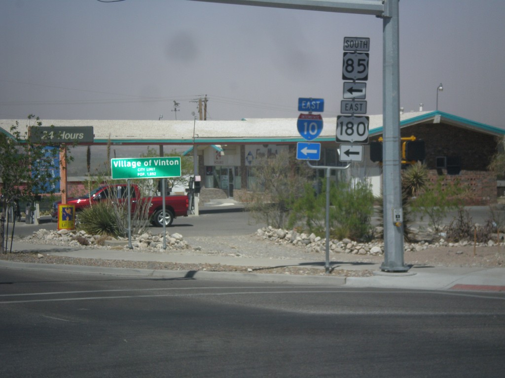
TX-37 Spur West at I-10 Onramp
TX-37 Spur West at I-10/US-180 East/US-85 South. This is the onramp for Exit 2 on I-10. In the background of the photo is the city limit sign for the Village of Vinton.
Taken 04-15-2013


 Anthony
El Paso County
Texas
United States
Anthony
El Paso County
Texas
United States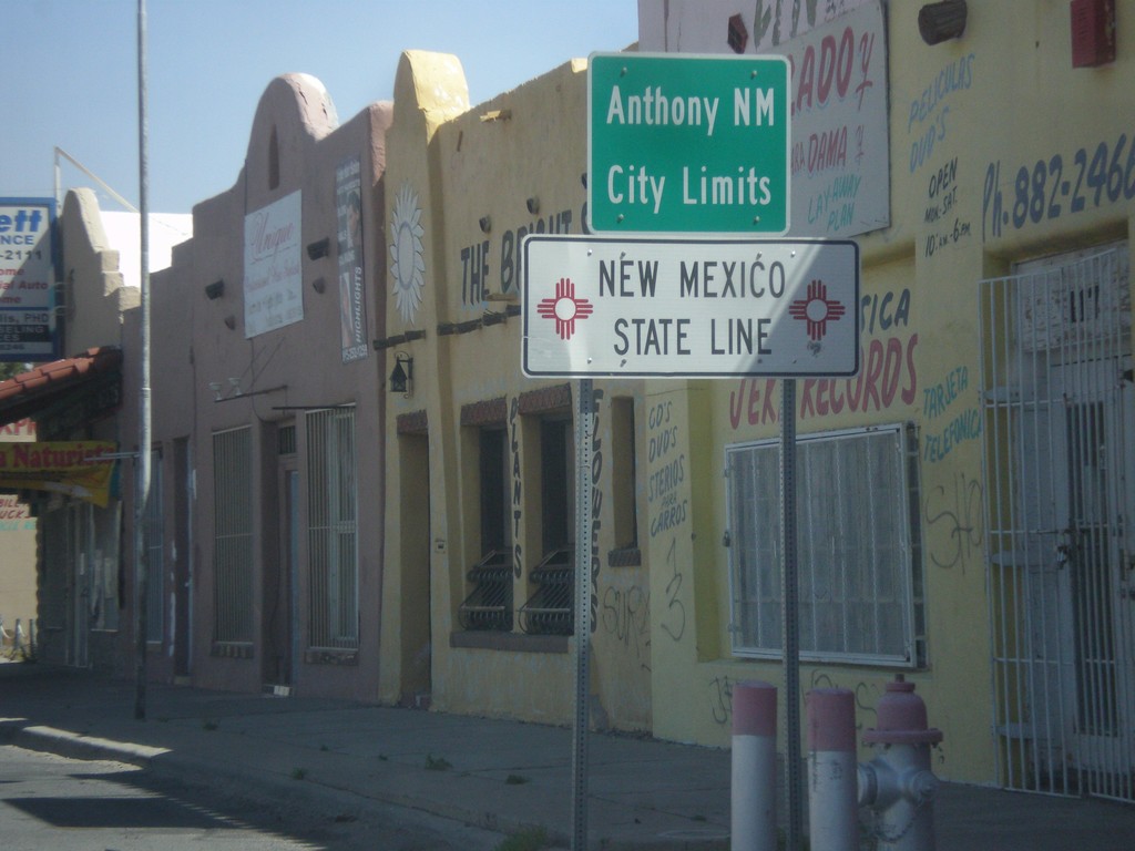
NM-460 North - New Mexico State Line
New Mexico State Line and Anthony, NM city limits on NM-460 north. Taken at the Texas-New Mexico state line on the border between Anthony, NM and Anthony, TX.
Taken 04-15-2013
 Anthony
Doña Ana County
New Mexico
United States
Anthony
Doña Ana County
New Mexico
United States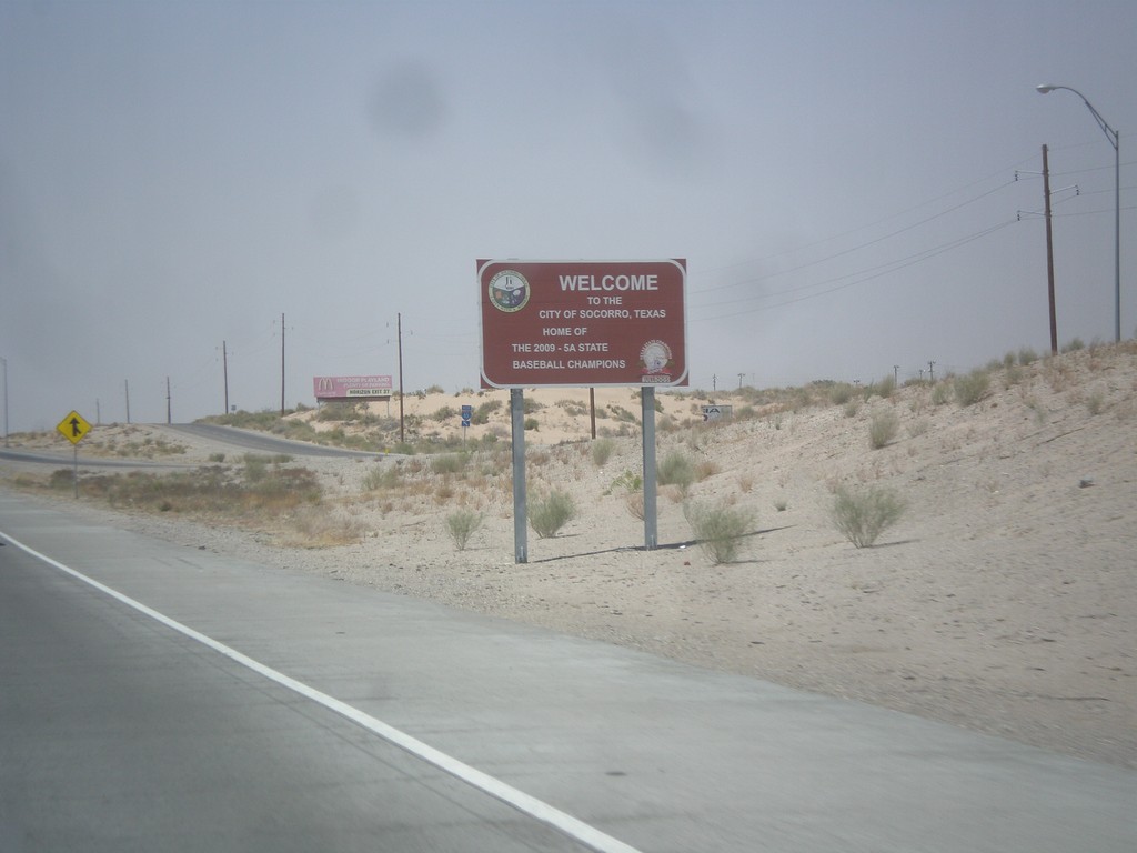
I-10 West - Entering Socorro
Entering Socorro, Texas on I-10 west. This is a non-standard city limit sign, which is brown and contains the city logo. Socorro is an eastern suburb of El Paso.
Taken 04-15-2013
Clint
El Paso County
Texas
United States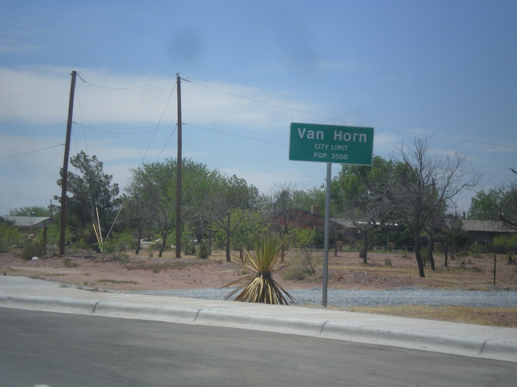
TX-54 South - Van Horn City Limit
Van Horn City Limit - Pop. 2500. Taken on TX-54 south. Van Horn is the county seat of Culberson County.
Taken 04-15-2013
 Van Horn
Culberson County
Texas
United States
Van Horn
Culberson County
Texas
United States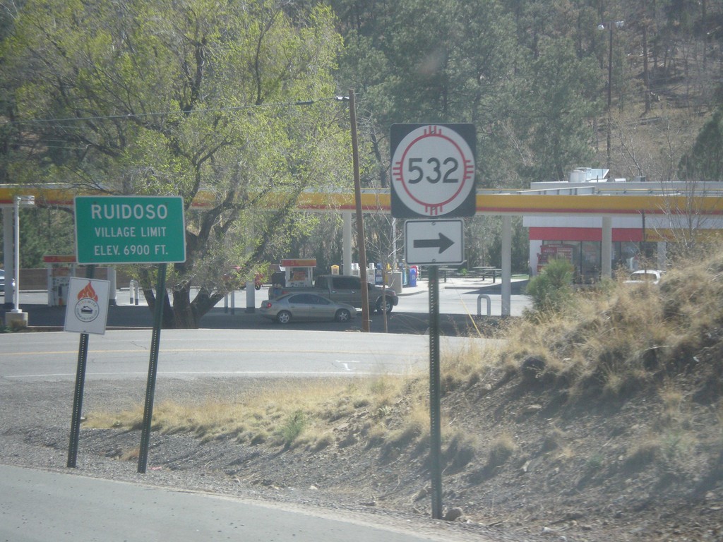
NM-48 South at NM-532
NM-48 south at NM-532. Entering the village of Ruidoso - Elevation 6,900 Feet.
Taken 04-15-2013

 Alto
Lincoln County
New Mexico
United States
Alto
Lincoln County
New Mexico
United States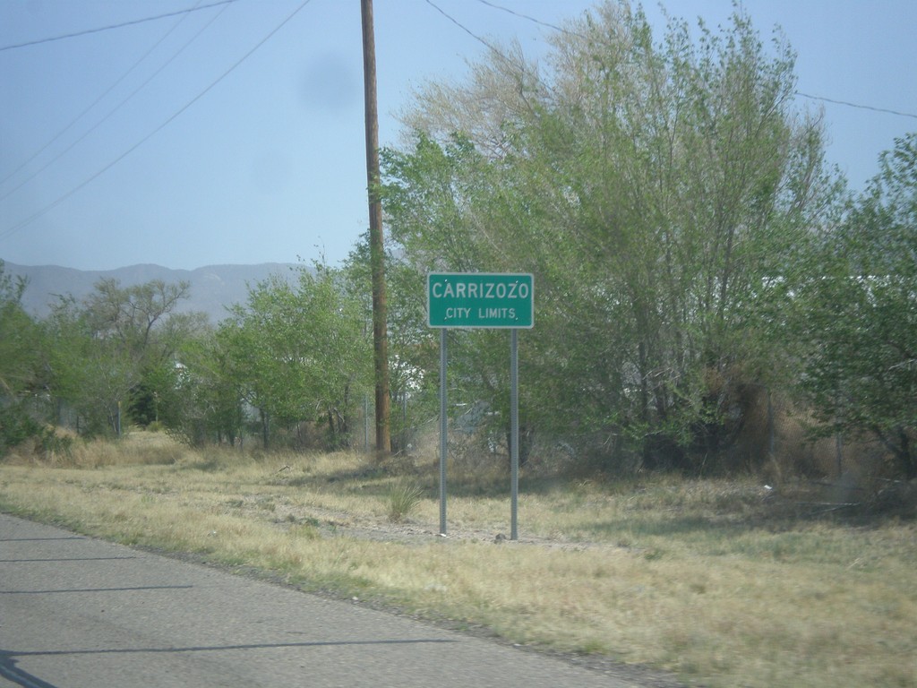
US-380 East - Carrizozo City Limits
Carrizozo City Limits on US-380 east. Carrizozo is the county seat of Lincoln County.
Taken 04-15-2013
 Carrizozo
Lincoln County
New Mexico
United States
Carrizozo
Lincoln County
New Mexico
United States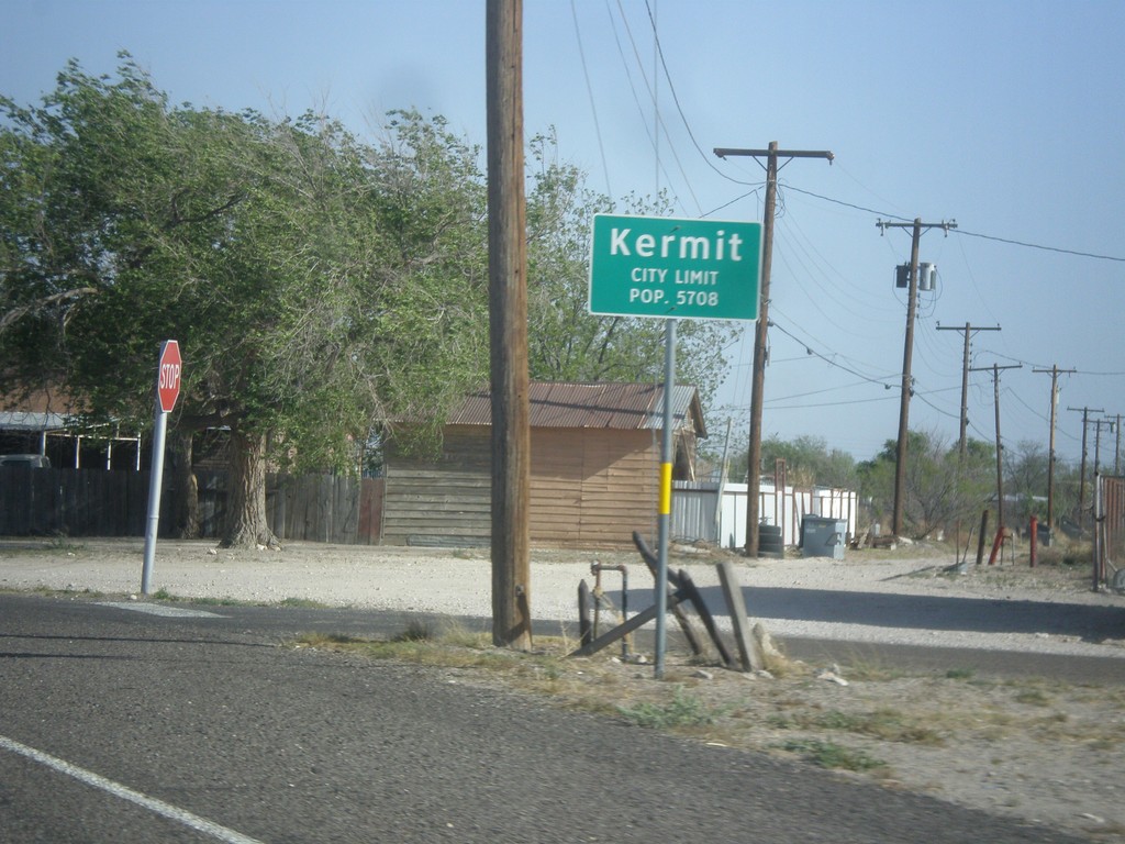
TX-18 South - Kermit City Limit
Kermit City Limit on TX-18 south. Population 5,708.
Taken 04-14-2013
 Kermit
Winkler County
Texas
United States
Kermit
Winkler County
Texas
United States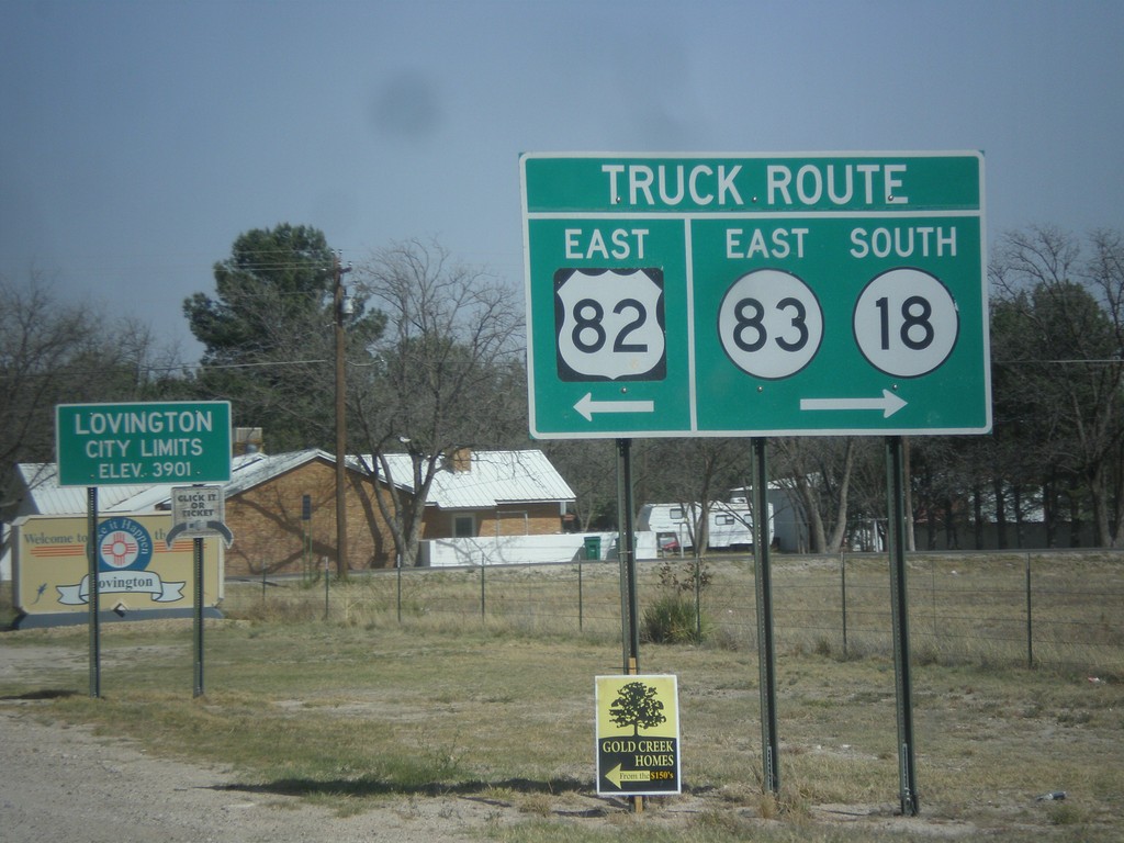
US-82 East at 17th St.
US-82 east at 17th St., the truck around around Lovington. Turn right for NM-18 South/NM-83 East truck route; turn left for US-82 east truck route. Entering Lovington, New Mexico. Lovington is the seat of Lea County.
Taken 04-14-2013


 Lovington
Lea County
New Mexico
United States
Lovington
Lea County
New Mexico
United States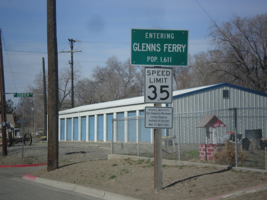
BL-84 West - Entering Glenns Ferry
Entering Glenns Ferry, Idaho on BL-84 west - Population 1,611.
Taken 03-16-2013
 Glenns Ferry
Elmore County
Idaho
United States
Glenns Ferry
Elmore County
Idaho
United States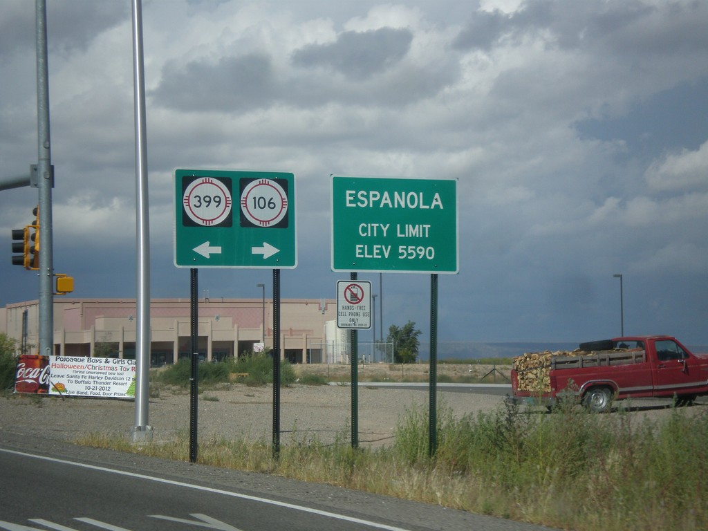
US-84 West/US-285 North - NM-399/NM-106 Jct.
US-84 West/US-285 North at NM-399/NM-106 Jct. Entering Espanola, Elevation 5590.
Taken 10-12-2012


 Santa Cruz
Santa Fe County
New Mexico
United States
Santa Cruz
Santa Fe County
New Mexico
United States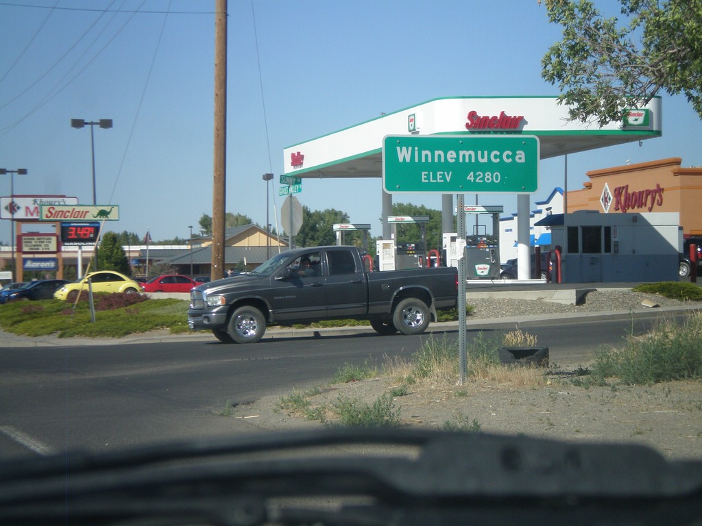
Winnemucca - Elevation 4280
Entering Winnemucca - Elevation 4280 on NV-294 North (Grass Valley Road).
Taken 07-28-2012
 Winnemucca
Humboldt County
Nevada
United States
Winnemucca
Humboldt County
Nevada
United States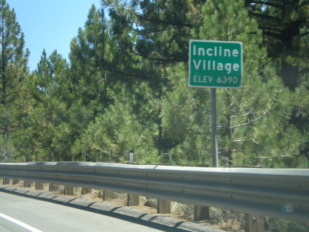
NV-28 East - Incline Village
Entering Incline Village (Elevation 6390) on NV-28 east. Incline Village is a community on the Nevada side of Lake Tahoe on the north shore.
Taken 07-28-2012
 Incline Village
Washoe County
Nevada
United States
Incline Village
Washoe County
Nevada
United States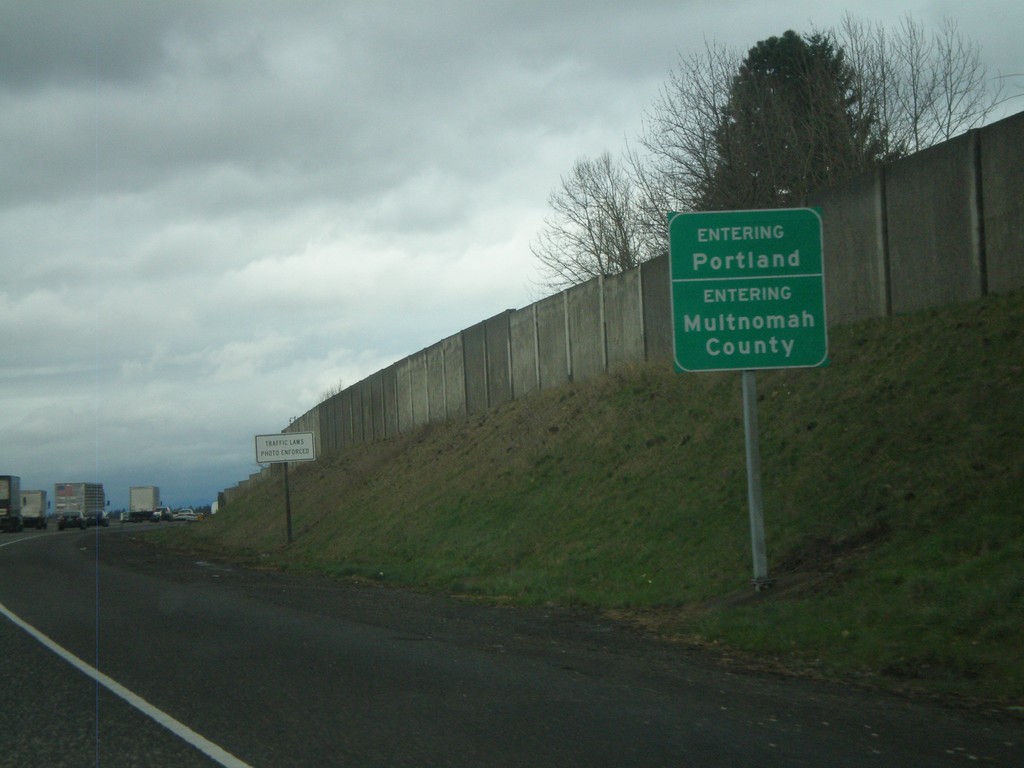
I-205 North - Entering Portland and Multnomah County
Entering Portland on I-205 North. Also entering Multnomah County.
Taken 02-21-2012
 Portland
Multnomah County
Oregon
United States
Portland
Multnomah County
Oregon
United States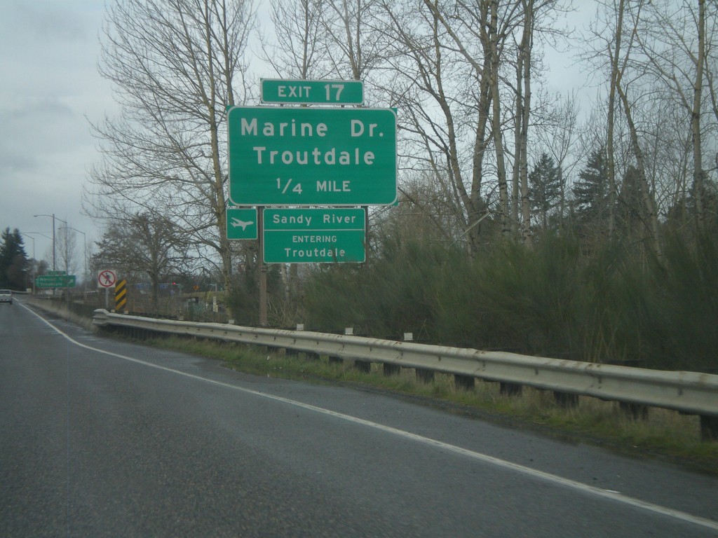
I-84 West - Exit 17
I-84 west approaching Exit 17 - Marine Drive/Troutdale. Entering Troutdale and crossing the Sandy River. The Sandy River is the boundary of the Columbia River Gorge National Scenic Area.
Taken 02-18-2012

 Troutdale
Multnomah County
Oregon
United States
Troutdale
Multnomah County
Oregon
United States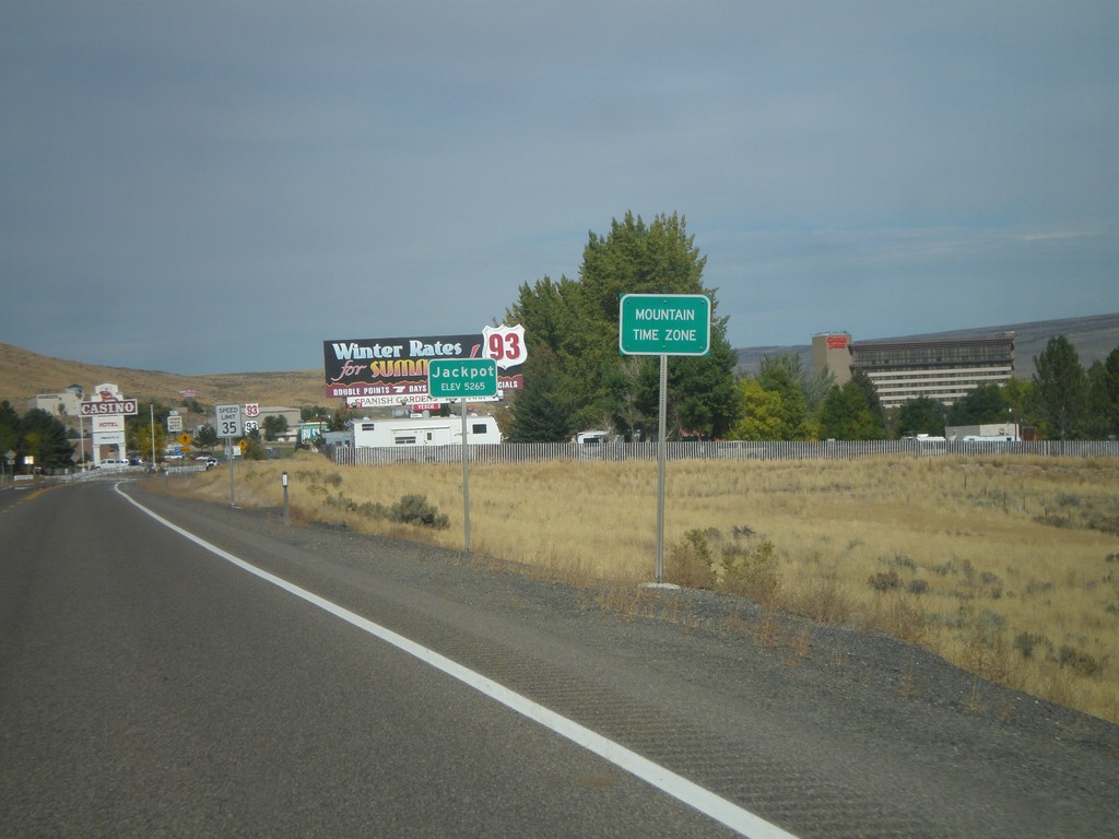
US-93 North - Entering Jackpot and Mountain Time
Entering Mountain Time Zone and Jackpot on US-93 north. Most of Nevada is on Pacific Time, except for a few of the border towns, bordering states in Mountain Time. Jackpot is on the border with Idaho.
Taken 10-15-2011
 Jackpot
Elko County
Nevada
United States
Jackpot
Elko County
Nevada
United States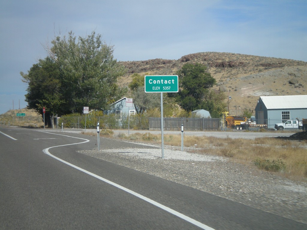
US-93 North - Contact
Entering Contact on US-93 north. The only thing in Contact is a Nevada DOT Highway Maintenance Station.
Taken 10-15-2011
Jackpot
Elko County
Nevada
United States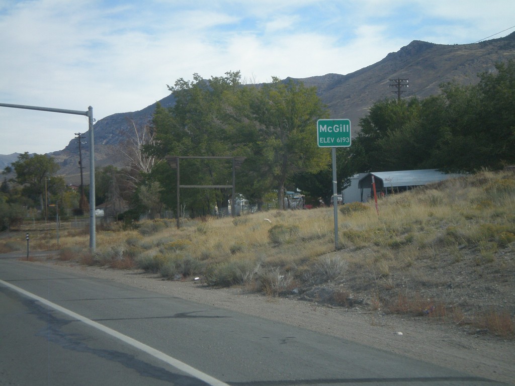
US-93 North - Mc Gill
Entering Mc Gill - Elevation 6193 Feet, on US-93 north.
Taken 10-15-2011
Ely
White Pine County
Nevada
United States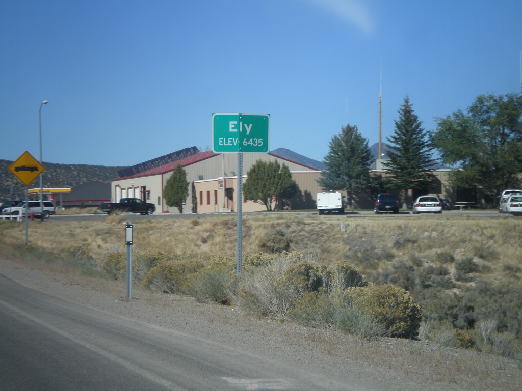
US-93 North - Entering Ely
Entering Ely - Elevation 6435 on US-93 North. Ely is the county seat of White Pine County.
Taken 10-14-2011

 Ely
White Pine County
Nevada
United States
Ely
White Pine County
Nevada
United States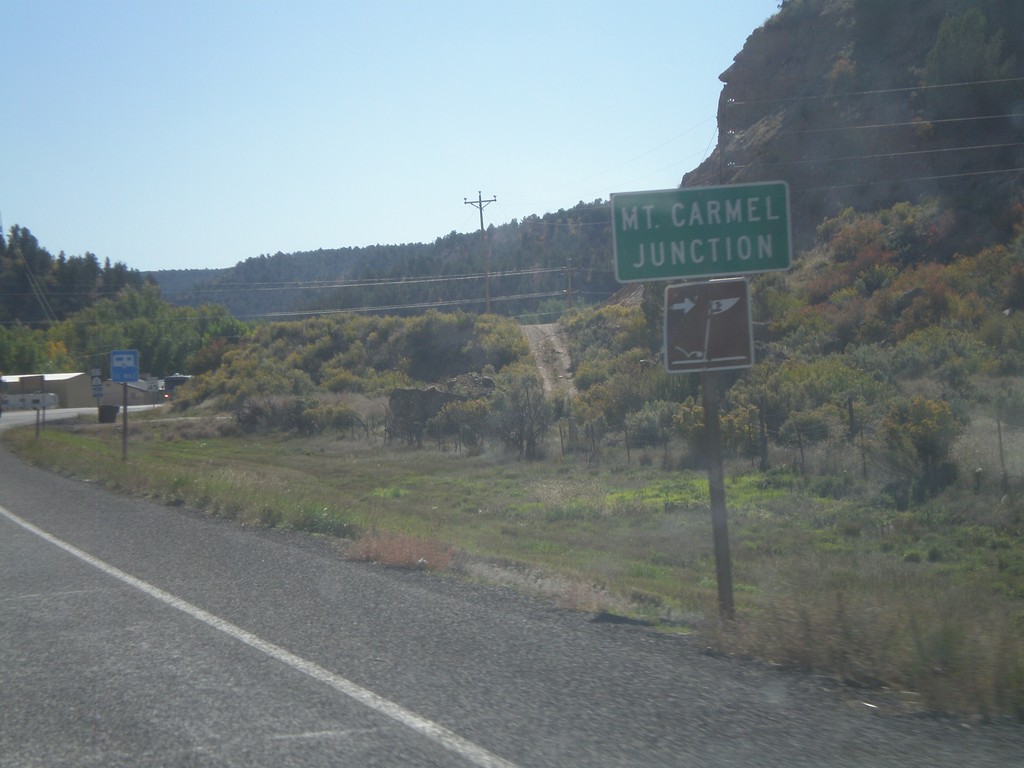
Entering Mt. Carmel Junction on US-89 South
Entering Mt. Carmel Junction on US-89 south Mt. Carmel Junction is at the junction of UT-9 and US-89 on the east side of Zion National Park.
Taken 10-13-2011
Orderville
Kane County
Utah
United States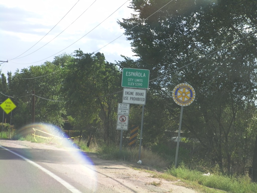
NM-68 South - Española City Limit
Española City Limit on NM-68 south.
Taken 10-03-2011
 Española
Rio Arriba County
New Mexico
United States
Española
Rio Arriba County
New Mexico
United States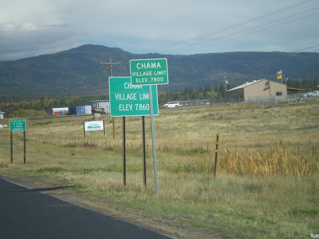
US-64 East/US-84 South - Village of Chama
US-64 East/US-84 South - Village of Chama (Elevation 7800 Feet).
Taken 10-02-2011
 Chama
Rio Arriba County
New Mexico
United States
Chama
Rio Arriba County
New Mexico
United States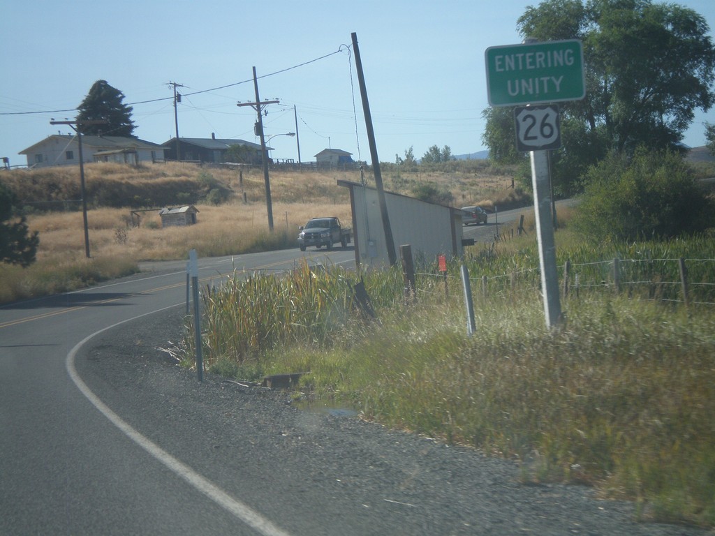
US-26 East - Entering Unity
Entering Unity Oregon on US-26 east.
Taken 09-04-2011
 Unity
Baker County
Oregon
United States
Unity
Baker County
Oregon
United States