Signs Tagged With Municipality Boundary
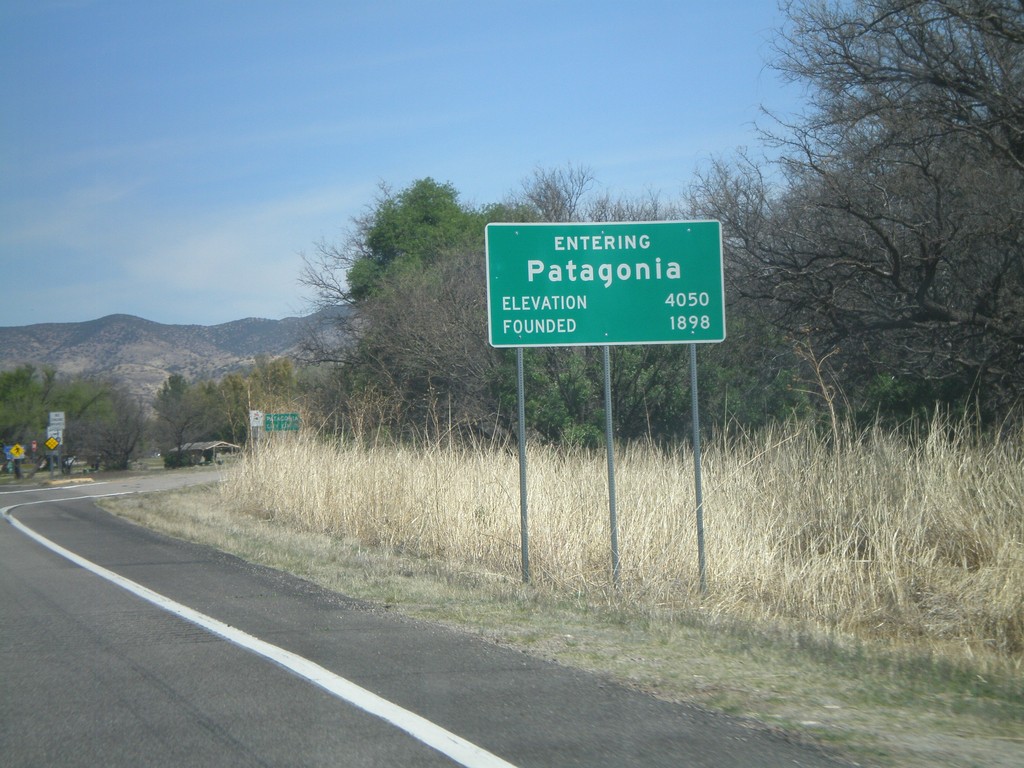
AZ-82 East - Entering Patagonia
Entering Patagonia on AZ-82 East. Elevation 4,050. Founded in 1898.
Taken 03-22-2009
 Patagonia
Santa Cruz County
Arizona
United States
Patagonia
Santa Cruz County
Arizona
United States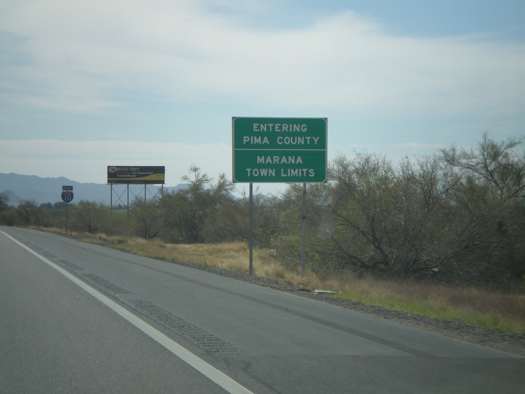
I-10 East - Pima County Line
Entering Pima County on I-10 east. Also entering the town of Marana. Taken on the Pima-Pinal County Line.
Taken 03-22-2009
 Marana
Pinal County
Arizona
United States
Marana
Pinal County
Arizona
United States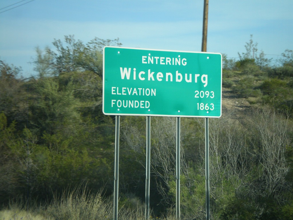
US-93 South - Entering Wickenburg
Entering Wickenburg on US-93 South. Elevation 2,093 Feet. Founded 1863.
Taken 03-21-2009
 Wickenburg
Maricopa County
Arizona
United States
Wickenburg
Maricopa County
Arizona
United States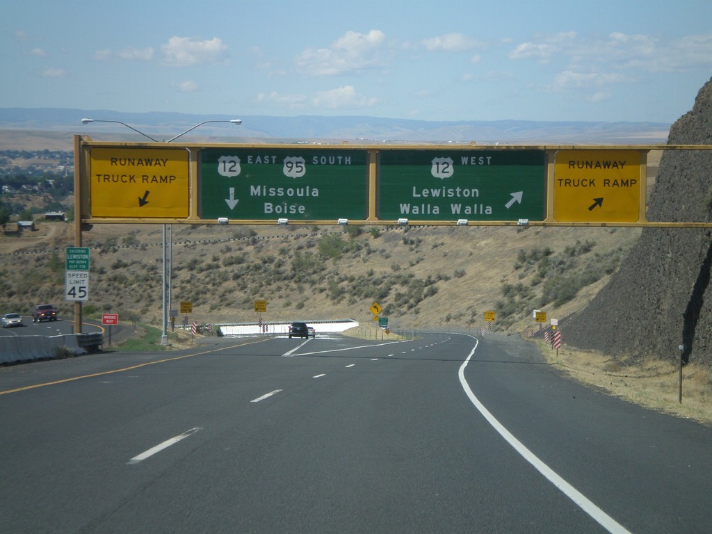
US-95 South at US-12
US-95 south at US-12 junction. Merge right for US-12 West/Lewiston/Walla Walla (Washington). Use left lane for US-95 South/US-12 East/Missoula (Montana)/Boise. Use either lane for access to Runaway Truck Ramps.
Taken 07-27-2008

 Lewiston
Nez Perce County
Idaho
United States
Lewiston
Nez Perce County
Idaho
United States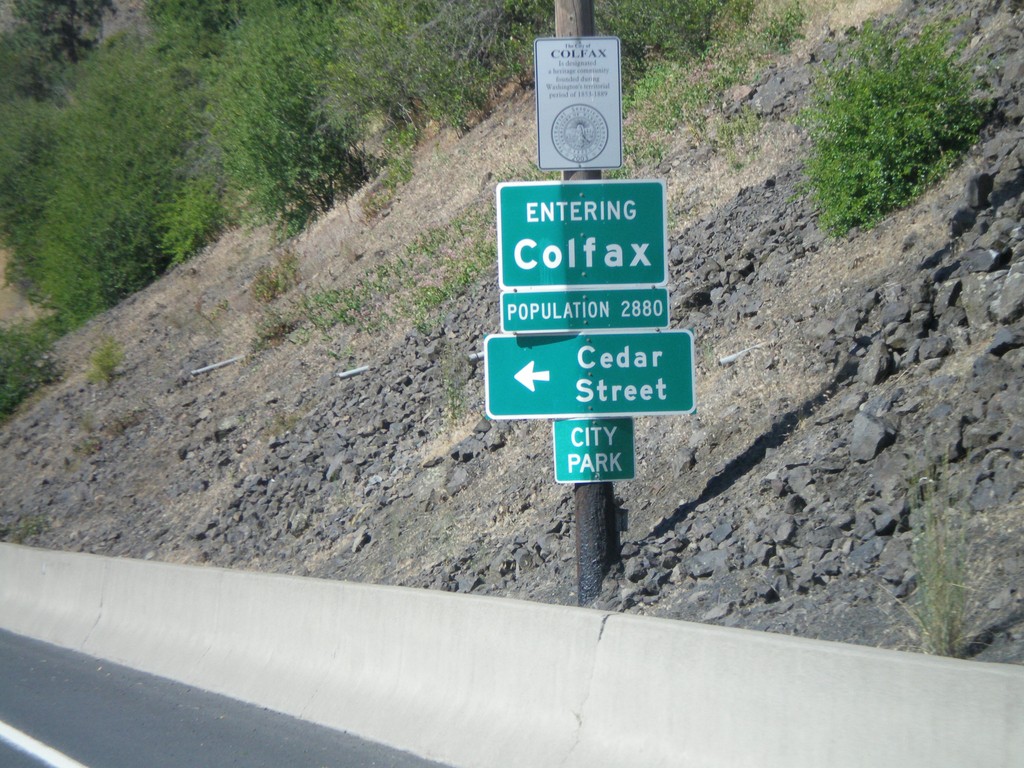
US-195 South - Entering Colfax
Entering Colfax on US-195 south.
Taken 07-27-2008
 Colfax
Whitman County
Washington
United States
Colfax
Whitman County
Washington
United States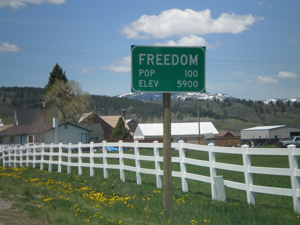
WY-239 West - Entering Freedom
Entering Freedom on WY-239 west.
Taken 05-19-2008
 Freedom
Lincoln County
Wyoming
United States
Freedom
Lincoln County
Wyoming
United States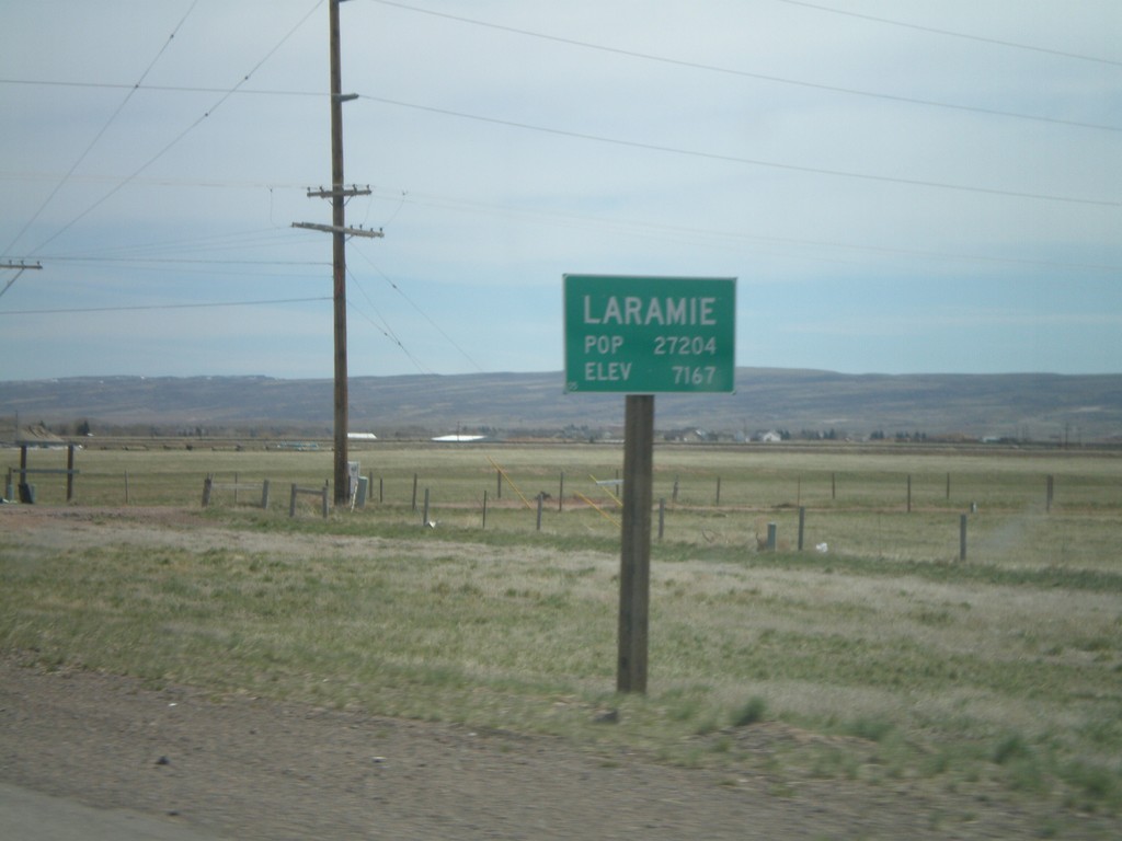
US-287 North - Entering Laramie
Entering Laramie on US-287 north. Pop: 27,204 - Elev - 7,167.
Taken 05-18-2008
 Laramie
Albany County
Wyoming
United States
Laramie
Albany County
Wyoming
United States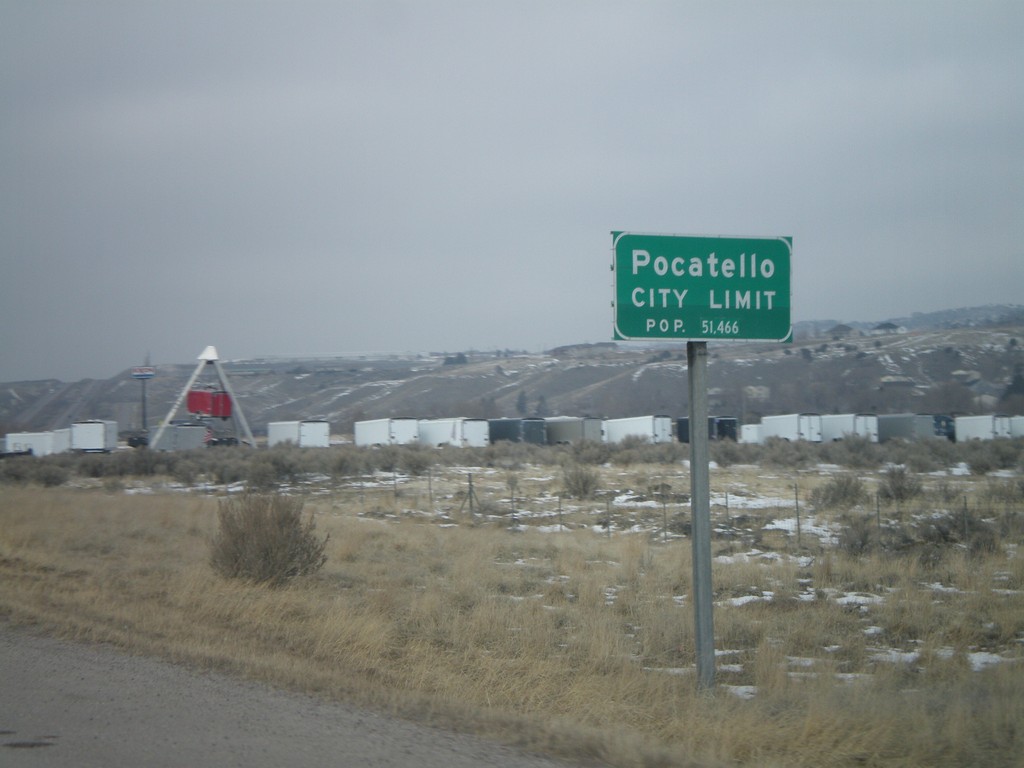
I-15 North - Pocatello City Limit
Entering Pocatello on I-15 north. Pocatello is the 3rd largest city in Idaho followed by Boise and Nampa.
Taken 02-17-2008


 Pocatello
Bannock County
Idaho
United States
Pocatello
Bannock County
Idaho
United States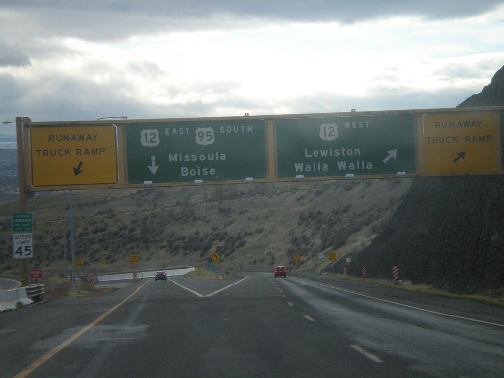
US-95 South at US-12
US-95 south at US-12 at the bottom of the Lewiston Hill. The welcome to Lewiston sign is right above the speed limit sign on the left side of the photo. Lewiston is the lowest city in Idaho - 738 feet. There are Runaway Truck Ramps on either side of the photo.
Taken 12-26-2007
Lewiston
Nez Perce County
Idaho
United States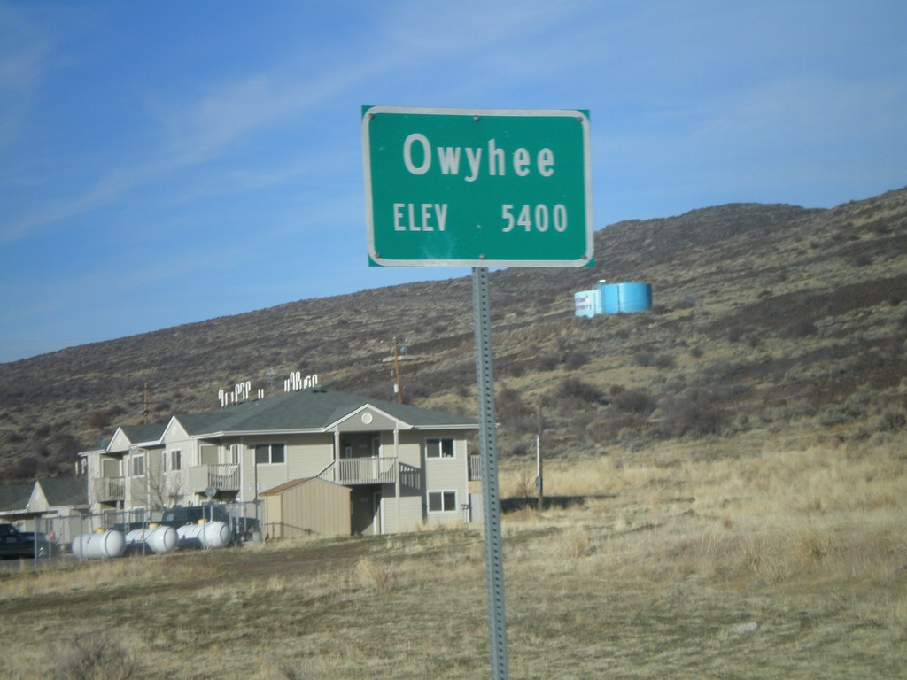
NV-225 North - Entering Owyhee
Entering Owyhee, Nevada on NV-225 north. Elevation 5400 feet. Owyhee is on the Duck Valley Indian Reservation.
Taken 11-24-2007
 Owyhee
Elko County
Nevada
United States
Owyhee
Elko County
Nevada
United States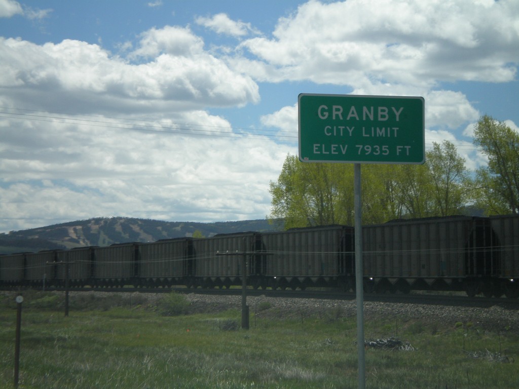
US-40 East - Granby City Limit
Granby City Limits on US-40 east.
Taken 05-25-2007
 Granby
Grand County
Colorado
United States
Granby
Grand County
Colorado
United States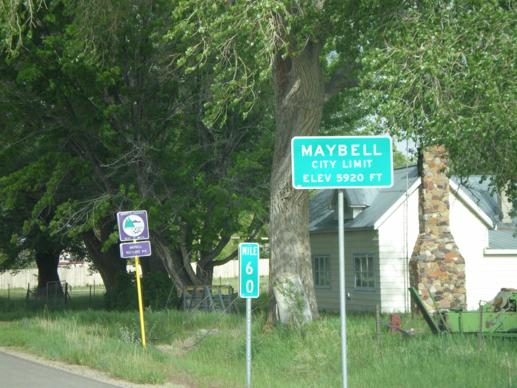
US-40 East - Maybell City Limit
Maybell City Limits on US-40 east.
Taken 05-24-2007
Craig
Moffat County
Colorado
United States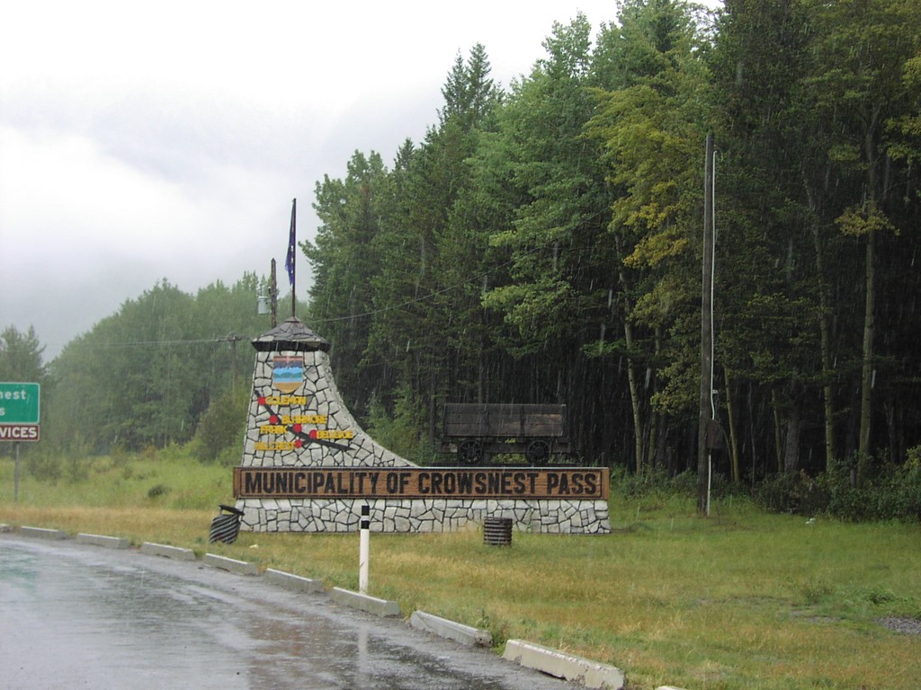
Municipality Of Crowsnest Pass - AB-3 East
Muncipality of Crowsnest Pass on AB-3 east
Taken 09-10-2005
 Crowsnest
 Pass
Alberta
Canada
Crowsnest
Crowsnest Pass
Alberta
Canada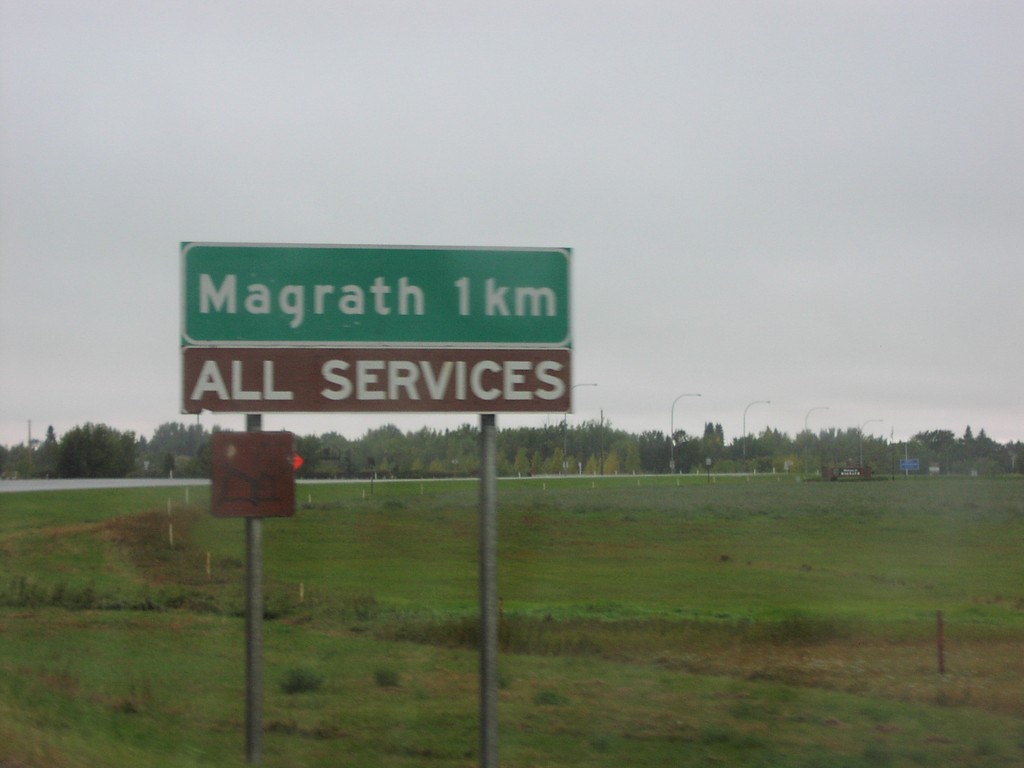
AB-62 North - Magrath
Magrath 1Km - All Traveller Services on AB-62 north
Taken 09-10-2005
 Magrath
Cardston County
Alberta
Canada
Magrath
Cardston County
Alberta
Canada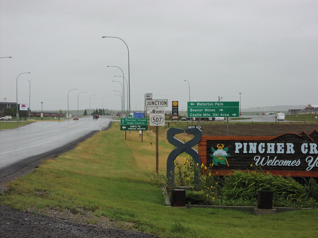
AB-6 South AB-507Jct
AB-6 South entering Pincher Creek, and ABS-507 junction to Waterton Park
Taken 09-10-2005

 Pincher Creek
 No. 9
Alberta
Canada
Pincher Creek
Pincher Creek No. 9
Alberta
Canada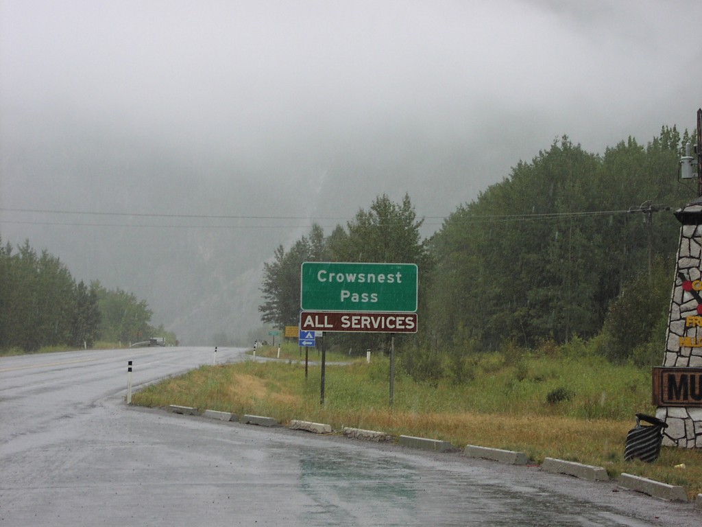
AB-3 East Crowsnest Pass
Crowsnest Pass - All Services on AB-3 east
Taken 09-10-2005
Crowsnest
Crowsnest Pass
Alberta
Canada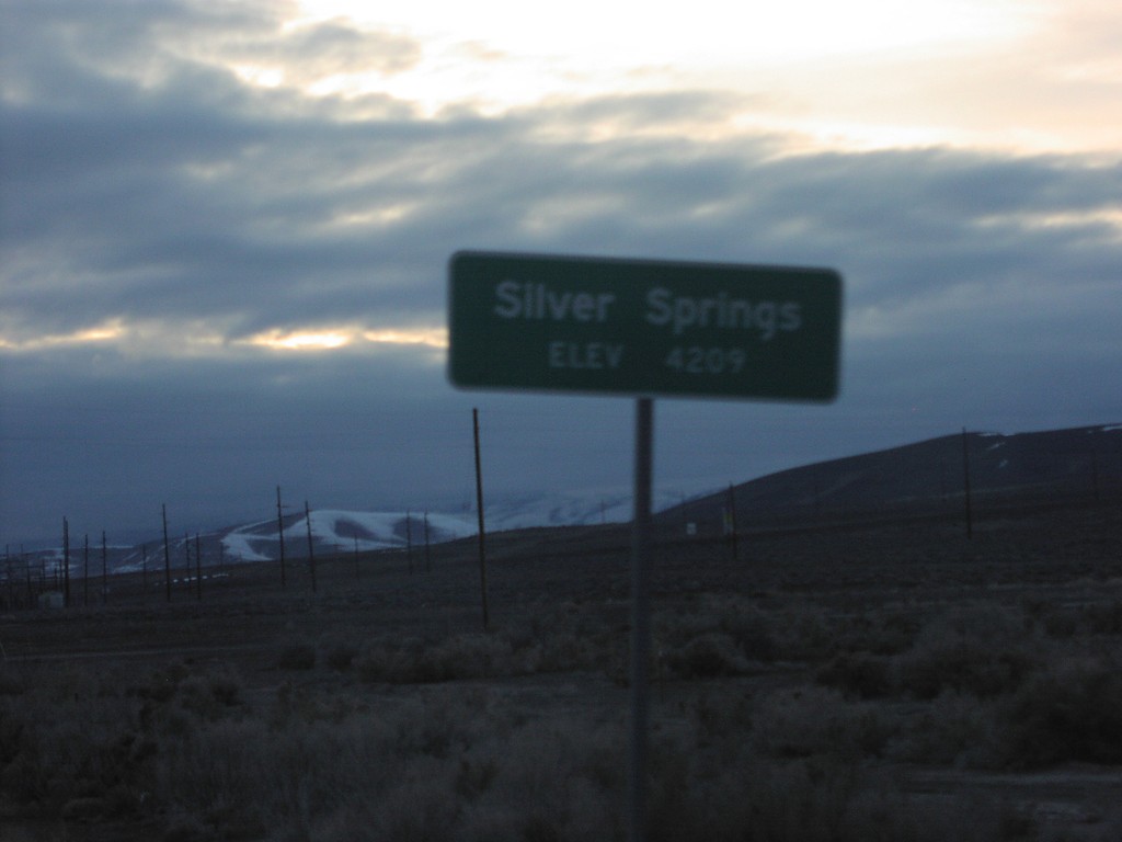
US-50 West - Silver Springs
Entering Silver Springs on US-50 west.
Taken 02-01-2005
 Silver Springs
Lyon County
Nevada
United States
Silver Springs
Lyon County
Nevada
United States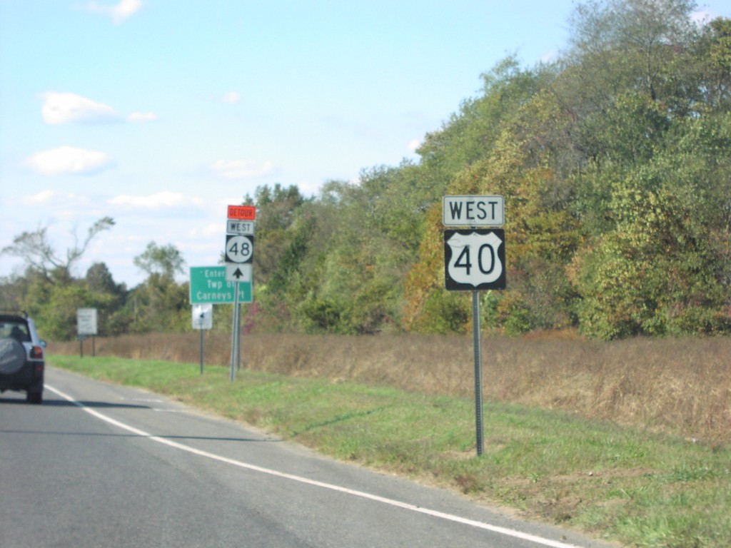
US-40 West/NJ-48 Detour
US-40 West and Detour NJ-48
Taken 10-01-2004
 Pilesgrove
Salem County
New Jersey
United States
Pilesgrove
Salem County
New Jersey
United States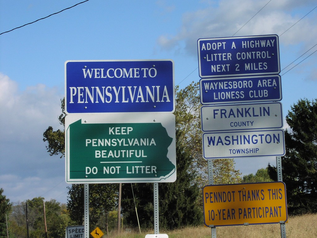
PA-316 North - Welcome To Pennsylvania
Welcome To Pennsylvania, Franklin County, Washington Township on PA-316 North at the Maryland border.
Taken 10-01-2004
 Waynesboro
Franklin County
Pennsylvania
United States
Waynesboro
Franklin County
Pennsylvania
United States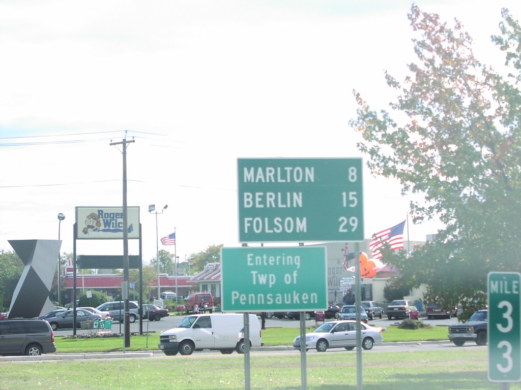
NJ-73 South - Distance Marker/Twp of Pennsauken
Entering Township of Pennsauken and Distance Marker on NJ-73 South.
Taken 10-01-2004
 Pennsauken Township
Camden County
New Jersey
United States
Pennsauken Township
Camden County
New Jersey
United States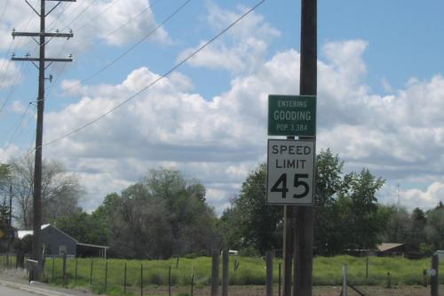
Entering Gooding - US-26 West
Entering Gooding on US-26 West
Taken 05-01-2004
 Gooding
 County
Idaho
United States
Gooding
Gooding County
Idaho
United States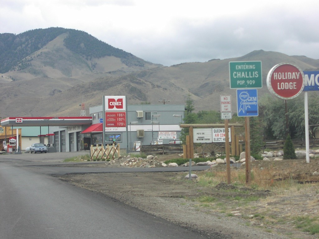
US-93 South - Entering Challis
Entering Challis on US-93 South
Taken 09-01-2003
Challis
Custer County
Idaho
United States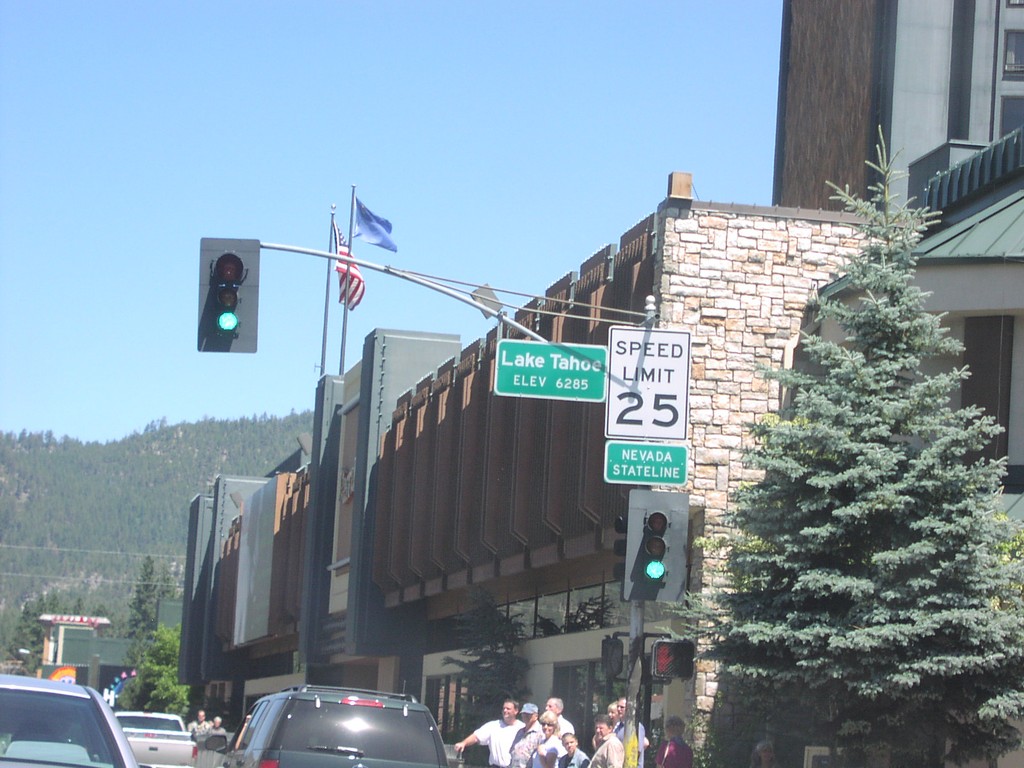
US-50 East - Nevada State Line
US-50 east at the California-Nevada state line.
Taken 08-01-2003
Stateline
Douglas County
Nevada
United States