Signs Tagged With Municipality Boundary
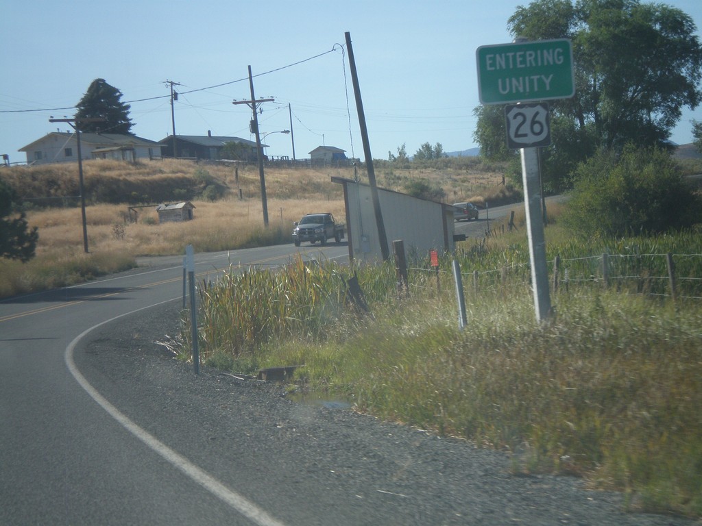
US-26 East - Entering Unity
Entering Unity Oregon on US-26 east.
Taken 09-04-2011
 Unity
Baker County
Oregon
United States
Unity
Baker County
Oregon
United States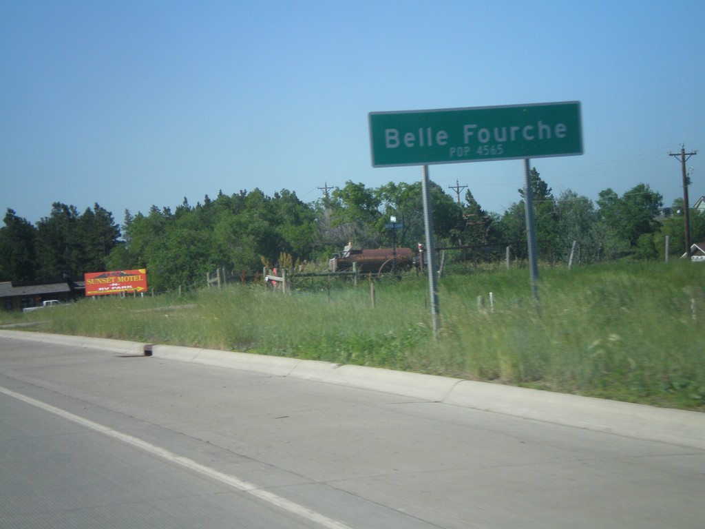
US-85 North - Belle Fourche
Entering Belle Fourche on US-85 north. Population 4,565. Belle Fourche is the county seat of Butte County, South Dakota.
Taken 07-03-2011
 Belle Fourche
Butte County
South Dakota
United States
Belle Fourche
Butte County
South Dakota
United States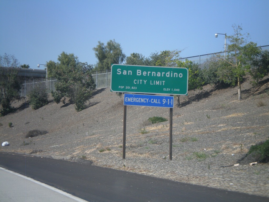
CA-210 West - San Bernardino City Limit
San Bernardino City Limit on CA-210 west. San Bernardino is the county seat of San Bernardino County.
Taken 02-28-2011
 Highland
San Bernardino County
California
United States
Highland
San Bernardino County
California
United States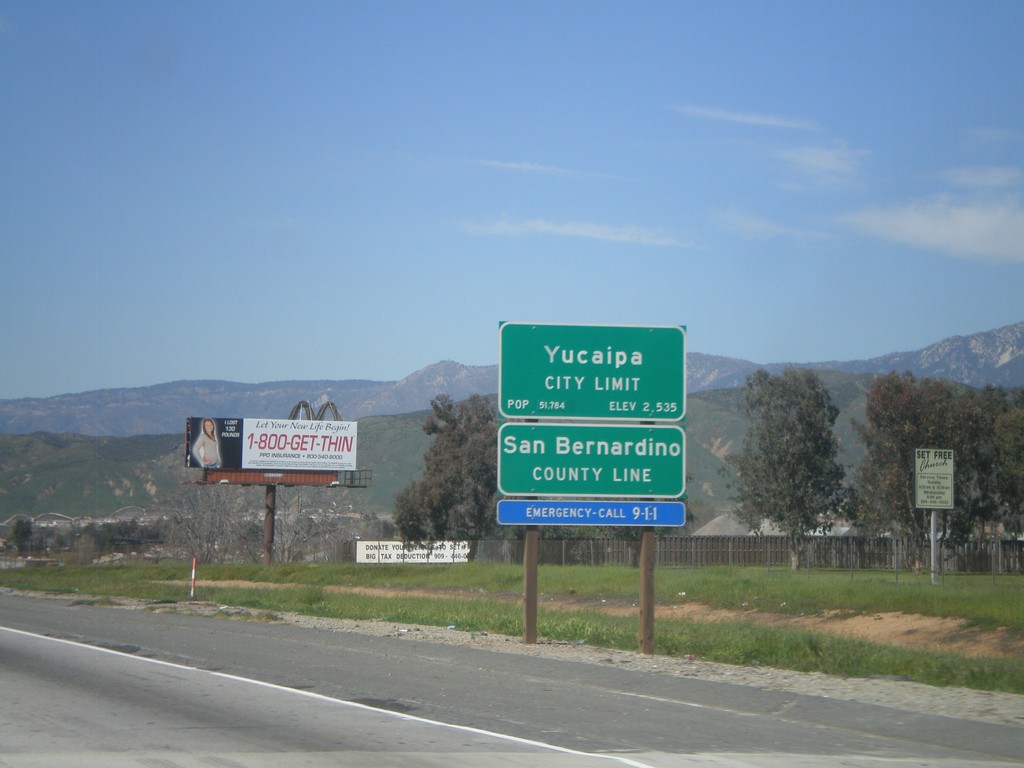
I-10 West - San Bernardino County Line
I-10 west at San Bernardino County Line, and Yucaipa City Limits.
Taken 02-28-2011
 Calimesa
San Bernardino County
California
United States
Calimesa
San Bernardino County
California
United States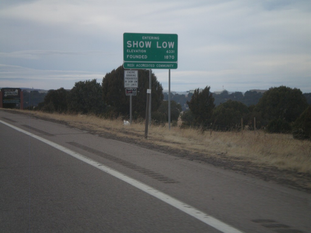
US-60 West - Entering Show Low
Entering Show Low on US-60 west. Elevation 6,331, founded in 1870.
Taken 02-24-2011
 Show Low
Navajo County
Arizona
United States
Show Low
Navajo County
Arizona
United States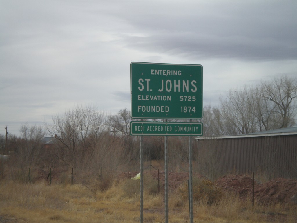
US-191 South/AZ-61 West - Entering St. Johns
Entering St. Johns on US-191 South/AZ-61 West. Elevation 5725 Feet. Founded in 1874. St. Johns is the county seat of Apache County.
Taken 02-24-2011

 Saint Johns
Apache County
Arizona
United States
Saint Johns
Apache County
Arizona
United States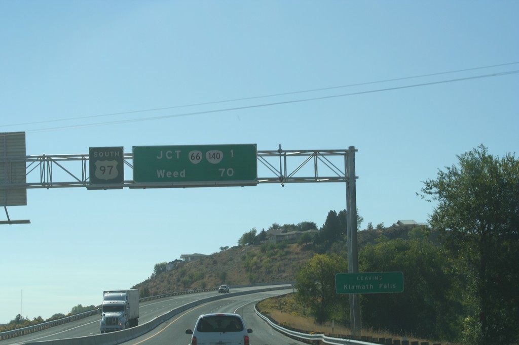
US-97 South Overhead
Distance marker on US-97 south for Weed, and OR-66/OR-140 junction. Leaving the city of Klamath Falls.
Taken 09-25-2010


 Klamath Falls
Klamath County
Oregon
United States
Klamath Falls
Klamath County
Oregon
United States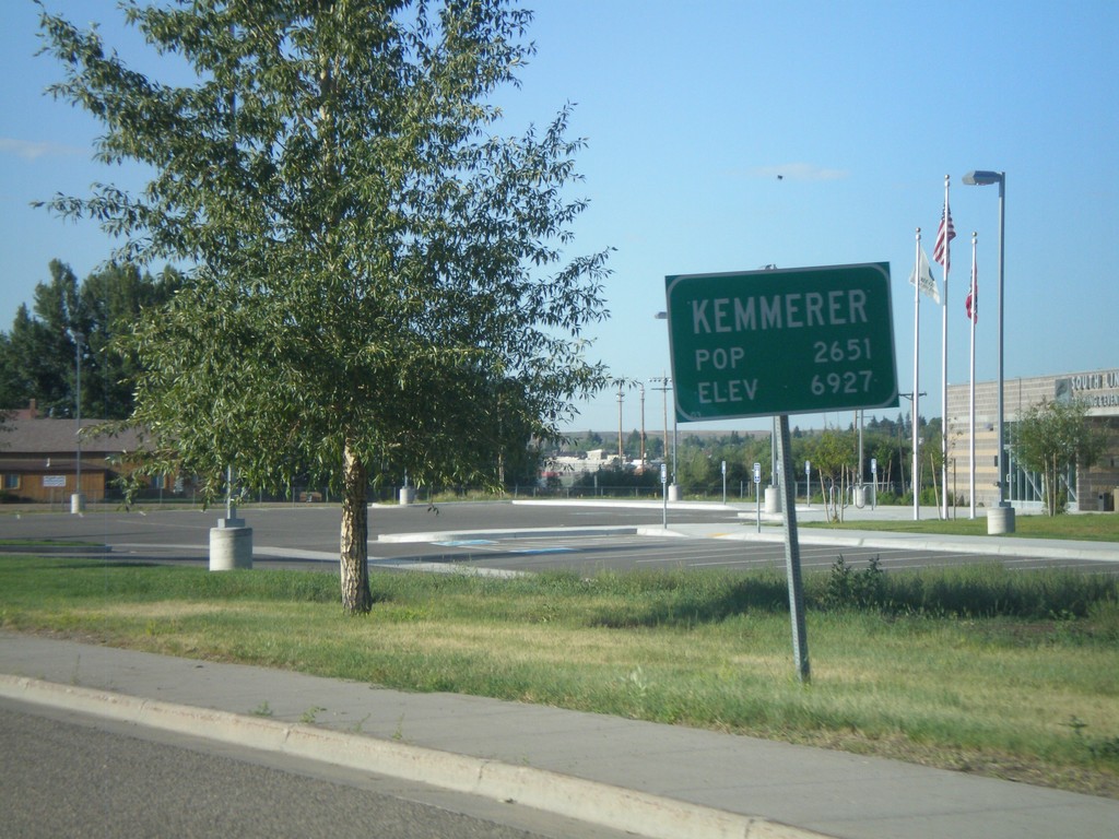
Entering Kemmerer - WY-233 South
Entering the city of Kemmerer on WY-233 south. Kemmerer is the county seat of Lincoln County.
Taken 08-02-2010
 Kemmerer
Lincoln County
Wyoming
United States
Kemmerer
Lincoln County
Wyoming
United States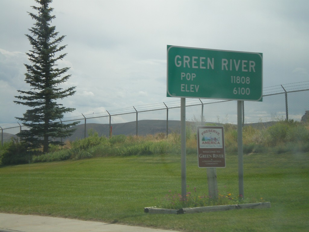
BL-80/Bus. US-30 West - Green River
Entering Green River on BL-80/Bus. US-30 West. Green River has a population of 11808, and an elevation of 6100 Feet.
Taken 08-01-2010

 Green River
Sweetwater County
Wyoming
United States
Green River
Sweetwater County
Wyoming
United States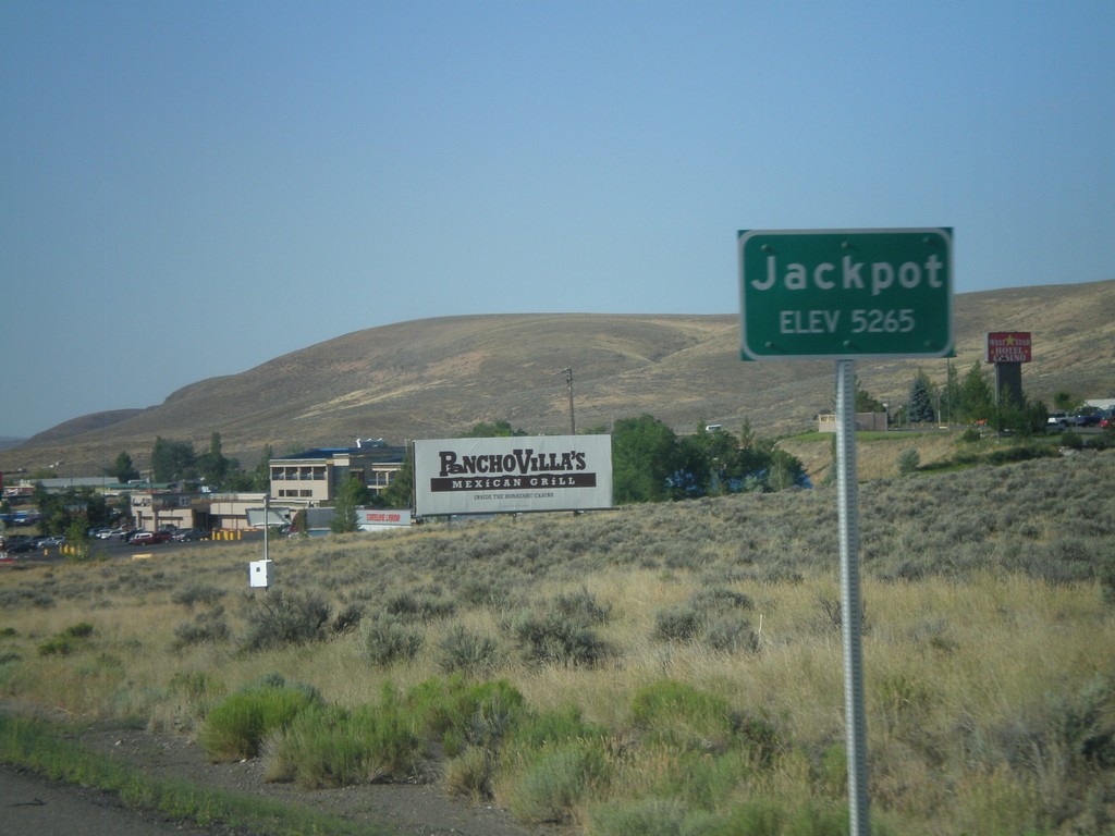
US-93 South - Jackpot
Entering Jackpot on US-93 south. Jackpot lies right on the Idaho-Nevada border, and is home to several casinos.
Taken 07-31-2010
 Jackpot
Elko County
Nevada
United States
Jackpot
Elko County
Nevada
United States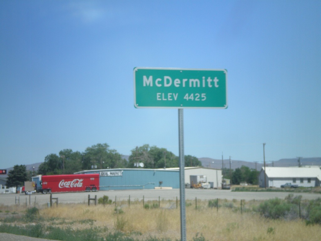
US-95 North - Entering McDermitt
Entering McDermitt - Elevation 4425. McDermitt is located along the Nevada-Oregon border.
Taken 07-13-2010
 McDermitt
Humboldt County
Nevada
United States
McDermitt
Humboldt County
Nevada
United States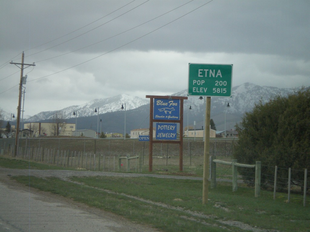
US-89 North - Entering Etna
Entering Etna on US-89 North. Population 200, Elevation 5,815
Taken 05-01-2010
 Etna
Lincoln County
Wyoming
United States
Etna
Lincoln County
Wyoming
United States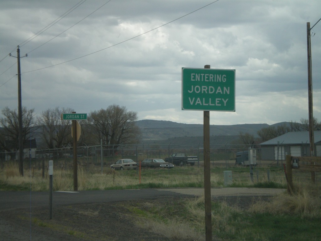
US-95 North - Entering Jordan Valley
Entering Jordan Valley on US-95 north.
Taken 04-20-2010
Jordan Valley
Malheur County
Oregon
United States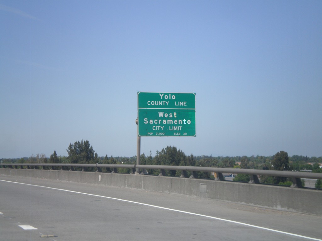
US-50/BL-80 West - Yolo-Sacramento County Line
US-50/BL-80 west at the Yolo-Sacramento County Line at the Sacramento River. Also entering the city of West Sacramento.
Taken 04-16-2010
 Sacramento
 County
California
United States
Sacramento
Sacramento County
California
United States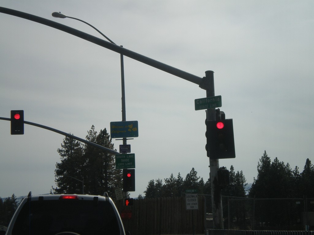
US-50 West - Welcome To California
Welcome to California on US-50 west at the California-Nevada state line. Entering South Lake Tahoe.
Taken 04-15-2010
South Lake Tahoe
El Dorado County
California
United States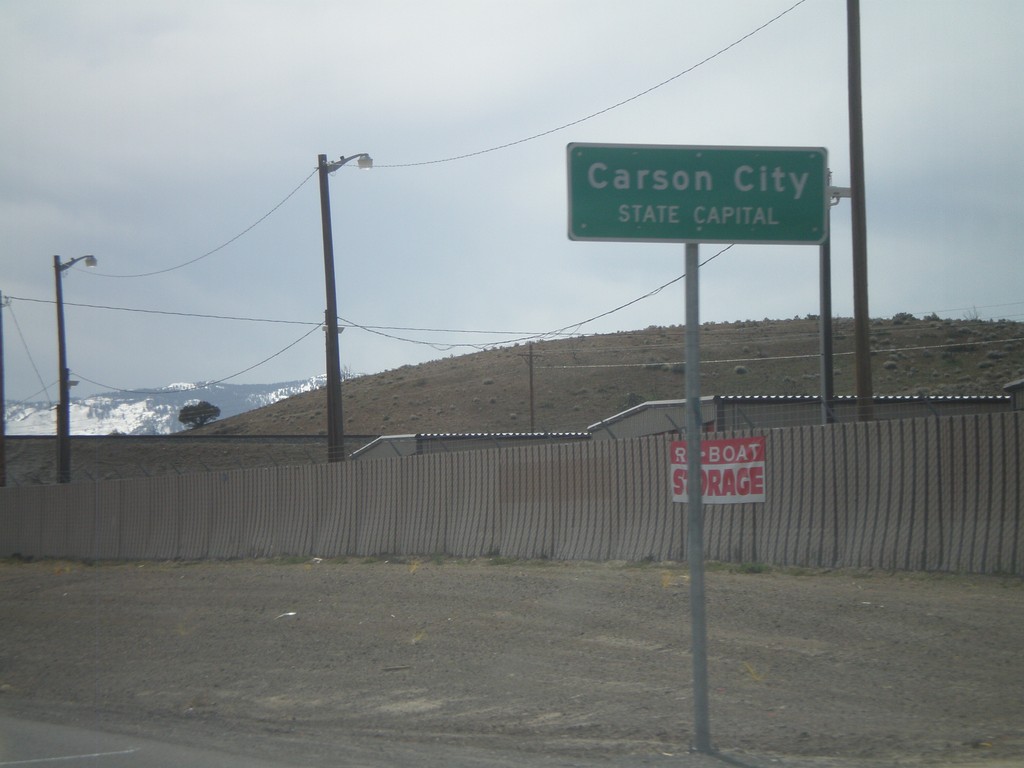
US-50 West - Entering Carson City
US-50 west at the Lyon County - Carson City line. When entering all other counties in Nevada, the county name is above the words County Line. In Carson City, the County Line is replaced with State Capitol.
Taken 04-15-2010
Mound House
Lyon County
Nevada
United States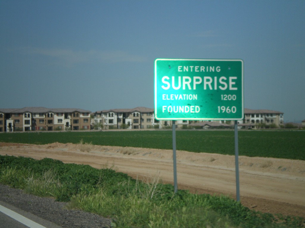
AZ-303 Loop North - Entering Surprise
Entering Surprise on AZ-303 Loop North.
Taken 03-22-2010
 Surprise
Maricopa County
Arizona
United States
Surprise
Maricopa County
Arizona
United States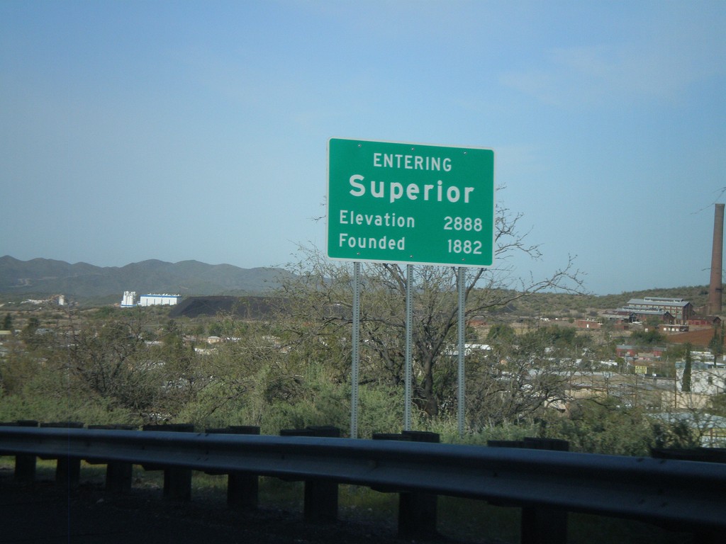
Entering Superior
US-60 west - Entering Superior. Elevation 2,888. Founded in 1882.
Taken 03-22-2010
Superior
Pinal County
Arizona
United States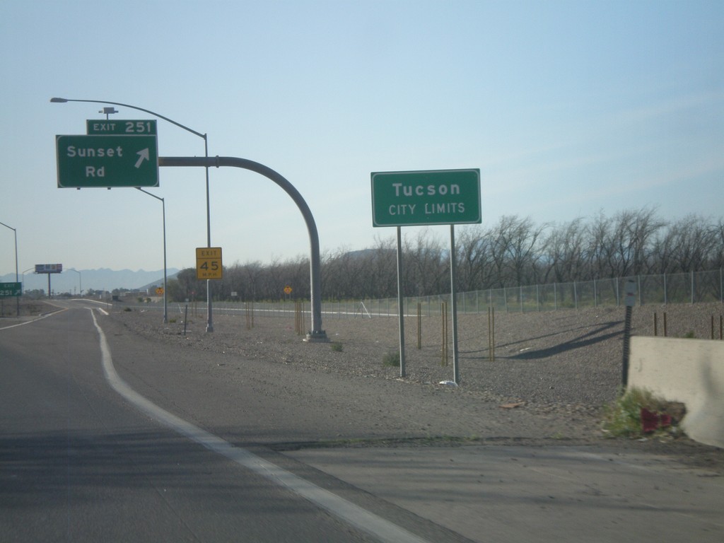
I-10 East - Exit 251. Tucson City Limits.
I-10 east at Exit 251 - Sunset Road. Entering the city of Tucson.
Taken 03-21-2010
Tucson
Pima County
Arizona
United States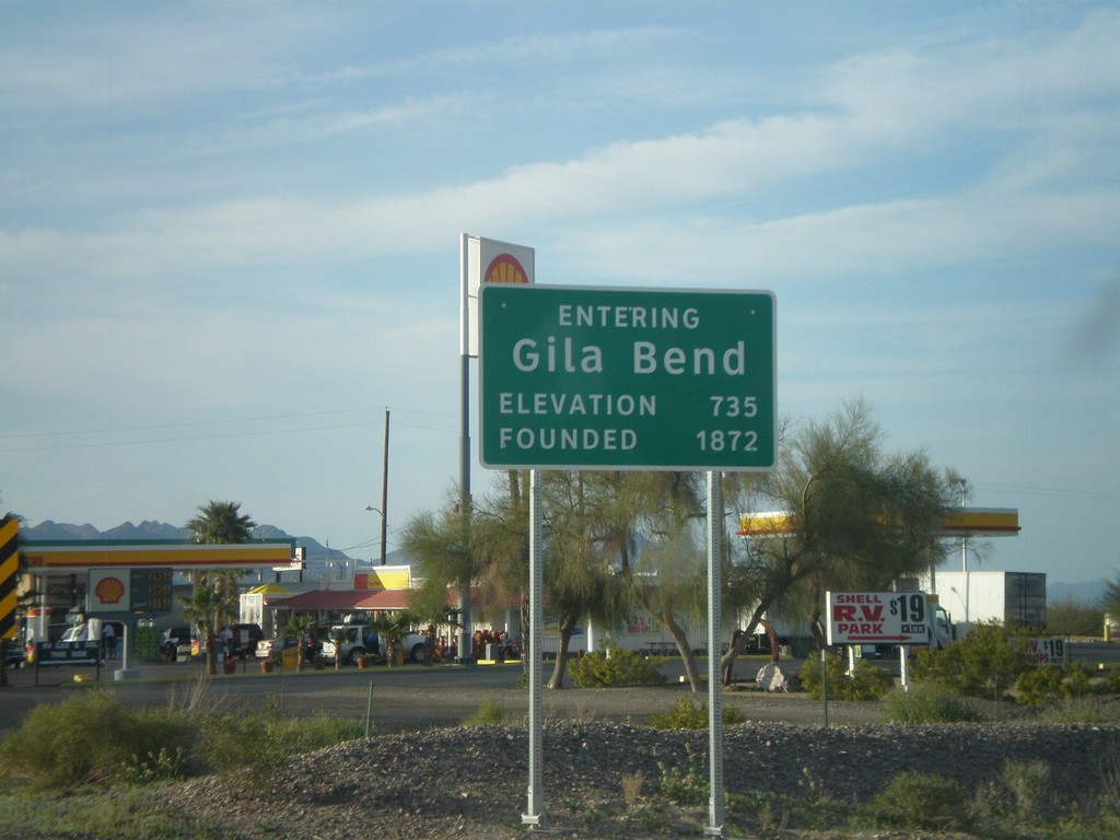
Entering Gila Bend on BL-8 West
Entering Gila Bend on BL-8 west. Founded in 1872. Elevation 735.
Taken 03-20-2010
 Gila Bend
Maricopa County
Arizona
United States
Gila Bend
Maricopa County
Arizona
United States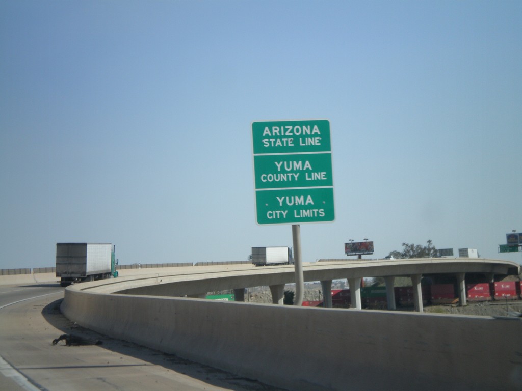
I-8 East - Arizona State Line
Arizona State Line, Yuma County Line, and Yuma City Limits on the Colorado River bridge at the Arizona-California State Line.
Taken 03-20-2010
 Yuma
Yuma County
Arizona
United States
Yuma
Yuma County
Arizona
United States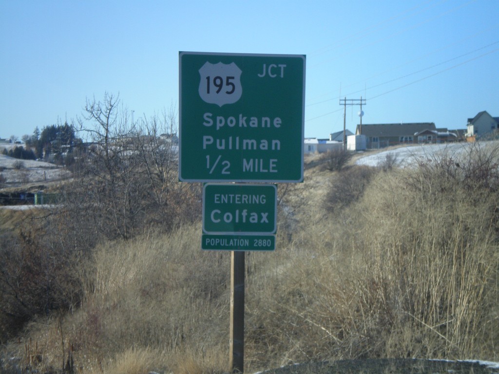
WA-272 West Approaching US-195
WA-272 west approaching US-195 to Spokane and Pullman. Entering Colfax - Population 2880. Colfax is the Whitman County Seat.
Taken 12-26-2009

 Colfax
Whitman County
Washington
United States
Colfax
Whitman County
Washington
United States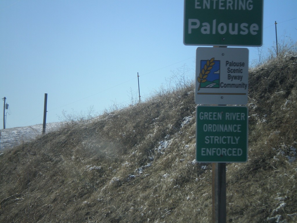
WA-272 West - Entering Palouse
Entering Palouse on WA-272 west. Palouse is a Palouse Scenic Byway Community.
Taken 12-26-2009
Palouse
Whitman County
Washington
United States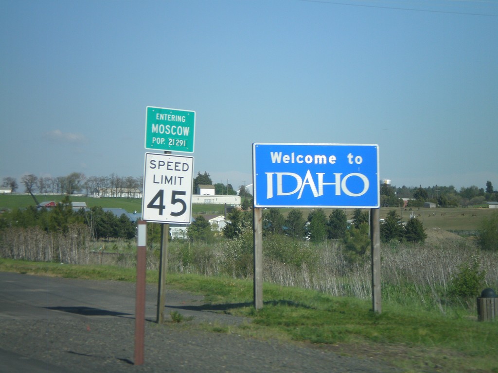
Welcome To Idaho - ID-8 East
Welcome to Idaho on ID-8 east. Entering Moscow. Moscow is home to the University of Idaho.
Taken 05-25-2009
 Moscow
Latah County
Idaho
United States
Moscow
Latah County
Idaho
United States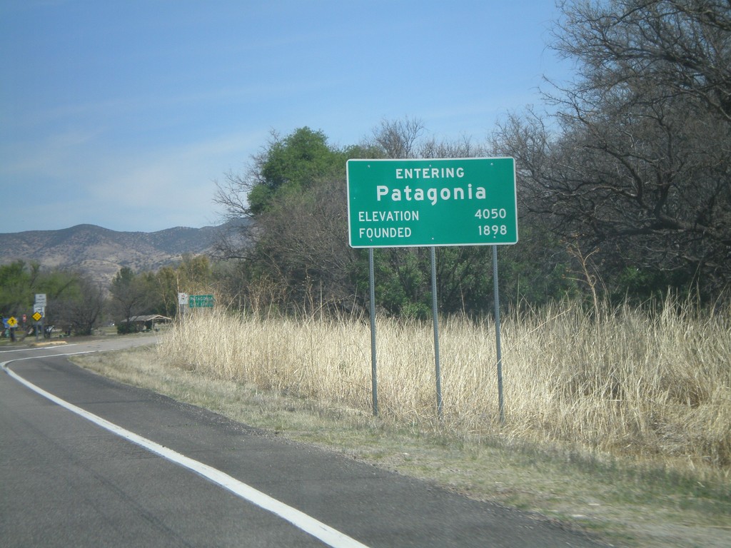
AZ-82 East - Entering Patagonia
Entering Patagonia on AZ-82 East. Elevation 4,050. Founded in 1898.
Taken 03-22-2009
 Patagonia
Santa Cruz County
Arizona
United States
Patagonia
Santa Cruz County
Arizona
United States