Signs Tagged With Bridge
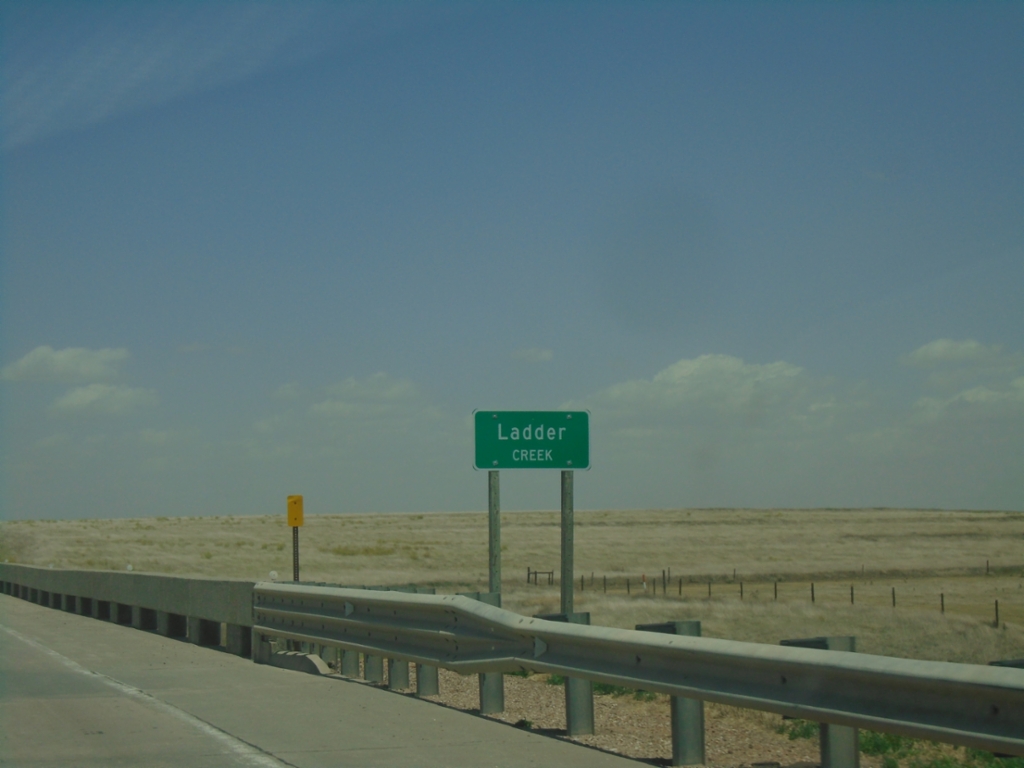
KS-27 North - Ladder Creek
Ladder Creek on KS-27 North. Ladder Creek is a tributary of the Smoky Hill River.
Taken 06-20-2026
 Tribune Township
Greeley County
Kansas
United States
Tribune Township
Greeley County
Kansas
United States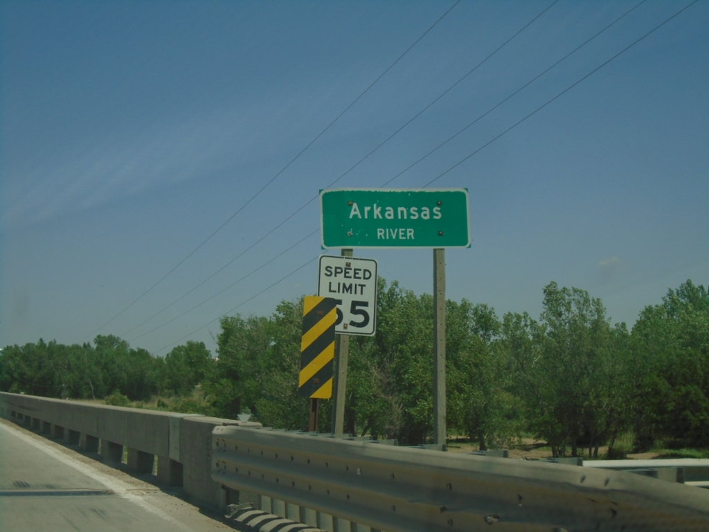
KS-27 North - Arkansas River
Arkansas River bridge on KS-27 North.
Taken 06-20-2026
Syracuse
Hamilton County
Kansas
United States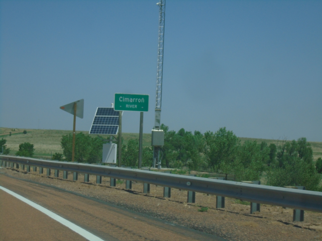
KS-27 North - Cimarron River
Cimarron River bridge on KS-27 North.
Taken 06-20-2026
Taloga
Morton County
Kansas
United States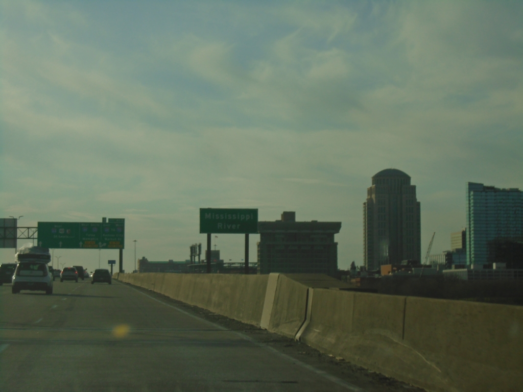
I-64 East/I-55 South - Mississippi River
Mississippi River bridge on I-64 East/I-55 South. The skyline of Saint Louis, Missouri is in the background.
Taken 03-29-2026


 East St. Louis
St. Clair County
Illinois
United States
East St. Louis
St. Clair County
Illinois
United States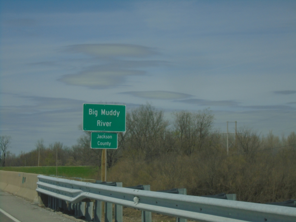
IL-3 North - Jackson County/Big Muddy River
Entering Jackson County on IL-3 North. At the Big Muddy River bridge.
Taken 03-29-2026
 Grand Tower
Jackson County
Illinois
United States
Grand Tower
Jackson County
Illinois
United States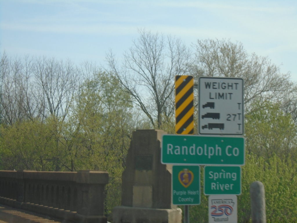
US-62 East - Randolph County
Entering Randolph County on US-62 East at the Spring River bridge.
Taken 03-29-2026
 Imboden
Randolph County
Arkansas
United States
Imboden
Randolph County
Arkansas
United States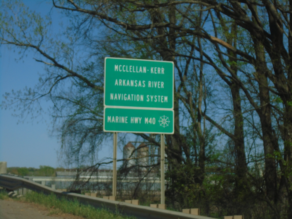
AR-7 North - Arkansas River
AR-7 North crossing the Arkansas River. This is part of the McClellan-Kerr Arkansas River Navigation System and Marine Highway M40.
Taken 03-28-2026
 Dardanelle
Yell County
Arkansas
United States
Dardanelle
Yell County
Arkansas
United States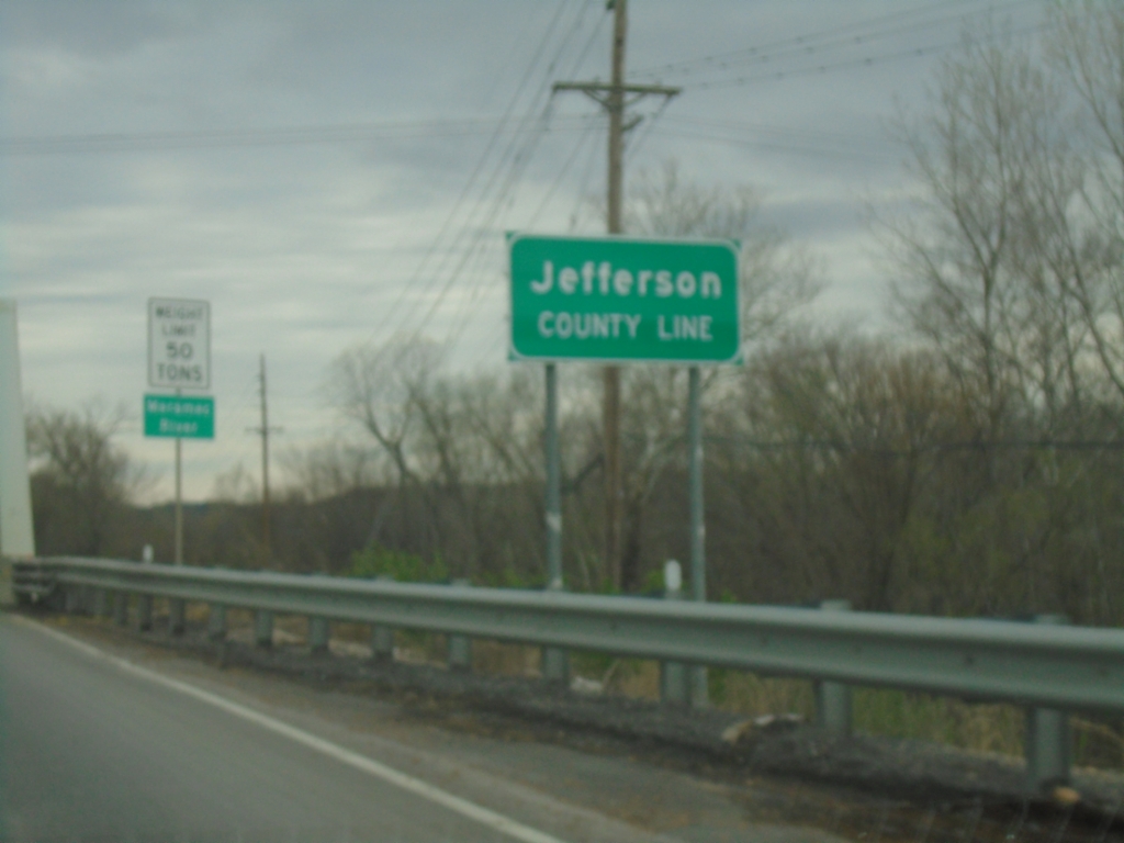
MO-21 South - Jefferson County Line
Jefferson County Line on MO-21 south at the Meramec River bridge.
Taken 03-27-2026
 Rock Township
Jefferson County
Missouri
United States
Rock Township
Jefferson County
Missouri
United States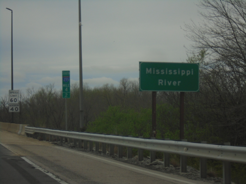
I-255 South - Mississippi River
I-255 South/US-50 West at the Mississippi River at the Missouri/Illinois State Line. This is the southernmost bridge over the Mississippi River in the Saint Louis metro area.
Taken 03-27-2026

 Columbia
Monroe County
Illinois
United States
Columbia
Monroe County
Illinois
United States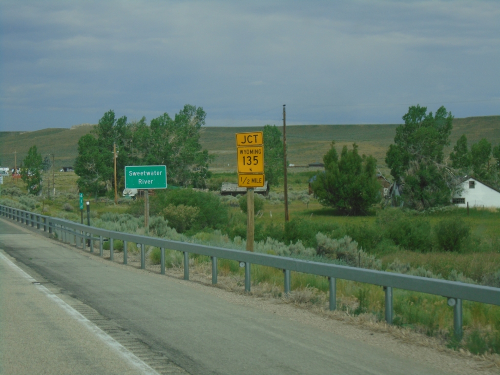
US-287/WY-789 North Approaching WY-135
US-287/WY-789 North approaching WY-135 at Sweetwater Station. Crossing the Sweetwater River.
Taken 07-04-2025


 Lander
Fremont County
Wyoming
United States
Lander
Fremont County
Wyoming
United States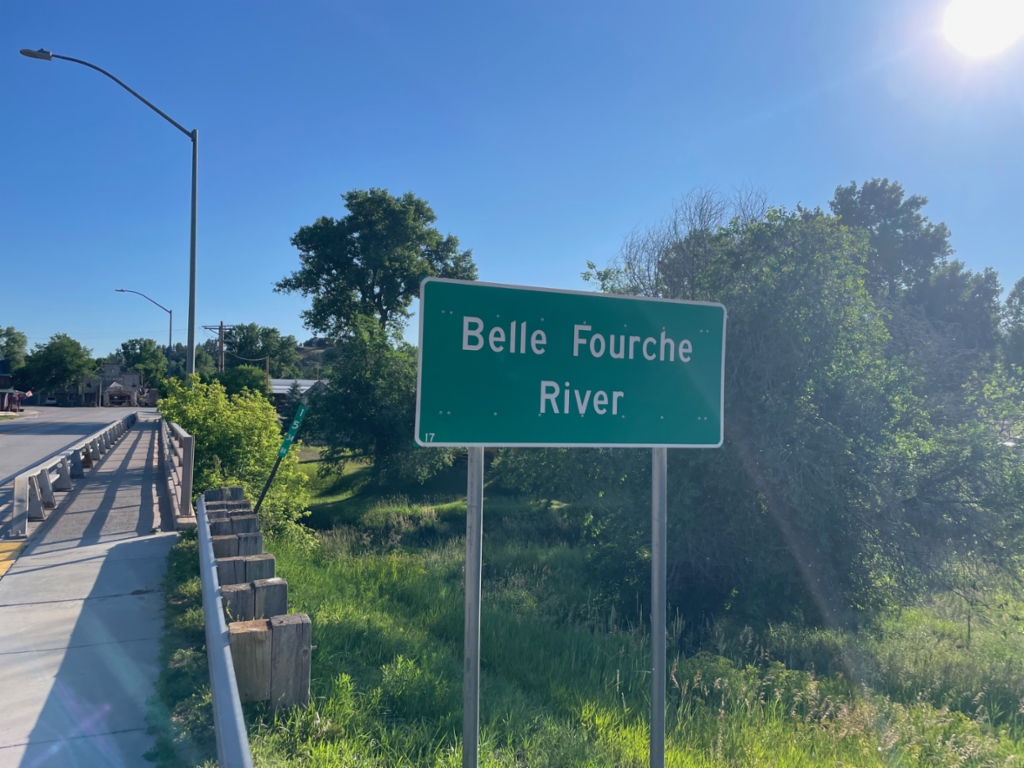
WY-24 East - Belle Fourche River
Belle Fourche River on WY-24 east in Hulett.
Taken 07-01-2025
 Hulett
Crook County
Wyoming
United States
Hulett
Crook County
Wyoming
United States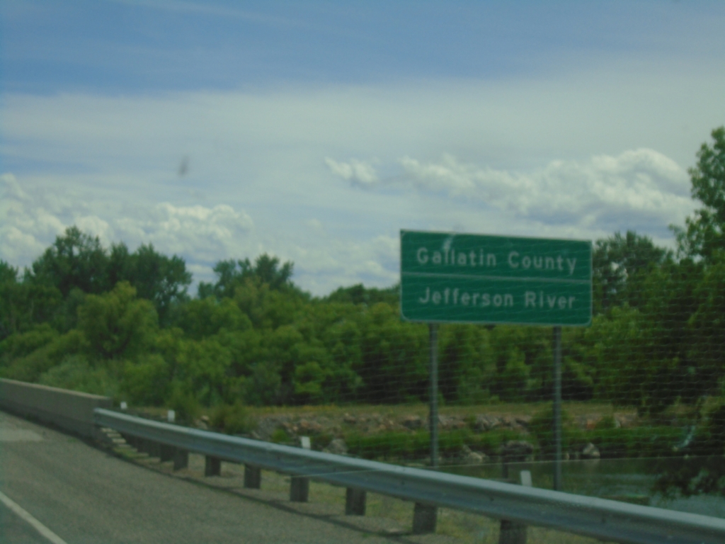
I-90 East - Gallatin County
Entering Gallatin County on I-90 east at the Jefferson River bridge.
Taken 06-28-2025
 Wheatland
Gallatin County
Montana
United States
Wheatland
Gallatin County
Montana
United States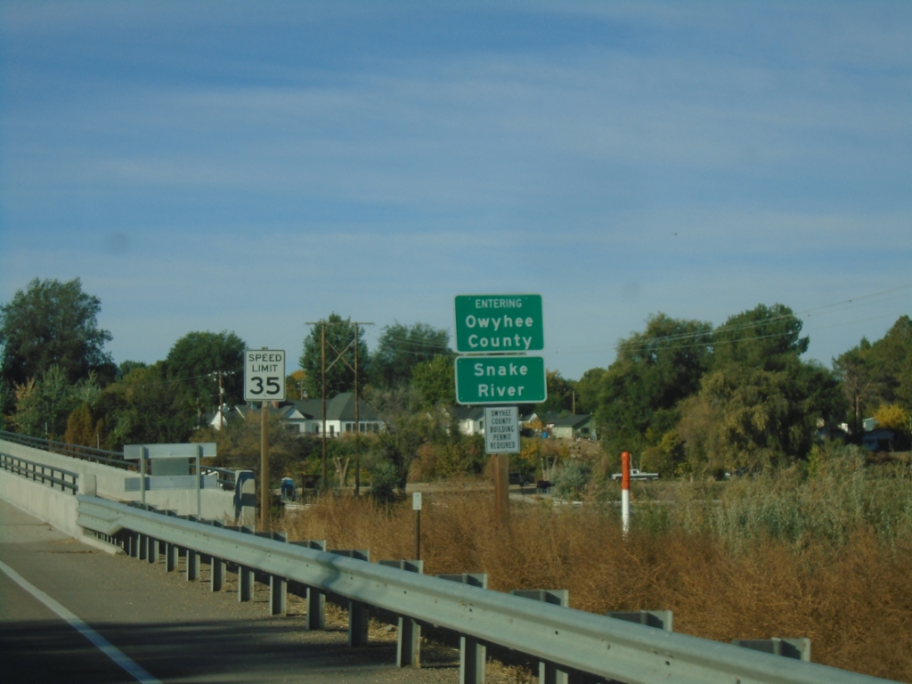
ID-55 South - Entering Owyhee County
ID-55 south - Entering Owyhee County/Snake River.
Taken 10-19-2024
 Caldwell
Canyon County
Idaho
United States
Caldwell
Canyon County
Idaho
United States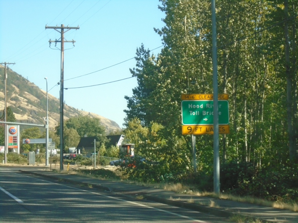
WA-14 East at Hood River Toll Bridge
WA-14 East at Hood River Toll Bridge over the Columbia River.
Taken 09-28-2024
 White Salmon
Klickitat County
Washington
United States
White Salmon
Klickitat County
Washington
United States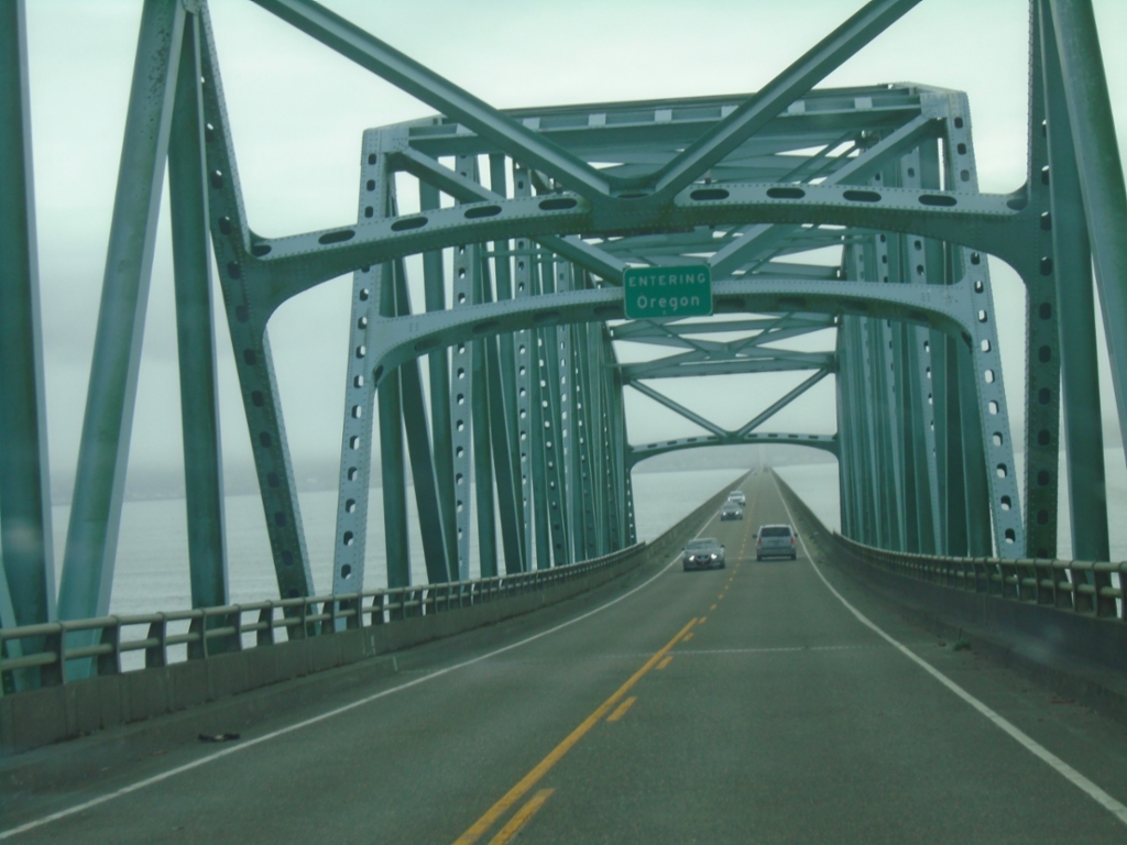
US-101 South - Entering Oregon
Entering Oregon on US-101 south, crossing the Columbia River.
Taken 09-23-2024
 Astoria
Clatsop County
Oregon
United States
Astoria
Clatsop County
Oregon
United States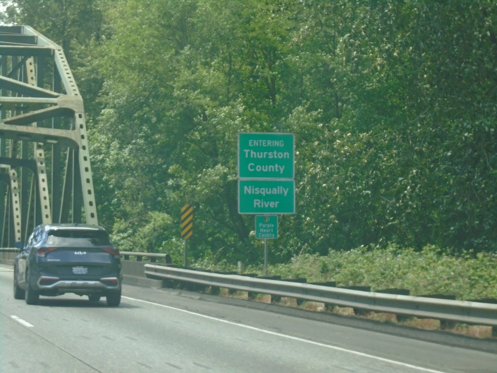
I-5 South - Thurston County / Nisqually River
Entering Thurston County on I-5 South at the Nisqually River bridge.
Taken 06-15-2024
 DuPont
Thurston County
Washington
United States
DuPont
Thurston County
Washington
United States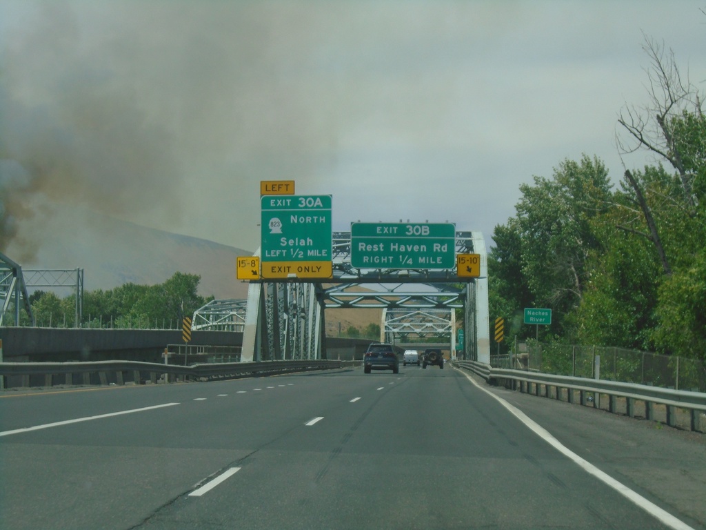
I-82 West - Exits 30B and 30A
I-82 west approaching Exit 30B - Rest Haven Road. Approaching Exit 30A - WA-823 North/Selah. Approaching bridge over the Yakima River.
Taken 06-13-2024


 Yakima
 County
Washington
United States
Yakima
Yakima County
Washington
United States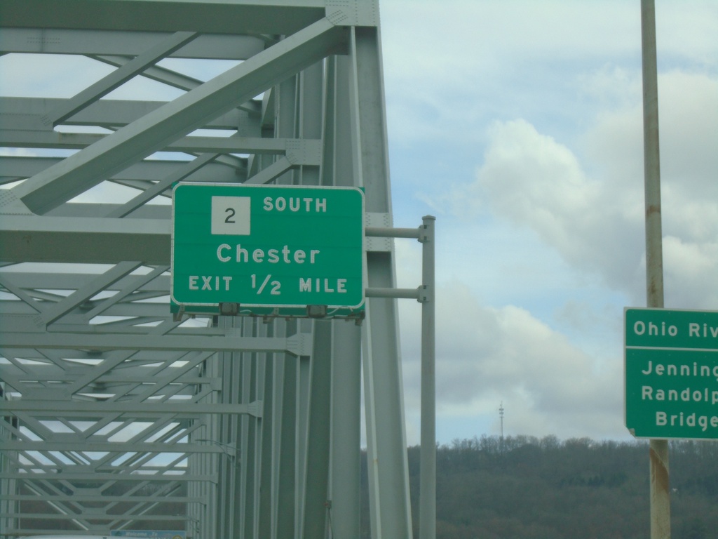
US-30 East Approaching WV-2
US-30 East approaching WV-2 South/Chester. This is the northern terminus of WV-2 which follows the northern border of West Virginia along the Ohio River from Parkersburg to Chester. On the approach to the Ohio River/Jennings Randolph Bridge.
Taken 04-01-2024

 Chester
Hancock County
West Virginia
United States
Chester
Hancock County
West Virginia
United States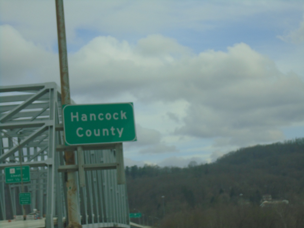
US-30 East - Hancock County
Entering Hancock County West Virginia on US-30 East. Taken on the Jennings Randolph Bridge over the Ohio River at the Ohio/West Virginia State Line.
Taken 04-01-2024
Chester
Hancock County
West Virginia
United States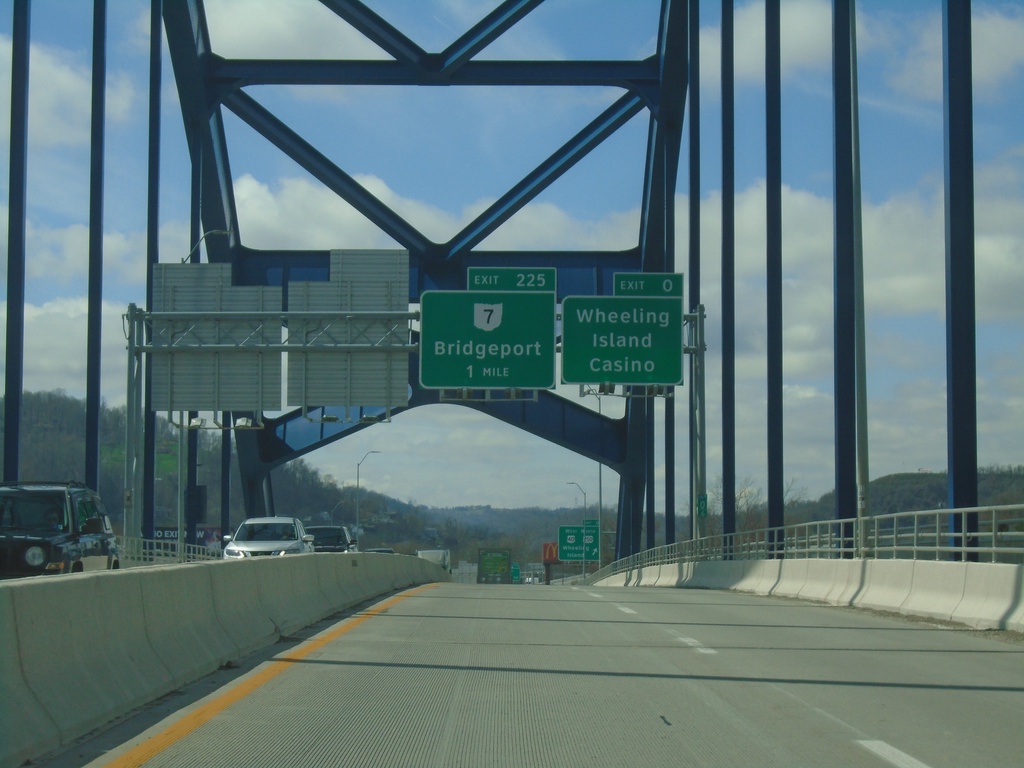
I-70 West - Exits 0 and 225
I-70 west approaching Exit 0 - Wheeling Island Casino and Exit 225 - OH-7/Bridgeport. Taken on the bridge over the Ohio River between Wheeling and Wheeling Island.
Taken 04-01-2024


 Wheeling
Ohio County
West Virginia
United States
Wheeling
Ohio County
West Virginia
United States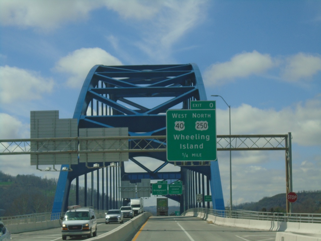
I-70 West - Exit 0
I-70/US-40/US-250 West approaching Exit 0 - US-40 West/US-250 North/Wheeling Island. On the bridge over the Ohio River between Wheeling and Wheeling Island. This is the last exit westbound on I-70 in West Virginia.
Taken 04-01-2024
Wheeling
Ohio County
West Virginia
United States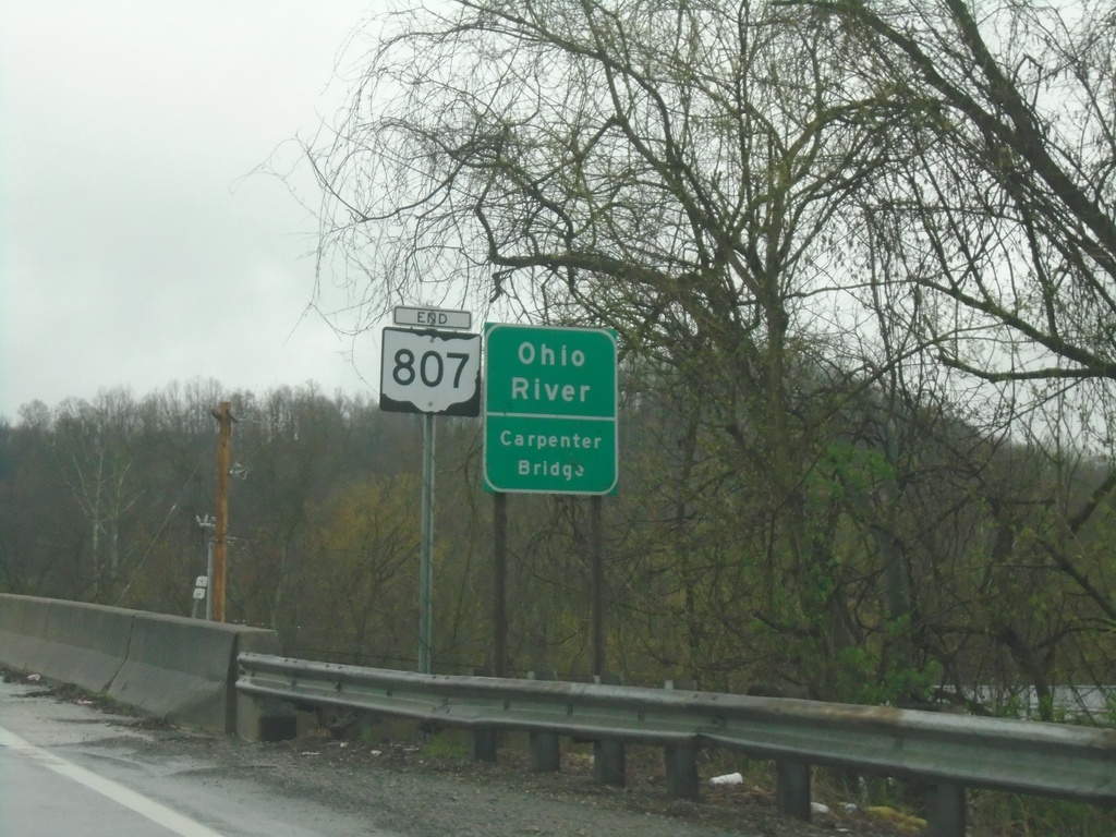
End OH-807 - Ohio River
End OH-807 at the Ohio River/Carpenter Bridge.
Taken 04-01-2024
 Newport
Washington County
Ohio
United States
Newport
Washington County
Ohio
United States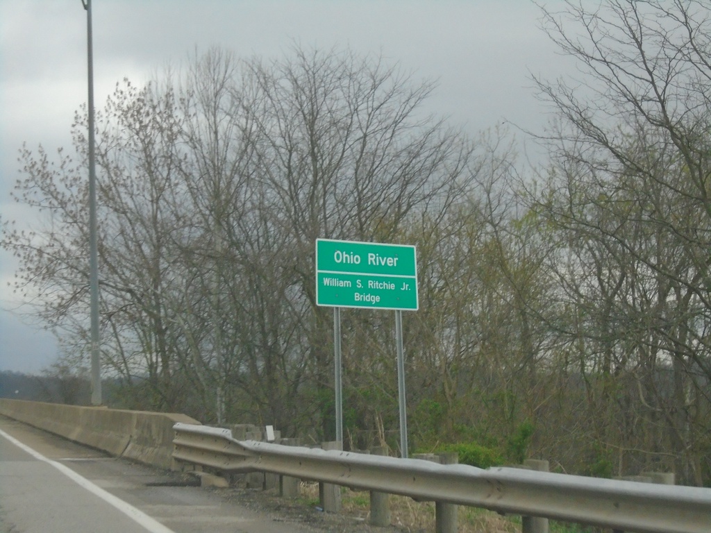
US-33 East - Ohio River
US-33 East - Ohio River. The William S. Ritchie Jr. Bridge.
Taken 04-01-2024
 Portland
Meigs County
Ohio
United States
Portland
Meigs County
Ohio
United States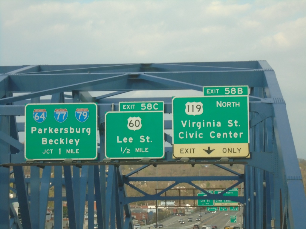
I-64 East - Exits 58B, 58C, and Exit 59
I-64 East - Exits 58B - US-119 North/Virginia St./Civic Center. Approaching Exit 59C - US-60/Lee St. Approaching I-64/I-77/I-79/Parkersburg/Beckley. Taken on the bridge over the Kanawah River.
Taken 03-31-2024


 Charleston
Kanawha County
West Virginia
United States
Charleston
Kanawha County
West Virginia
United States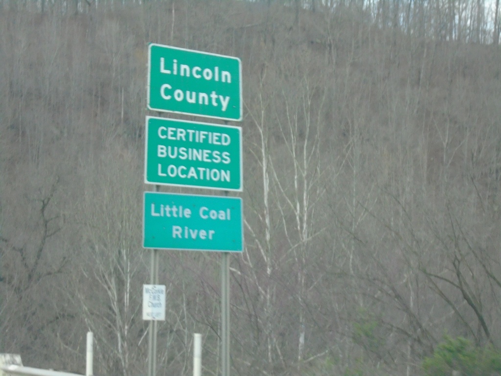
US-119 North - Lincoln County
Lincoln County on US-119 North. Crossing the Little Coal River.
Taken 03-31-2024
Alum Creek
Lincoln County
West Virginia
United States