Signs Tagged With Bridge
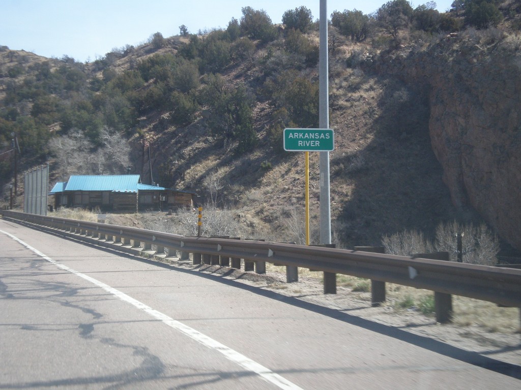
US-50 East - Arkansas River
US-50 east at the Arkansas River bridge. The Arkansas River leaves the highway here and enters Royal Gorge.
Taken 03-29-2014
 Cañon City
Fremont County
Colorado
United States
Cañon City
Fremont County
Colorado
United States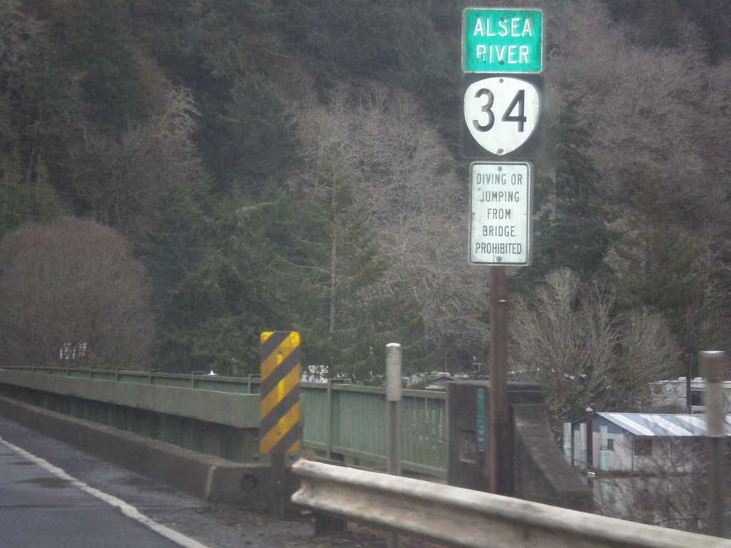
OR-34 East - Alsea River
OR-34 east at the Alsea River bridge.
Taken 02-21-2014
 Waldport
Lincoln County
Oregon
United States
Waldport
Lincoln County
Oregon
United States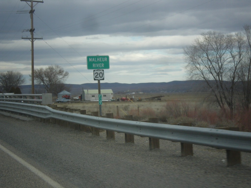
US-20 East - Malheur River
Malheur River bridge on US-20 east in Malheur County.
Taken 02-17-2014
 Vale
Malheur County
Oregon
United States
Vale
Malheur County
Oregon
United States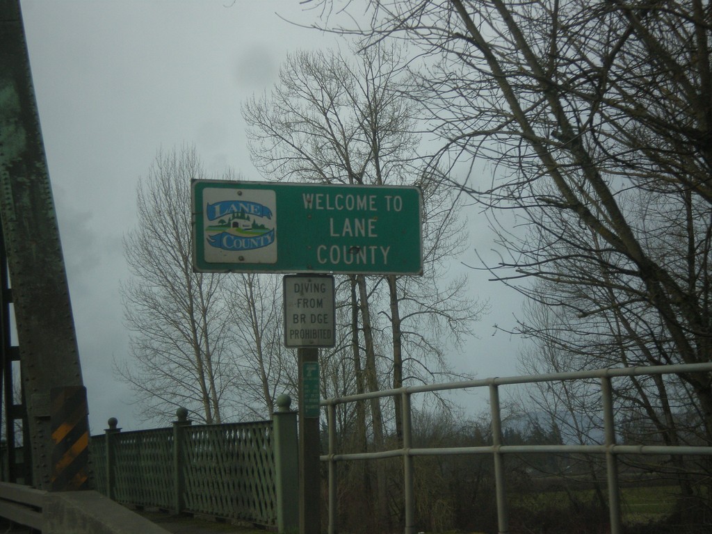
OR-99E South - Entering Lane County
Entering Lane County on OR-99E south on the Willamette River bridge. Many of the counties on western Oregon put logos on their county welcome signs.
Taken 02-13-2014
 Harrisburg
Lane County
Oregon
United States
Harrisburg
Lane County
Oregon
United States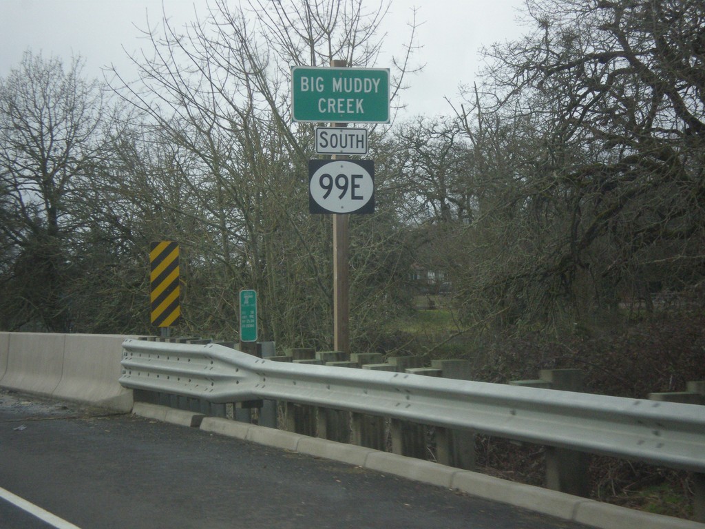
OR-99E - Big Muddy Creek
OR-99E at Big Muddy Creek. The OR-99E shield here is not a typical Oregon state highway style, rather a plain white circle. There were a few shields along or OR-99E in southern Linn County that were not standard.
Taken 02-13-2014
Harrisburg
Linn County
Oregon
United States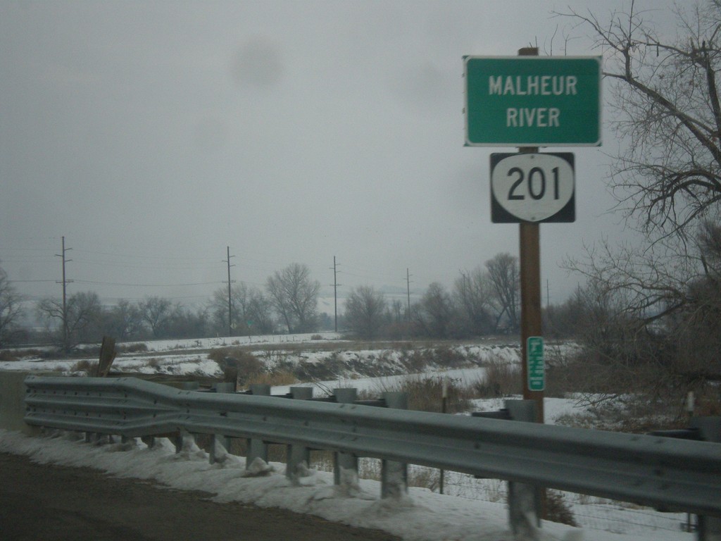
OR-201 North - Malheur River
OR-201 north at the Malheur River bridge. The Malheur River flows into the Snake River just east of here.
Taken 12-15-2013
 Ontario
Malheur County
Oregon
United States
Ontario
Malheur County
Oregon
United States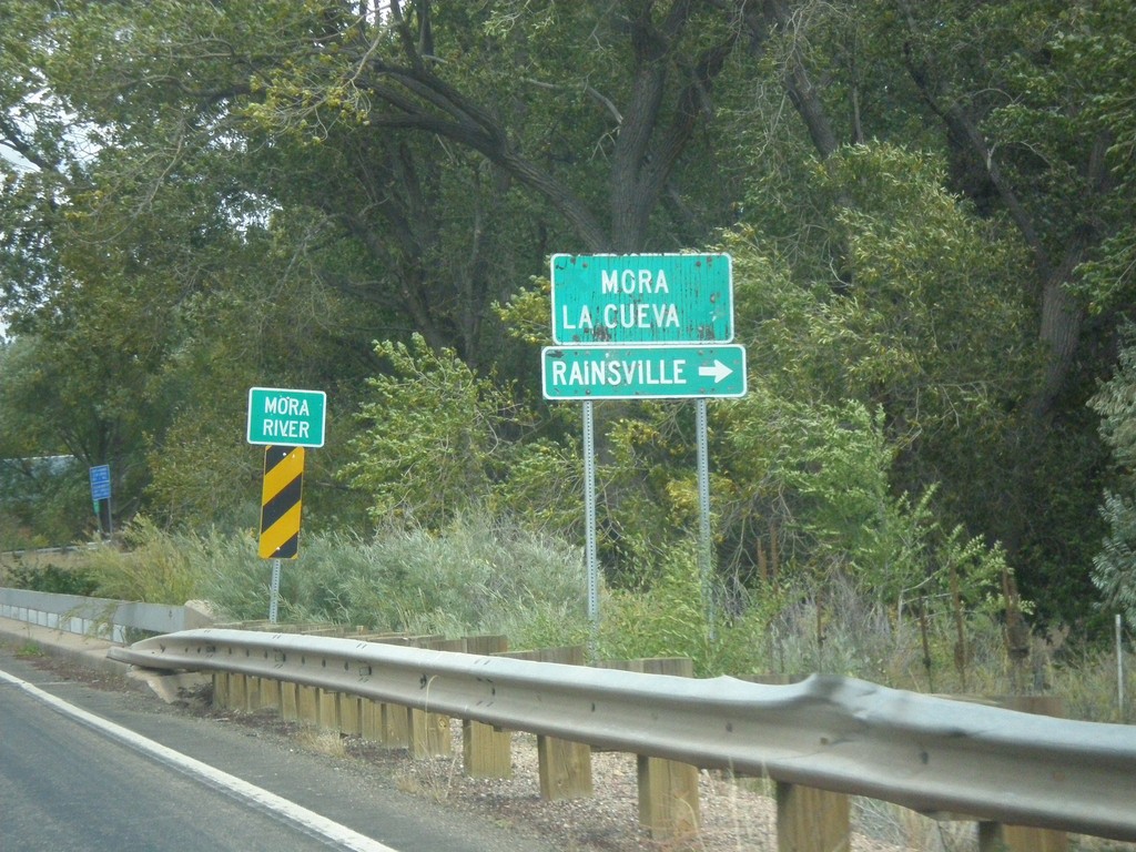
NM-518 North At NM-442
NM-518 north at NM-442. Turn right on NM-442 for Rainsville. Continue north on NM-518 for Mora and La Cueva. Crossing the Mora River.
Taken 10-10-2013

 Mora
Mora County
New Mexico
United States
Mora
Mora County
New Mexico
United States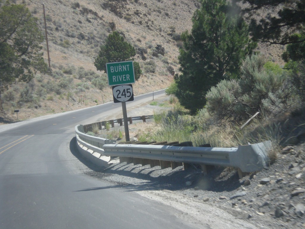
OR-245 East - Burnt River
Burnt River on OR-245 East.
Taken 07-15-2013
 Hereford
Baker County
Oregon
United States
Hereford
Baker County
Oregon
United States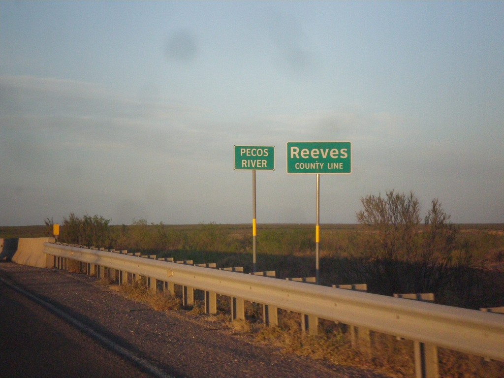
TX-302 West - Reeves County Line
Reeves County Line on TX-302 west, crossing the Pecos River (dry when this photo was taken).
Taken 04-15-2013
 Mentone
Loving County
Texas
United States
Mentone
Loving County
Texas
United States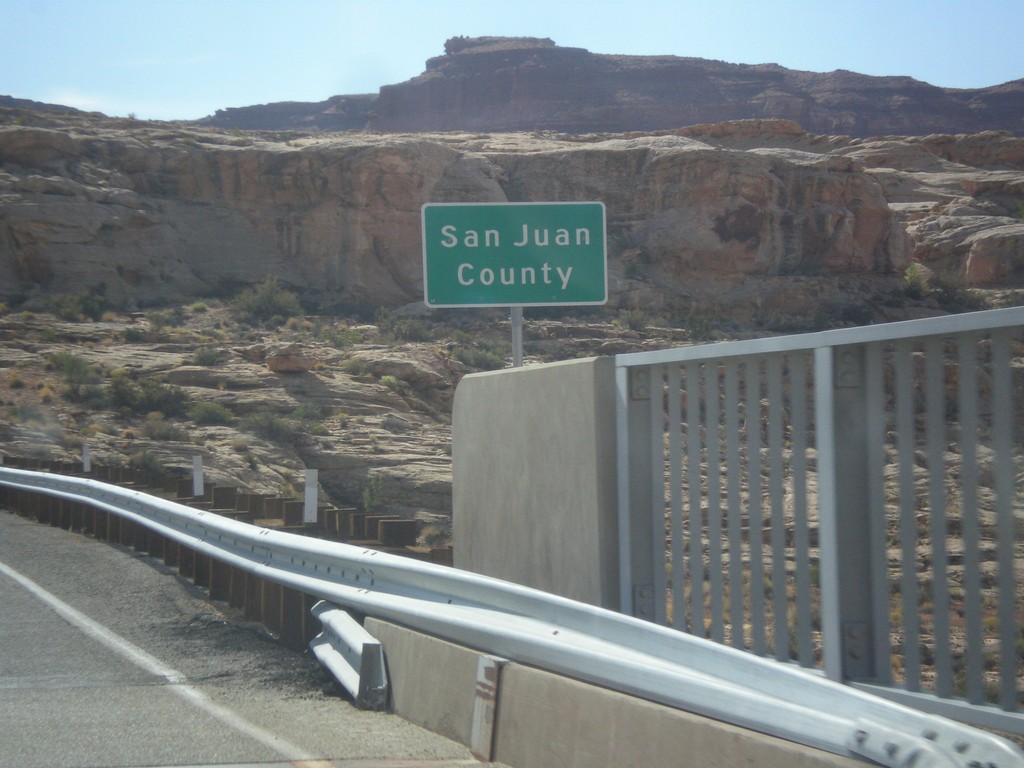
UT-95 East - San Juan County
Entering San Juan County on UT-95 east, crossing the Colorado River. This is the backwaters of Lake Powell, near Hite Marina.
Taken 10-10-2012
 Lake Powell
San Juan County
Utah
United States
Lake Powell
San Juan County
Utah
United States