Signs Tagged With Bridge
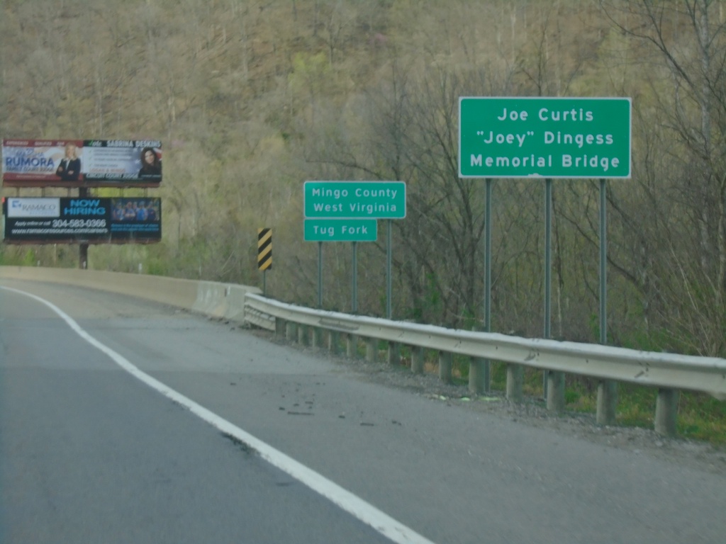
US-119/US-52 - Entering Mingo County West Virginia
Entering Mingo County West Virginia on US-119/US-52 north. At the Kentucky/West Virginia State Line crossing the Tug Fork.
Taken 03-31-2024

 Williamson
Mingo County
West Virginia
United States
Williamson
Mingo County
West Virginia
United States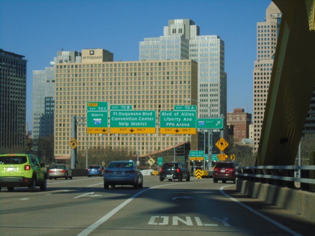
I-376 East - Exits 70A, 70B, and 70C
I-376 East at Exit 70A - Blvd. of Allies/Liberty Ave./PPG Arena, 70B - Ft. Duquesne Blvd/Convention Center/Strip District, and 70C - I-279 North. I-376 exits to the right. Picture taken at the end of the Fort Pitt Bridge with the Pittsburgh skyline in the background.
Taken 03-28-2024


 Pittsburgh
Allegheny County
Pennsylvania
United States
Pittsburgh
Allegheny County
Pennsylvania
United States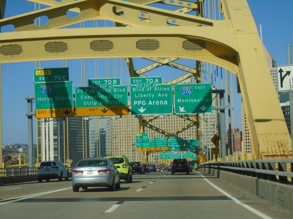
I-376 East - Exits 70A, 70B, and 70C
I-376 east approaching Exit 70A - Blvd. of Allies/Liberty Ave./PPG Arena. Approaching Exit 70B - Fort Duquesne Blvd./Convention Center/Strip District. Approaching Exit 70C - I-279 North/North Shore. Picture taken on the Fort Pitt Bridge with the Pittsburgh skyline in the background.
Taken 03-28-2024
 Pittsburgh
Allegheny County
Pennsylvania
United States
Pittsburgh
Allegheny County
Pennsylvania
United States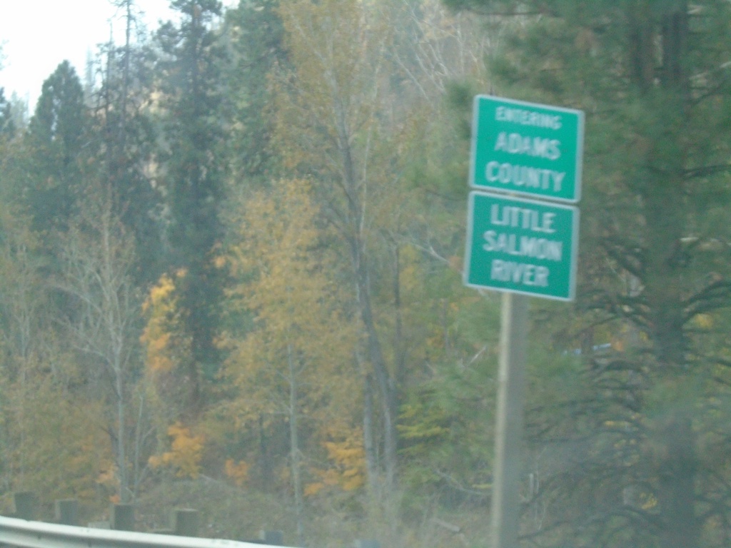
US-95 South - Entering Adams County
Entering Adams County on US-95 South at the Little Salmon River.
Taken 10-22-2023
 New Meadows
Adams County
Idaho
United States
New Meadows
Adams County
Idaho
United States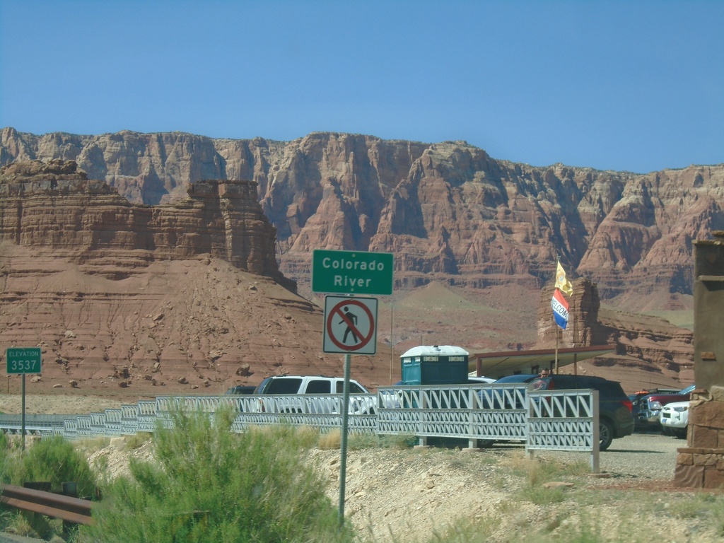
US-89A North - Colorado River
Colorado River (Navajo Bridge) on US-89A north. Elevation 3537 Feet. The Vermillion Cliffs are in the background. The next road crossing of the Colorado River south of here is US-93 below Hoover Dam. Between the Navajo Bridge and Hoover Dam lies the Grand Canyon and Lake Mead.
Taken 09-08-2023
 Marble Canyon
Coconino County
Arizona
United States
Marble Canyon
Coconino County
Arizona
United States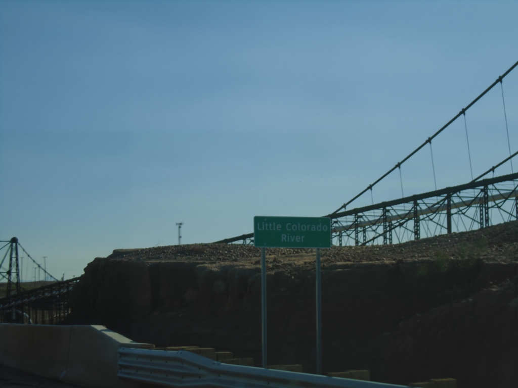
US-89 South - Little Colorado River Bridge
US-89 South crossing Little Colorado River Bridge in Cameron.
Taken 09-07-2023
 Cameron
Coconino County
Arizona
United States
Cameron
Coconino County
Arizona
United States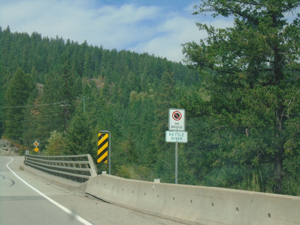
BC-395 North - Kettle River
Kettle River bridge on BC-395 north.
Taken 07-24-2023
 Christina Lake
Kootenay Boundary
British Columbia
Canada
Christina Lake
Kootenay Boundary
British Columbia
Canada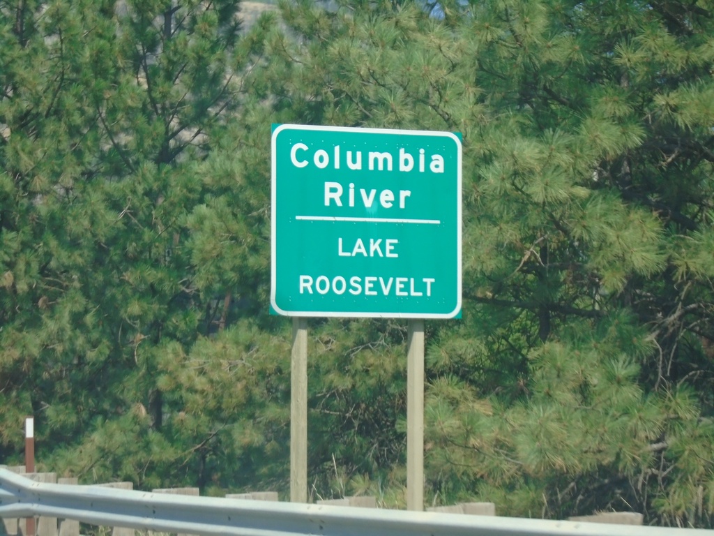
US-395 North/WA-20 West - Columbia River
US-395 North/WA-20 West at Columbia River/Lake Roosevelt Bridge. Lake Roosevelt is created by the Grand Coulee Dam.
Taken 07-24-2023

 Kettle Falls
Stevens County
Washington
United States
Kettle Falls
Stevens County
Washington
United States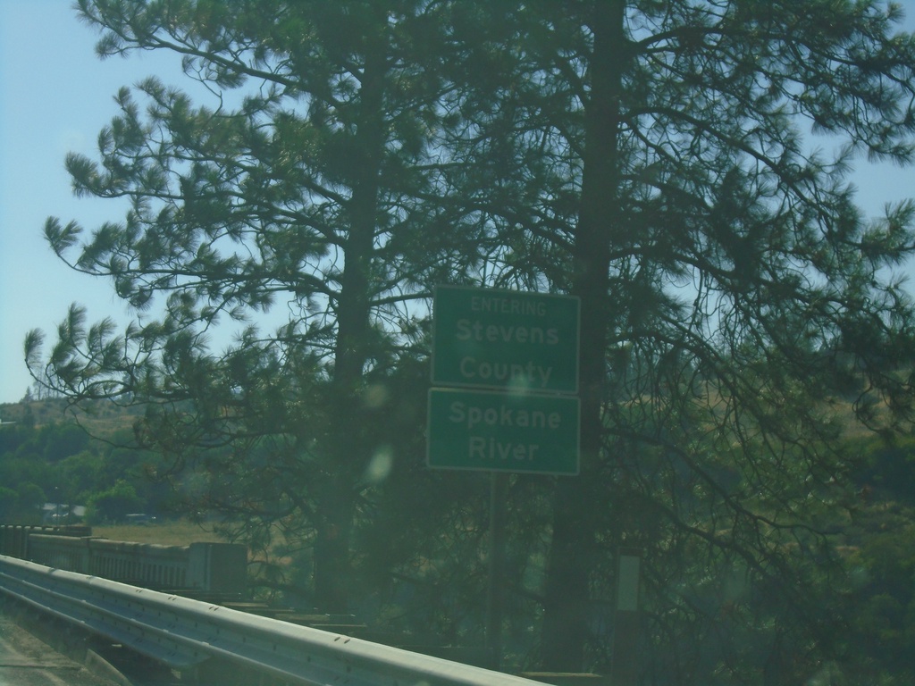
WA-25 North - Stevens County/Spokane River
Entering Stevens County on WA-25 north, crossing the Spokane River.
Taken 07-23-2023
 Davenport
Lincoln County
Washington
United States
Davenport
Lincoln County
Washington
United States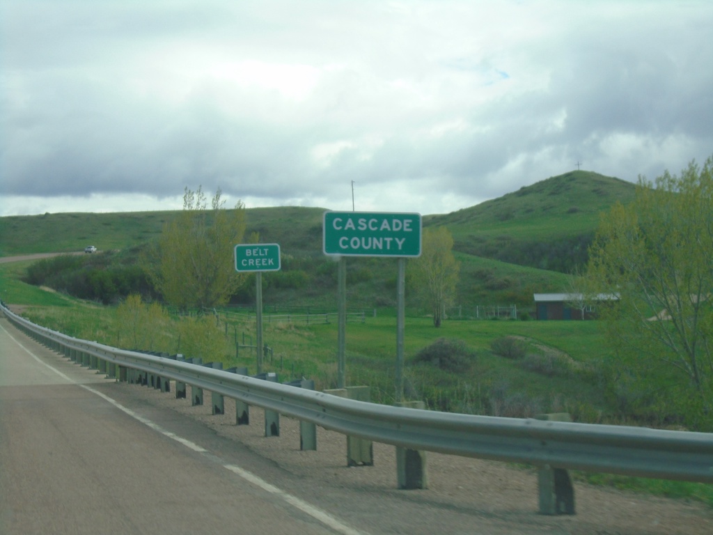
MTS-228 South - Cascade County
Entering Cascade County at Belt Creek bridge on MTS-228 south.
Taken 05-13-2023
 Great Falls
Cascade County
Montana
United States
Great Falls
Cascade County
Montana
United States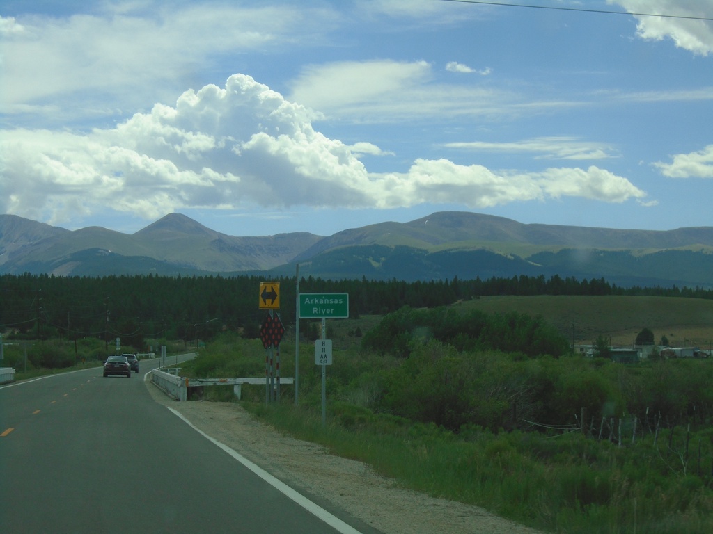
CO-300 East - Arkansas River
CO-300 east crossing the Arkansas River. This is near the headwaters of the Arkansas River. The Mosquito Range is in the background.
Taken 07-10-2022
 Leadville
Lake County
Colorado
United States
Leadville
Lake County
Colorado
United States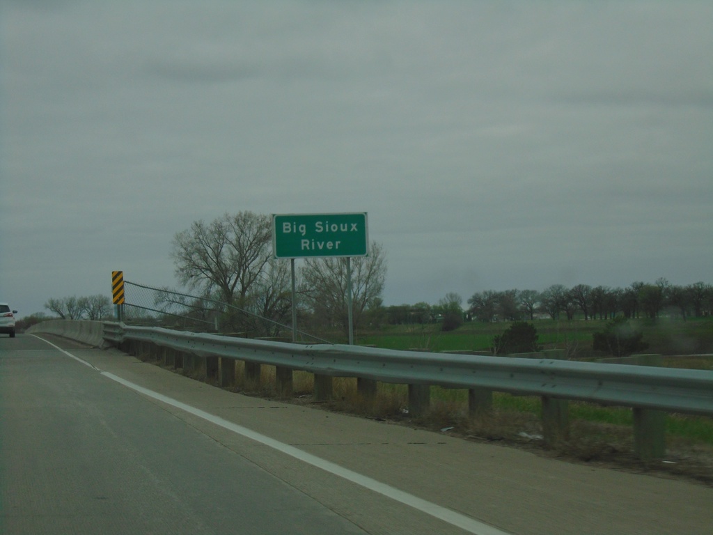
I-29 North - Big Sioux River
I-29 north at the Big Sioux River. The Big Sioux River marks the state line between Iowa and South Dakota.
Taken 05-02-2022
 Sioux City
Woodbury County
Iowa
United States
Sioux City
Woodbury County
Iowa
United States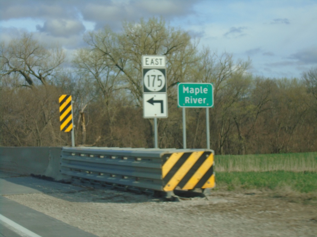
IA-175 East at IA-37 Junction and Maple River Bridge
IA-175 East at IA-37 Junction bridge over Maple River.
Taken 05-01-2022

 Onawa
Monona County
Iowa
United States
Onawa
Monona County
Iowa
United States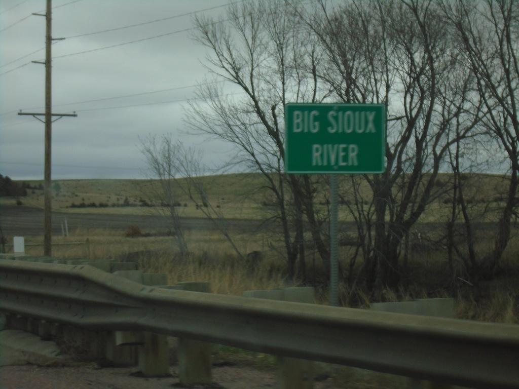
SD-34 East - Big Sioux River
SD-34 East - Big Sioux River
Taken 05-01-2022
 Egan
Moody County
South Dakota
United States
Egan
Moody County
South Dakota
United States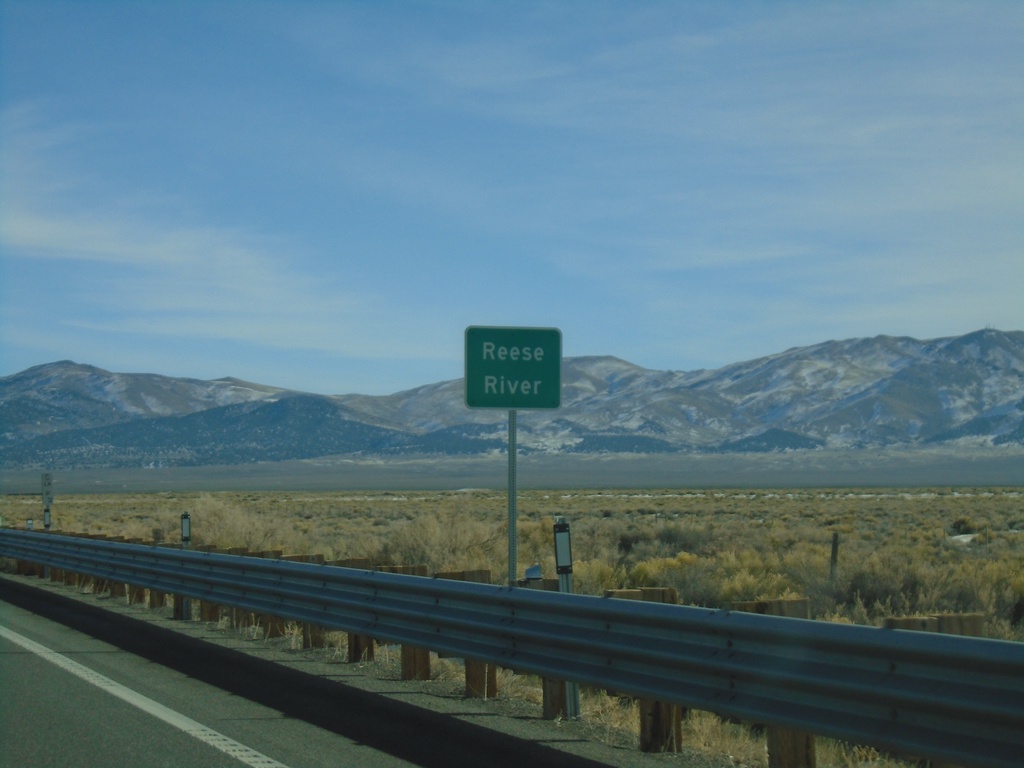
US-50 East - Reese River
US-50 east at the Reese River in Lander County. The Reese River starts in the Toyiabe Range, south of here, and flows north to the Humboldt River near Battle Mountain.
Taken 01-15-2022
 Austin
Lander County
Nevada
United States
Austin
Lander County
Nevada
United States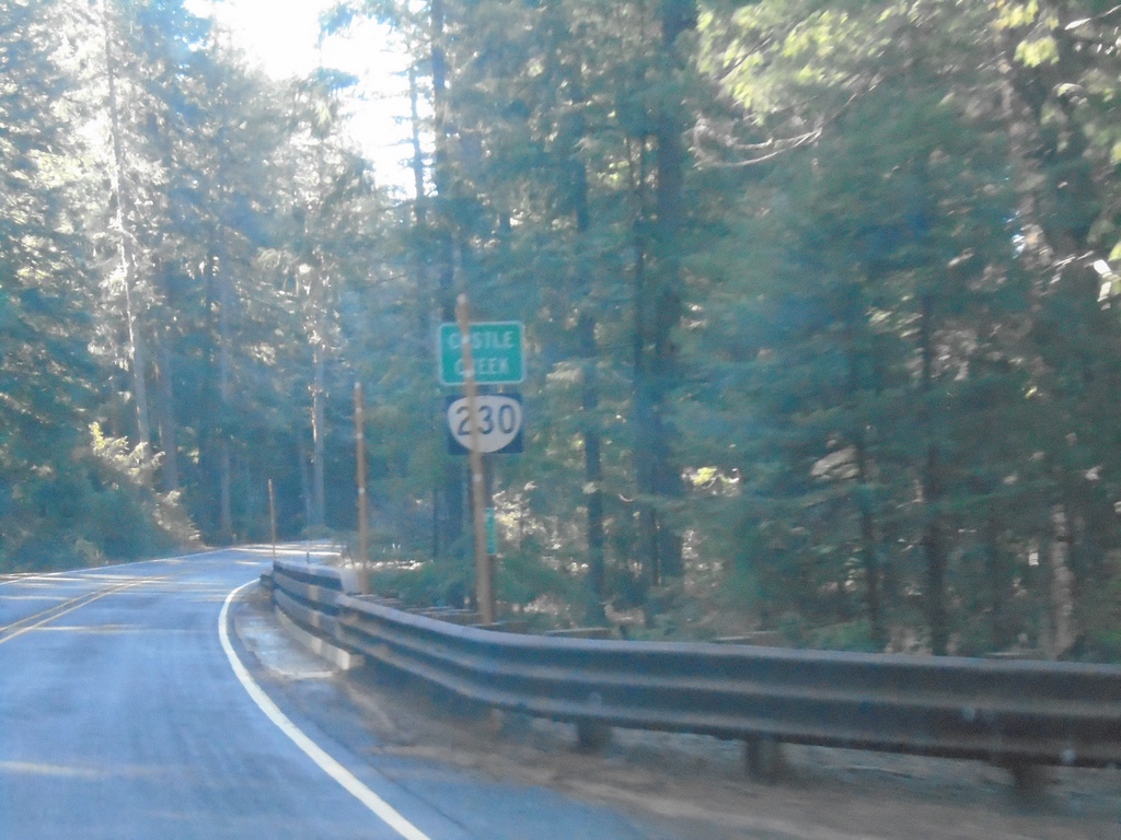
OR-230 West - Castle Creek
OR-230 west crossing Castle Creek.
Taken 11-20-2021
 Prospect
Jackson County
Oregon
United States
Prospect
Jackson County
Oregon
United States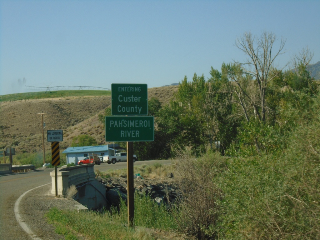
US-93 South - Custer County/Pahsimeroi River
US-93 South Entering Custer County at the Pahsimeroi River
Taken 07-03-2021
 Ellis
Custer County
Idaho
United States
Ellis
Custer County
Idaho
United States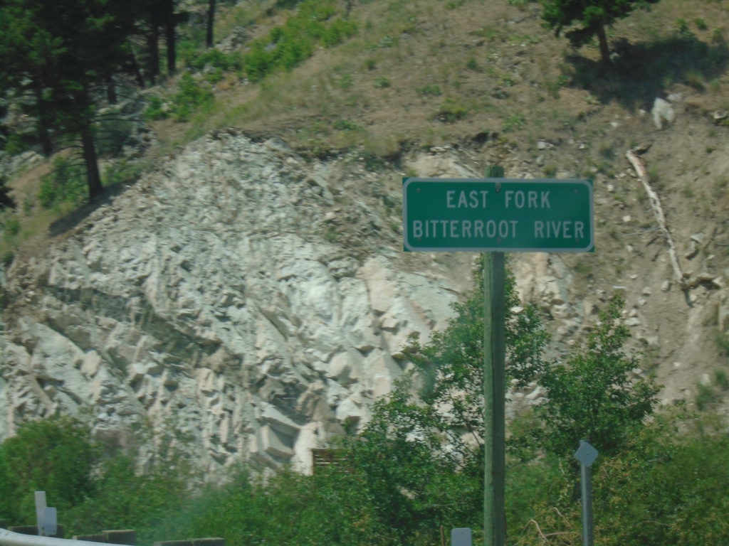
US-93 North - East Fork Bitterroot River
East Fork Bitterroot River bridge on US-93 North.
Taken 07-02-2021
Sula
Ravalli County
Montana
United States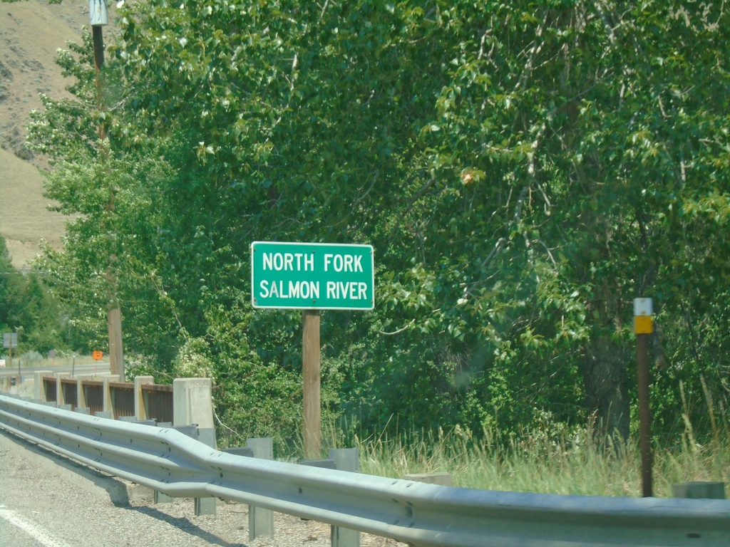
US-93 North - North Fork Salmon River
US-93 North at North Fork Salmon River bridge.
Taken 07-02-2021
North Fork
Lemhi County
Idaho
United States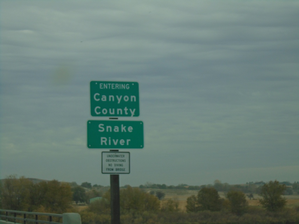
ID-55 North - Canyon County/Snake River
ID-55 north crossing the Snake River and entering Canyon County.
Taken 11-06-2020
 Marsing
Owyhee County
Idaho
United States
Marsing
Owyhee County
Idaho
United States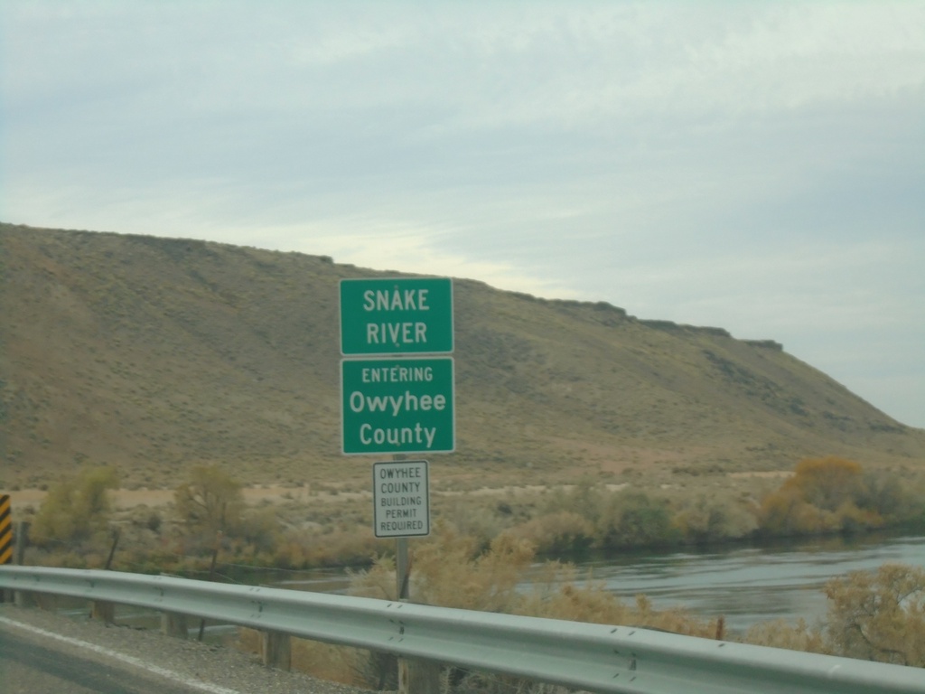
ID-78 West - Owyhee County/Snake River
Entering Owyhee County on ID-78 West at the Snake River bridge.
Taken 11-06-2020
 Hammett
Elmore County
Idaho
United States
Hammett
Elmore County
Idaho
United States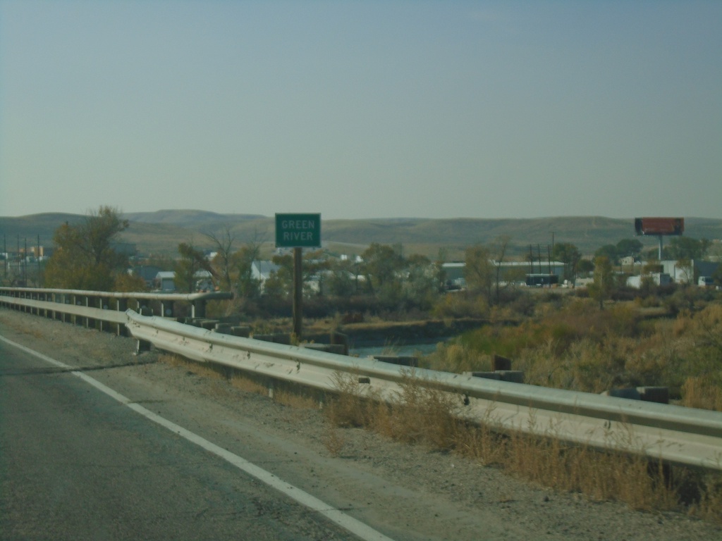
WY-374 West - Green River
Green River bridge on WY-374 west.
Taken 10-03-2020
 Green River
Sweetwater County
Wyoming
United States
Green River
Sweetwater County
Wyoming
United States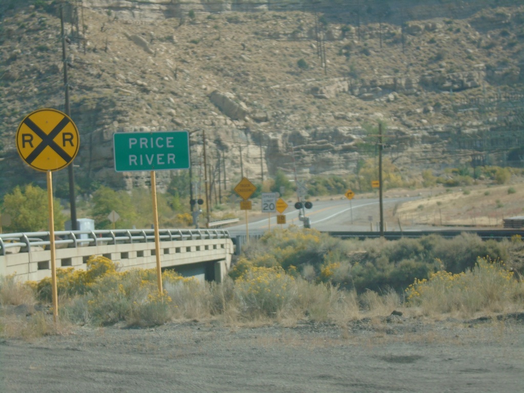
US-191 North - Price River
Price River on US-191 north in Carbon County.
Taken 10-03-2020
 Helper
Carbon County
Utah
United States
Helper
Carbon County
Utah
United States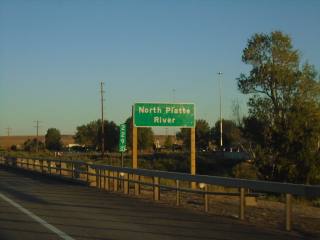
I-80 West - North Platte River
I-80 west crossing the North Platte River in Carbon County. Milemarker 229.03 in the background.
Taken 08-15-2020

 Sinclair
Carbon County
Wyoming
United States
Sinclair
Carbon County
Wyoming
United States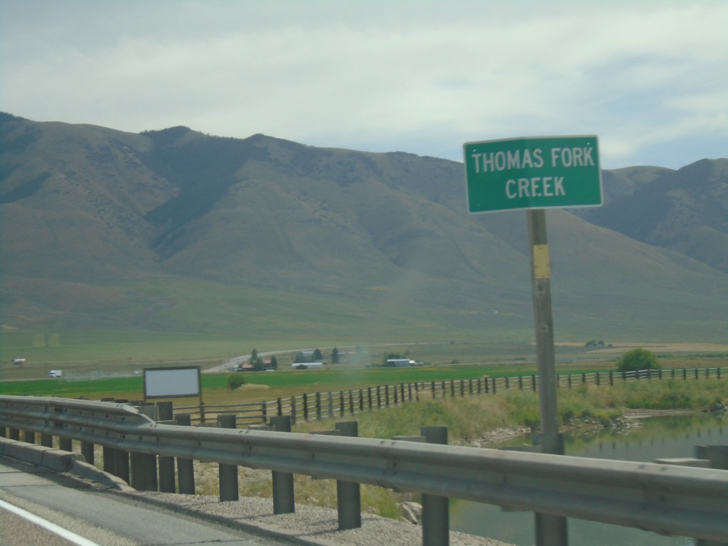
US-30 East - Thomas Fork Creek
US-30 east at Thomas Fork Creek
Taken 08-13-2020
Montpelier
Bear Lake County
Idaho
United States